- Georgia (U.S. state)
-
"State of Georgia" redirects here. For TV series, see State of Georgia (TV series). For the sovereign state, see Georgia (country).
State of Georgia 

Flag Seal Nickname(s): Peach State;
Empire State of the SouthMotto(s): Wisdom, Justice, Moderation 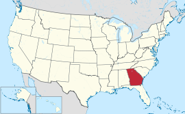
Official language(s) English Demonym Georgian Capital
(and largest city)Atlanta Largest metro area Atlanta metro area Area Ranked 24th in the U.S. - Total 59,425 sq mi
(153,909 km2)- Width 230 miles (370 km) - Length 298 miles (480 km) - % water 2.6 - Latitude 30.356 – 34.985° N - Longitude 80.840 – 85.605° W Population Ranked 9th in the U.S. - Total (2010) 9,687,653[1] - Density 141.4/sq mi (54.59/km2)
Ranked 18th in the U.S.- Median income $50,861 (23rd) Elevation - Highest point Brasstown Bald[2][3]
4,784 ft (1458 m)- Mean 600 ft (180 m) - Lowest point Atlantic Ocean[2]
sea levelBefore statehood Province of Georgia Admission to Union January 2, 1788 (4th) Governor Nathan Deal (R) Lieutenant Governor Casey Cagle (R) Legislature General Assembly - Upper house State Senate - Lower house House of Representatives U.S. Senators Saxby Chambliss (R)
Johnny Isakson (R)U.S. House delegation 8 Republicans, 5 Democrats (list) Time zone Eastern: UTC-5/-4 Abbreviations GA Ga. US-GA Website georgia.gov Georgia
 i/ˈdʒɔrdʒⁱə/ is a state located in the southeastern United States. It was established in 1732, the last of the original Thirteen Colonies. The state is named after King George II of Great Britain. Georgia was the fourth state to ratify the United States Constitution, on January 2, 1788. It declared its secession from the Union on January 21, 1861, and was one of the original seven Confederate states. It was the last state to be restored to the Union, on July 15, 1870.
The 2010 US Census reported 9,687,653 residents, making Georgia the ninth most populous state.[1] From 2007 to 2008, 14 of Georgia's counties ranked among the nation's 100 fastest-growing, second only to Texas.[4] Georgia is known as the Peach State and the Empire State of the South. Atlanta is the capital and the most populous city.
Georgia is bordered on the south by Florida; on the east by the Atlantic Ocean and South Carolina; on the west by Alabama; and on the north by Tennessee and North Carolina. The northern part of the state is in the Blue Ridge Mountains, a mountain range in the vast Appalachian Mountains system. The central piedmont extends from the foothills to the fall line, where the rivers cascade down in elevation to the continental coastal plain of the southern part of the state. The highest point in Georgia is Brasstown Bald, 4,784 feet (1,458 m); the lowest point is sea level.
With an area of 59,425 square miles (153,910 km2), Georgia is ranked 24th in size among the 50 U.S. states. Georgia is the largest state east of the Mississippi River in terms of land area, although it is the fourth largest (after Michigan, Florida, and Wisconsin) in total area, a term which includes expanses of water which are part of state territory.[5]
Contents
Geography
Main article: Geography of Georgia (U.S. state)Boundaries
Beginning from the Atlantic Ocean, the state's eastern border with South Carolina runs up the Savannah River, northwest to its origin at the confluence of the Tugaloo and Seneca Rivers. It then continues up the Tugaloo (originally Tugalo) and into the Chattooga River, its most significant tributary. These bounds were decided in the 1797 Treaty of Beaufort, and tested in the U.S. Supreme Court in the two Georgia v. South Carolina cases in 1923 and 1989.
The border then takes a sharp turn around the tip of Rabun County, at latitude 35°N, though from this point it diverges slightly south (due to inaccuracies in the original survey). This originally was the Georgia and North Carolina border all the way back to the Mississippi River, until Tennessee was divided from North Carolina, and Alabama and Mississippi (the Yazoo lands) were taken from Georgia.[clarification needed]
The state's western border then departs in another straight line south-southeastward, at a point southwest of Chattanooga, to meet the westernmost point of the Chattahoochee River near West Point. It continues down to the point where it ends at the Flint River (the confluence of the two forming Florida's Apalachicola River), and goes almost due east and very slightly south, in a straight line to the origin of the St. Mary's River, which then forms the remainder of the boundary back to the ocean.
It should be noted that the water boundaries are still set to be the original thalweg of the rivers. Since then, several have been inundated by lakes created by dams, including the Apalachicola/Chattahoochee/Flint point now under Lake Seminole.
Georgia state legislators have claimed that the state's border with Tennessee has been erroneously placed one mile (1.6 km) further south than intended in an 1818 survey, and proposed that the border should be corrected. This would allow Georgia, in the midst of a significant drought, to access water from the Tennessee River.[6]
Geology and terrain
 Map of elevations in Georgia
 Main article: Geology of Georgia (U.S. state)
Each region has its own distinctive characteristics. For instance, the Ridge and Valley, which lies in the northwest corner of the state, includes limestone, sandstone, shale and other sedimentary rocks, which have yielded construction-grade limestone, barite, ocher and small amounts of coal.
Flora
Main article: Ecology of Georgia (U.S. state)Georgia has a diverse mix of flora and fauna. The State of Georgia has approximately 250 tree species and 58 protected plants. Georgia's native trees include red cedar, a variety of pines, oaks, maples, cypress, Liquidambar and scaly-bark and white hickories, as well as many others. Palmettos and other subtropical flora are found in the southern and coastal regions. Yellow jasmine, and mountain laurel make up just a few of the flowering shrubs in the state.
Fauna
White-tailed (Virginia) deer are in nearly all counties. The northern mockingbird and Brown Thrasher are among the 160 bird species that live in the state.[7]
Reptiles include the eastern diamondback, copperhead, and cottonmouth, salamanders, frogs, alligators and toads. There are about 79 species of reptile and 63 amphibians known to live in Georgia.[7]
The most popular freshwater game fish are trout, bream, bass, and catfish, all but the last of which are produced in state hatcheries for restocking. Popular saltwater game fish include red drum, spotted seatrout, flounder, and tarpon, among many others. Porpoises, whales, shrimp, oysters, and blue crabs are found inshore and offshore of the Georgia coast.[7]
Climate
Main article: Climate of Georgia (U.S. state) Map of Georgia
The majority of Georgia is primarily a humid subtropical climate. Hot and humid summers are typical, except at the highest elevations. The entire state, including the north Georgia mountains, receives moderate to heavy precipitation, which varies from 45 inches (1143 mm) in central Georgia[8] to approximately 75 inches (1905 mm) around the northeast part of the state.[9] The degree to which the weather of a certain region of Georgia is subtropical depends on the latitude, its proximity to the Atlantic Ocean or Gulf of Mexico and the elevation. The latter factor is felt chiefly in the mountainous areas of the northern part of the state, which are farther away from the ocean and can be 4500 feet (1350 m) above sea level. The USDA Plant hardiness zones for Georgia range from zone 6b (no colder than −5 °F (−21 °C) ) in the Blue Ridge Mountains mountains to zone 8b (no colder than 15 °F (−9 °C) ) along the Atlantic coast and Florida border.[10]
The highest temperature ever recorded is 112 °F (44.4 °C) at Louisville on July 24, 1952,[11] while the lowest is −17 °F (−27.2 °C) at northern Floyd County on January 27, 1940.[12] Georgia is one of the leading states in frequency of tornadoes, though they rarely are stronger than F1. A tornado hit downtown Atlanta on March 14, 2008, causing moderate to severe damage. With a coastline on the Atlantic Ocean, Georgia is also vulnerable to hurricanes, although direct hurricane strikes were rare during the 20th century. Georgia often is affected by hurricanes that strike the Florida panhandle, weaken over land, and bring strong tropical storm winds and heavy rain to the interior, as well as hurricanes that come close to the Georgia coastline, brushing the coast on their way north.
Monthly average daily high and low temperatures for major Georgia cities City Jan Feb Mar Apr May Jun Jul Aug Sep Oct Nov Dec Athens 51/11
33/156/13
35/265/18
42/673/23
49/980/27
58/1487/31
65/1890/32
69/2188/31
68/2082/28
63/1773/23
51/1163/17
42/654/12
35/2Atlanta 52/11
34/157/14
36/265/18
44/773/23
50/1080/27
60/1686/30
67/1989/32
71/2288/31
70/2182/28
64/1873/23
53/1263/17
44/755/13
36/2Augusta 56/13
33/161/16
36/469/21
42/677/25
48/984/29
57/1490/32
65/1892/33
70/2190/32
68/2085/29
62/1776/24
50/1068/20
41/559/15
35/2Columbus 57/14
37/362/17
39/469/21
46/876/24
52/1183/28
61/1690/32
69/2192/33
72/2291/32
72/2286/30
66/1977/25
54/1268/20
46/859/15
39/4Macon 57/14
34/161/16
37/368/20
44/776/24
50/1083/28
59/1590/32
67/1992/33
70/2190/32
70/2185/29
64/1877/25
51/1168/20
42/659/15
36/2Savannah 60/16
38/364/18
41/571/22
48/978/26
53/1284/29
61/1690/32
68/2092/33
72/2290/32
71/2286/30
67/1978/26
56/1370/21
47/863/17
40/4Temperatures are given in °F/°C format, with highs on top of lows.[13] Protected lands
Main article: Protected areas of Georgia (U.S. state)There are 63 parks in Georgia, 48 of which are state parks and 15 that are historic sites, and numerous state wildlife preserves, under the supervision of the Georgia Department of Natural Resources.[14] Other historic sites and parks are supervised by the National Park Service and include the Andersonville National Historic Site in Andersonville; Appalachian National Scenic Trail; Chattahoochee River National Recreation Area near Atlanta; Chickamauga and Chattanooga National Military Park at Fort Oglethorpe; Cumberland Island National Seashore near St. Marys; Fort Frederica National Monument on St. Simons Island; Fort Pulaski National Monument in Savannah; Jimmy Carter National Historic Site near Plains; Kennesaw Mountain National Battlefield Park near Kennesaw; Martin Luther King, Jr., National Historic Site in Atlanta; Ocmulgee National Monument at Macon; Trail of Tears National Historic Trail; and the Okefenokee Swamp in Waycross, Georgia[15]
History
Main article: History of Georgia (U.S. state)Early history
The local moundbuilder culture, described by Hernando de Soto in 1540, completely disappeared by 1560. Early on, in the course of European exploration of the area, a number of Spanish explorers visited the inland region of Georgia.
The conflict between Spain and England over control of Georgia began in earnest in about 1670, when the English founded the Carolina colony in present-day South Carolina. Nearly a century earlier, the Spanish of Spanish Florida had established the missionary provinces of Guale and Mocama on the coast and Sea Islands of present-day Georgia. After decades of fighting, the Carolinians and allied Native Americans permanently destroyed the Spanish mission system during the invasions of 1702 and 1704.
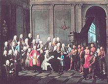 Yamacraw Creek Native Americans meet with the Trustee of the colony of Georgia in England, July 1734. A Native American boy is in a blue coat. A woman is in a red dress (European clothing).
After 1704, Spanish control was limited to St. Augustine and Pensacola, both in present-day Florida. The Florida peninsula was subjected to raids as far as the Florida Keys. The coast of Georgia was occupied by now British-allied Native Americans such as the Yamasee until the Yamasee War of 1715–1717, after which the region was depopulated, opening up the possibility of a new British colony. In 1724, it was first suggested the British colony there be called Province of Georgia in honor of King George II.
British interest in establishing a colony below South Carolina came from varied sources. Spanish Florida was a threat to South Carolina and a haven for runaway slaves. The French in the 1720s established a fort near present-day Montgomery, Alabama, also a threat to British interests in the region. Traders from Charleston, South Carolina, had established trading posts as far west as the Ocmulgee River, near present-day Macon, Georgia. The British trading network kept the Creek Indians allied with them; the French move threatened to wrest these Indians' trade away from the British. These strategic interests made the British government interested in establishing a new colony that would reinforce the British influence in the border country that had been open to Spanish and French penetration.
Meanwhile, many members of the British Parliament had become concerned about the plight of Britain's debtors. A parliamentary committee investigated and reported on conditions in Britain's debtor prisons. A group of philanthropists organized themselves to establish a colony where the "worthy poor" of Britain could reestablish themselves as productive citizens. This goal was seen as both philanthropic, helping these distressed people, and patriotic, simultaneously relieving Britain of the burden of the imprisoned debtors and augmenting Britain's vital mercantile empire by planting new, industrious subjects to strengthen her trade.
In 1732, a group of these philanthropists were granted a royal charter as the Trustees of the Province of Georgia. They carefully selected the first group of colonists to send to the new colony. On 12 February 1733, 113 settlers aboard the Anne landed at what was to become the city of Savannah. This day is now known as Georgia Day, which is not a public holiday but is observed in schools and by some local civic groups. James Oglethorpe, one of the trustees of the colony, traveled with the first group of colonists, laid out the design of the town of Savannah, and acted as governor of the colony, although technically under the trustees there was no "governor." Oglethorpe acted as the only trustee present in the colony. When he returned to Britain, a series of disputes ended his tenure governing the colony; Georgia was then led by a series of presidents named by the trustees.
A large majority of the original settlers were English, but at the time Georgia was founded in 1732, the number of non-English immigrants to the 13 colonies was at an all time high. Although religious toleration was not valued in itself, the pragmatic need to attract settlers led to broad religious freedoms. South Carolina wanted German Lutherans, Scottish Presbyterians, Moravians, French Huguenots and Jews, and English and Welsh Protestants whom they valued as a counter to the French and Spanish Catholic and absolutist presence to the south. When the Moravians turned out to be pacifists who refused to serve in the colonial defense against Spain, they were expelled by the British in 1738. Catholics were denied the right to own property.[16]
Jewish immigrants fleeing the Spanish Inquisition, which was being carried out by the Spanish colonies in the New World, were allowed in after some debate, owing to the leadership of James Oglethorpe. In 1733, over forty Jews fleeing persecution arrived in Savannah, the largest such group to enter an American colony up to that time. Among them was Dr. Samuel Nunez, who was the first doctor in Georgia. He immediately showed his value as a citizen by playing an invaluable role in curbing an epidemic that had already killed scores of English and Scottish settlers, and was credited with saving the colony by General Oglethorpe.[16]
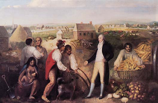
 Benjamin Hawkins, seen here on his plantation, teaches Creek Native Americans how to use European technology. Painted in 1805.
In 1752, after the government failed to renew subsidies that had helped support the colony, the Trustees turned over control to the crown. Georgia became a crown colony, with a governor appointed by the king.[17] However, even after Georgia eventually became a royal colony (1752), there were so many dissenters (Protestants of minority denominations, that is, non-Anglican) that the establishment of the Church of England was successfully resisted until 1752. These dissenting churches were the mainstay of the Revolutionary movement, culminating in the War for Independence from Britain, through the patriotic and anti-authoritarian sermons of their ministers, and the use of the churches to organize rebellion. Whereas the Anglican Church tended to preach stability and loyalty to the Crown, other Protestant sects preached heavily from the Old Testament and emphasized freedom and equality of all men before God, as well as the moral responsibility to rebel against tyrants.[18]
Revolutionary War history
Main article: Georgia during the American RevolutionProvince of Georgia was one of the Thirteen Colonies that revolted against British rule in the American Revolution by signing the 1776 Declaration of Independence, despite a large population of people loyal to the crown. Since Georgia was a relatively new colony at the time compared to the other twelve colonies, Georgia was not as active in the war. Also, the Georgian militia was not fully developed, which led to the capture of Savannah by British forces in December 1778.
American forces under the command of General Benjamin Lincoln combined with French forces under the command of Charles Henri Comte d’Estaing to lay siege to Savannah in 1779. The attempt was unsuccessful, and Savannah remained in British hands until the end of the war. During the war, nearly one-third of the slaves, more than 5,000 enslaved African Americans, exercised their desire for independence by escaping and joining British forces, where they were promised freedom. Some went to Great Britain or the Caribbean; others were resettled in Canada provinces.[19] Other estimates show an even greater impact from the war, when slaves escaped during the disruption. "The sharp decline between 1770 and 1790 in the proportion of the population made up of blacks (almost all of whom were slaves) [went] from 45.2 percent to 36.1 percent in Georgia."[20]
Following the war, Georgia became the fourth state of the United States of America after ratifying the United States Constitution on 2 January 1788. Georgia established its first state constitution in 1777. The state established new constitutions in 1788, 1799, 1861, 1865, 1868, 1877, 1945, 1976, and 1983, for a total of 10 — more constitutions than any other state, except for Louisiana, which has had 11.
In 1829, gold was discovered in the north Georgia mountains, resulting in the Georgia Gold Rush, the second gold rush in U.S. history. A Federal mint was established in Dahlonega, Georgia and continued to operate until 1861. An influx of white settlers pressured the U.S. government to take the land away from the citizens of the Cherokee Nation, who operated their own government, complete with a written constitution, and who did not recognize the authority of the state of Georgia.
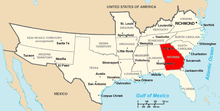 A map of the Confederate States of America with Georgia's position highlighted
The dispute culminated in the Indian Removal Act of 1830, under which all eastern tribes were sent west to Indian reservations in present-day Oklahoma. In Worcester v. Georgia, the Supreme Court in 1832 ruled that states were not permitted to redraw the boundaries of Indian lands, but President Andrew Jackson and the state of Georgia ignored the ruling. In 1838, his successor, Martin Van Buren dispatched federal troops to round up the Cherokee and deport them west of the Mississippi. This forced relocation, known as the Trail of Tears, led to the death of over 4,000 Cherokees.
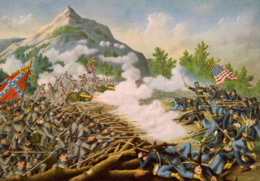 Battle of Kennesaw Mountain, June 27, 1864.
Confederate history
Main article: Georgia in the American Civil WarOn January 18, 1861, Georgia joined the Confederacy and became a major theater of the American Civil War. Major battles took place at Chickamauga, Kennesaw Mountain, and Atlanta. In December 1864, a large swath of the state from Atlanta to Savannah was destroyed during General William Tecumseh Sherman's March to the Sea. This event served as the historical background for the 1936 novel Gone with the Wind and the 1939 film of the same name. On July 15, 1870, following Reconstruction, Georgia became the last former Confederate state to be reseated in Congress and restored to the Union. On April 29, 2009, Governor Sonny Perdue signed into law a bill that will make April Confederate History and Heritage month in the state.[21]
Civil War to World War II
It took nearly 80 years to recover from the devastation of the Civil War. Georgia, along with the rest of the South had been destroyed financially. With job creation at a standstill, Jim Crow laws were politically popular to ensure that the better available jobs were filled by whites.
A new economy arose during World War II, one that needed a more highly skilled labor force, making the overturning of Jim Crow laws by the US Congress and US Supreme Court, less unpopular than might have been the case at an earlier time.
Capitals
Georgia has had five official state capitals: colonial Savannah; which later alternated with Augusta; then (for a decade) Louisville (pronounced Lewis-ville, /ˈluɪsvɪl/); and Milledgeville, from 1806 through 1868 (which included the American Civil War period). The state legislature also often met at temporary sites, including Macon (especially during the turmoil of the Civil War). In 1868, the capital was moved to the reconstructed city of Atlanta — one with better access by railroad.
Cities
See also: Georgia census statistical areasLargest cities, 2010
On March 17, 2011, the US Census Bureau released 2010 population counts for Georgia's cities with populations above 50,000.[22]
Largest cities, 2010 Census City Population Atlanta 420,003Augusta 195,844Columbus 189,885Savannah 136,286Athens 115,452Sandy Springs 93,853Macon 91,351Roswell 88,346Albany 77,434Johns Creek 76,728Warner Robins 66,588Alpharetta 57,551Marietta 56,579Valdosta 54,518Smyrna 51,271Largest metropolitan areas, 2010
On March 17, 2011, the US Census Bureau's 2010 figures were announced for Georgia's twenty-two Metropolitan Statistical Areas and Micropolitan Statistical Areas with populations above 50,000.[23] In descending order, they are:
Largest metropolitan areas, 2010 Census Metro. Area Population Atlanta 5,268,860Augusta 556,877Savannah 347,611Columbus 294,865Macon 232,293Athens 192,541Gainesville 179,684Albany 157,308Dalton 142,227Warner Robins 139,900Valdosta 139,588Brunswick 112,370Rome 96,317Hinesville 77,917Statesboro 70,217LaGrange 67,044Dublin 58,414Calhoun 55,186Milledgeville 55,149Waycross 55,070Douglas 50,731St. Marys 50,513Demographics
Historical populations Census Pop. %± 1790 82,548 — 1800 162,686 97.1% 1810 251,407 54.5% 1820 340,989 35.6% 1830 516,823 51.6% 1840 691,392 33.8% 1850 906,185 31.1% 1860 1,057,286 16.7% 1870 1,184,109 12.0% 1880 1,542,181 30.2% 1890 1,837,353 19.1% 1900 2,216,331 20.6% 1910 2,609,121 17.7% 1920 2,895,832 11.0% 1930 2,908,506 0.4% 1940 3,123,723 7.4% 1950 3,444,578 10.3% 1960 3,943,116 14.5% 1970 4,589,575 16.4% 1980 5,463,105 19.0% 1990 6,478,216 18.6% 2000 8,186,453 26.4% 2010 9,687,653 18.3% Sources: 1910–2010[24] In 2007, Georgia had an estimated population of 9,544,750 which was an increase of 180,809 from the previous year, and an increase of 1,177,125 since 2000. This includes a natural increase since the last census of 438,939 people (that is 849,414 births minus 410,475 deaths) and an increase from net migration of 606,673 people into the state. Immigration from outside the United States resulted in a net increase of 228,415 people, and migration within the country produced a net increase of 378,258 people.
The state stood sixth in the country for illegal immigrants. There were 35,000 in 1990; the count more than doubled from January 2000 to January 2009, at 480,000.[25]
There were 743,000 veterans in 2009.[26]
Race, language and age
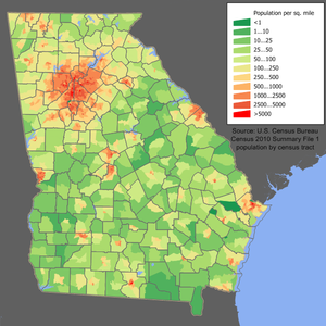 Georgia population density map.
According to the 2010 U.S. Census, Georgia had a population of 9,687,653. In terms of race and ethnicity, the state was 59.7% White (55.9% Non-Hispanic White Alone), 30.5% Black or African American, 0.3% American Indian and Alaska Native, 3.2% Asian, 0.1% Native Hawaiian and Other Pacific Islander, 4.0% from Some Other Race, and 2.1% from Two or More Races. Hispanics and Latinos of any race made up 8.8% of the population.[27] The largest ancestry groups are: 10.8% American (mostly British descent), 9.5% Irish, 8.9% English and 8.2% German.[28] In the 1980 census 1,584,303 Georgians cited that they were of English ancestry out of a total state population of 3,994,817 making them 40% of the state, and the largest ethnic group at the time.[29] Today, many of these same people cite that they are of "American" ancestry, in many cases because their families have been in the country for so long, often since the early colonial period, even though they are of English or primarily English ancestry.[30][31][32][33]
As of 2005, 90% of Georgia residents age 5 and older speak only English at home and 5.6% speak Spanish. French is the third most spoken language at 0.9%, followed by German at 0.8% and Vietnamese at 0.6%. As of 2004, 7.7% of its population was reported as under 5 years of age, 26.4% under 18, and 9.6% were 65 or older. Also as of 2004, females made up approximately 50.6% of the population and African Americans made up approximately 29.6%.
Historically, about half of Georgia's population was composed of African Americans who, prior to the Civil War, were almost exclusively enslaved. The Great Migration of hundreds of thousands of blacks from the rural South to the industrial North from 1914–1970 reduced the African American population.[34]
Georgia had the second fastest growing Asian population growth in the U.S. from 1990 to 2000, more than doubling in size during the ten-year period.[35] In addition, according to census estimates, Georgia ranks third among the states in terms of the percent of the total population that is African American (after Mississippi and Louisiana) and third in numerical Black population after New York and Florida. Georgia was the state with the largest numerical increase in the black population from 2006 to 2007 with 84,000.
Georgia is the state with the third-lowest percentage of older people (65 or older), at 10.1 percent (as of 2008).[36]
The colonial settlement of large numbers of Scottish American, English American and Scotch-Irish Americans in the mountains and piedmont, and coastal settlement by some English Americans and African Americans, have strongly influenced the state's culture in food, language and music. The concentration of Africans imported to coastal areas in the 18th century repeatedly from rice growing regions of West Africa led to the development of Gullah-Geechee language and culture in the Low Country among African Americans. They share a unique heritage in which African traditions of food, religion and culture were continued more than in some other areas. In the creolization of Southern culture, their foodways became an integral part of all Southern cooking in the Low Country.[37]
Religion
Like most other Southern states, Georgia is largely Protestant Christian. The religious affiliations of the people of Georgia are as follows:[38]
- Protestant: 70%
- Baptist: 24%
- Methodist: 12%
- Presbyterian: 3%
- Pentecostal: 3%
- Catholic: 12%
- Other: 3%
- Non-religious: 13%
The largest Christian denominations by number of adherents in 2000 were the Southern Baptist Convention with 1,719,484; the United Methodist Church with 570,674; and the Catholic Church with 374,185.[39]
Economy
 Atlanta skyline.
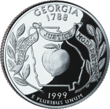 A Georgia U.S. quarter
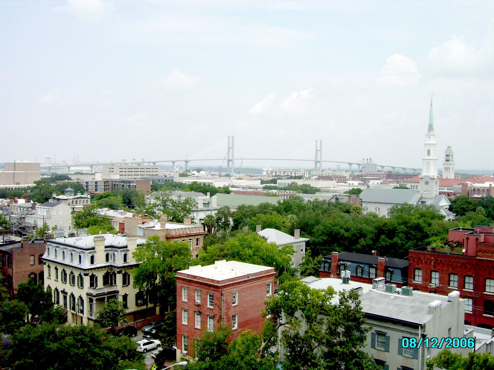
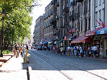 Savannah's River Street is a popular destination among tourists visiting coastal Georgia.
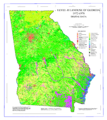 Map showing land use in Georgia
Georgia's 2010 total gross state product was $403.1 billion.[40] Its Per Capita personal income for 2007 puts it 37th in the nation at $33,499. If Georgia were a stand-alone country, it would be the 28th largest economy in the world.[41]
There are 15 Fortune 500 companies and 26 Fortune 1000 companies with headquarters in Georgia, including such names as Home Depot, UPS, Coca Cola, Delta Air Lines, Aflac, Southern Company, and SunTrust Banks. Georgia has over 1,700 internationally headquartered facilities representing 43 countries, employing more than 112,000 Georgians with an estimated capital investment of $22.7 billion.
Agriculture and industry
Georgia's agricultural outputs are poultry and eggs, pecans, peaches, peanuts, rye, cattle, hogs, dairy products, turfgrass, tobacco, and vegetables. Its industrial outputs are textiles and apparel, transportation equipment, cigarettes, food processing, paper products, chemical products, and electric equipment. Tourism also makes an important contribution to the economy. Atlanta has been the site of enormous growth in real estate, service, and communications industries.
Atlanta has a very large effect on the state of Georgia and the Southeastern United States. The city is an ever growing addition to communications, industry, transportation, tourism, and government.
Food is also a major industry in Georgia, with widespread farms producing peanuts, corn, and soybeans across middle and south Georgia. The state is the number one producer of pecans in the world, with the region around Albany in southwest Georgia being the center of Georgia's pecan production. Gainesville in northeast Georgia touts itself as the Poultry Capital of the World.
Industry in Georgia is quite diverse. Major products in the mineral and timber industry include a variety of pines, clays, stones, and sands. The clay palygorskite, known as attapulgite, was named because of its abundance near the Decatur County town of Attapulgus in the deep southwest corner of the state. Attapulgite has numerous medical, cosmetic, and industrial uses. Textile industry is located around the cities of Rome, Columbus, Augusta, Macon and along the I-75 corridor between Atlanta and Chattanooga, Tennessee to include the towns of Cartersville, Calhoun, Ringgold, and Dalton (the Carpet Capital of the World). In November 2009, Kia started production at the first U.S. Kia Motors plant, Kia Motors Manufacturing Georgia in West Point.
With its great population base and location along major transportation routes, Atlanta is a leading center of tourism, transportation, communications, government, and industry. Some industries there include automobile and aircraft manufacturing, food and chemical processing, printing, publishing, and large corporations. Some of the corporations headquartered in the metropolitan Atlanta area are: Arby's, Chick-fil-A, The Coca-Cola Company, Georgia-Pacific, Hooters, ING Americas, Cox Enterprises, Delta Air Lines, The Home Depot, Newell Rubbermaid, Primerica Financial Services, United Parcel Service, Waffle House, and NCR Corporation. Major corporations in other parts of the state include: Aflac, CareSouth, Gulfstream Aerospace, Mohawk Industries, and Zaxby's.
Georgia has one of the strongest military presences in the country. Several United States military installations are located in the state including Fort Stewart, Hunter Army Airfield, Naval Submarine Base Kings Bay, Fort Benning, Moody Air Force Base, Robins Air Force Base, Naval Air Station Atlanta, Fort McPherson, Fort Gillem, Fort Gordon, Marine Corps Logistics Base Albany Dobbins Air Reserve Base, Coast Guard Air Station Savannah and Coast Guard Station Brunswick. However, due to the latest round of BRAC cuts, Forts Gillem and McPherson will be closing and NAS Atlanta will be transferred to the Georgia National Guard.
Energy use and production
Georgia's electricity generation and consumption are among the highest in the United States, with coal being the primary electrical generation of fuel. However, the state also has two nuclear power plants which contribute less than one fourth of Georgia's electricity generation. The statistics are 75% coal, 16% nuclear, 7% oil and natural gas, and 1% hydroelectric/other. The leading area of energy consumption is the industrial sector because Georgia "is a leader in the energy-intensive wood and paper products industry".[42]
State taxes
Georgia's personal income tax ranges from 1% to 6% within six tax brackets. There is a 4% state sales tax,[43] which is not applied to prescription drugs, certain medical devices, and groceries. Each county may add up to a 2% SPLOST. Counties participating in MARTA have another 1%. The city of Atlanta (in two counties, roughly 90% in Fulton and 10% in Dekalb) has the only city sales tax (1%, total 8%) for fixing its aging sewers. Local taxes are almost always charged on groceries but never prescriptions. Up to 1% of a SPLOST can go to homestead exemptions (the HOST). All taxes are collected by the Georgia Department of Revenue and then properly distributed according to any agreements that each county has with its cities.
Governance
Main article: Government of Georgia (U.S. state)State government
See also: List of governors of Georgia and Georgia elected officials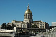 The Georgia State Capitol Building in Atlanta with the distinctive gold dome.
The capital of Georgia is Atlanta. As with all other U.S. states and the federal government, Georgia's government is based on the separation of legislative, executive and judicial power.[44] Executive authority in the state rests with the governor, currently Nathan Deal (Republican). (See List of Governors of Georgia). Both the governor and lieutenant governor are elected on separate ballots to four-year terms of office. Unlike the federal government, but like many other U.S. States, most of the executive officials who comprise the governor's cabinet are elected by the citizens of Georgia rather than appointed by the governor.
Legislative authority resides in the General Assembly, composed of the Senate and House of Representatives. The Lieutenant Governor presides over the Senate, while the House of Representatives selects their own Speaker. The Georgia Constitution mandates a maximum of 56 senators, elected from single-member districts, and a minimum of 180 representatives, apportioned among representative districts (which sometimes results in more than one representative per district); there are currently 56 senators and 180 representatives. The term of office for senators and representatives is two years.[45]
State judicial authority rests with the state Supreme Court and Court of Appeals, which have statewide authority.[46] In addition, there are smaller courts which have more limited geographical jurisdiction, including State Courts, Superior Courts, Magistrate Courts and Probate Courts. Justices of the Supreme Court and judges of the Court of Appeals are elected statewide by the citizens in non-partisan elections to six-year terms. Judges for the smaller courts are elected by the state's citizens who live within that court's jurisdiction to four-year terms.
Local government
Georgia consists of 159 counties; more than any other state except Texas which consists of 254 counties.[47] Before the year of 1932, there were 161, with Milton and Campbell being merged into Fulton at the end of 1931. Counties have been named for prominent figures in both American and Georgian history, but many bear names with Native American origin. Counties in Georgia have their own elected legislative branch, usually called the Board of Commissioners, which usually also has executive authority in the county.[48] Several counties have a Sole Commissioner government, with legislative and executive authority vested in a single person. Georgia is the only state with Sole Commissioner counties. Georgia's Constitution provides all counties and cities with "home rule" authority, and so the county commissions have considerable power to pass legislation within their county as a municipality would.
Further information: list of Georgia countiesBesides the counties, Georgia only defines cities as local units of government. Every incorporated town, no matter how small, is legally a city. Georgia does not provide for townships or independent cities (though there is a movement in the Legislature to provide for townships)[citation needed] but does allow consolidated city-county governments by local referendum. So far, only Columbus, Augusta, Athens, and Cusseta have done this. Conyers is studying possibly becoming consolidated with Rockdale County.[citation needed] Recently, Savannah has consolidated its police department with the county police department and is currently studying possible consolidation with Chatham County.[citation needed]
There is no true metropolitan government in Georgia, though the Atlanta Regional Commission and Georgia Regional Transportation Authority do provide some services, and the ARC must approve all major land development projects in the Atlanta metropolitan area.
Elections
Main article: Elections in Georgia (U.S. state)Presidential elections results Year Republican Democratic 2008 52.20% 2,048,744 47.00% 1,844,137 2004 57.97% 1,914,254 41.37% 1,366,149 2000 54.67% 1,419,720 42.98% 1,116,230 1996 47.01% 1,080,843 45.84% 1,053,849 1992 42.88% 995,252 43.47% 1,008,966 1988 59.75% 1,081,331 39.50% 714,792 1984 60.17% 1,068,722 39.79% 706,628 1980 40.95% 654,168 55.76% 890,733 1976 32.96% 483,743 66.74% 979,409 1972 75.04% 881,496 24.65% 289,529 1968* 30.40% 380,111 26.75% 334,440 1964 54.12% 616,584 41.15% 522,557 1960 37.43% 274,472 62.54% 458,638 1956 32.65% 216,652 66.48% 441,094 1952 30.34% 198,979 69.66% 456,823 1948 18.31% 76,691 60.81% 254,646 1944 18.25% 59,880 81.74% 268,187 1940 14.83% 46,360 84.85% 265,194 1936 12.60% 36,942 87.10% 255,364 1932 7.77% 19,863 91.60% 234,118 *State won by George Wallace
of the American Independent Party,
at 42.83%, or 535,550 votesUntil recently, Georgia's state government had the longest unbroken record of single-party dominance, by the Democratic Party, of any state in the Union. This record was established partly by disfranchisement of most blacks and many poor whites in the early 20th century, lasting into the 1960s.
After Reconstruction, white Democrats regained power, especially by legal disfranchisement of most African Americans and many poor whites through erection of barriers to voter registration. In 1900, shortly before Georgia adopted a disfranchising constitutional amendment in 1908, blacks comprised 47% of the state's population.[49] A "clean" franchise was linked by Progressives to electoral reform.[50] White, one-party rule was solidified.
For over 130 years, from 1872 to 2003, Georgians only elected white Democratic governors, and white Democrats held the majority of seats in the General Assembly. Most of the Democrats elected throughout these years were Southern Democrats or Dixiecrats, who were very conservative by national standards. This continued after the segregationist period, which ended legally in the 1960s. According to the 1960 census, the proportion of Georgia's population that was African American had decreased to 28%.[51] After a Democratic-controlled Congress passed civil rights legislation to secure voting and civil rights in the mid-1960s, most African Americans in the South joined the Democratic Party.
Progress in civil rights was demonstrated with the election of former Georgia Governor Jimmy Carter in 1976 to the U.S. Presidency.
The political dominance of Democrats ended in 2003, when then-Governor Roy Barnes was defeated by Republican Sonny Perdue, a state legislator and former Democrat himself. While Democrats retained control of the State House, they lost their majority in the Senate when four Democrats switched parties. They lost the House in the 2004 election. Republicans now control all three partisan elements of the state government.
Even before 2003, the state had become increasingly supportive of Republicans in Presidential elections. It has supported a Democrat for president only three times since 1960. In 1976 and 1980, native son Jimmy Carter carried the state; in 1992, the former Arkansas governor Bill Clinton narrowly won the state. Generally, Republicans are strongest in the predominantly white suburban (especially the Atlanta suburbs) and rural portions of the state.[52] Many of these areas were represented by conservative Democrats in the state legislature well into the 21st century. One of the most conservative of these was U.S. Congressman Larry McDonald, former head of the John Birch Society who was killed when the Soviet Union shot down KAL 007 near Sakhalin Island. Democratic candidates have tended to win a higher percentage of the vote in the areas where black voters are most numerous,[52] as well as in the cities (especially Atlanta and Athens), and the rural Black Belt region that travels through the central and southwestern portion of the state.
As of the 2001[update] reapportionment, the state has 13 seats in the U.S. House of Representatives, which are currently held by 7 Republicans and 6 Democrats.
In recent events, Democrat Jim Martin ran against incumbent Republican Senator Saxby Chambliss. Chambliss failed to acquire the necessary 50 percent of votes, a Libertarian Party candidate receiving the remainder of votes. In the runoff election held on December 2, 2008, Chambliss became only the second Georgia Republican to be reelected to the U.S. Senate.
See also: United States presidential election, 2004, in Georgia and Political party strength in Georgia (U.S. state)Politics
Main article: Politics of Georgia (U.S. state)During the 1960s and 1970s, Georgia made significant changes in civil rights, governance, and economic growth focused on Atlanta. It was a bedrock of the emerging "New South".
In the 21st century, many conservative Democrats, including former U.S. Senator and governor Zell Miller, have decided to support Republicans. The state's socially conservative bent results in wide support for such measures as restrictions on abortion. Its voters passed a ban on same-sex marriage with 76% voting yes.[53]
On April 1, 2009, Senate Resolution 632 passed by a vote of 43–1.[54] It reads in part:[55]
Any Act by the Congress of the United States, Executive Order of the President of the United States of America or Judicial Order by the Judicatories of the United States of America which assumes a power not delegated to the government of the United States of America by the Constitution for the United States of America and which serves to diminish the liberty of the any of the several States or their citizens shall constitute a nullification of the Constitution for the United States of America by the government of the United States of America.
On April 16, Jay Bookman of The Atlanta Journal-Constitution wrote "It wasn’t quite the firing on Fort Sumter that launched the Civil War. But on April 1, your Georgia Senate did threaten by a vote of 43–1 to secede from and even disband the United States."[56]
Cultural
Main article: Culture of Georgia (U.S. state)Fine and performing arts
Georgia's major fine art museums include the High Museum of Art, the Michael C. Carlos Museum, the Telfair Museum of Art, and the Morris Museum of Art.[57]
The Atlanta Opera is a full time company that brings opera to Georgia stages,[58] while the Atlanta Symphony Orchestra is the most widely recognized orchestra and largest arts organization in the southeastern United States.[59]
There are a number of performing arts venues in the state, among the largest are the Fox Theatre, and the Alliance Theatre at the Woodruff Arts Center, both on Peachtree Street in Midtown Atlanta. Duluth, Roswell, Norcross, and Marietta each have a fairly active theater community.
Literature
Dramas such as the play (on which a successful movie was also based) Driving Miss Daisy are one example of Georgia's literary culture. The most popular and famous novel has probably been Margaret Mitchell's Gone with the Wind, also the basis of a wildly successful movie. Other authors who challenged popular ideas were Carson McCullers and Flannery O'Connor. Contemporary authors such as Alice Walker have also used Georgia's complex past as subjects for fiction, as in her The Color Purple.
Georgia's poets, such as James Dickey and Sidney Lanier, and nonfiction writers like humorist Lewis Grizzard also have a place in the state's literary life.[60]
Film
The state film commission was established in 1973; the agency is now referred to as the Georgia Film, Music and Digital Entertainment Office.[61] Since 1972, seven hundred film and television projects have been filmed on location in Georgia.[62] In 2008–2009, Georgia's film and television industry created a $1.15 billion economic impact on the state's economy.[63]
Health care
Georgians can find medical and dental care "via 151 general hospitals, more than 15,000 doctors and nearly 6,000 dentists."[64] The state is ranked forty-first in the percentage of residents who engage in regular exercise.[65]
Education
 Anderson Hall at Savannah College of Art and DesignMain article: Education in Georgia (U.S. state)
Georgia high schools (grades nine through twelve) are required to administer a standardized, multiple choice End of Course Test, or EOCT, in each of eight core subjects including Algebra I, Geometry, U.S. History, Economics, Biology, Physical Science, Ninth Grade Literature and Composition, and American Literature and Composition. The official purpose of the tests is to assess "specific content knowledge and skills." Although a minimum test score is not required for the student to receive credit in the course, completion of the test is mandatory. The EOCT score comprises 15% of a student's grade in the course.[66] The Criterion-Referenced Competency Tests (CRCT) is taken in 1st–8th grade.
High school students must also receive passing scores on four Georgia High School Graduation Tests (GHSGT) and the Georgia High School Writing Assessment in order to receive a diploma. Subjects assessed include Mathematics, Science, Language Arts, and Social Studies. These tests are initially offered during students' eleventh-grade year, allowing for multiple opportunities to pass the tests before graduation at the end of twelfth grade.[67]
Georgia has almost 70 public colleges, universities, and technical colleges in addition to over 45 private institutes of higher learning.
The HOPE Scholarship, funded by the state lottery, is available to all Georgia residents who have graduated from high school or earned a General Educational Development certificate. The student must maintain a 3.0 or higher grade point average and attend a public college or university in the state.
Transportation
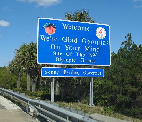
Main article: Transportation in Georgia (U.S. state) Georgia state welcome sign.
Transportation in Georgia is overseen by the Georgia Department of Transportation, a part of the executive branch of the state government. Georgia's major Interstate Highways are I-75 and I-85. On March 18, 1998, the Georgia House of Representatives passed a resolution naming the portion of Interstate Highway 75, which runs from the Chattahoochee River northward to the Tennessee state line the Larry McDonald Memorial Highway. Larry McDonald, a Democratic member of the House of Representatives, had been on Korean Air Lines Flight 007 when it was shot down by the Soviets on September 1, 1983.
Other important interstate highways are I-95, I-20, I-16, I-59 and I-24. I-285 is Atlanta, Georgia's perimeter route and I-575 connects with counties in north Georgia on I-75.[68] Major freight railroads in Georgia include CSX and Norfolk Southern Railway. Passenger service in Georgia is available on two Amtrak routes: the Crescent, which runs from New York to Washington, D.C., through north Georgia and Atlanta to New Orléans and the other runs from New York to the Georgia coast and from there to Florida.[69]
Interstate highways
 Interstate 16,
  Interstate 516
 Interstate 20,
  Interstate 520
 Interstate 24 (two interchanges)
 Interstate 59 (four interchanges)
 Interstate 75,
  Interstate 475,
  Interstate 575,
  Interstate 675
 Interstate 85,
  Interstate 185,
  Interstate 985
 Interstate 95
 Interstate 285 (The Perimeter around Atlanta)
 Interstate 3 (proposed)
 Interstate 14 (proposed)
United States highways
North-south routes
East-west routes
Airports
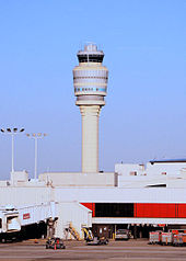 Hartsfield–Jackson Atlanta International Airport's 398-foot (121 m) tall control tower
Georgia's primary commercial airport is Hartsfield–Jackson Atlanta International Airport (ATL), and is the world's busiest passenger airport.[70] In addition to Hartsfield-Jackson, there are eight other airports serving major commercial traffic in Georgia. Savannah/Hilton Head International Airport is the second-busiest airport in the state as measured by passengers served, and is the only additional international airport. Other commercial airports (ranked in order of passengers served) are located in Augusta, Columbus, Albany, Macon, Brunswick, Valdosta, and Athens.[71]
Georgia has 98 public-use general aviation airports in addition to its primary commercial airports. The busiest of these airports in terms of daily takoff and landing traffic is DeKalb-Peachtree Airport in Chamblee, Georgia (known as "PDK" due to its DOT call letters). PDK has averaged more than 230,000 takeoffs and landings per year for over thirty years, and serves as a "general reliever airport" for the Atlanta area.[71] Other general reliever airports in the metro Atlanta area include Charlie Brown Field in Atlanta, Briscoe Field in Lawrenceville, and McCollum Field in Kennesaw.
Media
Television
See also: List of television stations in Georgia (U.S. state)Georgia resident Ted Turner founded TBS, TNT, TCM, Cartoon Network, CNN and Headline News, among others. The CNN Center, which houses the news channel's world headquarters, is located in downtown Atlanta, facing Marietta Street, while the home offices of the Turner Entertainment networks are located in midtown, near the Georgia Tech campus, on Techwood Drive. A third Turner building is on Williams Street, directly across Interstate 75 and Interstate 85 from the Techwood Drive campus and Swim and Williams Street Studios.
The Weather Channel's headquarters are located in the Smyrna area of metropolitan Atlanta in Cobb County.
WSB-TV was the state's first television station, and the southeastern United States' second. WSB-TV signed on Channel 8 in 1948, and moved to its present day location on Channel 2 in 1952.
Georgia Public Broadcasting (GPB) operates nine major Non-commercial educational television stations across the state as Georgia Public Broadcasting Television.[72]
SportSouth and Fox Sports South are the leaders in sports television in the southeast. The Television studio and offices are located in Atlanta, Georgia on Peachtree Street.
Radio
See also: List of radio stations in GeorgiaWSB-AM in Atlanta was the first licensed radio station in the southeastern United States, signing on in 1922. The station currently broadcasts a news/talk format. WMAZ (Watch Mercer Attain Zenith) in Macon first broadcast commencement exercises of Mercer University in June 1921 but was unlicensed and had a power of only 10 watts. It was licensed in February 1923 and today has a power of 50,000 watts daytime and uses the call sign WMAC AM 940.See http://www.antiqueradio.com/wmaz_03-98.html WSB-FM signed on in 1948 on 104.5 FM, and moved to 98.5 FM in 1952. The station broadcasts today, still with the WSB-FM callsign, but is known as "B98.5FM".
Georgia Public Radio has been in service since 1984 and, with the exception of Atlanta, it broadcasts daily on several FM (and one AM) stations across the state. 1984.[73][74] Georgia Public Radio reaches nearly all of Georgia (with the exception of the Atlanta area, which is served by WABE), as well as portions of Alabama, Florida, South Carolina, and Tennessee.
Newspapers
There are several notable newspapers in Georgia. Among them are The Atlanta Journal-Constitution, The Augusta Chronicle, the Columbus Ledger-Enquirer, The Telegraph (formerly The Macon Telegraph) and the Savannah Morning News.
Sports and recreation
Main article: Sports in Georgia (U.S. state)Sports in Georgia include professional teams in all major sports, Olympic Games contenders and medalists, collegiate teams in major and small-school conferences and associations, and active amateur teams and individual sports. The State of Georgia has a team in seven major professional leagues (MLB, NFL, NBA, ABA, AFL, IL, and ECHL). Georgia has an abundance of outdoor recreational activities. Outdoor activities include, but are not limited to, hiking along the Appalachian Trail; Civil War Heritage Trails; rock climbing and whitewater paddling.[75][76][77][78] Other outdoor activities include hunting and fishing. Less rustic activities are trips to Callaway Gardens; and Zoo Atlanta.[79][80][81][82] NBA superstars Dwight Howard, Josh Smith,and Javaris Crittenton, Heavyweight champion boxer Evander Holyfield and wrestling superstar Hulk Hogan are also from Atlanta.
State facts and symbols
Georgia State symbols 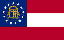
The Flag of Georgia. Animate insignia Amphibian American Green Tree Frog Bird(s) Brown Thrasher Butterfly Eastern Tiger Swallowtail Fish Largemouth bass Flower(s) Cherokee Rose Insect European honey bee Mammal(s) Right whale Reptile Gopher tortoise Tree Live oak Inanimate insignia Dance Square dance Food Grits, Peach, Vidalia Sweet Onion Fossil Shark tooth Gemstone Quartz Mineral Staurolite Rock Granite Shell Knobbed Whelk Soil Tifton Song(s) Georgia on My Mind Tartan Georgia state tartan Route marker(s) 
State Quarter 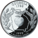
Released in 1999 Lists of United States state insignia Georgia's nicknames include Peach State and Empire State of the South.[83] The state song, "Georgia on My Mind" by Hoagy Carmichael, was originally written about a woman of that name. After Georgia native Ray Charles made it popular with his recording, the state legislature voted it the state song on April 24, 1979. Ray Charles sang it on the legislative floor when the bill was passed. The legislature's action was considered symbolic of the state's move away from racial segregation and racism.
The state commemorative quarter was released on July 19, 1999.[84] The first houses in Georgia to be designated historic state landmarks are the Owens Thomas House and the Sorrel Weed House, in the Savannah historic district. The state animal, an opossum, is called "Pogo Possum".[85]
See also
- Outline of Georgia (U.S. state)
- Index of Georgia (U.S. state)-related articles
- Atlantic Ocean
- List of National Register of Historic Places in Georgia
- List of people from Georgia (U.S. state)
- List of places in Georgia (U.S. state)
- U.S. state
- Georgia (U.S. state) wiretapping laws
References
- ^ a b "2010 Census: Resident Population Data". 2010. http://2010.census.gov/2010census/data/apportionment-pop-text.php. Retrieved 2010-12-22.
- ^ a b "Elevations and Distances in the United States". United States Geological Survey. 2001. http://egsc.usgs.gov/isb/pubs/booklets/elvadist/elvadist.html. Retrieved October 21, 2011.
- ^ Elevation adjusted to North American Vertical Datum of 1988.
- ^ "Coweta is the 41st fastest growing county in United States". The Times-Herald. http://www.times-herald.com/Local/Coweta-is-the-41st-fastest-growing-county-in-United-States-690912. Retrieved 2010-05-22.
- ^ States Ranked for Total Area, Land Area, and Water Area – NETSTATE.com. Retrieved December 26, 2006.
- ^ Drought-stricken Georgia eyes Tennessee's border – and river water Los Angeles Times.
- ^ a b c Georgia – Flora and fauna – city-data.com. Retrieved February 3, 2007.
- ^ Monthly Averages for Macon, GA The Weather Channel.
- ^ Monthly Averages for Clayton, GA The Weather Channel.
- ^ "Georgia USDA Plant Hardiness Zone Map". http://www.plantmaps.com/interactive-georgia-usda-plant-zone-hardiness-map.php. Retrieved 2010-11-11.
- ^ Each state's high temperature record USA Today, last updated August 2004.
- ^ Each state's low temperature record USA Today, last updated August 2006
- ^ "Weather By Day Georgia". Weatherbyday.com. http://www.weatherbyday.com/georgia/. Retrieved 2010-10-24.
- ^ Georgia Department of Natural Resources gadnr.org, accessed May 13, 2007
- ^ National Park Service nps.gov, accessed May 13, 2007
- ^ a b Patricia U. Bonomi, "Under the Cope of Heaven. Religion, Society and Politics in Colonial America", Oxford University Press, 1986, p 32-33
- ^ "Trustee Georgia, 1732–1752". Georgiaencyclopedia.org. 2009-07-27. http://www.georgiaencyclopedia.org/nge/Article.jsp?id=h-816. Retrieved 2010-10-24.
- ^ Patricia U. Bonomi, "Under the Cope of Heaven. Religion, Society and Politics in Colonial America", Oxford University Press, Chapter 7 'Religion and the American Revolution'
- ^ Steven Mintz. "Digital History". Digitalhistory.uh.edu. http://www.digitalhistory.uh.edu/hyperhistorian.cfm. Retrieved 2010-10-24.
- ^ Peter Kolchin, American Slavery: 1619–1877, New York: Hill and Wang, 1994, p. 73
- ^ "Governor Perdue signs Confederate History Month bill". Canadafreepress.com. http://www.canadafreepress.com/index.php/article/10742. Retrieved 2010-05-22.
- ^ "American FactFinder". Factfinder2.census.gov. http://factfinder2.census.gov. Retrieved 2011-08-05.
- ^ "Metropolitan Area Population & Housing Patterns: 2000–2010". http://proximityone.com/metros0010.htm.
- ^ Resident Population Data. "Resident Population Data – 2010 Census". 2010.census.gov. http://2010.census.gov/2010census/data/apportionment-pop-text.php. Retrieved 2011-08-05.
- ^ "Illegals on rise in Southeast". Melbourne, Florida: Florida Today. 24 February 2010. pp. 6A. http://www.star-telegram.com/2010/02/23/1991912/illegal-immigrant-numbers-rise.html.
- ^ Kanell, Michael E. (16 November 2009). "Number of veterans, October". Atlanta, Georgia: Atlanta Constitution-Journal. pp. A6. http://www.ajc.com/business/vets-jobs-challenges-in-199084.html. quoting the Bureau of Labor Statistics
- ^ "American FactFinder". Factfinder2.census.gov. 2010-10-05. http://factfinder2.census.gov/faces/tableservices/jsf/pages/productview.xhtml?pid=DEC_10_PL_QTPL&prodType=table. Retrieved 2011-08-05.
- ^ http://factfinder.census.gov/servlet/ADPTable?_bm=y&-geo_id=04000US13&-qr_name=ACS_2009_1YR_G00_DP2&-context=adp&-ds_name=ACS_2009_1YR_G00_&-tree_id=308&-_lang=en&-redoLog=false&-format=
- ^ http://www.census.gov/population/www/censusdata/files/pc80-s1-10/tab03.pdf
- ^ Sharing the Dream: White Males in a Multicultural America By Dominic J. Pulera.
- ^ Reynolds Farley, 'The New Census Question about Ancestry: What Did It Tell Us?', Demography, Vol. 28, No. 3 (August 1991), pp. 414, 421.
- ^ Stanley Lieberson and Lawrence Santi, 'The Use of Nativity Data to Estimate Ethnic Characteristics and Patterns', Social Science Research, Vol. 14, No. 1 (1985), pp. 44-6.
- ^ Stanley Lieberson and Mary C. Waters, 'Ethnic Groups in Flux: The Changing Ethnic Responses of American Whites', Annals of the American Academy of Political and Social Science, Vol. 487, No. 79 (September 1986), pp. 82-86.
- ^ William H. Frey, "The New Great Migration: Black Americans' Return to the South, 1965–2000", The Brookings Institution, May 2004, accessed 19 May 2008
- ^ [1][dead link]
- ^ Georgia census Quickfacts[dead link]
- ^ Early Mountain Life, Who are Americans
- ^ "Pew Forum on Religion & Public Life". Religions.pewforum.org. http://religions.pewforum.org/maps. Retrieved 2010-10-24.
- ^ "The Association of Religion Data Archives | Maps & Reports". Thearda.com. http://www.thearda.com/mapsReports/reports/state/13_2000.asp. Retrieved 2010-05-22.
- ^ "GDP by State". Greyhill Advisors. http://greyhill.com/gdp-by-state. Retrieved 7 September 2011.
- ^ BEA statistics for 2005 GSP – October 26, 2006, Accessed May 9, 2008
- ^ Energy Information Administration. Retrieved December 30, 2007.
- ^ Georgia Public Policy Foundation.
- ^ Senate Kids. Retrieved December 30, 2007.
- ^ Constitution of Georgia Article III Section II. Retrieved December 30, 2007. Archived December 9, 2007 at the Wayback Machine
- ^ Supreme Court Brochure. Retrieved December 30, 2007. Archived September 27, 2007 at the Wayback Machine
- ^ A Brief History of Georgia Counties. Retrieved December 30, 2007. Archived November 2, 2007 at the Wayback Machine
- ^ Georgia's County Governments. Retrieved December 31, 2007.
- ^ Historical Census Browser, 1900 US Census, University of Virginia. Retrieved 15 March 2008.
- ^ Charles Crowe, "Racial Violence and Social Reform – Origins of the Atlanta Riot of 1906", The Journal of Negro History: Vol.53, No.3, July 1968. Retrieved 23 March 2008.
- ^ Historical Census Browser, 1960 US Census, University of Virginia. Retrieved 13 March 2008.
- ^ a b "Election 2004". CNN.com. http://www.cnn.com/ELECTION/2004//pages/results/states/GA/P/00/epolls.0.html. Retrieved 2010-10-24.
- ^ "Georgia Marriage Amendment, Question 1 (2004)". Ballotpedia. http://ballotpedia.org/wiki/index.php/Georgia_Constitutional_Amendment_1_%282004%29. Retrieved 2010-05-22.
- ^ 7:02 am April 16, 2009, by Jay (2009-04-16). "Georgia Senate threatens dismantling of USA | Jay Bookman". Blogs.ajc.com. http://blogs.ajc.com/jay-bookman-blog/2009/04/16/georgia-senate-threatens-dismantling-of-usa/. Retrieved 2010-05-22.
- ^ "sr632.html". Legis.ga.gov. http://www.legis.ga.gov/legis/2009_10/fulltext/sr632.htm. Retrieved 2010-05-22.
- ^ Bookman, Jay (2009-04-16). "Atlanta News, Sports, Atlanta Weather, Business News". ajc.com. http://www.ajc.com/services/content/printedition/2009/04/16/bookmaned0416.html. Retrieved 2010-05-22.
- ^ Willamette. Retrieved December 8, 2007.
- ^ Atlanta Opera. Retrieved December 8, 2007.
- ^ Atlanta Symphony Orchestra. Retrieved December 8, 2007.
- ^ Literature: Overview. Retrieved December 5, 2007.
- ^ Film Industry in Georgia. (2004–2010). The New Georgia Encyclopedia. Retrieved 2010-04-01.
- ^ Georgia Industries: Film Facts. (2010). Georgia. Retrieved 2010-04-01.
- ^ Georgia Industries: Film & TV. (2010). georgia.org. Retrieved 2010-04-01.
- ^ Georgia.org, Accessed May 16, 2007
- ^ Statemaster.com, Accessed May 16, 2007
- ^ GA DOE – Testing – EOCT. Retrieved 24 April 2008.
- ^ GA DOE – Testing – GHSGT. Retrieved 24 April 2008.
- ^ Interstate Highway System. Retrieved June 17, 2008.
- ^ Railroads. Retrieved June 17, 2008.
- ^ Hartsfield-Jackson Atlanta International Airport. Retrieved June 18, 2008.
- ^ a b Public-Use Airports, Georgia Encyclopedia.com. Retrieved June 27, 2011.
- ^ Georgia Public Broadcasting Accessed, May 19, 2007 Archived May 3, 2007 at the Wayback Machine
- ^ Georgia Public Radio Accessed, May 19, 2007 Archived February 2, 2007 at the Wayback Machine
- ^ Georgia Public Radio Accessed, May 19, 2007 Archived May 3, 2007 at the Wayback Machine
- ^ Appalachian Trail. Retrieved December 8, 2007.
- ^ Civil War Heritage Trails. Retrieved December 8, 2007.
- ^ Rock climbing. Retrieved December 8, 2007.
- ^ Whitewater rafting. Retrieved December 8, 2007.
- ^ Callaway Gardens. Retrieved December 8, 2007.
- ^ Circues. Retrieved December 8, 2007.
- ^ Rattlesnake Roundups. Retrieved December 8, 2007.
- ^ Zoo Atlanta. Retrieved December 8, 2007.
- ^ "Look Georgia Agriculture on www.georgia.gov" (PDF). http://www.georgia.gov/vgn/images/portal/cit_1210/7/36/59432712LOOK%20AT%20GEORGIA.pdf. Retrieved 2011-08-05.
- ^ "State symbols and emblems". Netstate.com. http://www.netstate.com/states/symb/ga_symb.htm. Retrieved 2010-10-24.
- ^ "Georgia Secretary of State – State 'Possum". Georgia Secretary of State. http://sos.georgia.gov/state_symbols/state_possum.html. Retrieved 2008-01-15.
- Walker, V. (2005). "Organized resistance and black educators' quest for school equality", 1878–1938. Teachers College Record, 107, 355–388.[clarification needed]
Further reading
- New Georgia Encyclopedia (2005).
- Bartley, Numan V. The Creation of Modern Georgia (1990). Covers 1865–1990 period. ISBN 0-8203-1183-9.
- Coleman, Kenneth. ed. A History of Georgia (1991). ISBN 0-8203-1269-X.
- London, Bonnie Bullard. (2005) Georgia and the American Experience Atlanta, Georgia: Clairmont Press ISBN 1-56733-100-9. A middle school textbook.
- Peirce, Neal R. The Deep South States of America: People, Politics, and Power in the Seven Deep South States (1974). Information on politics and economics 1960–72. ISBN 0-393-05496-9.
External links
- Georgia state government website
- Georgia state information and cities
- Georgia State Guide, from the Library of Congress
- Official Georgia Tourism Website
- Georgia Archives – Official archives of the State of Georgia.
- Summary of duties, powers and responsibilities of the branches of Georgia state government (Georgia Secretary of State website)
- Energy Profile for Georgia
- USGS real-time, geographic, and other scientific resources of Georgia
- U.S. Census Bureau
- The New Georgia Encyclopedia
- Georgia Guide
- Digital Library of Georgia
- Georgia (U.S. state) at the Open Directory Project
- Georgia State Databases – Annotated list of searchable databases produced by Georgia state agencies and compiled by the Government Documents Roundtable of the American Library Association.
- Georgia Constitution Web Page, Carl Vinson Institute of Government at The University of Georgia (includes historical Constitutions of Georgia)
Coordinates: 33°00′N 83°30′W / 33°N 83.5°W
Related information

 Tennessee •
  North Carolina
 South Carolina
 Alabama
 Georgia: Outline • Index

 Florida
Atlantic Ocean Political divisions of the United States States - Alabama
- Alaska
- Arizona
- Arkansas
- California
- Colorado
- Connecticut
- Delaware
- Florida
- Georgia
- Hawaii
- Idaho
- Illinois
- Indiana
- Iowa
- Kansas
- Kentucky
- Louisiana
- Maine
- Maryland
- Massachusetts
- Michigan
- Minnesota
- Mississippi
- Missouri
- Montana
- Nebraska
- Nevada
- New Hampshire
- New Jersey
- New Mexico
- New York
- North Carolina
- North Dakota
- Ohio
- Oklahoma
- Oregon
- Pennsylvania
- Rhode Island
- South Carolina
- South Dakota
- Tennessee
- Texas
- Utah
- Vermont
- Virginia
- Washington
- West Virginia
- Wisconsin
- Wyoming
Federal district Insular areas Outlying islands United States (Outline) History Pre-Columbian era · Colonial era (Thirteen Colonies · Colonial American military history) · American Revolution (War) · Federalist Era · War of 1812 · Territorial acquisitions · Territorial evolution · Mexican–American War · Civil War · Reconstruction era · Indian Wars · Gilded Age · African-American Civil Rights Movement (1896–1954) · Spanish–American War · Imperialism · World War I · Roaring Twenties · Great Depression · World War II (Home front) · Cold War · Korean War · Space Race · African-American Civil Rights Movement (1955–1968) · Feminist Movement · Vietnam War · Post-Cold War (1991–present) · War on Terror (War in Afghanistan · Iraq War) · Timeline of modern American conservatismTopicsDemographic · Discoveries · Economic (Debt Ceiling) · Inventions (before 1890 · 1890–1945 · 1946–1991 · after 1991) · Military · Postal · Technological and industrialFederal
governmentLegislature - Congress
Senate
· Vice President
· President pro tem
House of Representatives
· Speaker
Judiciary - Supreme Court
Federal courts
Courts of appeal
District courtsExecutive - President
Executive Office
Cabinet / Executive departments
Civil service
Independent agencies
Law enforcement
Public policy
Intelligence
Central Intelligence Agency
Defense Intelligence Agency
National Security Agency
Federal Bureau of InvestigationPolitics Divisions · Elections (Electoral College) · Foreign policy · Foreign relations · Ideologies · Local governments · Parties (Democratic Party · Republican Party · Third parties) · Political status of Puerto Rico · Red states and blue states · Scandals · State governments · Uncle SamGeography Cities, towns, and villages · Counties · Extreme points · Islands · Mountains (Peaks · Appalachian · Rocky) · National Park System · Regions (Great Plains · Mid-Atlantic · Midwestern · New England · Northwestern · Southern · Southwestern · Pacific · Western) · Rivers (Colorado · Columbia · Mississippi · Missouri · Ohio · Rio Grande) · States · Territory · Water supply and sanitationEconomy Agriculture · Banking · Communications · Companies · Dollar · Energy · Federal Budget · Federal Reserve System · Financial position · Insurance · Mining · Public debt · Taxation · Tourism · Trade · Transportation · Wall StreetSociety TopicsCrime · Demographics · Education · Family structure · Health care · Health insurance · Incarceration · Languages (American English · Spanish · French) · Media · People · Public holidays · Religion · SportsArchitecture · Art · Cinema · Cuisine · Dance · Fashion · Flag · Folklore · Literature · Music · Philosophy · Radio · Television · TheaterIssuesThe Thirteen Colonies of Colonial America Connecticut Colony · Delaware Colony · Province of Georgia · Province of Maryland · Province of Massachusetts Bay · Province of New Hampshire · Province of New York · Province of New Jersey · Province of North Carolina · Province of Pennsylvania · Colony of Rhode Island and Providence Plantations · Province of South Carolina · Colony of VirginiaColonial Colleges Preceded by
New JerseyList of U.S. states by date of statehood
Ratified Constitution on January 2, 1788 (4th)Succeeded by
ConnecticutCategories:- Georgia (U.S. state)
- Former British colonies
- States and territories established in 1788
- States of the Confederate States of America
- States of the Southern United States
- States of the United States
- Protestant: 70%


Wikimedia Foundation. 2010.