- Missouri
-
This article is about the U.S. state of Missouri. For the river, see Missouri River. For other uses, see Missouri (disambiguation).
State of Missouri 

Flag Seal Nickname(s): The Show-Me State (unofficial) Motto(s): Salus populi suprema lex esto (Latin) 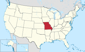
Official language(s) English Demonym Missourian Capital Jefferson City Largest city Kansas City Largest metro area Greater St Louis Area[1] Area Ranked 21st in the U.S. - Total 69,704 sq mi
(180,533 km2)- Width 240 miles (385 km) - Length 300 miles (480 km) - % water 1.17 - Latitude 36° N to 40° 37′ N - Longitude 89° 6′ W to 95° 46′ W Population Ranked 18th[2] in the U.S. - Total (2010) 5,988,927[2] - Density 88.3 (2010)[2]/sq mi (33.62/km2)
Ranked 30th[2] in the U.S.- Median income $46,867 (35th) Elevation - Highest point Taum Sauk Mountain[3][4]
1,772 ft (540 m)- Mean 800 ft (240 m) - Lowest point Saint Francis River at southern Arkansas border[3][4]
230 ft (70 m)Before statehood Missouri Territory Admission to Union August 10, 1821 (24th) Governor Jay Nixon (D) Lieutenant Governor Peter Kinder (R) Legislature General Assembly - Upper house Senate - Lower house House of Representatives U.S. Senators Claire McCaskill (D)
Roy Blunt (R)U.S. House delegation 6 Republicans, 3 Democrats (list) Time zone Central: UTC-6/-5 Abbreviations MO US-MO Website www.mo.gov Missouri State symbols Animate insignia Amphibian American Bullfrog Bird(s) Bluebird Fish Channel Catfish Flower(s) White hawthorn Grass Big bluestem Insect Honey bee Mammal(s) Missouri Mule Tree Flowering Dogwood Inanimate insignia Dance Square Dance Dinosaur Hypsibema missouriensis[5] Fossil Crinoid Gemstone Aquamarine Mineral Galena Rock Mozarkite Slogan(s) Show Me (unofficial) Song(s) "Missouri Waltz" Route marker(s) 
State Quarter 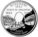
Released in 2003 Lists of United States state insignia Missouri (
 i/mɨˈzʊəri/)[6] is a US state located in the Midwestern United States,[7] bordered by Iowa, Illinois, Kentucky, Tennessee, Arkansas, Oklahoma, Kansas and Nebraska. With a 2010 population of 5,988,927, Missouri is the 18th most populous state in the nation and the fifth most populous in the Midwest.[8] It comprises 114 counties and the independent city of St. Louis. The four largest urban areas are St. Louis, Kansas City, Springfield, and Columbia.[9] Missouri's capital is Jefferson City. The land that is now Missouri was acquired from France as part of the Louisiana Purchase and became known as the Missouri Territory. Part of the Territory was admitted into the union as the 24th state on August 10, 1821.
Missouri mirrors the demographic, economic and political makeup of the nation (in general) with a mix of urban and rural culture. It has long been considered a political bellwether state.[10] With the exceptions of 1956 and 2008, Missouri's results in U.S. presidential elections have accurately predicted the next President of the United States in every election since 1904. It has both Midwestern and Southern cultural influences, reflecting its history as a border state. It is also a transition between the Eastern and Western United States, as St. Louis is often called the "western-most Eastern city" and Kansas City the "eastern-most Western city." Missouri's geography is highly varied. The northern part of the state lies in dissected till plains while the southern part lies in the Ozark Mountains (a dissected plateau), with the Missouri River dividing the two. The confluence of the Mississippi and Missouri Rivers is located near St. Louis.[11] The starting points of the Pony Express Trail and Oregon Trail were both in Missouri.[12] The mean center of United States population as of the 2010 Census is at the town of Plato in Texas County, Missouri.[13]
Contents
Etymology
The state is named for the Missouri River, which was named after the Siouan-language tribe. They were called the ouemessourita (wimihsoorita[14]), meaning "those who have dugout canoes", by the Miami-Illinois language speakers. The Illini were the first natives encountered by Europeans in the region and they adopted the name of the Missouri from them.[15]
Geography
Main article: Geography of MissouriSee also: List of Missouri state parks Missouri, showing major cities and roads
Missouri borders eight different states, as does its neighbor, Tennessee. No state in the U.S. touches more than eight states. Missouri is bounded on the north by Iowa; on the east, across the Mississippi River, by Illinois, Kentucky, and Tennessee; on the south by Arkansas; and on the west by Oklahoma, Kansas, and Nebraska (the last across the Missouri River). The two largest Missouri rivers are the Mississippi, which defines the eastern boundary of the state, and the Missouri River, which flows from west to east through the state, essentially connecting the two largest metros, Kansas City and St. Louis.
Although today the state is usually considered part of the Midwest,[16][17] historically Missouri was considered by many to be a Southern state,[18] chiefly because of the settlement of migrants from the South and its status as a slave state before the Civil War. The counties that made up "Little Dixie" were those along the Missouri River in the center of the state, settled by Southern migrants who held the greatest concentration of slaves.
Residents of cities and rural areas farther north and of the state's large metropolitan areas, where most of the state's population resides (Kansas City, St. Louis, and Columbia), typically consider themselves Midwestern.
In 2005, Missouri received 16,695,000 visitors to its national parks and other recreational areas totaling 202,000 acres (820 km2), giving it $7.41 mil. in annual revenues, 26.6% of its operating expenditures.[19]
Topography
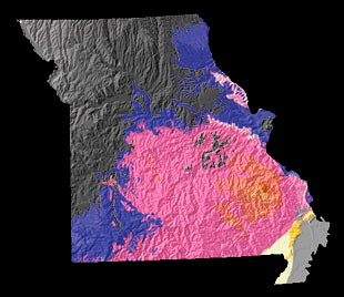
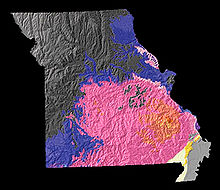 A physiographic map of Missouri
North of, and in some cases just south of, the Missouri River lie the Northern Plains that stretch into Iowa, Nebraska, and Kansas. Here, gentle rolling hills remain from the glaciation that once extended from the Canadian Shield to the Missouri River. Missouri has many large river bluffs along the Mississippi, Missouri, and Meramec Rivers. Southern Missouri rises to the Ozark Mountains, a dissected plateau surrounding the Precambrian igneous St. Francois Mountains. This region also hosts karst topography characterized by high limestone content with the formation of sinkholes and caves.[20]
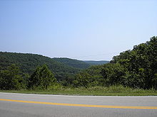 A portion of the Ozarks in Southern Missouri
The southeastern part of the state is the Bootheel region, part of the Mississippi Alluvial Plain or Mississippi embayment. This region is the lowest, flattest, and wettest part of the state. It is also among the poorest, as the economy is mostly agricultural.[21] It is also the most fertile, with cotton and rice crops predominant. The Bootheel was the epicenter of the four New Madrid Earthquakes of 1811–1812.
Climate
Main article: Climate of MissouriMissouri generally has a humid continental climate (Koppen climate classification Dfa) with cold winters and hot and humid summers. In the southern part of the state, particularly in the Bootheel, the climate borders on a humid subtropical climate (Koppen Cfa). Located in the interior United States, Missouri often experiences extremes in temperatures. Without high mountains or oceans nearby to moderate temperature, its climate is alternately influenced by air from the cold Arctic and the hot and humid Gulf of Mexico. Missouri's highest recorded temperature is 118 °F (48 °C) at Warsaw and Union on July 14, 1954 while the lowest recorded temperature is −40 °F (−40 °C) also at Warsaw on February 13, 1905.
Missouri also receives extreme weather in the form of thunderstorms and powerful tornadoes. The most recent EF5 tornado in the state to cause damage and casualties was the 2011 Joplin tornado, which destroyed roughly 1/3 of the city of Joplin. The tornado caused an estimated $1–3 billion dollars in damages, killed 159 (+1 non-tornadic), and injured over 1,000 people. The tornado was the first EF5 to hit the state since 1957. The tornado was the deadliest in the U.S. since 1947, making it the 7th deadliest tornado in American history, but the 27th deadliest in the world.
Monthly Normal High and Low Temperatures For Various Missouri Cities City Jan Feb Mar Apr May Jun Jul Aug Sep Oct Nov Dec Columbia 37/18 44/23 55/33 66/43 75/53 84/62 89/66 87/64 79/55 68/44 53/33 42/22 Kansas City 36/18 43/23 54/33 65/44 75/54 84/63 89/68 87/66 79/57 68/46 52/33 40/22 Springfield 42/22 48/26 58/35 68/44 76/53 85/62 90/67 90/66 81/57 71/46 56/35 46/26 St. Louis[22] 38/21 45/26 55/36 66/47 77/57 86/66 91/71 88/69 81/61 69/49 54/38 42/27 History
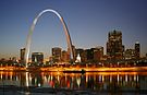
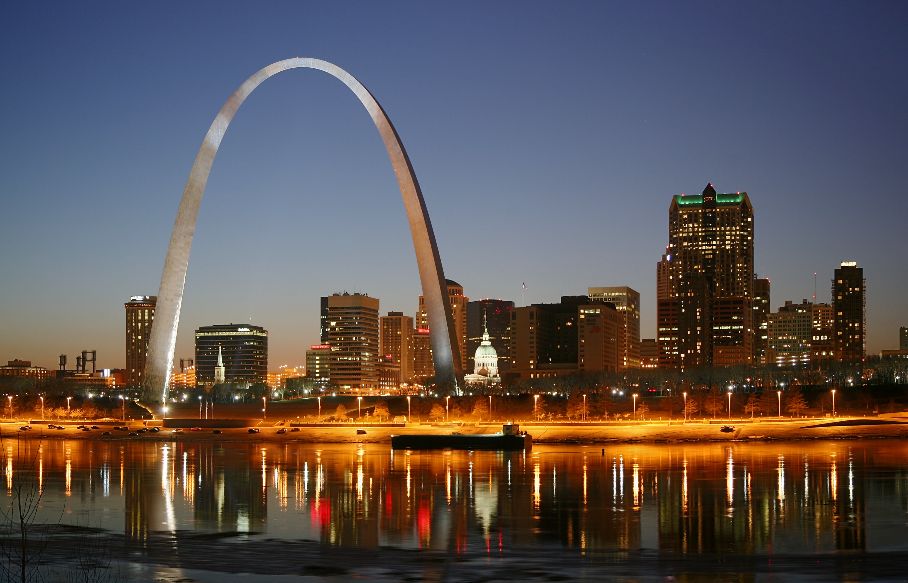
Main article: History of Missouri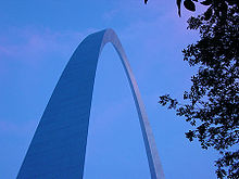 The Gateway Arch in St. Louis
Indigenous peoples inhabited Missouri for thousands of years before European exploration and settlement. Archaeological excavations along the rivers have shown continuous habitation for more than 7,000 years. Beginning before 1000 CE, there arose the complex Mississippian culture, whose people created regional political centers at present-day St. Louis and across the Mississippi River at Cahokia, near present-day Collinsville, Illinois. Their large cities included thousands of individual residences, but they are known for their surviving massive earthwork mounds, built for religious, political and social reasons, in platform, ridgetop and conical shapes. Cahokia was the center of a regional trading network that reached from the Great Lakes to the Gulf of Mexico. The civilization declined by 1400 CE, and most descendants left the area long before the arrival of Europeans. St. Louis was at one time known as Mound City by the European Americans, because of the numerous surviving prehistoric mounds, since lost to urban development. The Mississippian culture left mounds throughout the middle Mississippi and Ohio river valleys, extending into the southeast as well as the upper river.
The first European settlers were mostly ethnic French Canadians, who created their first settlement in Missouri at present-day Ste. Genevieve, about an hour south of St. Louis. They had migrated about 1750 from the Illinois Country. They came from colonial villages on the east side of the Mississippi River, where soils were becoming exhausted and there was insufficient river bottom land for the growing population. Ste. Genevieve became a thriving agricultural center, producing enough surplus wheat, corn and tobacco to ship tons of grain annually downriver to Lower Louisiana for trade. Grain production in the Illinois Country was critical to the survival of Lower Louisiana and especially the city of New Orleans.
St. Louis was founded soon after by French from New Orleans. It became the center of a regional fur trade with Native American tribes that extended up the Missouri and Mississippi rivers, which dominated the regional economy for decades. Trading partners of major firms shipped their furs from St. Louis by river down to New Orleans for export to Europe. They provided a variety of goods to traders for sale and trade with their Native American clients. The fur trade and associated businesses made St. Louis an early financial center and provided the wealth for some to build fine houses and import luxury goods. Its location near the confluence of the Illinois River meant it also handled produce from the agricultural areas. River traffic and trade along the Mississippi were integral to the state's economy, and as the area's first major city, St. Louis expanded greatly after the invention of the steamboat and the increased river trade.
Part of the 1803 Louisiana Purchase by the United States, Missouri earned the nickname "Gateway to the West" because it served as a major departure point for expeditions and settlers heading to the West in the 19th century. St. Charles, just west of St. Louis, was the starting point and the return destination of the Lewis and Clark Expedition, which departed up the Missouri River in 1804 to explore the western territories to the Pacific Ocean. St. Louis was a major supply point for decades for parties of settlers heading west.
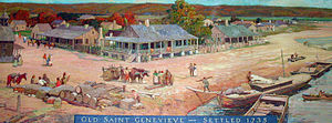 Ste. Genevieve, one of the oldest towns in the United States
As many of the early American settlers in western Missouri migrated from the Upper South, they brought enslaved African Americans for labor, and a desire to continue their culture and the institution of slavery. They settled predominantly in 17 counties along the Missouri River, in an area of flatlands that enabled plantation agriculture and became known as "Little Dixie". In 1821 the territory was admitted as a slave state in 1821 as part of the Missouri Compromise with a temporary state capitol in St. Charles. In 1826 the capital was shifted to its permanent location of Jefferson City, also on the Missouri.
The state was rocked by the 1812 New Madrid earthquake. Casualties were light due to the sparse population.
Originally the state's western border was a straight line, defined as the meridian passing through the Kawsmouth,[23] the point where the Kansas River enters the Missouri River. The river has moved since this designation. This line is known as the Osage Boundary.[24] In 1835 the Platte Purchase was added to the northwest corner of the state after purchase of the land from the native tribes, making the Missouri River the border north of the Kansas River. This addition increased the land area of what was already the largest state in the Union at the time (about 66,500 square miles (172,000 km2) to Virginia's 65,000 square miles (which then included West Virginia).[25]
In the early 1830s, Mormon migrants from northern states and Canada began settling near Independence and areas just north of there. Conflicts over religion and slavery arose between the 'old settlers' (mainly from the South) and the Mormons (mainly from the North). The Mormon War erupted in 1838. By 1839, with the help of an "Extermination Order" by Governor Lilburn Boggs, the old settlers forcefully expelled the Mormons from Missouri and confiscated their lands.
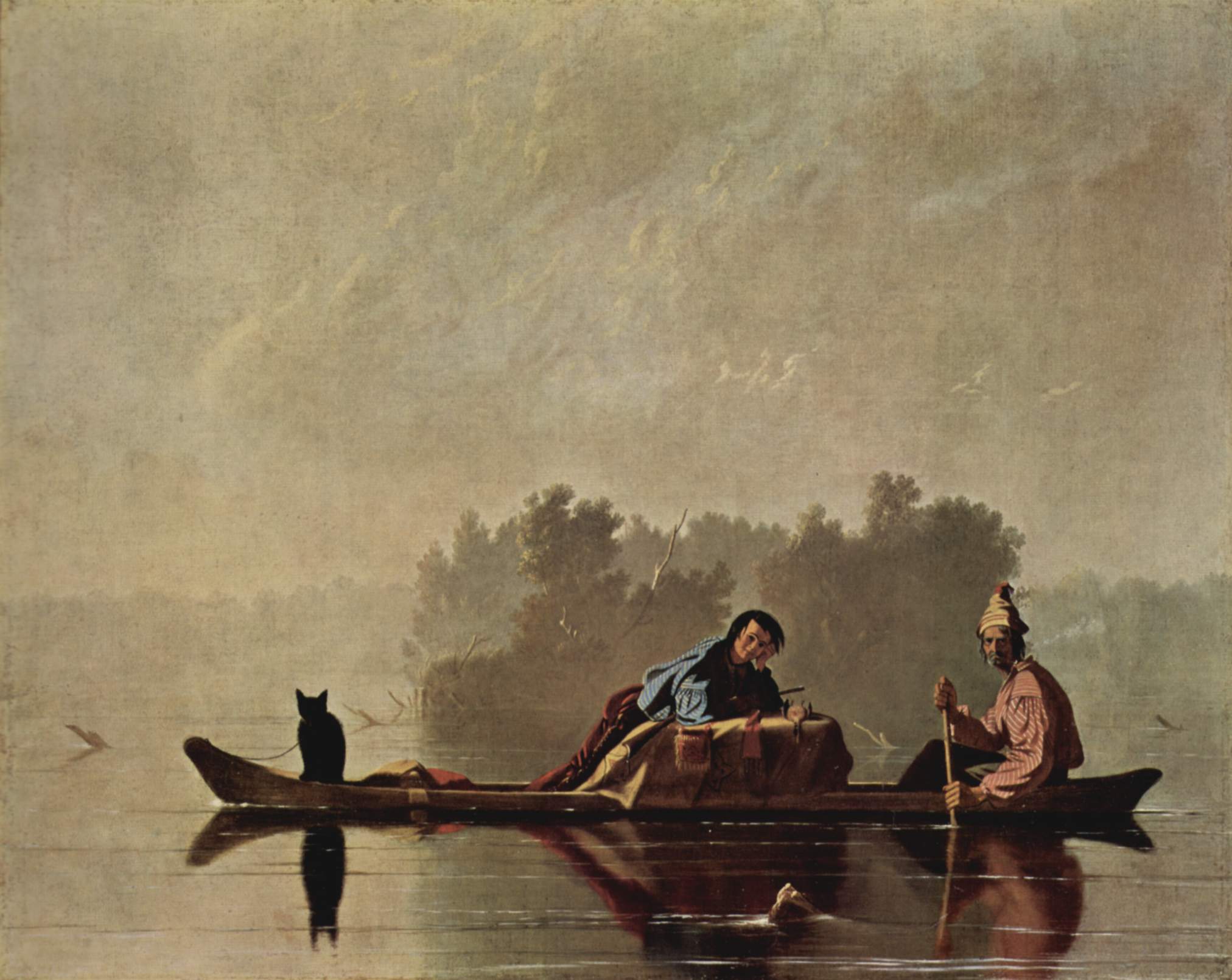
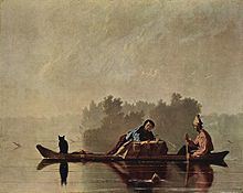 Fur Traders Descending the Missouri by Missouri painter George Caleb Bingham
Conflicts over slavery exacerbated border tensions among the states and territories. In 1838–1839 a border dispute with Iowa over the so-called Honey Lands resulted in both states' calling up militias along the border.
With increasing migration, from the 1830s to the 1860s Missouri's population almost doubled with every decade. Most of the newcomers were American-born, but many Irish and German immigrants arrived in the late 1840s and 1850s. As they were mostly Catholic, they mostly set up their own religious institutions in the state, which had been mostly Protestant. Having fled famine and oppression in Ireland, and revolutionary upheaval in Germany, the immigrants were not sympathetic to slavery. Many settled in cities, where they created a regional and then state network of Catholic churches and schools. Nineteenth-century German immigrants created the wine industry along the Missouri River and the beer industry in St. Louis.
Most Missouri farmers practiced subsistence farming before the Civil War. The majority of those who held slaves had fewer than 5 each. Planters, defined by historians as those holding 20 or more slaves, were concentrated in the counties known as "Little Dixie", in the central part of the state along the Missouri River. The tensions over slavery had chiefly to do with the future of the state and nation. In 1860 enslaved African Americans made up less than 10% of the state's population of 1,182,012.[26] To try to control regular flooding of farmland and low-lying villages along the Mississippi, by 1860 the state had completed construction of 140 miles (230 km) of levees along the river.[27]
American Civil War
Main article: Missouri in the American Civil WarAfter the secession of Southern states began in 1861, the Missouri legislature called for the election of a special convention on secession. The convention voted decisively to remain within the Union. Pro-Southern Governor Claiborne F. Jackson ordered the mobilization of several hundred members of the state militia who had gathered in a camp in St. Louis for training. Alarmed at this action, Union General Nathaniel Lyon struck first, encircling the camp and forcing the state troops to surrender. Lyon directed his soldiers, largely non-English-speaking German immigrants, to march the prisoners through the streets, and they opened fire on the largely hostile crowds of civilians who gathered around them. Soldiers killed unarmed prisoners as well as men, women and children of St. Louis in the incident that became known as the "St. Louis Massacre".
These events heightened Confederate support within the state. Governor Jackson appointed Sterling Price, president of the convention on secession, as head of the new Missouri State Guard. In the face of Union General Lyon's rapid advance through the state, Jackson and Price were forced to flee the capital of Jefferson City on June 14, 1861. In the town of Neosho, Missouri, Jackson called the state legislature into session. They enacted a secession ordinance. However, even under the Southern view of secession, only the state convention had the sole power to secede. Since the convention was dominated by unionists, and the state was more pro-Union than pro-Confederate in any event, the ordinance of secession adopted by the legislature is generally given little credence. The Confederacy nonetheless recognized it on October 30, 1861.
With the elected governor absent from the capital and the legislators largely dispersed, the state convention was reassembled with most of its members present, save 20 that fled south with Jackson's forces. The convention declared all offices vacant, and installed Hamilton Gamble as the new governor of Missouri. President Lincoln's administration immediately recognized Gamble's government as the legal Missouri government. The federal government's decision enabled raising pro-Union militia forces for service within the state as well as volunteer regiments for the Union Army.
Fighting ensued between Union forces and a combined army of General Price's Missouri State Guard and Confederate troops from Arkansas and Texas under General Ben McCulloch. After winning victories at the battle of Wilson's Creek and the siege of Lexington, Missouri and suffering losses elsewhere, the Confederate forces retreated to Arkansas and later Marshall, Texas, in the face of a largely reinforced Union Army.
Though regular Confederate troops staged some large-scale raids into Missouri, the fighting in the state for the next three years consisted chiefly of guerrilla warfare. "Citizen soldiers" or insurgents such as Colonel William Quantrill, Frank and Jesse James, the Younger brothers, and William T. Anderson made use of quick, small-unit tactics. Pioneered by the Missouri Partisan Rangers, such insurgencies also arose in portions of the Confederacy occupied by the Union during the Civil War. Recently historians have assessed the James brothers' outlaw years as continuing guerrilla warfare after the official war was over. The activities of the 'Bald Knobbers' of south-central Missouri in the 1880s has also been seen as an unofficial continuation of insurgent hostilities long after the official end of the war.
20th century to present
In 1930, there was a diphtheria epidemic in the area around Springfield, which killed approximately 100 people. Serum was rushed to the area, and medical personnel stopped the epidemic.
During the mid-1950s and 1960s, St. Louis and Kansas City suffered deindustrialization and loss of jobs in railroads and manufacturing, as did other Midwestern industrial cities. In 1956 St. Charles was the site of the first interstate highway project.[28] Such highway construction made it easy for middle-class residents to leave the city for newer housing developed in the suburbs, often former farmland where land was available at lower prices. These major cities have gone through decades of readjustment to develop different economies and adjust to demographic changes. Suburban areas have developed separate job markets, both in knowledge industries and services, such as major retail malls.
Demographics
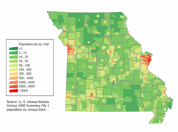 Missouri Population Density Map
Historical populations Census Pop. %± 1810 19,783 — 1820 66,586 236.6% 1830 140,455 110.9% 1840 383,702 173.2% 1850 682,044 77.8% 1860 1,182,012 73.3% 1870 1,721,295 45.6% 1880 2,168,380 26.0% 1890 2,679,185 23.6% 1900 3,106,665 16.0% 1910 3,293,335 6.0% 1920 3,404,055 3.4% 1930 3,629,367 6.6% 1940 3,784,664 4.3% 1950 3,954,653 4.5% 1960 4,319,813 9.2% 1970 4,676,501 8.3% 1980 4,916,686 5.1% 1990 5,117,073 4.1% 2000 5,595,211 9.3% 2010 5,988,927 7.0% Source: 1910–2010[29] According to the 2010 Census, Missouri had a population of 5,988,927; an increase of 392,369 (7.0 percent) since the year 2000. From 2000 to 2007, this includes a natural increase of 137,564 people since the last census (480,763 births less 343,199 deaths), and an increase of 88,088 people due to net migration into the state. Immigration from outside the United States resulted in a net increase of 50,450 people, and migration within the country produced a net increase of 37,638 people. Over half of Missourians (3,294,936 people, or 55.0%) live within the state's two largest metropolitan areas–-St. Louis and Kansas City. The state's population density 86.9 in 2009, is also closer to the national average (86.8 in 2009) than any other state.
The U.S. Census of 2000 found that the population center of the United States is in Phelps County, Missouri. The center of population of Missouri itself is located in Osage County, in the city of Westphalia.[30]
As of 2004, the population included 194,000 foreign-born (3.4 percent of the state population).
Demographics of Missouri (csv) By race White Black AIAN* Asian NHPI* 2000 (total population) 86.90% 11.76% 1.08% 1.37% 0.12% 2000 (Hispanic only) 1.96% 0.12% 0.07% 0.03% 0.01% 2005 (total population) 86.54% 12.04% 1.03% 1.61% 0.13% 2005 (Hispanic only) 2.49% 0.14% 0.07% 0.03% 0.01% Growth 2000–05 (total population) 3.23% 6.15% -0.57% 21.83% 10.71% Growth 2000–05 (non-Hispanic only) 2.57% 5.94% -1.34% 21.81% 10.99% Growth 2000–05 (Hispanic only) 32.07% 26.42% 10.52% 22.82% 8.09% * AIAN is American Indian or Alaskan Native; NHPI is Native Hawaiian or Pacific Islander The five largest ancestry groups in Missouri are: German (27.4 percent), Irish (14.8 percent), English (10.2 percent), American (8.5 percent) and French (3.7 percent). "American" includes some of those reported as Native American or African American, but also European Americans whose ancestors have lived in the United States for a considerable time.
German Americans are an ancestry group present throughout Missouri. African Americans are a substantial part of the population in St. Louis, Kansas City, and in the southeastern Bootheel and some parts of the Missouri River Valley, where plantation agriculture was once important. Missouri Creoles of French ancestry are concentrated in the Mississippi River Valley south of St. Louis (see Missouri French). Kansas City is home to large and growing immigrant communities from Latin America esp. Mexico, Africa (i.e. Sudan, Somalia and Nigeria), and Southeast Asia including China and the Philippines; and Eastern Europe like the former Yugoslavia (see Bosnian American). A notable Cherokee Indian population exists in Southern Missouri.[citation needed]
In 2004, 6.6 percent of the state's population was reported as younger than 5 years old, 25.5 percent younger than 18, and 13.5 percent was 65 or older. Females were approximately 51.4 percent of the population. 81.3 percent of Missouri residents were high school graduates (more than the national average), and 21.6 percent had a bachelor's degree or higher. 3.4 percent of Missourians were foreign-born, and 5.1 percent reported speaking a language other than English at home.
In 2000, there were 2,194,594 households in Missouri, with 2.48 people per household. The homeownership rate was 70.3 percent, and the mean value of an owner-occupied dwelling was $89,900. The median household income for 1999 was $37,934, or $19,936 per capita. There were 11.7 percent (637,891) Missourians living below the poverty line in 1999.
The mean commute time to work was 23.8 minutes.
Language
The majority of people in Missouri speak English. Approximately 5.1 percent of the population reported speaking a language other than English at home. The Spanish language is spoken in small Latino communities in the St. Louis and Kansas City Metro areas.[citation needed]
Missouri is home to an endangered dialect of the French language known as Missouri French. Speakers of the dialect, who call themselves Creoles, are descendants of the French pioneers who settled the area then known as the Illinois Country beginning in the late 17th century. It developed in isolation from French speakers in Canada and Louisiana, becoming quite distinct from the varieties of Canadian French and Louisiana Creole French. Once widely spoken throughout the area, Missouri French is now nearly extinct, with only a few elderly speakers able to use it.[31][32]
Religion
Of those Missourians who identify with a religion, three out of five are Protestants. There is also a moderate-sized Roman Catholic community in some parts of the state; approximately one out of five Missourians are Roman Catholic. Areas with large Catholic communities include St. Louis, Jefferson City, Westplex, and the Missouri Rhineland (particularly that south of the Missouri River).[33] The St. Louis and Kansas City metropolitan areas also have important Jewish communities who have contributed much to the culture and charities of the cities; more recently, those same areas have Indian and Pakistani immigrants, who have created Hindu and Muslim congregations as well.
The religious affiliations of the people of Missouri according to the American Religious Identification Survey:[34]
- Christian – 77%
- Anglican – 4%
- Episcopal – 4%
- Protestant – 45% (Combined)
- Roman Catholic – 19%
- Latter Day-Saint – 1%*
- Other or unspecified Christian – 8%
- Anglican – 4%
- Other religions – 2%
- Not religious – 15%
- No answer – 5%
The largest denominations by number of adherents in 2000 were the Roman Catholic Church with 856,964; the Southern Baptist Convention with 797,732; and the United Methodist Church with 226,578.[35]
Several religious organizations have headquarters in Missouri, including the Lutheran Church—Missouri Synod, which has its headquarters in Kirkwood, as well as the United Pentecostal Church International in Hazelwood, both outside St. Louis. Independence, near Kansas City, is the headquarters for the Community of Christ (formerly the Reorganized Church of Jesus Christ of Latter Day Saints), and the group Remnant Church of Jesus Christ of Latter Day Saints. This area and other parts of Missouri are also of significant religious and historical importance to The Church of Jesus Christ of Latter-day Saints (Mormons), which maintains several sites/visitors centers, and whose members make up about 1 percent, or 62,217 members, of Missouri's population. Springfield is the headquarters of the Assemblies of God and the Baptist Bible Fellowship International. The General Association of General Baptists has its headquarters in Poplar Bluff. The Pentecostal Church of God is headquartered in Joplin. The Unity Church is headquartered in Unity Village.
Economy
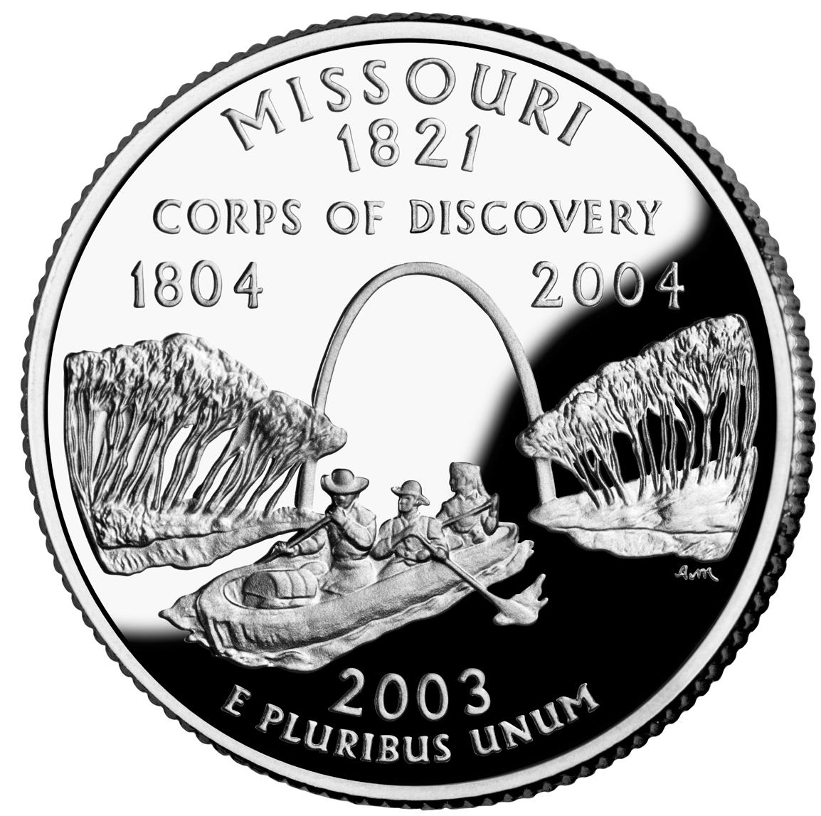
 Commemorative US quarter featuring the Lewis and Clark expedition
The Bureau of Economic Analysis estimates that Missouri's total state product in 2006 was $225.9 billion. Per capita personal income in 2006 was $32,705,[19] ranking 26th in the nation. Major industries include aerospace, transportation equipment, food processing, chemicals, printing/publishing, electrical equipment, light manufacturing, and beer.
The agriculture products of the state are beef, soybeans, pork, dairy products, hay, corn, poultry, sorghum, cotton, rice, and eggs. Missouri is ranked 6th in the nation for the production of hogs and 7th for cattle. Missouri is ranked in the top five states in the nation for production of soy beans. As of 2001, there were 108,000 farms, the second largest number in any state after Texas. Missouri actively promotes its rapidly growing wine industry.
Missouri has vast quantities of limestone. Other resources mined are lead, coal, and crushed stone. Missouri produces the most lead of all of the states. Most of the lead mines are in the central eastern portion of the state. Missouri also ranks first or near first in the production of lime, a key ingredient in Portland cement.
Tourism, services and wholesale/retail trade follow manufacturing in importance.
Personal income is taxed in 10 different earning brackets, ranging from 1.5 percent to 6.0 percent. Missouri's sales tax rate for most items is 4.225 percent. Additional local levies may apply. More than 2,500 Missouri local governments rely on property taxes levied on real property (real estate) and personal property. Most personal property is exempt, except for motorized vehicles. Exempt real estate includes property owned by governments and property used as nonprofit cemeteries, exclusively for religious worship, for schools and colleges and for purely charitable purposes. There is no inheritance tax and limited Missouri estate tax related to federal estate tax collection.
Missouri is the only state in the Union to have two Federal Reserve Banks: one in Kansas City (serving western Missouri, Kansas, Nebraska, Oklahoma, Colorado, northern New Mexico, and Wyoming) and one in St. Louis (serving eastern Missouri, southern Illinois, southern Indiana, western Kentucky, western Tennessee, northern Mississippi, and all of Arkansas).[36]
As of January 2010, the state’s unemployment rate is 9.5%.[37]
Transportation
Air
 Commercial airliners at Kansas City International Airport
The state of Missouri has two major airport hubs: Lambert-St. Louis International Airport and Kansas City International Airport.
Rail
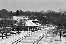 Amtrak station in Kirkwood, Missouri
Two of the nation's three busiest rail centers are located in Missouri. Kansas City is a major railroad hub for BNSF Railway, Norfolk Southern Railway, Kansas City Southern Railway, and Union Pacific Railroad. Kansas City is the second largest freight rail center in the US (but is first in the amount of tonnage handled). Like Kansas City, St. Louis is a major destination for train freight. Amtrak passenger trains serve Kansas City, La Plata, Jefferson City, St. Louis, Lee's Summit, Independence, Warrensburg, Hermann, Washington, Kirkwood, Sedalia, and Poplar Bluff.
The only urban light rail/subway system in Missouri is the St. Louis MetroLink which connects the city of St. Louis with suburbs in Illinois and St. Louis County. It is one of the largest (track mileage) systems in the USA. In 2007 preliminary planning was being performed for a light rail system in the Kansas City area, but was defeated by voters in November 2008.
The Gateway Multimodal Transportation Center in St. Louis is the largest active multi-use transportation center in the state. It is located in Downtown St. Louis next to the historic St. Louis Union Station complex. It serves as a hub center/station for the city's rail system St. Louis MetroLink and regional bus system St. Louis MetroBus, Greyhound, Amtrak and city taxi services.
Springfield remains an operational hub for BNSF Railway.
Bus
Many cities have regular fixed-route systems, and many rural counties have rural public transit services. Greyhound, Trailways, and Megabus all provide inter-city bus service in Missouri.
Rivers
The Mississippi River and Missouri River are commercially navigable over their entire lengths in Missouri. The Missouri was channelized through dredging and jettys and the Mississippi was given a series of locks and dams to avoid rocks and deepen the river. St. Louis is a major destination for barge traffic on the Mississippi River.
Roads
- Main article List of Missouri highways
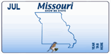 Missouri state license plate as of 2009
Several highways, detailed below, traverse the state.
Following the passage of Amendment 3 in late 2004, the Missouri Department of Transportation (MoDOT) began its Smoother, Safer, Sooner road-building program with a goal of bringing 2,200 miles (3,500 km) of highways up to good condition by December 2007. From 2006–2008 traffic deaths have decreased annually from 1,257 in 2005, to 1,096 in 2006, to 974 for 2007, to 941 for 2008.[38]
Interstate freeways
 Interstate 29,
  Interstate 229
 Interstate 35,
  Interstate 435 (Perimeter around Kansas City),
  Interstate 635
 Interstate 44
 Interstate 55,
  Interstate 155,
  Interstate 255 (the perimeter around the Illinois side of St. Louis)
 Interstate 57
 Interstate 64
 Interstate 70,
  Interstate 170,
  Interstate 270 (the perimeter around the Missouri side of St. Louis),
  Interstate 470,
  Interstate 670
 Interstate 72
 Interstate 49 (In Progress)[39]
 Interstate 66 (Proposed)
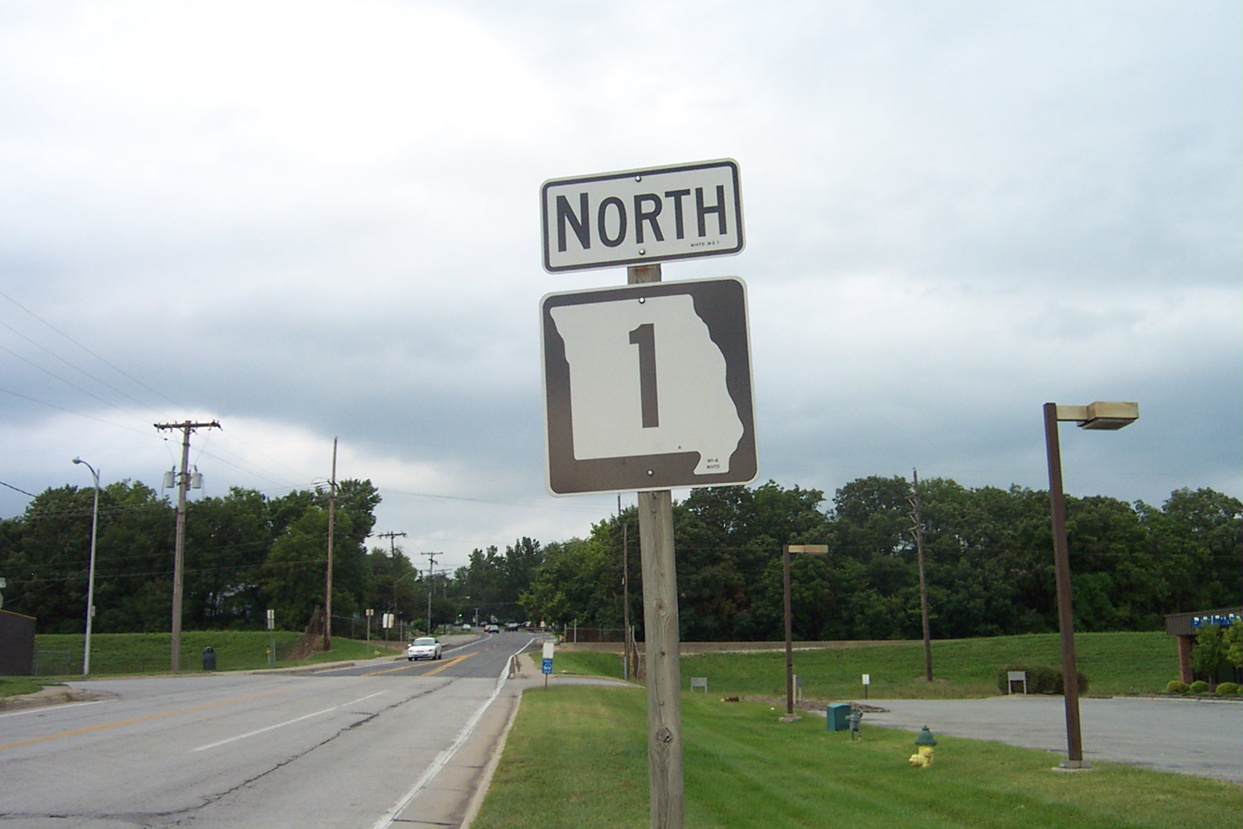
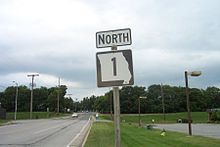 Missouri Highway 1 in Western Missouri
United States Routes
North-south routes East-west routes  U.S. Route 59
 U.S. Route 159
 U.S. Route 61
 U.S. Route 63
 U.S. Route 65
 U.S. Route 67
 U.S. Route 69
 U.S. Route 169
 U.S. Route 71
 U.S. Route 275
 U.S. Route 412
 U.S. Route 24
 U.S. Route 36
 U.S. Route 136
 U.S. Route 40
 U.S. Route 50
 U.S. Route 54
 U.S. Route 56
 U.S. Route 60
 U.S. Route 160
 U.S. Route 460 (decommissioned in Missouri)
 U.S. Route 62
 U.S. Route 66 (decommissioned)
 U.S. Route 166
 U.S. Route 400
See also: List of Missouri state highways and Missouri Supplemental RouteLaw and government
Missouri Government Governor of Missouri Jay Nixon (D) Lieutenant Governor of Missouri: Peter Kinder (R) Missouri Attorney General: Chris Koster (D) Missouri Secretary of State: Robin Carnahan (D) Missouri State Auditor: Tom Schweich (R) Missouri State Treasurer: Clint Zweifel (D) Senior United States Senator: Claire McCaskill (D) Junior United States Senator: Roy Blunt (R) Framework
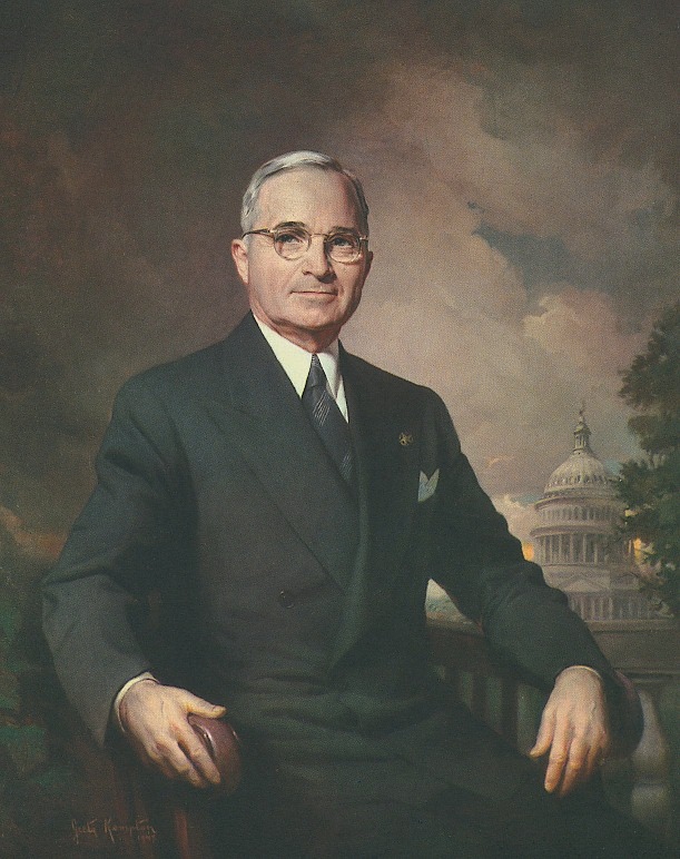
 Harry S Truman, 33rd President of the United States and the only one from MissouriMain articles: Law and government of Missouri and List of Missouri Governors
The current Constitution of Missouri, the fourth constitution for the state, was adopted in 1945. It provides for three branches of government: the legislative, judicial, and executive branches. The legislative branch consists of two bodies: the House of Representatives and the Senate. These bodies comprise the Missouri General Assembly.
The House of Representatives has 163 members who are apportioned based on the last decennial census. The Senate consists of 34 members from districts of approximately equal populations. The judicial department comprises the Supreme Court of Missouri, which has seven judges, the Missouri Court of Appeals (an intermediate appellate court divided into three districts, sitting in Kansas City, St. Louis, and Springfield), and 45 Circuit Courts which function as local trial courts. The executive branch is headed by the Governor of Missouri and includes five other statewide elected offices. Following the election of 2008, all but one of Missouri's statewide elected offices are held by Democrats.
Harry S Truman (1884–1972), the 33rd President of the United States (Democrat, 1945–1953), was born in Lamar. He was a judge in Jackson County and then represented the state in the United States Senate for ten years, before being elected Vice-President in 1944. He lived in Independence after retiring.
Status as a political bellwether
Past Presidential Elections Results Year Republican Democratic Third Parties 2008 49.39% 1,445,814 49.25% 1,441,911 1.36% 39,889 2004 53.30% 1,455,713 46.10% 1,259,171 0.60% 16,480 2000 50.42% 1,189,924 47.08% 1,111,138 2.50% 58,830 1996 41.24% 890,016 47.54% 1,025,935 11.22% 242,114 1992 33.92% 811,159 44.07% 1,053,873 22.00% 526,238 1988 51.83% 1,084,953 47.85% 1,001,619 0.32% 6,656 1984 60.02% 1,274,188 39.98% 848,583 0.00% None 1980 51.16% 1,074,181 44.35% 931,182 4.49% 94,461 1976 47.47% 927,443 51.10% 998,387 1.42% 27,770 1972 62.29% 1,154,058 37.71% 698,531 0.00% None 1968 44.87% 811,932 43.74% 791,444 11.39% 206,126 1964 35.95% 653,535 64.05% 1,164,344 0.00% None 1960 49.74% 962,221 50.26% 972,201 0.00% None 1956 49.89% 914,289 50.11% 918,273 0.00% None 1952 50.71% 959,429 49.14% 929,830 0.15% 2,803 1948 41.49% 655,039 58.11% 917,315 0.39% 6,274 1944 48.43% 761,524 51.37% 807,804 0.20% 3,146 1940 47.50% 871,009 52.27% 958,476 0.23% 4,244 1936 38.16% 697,891 60.76% 1,111,043 1.08% 19,701 1932 35.08% 564,713 63.69% 1,025,406 1.22% 19,775 1928 55.58% 834,080 44.15% 662,562 0.27% 4,079 1924 49.58% 648,486 43.79% 572,753 6.63% 86,719 1920 54.56% 727,162 43.13% 574,799 2.32% 30,839 1916 46.94% 369,339 50.59% 398,032 2.46% 19,398 1912 29.75% 207,821 47.35% 330,746 22.89% 159,999 1908 48.50% 347,203 48.41% 346,574 3.08% 22,150 1904 49.93% 321,449 46.02% 296,312 4.05% 26,100 1900 45.94% 314,092 51.48% 351,922 2.58% 17,642 Main article: Missouri bellwetherFurther information: Political party strength in MissouriMissouri is widely regarded as a state bellwether in American politics. The state has a longer stretch of supporting the winning presidential candidate than any other state, having voted with the nation in every election since 1904 with two exceptions: in 1956 when it voted for Governor Adlai Stevenson of Illinois over the winner, incumbent President Dwight Eisenhower of Kansas, and in 2008 when it voted for Senator John McCain of Arizona over national winner Senator Barack Obama of Illinois, both by extremely narrow margins. Missouri was the closest state in both of those presidential elections.
Laissez-faire alcohol and tobacco laws
Missouri has been known for its population's generally "stalwart, conservative, noncredulous" attitude toward regulatory regimes, which is one of the origins of the state's unofficial nickname, the "Show-Me State."[40] As a result, and combined with the fact that Missouri is one of America's leading alcohol and tobacco-producing states, regulation of alcohol and tobacco in Missouri is among the most laissez-faire in America.
Main article: Alcohol laws of MissouriWith a large German immigrant population and the development of a brewing industry, Missouri always has had among the most permissive alcohol laws in the United States. It never enacted statewide prohibition. Missouri voters rejected prohibition in three separate referenda in 1910, 1912, and 1918. Alcohol regulation did not begin in Missouri until 1934. Today, alcohol laws are controlled by the state government, and local jurisdictions are prohibited from going beyond those state laws. Missouri has no statewide open container law or prohibition on drinking in public, no alcohol-related blue laws, no local option, no precise locations for selling liquor by the package (thus allowing even drug stores and gas stations to sell any kind of liquor), and no differentiation of laws based on alcohol percentage. Missouri had no laws prohibiting "consumption" of alcohol by minors (as opposed to possession), and state law protects persons from arrest or criminal penalty for public intoxication.[41] Missouri law expressly prohibits any jurisdiction from going dry.[42] Missouri law also expressly allows parents and guardians to serve alcohol to their children.[43] The Power & Light District in Kansas City is one of the few places in the United States where a state law explicitly allows persons over the age of 21 to possess and consume open containers of alcohol in the street (as long as the beverage is in a plastic cup).[44]
See also: Smoking laws of MissouriAs for tobacco, as of May 2010 Missouri has the lowest cigarette excise taxes in the United States,[45] and the electorate voted in 2002 and 2006 to keep it that way.[46] In 2007, Forbes named Missouri's largest metropolitan area, St. Louis, America's "best city for smokers."[47] According to the Centers for Disease Control and Prevention, in 2008 Missouri had the fourth highest percentage of adult smokers among U.S states, at 24.5%.[48] Although Missouri's minimum age for purchase and distribution of tobacco products is 18, tobacco products can be distributed to persons under 18 by family members on private property.[49] No statewide smoking ban ever has been seriously entertained before the Missouri General Assembly, and in October 2008, a statewide survey by the Missouri Department of Health and Senior Services found that only 27.5% of Missourians support a statewide ban on smoking in all bars and restaurants.[50] Missouri state law permits bars, restaurants which seat less than 50 people, bowling alleys, and billiard parlors to decide their own smoking policies, without limitation.[51]
Additionally, in Missouri, it is "an improper employment practice" for an employer to refuse to hire, to fire, or otherwise to disadvantage any person because that person lawfully uses alcohol and/or tobacco products when he or she is not at work.[52]
Counties
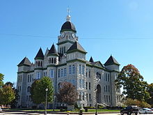 The highly photographed Jasper County Courthouse in Carthage, Missouri is listed in the National Register of Historic PlacesSee also: List of counties in Missouri
Missouri has 114 counties and one independent city (St. Louis).
The largest county by size is Texas County (1,179 sq. miles) and Shannon County is second (1,004 sq. miles). Worth County is the smallest (266 sq. miles). The independent city of St. Louis has only 62 square miles (160 km2) of area. St. Louis City is the most densely populated area (5,724.7 per sq. mi.) in Missouri.
The largest county by population (2008 estimate) is St. Louis County (991,830 residents), with Jackson County second (668,417 residents), St. Louis third (354,361), and St. Charles fourth (349,407). Worth County is the least populous with 2,039 residents.
Important cities and towns
See also: List of cities in Missouri and List of towns and villages in MissouriLeading population centers Rank City population County

Kansas City
St. Louis
Jefferson City1 Kansas City 459,787 Jackson, Clay, Platte, Cass 2 St. Louis 319,294 3 Springfield 159,498 Greene, Christian 4 Independence 116,830 Jackson 5 Columbia 108,500 Boone 6 Lee’s Summit 91,364 Jackson 7 O'Fallon 79,329 St.Charles 8 St. Joseph 76,780 Buchanan 9 St. Charles 65,794 St. Charles 10 St. Peters 52,575 St. Charles 10 Blue Springs 52,575 Jackson 12 Florissant 52,158 St. Louis County 13 Joplin 50,150 Jasper, Newton 14 Chesterfield 47,484 St. Louis County 15 Jefferson City 43,079 Cole 16 Cape Girardeau 37,941 Cape Girardeau 17 Wildwood 35,517 St. Louis County 18 Unversity City 35,371 St. Louis County 19 Ballwin 30,404 St. Louis County 20 Raytown 29,526 Jackson based on 2010 U.S. Census Bureau figures[53] Jefferson City is the state capital of Missouri.
The five largest cities in Missouri are Kansas City, St. Louis, Springfield, Independence, and Columbia.[54]
St. Louis is the principal city of the largest metropolitan area in Missouri, comprising seventeen counties and the independent city of St. Louis; eight of those counties lie in the state of Illinois. As of 2009, St. Louis was the 18th largest metropolitan area in the nation with 2.83 million people. However, if ranked using Combined Statistical Area, it is 15th largest with 2.89 million people. Some of the major cities making up the St. Louis Metro area in Missouri include St. Charles, St. Peters, Florissant, Chesterfield, Creve Coeur, Wildwood, Maryland Heights, O'Fallon, Clayton, Ballwin, and University City.
Kansas City is Missouri's largest city and the principal city of the fifteen-county Kansas City Metropolitan Statistical Area, including six counties in the state of Kansas. As of 2009, it was the 29th largest metropolitan area in the nation, with 2.068 million people. Some of the other major cities comprising the Kansas City metro area in Missouri include Independence, Lee's Summit, Blue Springs, Raytown, Liberty, and Gladstone.
Branson is a major tourist attraction in the Ozarks of southwestern Missouri.
Education
Main article: Education in MissouriMissouri State Board of education
The Missouri State Board of Education has general authority over all public education in the state of Missouri. It is made up of eight citizens appointed by the governor and confirmed by the Missouri Senate.
Primary and secondary schools
Education is compulsory from ages seven to seventeen per Statute 167.031, RSMo, states that any parent, guardian or other person having custody or control of a child between the ages of seven (7) and the compulsory attendance age for the district, must ensure that the child is enrolled in and regularly attends public, private, parochial school, home school or a combination of schools for the full term of the school year.
The term "compulsory attendance age for the district" shall mean seventeen (17) years of age or having successfully completed sixteen (16) credits towards high school graduation in all other cases. Children between the ages of five (5) and seven (7) are not required to be enrolled in school. However, if they are enrolled in a public school their parent, guardian or custodian must ensure that they regularly attend. Missouri schools are commonly but not exclusively divided into three tiers of primary and secondary education: elementary school, middle school or junior high school and high school. The public schools system includes kindergarten to 12th grade. District territories are often complex in structure. In some cases, elementary, middle and junior high schools of a single district feed into high schools in another district. High school athletics and competitions are governed by the Missouri State High School Activities Association or MSHSAA.
Homeschooling is legal in Missouri and is an option to meet the compulsory education requirement. It is neither monitored nor regulated by the state's Department of Elementary and Secondary Education[55]
A supplemental education program, the Missouri Scholars Academy, provides an extracurricular learning experience for gifted high school students in the state of Missouri. The official MSA website describes the goals of the Academy to be as such: "The academy reflects Missouri's desire to strive for excellence in education at all levels. The program is based on the premise that Missouri's gifted youth must be provided with special opportunities for learning and personal development in order for them to realize their full potential."
Another highly accepted gifted school is the Missouri Academy of Science, Mathematics and Computing, which is located at the Northwest Missouri State University.
Colleges and universities
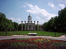
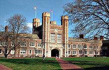 Brookings Hall at Washington University
The University of Missouri System is Missouri's statewide public university system. The flagship institution and largest university in the state is the University of Missouri in Columbia. The others in the system are University of Missouri–Kansas City, University of Missouri–St. Louis, and Missouri University of Science and Technology in Rolla. During the late nineteenth and early twentieth century the state established a series of normal schools in each region of the state, originally named after the geographic districts: Northeast Missouri State University (now Truman State University) (1867), University of Central Missouri (1871), Southeast Missouri State University (1873), Southwest Missouri State University (now Missouri State University) (1905), Northwest Missouri State University (1905), Missouri Western State University (1915), and Missouri Southern State University (1937). Lincoln University and Harris-Stowe State University were established in the mid-nineteenth century and are historically black colleges and universities.
Among private institutions Washington University in St. Louis is a top 20 university and Saint Louis University is ranked in the top 70s.[56] There are numerous junior colleges, trade schools, church universities and other private universities in the state. A. T. Still University was the first osteopathic medical school in the world. Hannibal-LaGrange University in Hannibal, MO, was one of the first colleges west of the Mississippi (founded 1858 in LaGrange, MO, and moved to Hannibal, MO, in 1928[57]).
The state funds a $2000, renewable merit-based scholarship, Bright Flight, given to the top three percent of Missouri high school graduates who attend a university in-state.
The 19th century border wars between Missouri and Kansas have continued as a sports rivalry between the University of Missouri and University of Kansas. The rivalry is chiefly expressed through football and basketball games between the two universities. It is the oldest college rivalry west of the Mississippi River and the second oldest in the nation. Each year when the universities meet to play, the game is coined "Border War." An exchange occurs following the game where the winner gets to take a historic Indian War Drum, which has been passed back and forth for decades.
Sports
Missouri hosted the 1904 Summer Olympics at St. Louis, the first time the games were hosted in the United States.
Professional Sports Teams
- Major ouis Athletica (franchise folded in June 2010)
- Major Indoor Soccer League: St. Louis Steamers and Kansas City Comets
- Arena Football: Kansas City Brigade and River City Rage (UIFL)
- World Team Tennis: Kansas City Explorers, Springfield Lasers and St. Louis Aces
- Cycling: Tour of Missouri
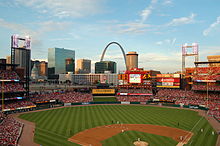
- Major League Baseball: St. Louis Cardinals and Kansas City Royals
- NFL St. Louis Rams and Kansas City Chiefs
- NHL "'St. Louis Blues'"
Minor leagues
- Baseball:
- Springfield Cardinals (Class AA, Texas League)
- River City Rascals (O'Fallon) (Independent, Frontier League)
- Chillicothe Mudcats (Independent, M.I.N.K. League)
- Excelsior Springs Cougars (Independent, M.I.N.K. League)
- Farmington Firebirds (Independent, KIT League)
- Joplin Outlaws (Independent, M.I.N.K. League)
- Marysville Magpies (Independent, Jayhawk League)
- Nevada Griffins (Independent, M.I.N.K. League)
- Ozark Generals (Independent, M.I.N.K. League)
- St. Joe Mustangs (Independent, M.I.N.K. League)
- Sedalia Bombers (Independent, M.I.N.K. League)
- St. Louis Tribe (Independent, MSBL National League)
- Sikeston Bulls (Independent, KIT League)
- Hannibal Cavemen (Prospect League) Kansas City T-bones (Kansas City)
- Ice Hockey:
- St. Louis Chill (Midwest Hockey League)
- Missouri Mavericks (Central Hockey League)
Former professional sports teams
- National Football League:
- St. Louis Cardinals (moved from Chicago in 1960; moved to Tempe, Arizona in 1988 and are now the Arizona Cardinals)
- St. Louis All Stars (active in 1923 only)
- Kansas City (NFL) (Blues/Cowboys) (active 1924–1926, folded)
- St. Louis Gunners (independent team, joined the NFL for the last three weeks of the 1934 season and folded thereafter)
- Major League Baseball (American League):
- St. Louis Browns (moved from Milwaukee in 1902; moved to Baltimore, Maryland after the 1953 season and are now the Baltimore Orioles)
- Kansas City Athletics (moved from Philadelphia in 1955; moved to Oakland, California after the 1967 season and are now the Oakland Athletics)
- National Basketball Association:
- St. Louis Bombers (charter BAA franchise in 1946, joined the NBA when it formed in 1949; ceased operations in 1950)
- St. Louis Hawks (moved from Milwaukee in 1955; moved to Atlanta in 1968 and are now the Atlanta Hawks)
- Kansas City Kings (moved to Sacramento in 1985 and are now the Sacramento Kings)
- National Hockey League:
- Kansas City Scouts (1974 expansion team, moved to Denver, Colorado in 1976 and became the Colorado Rockies, and would move again to Newark, New Jersey; now called the New Jersey Devils)
- St. Louis Eagles (1934 relocation of the original Ottawa Senators, folded after the 1934–35 season)
- Major League Soccer:
- Kansas City Wizards (founded in Kansas City, Missouri, in 1995; moved to Kansas City, Kansas in 2007)
- Continental Basketball Association:
- Teams in Kansas City and St. Louis
Four US Navy vessels have been named after the state.
- USS Missouri (1841), a sidewheel frigate launched in 1841 and destroyed by fire in 1843
- USS Missouri (BB-11), a Maine-class battleship in service from 1900 to 1922
- USS Missouri (BB-63), an Iowa-class battleship in service from 1944 to 1998; site of the official Japanese surrender of World War II; decommissioned in 1998; now a floating war memorial at Pearl Harbor Naval Base in Hawaii
- USS Missouri (SSN-780), a Virginia-class submarine joined the fleet after a commissioning ceremony July 31, 2010 at the Naval Submarine Base New London.
State nickname
The use of the unofficial nickname the Show-Me State has several possible origins. The phrase "I'm from Missouri" means 'I'm skeptical of the matter and not easily convinced'. This is related to the state's unofficial motto of "Show Me," whose origin is popularly ascribed to an 1899 speech by Congressman Willard Vandiver, who declared that "I come from a country that raises corn and cotton, cockleburs and Democrats, and frothy eloquence neither convinces nor satisfies me. I'm from Missouri, and you have got to show me." However, according to researchers, the phrase was in circulation earlier in the 1890s.[58] According to another legend, the phrase was a reference to Missouri miners brought to Leadville, Colorado to take the place of striking miners and being unfamiliar with the mining methods there required frequent instruction.[59]
Missouri is also known as "The Cave State" with over 6000 recorded caves (second to Tennessee). Perry County has both the largest number of caves and the single longest cave in the state.[60]
Other nicknames include "The Lead State", "The Bullion State", "The Ozark State", "Mother of the West", "The Iron Mountain State", and "Pennsylvania of the West".[61]
There is no official state nickname.[62] However, the official state motto is "Salus Populi Suprema Lex Esto", Latin for "Let the welfare of the people be the supreme law."[63]
See also
- Outline of geography
- Index of Missouri-related articles
- List of National Register of Historic Places in Missouri
- List of people from Missouri
References
- ^ "U.S. Census 2000 Metropolitan Area Rankings; ranked by population". http://www.census.gov/population/cen2000/phc-t29/tab03b.xls. Retrieved 2010-07-31.
- ^ a b c d 2010 US Census data
- ^ a b "Elevations and Distances in the United States". United States Geological Survey. 2001. http://egsc.usgs.gov/isb/pubs/booklets/elvadist/elvadist.html. Retrieved October 24, 2011.
- ^ a b Elevation adjusted to North American Vertical Datum of 1988.
- ^ http://www.moga.state.mo.us/statutes/C000-099/0100000095.HTM
- ^ Missouri. (2009). In Merriam-Webster Online Dictionary. Retrieved May 13, 2009.
- ^ http://www.census.gov/const/regionmap.pdf
- ^ "Annual Estimates of the Resident Population for the United States, Regions, States, and Puerto Rico: April 1, 2000 to July 1, 2009". United States Census Bureau. http://www.census.gov/popest/states/tables/NST-EST2009-01.csv. Retrieved 2010-01-04.
- ^ http://www.census.gov/geo/www/ua/ua2k.txt
- ^ "Topic Galleries". Chicago Tribune. http://www.chicagotribune.com/news/nationworld/chi-0411030358nov03,1,6377649.story?coll=chi-newsnationworld-utl&ctrack=1&cset=true. Retrieved 2010-07-31.
- ^ "Introduction to Missouri – The Show Me State Capital Jefferson City". Netstate.com. http://www.netstate.com/states/intro/mo_intro.htm. Retrieved 2010-07-31.
- ^ "Pony Express National Historic Trail". http://www.nps.gov/poex/.
- ^ Centers of Population for the 2010 Census, U.S. Census Bureau
- ^ McCafferty, Michael. 2004. speech/v079/79.1mccafferty.html "Correction: Etymology of Missouri" (restricted access), American Speech, 79.1:32[dead link]
- ^ "Missouri", American Heritage Dictionary
- ^ http://www.eduplace.com/ss/maps/pdf/midwestus_nl.pdf
- ^ "Midwest Region Economy at a Glance". Bls.gov. http://www.bls.gov/eag/eag.midwest.htm. Retrieved 2010-07-31.
- ^ "UNC-CH surveys reveal where the ‘real' South lies". Unc.edu. 1999-06-02. http://www.unc.edu/news/archives/jun99/reed16.htm. Retrieved 2010-07-31.
- ^ a b Almanac of the 50 States (Missouri). Information Publications (Woodside, CA). 2008. p. 203.
- ^ "Missouri's Karst Wonderland – Missouri State Parks and Historic Sites, DNR". Mostateparks.com. 2008-06-06. http://www.mostateparks.com/karst.htm. Retrieved 2010-02-20.
- ^ "Income Inequality in Missouri". Ded.mo.gov. 2001-12-21. http://ded.mo.gov/researchandplanning/community/misc/sa-1102-1.stm. Retrieved 2010-07-31.
- ^ "Average Weather for St. Louis, MO – Temperature and Precipitation". Weather.com. http://www.weather.com/weather/wxclimatology/monthly/graph/USMO0787?from=36hr_bottomnav_undeclared. Retrieved October 15, 2009.
- ^ Hoffhaus. (1984). Chez Les Canses: Three Centuries at Kawsmouth, Kansas City: Lowell Press. ISBN 0-913504-91-2.
- ^ "''MISSOURI V. IOWA'', 48 U.S. 660 (1849) – US Supreme Court Cases from Justia & Oyez". Supreme.justia.com. http://supreme.justia.com/us/48/660/case.html. Retrieved 2010-07-31.
- ^ Meinig, D.W. (1993). The Shaping of America: A Geographical Perspective on 500 Years of History, Volume 2: Continental America, 1800–1867. New Haven: Yale University Press. ISBN 0-300-05658-3; pg. 437
- ^ Historical Census Browser, 1860 Federal Census, University of Virginia Library. Retrieved March 21, 2008.
- ^ "Louisiana: The Levee System of the State", New York Times, 10/8/1874; accessed 11/15/2007
- ^ "First interstate project". Fhwa.dot.gov. http://www.fhwa.dot.gov/infrastructure/rw96h.cfm. Retrieved 2010-07-31.
- ^ Resident Population Data – 2010 Census
- ^ "Population and Population Centers by State – 2000". United States Census Bureau. http://www.census.gov/geo/www/cenpop/statecenters.txt. Retrieved 2008-12-05.
- ^ Ammon, Ulrich; International Sociological Association (1989). Status and Function of Languages and Language Varieties. Walter de Gruyter. pp. 306–308. ISBN 0899253563. http://books.google.com/?id=geh261xgI8sC&printsec=frontcover&q. Retrieved September 3, 2010.
- ^ Carrière, J. -M. (1939). "Creole Dialect of Missouri". American Speech (Duke University Press) 12 (6): 502–503. JSTOR 451217.
- ^ "Valparaiso University". http://www.valpo.edu/geomet/pics/geo200/religion/catholic.gif. Retrieved 2010-07-31.
- ^ 2001 American Religious Identification Survey, City University of New York
- ^ "The Association of Religion Data Archives | Maps & Reports". Thearda.com. http://www.thearda.com/mapsReports/reports/state/29_2000.asp. Retrieved 2010-02-20.
- ^ "FRB: Federal Reserve Districts and Banks". Federalreserve.gov. 2005-12-13. http://www.federalreserve.gov/OTHERFRB.HTM. Retrieved 2010-02-20.
- ^ Bls.gov; Local Area Unemployment Statistics
- ^ [1][dead link]
- ^ Wade, Lynn A. (2010-08-07). "Upgrade of U.S. 71 to I-49 coming to Missouri soon". Nevada Daily Mail. http://www.nevadadailymail.com/story/1655119.html. Retrieved 2011-03-29.
- ^ "Missouri Secretary of State – State Archives – Origin of "Show Me" slogan". Sos.mo.gov. http://www.sos.mo.gov/archives/history/slogan.asp. Retrieved 2010-07-31.
- ^ "Mo. Rev. Stat. § 67.305". Moga.mo.gov. 2009-08-28. http://moga.mo.gov/statutes/C000-099/0670000305.HTM. Retrieved 2010-07-31.
- ^ "Mo. Rev. Stat. § 311.170". Moga.mo.gov. 2009-08-28. http://moga.mo.gov/statutes/C300-399/3110000170.HTM. Retrieved 2010-07-31.
- ^ "Mo. Rev. Stat. § 311.310". Moga.mo.gov. 2009-08-28. http://moga.mo.gov/statutes/C300-399/3110000310.HTM. Retrieved 2010-07-31.
- ^ "Mo. Rev. Stat. § 311.086". Moga.mo.gov. 2009-08-28. http://moga.mo.gov/statutes/C300-399/3110000086.HTM. Retrieved 2010-07-31.
- ^ "State Cigarette Excise Tax Rates" (PDF). http://www.tobaccofreekids.org/research/factsheets/pdf/0097.pdf. Retrieved 2010-07-31.
- ^ "A burning issue," St. Louis Post-Dispatch, November 12, 2006
- ^ ""Best Cities for Smokers," ''Forbes Magazine'', November 1, 2007". Forbes. http://www.forbes.com/business/2007/11/01/tobacco-smoking-north-carolina-biz-cx_tvr_1101smoking.html. Retrieved 2010-07-31.[dead link]
- ^ "Centers for Disease Control and Prevention, "Behavioral Risk Factor Surveillance System – Adults who are current smokers", September 19, 2008". Apps.nccd.cdc.gov. 2009-05-15. http://apps.nccd.cdc.gov/brfss/list.asp?cat=TU&yr=2008&qkey=4396&state=All. Retrieved 2010-07-31.
- ^ "Mo. Rev. Stat. § 407.931.3". Moga.mo.gov. http://moga.mo.gov/statutes/C400-499/4070000931.HTM. Retrieved 2010-07-31.
- ^ "Missouri Department of Health and Senior Services, ''County Level Survey 2007: Secondhand Smoke for Missouri Adults'', October 1, 2008". Dhss.mo.gov. http://www.dhss.mo.gov/County_level_study/header.php?cnty=929&profile_type=2&chkBox=C. Retrieved 2010-07-31.
- ^ "Mo. Rev. Stat. § 191.769". Moga.mo.gov. 2009-08-28. http://moga.mo.gov/statutes/C100-199/1910000769.HTM. Retrieved 2010-07-31.
- ^ "Mo. Rev. Stat. § 290.145". Moga.mo.gov. 2009-08-28. http://moga.mo.gov/statutes/C200-299/2900000145.HTM. Retrieved 2010-07-31.
- ^ Table 1. The Most Populous Counties and Incorporated Places in 2010 in Missouri: 2000 and 2010 (.xls)
- ^ "Annual Estimates of the Population for Incorporated Places in Missouri". United States Census Bureau. http://www.census.gov/popest/cities/tables/SUB-EST2007-04-29.xls. Retrieved 2008-07-12.
- ^ Missouri Department Of Elementary And Secondary Education (2009-09-02). "Home Schooling". Dese.mo.gov. http://www.dese.mo.gov/schoollaw/HomeSch/. Retrieved 2010-02-20.
- ^ “America's Best Colleges 2008: National Universities: Top Schools.” USNews.com: . January 18, 2008.
- ^ http://www.hlg.edu/newsinfo/about.php
- ^ "I'm from Missouri – Show Me." http://www.barrypopik.com/index.php/new_york_city/entry/summary3
- ^ Origin of "Show Me" Slogan. Secretary of State, Missouri. http://www.sos.mo.gov/archives/history/slogan.asp
- ^ Scott House (2005-05-14). "Fact Sheet on 6000 Caves". The Missouri Speleological Survey, Inc.. http://www.mospeleo.org/docs/pr6000.htm. Retrieved 2008-03-16.
- ^ "Introduction to Missouri", Netstate http://www.netstate.com/states/intro/mo_intro.htm>
- ^ "SOS, Missouri – State Archives Missouri History FAQ – Origin of"Show-Me"Slogan". Sos.mo.gov. http://www.sos.mo.gov/archives/history/slogan.asp. Retrieved 2010-02-20.
- ^ The Great Seal of Missouri, Secretary of State, Missouri. http://www.sos.mo.gov/symbols/symbols.asp?symbol=seal
External links
- Missouri Government
- Missouri Digital Heritage
- State Historical Society of Missouri, Columbia
- Missouri's African American History
- Missouri State Tourism Office
- Energy & Environmental Data for Missouri
- USGS real-time, geographic, and other scientific resources of Missouri
- U.S. Census Bureau
- Missouri QuickFacts. Geographic and demographic information.
- Missouri – Race and Hispanic Origin: 1810 to 1990PDF (71.1 KB)
- Missouri State Facts
- List of searchable databases produced by Missouri state agencies hosted by the American Library Association Government Documents Roundtable.
- Missouri at the Open Directory Project
- Missouri History, Geology, Culture
- Historic Sanborn Fire Insurance Maps of Missouri
- 1930 Platbooks of Missouri Counties

 Nebraska
 Iowa
Iowa Kansas
 Illinois
 Missouri: Outline • Index

 Oklahoma
 Arkansas
 Kentucky
 Tennessee
Political divisions of the United States States - Alabama
- Alaska
- Arizona
- Arkansas
- California
- Colorado
- Connecticut
- Delaware
- Florida
- Georgia
- Hawaii
- Idaho
- Illinois
- Indiana
- Iowa
- Kansas
- Kentucky
- Louisiana
- Maine
- Maryland
- Massachusetts
- Michigan
- Minnesota
- Mississippi
- Missouri
- Montana
- Nebraska
- Nevada
- New Hampshire
- New Jersey
- New Mexico
- New York
- North Carolina
- North Dakota
- Ohio
- Oklahoma
- Oregon
- Pennsylvania
- Rhode Island
- South Carolina
- South Dakota
- Tennessee
- Texas
- Utah
- Vermont
- Virginia
- Washington
- West Virginia
- Wisconsin
- Wyoming
Federal district Insular areas Outlying islands Mayors of cities with populations exceeding 100,000 in Missouri - Sly James
(Kansas City)
- Jim O'Neal
(Springfield)
- Don Reimal
(Independence)
- Bob McDavid
(Columbia)
 State capital: John Landwehr, (Jefferson City)
Other states: AL • AK • AZ • AR • CA • CO • CT • DE • FL • GA • HI • ID • IL • IN • IA • KS • KY • LA • ME • MD • MA • MI • MN • MS • MO • MT • NE • NV • NH • NJ • NM • NY • NC • ND • OH • OK • OR • PA • RI • SC • SD • TN • TX • UT • VT • VA • WA • WV • WI • WYUnited States (Outline) History Pre-Columbian era · Colonial era (Thirteen Colonies · Colonial American military history) · American Revolution (War) · Federalist Era · War of 1812 · Territorial acquisitions · Territorial evolution · Mexican–American War · Civil War · Reconstruction era · Indian Wars · Gilded Age · African-American Civil Rights Movement (1896–1954) · Spanish–American War · Imperialism · World War I · Roaring Twenties · Great Depression · World War II (Home front) · Cold War · Korean War · Space Race · African-American Civil Rights Movement (1955–1968) · Feminist Movement · Vietnam War · Post-Cold War (1991–present) · War on Terror (War in Afghanistan · Iraq War) · Timeline of modern American conservatismTopicsDemographic · Discoveries · Economic (Debt Ceiling) · Inventions (before 1890 · 1890–1945 · 1946–1991 · after 1991) · Military · Postal · Technological and industrialFederal
governmentLegislature - Congress
Senate
· Vice President
· President pro tem
House of Representatives
· Speaker
Judiciary - Supreme Court
Federal courts
Courts of appeal
District courtsExecutive - President
Executive Office
Cabinet / Executive departments
Civil service
Independent agencies
Law enforcement
Public policy
Intelligence
Central Intelligence Agency
Defense Intelligence Agency
National Security Agency
Federal Bureau of InvestigationPolitics Divisions · Elections (Electoral College) · Foreign policy · Foreign relations · Ideologies · Local governments · Parties (Democratic Party · Republican Party · Third parties) · Political status of Puerto Rico · Red states and blue states · Scandals · State governments · Uncle SamGeography Cities, towns, and villages · Counties · Extreme points · Islands · Mountains (Peaks · Appalachian · Rocky) · National Park System · Regions (Great Plains · Mid-Atlantic · Midwestern · New England · Northwestern · Southern · Southwestern · Pacific · Western) · Rivers (Colorado · Columbia · Mississippi · Missouri · Ohio · Rio Grande) · States · Territory · Water supply and sanitationEconomy Agriculture · Banking · Communications · Companies · Dollar · Energy · Federal Budget · Federal Reserve System · Financial position · Insurance · Mining · Public debt · Taxation · Tourism · Trade · Transportation · Wall StreetSociety TopicsCrime · Demographics · Education · Family structure · Health care · Health insurance · Incarceration · Languages (American English · Spanish · French) · Media · People · Public holidays · Religion · SportsArchitecture · Art · Cinema · Cuisine · Dance · Fashion · Flag · Folklore · Literature · Music · Philosophy · Radio · Television · TheaterIssuesPreceded by
MaineList of U.S. states by date of statehood
Admitted on August 10, 1821 (24th)Succeeded by
ArkansasCategories:- Missouri
- States of the United States
- States and territories established in 1821
- Christian – 77%


Wikimedia Foundation. 2010.