- Idaho
-
This article is about the U.S. state of Idaho. For other uses, see Idaho (disambiguation).
Idaho 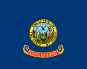

Flag Seal Nickname(s): Gem State Motto(s): Esto perpetua 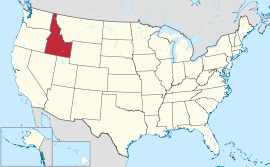
Official language(s) English Demonym Idahoan Capital
(and largest city)Boise Largest metro area Boise metropolitan area Area Ranked 14th in the U.S. - Total 83,570 sq mi
(216,632 km2)- Width 305 miles (491 km) - Length 479 miles (771 km) - % water 0.98 - Latitude 42° N to 49° N - Longitude 111°03′ W to 117°15′ W Population Ranked 39th in the U.S. - Total 1,567,582 (2010 Census) - Density 15.64/sq mi (6.04/km2)
Ranked 44th in the U.S.Elevation - Highest point Borah Peak[1][2][3]
12,668 ft (3861.2 m)- Mean 5,000 ft (1,520 m) - Lowest point Confluence of Snake River and Clearwater River[2][3]
713 ft (217 m)Before statehood Idaho Territory Admission to Union July 3, 1890 (43rd) Governor C.L. "Butch" Otter (R) Lieutenant Governor Brad Little (R) Legislature Idaho Legislature - Upper house Senate - Lower house House of Representatives U.S. Senators Mike Crapo (R)
Jim Risch (R)U.S. House delegation 1-Raúl Labrador (R)
2-Mike Simpson (R) (list)Time zones - north of Salmon River Pacific: UTC−8/−7 - remainder Mountain: UTC−7/−6 Abbreviations ID US-ID Website idaho.gov Idaho
 i/ˈaɪdəhoʊ/ is a state in the Rocky Mountain area of the United States. The state's largest city and capital is Boise. Residents are called "Idahoans". Idaho was admitted to the Union on July 3, 1890, as the 43rd state.
Idaho is a mountainous state, and is the 14th largest state by land area, with an area larger than that of all of New England. It is landlocked, surrounded by the states of Washington, Oregon, Nevada, Utah, Wyoming, Montana and the Canadian province of British Columbia. However, the network of dams and locks on the Columbia River and Snake River make the city of Lewiston the farthest inland seaport on the Pacific coast of the contiguous United States.
According to the United States Census 2010, Idaho had a population of 1,567,582. The state's postal abbreviation is ID. Idaho's nickname is the Gem State, because nearly every known gemstone has been found there.[4] In addition, Idaho is one of only two places in the world where star garnets can be found (the other is the Himalaya Mountains, in Pakistan and India), and is the only place six-pointed star garnets have been found. Additionally Idaho is sometimes called the Potato State owing to its popular crop. The state motto is Esto Perpetua (Latin for "Let it be forever").
Etymology
The exact origin of the name remains a mystery.[5] In the early 1860s, when the United States Congress was considering organizing a new territory in the Rocky Mountains, eccentric lobbyist George M. Willing suggested the name "Idaho," which he claimed was derived from a Shoshone language term meaning "the sun comes from the mountains" or "gem of the mountains". Willing later claimed that he had made up the name himself.[6][7] Congress ultimately decided to name the area Colorado Territory when it was created in February 1861. Thinking they would get a jump on the name, locals named a community in Colorado "Idaho Springs".
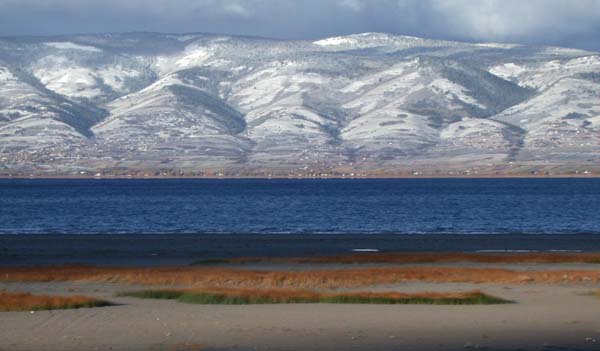
 Lake Coeur d'Alene in North Idaho
However, the name "Idaho" did not go away. The same year Congress created Colorado Territory, a county called Idaho County was created in eastern Washington Territory. The county was named after a steamship named Idaho, which was launched on the Columbia River in 1860. It is unclear whether the steamship was named before or after Willing's claim was revealed. Regardless, a portion of Washington Territory, including Idaho County, was used to create Idaho Territory in 1863.
Despite this lack of evidence for the origin of the name, many textbooks well into the 20th century repeated as fact Willing's account that the name "Idaho" derived from the Shoshone term "ee-da-how".
The name "Idaho" may be derived from the Plains Apache word "ídaahę́" which means "enemy." The Comanches used this word to refer to the Idaho Territory.[8]
An excerpt from an Idaho History Textbook:
- "Idaho" is a Shoshoni Indian exclamation. The word consists of three parts. The first is "Ee", which in English conveys the idea of "coming down". The second is "dah" which is the Shoshoni stem or root for both "sun" and "mountain". The third syllable, "how", denotes the exclamation and stands for the same thing in Shoshoni that the exclamation mark (!) does in the English language. The Shoshoni word is "Ee-dah-how", and the Indian thought thus conveyed when translated into English means, "Behold! the sun coming down the mountain".[9]
Geography
 Digitally colored elevation map of Idaho.
 Reynolds Creek Experimental Watershed in the Owyhee Mountains about 50 miles (80 km) southwest of Boise, Idaho.
 Redfish Lake in central Idaho.
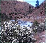
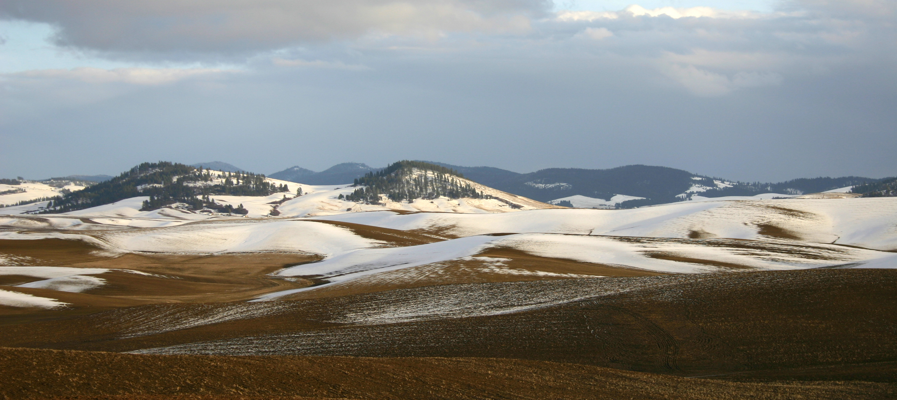
 The Palouse region of North Idaho.Further information: List of Idaho counties
Idaho borders six states and one Canadian province. The states of Washington and Oregon are to the west, Nevada and Utah are to the south, and Montana and Wyoming are to the east. Idaho also shares a short border with the Canadian province of British Columbia to the north. The landscape is rugged with some of the largest unspoiled natural areas in the United States. For example, at 2.3 million acres (9,300 km²), the Frank Church-River of No Return Wilderness Area is the largest contiguous area of protected wilderness in the continental United States. Idaho is a Rocky Mountain state with abundant natural resources and scenic areas. The state has snow-capped mountain ranges, rapids, vast lakes and steep canyons. The waters of the Snake River rush through Hells Canyon, the deepest gorge in the United States.
 The Shoshone Falls in southern Idaho.
Shoshone Falls plunges down rugged cliffs from a height greater than that of Niagara Falls. The major rivers in Idaho are the Snake River, the Clark Fork/Pend Oreille River, the Clearwater River, the Salmon River. Other significant rivers include the Coeur d'Alene River, the Spokane River, the Boise River, and the Payette River. The Salmon River empties into the Snake in Hells Canyon and forms the southern boundary of Nez Perce County on its north shore, of which Lewiston is the county seat. The Port of Lewiston, at the confluence of the Clearwater and the Snake Rivers is the farthest inland seaport on the West Coast at 465 river miles from the Pacific at Astoria, Oregon.[12]
Idaho's highest point is Borah Peak, 12,662 ft (3,859 m), in the Lost River Range north of Mackay. Idaho's lowest point, 710 ft (216 m), is in Lewiston, where the Clearwater River joins the Snake River and continues into Washington. The Sawtooth Range is often considered Idaho's most famous mountain range.[13] Other mountain ranges in Idaho include the Bitterroot Range, the White Cloud Mountains, the Lost River Range, the Clearwater Mountains, and the Salmon River Mountains.
 Map of Idaho
Southern Idaho, including the Boise metropolitan area, Idaho Falls, Pocatello, and Twin Falls are in the Mountain Time Zone. (A legislative oddity (15 U.S.C. ch.6 §264) theoretically placed this region in the Central Time Zone, but this error was corrected with a 2007 Amendment.)[14] Areas north of the Salmon River, including Coeur d'Alene, Moscow, Lewiston, and Sandpoint are in the Pacific Time Zone and revolve commercially and culturally around Washington State through the second largest city, Spokane, Washington.
Climate
Idaho has much variation in its climate. Although the state's western border is located about 350 miles (560 km) from the Pacific Ocean, the maritime influence is still felt in Idaho, especially in the winter when cloud cover, humidity, and precipitation are at their maximum extent. This influence has a moderating effect in the winter where temperatures are not as low as would otherwise be expected for a northern state with a predominantly elevated altitude.[15] The maritime influence is the least prominement in the eastern part of the state where the precipitation patterns are often reversed, with wetter summers and drier winters, and seasonal temperature differences more extreme, showing a more semi-arid continental climate.
Climate in Idaho can be hot, although extended periods over 100 °F (38 °C) for the maximum temperature are rare, except for the lowest point in elevation, Lewiston, which correspondingly sees very little snow. Hot summer days are tempered by the low relative humidity and cooler evenings during summer months since, for most of the state, the highest diurnal difference in temperature is often in the summer. Winters can be cold, although extended periods of bitter cold weather below zero are unusual. This is what led the railroad tycoon Harriman family to develop the most famous ski resort, Sun Valley. Idaho's all time highest temperature of 118 °F (48 °C) was recorded at Orofino on July 28, 1934; the all time lowest temperature of −60 °F (−51 °C) was recorded at Island Park Dam on January 18, 1943.
Monthly Normal High and Low Temperatures For Various Idaho Cities. (F) City Jan Feb Mar Apr May Jun Jul Aug Sep Oct Nov Dec Boise 38/24 45/27 55/33 62/38 72/46 81/53 91/59 90/59 79/50 65/40 48/31 38/23 Lewiston 42/30 47/31 55/36 62/41 71/47 79/54 89/60 89/60 78/51 63/41 48/34 40/28 Pocatello 33/16 38/19 49/27 59/33 68/40 78/46 88/52 88/51 76/42 62/33 45/24 33/16 [3] Lakes
- Alturas Lake
- Bear Lake (Idaho-Utah)
- Hayden Lake
- Henry's Lake
- Hidden Lake
- Lake Cascade
- Lake Coeur d'Alene
- Lake Lowell
- Lake Ruvet
- Lake Walcott
- Payette Lake (McCall)
- Pend Oreille
- Little Redfish Lake
- Lucky Peak Lake
- Pettit Lake
- Priest Lake
- Redfish Lake
- Sawtooth Lake
- Stanley Lake
- Warm Lake
- Williams Lake (Salmon)
History
Main article: History of IdahoHumans may have been present in the Idaho area as long as 14,500 years ago. Excavations at Wilson Butte Cave near Twin Falls in 1959 revealed evidence of human activity, including arrowheads, that rank among the oldest dated artifacts in North America. American Indian peoples predominant in the area included the Nez Perce in the north and the Northern and Western Shoshone in the south.
A early presence of French-Canadian trappers is visible in names and toponyms that have survived to this day: Nez Percé, Coeur d'Alène, Boisé, Payette, some preexisting the Lewis and Clark and Astorian expeditions which themselves included significant numbers of French and Metis guides recruited for their familiarity with the terrain.
Idaho, as part of the Oregon Country, was claimed by both the United States and Great Britain until the United States gained undisputed jurisdiction in 1846. From 1843 to 1849 present-day Idaho was under the de facto jurisdiction of the Provisional Government of Oregon. When Oregon became a state, what is now Idaho was in what was left of the original Oregon Territory not part of the new state, and designated as the Washington Territory.
Between then and the creation of the Idaho Territory on July 4, 1863 at Lewiston, parts of the present-day state were included in the Oregon, Washington, and Dakota Territories. The new territory included present-day Idaho, Montana, and most of Wyoming. The Lewis and Clark expedition crossed Idaho in 1805 on the way to the Pacific and in 1806 on the return, largely following the Clearwater River both directions. The first non-indigenous settlement was Kullyspell House, established on the shore of Lake Pend Oreille for fur trading in 1809 by David Thompson of the North West Company.[16][17] In 1812 Donald Mackenzie, working for the Pacific Fur Company at the time, established a post on the lower Clearwater River near present-day Lewiston. This post, known as "MacKenzie's Post" or "Clearwater", operated until the Pacific Fur Company was bought out by the North West Company in 1813, after which it was abandoned.[18][19] The first attempts at organized communities, within the present borders of Idaho, were established in 1860.[20][21] The first permanent, substantial incorporated community was Lewiston in 1861.
After some tribulation as a territory, including the illegal and chaotic transfer of the territorial capital from Lewiston in December 1864 to Boise in January 1865, disenfranchisement of Mormon polygamists upheld by the U.S. Supreme Court in 1877,[22] and a federal attempt to split the territory between Washington Territory which gained statehood in 1889, a year before Idaho, and the state of Nevada which had been a state since 1863, Idaho achieved statehood in 1890. The economy of the state, which had been primarily supported by metal mining, shifted towards agriculture, forest products and tourism.
In recent years, Idaho has expanded its commercial base as a tourism and agricultural state to include science and technology industries. Science and technology have become the largest single economic center (over 25% of the state's total revenue) within the state and are greater than agriculture, forestry and mining combined.[23]
The Idaho State Historical Society and numerous local historical societies and museums preserve and promote Idaho’s cultural heritage.
Demographics
 Idaho Population Density Map.
Historical populations Census Pop. %± 1870 14,999 — 1880 32,610 117.4% 1890 88,548 171.5% 1900 161,772 82.7% 1910 325,594 101.3% 1920 431,866 32.6% 1930 445,032 3.0% 1940 524,873 17.9% 1950 588,637 12.1% 1960 667,191 13.3% 1970 712,567 6.8% 1980 943,935 32.5% 1990 1,006,749 6.7% 2000 1,293,953 28.5% 2010 1,567,582 21.1% Source: 1910–2010[24] At the 2010 Census, 84.0% of the population was non-Hispanic White, 0.6% non-Hispanic Black or African American, 1.1% non-Hispanic American Indian and Alaska Native, 1.2% non-Hispanic Asian, 0.1% non-Hispanic Native Hawaiian and Other Pacific Islander, 0.1% from some other race (non-Hispanic) and 1.7% of two or more races (non-Hispanic). 11.2% of Idaho's population was of Hispanic, Latino, or Spanish origin (they may be of any race).
As of 2005, Idaho has an estimated population of 1,429,096, which is an increase of 33,956, or 2.4%, from the prior year and an increase of 135,140, or 10.4%, since the year 2000. This includes a natural increase since the last census of 58,884 people (that is 111,131 births minus 52,247 deaths) and an increase due to net migration of 75,795 people into the state. There are large numbers of Americans of English and German ancestry in Idaho. Immigration from outside the United States resulted in a net increase of 14,522 people, and migration within the country produced a net increase of 61,273 people.
This made Idaho the sixth fastest-growing state after Arizona, Nevada, Florida, Georgia, and Utah. From 2004 to 2005, Idaho grew the third-fastest, surpassed only by Nevada and Arizona.
Nampa, the state's second largest city, has experienced particularly strong growth in recent years. According to census estimates Nampa has grown 22.1% to nearly 65,000 residents between 2000 and 2003. As of 2007, the population in Nampa was estimated at 84,000. Growth of 5% or more over the same period has also been observed in Caldwell, Coeur d'Alene, Meridian, Post Falls and Twin Falls.[25]
Since 1990, Idaho's population has increased by 386,000 (38%).
The Boise Metropolitan Area (officially known as the Boise City-Nampa, ID Metropolitan Statistical Area) is Idaho's largest metropolitan area. Other metropolitan areas in order of size are Coeur d'Alene, Idaho Falls, Pocatello and Lewiston.
As of 2006, six official micropolitan statistical areas are based in Idaho. Twin Falls is the largest of these.
The center of population of Idaho is located in Custer County, in the town of Stanley.[26]
The most common reported ancestries in the state are: German (18.9%), English (18.1%), Irish (10%), American (8.4%), Norwegian (3.6%), and Swedish (3.5%).
Religion
 The Church of Jesus Christ of Latter-day Saints Idaho Falls Temple.
According to a report produced by the Pew Forum on Religion & Public Life the self-identified religious affiliations of Idahoans over the age of 18 as of 2008 are:[27]
Denomination % Church of Jesus Christ of Latter-day Saints 23 Evangelical Protestant 22 Catholic 18 Unaffiliated 18 Mainline Protestant 16 Other Faiths 2 Jehovah's Witness 1 Eastern Orthodox <0.5 Other Christian <0.5 Jewish <0.5 Muslim <0.5 Buddhist <0.5 Hindu <0.5 Other World <0.5 Don't know/refused <0.5 The largest denominations by number of members in 2000 were The Church of Jesus Christ of Latter-day Saints with 311,425; (2008: 406,764) the Roman Catholic Church with 130,847; the Assemblies of God with 18,745; and the United Methodist Church with 17,683.[28]
Economy
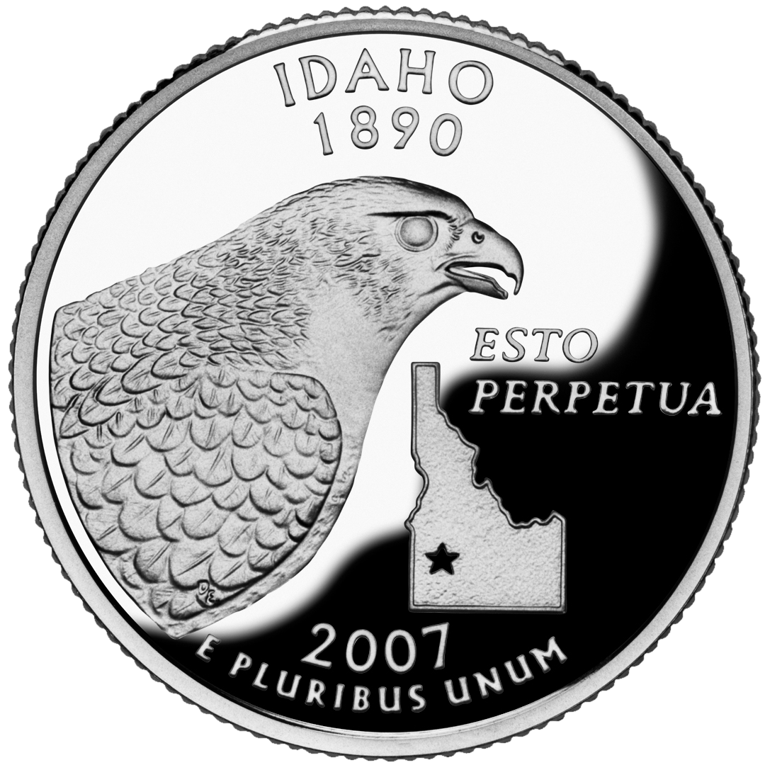
 Idaho State Quarter
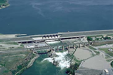
 American Falls Dam
Gross state product for 2004 was US$43.6 billion. The per capita income for 2004 was US$26,881. Idaho is an important agricultural state, producing nearly one-third of the potatoes grown in the United States. All three varieties of wheat, Dark Northern Spring, Hard Red and Soft White are grown in the state. Nez Perce County is considered a premier Soft White growing locale.
Important industries in Idaho are food processing, lumber and wood products, machinery, chemical products, paper products, electronics manufacturing, silver and other mining, and tourism. The world's largest factory for barrel cheese, the raw product for processed cheese is located in Gooding, Idaho. It has a capacity of 120,000 metric tons per year of barrel cheese and belongs to the Glanbia group.[29] The Idaho National Laboratory (INL), a government lab for nuclear energy research, is also an important part of the eastern Idaho economy. Idaho also is home to three facilities of Anheuser-Busch which provide a large part of the malt for breweries located across the nation.
Locally, a variety of industries are important. Outdoor recreation is a common example ranging from numerous snowmobile and downhill and cross-country ski areas in winter to the evolution of Lewiston as a retirement community based on mild winters, dry year-round climate and one of the lowest median wind velocities anywhere, combined with the rivers for a wide variety of activities. Other examples would be ATK Corporation, which operates three ammunition and ammunition components plants in Lewiston. Two are sporting and one is defense contract. The Lewis-Clark Valley has an additional independent ammunition components manufacturer and the Chipmunk rifle factory. Four of the world's six welded aluminum jet boat (for running river rapids) manufacturers are in the Lewiston-Clarkston, WA valley. Wine grapes were grown between Kendrick and Julietta in the Idaho Panhandle by the French Rothchilds until Prohibition. In keeping with this, while there are no large wineries or breweries in Idaho, there are numerous and growing numbers of award winning boutique wineries and microbreweries in the northern part of the state.
Today, the largest industry in Idaho is the science and technology sector. It accounts for over 25% of the State's total revenue and 70%+ of the State's exports (in dollars). Idaho's industrial economy is growing, with high-tech products leading the way. Since the late 1970s, Boise has emerged as a center for semiconductor manufacturing. Boise is the home of Micron Technology Inc., the only U.S. manufacturer of dynamic random access memory (DRAM) chips. Micron at one time manufactured desktop computers, but with very limited success. Hewlett-Packard has operated a large plant in Boise since the 1970s, which is devoted primarily to LaserJet printers production.[30] ON Semiconductor, whose worldwide headquarters in Pocatello, is a widely recognized innovator in modern integrated mixed-signal semiconductor products, mixed-signal foundry services, and structured digital products. Coldwater Creek, a women's clothing retailer, is headquartered in Sandpoint. Sun Microsystems (now a part of Oracle Corporation) has two offices in Boise and a parts depot in Pocatello. Sun brings $4M in annual salaries and over $300M of revenue to the state each year.
A number of Fortune 500 companies started in or trace their roots to Idaho, including JC Penney (as The Golden Rule) in Twin Falls, Safeways in American Falls, Albertsons in Boise, JR Simplot across southern Idaho, Potlatch Corp. in Lewiston and Zimmerly Air Transport in Lewiston-Clarkston was one of the five companies in the merger centered around Varney Flying Service of Pasco, Washington, which became United Air Lines and subsequently Varney Air Group that became Continental Airlines.
The state personal income tax ranges from 1.6% to 7.8% in eight income brackets. Idahoans may apply for state tax credits for taxes paid to other states, as well as for donations to Idaho state educational entities and some nonprofit youth and rehabilitation facilities.
The state sales tax is 6% with a very limited, selective local option up to 6.5%. Sales tax applies to the sale, rental or lease of tangible personal property and some services. Food is taxed, but prescription drugs are not. Hotel, motel, and campground accommodations are taxed at a higher rate (7% to 11%). Some jurisdictions impose local option sales tax.
Idaho has a state gambling lottery which contributed $333.5 million in payments to all Idaho public schools and Idaho higher education from 1990–2006.[31]
Energy
 Electricity Generation in Idaho
The energy landscape of Idaho is favorable to the development of renewable energy systems. The state is rich in renewable energy resources but has limited fossil fuel resources. The Snake River Plain and smaller river basins provide Idaho with some of the best hydroelectric power resources in the nation and its geologically active mountain areas have significant geothermal power and wind power potential. These realities have shaped much of the state’s current energy landscape.
Most of the energy consumed in Idaho is imported from other states. Imports account for more than 80% of total energy consumption, including all of Idaho's natural gas and petroleum supplies and more than half of its electricity. Of the electricity consumed in Idaho in 2005, 48% came from hydroelectricity, 42% was generated by burning coal and 9% was generated by burning natural gas. The remainder came from other renewable sources such as wind.[32]
The state’s numerous river basins allow hydroelectric power plants to provide 556 thousand MWh, which amounts to about three-fourths of Idaho’s electricity generated in the state. Washington State provides most of the natural gas used in Idaho through one of the two major pipeline systems supplying the state. Although the state relies on out-of-state sources for its entire natural gas supply, it uses natural gas-fired plants to generate 127 thousand MWh, or about ten percent of its output. Coal-fired generation and the state’s small array of wind turbines supplies the remainder of the state’s electricity output. The state produces 739 thousand MWh but still needs to import half of its electricity from out-of-state to meet demand.[33]
While Idaho’s 515 trillion Btu total energy consumption is low compared with other states and represents just 0.5% of United States consumption, the state also has the nation’s 11th smallest population, 1.5 million, so its per capita energy consumption of 352 million Btu is currently just above the national average of 333 million Btu.[33] As the 13th largest state in land area, distance creates the additional problem of "line loss". When the length of an electrical transmission line is doubled, the resistance to an electric current passing through it is also doubled.
In addition, Idaho also has the 6th fastest growing population in the United States with the population expected to increase by 31% from 2008 to 2030.[34] This projected increase in population will contribute to a 42% increase in demand by 2030, further straining Idaho’s finite hydroelectric resources.[35]
Transportation
Main article: List of Idaho State Highways The current state license plate design, modified since its introduction in 1991.
Major highways
Idaho is among the few states in the nation without a major freeway linking the two largest metropolitan areas of Boise in the south and Coeur d'Alene in the north. US 95 links the two ends of the state, but like many other highways in Idaho, it is badly in need of repair and upgrade. In 2007, the Idaho Transportation Department stated that the state's highway infrastructure faces a $200 million per year shortfall in maintenance and upgrades. Interstate 84 is the main highway linking the Southeast and Southwest portions of the state, along with Interstate 86 and Interstate 15.
Major federal aid highways in Idaho:
North
 U.S. Highway 2
 U.S. Highway 12
North/South
 U.S. Highway 93
 U.S. Highway 95
 Interstate 15
West/East
 U.S. Highway 20
 U.S. Highway 26
 U.S. Highway 30
 Interstate 84
 Interstate 86
 Interstate 90
Southwest Air Travel
Major airports include the Boise Airport serving the southwest region of Idaho, and the Spokane International Airport (located in Spokane, Washington), which serves northern Idaho. Other airports with scheduled service are the Pullman-Moscow Regional Airport serving the Palouse; the Lewiston-Nez Perce County Airport, serving the Lewis-Clark Valley and north central and west central Idaho; The Magic Valley Regional Airport in Twin Falls; the Idaho Falls Regional Airport; and the Pocatello Regional Airport.
Rail Travel
Idaho is served by two transcontinental railroads. The Burlington Northern Santa Fe (BNSF) connects North Idaho with Seattle, Portland and Spokane to the west, and Minneapolis and Chicago to the east. The BNSF travels through Kootenai, Bonner and Boundary Counties. The Union Pacific Railroad crosses southern Idaho traveling between Portland, Green River, WY, and Ogden, Utah and serves Boise, Nampa, Twin Falls, and Pocatello. Amtrak's Empire Builder crosses northern Idaho, with its only stop being in Sandpoint. There has been a push recently to return Amtrak service to southern Idaho, as well.
Ports
The Port of Lewiston is the farthest inland Pacific port on the west coast. A series of dams and locks on the Snake River and Columbia River facilitate barge travel from here to Portland, where goods are loaded on ocean-going vessels.
Law and government
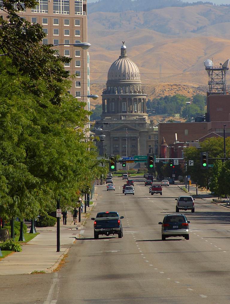
 The Idaho State Capitol building in Boise.
State Constitution
The Constitution of Idaho is roughly modeled on the national constitution with several additions. The constitution defines the form and functions of the state government, and may be amended through plebiscite. Notably, the state constitution presently requires the state government to maintain a balanced budget. As result, Idaho has limited debt (construction bonds, etc.).
Idaho Code
All of Idaho's state laws are contained in the Idaho Code. The code is amended through the Legislature with the approval of the Governor. Idaho still follows its original state Constitution.
State government
The constitution of Idaho provides for three branches of government: the executive, legislative and judicial branches. Idaho has a bicameral legislature, elected from 35 legislative districts, each represented by one senator and two representatives. Idaho still operates under its original (1889) state constitution.
Since 1946, statewide elected constitutional officers have been elected to four-year terms. They include: Governor, Lieutenant Governor, Secretary of State, Controller (Auditor before 1994), Treasurer, Attorney General, and Superintendent of Public Instruction.
Last contested in 1966, Inspector of Mines was an original elected constitutional office. Afterward it was an appointed position and ultimately done away with entirely in 1974.
Idaho's government has an alcohol monopoly.
Executive Branch
Further information: List of Idaho GovernorsFurther information: Lieutenant Governor of IdahoFurther information: Secretary of State of IdahoThe governor of Idaho serves a four-year term, and is elected during what is nationally referred to as midterm elections. As such, the governor is not elected in the same election year as the president of the United States. The current governor is Republican C. L. "Butch" Otter, who was elected in 2006 and re-elected in 2010.
Legislative Branch
Main article: Idaho LegislatureIdaho's legislature is part-time. However, the session may be extended if necessary, and often is. Because of this, Idaho's legislators are considered "citizen legislators", meaning that their position as a legislator is not their main occupation.
Terms for both the Senate and House of Representatives are two years. Legislative elections occur every even numbered year.
The Idaho Legislature has been continuously controlled by the Republican Party since the late 1950s, although Democratic legislators are routinely elected from Boise, Pocatello, Blaine County and the northern Panhandle.
See also List of Idaho senators and representatives
Judicial Branch
Main article: Courts of IdahoThe highest court in Idaho is the Idaho Supreme Court. There is also an intermediate appellate court, the Idaho Court of Appeals, which hears cases assigned to it from the Supreme Court. The state's District Courts serdistricts.[36]
Counties
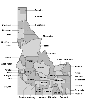
Idaho is divided into political jurisdictions designated as counties. Since 1919 there are 44 counties in the state, ranging in size from 410 to 8,502 square miles (1,062 to 22,020 square kilometers).
County name County seat Year founded Population 2008 Est. Population Percentage Area (sq. m.) Area Percentage Ada Boise 1864 380,920 25.00 % 1,060 1.21 % Adams Council 1911 3,499 00.23 % 1,370 1.57 % Bannock Pocatello 1893 80,812 05.30 % 1,147 1.31 % Bear Lake Paris 1893 5,798 00.38 % 1,049 1.20 % Benewah St. Maries 1915 9,352 00.61 % 784 0.90 % Bingham Blackfoot 1885 43,903 02.88 % 2,120 2.42 % Blaine Hailey 1895 21,731 01.43 % 2,661 3.04 % Boise Idaho City 1864 7,504 00.49 % 1,907 2.18 % Bonner Sandpoint 1907 41,168 02.70 % 1,920 2.19 % Bonneville Idaho Falls 1911 99,135 06.51 % 1,901 2.17 % Boundary Bonners Ferry 1915 10,962 00.72 % 1,278 1.46 % Butte Arco 1917 2,751 00.18 % 2,234 2.55 % Camas Fairfield 1917 1,126 00.07 % 1,079 1.23 % Canyon Caldwell 1891 183,939 12.07 % 604 0.69 % Caribou Soda Springs 1919 6,826 00.45 % 1,799 2.06 % Cassia Burley 1879 21,348 01.40 % 2,580 2.95 % Clark Dubois 1919 910 00.06 % 1,765 2.02 % Clearwater Orofino 1911 8,176 00.54 % 2,488 2.84 % Custer Challis 1881 4,254 00.28 % 4,937 5.64 % Elmore Mountain Home 1889 28,997 01.90 % 3,101 3.54 % Franklin Preston 1913 12,454 00.82 % 668 0.76 % Fremont St. Anthony 1893 12,551 00.82 % 1,896 2.17 % Gem Emmett 1915 16,513 01.08 % 566 0.65 % Gooding Gooding 1913 14,295 00.94 % 734 0.84 % Idaho Grangeville 1861/1864 15,448 01.01 % 8,502 9.71 % Jefferson Rigby 1913 23,860 01.57 % 1,106 1.26 % Jerome Jerome 1919 20,468 01.34 % 602 0.69 % Kootenai Coeur d'Alene 1864 137,475 09.02 % 1,316 1.50 % Latah Moscow 1886 35,906 02.36 % 1,077 1.23 % Lemhi Salmon 1869 7,808 00.51 % 4,570 5.22 % Lewis Nezperce 1911 3,594 00.24 % 480 0.55 % Lincoln Shoshone 1895 4,503 00.30 % 1,206 1.38 % Madison Rexburg 1914 37,456 02.46 % 473 0.54 % Minidoka Rupert 1913 18,645 01.22 % 763 0.87 % Nez Perce Lewiston 1861/1864 38,975 02.56 % 856 0.98 % Oneida Malad City 1864 4,130 00.27 % 1,202 1.37 % Owyhee Murphy 1863 10,877 00.71 % 7,697 8.79 % Payette Payette 1917 22,966 01.51 % 410 0.47 % Power American Falls 1913 7,683 00.50 % 1,443 1.65 % Shoshone Wallace 1861/1864 12,913 00.85 % 2,636 3.01 % Teton Driggs 1915 8,833 00.58 % 451 0.52 % Twin Falls Twin Falls 1907 74,284 04.87 % 1,928 2.20 % Valley Cascade 1917 8,862 00.58 % 3,734 4.27 % Washington Weiser 1879 10,206 00.67 % 1,474 1.68 % Total Counties: 44. Total 2008 Population Est.: 1,523,816. Total Area: 87,530 square miles (226,700 km2).
Three counties were first designated as such by the Washington Territorial Legislature in 1861;[37] they were subsequently re-designated as Idaho counties in 1864. The 1861 Nez Perce county has since been broken up into Nez Perce, Lewis, Boundary, Benewah, Latah, Kootenai and Clearwater counties.
Idaho license plates begin with a county designation based on the first letter of the county's name. Where a letter is at the beginning of more than one name, a number accompanies precedingly in alphabetical order. This reflects an anomalous coincidental situation wherein 10 counties begin with B, seven with C and four with L, which is 21 of the 44 counties.
Politics
Presidential elections results Year Republican Democratic 2008 61.5% 403,012 36.1% 236,440 2004 68.38% 409,235 30.26% 181,098 2000 67.17% 336,937 27.64% 138,637 1996 52.18% 256,595 33.65% 165,443 1992 42.03% 202,645 28.42% 137,013 1988 62.08% 253,881 36.01% 147,272 1984 72.36% 297,523 26.39% 108,510 1980 66.46% 290,699 25.19% 110,192 1976 59.88% 204,151 37.12% 126,549 1972 64.24% 199,384 26.04% 80,826 1968 56.79% 165,369 30.66% 89,273 1964 49.08% 143,557 50.92% 148,920 1960 53.78% 161,597 46.22% 138,853 After the Civil War, many Midwestern and Southern Democrats moved to the Idaho Territory. As a result, the early territorial legislatures were solidly Democrat-controlled. In contrast, most of the territorial governors were appointed by Republican presidents and were Republicans themselves. This led to sometimes-bitter clashes between the two parties, including a range war with the Democrats backing the sheepherders and the Republicans the cattlemen. That ended with the "Diamondfield" Jack Davis murder trial. In the 1880s, Republicans became more prominent in local politics.
Since statehood, the Republican Party has usually been the dominant party in Idaho, as there was a polar shift in social and political stance between the two parties, when the Democrats became more liberal and the Republicans more conservative. At one time, Idaho had two Democratic parties, one being the mainstream and the other called the Anti-Mormon Democrats, lasting into the early 20th century. In the 1890s and early 1900s, the Populist Party enjoyed prominence while the Democratic Party maintained a brief dominance in the 1930s during the Great Depression. Since World War II, most statewide elected officials have been Republicans. The last time the Democratic Party held a majority in either house of the state legislature was the House of Representatives in 1958 by one seat. However, Democrats did hold the governorship from 1971 to 1995, despite the state's Republican tilt.
Idaho Congressional delegations have also been generally Republican since statehood. Several Idaho Democrats have had electoral success in the House over the years, but the Senate delegation has been a Republican stronghold for decades. Several Idaho Republicans, including current Senator Mike Crapo, have won reelection to the Senate, but only Frank Church has won reelection as a Democrat. Church was the last Idaho Democrat to win a U.S. Senate race, in 1974. Walt Minnick's 2008 win in the First Congressional District was the state's first Democratic Congressional victory in 16 years.
In modern times, Idaho has been a reliably Republican state in presidential politics as well. It has not supported a Democrat for president since 1964. Even in that election, Lyndon Johnson defeated Barry Goldwater in the state by fewer than two percentage points, compared to a landslide nationally. In 2004, Republican George W. Bush carried Idaho by a margin of 38 percentage points and with 68.4% of the vote, winning in 43 of 44 counties. Only Blaine County, which contains the Sun Valley ski resort, supported John Kerry, who owns a home in the area. In 2008 Barack Obama's 36.1 percent[38] showing was the best for a Democratic presidential candidate in Idaho since 1976. However, Republican margins were narrower in 1992 and 1996.
In the 2006 elections, Republicans, led by gubernatorial candidate C. L. "Butch" Otter, won all the state's constitutional offices and retained both of the state's seats in the United States House of Representatives. However, Democrats picked up several seats in the Idaho Legislature, notably in the Boise area.[39]
Republicans lost one of the House seats in 2008 to Minnick, but Republican Jim Risch retained Larry Craig's Senate seat for the GOP by a comfortable margin.[40]
Further information: Political party strength in IdahoImportant cities and towns
Population > 100,000 (urbanized area)
- Boise (state capital)
Population > 50,000 (urbanized area)
- Idaho Falls – Location of the main offices of the Idaho National Laboratory
- Nampa – Home of Northwest Nazarene University
- Pocatello – Home of Idaho State University
- Meridian – Suburb of Boise, Fastest growing city in Idaho
Population > 30,000 (urbanized area)
- Caldwell – Home of the College of Idaho
- Coeur d'Alene – Home of North Idaho College, major tourist hub
- Lewiston – Home of Lewis-Clark State College, Seaport
- Twin Falls – Home of College of Southern Idaho, BASE jumping
Population > 10,000 (urbanized area)
- Ammon – Suburb of Idaho Falls
- Blackfoot – Home of the Idaho Potato Museum
- Burley
- Eagle – Suburb of Boise
- Garden City – Suburb of Boise
- Hayden
- Jerome
- Kuna – Suburb of Boise
- Moscow – Home of the University of Idaho
- Mountain Home – U.S. Air Force Base
- Post Falls
- Rexburg – Home of Brigham Young University-Idaho
Smaller Towns and Cities
- American Falls – First town to be entirely relocated
- Arco – First city to be lit by electricity generated from a nuclear power plant
- Bonners Ferry – Northernmost major town in Idaho
- Buhl – "Trout capital of the world"
- Bone- Population 2 But still has gas station
- Driggs – skiing (Grand Targhee)
- Eden
- Emmett
- Greenleaf
- Firth- Home of the Firth Cougars
- Fruitland
- Filer – Suburb of Twin Falls
- Hazelton
- Homedale – town's name was chosen from a hat
- Island Park – snowmobiling, world-class fishing
- Kimberly – Suburb of Twin Falls
- Kellogg – skiing ( Silver Mountain Ski Resort)
- Malad City
- McCall – skiing (Brundage Ski Resort) and Recreation Payette Lake
- Middleton
- Montpelier bank robbed by the wild bunch
- Mullan – silver/lead/zinc mining
- New Meadows
- New Plymouth – first planned community in Idaho, third west of the Rocky Mountains
- Notus
- Oakley – famous pioneer town, home of many historic buildings
- Orofino – Clearwater County seat, site of Dworshak Dam, highest straight-axis dam in Western hemisphere
- Paris – Bear Lake County seat
- Parma
- Payette – Payette County seat
- Plummer- CDA tribal headquarters
- Preston- location of the 2004 film Napoleon Dynamite and the annual International Bed Races
- Rupert- Minidoka County seat
- Rigby – Television birthplace
- Salmon – Gateway to "River of No Return" (Salmon River)
- Sandpoint – skiing (Schweitzer Mountain Ski Resort) and Recreation Lake Pend Oreille
- Shelley – Home of the Russet SPUD
- Soda Springs – U.S.'s only captive geyser
- St. Anthony – sand dunes and several lava tubes
- St. Maries – Benewah County seat
- Stanley, Idaho – heart of the Sawtooth mountains
- Star, Idaho
- Sun Valley – Year-round resort with world-class skiing
- Wallace – Historic district and Shoshone County seat
- Weiser – Washington County seat, home of the National Oldtime Fiddlers' Contest
- Wilder
- Worley – casino
National Parks, Reserves, Monuments and Historic sites
-

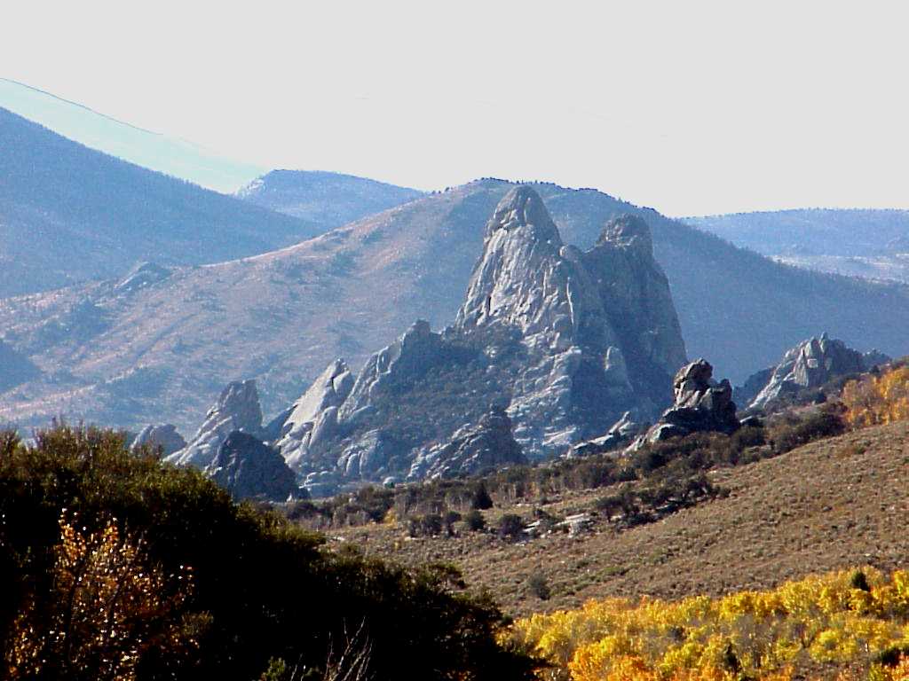
City of Rocks National Reserve
-

Craters of the Moon National Monument
- California National Historic Trail
- City of Rocks National Reserve
- Craters of the Moon National Monument
- Hagerman Fossil Beds National Monument
- Lewis and Clark National Historic Trail
- Minidoka National Historic Site
- Nez Perce National Historical Park
- Oregon National Historic Trail
- Yellowstone National Park
National Recreation Areas
 Hells Canyon National Recreation Area.
National Wildlife Refuges
- Bear Lake National Wildlife Refuge
- Camas National Wildlife Refuge
- Deer Flat National Wildlife Refuge
- Grays Lake National Wildlife Refuge
- Kootenai National Wildlife Refuge
- Minidoka National Wildlife Refuge
National Conservation Areas
State parks
 Bear lake viewed from Bear Lake State Park.See also: List of Idaho state parks
- Bear Lake State Park
- Bruneau Dunes State Park
- Castle Rocks State Park
- City of Rocks National Reserve
- Coeur d'Alene Parkway State Park
- Dworshak State Park
- Eagle Island State Park
- Farragut State Park
- Harriman State Park
- Hells Gate State Park
- Henrys Lake State Park
- Heyburn State Park
- Lake Cascade State Park
- Lake Walcott State Park
- Land of the Yankee Fork State Park
- Lucky Peak State Park
- Massacre Rocks State Park
- McCroskey State Park
- Old Mission State Park
- Ponderosa State Park
- Priest Lake State Park
- Round Lake State Park
- Thousand Springs State Park
- Three Island Crossing State Park
- Trail of the Coeur d'Alenes
- Winchester Lake State Park
Education
Colleges and universities
 The Jacob Spori Building at Brigham Young University-Idaho in Rexburg.
 Idaho State University in Pocatello.
 University of Idaho in Moscow.
 Boise State University in Boise.
The Idaho State Board of Education oversees three comprehensive universities. The University of Idaho in Moscow was the first university in the state (founded in 1889). A land-grant institution, the UI is the state's flagship university. Idaho State University in Pocatello opened in 1901 as the Academy of Idaho and received university status in 1963. Boise State University is the most recent school to attain university status in Idaho, and is primarily geared toward being a commuter school for part-time undergraduate students. The school opened in 1932 as Boise Junior College and became Boise State University in 1974. Lewis-Clark State College in Lewiston is the only public, non-university 4-year college in Idaho.
Idaho has three regional community colleges: North Idaho College in Coeur d'Alene; College of Southern Idaho in Twin Falls; and College of Western Idaho in Nampa, which opened in 2009. A public technical college, Eastern Idaho Technical College, operates in Idaho Falls.
Private institutions in Idaho are Boise Bible College, affiliated with congregations of the Christian churches and churches of Christ; Brigham Young University-Idaho in Rexburg, which is affiliated with the Church of Jesus Christ of Latter-day Saints; The College of Idaho in Caldwell, which still maintains a loose affiliation with the Presbyterian Church; Northwest Nazarene University in Nampa; and New Saint Andrews College in Moscow, of reformed Christian theological background.
- Boise Bible College
- Boise State University
- Brigham Young University-Idaho
- College of Idaho
- College of Southern Idaho
- College of Western Idaho
- Eastern Idaho Technical College
Sports
Central Idaho is home to one of North America's oldest ski resorts, Sun Valley, where the world's first chairlift was installed. Sites include Hell's Canyon, the Salmon River, and the embarkation point of Riggins, ID.
Club Sport League Boise Hawks Baseball Minor League Baseball Boise State Broncos NCAA Div I FBS – MW Idaho Vandals NCAA Div I FBS – WAC Idaho State Bengals NCAA Div I FCS – Big Sky Idaho Falls Chukars Baseball Minor League Baseball Idaho Stampede Basketball NBA Development League Idaho Steelheads Ice hockey East Coast Hockey League Boise is the host to the largest 5 km run for women, the St. Luke's Women's Fitness Celebration.
Official state emblems
Idaho State symbols Animate insignia Amphibian Eastern Tiger Salamander Bird(s) Mountain Bluebird Fish Cutthroat trout Flower(s) Syringa Insect Monarch Butterfly Tree Western White Pine Inanimate insignia Dance Square Dance Food Potato, Huckleberry Fossil Hagerman horse Gemstone Star garnet Slogan(s) Great Potatoes. Tasty Destinations. Soil Threebear Song(s) Here We Have Idaho Route marker(s) 
State Quarter 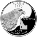
Released in 2007 Lists of United States state insignia - State Bird: Mountain Bluebird[41]
- State Dance: Square Dance[41]
- State Fish: Cutthroat Trout[41]
- State Flower: Syringa (Philadelphus lewisii)[41]
- State Fossil: Hagerman Horse (Equus simplicidens)[41]
- State Fruit: Huckleberry[41]
- State Gem: Idaho star garnet[41]
- State Horse: Appaloosa[41]
- State Motto: Esto perpetua ("Let it be perpetual")[41][42]
- State Insect: Monarch butterfly[41]
- State Raptor: Peregrine falcon[41]
- State Song: Here We Have Idaho[41]
- State Tree: Western White Pine[41]
- State Vegetable: Potato[41]
Idahoans
Main article: List of people from IdahoSee also
- Outline of Idaho
- Index of Idaho-related articles
- List of National Register of Historic Places in Idaho
- List of people from Idaho
- List of places in Idaho
- Rocky Mountains
- US state
References
- ^ "Beauty Reset". NGS data sheet. U.S. National Geodetic Survey. http://www.ngs.noaa.gov/cgi-bin/ds_mark.prl?PidBox=PZ0770. Retrieved October 20, 2011.
- ^ a b "Elevations and Distances in the United States". United States Geological Survey. 2001. http://egsc.usgs.gov/isb/pubs/booklets/elvadist/elvadist.html. Retrieved October 21, 2011.
- ^ a b Elevation adjusted to North American Vertical Datum of 1988.
- ^ Just, Rick. "Star Garnet." Idaho Snapshots. Meridian, Idaho: Radio Idaho, 1990. 9.
- ^ "Idaho-its meaning, origin and application : Rees, John E., 1868–1928 : Free Download & Streaming : Internet Archive". Archive.org. http://www.archive.org/details/idahoitsmeaningo00reesrich. Retrieved 2010-07-30.
- ^ "Idaho – MSN Encarta". Idaho – MSN Encarta. http://encarta.msn.com/encyclopedia_761565515/Idaho.html.
- ^ "Did Idaho Get Its Name As A Result Of A Hoax?". Museumofhoaxes.com. 2006-04-25. http://www.museumofhoaxes.com/hoax/weblog/permalink/did_idaho_get_its_name_as_a_result_of_a_hoax/. Retrieved 2010-07-30.
- ^ [1] etymonline.com
- ^ Barber & Martin (1956). Idaho in the Pacific Northwest. Caxton Printers Ltd. Library of Congress 55-5192.
- ^ "Western States Data Public Land Acreage". Wildlandfire.com. 2007-11-13. http://www.wildlandfire.com/docs/2007/western-states-data-public-land.htm. Retrieved 2010-07-30.
- ^ "USDA Forest Service – Comment Form". Fs.fed.us. 2005-04-01. http://www.fs.fed.us/land/staff/lar/2007/Table_4.htm. Retrieved 2010-07-30.
- ^ "Port of Lewiston". u-s-history.com. http://www.u-s-history.com/pages/h2812.html. Retrieved 2010-07-30.
- ^ "Sawtooth Range". Idahoaclimbingguide.co/m. http://www.idahoaclimbingguide.com/id27.htm. Retrieved 2010-07-30.
- ^ "264, Part of Idaho in fourth zone". http://uscode.house.gov/download/pls/15C6.txt.
- ^ "Climate Of Idaho". Wrcc.dri.edu. 1954-02-20. http://www.wrcc.dri.edu/narratives/IDAHO.htm. Retrieved 2010-07-30.
- ^ "David Thompson's Trading Post, Idaho Forts, American Forts Network". http://www.northamericanforts.com/West/id.html#thompson.
- ^ Meinig, D.W. (1995) [1968]. The Great Columbia Plain (Weyerhaeuser Environmental Classic ed.). University of Washington Press. pp. 36, 55. ISBN 0-295-97485-0.
- ^ "Fur Trade Posts In Idaho, Idaho State Historical Society.". http://www.idahohistory.net/Reference%20Series/0062.pdf.
- ^ "Donald MacKenzie's Post, Idaho Forts, American Forts Network". http://www.northamericanforts.com/West/id.html#clear.
- ^ Bennett, Eldon T.. "An Early History of Franklin". Franklin, Idaho. http://www.franklinidaho.org/History2.htm. Retrieved 2008-05-19.
- ^ "Elias Davidson Pierce and the Founding of Pierce" (PDF). Idaho State Historical Society. August 1966. http://www.idahohistory.net/Reference%20Series/0008.pdf. Retrieved 2008-05-19.
- ^ ""Mormon" Entry for The Encyclopedia of the Supreme Court of the United States, David S.Tanenhaus" (PDF). http://nboman.people.wm.edu/MormonsEUSC.pdf. Retrieved 2010-07-30.
- ^ "The Power of Idaho". Idaho Economic Development Association. 2004. http://ieda.biz/white.html. Retrieved 2007-10-07.
- ^ http://2010.census.gov/2010census/data/apportionment-pop-text.php
- ^ "Idaho QuickFacts from the U.S. Census Bureau". Quickfacts.census.gov. http://quickfacts.census.gov/qfd/states/16000.html. Retrieved 2010-07-30.
- ^ "Population and Population Centers by State". United States Census Bureau. 2000. http://www.census.gov/geo/cenpop/statecenters.txt. Retrieved 2008-12-04.
- ^ "RLS report 2-22.indd" (PDF). http://religions.pewforum.org/pdf/report-religious-landscape-study-full.pdf. Retrieved 2010-07-30.
- ^ "State Membership Report – Idaho". Association of Religion Data Archives. http://www.thearda.com/mapsReports/reports/state/16_2000.assp. Retrieved 2009-12-13.
- ^ "Zuivelzicht" April 25, 2007
- ^ "Today in History: March 4". Memory.loc.gov. http://memory.loc.gov/ammem/today/mar04.html. Retrieved 2010-07-30.
- ^ "Facts At a Glance". Idaho Lottery. 2007. Archived from the original on June 13, 2007. http://web.archive.org/web/20070613232433/http://idaholottery.com/facts.asp. Retrieved 2007-04-29.
- ^ "2007 Idaho Energy Plan". Idaho Legislative Council Interim Committee on Energy, Environment and Technology. 2007. http://www.energy.idaho.gov/informationresources/d/energy_plan_2007.pdf. Retrieved 2010-11-30.
- ^ a b "Idaho Energy Profile". Energy Information Administration. 2009. http://tonto.eia.doe.gov/state/state_energy_profiles.cfm?sid=ID. Retrieved 2007-06-02.
- ^ "Idaho Strategic Energy Alliance Frequently Asked Questions". Idaho Strategic Energy Alliance. 2009. http://www.energy.idaho.gov/idahostrategicenergyalliance/d/isea_faq.pdf. Retrieved 2007-06-02.[dead link]
- ^ "Idaho Energy Complex". Idaho Energy Complex. 2009. http://idahoenergycomplex.org/faq.htm. Retrieved 2007-06-02.
- ^ "Idaho District Court Websites". Isc.idaho.gov. http://www.isc.idaho.gov/district.htm. Retrieved 2008-12-17.
- ^ "IdahoHistory.net". IdahoHistory.net. 2010-07-07. http://www.idahohistory.net/pierce.html. Retrieved 2010-07-30.
- ^ Idaho Secretary of State Election Division, "November 4, 2008 General Election Results"
- ^ [2][dead link]
- ^ 2008 statewide totals[dead link]
- ^ a b c d e f g h i j k l m n "Governor C. L. "Butch" Otter – The State of Idaho – FYI Idaho State Symbols". Gov.idaho.gov. http://gov.idaho.gov/fyi/symbols/symbols_index.html. Retrieved 2010-07-30.
- ^ "Idaho history homepage". Idahohistory.net. 2010-07-07. http://idahohistory.net/Reference%20Series/0134.pdf. Retrieved 2010-07-30.
External links
- State of Idaho government website
- Idaho at the Open Directory Project
- Energy Profile for Idaho
- Idaho Department of Parks and Recreation
- Idaho Newspapers
- Idaho State Databases – Annotated list of searchable databases produced by Idaho state agencies and compiled by the Government Documents Roundtable of the American Library Association.
- Idaho State Facts
- Log Cabins in America: The Finnish Experience, a National Park Service Teaching with Historic Places (TwHP) lesson plan
- The History of Idaho
- U.S. Census Bureau
- USGS real-time, geographic, and other scientific resources of Idaho
- Visit Idaho site – The official state tourism website
Related information

Pacific Ocean  Canada
 British Columbia •
  Montana
 Alberta
 Washington
 Oregon
 Wyoming
 Idaho: Outline • Index

 Nevada •
  Utah
Utah State of Idaho
Topics - Index
- Geography
- Government
- Delegations
- Governors
- History
- Symbols
- Images
- People
- Visitor Attractions
Society Regions Larger
citiesSmaller
citiesCounties - Ada
- Adams
- Bannock
- Bear Lake
- Benewah
- Bingham
- Blaine
- Boise
- Bonner
- Bonneville
- Boundary
- Butte
- Camas
- Canyon
- Caribou
- Cassia
- Clark
- Clearwater
- Custer
- Elmore
- Franklin
- Fremont
- Gem
- Gooding
- Idaho
- Jefferson
- Jerome
- Kootenai
- Latah
- Lemhi
- Lewis
- Lincoln
- Madison
- Minidoka
- Nez Perce
- Oneida
- Owyhee
- Payette
- Power
- Shoshone
- Teton
- Twin Falls
- Valley
- Washington
Preceded by
WashingtonList of U.S. states by date of statehood
Admitted on July 3, 1890 (43rd)Succeeded by
WyomingCoordinates: 45°N 114°W / 45°N 114°W
United States (Outline) History Pre-Columbian era · Colonial era (Thirteen Colonies · Colonial American military history) · American Revolution (War) · Federalist Era · War of 1812 · Territorial acquisitions · Territorial evolution · Mexican–American War · Civil War · Reconstruction era · Indian Wars · Gilded Age · African-American Civil Rights Movement (1896–1954) · Spanish–American War · Imperialism · World War I · Roaring Twenties · Great Depression · World War II (Home front) · Cold War · Korean War · Space Race · African-American Civil Rights Movement (1955–1968) · Feminist Movement · Vietnam War · Post-Cold War (1991–present) · War on Terror (War in Afghanistan · Iraq War) · Timeline of modern American conservatismTopicsDemographic · Discoveries · Economic (Debt Ceiling) · Inventions (before 1890 · 1890–1945 · 1946–1991 · after 1991) · Military · Postal · Technological and industrialFederal
governmentLegislature - Congress
Senate
· Vice President
· President pro tem
House of Representatives
· Speaker
Judiciary - Supreme Court
Federal courts
Courts of appeal
District courtsExecutive - President
Executive Office
Cabinet / Executive departments
Civil service
Independent agencies
Law enforcement
Public policy
Intelligence
Central Intelligence Agency
Defense Intelligence Agency
National Security Agency
Federal Bureau of InvestigationPolitics Divisions · Elections (Electoral College) · Foreign policy · Foreign relations · Ideologies · Local governments · Parties (Democratic Party · Republican Party · Third parties) · Political status of Puerto Rico · Red states and blue states · Scandals · State governments · Uncle SamGeography Cities, towns, and villages · Counties · Extreme points · Islands · Mountains (Peaks · Appalachian · Rocky) · National Park System · Regions (Great Plains · Mid-Atlantic · Midwestern · New England · Northwestern · Southern · Southwestern · Pacific · Western) · Rivers (Colorado · Columbia · Mississippi · Missouri · Ohio · Rio Grande) · States · Territory · Water supply and sanitationEconomy Agriculture · Banking · Communications · Companies · Dollar · Energy · Federal Budget · Federal Reserve System · Financial position · Insurance · Mining · Public debt · Taxation · Tourism · Trade · Transportation · Wall StreetSociety TopicsCrime · Demographics · Education · Family structure · Health care · Health insurance · Incarceration · Languages (American English · Spanish · French) · Media · People · Public holidays · Religion · SportsArchitecture · Art · Cinema · Cuisine · Dance · Fashion · Flag · Folklore · Literature · Music · Philosophy · Radio · Television · TheaterIssuesCategories:- Idaho
- States of the United States
- States and territories established in 1890


Wikimedia Foundation. 2010.