- Tennessee
-
This article is about the U.S. state of Tennessee. For the river, see Tennessee River. For other uses, see Tennessee (disambiguation).
State of Tennessee 

Flag Seal Nickname(s): The Volunteer State Motto(s): Agriculture and Commerce 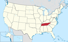
Official language(s) English Demonym Tennessean Capital Nashville Largest city Memphis Largest metro area Nashville Metropolitan Area Area Ranked 36th in the U.S. - Total 42,143 sq mi
(109,247 km2)- Width 440 miles (710 km) - Length 120 miles (195 km) - % water 2.2 - Latitude 34° 59′ N to 36° 41′ N - Longitude 81° 39′ W to 90° 19′ W Population Ranked 17th in the U.S. - Total 6,346,105(2010)[1] - Density 138/sq mi (53.29/km2)
Ranked 19th in the U.S.Elevation - Highest point Clingmans Dome[2][3]
6,643 ft (2025 m)- Mean 900 ft (270 m) - Lowest point Mississippi River at Mississippi border[2][3]
178 ft (54 m)Before statehood Southwest Territory Admission to Union June 1, 1796 (16th) Governor Bill Haslam (R) Lieutenant Governor Ron Ramsey (R) Legislature General Assembly - Upper house Senate - Lower house House of Representatives U.S. Senators Lamar Alexander (R)
Bob Corker (R)U.S. House delegation 7 Republicans, 2 Democrats (list) Time zones - East Tennessee Eastern: UTC-5/-4 - Middle and West Central: UTC-6/-5 Abbreviations TN Tenn. US-TN Website tennessee.gov Tennessee State symbols 
The Flag of Tennessee. 
The Seal of Tennessee. Animate insignia Amphibian Salamander Bird(s) Mockingbird Fish Channel Catfish
BassFlower(s) Iris Insect Honeybee Reptile Eastern Box Turtle Tree Tulip Poplar Inanimate insignia Gemstone Tennessee River Pearl Rock Limestone Song(s) 7 Songs Tartan Tennessee State Tartan Route marker(s) [[File:|125px|Tennessee Route Marker]] State Quarter 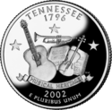
Released in 2002 Lists of United States state insignia Tennessee
 i/tɛnɨˈsiː/ (Cherokee: ᏔᎾᏏ) is a U.S. state located in the Southeastern United States. It has a population of 6,346,105, making it the nation's 17th-largest state by population, and covers 42,169 square miles (109,220 km2), making it the 36th-largest by total land area.[4] Tennessee is bordered by Kentucky and Virginia to the north, North Carolina to the east, Georgia, Alabama, and Mississippi to the south, and Arkansas and Missouri to the west. The Appalachian Mountains dominate the eastern part of the state, and the Mississippi River forms the state's western border. Tennessee's capital and second largest city is Nashville, which has a population of 626,144.[5] Memphis is the state's largest city, with a population of 670,902.[6]
The state of Tennessee is rooted in the Watauga Association, a 1772 frontier pact generally regarded as the first constitutional government west of the Appalachians.[7] What is now Tennessee was initially part of North Carolina, and later part of the Southwest Territory. Tennessee was admitted to the Union as the 16th state on June 1, 1796. Tennessee was the last state to leave the Union and join the Confederacy at the outbreak of the U.S. Civil War in 1861, and the first state to be readmitted to the Union at the end of the war.[8]
Tennessee furnished more soldiers for the Confederate Army than any other state, and more soldiers for the Union Army than any other Southern state.[8] Tennessee has seen some of the nation's worst racial strife, from the formation of the Ku Klux Klan in Pulaski in 1866 to the assassination of Martin Luther King in Memphis in 1968. In the 20th century, Tennessee transitioned from an agrarian economy to a more diversified economy, aided at times by federal entities such as the Tennessee Valley Authority. In the early 1940s, Oak Ridge, Tennessee was established to house the Manhattan Project's uranium enrichment facilities, helping to build the world's first atomic bomb.
Tennessee has played a critical role in the development of rock and roll and early blues music. Beale Street in Memphis is considered by many to be the birthplace of the blues, with musicians such as W.C. Handy performing in its clubs as early as 1909.[9] Memphis was also home to Sun Records, where musicians such as Elvis Presley, Johnny Cash, Carl Perkins, Jerry Lee Lewis, Roy Orbison, and Charlie Rich began their recording careers, and where rock and roll took shape in the 1950s.[10] The 1927 Victor recording sessions in Bristol generally mark the beginning of the country music genre,[11] and the rise of the Grand Ole Opry in the 1930s helped make Nashville the center of the country music recording industry.[12]
Tennessee's major industries include agriculture, manufacturing, and tourism. Poultry, soybeans, and cattle are the state's primary agricultural products,[13] and major manufacturing exports include chemicals, transportation equipment, and electrical equipment.[14] The Great Smoky Mountains National Park, the nation's most visited national park,[15] is headquartered in the eastern part of the state, and a section of the Appalachian Trail roughly follows the Tennessee-North Carolina border. Other major tourist attractions include Elvis Presley's Graceland in Memphis and the Tennessee Aquarium in Chattanooga.
Contents
Geography
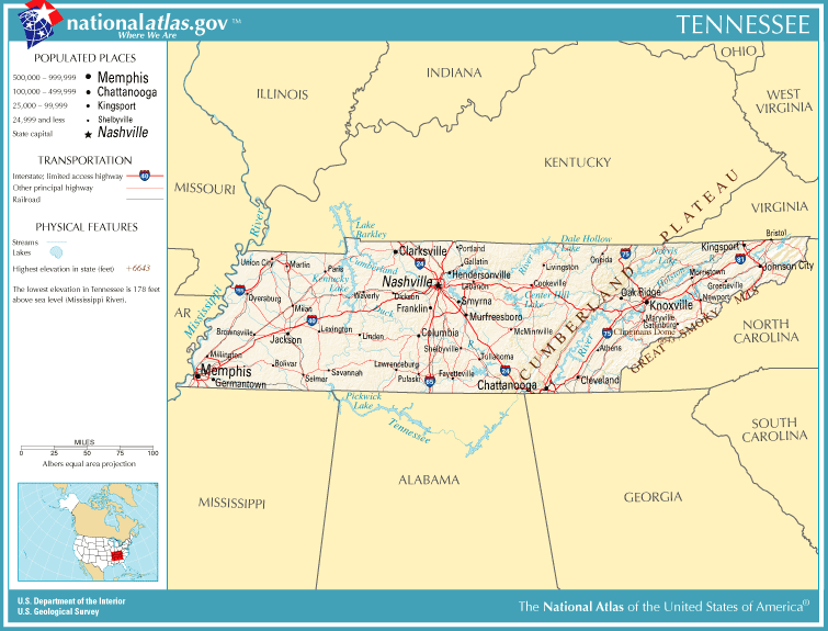
See also: List of counties in Tennessee and Geology of Tennessee Map of Tennessee.
Tennessee borders eight other states: Kentucky and Virginia to the north; North Carolina to the east; Georgia, Alabama and Mississippi on the south; Arkansas and Missouri on the Mississippi River to the west. Tennessee ties Missouri as the state bordering the most other states. The state is trisected by the Tennessee River.
The highest point in the state is Clingmans Dome at 6,643 feet (2,025 m).[16] Clingmans Dome, which lies on Tennessee's eastern border, is the highest point on the Appalachian Trail. The state line between Tennessee and North Carolina crosses the summit. The lowest point is the Mississippi River at the Mississippi state line. The geographical center of the state is located in Murfreesboro.
The state of Tennessee is geographically and constitutionally divided into three Grand Divisions: East Tennessee, Middle Tennessee, and West Tennessee. Tennessee features six principal physiographic regions: the Blue Ridge, the Appalachian Ridge and Valley Region, the Cumberland Plateau, the Highland Rim, the Nashville Basin, and the Gulf Coastal Plain. Tennessee is home to the most caves in the United States, with over 8,350 caves registered to date.
East Tennessee
Main article: East Tennessee Map of Tennessee highlighting East Tennessee
The Blue Ridge area lies on the eastern edge of Tennessee, bordering North Carolina. This region of Tennessee is characterized by the high mountains and rugged terrain of the western Blue Ridge Mountains, which are subdivided into several subranges, namely the Great Smoky Mountains, the Bald Mountains, the Unicoi Mountains, the Unaka Mountains and Roan Highlands, and the Iron Mountains.
The average elevation of the Blue Ridge area is 5,000 feet (1,500 m) above sea level. Clingmans Dome, the state's highest point, is located in this region. The Blue Ridge area was never more than sparsely populated, and today much of it is protected by the Cherokee National Forest, the Great Smoky Mountains National Park, and several federal wilderness areas and state parks.
Stretching west from the Blue Ridge for approximately 55 miles (89 km) is the Ridge and Valley region, in which numerous tributaries join to form the Tennessee River in the Tennessee Valley. This area of Tennessee is covered by fertile valleys separated by wooded ridges, such as Bays Mountain and Clinch Mountain. The western section of the Tennessee valley, where the depressions become broader and the ridges become lower, is called the Great Valley. In this valley are numerous towns and two of the region's three urban areas, Knoxville, the 3rd largest city in the state, and Chattanooga, the 4th largest city in the state.
The Cumberland Plateau rises to the west of the Tennessee Valley; this area is covered with flat-topped mountains separated by sharp valleys. The elevation of the Cumberland Plateau ranges from 1,500 to over 2,000 feet (450 to over 600 m) above sea level.
Middle Tennessee
Main article: Middle Tennessee Map of Tennessee highlighting Middle Tennessee
West of the Cumberland Plateau is the Highland Rim, an elevated plain that surrounds the Nashville Basin. The northern section of the Highland Rim, known for its high tobacco production, is sometimes called the Pennyroyal Plateau; it is located primarily in Southwestern Kentucky. The Nashville Basin is characterized by rich, fertile farm country and great diversity of natural wildlife.
Middle Tennessee was a common destination of settlers' crossing the Appalachians from Virginia in the late 18th century and early 19th century. An important trading route called the Natchez Trace, created and used for many generations by Native Americans, connected Middle Tennessee to the lower Mississippi River town of Natchez. The route of the Natchez Trace was used as the basis for a scenic highway called the Natchez Trace Parkway.
Some of the last remaining large American Chestnut trees grow in this region. They are being used to help breed blight-resistant trees.
Middle Tennessee is one of the primary state population and transportation centers along with the heart of state government. Nashville (the capitol), Clarksville and Murfreesboro are its largest cities. Fifty percent of the US population is within 600 miles of Nashville.[17] US Interstate Highways I-24, I-40 and I-65 trisect the Division.
West Tennessee
Main article: West Tennessee Map of Tennessee highlighting West Tennessee
West of the Highland Rim and Nashville Basin is the Gulf Coastal Plain, which includes the Mississippi embayment. The Gulf Coastal Plain is, in terms of area, the predominant land region in Tennessee. It is part of the large geographic land area that begins at the Gulf of Mexico and extends north into southern Illinois. In Tennessee, the Gulf Coastal Plain is divided into three sections that extend from the Tennessee River in the east to the Mississippi River in the west.
The easternmost section, about 10 miles (16 km) in width, consists of hilly land that runs along the western bank of the Tennessee River. To the west of this narrow strip of land is a wide area of rolling hills and streams that stretches all the way to Memphis; this area is called the Tennessee Bottoms or bottom land. In Memphis, the Tennessee Bottoms end in steep bluffs overlooking the Mississippi River. To the west of the Tennessee Bottoms is the Mississippi Alluvial Plain, less than 300 feet (90 m) above sea level. This area of lowlands, flood plains, and swamp land is sometimes referred to as the Delta region.
Most of West Tennessee remained Indian land until the Chickasaw Cession of 1818, when the Chickasaw ceded their land between the Tennessee River and the Mississippi River. The portion of the Chickasaw Cession that lies in Kentucky is known today as the Jackson Purchase.
Public lands

Areas under the control and management of the National Park Service include:
- Andrew Johnson National Historic Site in Greeneville
- Appalachian National Scenic Trail
- Big South Fork National River and Recreation Area
- Chickamauga and Chattanooga National Military Park
- Cumberland Gap National Historical Park
- Foothills Parkway
- Fort Donelson National Battlefield and Fort Donelson National Cemetery near Dover
- Great Smoky Mountains National Park
- Natchez Trace Parkway
- Obed Wild and Scenic River near Wartburg
- Overmountain Victory National Historic Trail
- Shiloh National Cemetery and Shiloh National Military Park near Shiloh
- Stones River National Battlefield and Stones River National Cemetery near Murfreesboro
- Trail of Tears National Historic Trail
Fifty-four state parks, covering some 132,000 acres (530 km2) as well as parts of the Great Smoky Mountains National Park and Cherokee National Forest, and Cumberland Gap National Historical Park are in Tennessee. Sportsmen and visitors are attracted to Reelfoot Lake, originally formed by the New Madrid earthquake; stumps and other remains of a once dense forest, together with the lotus bed covering the shallow waters, give the lake an eerie beauty.
See also: List of Tennessee state parksClimate
Most of the state has a humid subtropical climate, with the exception of some of the higher elevations in the Appalachians, which are classified as having a mountain temperate climate or a humid continental climate due to cooler temperatures.[18] The Gulf of Mexico is the dominant factor in the climate of Tennessee, with winds from the south being responsible for most of the state's annual precipitation. Generally, the state has hot summers and mild to cool winters with generous precipitation throughout the year. On average the state receives 50 inches (130 cm) of precipitation annually. Snowfall ranges from 5 inches (13 cm) in West Tennessee to over 16 inches (41 cm) in the higher mountains in East Tennessee.[19]
Summers in the state are generally hot and humid, with most of the state averaging a high of around 90 °F (32 °C) during the summer months. Winters tend to be mild to cool, increasing in coolness at higher elevations. Generally, for areas outside the highest mountains, the average overnight lows are near freezing for most of the state. The highest recorded temperature is 113 °F (45 °C) at Perryville on August 9, 1930 while the lowest recorded temperature is −32 °F (−36 °C) at Mountain City on December 30, 1917.
While the state is far enough from the coast to avoid any direct impact from a hurricane, the location of the state makes it likely to be impacted from the remnants of tropical cyclones which weaken over land and can cause significant rainfall, such as Tropical Storm Chris in 1982.[20] The state averages around 50 days of thunderstorms per year, some of which can be quite severe. Tornadoes are possible throughout the state, with West and Middle Tennessee the most vulnerable.[21] On average, the state has 15 tornadoes per year.[22] Tornadoes in Tennessee can be severe, and Tennessee leads the nation in the percentage of total tornadoes which have fatalities.[23] Winter storms are an occasional problem, although ice storms are a more likely occurrence. Fog is a persistent problem in parts of the state, especially in much of the Smoky Mountains.
Monthly Normal High and Low Temperatures For Various Tennessee Cities (F)[24] City Jan Feb Mar Apr May Jun Jul Aug Sep Oct Nov Dec Bristol 44/25 49/27 57/34 66/41 74/51 81/60 85/64 84/62 79/56 68/43 58/35 48/27 Chattanooga 49/30 54/33 63/40 72/47 79/56 86/65 90/69 89/68 82/62 72/48 61/40 52/33 Knoxville 47/30 52/33 61/40 71/48 78/57 85/65 88/69 87/68 81/62 71/50 60/41 50/34 Memphis 49/31 55/36 63/44 72/52 80/61 89/69 92/73 91/71 85/64 75/52 62/43 52/34 Nashville 46/28 52/31 61/39 70/47 78/57 85/65 90/70 89/69 82/61 71/49 59/40 49/32 History
Main article: History of TennesseeEarly history
 Mississippian-period art, carved from seashell, unearthed in Middle Tennessee
The area now known as Tennessee was first inhabited by Paleo-Indians nearly 12,000 years ago.[25] The names of the cultural groups that inhabited the area between first settlement and the time of European contact are unknown, but several distinct cultural phases have been named by archaeologists, including Archaic (8000–1000 BC), Woodland (1000 BC–1000 AD), and Mississippian (1000–1600 AD), whose chiefdoms were the cultural predecessors of the Muscogee people who inhabited the Tennessee River Valley prior to Cherokee migration into the river's headwaters.
The first recorded European excursions into what is now called Tennessee were three expeditions led by Spanish explorers, namely Hernando de Soto in 1540, Tristan de Luna in 1559, and Juan Pardo in 1567. Pardo recorded the name "Tanasqui" from a local Indian village, which may have evolved to the state's current name. At that time, Tennessee was inhabited by tribes of Muscogee and Yuchi people. Possibly because of European diseases devastating the Native tribes, which would have left a population vacuum, and also from expanding European settlement in the north, the Cherokee moved south from the area now called Virginia. As European colonists spread into the area, the native populations were forcibly displaced to the south and west, including all Muscogee and Yuchi peoples, the Chickasaw, and Choctaw.
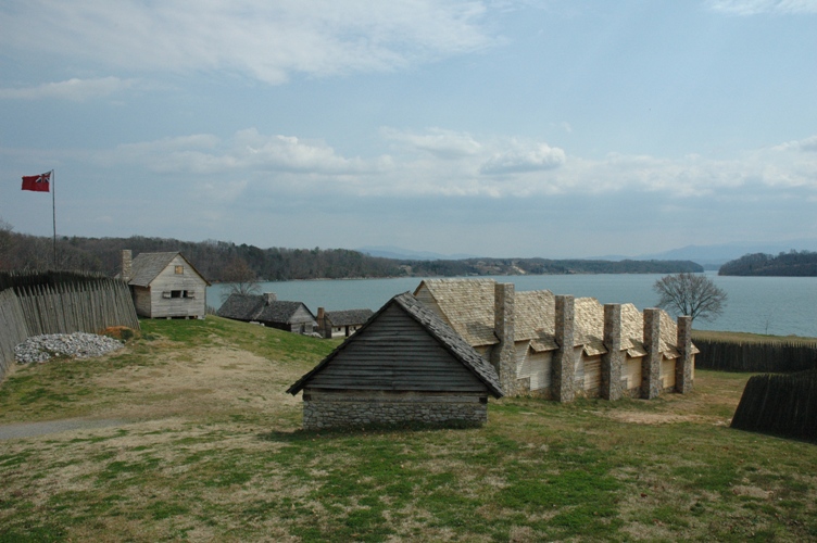
 Reconstruction of Fort Loudon, the first British settlement in Tennessee
The first British settlement in what is now Tennessee was Fort Loudoun, near present-day Vonore. Fort Loudoun became the westernmost British outpost to that date. The fort was designed by John William Gerard de Brahm and constructed by forces under British Captain Raymond Demeré. After its completion, Captain Raymond Demeré relinquished command on August 14, 1757 to his brother, Captain Paul Demeré. Hostilities erupted between the British and the neighboring Overhill Cherokees, and a siege of Fort Loudoun ended with its surrender on August 7, 1760. The following morning, Captain Paul Demeré and a number of his men were killed in an ambush nearby, and the most of the rest of the garrison was taken prisoner.[26]
In the 1760s, long hunters from Virginia explored much of East and Middle Tennessee, and the first permanent European settlers began arriving late in the decade. The vast majority of 18th century settlers were English or of primarily English descent but nearly 20% of them were also Scotch-Irish.[27] These settlers formed the Watauga Association, a community built on lands leased from the Cherokee peoples.
During the American Revolutionary War, Fort Watauga at Sycamore Shoals (in present-day Elizabethton) was attacked (1776) by Dragging Canoe and his warring faction of Cherokee who were aligned with the British Loyalists. These renegade Cherokee were referred to by settlers as the Chickamauga. They opposed North Carolina's annexation of the Washington District and the concurrent settling of the Transylvania Colony further north and west. The lives of many settlers were spared from the initial warrior attacks through the warnings of Dragging Canoe's cousin, Nancy Ward. The frontier fort on the banks of the Watauga River later served as a 1780 staging area for the Overmountain Men in preparation to trek over the Appalachian Mountains, to engage, and to later defeat the British Army at the Battle of Kings Mountain in North Carolina.
Three counties of the Washington District (now part of Tennessee) broke off from North Carolina in 1784 and formed the State of Franklin. Efforts to obtain admission to the Union failed, and the counties (now numbering eight) had re-joined North Carolina by 1789. North Carolina ceded the area to the federal government in 1790, after which it was organized into the Southwest Territory. In an effort to encourage settlers to move west into the new territory, in 1787 the mother state of North Carolina ordered a road to be cut to take settlers into the Cumberland Settlements—from the south end of Clinch Mountain (in East Tennessee) to French Lick (Nashville). The Trace was called the “North Carolina Road” or “Avery’s Trace,” and sometimes “The Wilderness Road (although it should not be confused with Daniel Boone's "Wilderness Road" through the Cumberland Gap).
Statehood (1796)
Tennessee was admitted to the Union in 1796 as the 16th state. It was the first state created from territory under the jurisdiction of the United States federal government. Apart from the former Thirteen Colonies only Vermont and Kentucky predate Tennessee's statehood, and neither was ever a federal territory.[28] The state boundaries, according to the Constitution of the State of Tennessee, Article I, Section 31, stated that the beginning point for identifying the boundary was the extreme height of the Stone Mountain, at the place where the line of Virginia intersects it, and basically ran the extreme heights of mountain chains through the Appalachian Mountains separating North Carolina from Tennessee past the Indian towns of Cowee and Old Chota, thence along the main ridge of the said mountain (Unicoi Mountain) to the southern boundary of the state; all the territory, lands and waters lying west of said line are included in the boundaries and limits of the newly formed state of Tennessee. Part of the provision also stated that the limits and jurisdiction of the state would include future land acquisition, referencing possible land trade with other states, or the acquisition of territory from west of the Mississippi River.
During the administration of U.S. President Martin Van Buren, nearly 17,000 Cherokees—along with approximately 2,000 black slaves owned by Cherokees—were uprooted from their homes between 1838 and 1839 and were forced by the U.S. military to march from "emigration depots" in Eastern Tennessee (such as Fort Cass) toward the more distant Indian Territory west of Arkansas.[29] During this relocation an estimated 4,000 Cherokees died along the way west.[30] In the Cherokee language, the event is called Nunna daul Isunyi—"the Trail Where We Cried." The Cherokees were not the only Native Americans forced to emigrate as a result of the Indian removal efforts of the United States, and so the phrase "Trail of Tears" is sometimes used to refer to similar events endured by other Native American peoples, especially among the "Five Civilized Tribes". The phrase originated as a description of the earlier emigration of the Choctaw nation.
Civil War and Reconstruction
Main article: Tennessee in the American Civil WarIn February 1861, secessionists in Tennessee's state government—led by Governor Isham Harris—sought voter approval for a convention to sever ties with the United States, but Tennessee voters rejected the referendum by a 54–46% margin. The strongest opposition to secession came from East Tennessee (which later tried to form a separate Union-aligned state). Following the Confederate attack upon Fort Sumter in April and Lincoln's call for troops from Tennessee and other states in response, Governor Isham Harris began military mobilization, submitted an ordinance of secession to the General Assembly, and made direct overtures to the Confederate government. The Tennessee legislature ratified an agreement to enter a military league with the Confederate States on May 7, 1861. On June 8, 1861, with people in Middle Tennessee having significantly changed their position, voters approved a second referendum calling for secession, becoming the last state to do so.
Many major battles of the American Civil War were fought in Tennessee—most of them Union victories. Ulysses S. Grant and the U.S. Navy captured control of the Cumberland and Tennessee rivers in February 1862. They held off the Confederate counterattack at Shiloh in April. Memphis fell to the Union in June, following a naval battle on the Mississippi River in front of the city The Capture of Memphis and Nashville gave the Union control of the western and middle sections; this control was confirmed at the Battle of Murfreesboro in early January 1863 and by the subsequent Tullahoma Campaign.
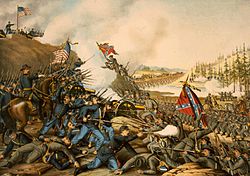 The Battle of Franklin, November 30, 1864.
Confederates held East Tennessee despite the strength of Unionist sentiment there, with the exception of extremely pro-Confederate Sullivan County. The Confederates besieged Chattanooga during the Chattanooga Campaign in early fall 1863, but were driven off by Grant in November. Many of the Confederate defeats can be attributed to the poor strategic vision of General Braxton Bragg, who led the Army of Tennessee from Perryville, Kentucky to Confederate defeat at Chattanooga.
The last major battles came when the Confederates invaded Middle Tennessee in November 1864 and were checked at Franklin, then completely diminished by George Thomas at Nashville in December. Meanwhile the civilian Andrew Johnson was appointed military governor of the state by President Abraham Lincoln.
When the Emancipation Proclamation was announced, Tennessee was mostly held by Union forces. Thus, Tennessee was not among the states enumerated in the Proclamation, and the Proclamation did not free any slaves there. Nonetheless, enslaved African Americans escaped to Union lines to gain freedom without waiting for official action. Old and young, men, women and children camped near Union troops. Thousands of former slaves ended up fighting on the Union side, nearly 200,000 in total across the South, and some 30,000 blacks fought for the Confederates.
Tennessee's legislature approved an amendment to the state constitution prohibiting slavery on February 22, 1865.[31] Voters in the state approved the amendment in March.[32] It also ratified the Thirteenth Amendment to the United States Constitution (abolishing slavery in every state) on April 7, 1865.
In 1864, Andrew Johnson (a War Democrat from Tennessee) was elected Vice President under Abraham Lincoln. He became President after Lincoln's assassination in 1865. Under Johnson's lenient re-admission policy, Tennessee was the first of the seceding states to have its elected members readmitted to the U.S. Congress, on July 24, 1866. Because Tennessee had ratified the Fourteenth Amendment, it was the only one of the formerly secessionist states that did not have a military governor during the Reconstruction period.
After the formal end of Reconstruction, the struggle over power in Southern society continued. Through violence and intimidation against freedmen and their allies, White Democrats regained political power in Tennessee and other states across the South in the late 1870s and 1880s. Over the next decade, the state legislature passed increasingly restrictive laws to control African Americans. In 1889 the General Assembly passed four laws described as electoral reform, with the cumulative effect of essentially disfranchising most African Americans in rural areas and small towns, as well as many poor Whites. Legislation included implementation of a poll tax, timing of registration, and recording requirements. Tens of thousands of taxpaying citizens were without representation for decades into the 20th century.[33] Disfranchising legislation accompanied Jim Crow laws passed in the late 19th century, which imposed segregation in the state. In 1900, African Americans made up nearly 24% of the state's population, and numbered 480,430 citizens who lived mostly in the central and western parts of the state.[34]
In 1897, Tennessee celebrated its centennial of statehood (though one year late of the 1896 anniversary) with a great exposition in Nashville. A full scale replica of the Parthenon was constructed for the celebration, located in what is now Nashville's Centennial Park.
20th century
On August 18, 1920, Tennessee became the thirty-sixth and final state necessary to ratify the Nineteenth Amendment to the United States Constitution, which provided women the right to vote. Disfranchising voter registration requirements continued to keep most African Americans and many poor whites, both men and women, off the voter rolls.
The need to create work for the unemployed during the Great Depression, a desire for rural electrification, the need to control annual spring flooding and improve shipping capacity on the Tennessee River were all factors that drove the federal creation of the Tennessee Valley Authority (TVA) in 1933. Through the power of the TVA projects, Tennessee quickly became the nation's largest public utility supplier.
During World War II, the availability of abundant TVA electrical power led the Manhattan Project to locate one of the principal sites for production and isolation of weapons-grade fissile material in East Tennessee. The planned community of Oak Ridge was built from scratch to provide accommodations for the facilities and workers. These sites are now Oak Ridge National Laboratory, the Y-12 National Security Complex, and the East Tennessee Technology Park.
Despite recognized effects of limiting voting by poor whites, successive legislatures expanded the reach of the disfranchising laws until they covered the state. In 1949 political scientist V. O. Key Jr. argued that "the size of the poll tax did not inhibit voting as much as the inconvenience of paying it. County officers regulated the vote by providing opportunities to pay the tax (as they did in Knoxville), or conversely by making payment as difficult as possible. Such manipulation of the tax, and therefore the vote, created an opportunity for the rise of urban bosses and political machines. Urban politicians bought large blocks of poll tax receipts and distributed them to blacks and whites, who then voted as instructed."[33]
In 1953 state legislators amended the state constitution, removing the poll tax. In many areas both blacks and poor whites still faced subjectively applied barriers to voter registration that did not end until after passage of national civil rights legislation, including the Voting Rights Act of 1965.[33]
Tennessee celebrated its bicentennial in 1996. With a yearlong statewide celebration entitled "Tennessee 200", it opened a new state park (Bicentennial Mall) at the foot of Capitol Hill in Nashville.
Demographics
Historical populations Census Pop. %± 1790 35,691 — 1800 105,602 195.9% 1810 261,727 147.8% 1820 422,823 61.6% 1830 681,904 61.3% 1840 829,210 21.6% 1850 1,002,717 20.9% 1860 1,109,801 10.7% 1870 1,258,520 13.4% 1880 1,542,359 22.6% 1890 1,767,518 14.6% 1900 2,020,616 14.3% 1910 2,184,789 8.1% 1920 2,337,885 7.0% 1930 2,616,556 11.9% 1940 2,915,841 11.4% 1950 3,291,718 12.9% 1960 3,567,089 8.4% 1970 3,923,687 10.0% 1980 4,591,120 17.0% 1990 4,877,185 6.2% 2000 5,689,283 16.7% 2010 6,346,105 11.5% The center of population of Tennessee is located in Rutherford County, in the city of Murfreesboro.[35]
According to the U.S. Census Bureau, as of 2006, Tennessee had an estimated population of 6,038,803, which is an increase of 83,058, or 1.4%, from the prior year and an increase of 349,541, or 6.1%, since the year 2000. This includes a natural increase since the last census of 142,266 people (that is 493,881 births minus 351,615 deaths), and an increase from net migration of 219,551 people into the state. Immigration from outside the United States resulted in a net increase of 59,385 people, and migration within the country produced a net increase of 160,166 people. 20% of Tennesseans were born outside the South, compared to a figure of 13.5% in 1990.[36]
In recent years, Tennessee has received an influx of people relocating from several northern states, California, and Florida, for the low cost of living, and the booming healthcare and automobile industries. Metropolitan Nashville is one of the fastest-growing areas in the country due in part to these factors.
Demographics of Tennessee (csv) By race White Black AIAN* Asian NHPI* 2000 (total population) 82.08% 16.81% 0.69% 1.22% 0.08% 2000 (Hispanic only) 1.99% 0.14% 0.05% 0.03% 0.02% 2005 (total population) 81.53% 17.22% 0.69% 1.47% 0.09% 2005 (Hispanic only) 2.81% 0.17% 0.06% 0.03% 0.02% Growth 2000–05 (total population) 4.11% 7.37% 3.86% 26.24% 12.40% Growth 2000–05 (non-Hispanic only) 3.02% 7.23% 2.41% 26.26% 12.66% Growth 2000–05 (Hispanic only) 48.16% 24.52% 22.34% 25.23% 11.23% * AIAN is American Indian or Alaskan Native; NHPI is Native Hawaiian or Pacific Islander 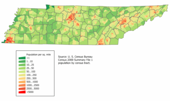 Tennessee Population Density Map.
In 2000, the five most common self-reported ethnic groups in the state were: American (17.3%), African American (16.4%), Irish (9.3%), English (9.1%), and German (8.3%).[37] Most Tennesseans who self-identify as having American ancestry are of English and Scotch-Irish stock. An estimated 21–24% of Tennesseans are of predominantly English ancestry.[38][39] In the 1980 census 1,435,147 Tennesseans claimed "English" or "mostly English" ancestry out of a state population of 3,221,354 making them 45% of the state at the time.[40]
6.6% of Tennessee's population were reported as under 5 years of age, 24.6% under 18, and 12.4% were 65 or older. Females made up approximately 51.3% of the population.
On June 19, 2010, the Tennessee Commission of Indian Affairs granted state recognition to six Indian tribes which was later repealed by the state's Attorney General because the action by the commission was illegal. The tribes were as follows:
- The Cherokee Wolf Clan in western Tennessee, with members in Carroll County, Benton, Decatur, Henderson, Henry, Weakley, Gibson and Madison counties.
- The Chikamaka Band based historically on the South Cumberland Plateau, said to have members in Franklin, Grundy, Marion, Sequatchie, Warren and Coffee counties.
- Central Band of Cherokee, also known as the Cherokee of Lawrence County, Tennessee.
- United Eastern Lenapee Nation of Winfield, Tennessee.
- The Tanasi Council, said to have members in Shelby, Dyer, Gibson, Humphreys and Perry counties; and
- Remnant Yuchi Nation, with members in Sullivan, Carter, Greene, Hawkins, Unicoi, Johnson and Washington counties.[41]
Religion
The religious affiliations of the people of Tennessee are: [42]
- Christian: 82%
- Baptist: 39%
- Methodist: 10%
- Church of Christ: 6%
- Roman Catholic: 6%
- Presbyterian: 3%
- Church of God: 2%
- Lutheran: 2%
- Pentecostal: 2%
- Other Christian (includes unspecified "Christian" and "Protestant"): 12%
- Islam: 1%[43]
- Other religions: 2%
- Non-religious: 9%
The largest denominations by number of adherents in 2000 were the Southern Baptist Convention with 1,414,199; the United Methodist Church with 393,994; the Churches of Christ with 216,648; and the Roman Catholic Church with 183,161.[44]
Tennessee is home to several Protestant denominations, such as the National Baptist Convention (headquartered in Nashville), the Church of God in Christ and the Cumberland Presbyterian Church (both headquartered in Memphis), the Church of God and The Church of God of Prophecy (headquartered in Cleveland, Tennessee). The Free Will Baptist denomination is headquartered in Antioch, and its main Bible college is in Nashville. The Southern Baptist Convention maintains its general headquarters in Nashville. Publishing houses of several denominations are located in Nashville.
Economy
According to the U.S. Bureau of Economic Analysis, in 2005 Tennessee's gross state product was $226.502 billion, making Tennessee the 18th largest economy in the nation. In 2003, the per capita personal income was $28,641, 36th in the nation, and 91% of the national per capita personal income of $31,472. In 2004, the median household income was $38,550, 41st in the nation, and 87% of the national median of $44,472.
Major outputs for the state include textiles, cotton, cattle, and electrical power. Tennessee has over 82,000 farms, roughly 59 percent of which accommodate beef cattle.[45] Although cotton was an early crop in Tennessee, large-scale cultivation of the fiber did not begin until the 1820s with the opening of the land between the Tennessee and Mississippi Rivers. The upper wedge of the Mississippi Delta extends into southwestern Tennessee, and it was in this fertile section that cotton took hold. Currently West Tennessee is also heavily planted in soybeans, focusing on the northwest corner of the state.[46]
Major corporations with headquarters in Tennessee include FedEx Corporation, AutoZone Incorporated and International Paper, all based in Memphis; Pilot Corporation and Regal Entertainment Group, based in Knoxville; Eastman Chemical Company, based in Kingsport, the North American headquarters of Nissan, based in Franklin; and the head-quarters of Caterpillar Financial (the finance division of the well known mining company Caterpillar) based in Nashville. Tennessee is also the location of the Volkswagen Chattanooga Assembly Plant and a 1.2 Billion dollar polysilicon production facility by Hemlock Semiconductor Group in Clarksville.
Tennessee is a right to work state, as are most of its Southern neighbors. Unionization has historically been low and continues to decline as in most of the U.S. generally. As of January 2010, the state's unemployment rate is 10.7%.[47]
Tax
The Tennessee income tax does not apply to salaries and wages, but most income from stocks, bonds and notes receivable is taxable. All taxable dividends and interest which exceed the $1,250 single exemption or the $2,500 joint exemption are taxable at the rate of 6%. The state's sales and use tax rate for most items is 7%. Food is taxed at a lower rate of 5.5%, but candy, dietary supplements and prepared food are taxed at the full 7% rate. Local sales taxes are collected in most jurisdictions, at rates varying from 1.5% to 2.75%, bringing the total sales tax to between 8.5% and 9.75%, one of the highest levels in the nation. Intangible property is assessed on the shares of stock of stockholders of any loan company, investment company, insurance company or for-profit cemetery companies. The assessment ratio is 40% of the value multiplied by the tax rate for the jurisdiction. Tennessee imposes an inheritance tax on decedents' estates that exceed maximum single exemption limits ($1,000,000 for deaths 2006 and after.)[48]
Transportation
Interstate highways

Interstate 40 crosses the state in a west-east orientation. Its branch interstate highways include I-240 in Memphis; I-440 in Nashville; and I-140 and I-640 in Knoxville. I-26, although technically an east-west interstate, runs from the North Carolina border below Johnson City to its terminus at Kingsport. I-24 is an east-west interstate that runs cross-state from Chattanooga to Clarksville.
In a north-south orientation are highways I-55, I-65, I-75, and I-81. Interstate 65 crosses the state through Nashville, while Interstate 75 serves Chattanooga and Knoxville and Interstate 55 serves Memphis. Interstate 81 enters the state at Bristol and terminates at its junction with I-40 near Dandridge. I-155 is a branch highway from I-55. The only spur highway of I-75 in Tennessee is I-275, which is in Knoxville.
Airports
Major airports within the state include Nashville International Airport (BNA), Memphis International Airport (MEM), McGhee Tyson Airport (TYS) in Knoxville, Chattanooga Metropolitan Airport (CHA), Tri-Cities Regional Airport (TRI), and McKellar-Sipes Regional Airport (MKL), in Jackson. Because Memphis International Airport is the major hub for FedEx Corporation, it is the world's largest air cargo operation.
Railroads
Memphis and Newbern, Tennessee, are served by the Amtrak City of New Orleans line on its run between Chicago, Illinois, and New Orleans, Louisiana.
Nashville is served by the Music City Star commuter rail service.
Governance
Tennessee's governor holds office for a four-year term and may serve a maximum of two consecutive terms. The governor is the only official who is elected statewide. Unlike most states, the state does not elect the lieutenant governor directly; the Tennessee Senate elects its Speaker, who serves as lieutenant governor.
The Tennessee General Assembly, the state legislature, consists of the 33-member Senate and the 99-member House of Representatives. Senators serve four-year terms, and House members serve two-year terms. Each chamber chooses its own speaker. The speaker of the state Senate also holds the title of lieutenant-governor. Constitutional officials in the legislative branch are elected by a joint session of the legislature.
The highest court in Tennessee is the state Supreme Court. It has a chief justice and four associate justices. No more than two justices can be from the same Grand Division. The Supreme Court of Tennessee also appoints the Attorney General, a practice that is not found in any of the other 49 states in the Union. Both the Court of Appeals and the Court of Criminal Appeals have 12 judges.[49] A number of local, circuit, and federal courts provide judicial services.
Tennessee's current state constitution was adopted in 1870. The state had two earlier constitutions. The first was adopted in 1796, the year Tennessee joined the union, and the second was adopted in 1834. The Tennessee Constitution outlaws martial law within its jurisdiction. This may be a result of the experience of Tennessee residents and other Southerners during the period of military control by Union (Northern) forces of the U.S. government after the American Civil War.
Politics
See also: List of Tennessee Governors, U.S. Congressional Delegations from Tennessee, Tennessee's congressional districts, and Political party strength in TennesseePresidential elections results Year Republican Democratic 2008 56.85% 1,479,178 41.79% 1,087,437 2004 56.80% 1,384,375 42.53% 1,036,477 2000 51.15% 1,061,949 47.28% 981,720 1996 45.59% 863,530 48.00% 909,146 1992 42.43% 841,300 47.08% 933,521 1988 57.89% 947,233 41.55% 679,794 1984 57.84% 990,212 41.57% 711,714 1980 48.70% 787,761 48.41% 783,051 1976 42.94% 633,969 55.94% 825,879 1972 67.70% 813,147 29.75% 357,293 1968 37.85% 472,592 28.13% 351,233 1964 44.49% 508,965 55.50% 634,947 1960 52.92% 556,577 45.77% 481,453 Tennessee politics, like that of most U.S. states, is dominated by the Republican and the Democratic Parties. Except for in two nationwide Republican landslides of the 1920s (in 1920, when Tennessee narrowly supported Warren G. Harding over Ohio Governor James Cos, and in 1928, when it more decisively voted for Herbert Hoover over New York Governor Al Smith), the state was part of the Democratic Solid South until the 1950s, when it twice voted for Republican Dwight D. Eisenhower. Tennessee has since voted for Republicans in most presidential elections, though it tends to be somewhat more moderate than its staunchly conservative neighbors to the south.[citation needed]
While the Republicans control slightly more than half of the state, Democrats have moderate support in parts of rural Middle Tennessee and northern West Tennessee and have strong support in the cities of Nashville and Memphis. The latter area includes a large African-American population.[50] Historically, Republicans had their greatest strength in East Tennessee prior to the 1960s. Tennessee's 1st / 2nd congressional districts based in East Tennessee are one of the few historically Republican districts in the South; the 1st has been in Republican hands continuously since 1881, and the 2nd district has been held continuously by Republicans since 1873.
In contrast, long disfranchisement of African Americans and their proportion as a minority (16.45% in 1960) meant that white Democrats generally dominated politics in the rest of the state until the 1960s. The GOP in Tennessee was essentially a sectional party. Former Gov. Winfield Dunn and former U.S. Sen. Bill Brock wins in 1970 built the Republican Party into a competitive party for the statewide victory. Tennessee has selected governors from different parties since 1970.
In the 2000 presidential election, Vice President Al Gore, a former U.S. Senator from Tennessee, failed to carry his home state, an unusual occurrence. Support for Republican George W. Bush increased in 2004, with his margin of victory in the state increasing from 4% in 2000 to 14% in 2004.[51] Democratic presidential nominees from Southern states (such as Lyndon B. Johnson, Jimmy Carter, Bill Clinton) usually fare better than their Northern counterparts do in Tennessee, especially among split-ticket voters outside the metropolitan areas.
Tennessee sends nine members to the US House of Representatives, of whom there are seven Republicans and two Democrats. Lieutenant Governor Ron Ramsey is the first Republican speaker of the state Senate in 140 years. In 2008 elections, the Republican party gained control of both houses of the Tennessee state legislature for the first time since Reconstruction. Now considered as 30% of the state's electorate are independents.[52]
The Baker v. Carr (1962) decision of the US Supreme Court, which established the principle of one man, one vote, was based on a lawsuit over rural-biased apportionment of seats in the Tennessee legislature.[53][54][55] This significant ruling led to an increased (and proportional) prominence in state politics by urban and, eventually, suburban, legislators and statewide officeholders in relation to their population within the state. The ruling also applied to numerous other states long controlled by rural minorities, such as Alabama.
Law enforcement
State agencies
The state of Tennessee maintains four dedicated law enforcement entities: the Tennessee Highway Patrol, the Tennessee Wildlife Resources Agency (TWRA), the Tennessee Bureau of Investigation (TBI), and the Tennessee State Parks Department.
The Highway Patrol is the primary law enforcement entity that concentrates on highway safety regulations and general non-wildlife state law enforcement and is under the jurisdiction of the Tennessee Department of Safety. The TWRA is an independent agency tasked with enforcing all wildlife, boating, and fisheries regulations outside of state parks. The TBI maintains state-of-the-art investigative facilities and is the primary state-level criminal investigative department. Tennessee State Park Rangers are responsible for all activities and law enforcement inside the Tennessee State Parks system.
Local government
Local law enforcement is divided between County Sheriff's Offices and Municipal Police Departments. Tennessee's Constitution requires that each County have an elected Sheriff. In 94 of the 95 Counties the Sheriff is the chief law enforcement officer in the County and has jurisdiction over the county as a whole. Each Sheriff's Office is responsible for warrant service, court security, jail operations and primary law enforcement in the unincorporated areas of a county as well as providing support to the Municipal Police Departments. Incorporated municipalities are required to maintain a Police Department to provide police services within their corporate limits.
The three Counties in Tennessee to adopt Metropolitan governments have taken different approaches to resolving the conflict that a Metro government presents to the requirement to have an elected Sheriff.
- Nashville/Davidson County split law enforcement duties and authority between the Metro Sheriff and the Metro Police Chief. In this instance the Sheriff is no longer the chief law enforcement officer for Davidson County. The Davidson County Sheriff's duties focus on warrant service and jail operations. The Metropolitan Police Chief is the chief law enforcement officer and the Metropolitan Police Department provides primary law enforcement for the entire county.
- Lynchburg/Moore County took a much simpler approach and abolished the Lynchburg Police Department when it consolidated and placed all law enforcement responsibility under the Sheriff's Office.
- Hartsville/Trousdale County, although the smallest county in Tennessee, adopted a system similar to Nashville's that retains the Sheriff's Office but also has a Metropolitan Police Department.
Important cities and towns
See also: List of cities and towns in TennesseeThe capital is Nashville, though Knoxville, Kingston, and Murfreesboro have all served as state capitals in the past. Memphis has the largest population of any city in the state. Nashville's 13-county metropolitan area has been the state's largest since c. 1990. Chattanooga and Knoxville, both in the eastern part of the state near the Great Smoky Mountains, each has approximately one-third of the population of Memphis or Nashville. The city of Clarksville is a fifth significant population center, some 45 miles (72 km) northwest of Nashville. Murfreesboro is the sixth-largest city in Tennessee, consisting of some 108,755 residents.
Major cities
Secondary cities
Education
Tennessee has a rich variety of public, private, charter, and specialized education facilities ranging from pre-school through university education.
Colleges and universities
Main article: List of colleges and universities in TennesseePublic Higher education is under the oversight of the Tennessee Higher Education Commission which provides guidance to two public university systems – the University of Tennessee system and the Tennessee Board of Regents. In addition a number of private colleges and universities are located throughout the state.
Local school districts
Main articles: List of school districts in Tennessee and List of high schools in TennesseePublic primary and secondary education systems are operated by county, city, or special school districts to provide education at the local level. These school districts operate under the direction of the Tennessee Department of Education. Private schools are found in a many counties.
Sports
Professional teams
Tennessee is also home to Bristol Motor Speedway which features NASCAR Sprint Cup racing two weekends a year, routinely selling out more than 160,000 seats on each date as well as Nashville Superspeedway.
Name origin
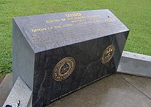 Monument near the ancient site of Tanasi in Monroe County
The earliest variant of the name that became Tennessee was recorded by Captain Juan Pardo, the Spanish explorer, when he and his men passed through a Native American village named "Tanasqui" in 1567 while traveling inland from South Carolina. In the early 18th century, British traders encountered a Cherokee town named Tanasi (or "Tanase") in present-day Monroe County, Tennessee. The town was located on a river of the same name (now known as the Little Tennessee River), and appears on maps as early as 1725. It is not known whether this was the same town as the one encountered by Juan Pardo, although recent research suggests that Pardo's "Tanasqui" was located at the confluence of the Pigeon River and the French Broad River, near modern Newport.[56]
The meaning and origin of the word are uncertain. Some accounts suggest it is a Cherokee modification of an earlier Yuchi word. It has been said to mean "meeting place", "winding river", or "river of the great bend".[57][58] According to James Mooney, the name "can not be analyzed" and its meaning is lost.[59]
The modern spelling, Tennessee, is attributed to James Glen, the governor of South Carolina, who used this spelling in his official correspondence during the 1750s. The spelling was popularized by the publication of Henry Timberlake's "Draught of the Cherokee Country" in 1765. In 1788, North Carolina created "Tennessee County", the third county to be established in what is now Middle Tennessee. (Tennessee County was the predecessor to current-day Montgomery County and Robertson County). When a constitutional convention met in 1796 to organize a new state out of the Southwest Territory, it adopted "Tennessee" as the name of the state.
Nickname
Tennessee is known as the "Volunteer State," a nickname earned during the War of 1812 because of the prominent role played by volunteer soldiers from Tennessee, especially during the Battle of New Orleans.[60]
State symbols
Main article: List of Tennessee state symbolsState symbols include:
- State bird – "Northern Mockingbird"
- State game bird – "Bobwhite Quail"
- State wild animal – "Raccoon"
- State sport fish – "Largemouth Bass"
- State commercial fish – "Channel Catfish"
- State horse – "Tennessee Walking Horse"
- State insect – "Lightning Bug and the Lady Bug"
- State cultivated flower – "Purple Iris"
- State wild flower – "Passion Flower"
- State tree – "Tulip Poplar"
- State fruit – "Tomato"
- State reptile – "Box turtle"
See also
- Outline of Tennessee
- Index of Tennessee-related articles
- List of National Register of Historic Places in Tennessee
- List of people from Tennessee
- U.S. state
References
- ^ "2010 Census Data". United States Census Bureau. http://2010.census.gov/2010census/data/. Retrieved 2011-03-19.
- ^ a b "Elevations and Distances in the United States". United States Geological Survey. 2001. http://egsc.usgs.gov/isb/pubs/booklets/elvadist/elvadist.html. Retrieved October 24, 2011.
- ^ a b Elevation adjusted to North American Vertical Datum of 1988.
- ^ "Tennessee QuickFacts". US Census Bureau. http://quickfacts.census.gov/qfd/states/47000.html.
- ^ "U.S. Census Largest US Counties By Population". http://www.census.gov/popest/counties/tables/CO-EST2008-07.xls. Retrieved 2010-07-31.
- ^ "Table 1: Annual Estimates of the Population for Incorporated Places Over 100,000, Ranked by July 1, 2008 Population: April 1, 2000 to July 1, 2008" (CSV). 2007 Population Estimates. United States Census Bureau, Population Division. 2008-07-10. http://www.census.gov/popest/cities/tables/SUB-EST2008-01.xls. Retrieved 2008-07-10.
- ^ John Finger, Tennessee Frontiers: Three Regions in Transition (Bloomington, Ind.: Indiana University Press, 2001), pp. 46–47.
- ^ a b Tennessee's Civil War Heritage Trail. Retrieved: 25 November 2009.[dead link]
- ^ Bobby Lovett, Beale Street. Tennessee Encyclopedia of History and Culture, 2002. Retrieved: 25 November 2009.
- ^ Michael Bertrand, Sun Records. Tennessee Encyclopedia of History and Culture, 2002. Retrieved: 25 November 2009.
- ^ Charles Wolfe, Music. Tennessee Encyclopedia of History and Culture, 2002. Retrieved: 25 November 2009.
- ^ Ted Olson and Ajay Kalra, "Appalachian Music: Examining Popular Assumptions". A Handbook to Appalachia: An Introduction to the Region (Knoxville, Tenn.: University of Tennessee Press, 2006), pp. 163–170.
- ^ [1]. Tennessee Agriculture 2010: Growing the Future, 2010. Retrieved: 15 January 2010.
- ^ James Fickle, Industry. Tennessee Encyclopedia of History and Culture, 2002. Retrieved: 25 November 2009.
- ^ Great Smoky Mountains National Park. Official site. Retrieved: 25 November 2009.
- ^ "Elevations and Distances in the United States". U.S Geological Survey. 29 April 2005. http://erg.usgs.gov/isb/pubs/booklets/elvadist/elvadist.html#Highest. Retrieved December 16, 2008.
- ^ "What's Happening in Nashville". Vanderbilt.edu. http://www.vanderbilt.edu/sociology/VDOS_Nashville.shtml. Retrieved 2010-08-07.
- ^ "World Map of Köppen−Geiger Climate Classification" (PDF). http://koeppen-geiger.vu-wien.ac.at/pdf/kottek_et_al_2006_A1.pdf. Retrieved 2008-12-19.[dead link]
- ^ "A look at Tennessee Agriculture" (PDF). Agclassroom.org. http://www.agclassroom.org/kids/stats/tennessee.pdf. Retrieved November 1, 2006.
- ^ David M. Roth. "Tropical Cyclone Rainfall in the Southeast". http://www.hpc.ncep.noaa.gov/tropical/rain/tcsoutheast.html. Retrieved 2007-12-20.
- ^ "US Thunderstorm distribution". src.noaa.gov. Archived from the original on October 15, 2006. http://web.archive.org/web/20061015060809/http://www.srh.noaa.gov/key/HTML/tstmhazards.htm. Retrieved November 1, 2006.
- ^ "Mean Annual Average Number of Tornadoes 1953–2004". ncdc.noaa.gov. http://www.ncdc.noaa.gov/img/climate/research/tornado/small/avgt5304.gif. Retrieved November 1, 2006.
- ^ "Top ten list". tornadoproject.com. http://www.tornadoproject.com/toptens/topten1.htm. Retrieved November 1, 2006.
- ^ "National and Local Weather Forecast, Hurricane, Radar and Report". Weather.com. http://www.weather.com/. Retrieved 2010-07-31.
- ^ "Archaeology and the Native Peoples of Tennessee". University of Tennessee, Frank H. McClung Museum. Retrieved on December 5, 2007.
- ^ Stanley Folmsbee, Robert Corlew, and Enoch Mitchell, Tennessee: A Short History (Knoxville, Tenn.: University of Tennessee Press, 1969), p. 45.
- ^ Robert E. Corlew, Tennessee: A Short History (Knoxville: University of Tennessee Press, 1981), page 106
- ^ Hubbard, Bill, Jr. (2009). American Boundaries: the Nation, the States, the Rectangular Survey. University of Chicago Press. p. 55. ISBN 978-0-226-35591-7.
- ^ Carter (III), Samuel (1976). Cherokee sunset: A nation betrayed: a narrative of travail and triumph, persecution and exile. New York: Doubleday, p. 232.
- ^ Satz, Ronald (1979). Tennessee's Indian Peoples. Knoxville, Tennessee: University of Tennessee Press. ISBN 0-87049-285-3.
- ^ "Chronology of Emancipation during the Civil War". University of Maryland: Department of History. http://www.history.umd.edu/Freedmen/chronol.htm.
- ^ "This Honorable Body: African American Legislators in 19th Century Tennessee". Tennessee State Library and Archives. http://www.state.tn.us/tsla/exhibits/blackhistory/timelines/timeline_1861-1865.htm.
- ^ a b c Disfranchising Laws, The Tennessee Encyclopedia of History and Culture. Retrieved 11 March 2008.
- ^ [http;//fisher.lib.virginia.edu/collections/stats/histcensus/php/state.php Historical Census Browser, 1900 US Census, University of Virginia]. Retrieved 15 March 2008.
- ^ "Population and Population Centers by State: 2000". United States Census Bureau. http://www.census.gov/geo/www/cenpop/statecenters.txt. Retrieved 2008-12-06.
- ^ DADE, COREY (November 22, 2008). "Tennessee Resists Obama Wave". Wall Street Journal. http://online.wsj.com/article/SB122731165800249331.html?mod=googlenews_wsj. Retrieved 2008-11-23.
- ^ "c2kbr01-2.qxd" (PDF). http://www.census.gov/prod/2004pubs/c2kbr-35.pdf. Retrieved 2010-07-31.
- ^ David Hackett Fischer, Albion's Seed: Four British Folkways in America, New York: Oxford University Press, 1989, pp.633–639
- ^ Sharing the Dream: White Males in a Multicultural America By Dominic J. Pulera.
- ^ http://www.census.gov/population/www/censusdata/files/pc80-s1-10/tab03.pdf
- ^ Tom Humphrey, "State grants six Indian tribes recognition: Cherokee Nation may try to have action by Indian Affairs voided", Knoxville News Sentinel, 21 June 2010, accessed 30 Jun 2010
- ^ American Religious Identification Survey (2001). Five percent of the people surveyed refused to answer.
- ^ "The Pew Forum on Religion & Public Life". Religions.pewforum.org. http://religions.pewforum.org/maps. Retrieved 2010-07-31.
- ^ "The Association of Religion Data Archives | Maps & Reports". Thearda.com. http://www.thearda.com/mapsReports/reports/state/47_2000.asp. Retrieved 2010-07-31.
- ^ [2][dead link]
- ^ "USDA 2002 Census of Agriculture, Maps and Cartographic Resources". Nass.usda.gov. http://www.nass.usda.gov/research/atlas02/index.html. Retrieved 2010-07-31.
- ^ Bls.gov; Local Area Unemployment Statistics
- ^ http://www.state.tn.us/revenue/forms/inhgift/guideinhestate.pdf
- ^ "Court of Criminal Appeals". Tsc.state.tn.us. http://www.tsc.state.tn.us/geninfo/Bio/CrimAppeals/Biocca.htm. Retrieved 2010-07-31.
- ^ Tennessee by County – GCT-PL. Race and Hispanic or Latino 2000 U.S. Census Bureau
- ^ Tennessee: McCain Leads Both Democrats by Double Digits Rasumussen Reports, April 6, 2008
- ^ DADE, COREY (November 22, 2008). "Tennessee Resists Obama Wave". Wall Street Journal. http://online.wsj.com/article/SB122731165800249331.html?mod=googlenews_wsj.
- ^ Eisler, Kim Isaac (1993). A Justice for All: William J. Brennan, Jr., and the decisions that transformed America. New York: Simon & Schuster. ISBN 0671767879.
- ^ Peltason, Jack W. (1992). "Baker v. Carr". In Hall, Kermit L. (ed.). The Oxford companion to the Supreme Court of the United States. New York: Oxford University Press. pp. 67–70. ISBN 0195058356.
- ^ Tushnet, Mark (2008). I dissent: Great Opposing Opinions in Landmark Supreme Court Cases. Boston: Beacon Press. pp. 151–166. ISBN 9780807000366.
- ^ Charles Hudson, The Juan Pardo Expeditions: Explorations of the Carolinas and Tennessee, 1566–1568 (Tuscaloosa, Ala.: University of Alabama Press, 2005), 36–40.
- ^ "Tennessee State Library and Archives FAQ". Web.archive.org. Archived from the original on 2004-10-23. http://web.archive.org/web/20041023191026/http://www.state.tn.us/sos/statelib/pubsvs/faq.htm#01. Retrieved 2010-07-31.
- ^ "Tennessee's Name Dates Back To 1567 Spanish Explorer Captain Juan Pardo". Tngenweb.org. 2005-01-01. http://www.tngenweb.org/campbell/hist-bogan/tennessee.html. Retrieved 2010-07-31.
- ^ Mooney, pg. 534
- ^ "Brief History of Tennessee in the War of 1812". Tennessee State Library and Archives. http://www.state.tn.us/TSLA/history/military/tn1812.htm. Retrieved April 30, 2006. Other sources differ on the origin of the state nickname; according to the Columbia Encyclopedia, the name refers to volunteers for the Mexican-American War.
Further reading
- Bergeron, Paul H. (1982). Antebellum Politics in Tennessee. University of Kentucky Press. ISBN 0813114691.
- Bontemps, Arna (1941). William C. Handy: Father of the Blues: An Autobiography. New York: Macmillan Company.
- Brownlow, W. G. (1862). Sketches of the Rise, Progress, and Decline of Secession: With a Narrative of Personal Adventures among the Rebels.
- Cartwright, Joseph H. (1976). The Triumph of Jim Crow: Tennessee’s Race Relations in the 1880s. University of Tennessee Press.
- Cimprich, John (1985). Slavery's End in Tennessee, 1861–1865. University of Alabama. ISBN 0817302573.
- Finger, John R. (2001). Tennessee Frontiers: Three Regions in Transition. Indiana University Press. ISBN 0253339855.
- Honey, Michael K. (1993). Southern Labor and Black Civil Rights: Organizing Memphis Workers. University of Illinois Press. ISBN 0252020006.
- Lamon, Lester C. (1980). Blacks in Tennessee, 1791–1970. University of Tennessee Press. ISBN 0870493248.
- Mooney, James (1900). Myths of the Cherokee. New York: reprinted Dover, 1995. ISBN 0914875191.
- Norton, Herman (1981). Religion in Tennessee, 1777–1945. University of Tennessee Press. ISBN 0870493183.
- Olson, Ted (2009). A Tennessee Folklore Sampler: Selected Readings from the Tennessee Folklore Society Bulletin, 1934–2009. University of Tennessee Press. ISBN 1572336684.
- Schaefer, Richard T. (2006). Sociology Matters. New York: NY: McGraw-Hill. ISBN 0-07-299775-3.
- Van West, Carroll (1998). Tennessee history: the land, the people, and the culture. University of Tennessee Press. ISBN 1572330007.
- Van West, Carroll, ed (1998). The Tennessee Encyclopedia of History and Culture. ISBN 1558535993.
External links
- State Government Website
- Tennessee Department of Tourist Development
- Tennessee State Databases – Annotated list of searchable databases produced by Tennessee state agencies and compiled by the Government Documents Roundtable of the American Library Association.
- Tennessee Encyclopedia of History and Culture
- Tennessee State Library and Archives
- Energy Profile for Tennessee
- USGS real-time, geographic, and other scientific resources of Tennessee
- U.S. Census Bureau
- Tennessee Blue Book – All things Tennessee
- Timeline of Modern Tennessee Politics
- Tennessee State Facts
- Tennessee landforms
- The Annals of Tennessee to the End of the Eighteenth Century – a history by J. G. M. Ramsey, 1853
- Tennessee at the Open Directory Project

 Missouri
 Kentucky
 Virginia
 Arkansas
 North Carolina
 Tennessee: Outline • Index

 Mississippi •
  Alabama •
  Georgia (U.S. state)
 South Carolina
United States (Outline) History Pre-Columbian era · Colonial era (Thirteen Colonies · Colonial American military history) · American Revolution (War) · Federalist Era · War of 1812 · Territorial acquisitions · Territorial evolution · Mexican–American War · Civil War · Reconstruction era · Indian Wars · Gilded Age · African-American Civil Rights Movement (1896–1954) · Spanish–American War · Imperialism · World War I · Roaring Twenties · Great Depression · World War II (Home front) · Cold War · Korean War · Space Race · African-American Civil Rights Movement (1955–1968) · Feminist Movement · Vietnam War · Post-Cold War (1991–present) · War on Terror (War in Afghanistan · Iraq War) · Timeline of modern American conservatismTopicsDemographic · Discoveries · Economic (Debt Ceiling) · Inventions (before 1890 · 1890–1945 · 1946–1991 · after 1991) · Military · Postal · Technological and industrialFederal
governmentLegislature - Congress
Senate
· Vice President
· President pro tem
House of Representatives
· Speaker
Judiciary - Supreme Court
Federal courts
Courts of appeal
District courtsExecutive - President
Executive Office
Cabinet / Executive departments
Civil service
Independent agencies
Law enforcement
Public policy
Intelligence
Central Intelligence Agency
Defense Intelligence Agency
National Security Agency
Federal Bureau of InvestigationPolitics Divisions · Elections (Electoral College) · Foreign policy · Foreign relations · Ideologies · Local governments · Parties (Democratic Party · Republican Party · Third parties) · Political status of Puerto Rico · Red states and blue states · Scandals · State governments · Uncle SamGeography Cities, towns, and villages · Counties · Extreme points · Islands · Mountains (Peaks · Appalachian · Rocky) · National Park System · Regions (Great Plains · Mid-Atlantic · Midwestern · New England · Northwestern · Southern · Southwestern · Pacific · Western) · Rivers (Colorado · Columbia · Mississippi · Missouri · Ohio · Rio Grande) · States · Territory · Water supply and sanitationEconomy Agriculture · Banking · Communications · Companies · Dollar · Energy · Federal Budget · Federal Reserve System · Financial position · Insurance · Mining · Public debt · Taxation · Tourism · Trade · Transportation · Wall StreetSociety TopicsCrime · Demographics · Education · Family structure · Health care · Health insurance · Incarceration · Languages (American English · Spanish · French) · Media · People · Public holidays · Religion · SportsArchitecture · Art · Cinema · Cuisine · Dance · Fashion · Flag · Folklore · Literature · Music · Philosophy · Radio · Television · TheaterIssuesPolitical divisions of the United States States - Alabama
- Alaska
- Arizona
- Arkansas
- California
- Colorado
- Connecticut
- Delaware
- Florida
- Georgia
- Hawaii
- Idaho
- Illinois
- Indiana
- Iowa
- Kansas
- Kentucky
- Louisiana
- Maine
- Maryland
- Massachusetts
- Michigan
- Minnesota
- Mississippi
- Missouri
- Montana
- Nebraska
- Nevada
- New Hampshire
- New Jersey
- New Mexico
- New York
- North Carolina
- North Dakota
- Ohio
- Oklahoma
- Oregon
- Pennsylvania
- Rhode Island
- South Carolina
- South Dakota
- Tennessee
- Texas
- Utah
- Vermont
- Virginia
- Washington
- West Virginia
- Wisconsin
- Wyoming
Federal district Insular areas Outlying islands Preceded by
KentuckyList of U.S. states by date of statehood
Admitted on June 1, 1796 (16th)Succeeded by
OhioCategories:- Tennessee
- State of Franklin
- States of the Confederate States of America
- States of the United States
- States and territories established in 1796
- States of the Southern United States


Wikimedia Foundation. 2010.