- Tennessee River
-
This article is about the river. For the song, see Tennessee River (song).
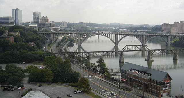
Tennessee River River 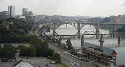 The Tennessee River in downtown Knoxville from the top of Neyland Stadium.
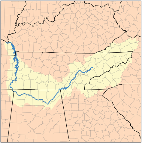
Country United States States Tennessee, Alabama, Mississippi, Kentucky Source Confluence of French Broad and Holston at Knoxville - elevation 813 ft (248 m) [1] - coordinates 35°57′33″N 83°51′01″W / 35.95917°N 83.85028°W [2] Mouth Ohio River at Livingston / McCracken counties, near Paducah, Kentucky - elevation 302 ft (92 m) [3] - coordinates 37°04′02″N 88°33′53″W / 37.06722°N 88.56472°W [2] Length 652 mi (1,049 km) [2] Basin 40,876 sq mi (105,868 km2) [4] Discharge - average 70,575 cu ft/s (1,998 m3/s) [4] - max 500,000 cu ft/s (14,158 m3/s)  Map of the Tennessee River watershed
 The John Ross Bridge, spanning the Tennessee River in Chattanooga.
 The "Steamboat Bill" Hudson Memorial Bridge in Decatur, Alabama.
The Tennessee River is the largest tributary of the Ohio River. It is approximately 652 miles (1049 km) long and is located in the southeastern United States in the Tennessee Valley. The river was once popularly known as the Cherokee River, among other names.[2] Its name is derived from the Cherokee village name Tanasi.[5]
Contents
Course
The Tennessee River is formed at the confluence of the Holston and French Broad Rivers on the east side of Knoxville, Tennessee. From Knoxville, it flows southwest through East Tennessee toward Chattanooga before crossing into Alabama. It loops through northern Alabama and eventually forms a small part of the state's border with Mississippi, before returning to Tennessee. At this point, it defines the boundary between Tennessee's other two Grand Divisions: Middle and West Tennessee. The Tennessee-Tombigbee Waterway, a U.S. Army Corps of Engineers project providing navigation on the Tombigbee River and a link to the Port of Mobile, enters Tennessee near the Tennessee-Alabama-Mississippi boundary. This waterway reduces the navigation distance from Tennessee, north Alabama, and northern Mississippi to the Gulf of Mexico by hundreds of miles. The final part of the Tennessee's run is in Kentucky, where it separates the Jackson Purchase from the rest of the state. It then flows into the Ohio River at Paducah, Kentucky.
Dams
The river has been dammed numerous times, primarily by Tennessee Valley Authority (TVA) projects. The placement of TVA's Kentucky Dam on the Tennessee River and the Corps' Barkley Dam on the Cumberland River directly led to the creation of Land Between the Lakes. A navigation canal located at Grand Rivers, Kentucky links Kentucky Lake and Lake Barkley. The canal allows for a shorter trip for river traffic going from the Tennessee to most of the Ohio River, and for traffic going down the Cumberland River toward the Mississippi.
Important cities and towns
Cities in bold type have more than 30,000 residents
- Bridgeport, Alabama
- Chattanooga, Tennessee
- Cherokee, Alabama
- Clifton, Tennessee
- Crump, Tennessee
- Decatur, Alabama
- Florence, Alabama
- Grand Rivers, Kentucky
- Guntersville, Alabama
- Harrison, Tennessee
- Huntsville, Alabama
- Killen, Alabama
- Kingston, Tennessee
- Knoxville, Tennessee
- Langston, Alabama
- Lenoir City, Tennessee
- Loudon, Tennessee
- New Johnsonville, Tennessee
- Paducah, Kentucky
- Redstone Arsenal, Alabama
- Savannah, Tennessee
- Scottsboro, Alabama
- Sheffield, Alabama
- Soddy-Daisy, Tennessee
- Signal Mountain, Tennessee
- South Pittsburg, Tennessee
- Triana, Alabama
- Waterloo, Alabama
History
Name
The river appears on French maps from the late 17th century with the names "Caquinampo" or "Kasqui." Maps from the early 18th century call it "Cussate," "Hogohegee," "Callamaco," and "Acanseapi." A 1755 British map showed the Tennessee River as the "River of the Cherakees."[6] By the late 18th century, it had come to be called "Tennessee," a name derived from the Cherokee village named Tanasi.[5][6]
Beginning
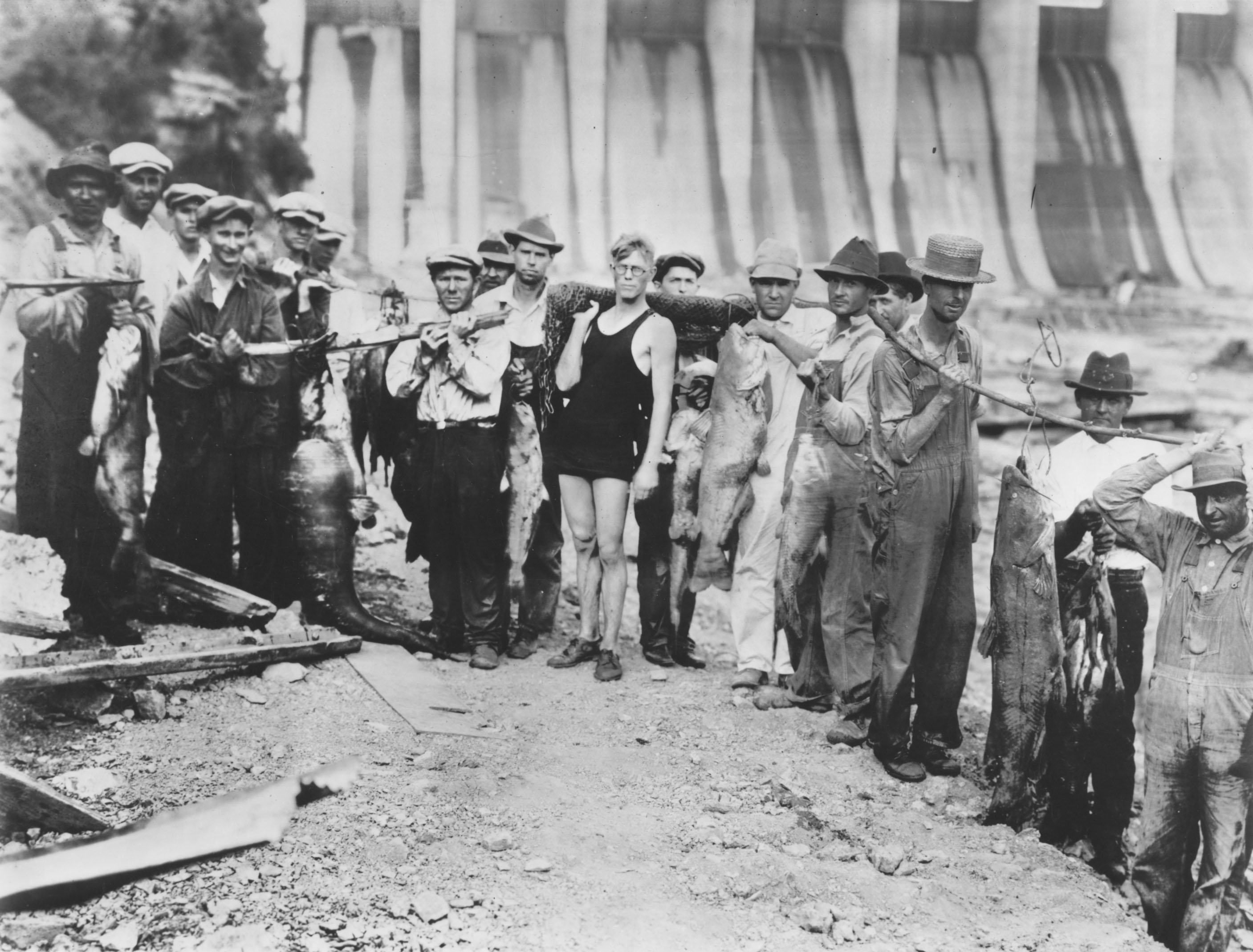
 Fish catch near Wilson Dam on the Tennessee River around 1940.
The Tennessee River begins at mile post 652, where the French Broad River meets the Holston River, but historically there were several different definitions of its starting point. In the late 18th century, the mouth of the Little Tennessee River (at Lenoir City) was considered to be the beginning of the Tennessee River. Through much of the 19th century, the Tennessee River was considered to start at the mouth of Clinch River (at Kingston). An 1889 declaration by the Tennessee General Assembly designated Kingsport (on the Holston River) as the start of the Tennessee, but the following year a federal law was enacted that finally fixed the start of the river at its current location.[6]
Water rights and border dispute with Georgia
At various points since the early 19th century, Georgia has disputed its northern border with Tennessee. In 1796, when Tennessee was admitted to the Union, the border was originally defined by United States Congress as located on the 35th parallel, thereby ensuring that at least a portion of the river would be located within Georgia. As a result of an erroneously conducted survey in 1818 (ratified by the Tennessee legislature, but not Georgia), however, the actual border line was set on the ground approximately one mile south, thus placing the disputed portion of the river entirely in Tennessee.[7][8]
Georgia made several unsuccessful attempts to correct what Georgia felt was an erroneous survey line 'in the 1890s, 1905, 1915, 1922, 1941, 1947 and 1971 to "resolve" the dispute', according to C. Crews Townsend, Joseph McCoin, Robert F. Parsley, Alison Martin and Zachary H. Greene, writing for the Tennessee Bar Journal, a publication of the Tennessee Bar Association, appearing on May 12, 2008.
In 2008, as a result of a serious drought and resulting water shortage, the Georgia General Assembly passed a resolution directing the governor to pursue its claim in the United States Supreme Court.[9][10]
According to a story aired on WTVC-TV in Chattanooga on March 14, 2008, a local attorney familiar with case law on border disputes, says the U.S. Supreme Court generally will maintain the original borders between states and avoid stepping into border disputes, preferring the parties work out their differences.[11]
Meanwhile, many Tennessee lawmakers have dismissed the Georgia claims.
Modern use
The Tennessee River is an important part of the Great Loop, the recreational circumnavigation of Eastern North America by water.
Two tributaries, the Emory River and Clinch River were the sites of the Kingston Fossil Plant coal fly ash slurry spill, which released 1.1 billion gallons of slurry into the surrounding waterways in 2008.
Ecology
The Tennessee River and its tributaries host some 102 species of mussels.[12] Native Americans ate freshwater mussels. During the Mississippian Period, crushed mussel shells were mixed into clay to add strength to pottery. A "pearl" button industry was established in the Tennessee Valley beginning in 1887, producing buttons from mussel shells, which were abundant. Button production ceased after World War II, when plastics largely replaced pearl as a button material.[13] Mussel populations have declined drastically due to dam construction, water pollution, and invasive species.[12] Destruction of aquatic habitat by dam construction caused some species to become extinct, while numerous other species are endangered.[14]
Popular culture
- Cormac McCarthy's 1979 novel Suttree concerns a man who forsakes his life of privilege to become a fisherman along the Tennessee River in Knoxville in the early 1950s.
- The song "Tennessee River" was recorded by the country music band Alabama in 1980.
- Darryl Worley's Tennessee River Run was written and recorded as a memoir to the memories he made over the course of his lifetime on the Tennessee River and at Pickwick Lake, just outside his hometown of Savannah, TN.
Tennessee River tributaries
 Forks-of-the-River in East Knoxville: the French Broad (left) joins the Holston (right) to form the Tennessee (center)
Tributaries and sub-tributaries are listed hierarchically in order from the mouth of the Tennessee River upstream.
- Horse Creek Savannah, TN (Hardin County, TN)
- Big Sandy River (Tennessee)
- White Oak Creek
- Duck River (Tennessee)
- Buffalo River (Tennessee)
- Piney River (Tennessee)
- Little Duck River
- Beech River (Tennessee)
- Shoal Creek
- Bear Creek (Alabama, Mississippi) [15]
- Buzzard Roost Creek (Alabama) [15]
- Colbert Creek (Alabama) [15]
- Malone Creek (Alabama) [15]
- Mulberry Creek (Alabama) [15]
- Cane Creek (Alabama) [15]
- Dry Creek (Alabama) [15]
- Little Bear Creek (Alabama) [15]
- Spring Creek (Alabama) [16]
- Cypress Creek (Alabama) [16]
- Shoal Creek (Alabama) [16]
- First Creek (Alabama) [16]
- Elk River (Tennessee, Alabama)
- Flint Creek (Alabama)
- Limestone Creek (Alabama, Tennessee)
- Beaverdam Creek (Alabama)
- Indian Creek (Alabama)
- Barren Fork Creek
- Flint River (Alabama, Tennessee)
- Paint Rock River (Alabama, Tennessee)
- Sequatchie River (Tennessee)
- Mountain Creek (Tennessee)
- Lookout Creek (Tennessee, Georgia)
- Chattanooga Creek (Tennessee, Georgia)
- Citico Creek (Tennessee)
- South Chickamauga Creek (Tennessee, Georgia)
- North Chickamauga Creek (Tennessee)
- Hiwassee River (Tennessee, North Carolina)
- Conasauga Creek (Tennessee)
- Ocoee River (Tennessee, Georgia)
- Nottely River (North Carolina, Georgia)
- Piney River (Tennessee)
- Clinch River (Tennessee, Virginia)
- Emory River (Tennessee)
- Little Emory River
- Obed River (Tennessee)
- Poplar Creek
- East Fork Poplar Creek
- Beaver Creek
- Powell River (Tennessee, Virginia)
- Emory River (Tennessee)
- Little Tennessee River (Tennessee, North Carolina)
- Tellico River (Tennessee)
- Tuckasegee River (North Carolina)
- Nantahala River (North Carolina)
- Cullasaja River (North Carolina)
- Little River (Tennessee)
- French Broad River
- Little Pigeon River (Tennessee)
- Nolichucky River (Tennessee, North Carolina)
- Pigeon River (Tennessee, North Carolina)
- Holston River (Tennessee)
- North Fork Holston River (Tennessee, Virginia)
- South Fork Holston River (Tennessee, Virginia)
- Watauga River (Tennessee, North Carolina)
- Doe River (Tennessee)
- Watauga River (Tennessee, North Carolina)
- Middle Fork Holston River (Virginia)
See also
- List of crossings of the Tennessee River
- List of dams and reservoirs of the Tennessee River
- List of Alabama rivers
- List of Kentucky rivers
- List of Mississippi rivers
- List of Tennessee rivers
- Stare decisis
- List of longest rivers of the United States (by main stem)
Notes
- ^ U.S. Geological Survey. Shooks Gap quadrangle, Tennessee. 1:24,000. 7.5 Minute Series. Washington D.C.: USGS, 1987.
- ^ a b c d U.S. Geological Survey Geographic Names Information System: Tennessee River
- ^ U.S. Geological Survey. Paducah East quadrangle, Kentucky. 1:24,000. 7.5 Minute Series. Washington D.C.: USGS, 1982.
- ^ a b "Arthur Benke & Colbert Cushing, "Rivers of North America". Elsevier Academic Press, 2005 ISBN 0-12-088253-1
- ^ a b Bright, William (2004). Native American placenames of the United States. University of Oklahoma Press. p. 488. ISBN 9780806135984. http://books.google.com/books?id=5XfxzCm1qa4C&pg=PA488. Retrieved 11 April 2011.
- ^ a b c Ann Toplovich, Tennessee River System, Tennessee Encyclopedia of History and Culture, December 25, 2009; updated January 1, 2010; accessed July 14, 2011
- ^ "Georgians thirst to move Tennessee state line". February 8, 2008. http://www.msnbc.msn.com/id/23076509/. Retrieved 2008-05-13.
- ^ "Desperate for water, Georgia revisits border dispute". February 8, 2008. http://www.cnn.com/2008/US/02/08/drought.state.line.ap/. Retrieved 2008-05-13.[dead link]
- ^ Jones, Andrea (February 20, 2008). "Ga.'s quest to move Tenn. border advances". The Atlanta Journal-Constitution. http://www.ajc.com/metro/content/metro/stories/2008/02/20/tennborder_0221.html. Retrieved 2008-05-14.
- ^ Dewan, Shaila (February 22, 2008). "Georgia Claims a Sliver of the Tennessee River". The New York Times. http://www.nytimes.com/2008/02/22/us/22water.html?em&ex=1203829200&en=9fe2c2ffaf5be75a&ei=5087%0A. Retrieved 2008-05-14.
- ^ http://www.newschannel9.com/articles/georgia-967199-tennessee-border.html
- ^ a b Freshwater Mussels, Virginia Department of Game and Inland Fisheries website, accessed July 14, 2011
- ^ Tennessee Freshwater Mussels, Frank H. McClung Museum website, accessed July 14, 2011
- ^ Ann Toplovich, Conservation, Tennessee Encyclopedia of History and Culture; December 25, 2009; updated January 1, 2010; accessed July 14, 2011.
- ^ a b c d e f g h "County Highway Maps" (Lizardtech Plugin). University of Alabama. 1997. http://cartweb.geography.ua.edu:9001/StyleServer/calcrgn?cat=North%20America%20and%20United%20States&item=States/Alabama/Counties/colbert/hy_colbert97.sid&wid=500&hei=400&props=item(Name,Description),cat(Name,Description)&style=simple/view.xsl&plugin=true. Retrieved 2007-06-25.
Further reading
- Woodside, M.D. et al. (2004). Water quality in the lower Tennessee River Basin, Tennessee, Alabama, Kentucky, Mississippi, and Georgia, 1999-2001 [U.S. Geological Survey Circular 1233]. Reston, VA: U.S. Department of the Interior, U.S. Geological Survey.
- Myers, Fred (2004). Tennessee River CruiseGuide, 5th Edition
- Hay, Jerry (2010). Tennessee River Guidebook, 1st Edition
External links
Categories:- Tennessee River
- Borders of Alabama
- Borders of Mississippi
- Borders of Tennessee
- Borders of Kentucky
- Internal territorial disputes of the United States
- Rivers of Alabama
- Rivers of Kentucky
- Rivers of Mississippi
- Rivers of Tennessee
- Tributaries of the Ohio River
- Geography of Livingston County, Kentucky
- Geography of McCracken County, Kentucky


Wikimedia Foundation. 2010.