- Cole County, Missouri
-
Cole County, Missouri 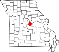
Location in the state of Missouri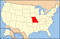
Missouri's location in the U.S.Founded 1820 Seat Jefferson City Area
- Total
- Land
- Water
399.08 sq mi (1,034 km²)
391.44 sq mi (1,014 km²)
7.64 sq mi (20 km²), 1.91%Population
- (2010)
- Density
75,990
74/sq mi (29/km²)Time zone Central: UTC-6/-5 Website www.colecounty.org Cole County is a county located in the central part of the U.S. state of Missouri, to the south of the Missouri River. As of 2010, the population was 75,990. Its county seat is Jefferson City[1]. The county was organized in 1820 and is named after pioneer Capt. Stephen Cole, who came from Virginia in 1807 and died in 1822.
Cole County is part of the Jefferson City, Missouri Metropolitan Statistical Area.
Contents
Geography
According to the 2000 census, the county has a total area of 399.08 square miles (1,033.6 km2), of which 391.44 square miles (1,013.8 km2) (or 98.09%) is land and 7.64 square miles (19.8 km2) (or 1.91%) is water.[2]
Adjacent counties
- Boone County (north)
- Callaway County (northeast)
- Osage County (southeast)
- Miller County (southwest)
- Moniteau County (northwest)
Major highways
 U.S. Route 50
 U.S. Route 54
 U.S. Route 63
 Route 179
Government
Cole County, Missouri Elected countywide officials Assessor Christopher Estes Circuit Clerk Brenda A. Umstattd Republican County Clerk Marvin Register Republican Collector Larry Vincent Republican Commissioner
(Presiding)Marc Ellinger Republican Commissioner
(District 1)Jeff Hoelscher
(eastern district)Republican Commissioner
(District 2)Chris Wrigley
(western district)Republican Coroner Ed Schniers Republican Prosecuting Attorney Mark Richardson Republican Public Administrator Marilyn R. Schmutzler Democratic Recorder Larry D. Rademan Democratic Sheriff Greg White Republican Treasurer Eric Peters Republican Demographics
 Cole County Courthouse
As of the census[3] of 2000, there were 71,397 people, 27,040 households, and 17,927 families residing in the county. The population density was 182 people per square mile (70/km²). There were 28,915 housing units at an average density of 74 per square mile (29/km²). The racial makeup of the county was 87.06% White, 9.92% Black or African American, 0.33% Native American, 0.88% Asian, 0.04% Pacific Islander, 0.54% from other races, and 1.23% from two or more races. 1.28% of the population were Hispanic or Latino of any race. 40.1% were of German, 13.6% American, 7.8% English and 6.9% Irish ancestry according to Census 2000.
There were 27,040 households out of which 33.60% had children under the age of 18 living with them, 53.00% were married couples living together, 10.00% had a female householder with no husband present, and 33.70% were non-families. 28.70% of all households were made up of individuals and 9.30% had someone living alone who was 65 years of age or older. The average household size was 2.43 and the average family size was 3.00.
In the county the population was spread out with 24.20% under the age of 18, 9.80% from 18 to 24, 32.30% from 25 to 44, 22.40% from 45 to 64, and 11.30% who were 65 years of age or older. The median age was 36 years. For every 100 females there were 105.60 males. For every 100 females age 18 and over, there were 106.50 males.
The median income for a household in the county was $42,924, and the median income for a family was $53,416. Males had a median income of $33,769 versus $25,189 for females. The per capita income for the county was $20,739. About 5.80% of families and 8.70% of the population were below the poverty line, including 11.50% of those under age 18 and 7.30% of those age 65 or over.
Cities and towns
Cities
Towns
Villages
Unincorporated towns
Government and infrastructure
The Missouri Department of Corrections (MDOC) operates the Jefferson City Correctional Center in Jefferson City.[4][5] The current JCCC was opened on September 15, 2004, replacing the Missouri State Penitentiary in Jefferson City.[6]
See also
References
- ^ "Find a County". National Association of Counties. http://www.naco.org/Counties/Pages/FindACounty.aspx. Retrieved 2011-06-07.
- ^ "Census 2000 U.S. Gazetteer Files: Counties". United States Census. http://www.census.gov/tiger/tms/gazetteer/county2k.txt. Retrieved 2011-02-13.
- ^ "American FactFinder". United States Census Bureau. http://factfinder.census.gov. Retrieved 2008-01-31.
- ^ "Jefferson City Correctional Center." Missouri Department of Corrections. May 7, 2006. Retrieved on September 18, 2010.
- ^ "MidMoGIS Mapping Website." City of Jefferson. Retrieved on September 18, 2010.
- ^ "Jefferson City Correctional Center." Missouri Department of Corrections. May 7, 2006. Retrieved on September 18, 2010.
External links
- Cole County government's website
- Missouri River Regional Library
- Digitized 1930 Plat Book of Cole County from University of Missouri Division of Special Collections, Archives, and Rare Books

Moniteau County Boone County Callaway County 
 Cole County, Missouri

Miller County Osage County Municipalities and communities of Cole County, Missouri Cities Jefferson City‡ | Lohman | Russellville | St. Martins | Taos

Villages Townships Clark | Jefferson | Liberty | Marion | Moreau | Osage
Unincorporated
communitiesFootnotes ‡This populated place also has portions in an adjacent county or counties
Categories:- Missouri counties
- 1820 establishments in the United States
- Populated places established in 1820
- Cole County, Missouri
- Missouri Rhineland
- Jefferson City metropolitan area
- Missouri counties on the Missouri River


Wikimedia Foundation. 2010.