- Dougherty County, Georgia
-
Dougherty County, Georgia 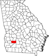
Location in the state of Georgia
Georgia's location in the U.S.Founded 1853 Seat Albany Largest city Albany Area
- Total
- Land
- Water
334.64 sq mi (867 km²)
329.60 sq mi (854 km²)
5.04 sq mi (13 km²), 1.51%PopulationEst.
- (2005)
- Density
94,882
292/sq mi (113/km²)Time zone Eastern: UTC-5/-4 Website www.albany.ga.us/county_gov.htm Dougherty County is a county located in the U.S. state of Georgia. As of 2000, the population was 96,065. The 2009 Census Estimate shows a population of 95,859.[1] It is included in the Albany, Georgia Metropolitan Statistical Area. The county seat and largest city is Albany.[2]
Contents
History
The county was created by the Georgia General Assembly on December 15, 1853, from a part of Baker County and was named after Charles Dougherty, a respected judge and lawyer from Athens, Georgia.
Geography
According to the 2000 census, the county has a total area of 334.64 square miles (866.7 km2), of which 329.60 square miles (853.7 km2) (or 98.49%) is land and 5.04 square miles (13.1 km2) (or 1.51%) is water.[3]
Major highways
 U.S. Route 19
 U.S. Route 82
 State Route 3
 State Route 62
 State Route 91
 State Route 133
 State Route 234
 State Route 300
 State Route 520
Adjacent counties
- Lee County, Georgia - north
- Worth County, Georgia - east
- Mitchell County, Georgia - south
- Baker County, Georgia - southwest
- Calhoun County, Georgia - west
- Terrell County, Georgia - northwest
Demographics
As of the census[4] of 2000, there were 96,065 people, 35,552 households, and 24,282 families residing in the county. The population density was 292 people per square mile (113/km²). There were 39,656 housing units at an average density of 120 per square mile (46/km²). The racial makeup of the county was 60.13% Black or African American, 37.80% White, 0.23% Native American, 0.57% Asian, 0.03% Pacific Islander, 0.49% from other races, and 0.74% from two or more races. 1.34% of the population were Hispanic or Latino of any race.
The largest European ancestry groups in Dougherty County are English (6.6%), Irish (6.5%), "American" (mostly English and Scots-Irish)(5.6%), German (4.5%) and Scots-Irish (1.6%).[5]
There were 35,552 households out of which 32.90% had children under the age of 18 living with them, 40.90% were married couples living together, 23.20% had a female householder with no husband present, and 31.70% were non-families. 26.80% of all households were made up of individuals and 8.90% had someone living alone who was 65 years of age or older. The average household size was 2.58 and the average family size was 3.13.
In the county the population was spread out with 27.70% under the age of 18, 12.20% from 18 to 24, 27.60% from 25 to 44, 20.90% from 45 to 64, and 11.70% who were 65 years of age or older. The median age was 32 years. For every 100 females there were 87.40 males. For every 100 females age 18 and over, there were 82.30 males.
The median income for a household in the county was $30,934, and the median income for a family was $36,655. Males had a median income of $30,742 versus $22,254 for females. The per capita income for the county was $16,645. About 19.60% of families and 24.80% of the population were below the poverty line, including 35.30% of those under age 18 and 17.20% of those age 65 or over.
Education
History
Dougherty County was created on December 15, 1853, from Baker County and named for Judge Charles Dougherty. In 1854 and 1856 small areas were added from Worth County.
Incorporated cities and towns
Unincorporated communities
- Acree
- Butler
- Dosaga
- Doublegate
- Ducker
- Five Points
- Four Points
- Gillionville
- Hotalihuyana
- Pecan City
- Pretoria
- Putney
- Radium Springs
- River Bend
- Ruark
- Turner City
- Walker
- Williamsburg
Ghost Towns
- Ocmulgee
See also
References
- ^ http://quickfacts.census.gov/qfd/states/13/13095.html
- ^ "Find a County". National Association of Counties. http://www.naco.org/Counties/Pages/FindACounty.aspx. Retrieved 2011-06-07.
- ^ "Census 2000 U.S. Gazetteer Files: Counties". United States Census. http://www.census.gov/tiger/tms/gazetteer/county2k.txt. Retrieved 2011-02-13.
- ^ "American FactFinder". United States Census Bureau. http://factfinder.census.gov. Retrieved 2008-01-31.
- ^ http://factfinder.census.gov/servlet/ADPTable?_bm=y&-context=adp&-qr_name=ACS_2008_3YR_G00_DP3YR2&-ds_name=ACS_2008_3YR_G00_&-tree_id=3308&-redoLog=true&-_caller=geoselect&-geo_id=05000US13095&-format=&-_lang=en
External links

Terrell County Lee County Calhoun County 
Worth County  Dougherty County, Georgia

Baker County Mitchell County Municipalities and communities of Dougherty County, Georgia City 
CDP Putney }
Unincorporated
communitiesDoublegate | Pretoria | Radium Springs
Categories:- Georgia (U.S. state) counties
- Dougherty County, Georgia
- 1853 establishments in the United States
- Counties of the United States with African American majority populations
- Albany, Georgia metropolitan area


Wikimedia Foundation. 2010.