- Coffee County, Georgia
-
Coffee County, Georgia 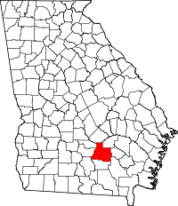
Location in the state of Georgia
Georgia's location in the U.S.Founded 1854 Seat Douglas Largest city Douglas Area
- Total
- Land
- Water
602.61 sq mi (1,561 km²)
598.90 sq mi (1,551 km²)
3.72 sq mi (10 km²), 0.62%PopulationEst.
- (2007)
- Density
40,085
62/sq mi (24/km²)Congressional district 1st Time zone Eastern: UTC-5/-4 Coffee County is a county located in the U.S. state of Georgia. As of 2000, the population was 37,413. The 2007 Census Estimate shows a population of 40,085.[1] The county seat is Douglas.[2]
Contents
History
Coffee County was created by an act of the Georgia General Assembly on February 9, 1854, from portions of Clinch, Irwin, Telfair, and Ware counties. These lands were originally ceded by the Creek in the Treaty of Fort Jackson in (1814) and the Treaty of the Creek Agency (1818) and apportioned to the above Counties before becoming Coffee County.
Berrien (1856), Jeff Davis (1905), and Atkinson (1917) Counties were subsequently formed from sections of Coffee's original borders.
The County is named for General John E. Coffee, a state legislator, and a U. S. representative.
Geography
According to the 2000 census, the county has a total area of 602.61 square miles (1,560.8 km2), of which 598.90 square miles (1,551.1 km2) (or 99.38%) is land and 3.72 square miles (9.6 km2) (or 0.62%) is water.[3]
Highways
 U.S. Route 221
 U.S. Route 319
 U.S. Route 441
 State Route 31
 State Route 32
 State Route 64
 State Route 90
 State Route 107
 State Route 135
 State Route 158
Adjacent counties
- Telfair County, Georgia - north
- Jeff Davis County, Georgia - northeast
- Bacon County, Georgia - east
- Ware County, Georgia - southeast
- Atkinson County, Georgia - south
- Berrien County, Georgia - southwest
- Irwin County, Georgia - west
- Ben Hill County, Georgia - west
See also: List of counties bordering eight or more countiesDemographics
As of the census[4] of 2000, there were 37,413 people, 13,354 households, and 9,788 families residing in the county. The population density was 62 people per square mile (24/km²). There were 15,610 housing units at an average density of 26 per square mile (10/km²). The racial makeup of the county was 68.23% White, 25.88% Black or African American, 0.32% Native American, 0.56% Asian, 0.04% Pacific Islander, 4.04% from other races, and 0.92% from two or more races. 6.82% of the population were Hispanic or Latino of any race.
There were 13,354 households out of which 37.30% had children under the age of 18 living with them, 53.50% were married couples living together, 15.20% had a female householder with no husband present, and 26.70% were non-families. 22.60% of all households were made up of individuals and 8.90% had someone living alone who was 65 years of age or older. The average household size was 2.69 and the average family size was 3.14.
In the county the population was spread out with 28.30% under the age of 18, 11.00% from 18 to 24, 30.30% from 25 to 44, 20.50% from 45 to 64, and 9.90% who were 65 years of age or older. The median age was 32 years. For every 100 females there were 98.60 males. For every 100 females age 18 and over, there were 97.00 males.
The median income for a household in the county was $30,710, and the median income for a family was $35,936. Males had a median income of $26,642 versus $20,644 for females. The per capita income for the county was $15,530. About 15.30% of families and 19.10% of the population were below the poverty line, including 23.90% of those under age 18 and 21.10% of those age 65 or over.
Education
Main article: Douglas, Georgia#EducationCities and towns
- Ambrose
- Broxton
- Bushnell
- Douglas
- Lax
- Mora
- Nicholls
- Pridgen
- Upton
- West Green
See also
- Coffee Road
- General Coffee State Park
- National Register of Historic Places listings in Coffee County, Georgia
- Sapps Still, Georgia
- Broxton Rocks
References
- ^ Counties Population in Georgia 2000-2007, U.S. Census Bureau, 2008. Retrieved 21 March 2008.
- ^ "Find a County". National Association of Counties. http://www.naco.org/Counties/Pages/FindACounty.aspx. Retrieved 2011-06-07.
- ^ "Census 2000 U.S. Gazetteer Files: Counties". United States Census. http://www.census.gov/tiger/tms/gazetteer/county2k.txt. Retrieved 2011-02-13.
- ^ "American FactFinder". United States Census Bureau. http://factfinder.census.gov. Retrieved 2008-01-31.
External links
- GeorgiaInfo Coffee County Courthouse History
- The New Georgia Encyclopedia entry for Coffee County
- Georgiagov.com info for Coffee County

Telfair County Jeff Davis County Irwin County and Ben Hill County 
Bacon County  Coffee County, Georgia

Berrien County Atkinson County Ware County Municipalities and communities of Coffee County, Georgia Cities 
Unincorporated
communitiesCategories:- Georgia (U.S. state) counties
- Coffee County, Georgia
- 1854 establishments in the United States


Wikimedia Foundation. 2010.