- Xinjiang
-
For other uses, see Xinjiang (disambiguation).
Xinjiang Uyghur Autonomous Region Chinese : 新疆维吾尔自治区 Xīnjiāng Wéiwú'ěr Zìzhìqū Uyghur : شىنجاڭ ئۇيغۇر ئاپتونوم رايونى Shinjang Uyghur Aptonom Rayoni Abbreviations: 新 (pinyin: Xīn) 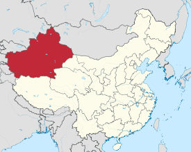
Origin of name 新 xīn – new
疆 jiāng – frontier
"new frontier"Administration type Autonomous region Capital Ürümqi Largest city Ürümqi CPC Ctte Secretary Zhang Chunxian (张春贤) Chairman Nur Bekri (نۇر بەكرى or 努尔•白克力) Area 1,660,001 km2 (640,930 sq mi) (1st) - Latitude 35° 14' to 49° 11' N - Longitude 073° 30' to 096° 23' E [1] Population (2010)
- Density21,813,334 (25th)
13 /km2 (34 /sq mi) (29th)GDP (2010)
- per capitaCNY 541.2 billion (US$80.04 billion) (25th)
CNY 19,798 (US $3,038) (21st)HDI (2008) 0.774 (medium) (21st) Ethnic composition Uyghur – 45%
Han – 41%
Kazakh – 7%
Hui – 5%
Kyrgyz – 0.9%
Mongol – 0.8%
Dongxiang – 0.3%
Pamiris – 0.2%
Xibe – 0.2%Spoken dialects Prefectural level 14 divisions County level 99 divisions Township level* 1005 divisions ISO 3166-2 CN-65 Official website
http://www.xinjiang.gov.cn (Various languages)Source for population and GDP data: 《中国统计年鉴—2005》 China Statistical Yearbook 2005Source for nationalities data:
ISBN 7503747382《2000年人口普查中国民族人口资料》 Tabulation on nationalities of 2000 population census of China*As at December 31, 2004
ISBN 7105054255Template ■ Discussion ■ WikiProject China Xinjiang (Uyghur: شىنجاڭ, ULY: Shinjang; Mandarin pronunciation: [ɕíntɕjɑ́ŋ]; Chinese: 新疆; pinyin: Xīnjiāng; Wade–Giles: Hsin1-chiang1; Postal map spelling: Sinkiang) is an autonomous region (Xinjiang Uyghur Autonomous Region[2]) of the People's Republic of China. It is the largest Chinese administrative division and spans over 1.6 million km2. Xinjiang borders Russia, Mongolia, Kazakhstan, Kyrgyzstan, Tajikistan, Afghanistan, Pakistan and India, has abundant oil reserves and is China's largest natural gas-producing region.
Xinjiang Chinese 新疆 Transcriptions Hakka - Romanization Sîn-kiông Mandarin - Hanyu Pinyin Xīnjiāng - Wade–Giles Hsin1-chiang1 - Postal Map Sinkiang Min - Hokkien POJ Sin-kiong - Min-dong BUC Sĭng-giŏng - Teochew Peng'im Sing-kiang Wu - Romanization sin cian Xinjiang Uyghur Autonomous Region Traditional Chinese 新疆維吾爾自治區 Simplified Chinese 新疆维吾尔自治区 Transcriptions Hakka - Romanization Sîn-kiông Vì-ngâ-ngì Tshṳ-tshṳ-khî Mandarin - Hanyu Pinyin Xīnjiāng Wéiwú'ěr Zìzhìqū Min - Hokkien POJ Sin-kiong Ûi-ngô͘-ní Chū-tī-khu - Min-dong BUC Sĭng-giŏng Mì-ngù-ī Cê̤ṳ-dê-kṳ̆ - Teochew Peng'im Sing-kiang Jûi-û-jéu Tsĕu-tī-khu Wu - Romanization sin cian vi ng el zy zy chiu Xinjiang was previously known as Xiyu (西域) or Qurighar (غەربىي دىيار), meaning Western Region, under the Han Dynasty, which drove the Xiongnu empire out of the region in 60 BC. This was in an effort to secure the profitable Silk Road.[3] The name "Xinjiang", which literally means "New Frontier" or "New Border", was given during the Qing Dynasty.[4] It is home to a number of different ethnic groups including the Uyghur, Han, Kazakh, Hui, Kyrgyz and Mongol. Older English-language reference works often refer to the area as Chinese Turkestan,[5] Sinkiang and East Turkestan. Xinjiang is divided into the Dzungarian Basin in the north and the Tarim Basin in the south by a mountain range. Only about 4.3% of Xinjiang's land area is fit for human habitation.[6]
With a documented history of at least 2,500 years, there have been a succession of different peoples and empires vying for control over all or parts of these territories. Prior to the 21st century, all or part of the region has been ruled or influenced at various times by the Tocharians, Yuezhi, Xiongnu Empire, Kushan Empire, Han Empire, Former Liang, Former Qin, Later Liang, Western Liáng, Tang Dynasty, Uyghur Khaganate, Kara-Khanid Khanate, Mongol Empire (Yuan Dynasty), Dzungar Khanate, Qing Dynasty, Republic of China and since 1949 People's Republic of China.
Contents
Names
Older English-language reference works often refer to the area as Chinese Turkestan,[5] Sinkiang, East Turkestan, or Uyghuristan. More specifically, at times, the term East Turkestan only referred to the Xinjiang area south of the Tian Shan mountains, North of the Tian Shan was called Dzungaria (Zungaria).[7]
The general region of Xinjiang has been known by many other names in earlier times including: 西域 (Mandarin: xiyu) = 'Western Regions',[8] Chinese Tartary, High Tartary, East Chagatay, Mugholistan, Kashgaria, Altishahr ('the six cities' of the Tarim), Little Bokhara and Serindia.[9]
The name "Xinjiang", which literally means "New Frontier", was given during the Qing Dynasty.[4] In the early part of the Qing Dynasty, the name "Xinjiang" was used to refer to any area of a former Chinese dynasty that had been previously lost but was regained by the Qing—for example, part of present-day Xinjiang was known as "Western Region xinjiang", present-day Jinchuan County was known as "Jinchuan xinjiang", etc. After 1821, the Qing changed the names of the other regained regions, and "Xinjiang" became the name specifically of present-day Xinjiang.[10]
Description
Xinjiang is a large, sparsely populated area, spanning over 1.6 million km2 (comparable in size to Iran or Western Europe), which takes up about one sixth of the country's territory. Xinjiang borders the Tibet Autonomous Region and India's Leh District to the south and Qinghai and Gansu provinces to the southeast, Mongolia to the east, Russia to the north, and Kazakhstan, Kyrgyzstan, Tajikistan, Afghanistan, Pakistan and India to the west.
The east-west chain of the Tian Shan Mountains separate Dzungaria in the north from the Tarim Basin in the south. Dzungaria is dry steppe. The Tarim Basin is desert surrounded by oases. In the east is the Turpan Depression. In the west, the Tian Shan split, forming the Ili River valley.
History
Main article: History of XinjiangEarly history
According to J.P. Mallory, the Chinese sources describe the existence of "white people with lightish hair" or the Bai people in the Shan Hai Jing, who lived beyond their northwestern border.[11]
The well-preserved Tarim mummies with Caucasoid features, often with reddish or blond hair, today displayed at the Ürümqi Museum and dated to the 3rd century BC, have been found in precisely the same area of the Tarim Basin.[12] Various nomadic tribes, such as the Yuezhi were part of the large migration of Indo-European speaking peoples who were settled in eastern Central Asia (possibly as far as Gansu) at that time. The Ordos culture situated at northern China east of the Yuezhi, are another example.
Nomadic cultures such as the Yuezhi are documented in the area of Xinjiang where the first known reference to the Yuezhi was made in 645 BC by the Chinese Guan Zhong in his Guanzi 管子(Guanzi Essays: 73: 78: 80: 81). He described the Yuzhi 禺氏, or Niuzhi 牛氏, as a people from the north-west who supplied jade to the Chinese from the nearby mountains of Yuzhi 禺氏 at Gansu.[13] The supply of jade[14] from the Tarim Basin from ancient times is indeed well documented archaeologically: "It is well known that ancient Chinese rulers had a strong attachment to jade. All of the jade items excavated from the tomb of Fuhao of the Shang dynasty, more than 750 pieces, were from Khotan in modern Xinjiang. As early as the mid-first millennium BC the Yuezhi engaged in the jade trade, of which the major consumers were the rulers of agricultural China.".[15]
The nomadic tribes of the Yuezhi are also documented in detail in Chinese historical accounts, in particular the 2nd-1st century BC "Records of the Great Historian", or Shiji, by Sima Qian, which state that they "were flourishing" but regularly in conflict with the neighboring tribe of the Xiongnu to the northeast. According to these accounts:
The Yuezhi originally lived in the area between the Qilian or Heavenly Mountains (Tian Shan) and Dunhuang, but after they were defeated by the Xiongnu they moved far away to the west, beyond Dayuan, where they attacked and conquered the people of Daxia and set up the court of their king on the northern bank of the Gui [= Oxus] River. A small number of their people who were unable to make the journey west sought refuge among the Qiang barbarians in the Southern Mountains, where they are known as the Lesser Yuezhi.[16]
Xiongnu Empire
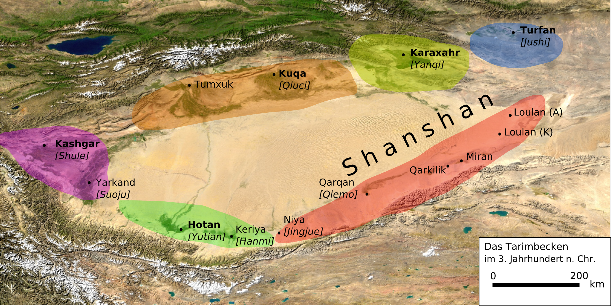
Main article: Xiongnu The Tarim Basin in the 3rd century CE.
Traversed by the Northern Silk Road,[17] Western Regions or Xinjiang is the Chinese name for the Tarim and Dzungaria regions of what is now northwest China. At the beginning of the Han Dynasty (206 BC – AD 220), the region was subservient to the Xiongnu, a powerful nomadic people based in modern Mongolia.
Han Dynasty
Main article: Protectorate of the Western RegionsSee also: Han DynastyIn the 2nd century BC, Han China sent Zhang Qian as an envoy to the states in the region, beginning several decades of struggle between the Xiongnu and Han China over dominance of the region, eventually ending in Chinese success. In 60 BC Han China established the Protectorate of the Western Regions (西域都護府) at Wulei (烏壘; near modern Luntai) to oversee the entire region as far west as the Pamir.
During the usurpation of Wang Mang in China, the dependent states of the protectorate rebelled and returned to domination in AD 13. Over the next century, Han China conducted several expeditions into the region, re-establishing the protectorate from 74 to 76, 91 to 107, and from 123 onward. This region was also ruled by Kushan Empire between 114 and 168. After the fall of the Han Dynasty, the protectorate continued to be maintained by Cao Wei (until 265) and the Western Jin Dynasty (from 265 onwards).

A summary of Classical sources on the Seres (Greek and Roman name of Xinjiang) (essentially Pliny and Ptolemy) gives the following account:
The region of the Seres is a vast and populous country, touching on the east the Ocean and the limits of the habitable world, and extending west nearly to Imaus and the confines of Bactria. The people are civilised men, of mild, just, and frugal temper, eschewing collisions with their neighbours, and even shy of close intercourse, but not averse to dispose of their own products, of which raw silk is the staple, but which include also silk stuffs, furs, and iron of remarkable quality.
— Henry Yule, "Cathey and the way thither"
Ptolemy had quite good information on Xinjiang, taken from three different accounts.[18]
A succession of peoples
See also: Sixteen KingdomsThe Western Jin Dynasty succumbed to successive waves of invasions by nomads from the north at the beginning of the 4th century. The short-lived kingdoms (both Han and non-Han) that ruled northwestern China one after the other, including Former Liang, Former Qin, Later Liang, and Western Liáng, all attempted to maintain the protectorate, with varying extents and degrees of success. After the final reunification of northern China under the Northern Wei empire, its protectorate controlled what is now the southeastern third of Xinjiang. Local states such as Shule, Yutian, Guizi and Qiemo controlled the western half, while the central region around Turpan was controlled by Gaochang, remnants of a state (Northern Liang) that once ruled part of what is now Gansu province in northwestern China.
Tang Dynasty
Main article: Anxi ProtectorateSee also: Tang DynastyThe Tang Dynasty was established in 618, and would prove to be one of the most expansionist dynasties in Chinese history. Starting from the 620's and 630's, Tang China conducted a series of expeditions against the Tujue, eventually forcing the surrender of the western Tujue in 657. Xinjiang was placed under the Anxi Protectorate (安西都護府; "Protectorate Pacifying the West"). The protectorate did not outlast the decline of Tang China in the 8th century.
Uyghur Khaganate and Kara-Khanid Khanate
See also: Uyghur Khaganate and Kara-Khanid KhanateDuring the devastating Anshi Rebellion, Tibet invaded Tang China on a wide front from Xinjiang to Yunnan, occupied the Tang capital Chang'an in 763 for 16 days, and taking control of southern Xinjiang by the end of the century. At the same time, the Uyghur Khaganate took control of northern Xinjiang, as well as much of the rest of Central Asia, including Mongolia.
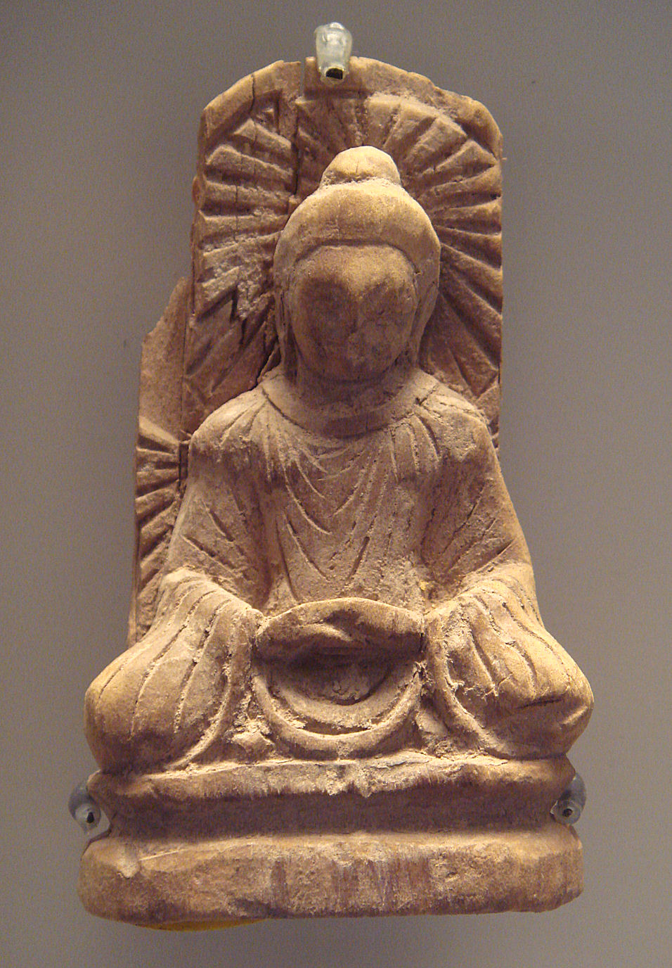
 Blue-eyed Central Asian (Tocharian?) and East-Asian Buddhist monks, Bezeklik, Eastern Tarim Basin, 9th-10th centuries CE.[19]
As both Tibet and the Uyghur Khaganate declined in the mid-9th century, the Kara-Khanid Khanate, which arose from a confederation of Turkic tribes scattered after the destruction of the Uyghur empire, took control of western Xinjiang in the 10th century and the 11th century. Meanwhile, after the Uyghur khanate in Mongolia had been smashed by the Kirghiz, branches of the Uyghurs established themselves in the area around today's Turpan and Urumchi in 840. This Uyghur state would remain in eastern Xinjiang until the 13th century, though it would be subject to various overlords during that time. Some scholars have argued, that the Kara-Khanids were likewise "Uyghurs," as some of the components in the Kara-Khanid federation were likewise from the ruling clans of the Uyghur empire. The Kara-Khanids converted to Islam, whereas the Uyghur state in eastern Xinjiang remained Manicheaean, while tolerating Buddhism and Christianity.
In 1132, remnants of the Khitan Empire from Manchuria entered Xinjiang, fleeing the onslaught of the Jurchens into north China. They established an exile regime, the Kara-Khitan Khanate, which became overlord over both Kara-Khanid-held and Uyghur-held parts of the Tarim Basin for the next century.
Mongol Empire and Yuan Dynasty
See also: Yuan DynastyAfter Genghis Khan had unified Mongolia and began his advance west, the Uyghur state in the Turpan-Urumchi area offered its allegiance to the Mongols in 1209, contributing taxes and troops to the Mongol imperial effort. In return, the Uyghur rulers retained control of their kingdom. By contrast, Genghis Khan's Mongol Empire conquered the Kara-Khitan in 1218. Because the Kara-Khitan had persecuted Islam, the Mongols were met as liberators in the Kashgar area. During the era of the Mongol Empire, the Qubilaid Yuan Dynasty vied for rule with the Chagatai Khanate in the area, with the latter taking control of most of this region. After the break-up of the Chagatai Khanate into smaller khanates in the mid-14th century, the region fractured and was ruled by various different Persianized Mongol Khans simultaneously, including the ones of Mogholistan (with the assistance of the local Dughlat Emirs), Uigurstan (later Turpan) and Kashgaria. These leaders engaged in numerous wars with each other and both the Timurids of Transoxania to the West and the Western Mongols to the East, the successor Chagatai regime based in Mongolia and in China. Although there were high points in Persian culture reached (e.g. the Dughlat historian Hamid-mirza), succession crises and internal divisions (Kashgaria split in two for centuries) meant that this region almost completely fades from the history books during the 16th and 17th centuries.[20] In the 17th century, the Mongolian Dzungars established an empire over much of the region.
Dzungar Empire
See also: Dzungar KhanateThe Mongolian Dzungar (also Jungar, Zunghar or Zungar; Mongolian: Зүүнгар Züüngar) is the collective identity of several Oirat tribes that formed and maintained one of the last nomadic empires. The Dzungar Khanate covered the area called Dzungaria and stretched from the west end of the Great Wall of China to present-day eastern Kazakhstan, and from present-day northern Kyrgyzstan to southern Siberia (most of this area is renamed to Xinjiang after the fall of the Dzungar Empire). It existed from the early 17th century to the mid-18th century.
Qing Dynasty
See also: Qing DynastyThe Manchu Qing dynasty gained control over eastern Xinjiang as a result of a long struggle with the Zunghars (Dzungars) that began in the 17th century. In 1755, with the help of the Oirat nobel Amursana, the Qing attacked Ghulja, and captured the Zunghar khan. After Amursana's request to be declared Zunghar Khan went unanswered, he led a revolt against the Qing. Over the next two years, Qing armies destroyed the remnants of the Zunghar khanate and colonised parts of Xinjiang with Han and Hui Chinese.[22]
The Dzungars suffered important loss in the brutal campaigns and the smallpox epidemic at the time. One writer, Wei Yuan, described the resulting desolation in what is now northern Xinjiang as: "an empty plain for several thousand li, with no Oirat yurt except those surrendered."[23] It has been estimated that 80% of the 600,000 or more Zunghars were destroyed by a combination of disease and warfare[24], and it took generations for it to recover.[25]
After the defeat of the Dzungars, the Qing made members of a clan of sufi shaykhs known as the Khojas, rulers in the western Tarim Basin, south of the Tianshan Mts. In 1758–59, however, rebellions against this arrangement broke out both north and south of the Tian Shan mountains. The Qing was thus forced, contrary to its initial intent, to establish a form of direct military rule over both Zungharia (northern Xinjiang) and the Tarim Basin (southern Xinjiang). The Manchus put the whole region under the rule of a General of Ili (Chinese: 伊犁将军), headquartered at the fort of Huiyuan (the so-called "Manchu Kuldja", or Yili), 30 km west of Ghulja (Yining).
After 1759 state farms were established, "especially in the vicinity of Urumchi, where there was fertile, well-watered land and few people." From 1760 to 1830 more state farms were opened and the Chinese population in Xinjiang grew rapidly to about 155,000.[26]
Jahangir Khoja invaded Kashgar in 1826 and the Khanate of Kokand conducted raids on Xinjiang. A large slave trade existed in Xinjiang during this time.
By the mid-19th century, the Russian Empire was encroaching upon Qing China along its entire northern frontier. The Opium Wars and Taiping and other rebellion's in China proper had severely restricted the dynasty's ability to maintain its garrisons in distant Xinjiang. In 1864 both Chinese Muslims (Hui) and Uyghurs rebelled in Xinjiang cities, following an on-going Chinese Muslim Rebellion in Gansu and Shaanxi provinces further east. Because all of the non-Muslim population in Xinjiang were regarded as infidels and enemies to be exterminated, the rebellion resulted in incredible cruelties whenever the towns held by the Qing force were taken.[27] Yaqub Beg's Turkic Muslim troops also committed massacres upon the Chinese Muslims.[28] In 1865, Yaqub Beg, a warlord from the neighbouring Khanate of Kokand, entered Xinjiang via Kashgar, and conquered nearly all of Xinjiang over the next six years.[29] At the Battle of Ürümqi (1870) Yaqub Beg's Turkic forces, allied with a Han chinese militia, attacked and besieged Chinese muslim forces in Urumqi. In 1871, Russia took advantage of the chaotic situation and seized the rich Ili River valley, including Gulja. By then, Qing China held onto only a few strongholds, including Tacheng.
Yaqub Beg's rule lasted until General Zuo Zongtang (also known as General Tso) reconquered the region between 1875 and 1877 for Qing China. In 1881, Qing China recovered the Gulja region through diplomatic negotiations (Treaty of Saint Petersburg (1881)).
In 1884, (1882 according to some sources),[30] Qing China established Xinjiang ("new frontier") as a province, formally applying onto it the political system of China proper, and dropping the old name of Huijiang or 'Muslimland'.[31][32]
Republican era
 Flag of the First East Turkestan Republic, which was a short-lived attempt at independence of the lands around Kashgar.
In 1912, the Qing Dynasty was replaced by the Republic of China. Yuan Dahua, the last Qing governor of Xinjiang, fled. One of his subordinates, Yang Zengxin (杨增新), took control of the province and acceded in name to the Republic of China in March of the same year. Through Machiavellian politics and clever balancing of mixed ethnic constituencies, Yang maintained control over Xinjiang until his assassination in 1928.[33]
The Kumul Rebellion and other rebellions arose against his successor Jin Shuren (金树仁) in the early 1930s throughout Xinjiang, involving Uyghurs, other Turkic groups, and Hui (Muslim) Chinese. Jin drafted White Russians to crush the revolt. In the Kashgar region on 12 November 1933, the short-lived self-proclaimed East Turkistan Republic was declared, after some debate over whether the proposed independent state should be called "East Turkestan" or "Uyghuristan."[34][35] The region claimed by the ETR in theory encompassed Kashgar, Khotan and Aqsu prefectures in southwestern Xinjiang.[36] The Chinese Muslim Kuomintang 36th Division (National Revolutionary Army) destroyed the army of the First East Turkestan Republic at the Battle of Kashgar (1934), bringing the Republic to an end after the Chinese Muslims executed the two Emirs of the Republic, Abdullah Bughra and Nur Ahmad Jan Bughra. The Soviet Union invaded the province in the Soviet Invasion of Xinjiang. In the Xinjiang War (1937), the entire province was brought under the control of northeast Chinese warlord Sheng Shicai (盛世才), who ruled Xinjiang for the next decade with close support from the Soviet Union, many of whose ethnic and security policies Sheng instituted in Xinjiang. The Soviet Union maintained a military base in Xinjiang and had several military and economic advisors deployed in the region. Sheng invited a group of Chinese Communists to Xinjiang, including Mao Zedong's brother Mao Zemin, but in 1943, fearing a conspiracy, Sheng executed them all, including Mao Zemin.
 The Soviet-backed Second East Turkestan Republic existed in what is now the Ili, Tarbagatay and Altay Districts of Xinjiang
1949-present
A Second East Turkistan Republic (2nd ETR, also known as the Three Districts Revolution) existed from 1944 to 1949 with Soviet support in what is now Ili Kazakh Autonomous Prefecture (Ili, Tarbagatay and Altay Districts) in northern Xinjiang.[34] The Second East Turkistan Republic came to an end when the People's Liberation Army entered Xinjiang in 1949.[35] Also, five ETR leaders, who would negotiate the final status of East Turkistan with the Chinese, died in an air crash in 1949 in Kazakh airspace.[37]
The Chinese Muslim General Bai Chongxi, advocated swamping Xinjiang with disbanded Chinese soldiers to prevent the Soviet union from seizing control during this time.[38]
According to the PRC interpretation, the 2nd ETR was Xinjiang's revolution, a positive part of the communist revolution in China; the 2nd ETR acceded to and welcomed the PLA when it entered Xinjiang, a process known as the Peaceful Liberation of Xinjiang. However, independence advocates view the ETR as an effort to establish an independent state, and the subsequent PLA entry as an invasion.[citation needed]
The autonomous region of the PRC was established on 1 October 1955, replacing the province.[35] The PRC's first nuclear test was carried out at Lop Nur, Xinjiang, on 16 October 1964. Although reports in western media report that between 100,000 and 200,000 people may have been killed in the testing,[39] the Lop Nur area has not been permanently inhabited since about 1920[40] and PRC media dispute these numbers, but without providing an alternate number.[41]
During the Great Chinese Famine (1958–1961), Xinjiang experienced a great emigration of residents both to the Soviet Union and to East China. After a number of student demonstrations in the 1980s, the Baren Township riot of April 1990 led to more than 20 deaths.[42] 1997 saw the Ghulja Incident and Urumqi bus bombs,[43] while police continue to battle with religious separatists from the East Turkestan Islamic Movement.
Han Youwen, a Salar General, once served as Vice Chairman of Xinjiang.
In recent years Xinjiang has been a focal point of ethnic and other tensions.[44][45]
Recent incidents include the 2007 Xinjiang raid,[46] a thwarted 2008 suicide bombing attempt on a China Southern Airlines flight,[47] and the 2008 Xinjiang attack which resulted in the deaths of sixteen police officers four days before the Beijing Olympics.[48][49] Further incidents include the July 2009 Ürümqi riots, the September 2009 Xinjiang unrest, and the 2010 Aksu bombing that led to the trials of 376 people.[50]
From 1949 to 2001, education has expanded greatly in the region, with 6,221 primary schools up from 1,335; 1,929 middle schools up from 9, and institutions of higher learning at 21, up from 1. The illiteracy rate for young and middle-aged people has decreased to less than 2%. Agricultural science has made inroads into the region, as well as innovative methods of road construction in the desert. Culturally, Xinjiang maintains 81 public libraries and 23 museums, compared to none of each in 1949, and Xinjiang has 98 newspapers in 44 languages, up from 4 newspapers in 1952. According to official statistics, the ratios of doctors, medical workers, medical clinics, and hospital beds to people surpass the national average, and immunization rates have reached 85%.[51]
Subdivisions
Main article: List of administrative divisions of XinjiangXinjiang is divided into two prefecture-level cities, seven prefectures, and five autonomous prefectures for Mongol, Kirgiz, Kazakh and Hui minorities . (Two of the seven prefectures are in turn part of Ili, an autonomous prefecture.) These are then divided into eleven districts, twenty county-level cities, sixty-two counties, and six autonomous counties. Four of the county-level cities do not belong to any prefecture, and are de facto administered by the Xinjiang Production and Construction Corps. Sub-level divisions of the Xinjiang Uyghur Autonomous Region is shown in the picture to the right, and described in the table below:
Sub-level divisions of the Xinjiang Uyghur Autonomous Region[52] 
Map # Conventional[53] Administrative Seat Uyghur
(kona yezik̡)Uyghur Latin
(yengi yezik̡)Hanzi Hanyu pinyin —Sub-Provincial Autonomous Prefecture — 11 Ili (Kazakh) Yining ئىلى قازاق ئاپتونوم ئوبلاستى Ili QazaQ Aptonom Oblasti 伊犁哈萨克自治州 Yīlí Hāsàkè Zìzhìzhōu — Prefecture-level city — 4 Karamay Karamay District قاراماي شەھرى Qaramay Shehri 克拉玛依市 Kèlāmǎyī Shì 8 Ürümqi Tianshan District ئۈرۈمچى شەھرى Ürümchi Shehri 乌鲁木齐市 Wūlǔmùqí Shì — Prefecture — 1 Altay
subordinate to Ili (Kazakh)Altay (city) ئالتاي ۋىلايىتى Altay Wilayiti 阿勒泰地区 Ālètài Dìqū 3 Tacheng
subordinate to Ili (Kazakh)Tacheng (city) تارباغاتاي ۋىلايىتى Tarbaghatay Wilayiti 塔城地区 Tǎchéng Dìqū 9 Turpan Turpan (city) تۇرپان ۋىلايىتى Turpan Wilayiti 吐鲁番地区 Tǔlǔfān Dìqū 10 Hami Hami (city) قۇمۇل ۋىلايىتى Qumul Wilayiti 哈密地区 Hāmì Dìqū 13 Kashgar Kashgar (city) قەشقەر ۋىلايىتى Qeshqer Wilayiti 喀什地区 Kāshí Dìqū 15 Aksu Aksu (city) ئاقسۇ ۋىلايىتى Aqsu Wilayiti 阿克苏地区 Ākèsū Dìqū 17 Hotan Hotan (city) خوتەن ۋىلايىتى Xoten Wilayiti 和田地区 Hétián Dìqū — Autonomous prefectures — 2 Bortala (Mongol) Bole بۆرتالا موڭغۇل ئاپتونوم ئوبلاستى Börtala Mongghul Aptonom Oblasti 博尔塔拉蒙古自治州 Bó'ěrtǎlā Měnggǔ Zìzhìzhōu 6 Changji (Hui) Changji (city) سانجى خۇيزۇ ئاپتونوم ئوبلاستى Sanji Xuyzu Aptonom Oblasti 昌吉回族自治州 Chāngjí Huízú Zìzhìzhōu 12 Kizilsu (Kirgiz) Artux قىزىلسۇ قىرغىز ئاپتونوم ئوبلاستى Qizilsu Qirghiz Aptonom Oblasti 克孜勒苏柯尔克孜自治州 Kèzīlèsū Kē'ěrkèzī Zìzhìzhōu 18 Bayingolin (Mongol) Korla بايىنغولىن موڭغۇل ئاپتونوم ئوبلاستى Bayingholin Mongghul Aptonom Oblasti 巴音郭楞蒙古自治州 Bāyīnguōlèng Měnggǔ Zìzhìzhōu — Sub-prefecture-level city — 5 Shihezi
(Administered by XPCC)Shihezi شىخەنزە شەھرى Shixenze Shehri 石河子市 Shíhézǐ Shì 7 Wujiaqu
(Administered by XPCC)Wujiaqu ئۇجاچۇ شەھرى Wujachu Shehri 五家渠市 Wǔjiāqú Shì 14 Tumxuk
(Administered by XPCC)Tumxuk تۇمشۇق شەھرى Tumshuq Shehri 图木舒克市 Túmùshūkè Shì 16 Aral
(Administered by XPCC)Aral ئارال شەھرى Aral Shehri 阿拉尔市 Ālā'ěr Shì Geography and geology
 Close to Karakoram Highway in Xinjiang.
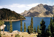 Tianchi lake.
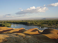 A river in Burqin County.
Xinjiang is the largest political subdivision of China—it accounts for more than one sixth of China's total territory and a quarter of its boundary length. It is split by the Tian Shan mountain range (Uyghur: تەڭرى تاغ, ULY: Tengri Tagh), which divides it into two large basins: the Dzungarian Basin in the north, and the Tarim Basin in the south. Much of the Tarim Basin is dominated by the Taklimakan Desert. The lowest point in Xinjiang, and in the entire PRC, is the Turpan Depression, 155 metres below sea level; its highest point is the mountain K2, 8611 metres above sea level, on the border with Pakistan. Other mountain ranges include the Pamir Mountains in the southeast, the Karakoram in the south, and the Altai Mountains in the north.
Most of Xinjiang is young geologically, having been formed from the collision of the Indian plate with the Eurasian plate, forming the Tian Shan, Kunlun Shan, and Pamir mountain ranges. Consequently, Xinjiang is a major earthquake zone. Older geological formations occur principally in the far north where the Junggar Block is geologically part of Kazakhstan, and in the east which is part of the North China Craton.
Xinjiang has within its borders the point of land remotest from the sea, the so-called Eurasian pole of inaccessibility (46°16.8′N 86°40.2′E / 46.28°N 86.67°E) in the Dzoosotoyn Elisen Desert, 1,645 miles (2648 km) from the nearest coastline (straight-line distance).
The Tian Shan mountain range marks the Xinjiang-Kyrgyzstan border at the Torugart Pass (3752 m). The Karakorum highway (KKH) links Islamabad, Pakistan with Kashgar over the Khunjerab Pass.
Rivers include the Tarim River.
Time
Technically, people are supposed to set their clock to the uniform time - Beijing time throughout China, but due to Xinjiang's westernmost position in China, some local residents follow their own unofficial time - Xinjiang time [2](Xinjiang time corresponds to the UTC+6 time zone, Beijing time corresponds to UTC+8). Thus, for instance, a movie that opens at 9:00 PM Beijing time, opens at 7:00 Xinjiang time.
Deserts
Deserts include:
Major cities
Climate
Generally, a semi-arid or desert climate (Köppen BSk or BWk, respectively) prevails in Xinjiang. The region is marked by great seasonal differences in temperature.
Politics
List of Secretaries of the CPC Xinjiang Committee
- Wang Zhen (王震): 1949–1952
- Wang Enmao (王恩茂): 1952–1967
- Long Shujin (龙书金): 1970–1972
- Saifuddin Azizi (赛福鼎•艾则孜): 1972–1978
- Wang Feng (汪锋): 1978–1981
- Wang Enmao (王恩茂): 1981–1985
- Song Hanliang (宋汉良): 1985–1994
- Wang Lequan (王乐泉): 1994−2010
- Zhang Chunxian (张春贤): 2010−incumbent
List of Chairmen of Xinjiang Government
- Saifuddin Azizi (赛福鼎•艾则孜): 1955–1967
- Long Shujin (龙书金): 1968–1972
- Saifuddin Azizi: 1972–1978
- Wang Feng (汪锋): 1978–1979
- Ismail Amet (司马义•艾买提): 1979–1985
- Tomur Dawamat (铁木尔•达瓦买提): 1985–1993
- Abdul'ahat Abdulrixit (阿不来提•阿不都热西提): 1993–2003
- Ismail Tiliwaldi (司马义•铁力瓦尔地): 2003–2007
- Nur Bekri (努尔•白克力): 2007−incumbent
Economy
Xinjiang is known for its fruits and produce, including grapes, melons, pears, cotton, wheat, silk, walnuts and sheep. Xinjiang also has large deposits of minerals and oil.
In the late 19th century the region was noted for producing salt, soda, borax, gold, jade and coal.[54]
Xinjiang's nominal GDP was approximately 220 billion RMB (28 billion USD) in 2004, and increased to 427.4 billion RMB (62.6 billion USD) in 2009, due to exploration of the regions abundant reserves of coal, crude oil and natural and the China Western Development policy introduced by the State Council to boost economic development in Western China[55]. Its per capita GDP for 2009 was 19,798 RMB (2,898 USD), with a growth rate of 1.7%[56]. Southern Xinjiang, with 95 per cent non-Han population has an average per capita income half that of Xinjiang as a whole.[57]
The oil and gas extraction industry in Aksu and Karamay is booming, with the West–East Gas Pipeline connecting to Shanghai. The oil and petrochemical sector account for 60% of Xinjiang's local economy.[58]
Xinjiang's exports amounted to 19.3 billion USD, while imports turned out to be 2.9 billion USD in 2008. Most of the overall import/export volume in Xinjiang was directed to and from Kazakhstan through Ala Pass. China's first border free trade zone (Horgos Free Trade Zone) was located at the Xinjiang-Kazakhstan border city of Horgos.[59] Horgos is the largest "land port" in China's western region and it has easy access to the Central Asian market. Xinjiang also opened its second border trade market to Kazakhstan in March 2006, the Jeminay Border Trade Zone.[60]
In July 2010 China Daily reported that:
Local governments in China's 19 provinces and municipalities, including Beijing, Shanghai, Guangdong, Zhejiang and Liaoning, are engaged in the commitment of "pairing assistance" support projects in Xinjiang to promote the development of agriculture, industry, technology, education and health services in the region.[61]
Economic and Technological Development Zones
- Bole Border Economic Cooperation Area[62]
- Shihezi Border Economic Cooperation Area[63]
- Tacheng Border Economic Cooperation Area[64]
- Urumqi Economic & Technological Development Zone
Urumqi Economic and Technological Development Zone is located northwest of Urumqi. It was approved in 1994 by the State Council as a national level economic and technological development zones. It is located 1.5 km away from the Urumqi International Airport, 2 km from the North Railway Station, and 10 km from the city center. Wu Chang Expressway and 312 National Road passes through the Zone. The development has unique resources and geographical advantages. Xinjiang's vast land, rich in various resources, borders 8 countries. As the leading economic zone, it brings together the resources of Xinjiang's industrial development, capital, technology, information, personnel and other factors of production.[65]
- Urumqi Export Processing Zone
Urumuqi Export Processing Zone is located in Urumuqi Economic and Technology Development Zone. It was established in 2007 as a state-level export processing zone.[66]
- Urumqi New & Hi-Tech Industrial Development Zone
Urumuqi Hi-Tech Industrial Development Zone was established in 1992, and it is the only high-tech development zone in Xinjiang, China. There are more than 3470 enterprises in the zone, of which 23 are Fortune 500 companies. It has a planned area of 9.8 square kilometres, and it is divided into 4 zones. There are future plans to expand the zone.[67]
- Yining Border Economic Cooperation Area[68]
Demographics
 The languages of Xinjang.
 Uyghur majorityHan majorityKazakh majority
The earliest Tarim mummies, dated to 1800 BC, are of a Caucasoid physical type.[69] East Asian migrants arrived in the eastern portions of the Tarim Basin about 3,000 years ago, while the Uighur peoples arrived after the collapse of the Orkon Uighur Kingdom, based in modern-day Mongolia, around the year 842.[70][71]
Muslim Turkic peoples in Xinjiang include Uyghurs, Uzbeks, Kyrgyz, Tatars and the Kazakhs; Muslim Iranian peoples include Pamiris and the Sarikolis[disambiguation needed
 ]/Wakhis (often conflated as Pamiris); and Muslim Sino-Tibetan peoples such as the Hui. Other PRC ethnic groups in the region include Han, Mongols (Oirats, Dagur, Dongxiang), Russians, Xibes, and Manchus. As of 1945, there were up to 70,000 persons of Russian origin living in Xinjiang.[72]
The Han Chinese of Xinjiang arrived at different times, from different directions and social backgrounds: they are descendants of criminals and officials who had been exiled from China proper during the second half of the eighteenth and first half of the 19th centuries; descendants of families of military and civil officers from Hunan, Yunnan, Gansu and Manchuria; descendants of merchants from Shanxi, Tianjin, Hubei and Hunan and descendants of peasants who started immigrating into the region in 1776.[73]
Some Uighur scholars claim descent from both the Turkic Uighurs and the pre-Turkic Tocharians (or Tokharians, whose language was Indo-European), and relatively fair-skin, hair and eyes, as well as other so-called 'Caucasoid' physical traits, are not uncommon among them. In general Uyghurs resemble those peoples who live around them in Afghanistan, Kyrgyzstan, Uzbekistan, Kazakhstan, and Pakistan. In 2002, there were 9,632,600 males (growth rate of 1.0%) and 9,419,300 females (growth rate of 2.2%). The population overall growth rate was 10.9‰, with 16.3‰ of birth rate and 5.4‰ mortality rate.
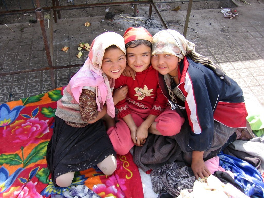
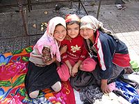 Three Uyghur girls at a Sunday market in the oasis city Khotan
At the start of the 19th century, forty years after the Qing reconquest, there were something like 155,000 Han and Hui Chinese in northern Xinjiang, and somewhat more than twice that number of Uyghurs in southern Xinjiang.[74] A census of the time tabulated ethnic shares of the population as 60% Turkic and 30% Han.[75] Before 1831 only a few hundred Chinese merchants lived in southern Xinjiang oases(Tarim Basin), and only a few Uyghurs lived in northern Xinjiang (Dzungaria).[76] After 1831 the Qing permitted and encouraged Han Chinese migration into the Tarim basin in southern Xinjiang, although with very little success, and stationed permanent troops on the land there as well.[77] Political killings and expulsions of non Uyghur populations in the uprisings of the 1860s[77] and 1930s saw them experience a sharp decline as a percentage of the total population[78] though they rose once again in the periods of stability following 1880 (which saw Xinjiang increase its population from 1.2 million)[79][80] and 1949. From a low of 7% in 1953, the Han began to return to Xinjiang between then and 1964, where they comprised 33% of the population (54% Uyghur), similarly to Qing times. A decade later, at the beginning of the Chinese economic reform in 1978, the demographic balance was 46% Uyghur and 40% Han;[75] this has not changed drastically until the last census in 2000, with the Uyghur population reduced to 42%.[81] Military personnel are not counted and national minorities are undercounted in the Chinese census, as in most censuses.[82] While some of the shift has be attributed to an increased Han presence,[83] Uyghurs have also emigrated to other parts of China, where their numbers have increased steadily. Uyghur independence activists claim that the Han population will dilute the Uyghur character of the region, but the Han and Hui Chinese mostly live in northern Xinjiang Dzungaria, and are separated from areas of historical Uyghur dominance south of the Tian Shan mountains(southwestern Xinjiang), where Uyghurs account for about 90% of the population.[84]
In general, Uyghurs are the majority in southwestern Xinjiang, including the prefectures of Kashgar, Khotan, Kizilsu, and Aksu(about 80% of Xinjiang's Uyghurs live in those four prefectures), as well as Turpan prefecture in eastern Xinjiang. Han are the majority in eastern and northern Xinjiang(Dzungaria), including the cities of Urumqi, Karamay, Shihezi and the prefectures of Changjyi, Bortala, Bayin'gholin, Ili (especially the cities of Kuitun), and Kumul. Kazakhs are mostly concentrated in Ili prefecture in northern Xinjiang. Kazaks are the majority in the northernmost part of Xinjiang.
Ethnic groups in Xinjiang, 2000 census.
Excludes members of the People's Liberation Army in active service.[84]Nationality Population Percentage Uyghur 8,345,622 45.21 Han 7,489,919 40.58 Kazakh 1,245,023 6.74 Hui 839,837 4.55 Kirghiz 158,775 0.86 Mongols, Dongxiangs, Daurs 194,891 1.14 Pamiris 39,493 0.21 Xibe 34,566 0.19 Manchu 19,493 0.11 Tujia 15,787 0.086 Uzbek 12,096 0.066 Russian 8935 0.048 Miao 7006 0.038 Tibetan 6153 0.033 Zhuang 5642 0.031 Tatar 4501 0.024 Salar 3762 0.020 Major ethnic groups in Xinjiang by region, 2000 census.[notes 1][85] Uyghurs Han Kazakhs others Xinjiang 45.2% 40.6% 6.7% 7.5% Ürümqi PLC 12.8% 75.3% 2.3% 9.6% Karamay PLC 13.8% 78.1% 3.7% 4.5% Turpan Prefecture 70.0% 23.3% <0.1% 6.6% Kumul Prefecture 18.4% 68.9% 8.8% 3.9% Changji AP + Wujiaqu DACLC 3.9% 75.1% 8.0% 13.0% Bortala AP 12.5% 67.2% 9.1% 11.1% Bayin'gholin AP 32.7% 57.5% <0.1% 9.7% Aksu Prefecture + Aral DACLC 71.9% 26.6% <0.1% 1.4% Kizilsu AP 64.0% 6.4% <0.1% 29.6% Kashgar Prefecture + Tumushuke DACLC 89.3% 9.2% <0.1% 1.5% Khotan Prefecture 96.4% 3.3% <0.1% 0.2% Ili AP[notes 2] 16.1% 44.4% 25.6% 13.9% - Kuitun DACLC 0.5% 94.6% 1.8% 3.1% - former Ili Prefecture 27.2% 32.4% 22.6% 17.8% - Tacheng Prefecture 4.1% 58.6% 24.2% 13.1% - Altay Prefecture 1.8% 40.9% 51.4% 5.9% Shihezi DACLC 1.2% 94.5% 0.6% 3.7% Religion
Xinjiang is home to several distinct ethnic groups of various religious traditions, with the majority of the region's total population adhering to Islam.[86] Afaq Khoja Mausoleum and Id Kah Mosque in Kashgar are among the most important Islamic sites in Xinjiang. Emin Minaret is another key Islamic site, in Turfan. Bezeklik Thousand Buddha Caves is a major Buddhist site. According to one source, more than 2% of the population are Christians.[87] Action against Christian activity tends to be stricter than in other parts of China.[88]
Media
The Xinjiang Networking Transmission Limited operates the Urumqi People Broadcasting Station and the Xinjiang People Broadcasting Station, broadcasting in Mandarin, Uyghur, Kazakh and Mongolian.
As of 1995[update], there were fifty minority-language newspapers published in Xinjiang, including the Qapqal News, the world's only Xibe-language newspaper.[89] The Xinjiang Economic Daily is considered one of China's most dynamic newspapers.[90]
For a time after the July 2009 riots, authorities placed restrictions on the internet and text messaging, gradually permitting access to websites like Xinhua's,[91] until restoring Internet to the same level as the rest of China on May 14, 2010.[92][93][94]
Sports
Xinjiang is home to the Xinjiang Guanghui Flying Tigers professional basketball team of the Chinese Basketball Association.
The capital, Urumqi, is also home to the Xinjiang University baseball team, an integrated Uyghur and Han group profiled in the documentary film, Diamond in the Dunes.
Transportation
Roads
In 2008, according to the Xinjiang Transportation Network Plan, the government has focused construction on State Road 314, Alar-Hotan Desert Highway, State Road 218, Qingshui River Line-Yining Highway, and State Road 217, as well as other roads.
The construction of the first expressway in the mountainous area of Xinjiang began a new stage in its construction on 24 July 2007. The 56 km highway linking Sayram Lake and Guozi Valley in Northern Xinjiang area had cost 2.39 billion yuan. The expressway is designed to improve the speed of national highway 312 in northern Xinjiang. The project started in August 2006 and several stages have been fully operational since March 2007. Over 3,000 construction workers have been involved. The 700 m-long Guozi Valley Cable Bridge over the expressway is now currently being constructed, with the 24 main pile foundations already completed. Highway 312 national highway Xinjiang section, connects Xinjiang with China's east coast, central and western Asia, plus some parts of Europe. It is a key factor in Xinjiang's economic development. The population it covers is around 40 percent of the overall in Xinjiang, who contribute half of the GDP in the area.
Rail
Xinjiang is linked to the rest of China by a single railway, the Lanzhou-Xinjiang (Lanxin) Railway, which runs from Ürümqi to Lanzhou through the Hexi Corridor in Gansu Province. This railway connects the regional capital, Ürümqi, with Turpan and Hami in eastern Xinjiang. West of Ürümqi, the Northern Xinjiang (Beijiang) Railway runs along the northern footslopes of the Tian Shan range through Changji, Shihezi, Kuytun and Jinghe to the Kazakh border at Alashankou, where it links up with the Turkestan-Siberia Railway of Central Asia. The Lanxin and Beijiang lines form part of the Trans-Eurasian Continental Railway, which extends from Rotterdam, on the North Sea, to Lianyungang, on the East China Sea.
The Second Ürümqi-Jinghe Railway opened in 2009 to supplement rail transport capacity on the Northern Xinjiang Railway between Ürümqi and Jinghe. From Jinghe, the Jinghe-Yining-Horgos Railway heads southwest into the Ili River Valley to Yining, Huocheng, and Khorgos, a second rail border crossing with Kazakhstan. From Kuytun, the Kuytun-Beitun Railway runs north into the Junggar Basin to Karamay and Beitun, near Altay in northern Xinjiang. The Ürümqi-Dzungaria Railway connects Ürümqi with coal fields in the eastern Junggar Basin.
The Southern Xinjiang (Nanjiang) Railway branches off of the Lanxin Line at Turpan and heads southwest along the southern footslopes of the Tian Shan into the Tarim Basin, with stops at Yanqi, Korla, Kuqa, Aksu, Maralbexi (Bachu), Artux, and Kashgar. From Kashgar, the Kashgar-Hotan Railway, follows the southern rim of the Tarim to Hotan, with stops at Shule, Akto, Yengisar, Shache (Yarkant), Yecheng (Karghilik), Moyu (Karakax).
A high-speed railway between Urumqi and Lanzhou is currently under construction.
See also
- List of universities and colleges in Xinjiang
- Cotton industry in China
- Xinjiang coins
- Xinjiang cuisine
Notes
- ^ Does not include members of the People's Liberation Army in active service.
P = Prefecture; AP = Autonomous prefecture; PLC = Prefecture-level city; DACLC = Directly administered county-level city. - ^ Ili AP is composed of Kuitun DACLC, Tacheng Prefecture, Aletai Prefecture, as well as former Ili Prefecture. Ili Prefecture has been disbanded and its former area is now directly administered by Ili AP.
Footnotes
- ^ Does not include any territory disputed with India or Pakistan
- ^ Xinjang Uyĝur Aptonom Rayoni in SASM/GNC romanization
- ^ Susan Whitfield (2004). The Silk Road: trade, travel, war and faith. Serindia Publications. p. 27.
- ^ a b Origin of the Names of China's Provinces, People's Daily Online. (Chinese)
- ^ a b "Turkestan". Catholic Encyclopedia. XV. New York: Robert Appleton Company. 1912. http://www.newadvent.org/cathen/15095a.htm. Retrieved 26 November 2008.
- ^ http://english.peopledaily.com.cn/english/200006/09/eng20000609_42636.html
- ^ Map of China 1900
- ^ Hill (2009), pp. xviii, 60.
- ^ Tyler (2003), p. 3.
- ^ "Cultivating and Guarding the West Regions: the Establishment of Xinjiang Province" (in Chinese). China Central Television. 6 December 2004. http://www.cctv.com/program/dtsdgs/20041207/101426.shtml. Retrieved 27 August 2009.
- ^ J.P. Mallory, The Tarim Mummies, pg.55, ISBN 0-500-05101-1. "The strange creatures of the Shanhai jing: (...) we find recorded north of the territory of the "fish dragons" the land of the Whites (Bai), whose bodies are white and whose long hair falls on their shoulders. Such a description could accord well with a Caucasoid population beyond the frontiers of ancient China and some scholars have identified these Whites as Yuezhi."
- ^ Saiget, Robert J. (19 April 2005). "Caucasians preceded East Asians in basin". The Washington Times (News World Communications). Archived from the original on 20 April 2005. http://web.archive.org/web/20050420224622/http://washingtontimes.com/world/20050419-101056-2135r.htm. Retrieved 20 August 2007. "A study last year by Jilin University also found that the mummies' DNA had Europoid genes."
- ^ Iaroslav Lebedynsky, Les Saces, ISBN 2-87772-337-2, p59.
- ^ Michael Dillon, China: A Historical and Cultural Dictionary.
- ^ Liu (2001), pp. 267–268
- ^ Watson, Burton. Trans. 1993. Records of the Grand Historian of China: Han Dynasty II. Translated from the Shiji of Sima Qian. Chapter 123: "The Account of Dayuan," Columbia University Press. Revised Edition. ISBN 0-231-08166-9; ISBN 0-231-08167-7 (pbk.), p. 234.
- ^ C.Michael Hogan (2007). Andy Burnham. ed. Silk Road, North China. The Megalithic Portal and Megalith Map. http://www.megalithic.co.uk/article.php?sid=18006. Retrieved 26 November 2008.
- ^ E. de la Vaissière, "The triple system of orography in Ptolemy's Xinjiang", in Exegisti monumenta Festschrift in Honour of Nicholas Sims-Williams, Harrassowitz, 2009
- ^ The Mummies of Xinjiang. DISCOVER Magazine. 1 April 1994.
- ^ Grousset, Rene (1970). The Empire of the Steppes: A History of Centra Asia (pages 491–501). Rutgers University Press. ISBN 0813506271.
- ^ Yakub Beg-Britannica
- ^ Millward (2007), p.98
- ^ Wei Yuan, 聖武記 Sheng Wu Ji, vol. 4.
- ^ Chu, Wen-Djang (1966). The Moslem Rebellion in Northwest China 1862-1878. Mouton & co.. p. 1.
- ^ Tyler (2003), p. 55
- ^ Millward (2007), p. 104
- ^ Ho-dong Kim(2004),p.71.
- ^ Great Britain. Parliament. House of Commons (1871). Accounts and papers of the House of Commons. Ordered to be printed. p. 34. http://books.google.com/?id=gitcAAAAQAAJ&pg=RA5-PA34&dq=tunganis+aksu+cut+out+garrisons+yakoob+beg+drove+massacring#v=onepage&q&f=false. Retrieved 2010-12-28.(Original from Oxford University)10 August 1871
- ^ Yakub Beg (Pamiri adventurer). Britannica Online Encyclopedia.
- ^ Mesny (1905), p. 5.
- ^ Tyler (2003), p. 61.
- ^ 从“斌静案”看清代驻疆官员与新疆的稳定
- ^ Governors of Xinjiang:Yang Zengxin (1912–1928), Jin Shuren (1928–33), Sheng Shicai(1933–44) [1].
- ^ a b R. Michael Feener, "Islam in World Cultures: Comparative Perspectives", ABC-CLIO, 2004, ISBN 1-57607-516-8
- ^ a b c "Uighurs and China's Xinjiang Region". cfr.org. http://www.cfr.org/publication/16870/uighurs_and_chinas_xinjiang_region.html. Retrieved 20 July 2009.
- ^ Millward, James A. (2007). Eurasian crossroads: A history of Xinjiang. ISBN 978-0-231-13924-3. p.24
- ^ "Uyghur Protests Widen as Xinjiang Unrest Flares". axisoflogic.com. http://axisoflogic.com/artman/publish/Article_56244.shtml. Retrieved 20 July 2009.
- ^ Diana Lary (1974). Region and nation: the Kwangsi clique in Chinese politics, 1925-1937 (illustrated ed.). Cambridge University Press. p. 124. ISBN 0521202043. http://books.google.com/books?id=tCA9AAAAIAAJ&dq=accused+chiang+feudal&q=muslim#v=snippet&q=pai%20soviet%20soldiers%20sovietization&f=false. Retrieved 2010-06-28.(Cambridge studies in Chinese history, literature, and institutions Soviet and East European Studies)
- ^ Did China's Nuclear Tests Kill Thousands and Doom Future Generations?. Scientific American.
- ^ http://www.britannica.com/EBchecked/topic/347840/Lop-Nur . Lop Nur. (2009). In Encyclopædia Britannica. Retrieved November 27, 2009, from Encyclopædia Britannica Online
- ^ China Youth Daily (Qingnian Cankao or Elite Reference), August 7, 2009. Hard copy article (site).
- ^ "China confirms 22 killed in riots". Bangor Daily News (Associated Press). April 23, 1990. http://news.google.com/newspapers?id=0KdJAAAAIBAJ&sjid=IQ4NAAAAIBAJ&pg=5434,2587472.
- ^ "China: Human Rights Concerns in Xinjiang". Human Rights Watch. 17 October 2001. http://www.hrw.org/backgrounder/asia/china-bck1017.htm. Retrieved 26 November 2008.
- ^ Rudelson, Justin Ben-Adam (16 February 2000). "Uyghur "separatism": China's policies in Xinjiang fuel dissent". Central Asia-Caucasus Institute Analyst. http://www.cacianalyst.org/newsite/newsite/?q=node/364. Retrieved 29 January 2010.
- ^ Gunaratna, Rohan; Pereire, Kenneth George (2006). "An al-Qaeda associate group operating in China?". China and Eurasia Forum Quarterly 4 (2): 59. http://www.silkroadstudies.org/new/docs/CEF/Quarterly/May_2006/GunaratnaPereire.pdf. "Since the Ghulja Incident, numerous attacks including attacks on buses, clashes between ETIM militants and Chinese security forces, assassination attempts, attempts to attack Chinese key installations and government buildings have taken place, though many cases go unreported."
- ^ "Chinese police destroy terrorist camp in Xinjiang, one policeman killed". CCTV International. 1 October 2007. http://www.cctv.com/english/20070110/100828.shtml. Retrieved 26 November 2008.
- ^ Elizabeth Van Wie Davis, "China confronts its Uyghur threat," Asia Times Online, 18 April 2008.
- ^ Jacobs, Andrew (5 August 2008). "Ambush in China Raises Concerns as Olympics Near". The New York Times. http://www.nytimes.com/2008/08/05/world/asia/05china.html. Retrieved 27 March 2010.
- ^ "Waterhouse Caulfield Cup breakthrough". http://www.theaustralian.news.com.au/beijing_olympics/story/0,,24124957-5014104,00.html.
- ^ "China prosecuted hundreds over Xinjiang unrest". London: The Guardian. 17 January 2011. http://www.guardian.co.uk/world/2011/jan/17/china-prosecuted-hundreds-xinjiang-unrest. Retrieved 18 January 2011.
- ^ "VI. Progress in Education, Science and Technology, Culture and Health Work". History and Development of Xinjiang. State Council of the People's Republic of China. 2003-05-26. http://www.china.org.cn/e-white/20030526/6.htm. Retrieved 2010-12-31.
- ^ References and details on data provided in the table can be found within the individual provincial articles.
- ^ Zhōngguó dìmínglù 中国地名录 (Beijing, Zhōngguó dìtú chūbǎnshè 中国地图出版社 1997); ISBN 7-5031-1718-4.
- ^ Mesny (1899), p. 386.
- ^ http://thechinaperspective.com/topics/province/xinjiang-province/
- ^ http://thechinaperspective.com/topics/province/xinjiang-province/
- ^ Millward (2007), p. 305
- ^ Alain Charles (2005). The China Business Handbook (8th ed.). ISBN 780951251287.
- ^ "Work on free trade zone on the agenda". People's Daily Online. 2 November 2004. http://english.peopledaily.com.cn/200411/02/eng20041102_162447.html. Retrieved 26 November 2008.
- ^ "Xinjiang to open 2nd border trade market to Kazakhstan". Xinhua. 12 December 2006. http://news.xinhuanet.com/english/2006-02/12/content_4168911.htm. Retrieved 26 November 2008.
- ^ "Efforts to boost 'leapfrog development' in Xinjiang". China Daily/Xinhua. 2010-07-05. http://www.chinadaily.com.cn/china/2010-07/05/content_10058467.htm. Retrieved 2010-07-14.
- ^ RightSite.asia | Bole Border Economic Cooperation Area
- ^ RightSite.asia | Shihezi Border Economic Cooperation Area
- ^ RightSite.asia | Tacheng Border Economic Cooperation Area
- ^ RightSite.asia | Urumqi Economic & Technological Development Zone
- ^ RightSite.asia | Urumqi Export Processing Zone
- ^ RightSite.asia | Urumuqi Hi-Tech Industrial Development Zone
- ^ RightSite.asia | Yining Border Economic Cooperation Area
- ^ Mallory, J. P.; Mair, Victor H. (2000). The Tarim Mummies: Ancient China and the Mystery of the Earliest Peoples from the West. London: Thames & Hudson. p. 237.
- ^ A meeting of civilisations: The mystery of China's celtic mummies. The Independent. 28 August 2006.
- ^ Rumbles on the Rim of China’s Empire
- ^ George Ginsburgs (1983). "The citizenship law of the USSR". p.309. ISBN 9024728630
- ^ Hann (2008). Community matters in Xinjiang. ISBN 978-90-04-16675-2. p51/52
- ^ Millward, James A. (2007). Eurasian crossroads: A history of Xinjiang. ISBN 978-0-231-13924-3. p. 306
- ^ a b Toops, Stanley (May 2004). "Demographics and Development in Xinjiang after 1949". East-West Center Washington Working Papers (East–West Center) (1): 1. http://www.eastwestcenter.org/fileadmin/stored/pdfs/EWCWwp001.pdf.
- ^ Millward, James A. (2007). Eurasian crossroads: A history of Xinjiang. ISBN 978-0-231-13924-3. p. 104
- ^ a b Millward, James A. (2007). Eurasian crossroads: A history of Xinjiang. ISBN 978-0-231-13924-3. p. 105
- ^ Hann (2008). Community matters in Xinjiang. ISBN 978-90-04-16675-2. p52
- ^ Mesny (1896), p. 272.
- ^ Mesny (1899), p. 485.
- ^ "China: Human Rights Concerns in Xinjiang". Human Rights Watch Backgrounder. Human Rights Watch. October 2001. http://www.hrw.org/backgrounder/asia/china-bck1017.htm. Retrieved 11 0 4 2007.
- ^ Starr, S. Frederick (2004). Xinjiang: China's Muslim borderland. M.E. Sharpe. p. 242. ISBN 9780765613189.
- ^ "Regions and territories: Xinjiang". BBC News. 7 May 2011. http://news.bbc.co.uk/2/hi/asia-pacific/country_profiles/8152132.stm.
- ^ a b Department of Population, Social, Science and Technology Statistics of the National Bureau of Statistics of China (国家统计局人口和社会科技统计司) and Department of Economic Development of the State Ethnic Affairs Commission of China (国家民族事务委员会经济发展司), eds. Tabulation on Nationalities of 2000 Population Census of China (《2000年人口普查中国民族人口资料》). 2 vols. Beijing: Nationalities Publishing House (民族出版社), 2003. (ISBN 7-105-05425-5)
- ^ 2000年人口普查中国民族人口资料,民族出版社,2003/9 (ISBN 7-105-05425-5)
- ^ http://news.bbc.co.uk/2/hi/asia-pacific/country_profiles/8152132.stm BBC Regions and territories:Xinjiang
- ^ Johnstone, Patrick; Schirrmacher, Thomas (2003). Gebet für die Welt. Hänssler. p. 267 ISBN 978-0-8133-4275-7.
- ^ http://shanghaiist.com/2010/05/07/christianity_uyghurs_and_xinjiang.php
- ^ "News Media for Ethnic Minorities in China". Xinhua News. 25 October 1995. http://www.highbeam.com/doc/1P2-17895275.html. Retrieved 13 April 2009.
- ^ Hathaway, Tim (9 November 2007). "A journalist in China: Tim Hathaway writes about his experience reporting and writing for state-run 'Xinjiang Economic Daily'". AsiaMedia (UCLA Asia Institute). http://www.asiamedia.ucla.edu/article.asp?parentid=81687. Retrieved 8 May 2009.
- ^ Grammaticas, Damian (11 February 2010). "Trekking 1,000km in China for e-mail". BBC News. http://news.bbc.co.uk/2/low/asia-pacific/8506601.stm. Retrieved 11 February 2010.
- ^ "新疆互联网业务全面恢复 (Xinjiang internet service completely restored)" (in Chinese). Tianshan Net. 2010-05-14. http://www.tianshannet.com/news/content/2010-05/14/content_4972406.htm. Retrieved 2010-05-14.
- ^ "新疆"7-5"事件后全面恢复互联网业务 (After the 'July 5' riots, Xinjiang completely restores Internet service" (in Chinese). news.163.com. 2010-05-14. http://news.163.com/10/0514/02/66K2S9EU0001124J.html. Retrieved 2010-05-14.
- ^ Summers, Josh (2010-05-14). "Xinjiang Internet restored after 10 months". FarWestChina blog. http://www.farwestchina.com/2010/05/xinjiang-internet-restored-after-10-months.html. Retrieved 2010-05-14.
References
- Beckwith, Christopher I. (2009). Empires of the Silk Road: A History of Central Eurasia from the Bronze Age to the Present. Princeton University Press. ISBN 978-0-691-13589-2.
- Findley, Carter Vaughn. 2005. The Turks in World History. Oxford University Press. ISBN 0-19-516770-8; 0-19-517726-6 (pbk.)
- Hill, John E. (2009). Through the Jade Gate to Rome: A Study of the Silk Routes during the Later Han Dynasty, 1st to 2nd Centuries CE. BookSurge, Charleston, South Carolina. ISBN 978-1-4392-2134-1.
- Hierman, Brent. "The Pacification of Xinjiang: Uighur Protest and the Chinese State, 1988-2002." Problems of Post-Communism, May/Jun2007, Vol. 54 Issue 3, pp 48–62.
- Kim, Hodong, Holy War in China: The Muslim Rebellion and State in Chinese Central Asia, 1864-1877 (Stanford, Stanford UP, 2004).
- Mesny, William (1896) Mesny's Chinese Miscellany. Vol. II. William Mesny. Shanghai.
- Mesny, William (1899) Mesny's Chinese Miscellany. Vol. III. William Mesny. Shanghai.
- Mesny, William (1905) Mesny's Chinese Miscellany. Vol. IV. William Mesny. Shanghai.
- Millward, James A. (2007). Eurasian Crossroads: A History of Xinjiang. New York: Columbia University Press. ISBN 978-0-231-13924. (European and Asian edition, London: Hurst, Co., 2007).
- Tyler, Christian. (2003). Wild West China: The Untold Story of a Frontier Land. John Murray, London. ISBN 0-7195-6341-0.
- Yap, Joseph P. (2009). ``Wars With The Xiongnu - A translation From Zizhi Tongjian`` AuthorHouse. ISBN 978-1-4490-0604-4
External links
- Xinjiang Government website(Chinese) and [3](English)
- Economic profile for Xinjiang at HKTDC
- "Evidence that a West-East admixed population lived in the Tarim Basin as early as the early Bronze Age" Li et al. BMC Biology 2010, 8:15. [4]
- Britannica Xinjiang
Xinjiang topics Ürümqi (capital) General Geography Cities • Tian Shan • Dzungarian Basin • Tarim Basin • Gurbantünggüt Desert • Kumtag Desert • Taklimakan Desert • Turpan Depression • Karakoram Mountains • Altai Mountains • Tian Shan • Kunlun Shan • Pamir Mountains • Torugart Pass • Karakoram PassEducation Culture Cuisine Dapanji • Sangza • Samsa • Youtazi • Pamirdin • Xurpa • Tohax • Tunurkawab • Chinese Islamic cuisineVisitor attractions Apak Khoja and Xiang Fei Tomb • Flaming Mountains • Jiaohe Ruins • Gaochang • Grand Bazaar, Ürümqi • Id Kah Mosque • Karakul Lake • Kizil Caves • Ruins of NiyaProvincial level divisions of the People's Republic of China Provinces 
Autonomous regions Guangxi • Inner Mongolia (Nei Mongol) • Ningxia • Tibet (Xizang) • Xinjiang
Municipalities Special Administrative Regions Territorial disputes Paracel, Spratly, Zhongsha Islands (see Paracels, Spratlys, & Zhongsha Iss. Authority) • Pratas Islands • Senkaku Islands • South Tibet • Taiwan, Kinmen & Matsu (see Legal status of Taiwan)
Turkic-speaking regions Federal subjects of Russia shown in italics. Western Turkic
 Azerbaijan1
 Bashkortostan
 Chuvashia
 Northern Cyprus
 Gagauzia (Moldova)
 Kabardino-Balkaria
 Karachay-Cherkessia
 Karakalpakstan (Uzbekistan)
 Turkmenistan
 Uzbekistan
 Xinjiang (China)
1 Includes the Nakhchivan Autonomous Republic. Categories:- Xinjiang
- Autonomous regions of the People's Republic of China
- States and territories established in 1955


Wikimedia Foundation. 2010.