- Tian Shan
-
Tian Shan Range  The Tian Shan range on the border between China and Kygyzstan with Khan Tengri (7,010 m), Tian Shan's tallest peak, visible at center.
Countries People's Republic of China, Pakistan, India, Kazakhstan, Kyrgyzstan, Uzbekistan Regions Fergana Province, Jammu and Kashmir, Northern Areas of Pakistan Highest point Jengish Chokusu - elevation 7,439 m (24,406 ft) - coordinates 42°02′06″N 80°07′32″E / 42.035°N 80.12556°E Period Cenozoic The Tian Shan (Chinese: 天山; pinyin: Tiān Shān; literally "celestial mountains"; Mongolian: Тэнгэр уул; Uyghur: تەڭرى تاغ, ULY: Tengri Tagh), also spelled Tien Shan, is a large mountain system located in Central Asia. The highest peak in the Tian Shan is Victory Peak (Jengish Chokusu), 7,439 metres (24,406 ft).
The Chinese name for Tian Shan may be derived from the Xiongnu name qilian (祁连), which was descried by the Shiji as the homeland of the Yuezhi, and has been said[1] to refer to the Tian Shan rather than to the range 1,500 kilometres (930 mi) further east now known by this name. The nearby Tannu-Ola Mountains (Tuvan: Таңды-Уула Tangdy-Uula) bear the same name ("heaven/celestial mountains" or "god/spirit mountains").
Contents
Geography
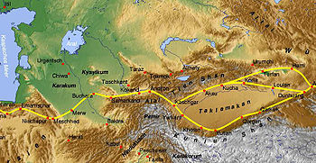
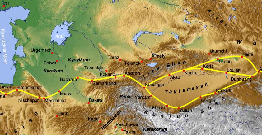
Tian Shan lies to the north and west of the Taklamakan Desert in the border region of Kazakhstan, Kyrgyzstan and the Xinjiang Uyghur Autonomous Region of western China. In the south it links up with the Pamir Mountains. It also extends into the Chinese province of Xinjiang and into the northern areas of Pakistan, where it joins the Hindu Kush.[citation needed]
In Western cartography, the eastern end of the Tian Shan is usually understood to be just west of Ürümqi, while the range to the east of that city is known as the Bogda Shan. In Chinese cartography from the Han Dynasty to the present, however, the Tian Shan also includes the Bogda Shan and Barkol ranges.
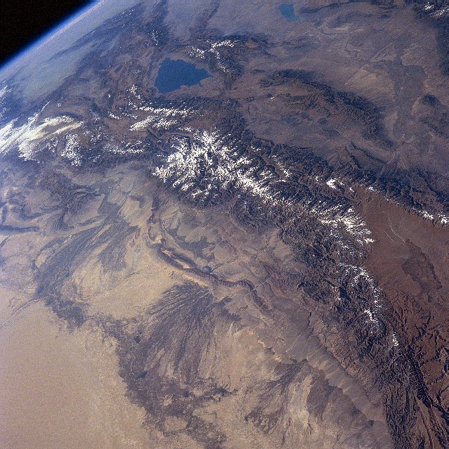
 Tian Shan Mountains from space, October 1997, with Issyk-Kul Lake in Kyrgyzstan at the northern end
The Tian Shan are a part of the Himalayan orogenic belt, which was formed by the collision of the Indian and Eurasian plates in the Cenozoic era. They are one of the longest mountain ranges in Central Asia and stretch some 2,800 kilometres (1,700 mi) eastward from Tashkent in Uzbekistan.
The highest peak in the Tian Shan is Victory Peak (пик Победы in Russian or Jengish Chokusu in Kyrgyz) which, at 7,439 metres (24,406 ft), is also the highest point in Kyrgyzstan and is on the border with China. The Tian Shan's second highest peak, Khan Tengri (Lord of the Spirits), straddles the Kazakhstan-Kyrgyzstan border and at 7,010 metres (23,000 ft) is the highest point of Kazakhstan. Mountaineers class these as the two most northerly peaks over 7,000 metres (23,000 ft) in the world.
The Torugart Pass, at 3,752 metres (12,310 ft), is located at the border between Kyrgyzstan and China's Xinjiang province. The forested Alatau ranges, which are at a lower altitude in the northern part of the Tian Shan, are inhabited by pastoral tribes that speak Turkic languages.
The major rivers rising in the Tian Shan are the Syr Darya, the Ili River and the Tarim River. The Aksu Canyon is a notable feature in the northwestern Tian Shan.
One of the first Europeans to visit and the first to describe the Tian Shan in detail was the Russian explorer Peter Semenov, who did so in the 1850s.
Ranges of the Tian Shan
The Tian Shan have a number of named ranges which are often mentioned separately. (all distances are approximate)
In China the Tian Shan starts north of Kumul City (Hami) with the U-shaped Barkol Mountains, from about 600 to 400 kilometres (370 to 250 mi) east of Ürümqi. Then the Bogda Shan (god mountains) run from 350 to 40 kilometres (220 to 25 mi) east of Ürümqi. Then there is a low area between Ürümqi and the Turfan Depression. The Borohoro mountains start just south of Ürümqi and run west northwest 450 kilometres (280 mi) separating Dzungaria from the Ili River basin. Their north end abuts on the 200 kilometres (120 mi) Dzungarian Alatau which run east northeast along Sino-Kazakh border. They start 50 kilometres (31 mi) east of Taldykorgan in Kazakhstan and end at the Dzungarian Gate. The Dzungarian Alatau in north, (name?) in middle and Borohoro range in south make a reversed Z or S, the northeast enclosing part of Dzungaria and the southwest enclosing the upper Ili valley.
 Kyrgyzstan (borders marked in red) The indentation on the west is the Fergana Valley
 Snow-capped peaks of Kengey Alatau seen from an Issyk Kul Lake beach
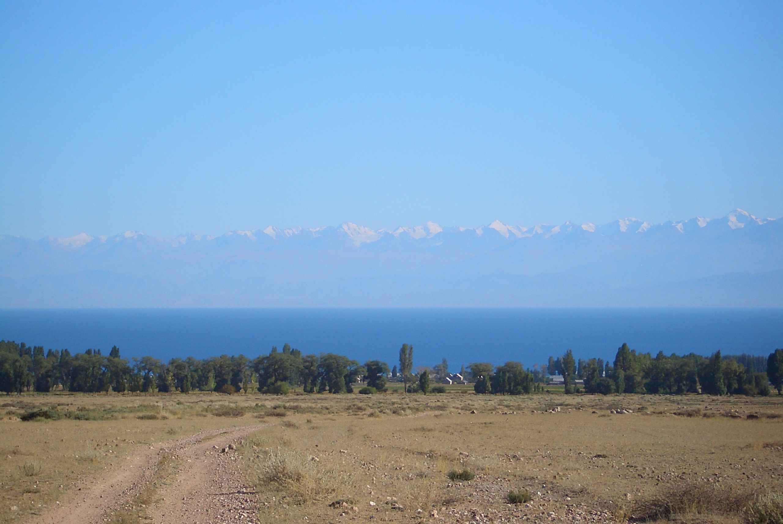
In Kyrgyzstan the main line of the Tian Shan continues as (name?) from the base of the Borohoros west 570 kilometres (350 mi) to the point where China, Kazakhstan and Kyrgyzstan meet. Here is the highest part of the range – the Central Tian Shan, with Peak Pobeda and Khan Tengri. West of this, the Tian Shan split into an ‘eye’, with Issyk Kul Lake in its center. The south side of the lake is the Terskey Alatau and the north side the Kyungey Ala-Too (shady and sunny Ala-Too). North of the Kyungey Ala-Too and parallel to it is the Trans-Ili Alatau in Kazakhstan just south of Almaty. West of the eye, the range continues 400 kilometres (250 mi) as the Kyrgyz Ala-Too, separating Chui Province from Naryn Oblast and then Kazakhstan from the Talas Province. This oblast is the upper valley of the Talas River, the south side of which is the 200 kilometres (120 mi) Talas Ala-Too Range ('Ala-too' is a Kirgiz spelling of Alatau). At the east end of the Talas Alatau the Suusamyr Too range runs southeast enclosing the Suusamyr Valley or plateau.
As for the area south of the Fergana Valley there is a 800 kilometres (500 mi) group of mountains that curves west-southwest from south of Issyk Kul Lake separating the Tarim Basin from the Fergana Valley. The Fergana Range runs northeast towards the Talas Ala-Too and separaties the upper Naryn basin from Fergana proper. The southern side of these mountains merge into the Pamirs in Tajikistan (Alay Mountains and Trans-Alay Range). West of this is the Turkestan Range, which continues almost to Samarkand.
Ecology
The Tian Shan holds important forests of Schrenk's Spruce (Picea schrenkiana) at altitudes of over 2,000 metres (6,600 ft); the lower slopes have unique natural forests of wild Walnuts and Apples.[citation needed]
Chinese religion
In Daoism Xi Wangmu, the Queen Mother of the West is believed to guard the peach trees of immortality in the Tian Shan.
Gallery
- Tian Shan
-

Khan Tengri (7010m), the tallest peak of the Tian Shan range, at sunset
-

Gorkiy Peak seen across the South Inylchek glacier
-

The South Inylchek Base Camp, with Chapaev and Khan Tengri across the glacier
-

Astronomical observations in the Tian Shan, January 1907, by Sergey Prokudin-Gorsky
-

Schrenk's Spruce forest
-

Yaks grazing, Xinjiang, China
-

Ala Köl (lake), Terskey Alatau range, Kyrgyzstan
-

Talgar Peak, Talgar
-

Tian Shan Range, Urumqi
-

Terskey Alatoo range seen from across Issyk Kul Lake
-

Astronaut photograph of central Tien Shan.
Footnotes
References
- The Contemporary Atlas of China. 1988. London: Marshall Editions Ltd. Reprint 1989. Sydney: Collins Publishers Australia.
- The Times Comprehensive Atlas of the World. Eleventh Edition. 2003. Times Books Group Ltd. London.
External links
- Russian mountaineering site
- Tien Shan
- United Nations University (2009) digital video "Finding a place to feed: Kyrgyz shepherds & pasture loss": Shepherd shares family's observations and adaptation to the changing climate in highland pastures of Kyrgyzstan's Tian Shan mountains Accessed 1 December 2009
Mountain ranges of China Ailao Mountains · Altai Mountains · Argu Tagh · Changbai Mountains · Daba Mountains · Dabie Mountains · Dalou Mountains · Daxue Mountains · Dzungarian Alatau · Greater Khingan · Helan Mountains · Hengduan Mountains · Himalayas · Jiuling Mountains · Jiuyi Mountains · Karakoram · Kunlun Mountains · Lesser Khingan · Luoxiao Mountains · Lüliang Mountains · Huangshan · Jingshan Mountains · Mount Lang · Min Mountains · Mufu Mountains · Nanling Mountains · Pamir Mountains · Qian Mountains · Qin Mountains · Qionglai Mountains · Taihang Mountains · Tarbagatai Mountains · Tian Shan · Tanggula Mountains · Wanda Mountains · Wudang Mountains · Wuling Mountains · Wuyi Mountains · Xuefeng Mountains · Yengisogat · Yin Mountains · Yunling Mountains · Zhongtiao Mountains Landforms of China
Xinjiang topics General Geography Cities • Tian Shan • Dzungarian Basin • Tarim Basin • Gurbantünggüt Desert • Kumtag Desert • Taklimakan Desert • Turpan Depression • Karakoram Mountains • Altai Mountains • Tian Shan • Kunlun Shan • Pamir Mountains • Torugart Pass • Karakoram PassEducation Culture Cuisine Dapanji • Sangza • Samsa • Youtazi • Pamirdin • Xurpa • Tohax • Tunurkawab • Chinese Islamic cuisineVisitor attractions Apak Khoja and Xiang Fei Tomb • Flaming Mountains • Jiaohe Ruins • Gaochang • Grand Bazaar, Ürümqi • Id Kah Mosque • Karakul Lake • Kizil Caves • Ruins of NiyaCategories:- Mountain ranges of Kazakhstan
- Mountain ranges of Kyrgyzstan
- Mountain ranges of China
- Sites along the Silk Road


Wikimedia Foundation. 2010.