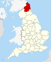
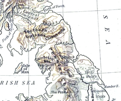
- Northumberland
-
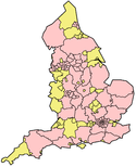
Northumberland 
Geography Status Ceremonial county & Unitary district Origin Historic Region North East Area
- Total
- Admin. councilRanked 6th
5,013 km2 (1,936 sq mi)
Ranked 1stAdmin HQ Morpeth ISO 3166-2 GB-NBL ONS code 00EM NUTS 3 UKC21 Demography Population
- Total (2010 est.[1])
- Density
- Admin. councilRanked 44th
312,000
62 /km2 (160 /sq mi)
Ranked 21stEthnicity 99.9% White Politics 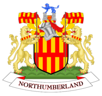
Northumberland County Council
http://www.northumberland.gov.ukExecutive Liberal Democrat (council NOC) Members of Parliament 4Districts N/A
Northumberland (
 /nɔrˈθʌmbərlənd/) is the northernmost ceremonial county and a unitary district in North East England. For Eurostat purposes Northumberland is a NUTS 3 region (code UKC21) and is one of three boroughs or unitary districts that comprise the "Northumberland and Tyne and Wear" NUTS 2 region. It borders Cumbria to the west, County Durham to the south and Tyne and Wear to the south east, as well as having a border with the Scottish Borders council area to the north, and a North Sea coastline of outstanding natural beauty[2] with a 64 mile (103 km) long distance path.[3] Since 1981, the county council has been located in Morpeth, situated in the east of the county.[4]
The historical boundaries of the county of Northumberland included Newcastle upon Tyne, the traditional county town, as well as Tynemouth and other settlements in North Tyneside, all areas transferred to Tyne and Wear in 1974 under the Local Government Act 1972. The historical county boundaries are sometimes taken to exclude Islandshire, Bedlingtonshire and Norhamshire (collectively North Durham), exclaves of County Durham which were incorporated into Northumberland in 1844.
Being on the border of England and Scotland, Northumberland has been the site of many battles. The county is noted for its undeveloped landscape of high moorland, a favourite with landscape painters, and now largely protected as a National Park. Northumberland is the most sparsely populated county in England, with only 62 people per square kilometre.
Contents
History
The area was once part of the Roman Empire and as Northumberland it was the scene of many wars between England and Scotland. As evidence of its violent history, Northumberland has more castles than any other county in England,[5] including the castles of Alnwick, Bamburgh, Dunstanburgh and Warkworth.
The region of present-day Northumberland once formed the core of the Anglian kingdom of Bernicia, which was later united with Deira south of the River Tees to form the kingdom of Northumbria. The historical boundaries of Northumbria under King Edwin stretched from the Humber in the south to the Forth in the north, though it was reduced to having its traditional northern border of the River Tweed after the area from the Tweed to the Forth was ceded to the Kingdom of Scotland in 1018, including Lothian, the region which contains Edinburgh. Northumberland is often called the "cradle of Christianity" in England, because it was on Lindisfarne, a tidal island north of Bamburgh, also called Holy Island, that Christianity flourished when monks from Iona were sent to convert the English. Lindisfarne was the home of the Lindisfarne Gospels and Saint Cuthbert, who is buried in Durham Cathedral.
Bamburgh is the historic capital of Northumberland, the "royal" castle from before the unification of England under one monarch. In contemporary times, although Northumberland County Council's offices are in Morpeth. Alnwick and Morpeth contest which of the two is the county town.[citation needed]
The Earldom of Northumberland was briefly held by the Scottish Royal Family via marriage from 1139–1157 and 1215–1217. Scotland relinquished all claims to the region as part of the Treaty of York. The Earls of Northumberland once wielded significant power in English affairs because, as the Marcher Lords, they were entrusted with protecting England from Scottish invasion.
Northumberland has a history of revolt and rebellion against the government, as seen in the Rising of the North in Tudor times. These revolts were usually led by the then Dukes of Northumberland, the Percy family. Shakespeare makes one of the Percys, the dashing Harry Hotspur, the real hero of his Henry IV, Part 1.
The county was[when?] also a centre for Roman Catholicism in England, as well as of Jacobite support after the Restoration. Northumberland became a sort of wild county, where outlaws and Border Reivers hid from the law. However, the frequent cross-border skirmishes and accompanying local lawlessness largely subsided after the Union of the Crowns of Scotland and England under King James I in 1603.
Northumberland played a key role in the industrial revolution. Coal mines were once[when?] widespread in Northumberland, with collieries at Ashington, Bedlington, Choppington, Netherton, Ellington and Pegswood. The region's coalfields fuelled industrial expansion in other areas of the country, and the need to transport the coal from the collieries to the Tyne led to the development of the first railways. Shipbuilding and armaments manufacture were other important industries.
Today, Northumberland is still largely rural. As the least densely populated county in England, it commands much less influence in British affairs than in times past. In recent years the county has had considerable growth in tourism due to its scenic beauty and the abundant evidence of its historical significance.
Physical geography
 Physical geography of Northumberland and surrounding areas
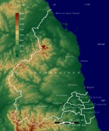
The physical geography of Northumberland is diverse. It is low and flat near the North Sea coast and increasingly mountainous toward the northwest. The Cheviot Hills, in the northwest of the county, consist mainly of resistant Devonian granite and andesite lava. A second area of igneous rock underlies the Whin Sill (on which Hadrian's Wall runs), an intrusion of Carboniferous dolerite. Both ridges support a rather bare moorland landscape. Either side of the Whin Sill the county lies on Carboniferous Limestone, giving some areas of karst landscape.[6] Lying off the coast of Northumberland are the Farne Islands, another dolerite outcrop, famous for their bird life.
There are coal fields in the southeast corner of the county, extending along the coastal region north of the river Tyne. The term 'sea coal' likely originated from chunks of coal, found washed up on beaches, that wave action had broken from coastal outcroppings.
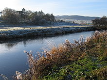 River Coquet.
Being in the far north of England, above 55° latitude, and having many areas of high land, Northumberland is one of the coldest areas of the country. It has an average annual temperature of 7.1 to 9.3 °C, with the coldest temperatures inland.[7] However, the county lies on the east coast, and has relatively low rainfall, between 466 and 1060 mm annually, mostly falling in the west on the high land.[8] Between 1971 and 2000 the county averaged 1321 to 1390 hours of sunshine per year.[9]
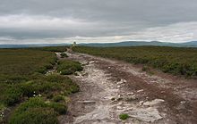
Approximately a quarter of the county is protected as the Northumberland National Park, an area of outstanding landscape that has largely been protected from development and agriculture. The park stretches south from the Scottish border and includes Hadrian's Wall. Most of the park is over 240 metres (800 feet) above sea level. The Northumberland Coast is also a designated Area of Outstanding Natural Beauty.
Ecology
There are a variety of notable habitats and species in Northumberland including: Chillingham Cattle herd; Holy Island; Farne Islands; and Staple Island.
Economy and industry
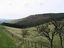 Housedon Hill
This is a chart of trend of regional gross value added of Northumberland at current basic prices published (pp. 240–253) by Office for National Statistics with figures in millions of British Pounds Sterling.
Year Regional Gross Value Added[10] Agriculture[11] Industry[12] Services[13] 1995 2,585 130 943 1,512 2000 2,773 108 831 1,833 2003 3,470 109 868 2,494 Northumberland has a relatively weak economy amongst the counties and other local government areas of the United Kingdom.[14] The county is ranked sixth lowest amongst these 63 council areas. In 2003 23% of males and 60% of females were earning less than the Council of Europe's decency threshold. As of May 2005 unemployment is at 2.3%, in line with the national average.[15] Between 1999 and 2003 businesses in the county grew 4.4% to 8,225, making 0.45% of registered businesses in Great Britain.[16]
A major source of employment and income in the county is tourism. The county annually receives 1.1 million British visitors and 50,000 foreign tourists who spend a total of £162million in the county.[17]
Education
Northumberland has a completely comprehensive education system with 15 state schools, two academies and one independent school. Like Bedfordshire, it embraced the comprehensive ideal with the three tier system of lower/middle/upper schools with large school year sizes (often around 300). This eliminated choice of school in most areas – as instead of having two secondary schools in one town, one school became a middle school and another became an upper school. A programme introduced in 2006 known as Putting the Learner First has eliminated this structure in the former areas of Blyth Valley and Wansbeck, where two tier education has been introduced. Although the two processes are not officially connected, the introduction of two tiers has coincided with the move to build academy schools in Blyth, with Bede Academy and in Ashington at Hirst. One response to these changes has been the decision of Ponteland High School to apply for Trust status.
Cramlington Learning Village has almost 400 pupils in each school year; making it one of the largest schools in England. Blyth Community College situated in south east Northumberland is able to hold 1500 students throughout the building. Astley Community High School which is situated in Seaton Delaval and accepts students from Seaton Deleval, Seaton Sluice and Blyth has been the subject of controversial remarks from politicians claiming it would no longer be viable once Bede Academy opened in Blyth, a claim strongly disputed by the headteacher. Haydon Bridge High School, in rural Northumberland, is claimed to have the largest catchment area of any school in England, reputedly covering an area larger than that encompassed by the M25 motorway around London.
The county of Northumberland is served by one Catholic High School, St. Benet Biscop Catholic High School, which is attended by students from all over the area. Students from Northumberland also attend independent schools such as the Royal Grammar School in Newcastle.
Demographics
At the Census 2001 Northumberland registered a population of 307,190,[18] estimated to be 309,237 in 2003.[19] In 2001 there were 130,780 households, 10% of which were all retired, and one third were rented. Northumberland has a very low ethnic minority population at 0.985% of the population, compared to 9.1% for England as a whole. 81% of the population reported their religion as Christianity, 0.8% as another religion, and 12% as having no religion.[20]
Being primarily rural with significant areas of upland, the population density of Northumberland is only 62 persons per square kilometre giving it the lowest population density in England.
Politics
Northumberland is a unitary local authority area and is the largest unitary area in England. The County Council is based in Morpeth.
Like most English shire counties Northumberland had until April 2009 a two-tier system of local government, with one county council and six districts, each with their own district council, responsible for different aspects of local government. These districts were, Blyth Valley, Wansbeck, Castle Morpeth, Tynedale, Alnwick and Berwick-upon-Tweed. The districts were abolished on 1 April 2009, the county council becoming a unitary authority.
Elections for the new unitary authority council took place on 1 May 2008.
Northumberland is represented in the House of Commons by four Members of Parliament, of whom one is a Conservative, one is a Liberal Democrat and two are Labour.
Northumberland is included within the North East England European Parliament constituency which is represented by 4 Members of the European Parliament.
Culture
Northumberland has traditions not found elsewhere in England. These include the rapper sword dance, the Clog dance and the Northumbrian smallpipe, a sweet chamber instrument, quite unlike the Scottish bagpipe. Northumberland also has its own tartan or check, sometimes referred to in Scotland as the Shepherd's Tartan. Traditional Northumberland music sounds similar to Lowland Scottish music, reflecting the strong historical links between Northumbria and the Lowlands of Scotland.
The Border ballads of the region have been famous since late mediaeval times. Thomas Percy, whose celebrated Reliques of Ancient English Poetry appeared in 1765, states that most of the minstrels who sang the Border ballads in London and elsewhere in the 15th and 16th centuries belonged to the North. The activities of Sir Walter Scott and others in the 19th century gave the ballads an even wider popularity. William Morris considered them to be the greatest poems in the language, while Algernon Charles Swinburne knew virtually all of them by heart.
One of the best-known is the stirring Chevy Chase, which tells of the Earl of Northumberland's vow to hunt for three days across the Border 'maugre the doughty Douglas'. Of it, the Elizabethan courtier, soldier and poet Sir Philip Sidney famously said: 'I never heard the old song of Percy and Douglas that I found not my heart moved more than with a trumpet'. Ben Jonson said that he would give all his works to have written Chevy Chase.
Overall the culture of Northumberland, as with the north east of England in general, has much more in common with Scottish Lowland and Northern English culture than with that of Southern England. Firstly both regions have their cultural origins in the old Anglian Kingdom of Northumbria, this is borne out by the linguistic links between the two regions, which include many Old English words not found in other forms of Modern English, such as bairn for child (see Scots language and Northumbria).[21][22] The other reason for the close cultural links is the clear pattern of net southward migration. There are more Scots in England than English people north of the border. Much of this movement is cross-county rather than distant migration, and the incomers thus bring aspects of their culture as well as reinforce shared cultural traits from both sides of the Anglo-Scottish border. Whatever the case, the lands just north or south of the border have long shared certain aspects of history and heritage and thus it is thought by some that the Anglo-Scottish border is largely political rather than cultural.[22][23]
Attempts to raise the level of awareness of Northumberland culture have also started, with the formation of a Northumbrian Language Society to preserve the unique dialects (Pitmatic and other Northumbrian dialects) of this region, as well as to promote home-grown talent.[21][22]
Northumberland's county flower is the Bloody Cranesbill (Geranium sanguineum) and her affiliated Royal Navy ship is her namesake, HMS Northumberland.
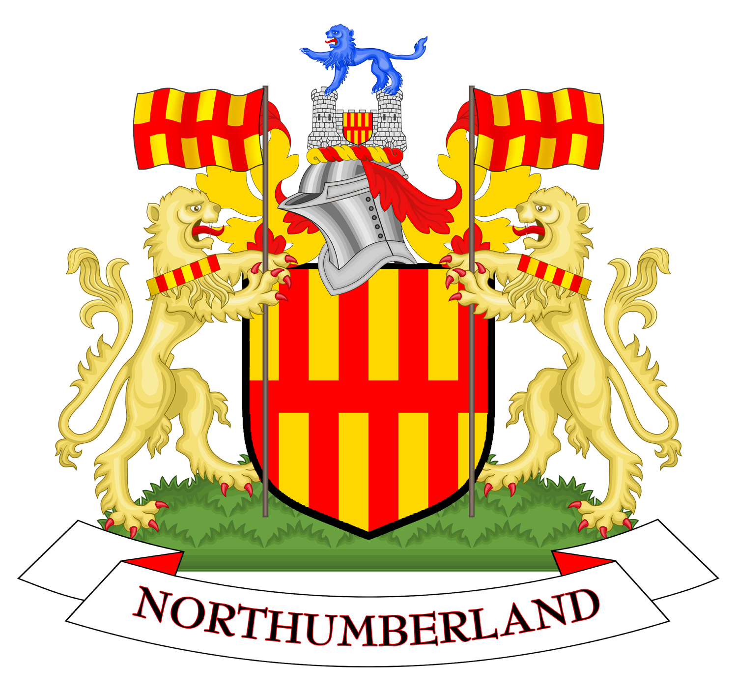
Flag
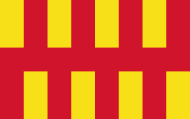 Northumberland flag
Northumberland has its own flag, which is a banner of the arms of Northumberland County Council. The shield of arms is in turn based on the arms mediæval heralds had attributed to the Kingdom of Bernicia (which the first County Council used until it received a regular grant of arms). The Bernician arms were fictional but inspired by Bede's brief description of a flag used on the tomb of St Oswald in the 7th century.[24]
The current arms were granted to the county council in 1951, and adopted as the flag of Northumberland in 1995.[25]
Media
Having no large population centres, the county's mainstream media outlets are served from nearby Tyne and Wear, including radio stations and television channels (such as BBC Look North, BBC Radio Newcastle, Tyne Tees Television and Metro Radio), along with the majority of daily newspapers covering the area (The Journal, Evening Chronicle). It is worth remembering however that although Northumberland, like many administrative areas in England, has been shorn of its geographical regional centre, that centre – Newcastle upon Tyne – remains an essential element within the entity we know as Northumberland. Newcastle's newspapers are as widely read in its Northumbrian hinterland as any of those of the wider county: the Northumberland Gazette, Morpeth Herald, Berwick Advertiser, Hexham Courant and the News Post Leader.
Lionheart FM, a community radio station based in Alnwick, has recently been awarded a five-year community broadcasting license by OFCOM. Radio Borders covers Berwick and the rural north of the county.
People
Famous people born in Northumberland
Ashington was the birth place of the three famous footballers Bobby and Jack Charlton in 1937 and 1935 respectively; and Jackie Milburn previously in 1924. The basketballer Alan Hoyle was born here in 1983 whilst in 1978 Steve Harmison, an international cricketer was born here.
Mickley was the birth place of Thomas Bewick, an artist, wood engraver and naturalist in 1753 and Bob Stokoe, a footballer and F.A. Cup winning manager (with Sunderland in 1973) born 1930.
Other notable births include:
- Thomas Addison, a physician born at Longbenton in 1793
- George Airy, an astronomer and geophysicist born at Alnwick in 1802
- Alexander Armstrong, a comedy actor born at Rothbury in 1970
- Lancelot 'Capability' Brown, landscape and garden designer born at Kirkharle in 1715
- Josephine Butler, social reformer born at Milfield in 1828
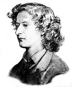
- Basil Bunting, a poet born at Scotswood-on-Tyne in 1900
- Eric Burdon, singer and leader of The Animals and War born at Walker-on-Tyne in 1941
- Grace Darling, a heroine born at Bamburgh in 1815
- Pete Doherty, a musician born at Hexham in 1979
- Bryan Donkin, an engineer and industrialist born at Sandhoe in 1768
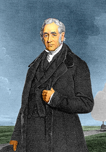
- Daniel Gooch, an engineer and politician born at Bedlington in 1816
- Sir Alistair Graham (1942 –), noted public figure
- Tom Graveney, former England cricketer and President of the Marylebone Cricket Club 2004/5, born in Riding Mill in 1927.
- Robson Green, an actor and singer born at Hexham in 1964
- Charles Grey, 2nd Earl Grey, British Prime Minister born at the family seat of Howick Hall in 1764
- Jean Heywood actress born at Blyth best known for Our Day Out and All Creatures Great and Small.
- Matt Ridley, a journalist, writer, and businessman, and son of Viscount Ridley
- John Rushworth (1793–1860), an historian born at Acklington Park, Warkworth
- George Stephenson, an engineer born at Wylam in 1781
- Trevor Steven, footballer born in Berwick-upon-Tweed in 1963
- Percival Stockdale, poet and abolitionist
- Ross Noble, a stand-up comedian born and raised in Cramlington in the 1970s and 1980s
- Hugh Trevor-Roper, an historian born at Glanton in 1914
- William Turner, ornithologist and botanist born at Morpeth in 1508
- Sid Waddell, a sports commentator and children's television screenwriter born at Alnwick in 1940
- C. V. Wedgwood, an historian born in 1910
- The Right Reverend Dr. N. T. Wright, Anglican theologian and author, born in Morpeth in 1948
- Gordon Dodds (1941–2010), Provincial Archivist of Manitoba and author, born in Wideopen
Famous people linked with Northumberland
- Thomas Burt, one of the first working-class Members of Parliament and was secretary of the Northumberland Miners' Association in 1863
- Matthew Festing, 79th Grand Master, the Order of Malta.
- Gordon Sumner, better known by his stage name of Sting, a school teacher turned musician was born in Newcastle upon Tyne in 1951
- Henry 'Hotspur' Percy (1365–1403), borders warlord and rebel
- Billy Pigg, a 20th century musician who was vice-President of the Northumbrian Pipers Society
- Alan Shearer footballer, lives in Ponteland.
- Algernon Charles Swinburne, a poet raised at Capheaton Hall
- Kathryn Tickell, a modern-day player of the Northumbrian smallpipes
- Turner, Thomas Girtin and John Cotman all painted memorable pictures of Northumberland. Turner always tipped his hat towards Norham Castle as the foundation of his fame and fortune.
- Jonny Wilkinson, English rugby player, currently lives in rural Northumberland.
The site [2] contains exhaustive detailed entries for famous deceased Northumbrians.
Settlements
Parishes
NOTE: New parishes have been added since 2001. These are missing from the list.
See also
- Lord Lieutenant of Northumberland
- High Sheriff of Northumberland
- Anglo-Scottish border
- Duke of Northumberland
- List of Parliamentary constituencies in Northumberland
- List of places of interest and tourist attractions in Northumberland
- List of people from Northumberland by occupation
- Northumbria
- Northumberland Street, Newcastle upon Tyne, Tyne and Wear
Notes and references
- ^ "Table 8a Mid-2010 Population Estimates: Selected age groups for local authorities in the United Kingdom; estimated resident population.". Population Estimates for UK, England and Wales, Scotland and Northern Ireland, Mid-2010. Office for National Statistics. 3 June 2011. http://www.ons.gov.uk/ons/publications/re-reference-tables.html?edition=tcm%3A77-231847. Retrieved 1 October 2011.
- ^ [1][dead link]
- ^ "Northumberland Coast Path – LDWA Long Distance Paths". Ldwa.org.uk. http://www.ldwa.org.uk/ldp/members/show_path.php?path_name=Northumberland+Coast+Path. Retrieved 25 September 2010.
- ^ Northumberland County Hall moved from Newcastle upon Tyne to Morpeth on 21 April 1981 (see notice in London Gazette: no. 48579. p. 5337. 10 April 1981.)
- ^ Long, B. (1967). Castles of Northumberland. Newcastle, UK: Harold Hill.
- ^ Northumberland National Park Authority, n.d. "The topology and climate of Northumberland National Park."
- ^ Met Office, 2000. "Annual average temperature for the United Kingdom."
- ^ Met Office, 2000. "Annual average rainfall for the United Kingdom."
- ^ Met Office, 2000. "Annual average sunshine for the United Kingdom."
- ^ Components may not sum to totals due to rounding
- ^ includes hunting and forestry
- ^ includes energy and construction
- ^ includes financial intermediation services indirectly measured
- ^ Northumberland County Council, 2003 "Northumberland in context.". MS Word, HTML (Google)
- ^ Northumberland InfoNet, 2005. "Unemployment Statistics."
- ^ Northumberland InfoNet, 2004. "Key Statistics: Businesses." (PDF)
- ^ Northumberland InfoNet, 2004 "Key Statistics: Tourism." (PDF)
- ^ Office for National Statistics, 2003. "Update on 2001 Census figures." (PDF)
- ^ Office of the Deputy Prime Minister, 2003. "Local Government Finance Settlement 2005/06." (PDF)
- ^ Office for National Statistics, 2001. "KS07 Religion: Census 2001, Key Statistics for local Authorities."
- ^ a b "North East England History Pages". Northeastengland.talktalk.net. http://www.northeastengland.talktalk.net/GeordieOrigins.htm. Retrieved 25 September 2010.
- ^ a b c "Northumbrian Language Society". Northumbriana.org.uk. http://www.northumbriana.org.uk/langsoc/about.htm. Retrieved 25 September 2010.
- ^ "Lowlands-L • a discussion group for people who share an interest in languages and cultures of the Lowlands". Lowlands-l.net. http://www.lowlands-l.net/english.php. Retrieved 25 September 2010.
- ^ Bede's Ecclesiatical History of the English People, Book III, Ch. 11: "And to furnish a lasting memorial of the royal saint, they hung the King's banner of purple and gold over his tomb."
- ^ "The Northumberland Flag Northumberland Northumbria England UK GB (page 113)". Web.archive.org. 24 June 2005. Archived from the original on 24 June 2005. http://web.archive.org/web/20050624074238/http://www.northumberland.gov.uk/vg/flag.html. Retrieved 25 September 2010.
- ^ Neighbourhood Statistics. "Office for National Statistics". Neighbourhood Statistics. http://www.neighbourhood.statistics.gov.uk/dissemination/viewFullDataset.do?instanceSelection=03070&productId=779&$ph=60_61&datasetInstanceId=3070&startColumn=1&numberOfColumns=8&containerAreaId=790203. Retrieved 25 September 2010.
Bibliography
- Sharp, Thomas (1937). Northumberland and Durham – a Shell Guide. B.T. Batsford.
- Tomlinson, W.W. (1968) [1888]. Comprehensive guide to the county of Northumberland. Trowbridge: Redwood.
- Thompson, Barbara; Norderhaug, Jennifer (2006). Walking the Northumberland Dales: Hadrian's Wall Country. Sigma Press. ISBN 1850588384.
External links
- Northumberland at the Open Directory Project
- Northumberland County Council
- Visit Northumberland – The Official Visitor Site
- Enjoy Northumberland
North East England Portal Unitary authorities NorthumberlandMajor settlements Alnwick · Amble · Ashington · Bedlington · Berwick-upon-Tweed · Blyth · Cramlington · Haltwhistle · Hexham · Morpeth · Newbiggin-by-the-Sea · Prudhoe · Rothbury · Wooler
See also: List of civil parishes in NorthumberlandTopics  Districts of North East England
County Durham 
Northumberland Northumberland
Tyne and Wear North Yorkshire Unitary authorities of England Districts Bath and North East Somerset · Bedford · Blackburn with Darwen · Blackpool · Bournemouth · Bracknell Forest · Brighton and Hove · Bristol · Central Bedfordshire · Cheshire East · Cheshire West and Chester · Cornwall · County Durham · Darlington · Derby · East Riding of Yorkshire · Halton · Hartlepool · Herefordshire · Isle of Wight · Kingston upon Hull · Leicester · Luton · Medway · Middlesbrough · Milton Keynes · North East Lincolnshire · North Lincolnshire · North Somerset · Northumberland · Nottingham · Peterborough · Plymouth · Poole · Portsmouth · Reading · Redcar and Cleveland · Rutland · Shropshire · Slough · Southampton · Southend-on-Sea · South Gloucestershire · Stockton-on-Tees · Stoke-on-Trent · Swindon · Telford and Wrekin · Thurrock · Torbay · Warrington · West Berkshire · Wiltshire · Windsor and Maidenhead · Wokingham · York
Councils Bournemouth · Cornwall · Herefordshire · Isle of Wight · Kingston upon Hull · Leicester · Middlesbrough · Northumberland · Nottingham · Poole · Rutland · Shropshire · Slough · Thurrock · Wiltshire
Categories:- Northumberland
- English unitary authorities created in 2009
- Local government districts of North East England
- Unitary authorities of England
- NUTS 2 statistical regions of the United Kingdom


Wikimedia Foundation. 2010.