- Milton Keynes (borough)
-
Borough of Milton Keynes — Borough — 
Coat of Arms of the CouncilMotto: By knowledge, design and understanding Milton Keynes shown within England Milton Keynes within Buckinghamshire
Sovereign state United Kingdom Constituent country England Region South East England Ceremonial county Buckinghamshire Admin HQ Central Milton Keynes Founded 1 April 1997 Government – Type Unitary authority – Governing body Milton Keynes Council – Mayor (ceremonial) Alan Richards – Leadership: Leader & Cabinet – Executive: Conservative (council NOC) Area – Total 119.2 sq mi ([[30,86 [1]_m²|308.63]] km2) Population – Estimate (2009) 236,700 Time zone Greenwich Mean Time (UTC+0) Postcode MK Area code(s) 01908 ONS code 00MG Website http://www.miltonkeynes.gov.uk The Borough of Milton Keynes is a unitary authority and borough in south central England, at the northern tip of the South East England Region. For ceremonial purposes, it is in the county of Buckinghamshire. It is the most northerly district of the South East region.
It borders the non-metropolitan counties of Buckinghamshire (the area under the control of Buckinghamshire County Council), Bedfordshire and Northamptonshire. The principal settlement in the borough is Milton Keynes itself, which accounts for about 33% of its area and 90% of its population.
Contents
History
See also: History of Milton KeynesThe district was created on 1 April 1974 under the Local Government Act 1972, by the merger of Bletchley Urban District, Newport Pagnell Urban District and Wolverton Urban District, Newport Pagnell Rural District and that part of Wing Rural District within the designated New Town area. The district council applied for and received borough status that year.
It was originally one of five non-metropolitan districts of Buckinghamshire, but on 1 April 1997, under a recommendation of the Local Government Commission for England it became a self-governing unitary authority, independent from Buckinghamshire County Council. The borough however remains part of Buckinghamshire for ceremonial purposes.
Local government
See also: Milton Keynes local electionsMilton Keynes council is under no overall control and is currently governed by a Conservative minority administration. The Liberal Democrats party is currently the main opposition group.
The political composition for the council is as follows.
Date Conservatives Liberal Democrats Labour Independents 6 May 2011 21 17 9 4 Economy
This is a table of trend of regional gross value added (GVA) of Milton Keynes at current basic prices published (pp. 240–253) by Office for National Statistics with figures in millions of British Pounds Sterling (except GVA index).
Year Regional Gross Value Added[1] Agriculture[2] Industry[3] Services[4] GVA index per person[5] 1995 2,834 7 751 2,075 135 2000 4,166 5 805 3,356 141 2003 5,203 7 852 4,344 147 ^ 1 Components may not sum to totals due to rounding
^ 2 includes hunting and forestry
^ 3 includes energy and construction
^ 4 includes financial intermediation services indirectly measured
^ 5 UK average index base = 100
Demographics
In 2006 the Office for National Statistics estimated the Borough's population at 224,500, making it the 54th-largest authority in England by population.[2] Using Census 2001 data the ONS estimated the population of the contiguous built-up area to be 184,506.[3] New 2009 population estimates have been released by the Office for National Statistics. They show that the Milton Keynes population was estimated to be 236,700 in 2009.[4] By 2026, the population of the borough is projected to be 323,146.[5]
In the 2001 census 90.72% of the population described their ethnic origin as white (nationally 90.92%), 3.66% as South Asian (4.58%), 2.41% as black (2.30%), 1.79% as mixed race (1.31%), 1.42% as Chinese and other (0.89%).[6] In the same census, 66% of the Borough's population registered their religion as Christianity and 30% as not religious or none given, compared to 72% and 22% nationally. A little over two percent of the population follow Islam (3% nationally) and a little over 1% are Hindu (1%), with no other religion above one percent.[7]
The borough’s population age profile is younger than that for England as a whole, with half of the borough’s population aged under 35 years old (the median age). [Nationally, half of the population is aged less than 38]. The 35-44 year olds in Milton Keynes Borough can be seen as the largest 10-year age group of the population with 35-39 year olds being the largest 5-year age group.[8]
Settlements
Milton Keynes (urban area)
Main articles: Milton Keynes and Milton Keynes urban areaThe urban area accounts for about 33% of the Borough by area and 90% by population. This is a partial list of the districts of Milton Keynes itself. For a discussion of the usage of the term "city" in Milton Keynes, see History of Milton Keynes.
 Population trend of Borough and Urban Area 1801-2001
The Borough of Milton Keynes is fully parished. These are the parishes, and the districts they contain, that are now elements of Milton Keynes as a whole.
- Bletchley and Fenny Stratford: Brickfields, Central Bletchley, Denbigh, Mount Farm, Fenny Lock, Granby, Fenny Stratford, Water Eaton
- Bradwell: Bradwell, Bradwell Common, Bradwell village, Heelands, Rooksley
- Bradwell Abbey: Bradwell Abbey, Kiln Farm, Stacey Bushes, Two Mile Ash, Wymbush
- Broughton and Milton Keynes (the Village) – a shared parish council: Atterbury, Brook Furlong, Broughton, Fox Milne, Middleton, Milton Keynes, Milton Keynes Village, Northfield, Oakgrove, Pineham
- Campbell Park: Campbell Park, Elfield Park, Fishermead, Newlands, Oldbrook, Springfield, Willen and Willen Lake, Winterhill
- Central Milton Keynes
- Great Linford: Blakelands, Conniburrow, Downs Barn, Downhead Park, Giffard Park, Great Linford, Neath Hill, Pennyland, Tongwell, Willen Park
- Kents Hill, Monkston and Brinklow: Brinklow, Kents Hill, Kingston, Monkston
- Loughton: Loughton, Loughton Lodge, Great Holm, the Bowl
- New Bradwell
- Shenley Brook End: Emerson Valley, Furzton, Kingsmead, Shenley Brook End, Snelshall, Tattenhoe, Tattenhoe Park, Westcroft
- Shenley Church End: Crownhill, Grange Farm, Hazeley, Medbourne, Oakhill, Oxley, Shenley Church End, Woodhill
- Simpson: Ashland, Simpson, West Ashland
- Stantonbury: Bancroft/Bancroft Park, Blue Bridge, Bradville, Linford Wood, Stantonbury, Stantonbury Fields
- Stony Stratford: Fullers Slade, Galley Hill, Stony Stratford
- Walton: Caldecotte, Old Farm Park, Tilbrook, Tower Gate, Walnut Tree, Walton, Walton Hall, Walton Park, Wavendon Gate
- West Bletchley: Far Bletchley, Old Bletchley, West Bletchley.
- Wolverton and Greenleys: Greenleys, Stonebridge, Wolverton, Old Wolverton
- Woughton: Beanhill, Bleak Hall, Coffee Hall, Eaglestone, Leadenhall, Netherfield, Peartree Bridge, Redmoor, Tinkers Bridge, Woughton on the Green, Woughton Park, Woughton village.
- Newport Pagnell lies within the Milton Keynes urban area as defined by the Office of National Statistics but is outside the 1967 'designated area' and is thus generally accepted as separate.
Rest of the borough
The rural area accounts for about 66% of the Borough by area and about 10% by population. These are the extra-urban civil parishes:
- Astwood
- Bow Brickhill
- Caldecote, Castlethorpe, Chicheley, Clifton Reynes, Cold Brayfield
- Emberton
- Filgrave
- Gayhurst
- Hanslope, Hardmead, Haversham
- Lathbury, Lavendon, Little Brickhill, Little Linford, Long Street,
- Moulsoe
- Newton Blossomville, North Crawley
- Olney
- Ravenstone
- Sherington, Stoke Goldington,
- Tyringham
- Warrington, Weston Underwood, Woburn Sands
References
- ^ http://www.mkiobservatory.org.uk/Download/Public/1026/DOCUMENT/7338/StatsupdatedFebruary-2010.pdf
- ^ See List of English districts by population
- ^ Office for National Statistics, Census 2001. "Usual resident population"
- ^ Milton Keynes Statistics Retrieved August 15, 2010
- ^ "Milton Keynes intelligence Observatory". http://analysis.mkiobservatory.org.uk/webview/index.jsp?v=2&mode=cube&cube=http%3A%2F%2Fanalysis.mkiobservatory.org.uk%3A80%2Fobj%2FfCube%2FPE097_C1&study=http%3A%2F%2Fanalysis.mkiobservatory.org.uk%3A80%2Fobj%2FfStudy%2FPE097&context=http%3A%2F%2Fanalysis.mkiobservatory.org.uk%3A80%2Fobj%2FcServer%2FMKi&top=yes.
- ^ Office for National Statistics, 2001. "Key Statistics 06: Ethnic group".
- ^ Office for National Statistics, Census 2001. "Key Statistics 07: Religion".
- ^ http://www.mkiobservatory.org.uk/download.aspx?id=5814&rt=1 Population Bulletin 2007/8 page 17
External links
Ceremonial county of Buckinghamshire Unitary authorities Milton KeynesBoroughs or districts - Aylesbury Vale
- Chiltern
- South Bucks
- Wycombe
Major settlements Rivers Topics - Boundary changes
- Grade I listed buildings
- High Sheriff
- History
- Lord Lieutenant
- Monastic houses
- Museums
- Parliamentary constituencies
- Places
- Places of interest
- Railways
- Schools (Bucks)
- Schools (Milton Keynes)
- Sites of Special Scientific Interest
- Transport
 Districts of South East England
Berkshire 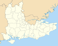
Buckinghamshire Aylesbury Vale • Chiltern • Milton Keynes • South Bucks • Wycombe
East Sussex Brighton and Hove • Eastbourne • Hastings • Lewes • Rother • Wealden
Hampshire Basingstoke and Deane • East Hampshire • Eastleigh • Fareham • Gosport • Hart • Havant • New Forest • Portsmouth • Rushmoor • Southampton • Test Valley • Winchester
Isle of Wight Kent Ashford • Canterbury • Dartford • Dover • Gravesham • Maidstone • Medway • Sevenoaks • Shepway • Swale • Thanet • Tonbridge and Malling • Tunbridge Wells
Oxfordshire Surrey Elmbridge • Epsom and Ewell • Guildford • Mole Valley • Reigate and Banstead • Runnymede • Spelthorne • Surrey Heath • Tandridge • Waverley • Woking
West Sussex Adur • Arun • Chichester • Crawley • Horsham • Mid Sussex • Worthing
Categories:- Milton Keynes
- Local government in Buckinghamshire
- Unitary authorities of England
- Local government districts of South East England


Wikimedia Foundation. 2010.