- Netherwitton
-
Coordinates: 55°12′32″N 1°50′13″W / 55.209°N 1.837°W
Netherwitton 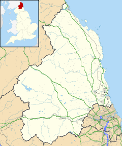
 Netherwitton
Netherwitton shown within NorthumberlandPopulation 272 (2001 census)[1] OS grid reference NZ105905 Unitary authority Northumberland Ceremonial county Northumberland Region North East Country England Sovereign state United Kingdom Post town MORPETH Postcode district NE61 Dialling code 01670 Police Northumbria Fire Northumberland Ambulance North East EU Parliament North East England UK Parliament Berwick upon Tweed List of places: UK • England • Northumberland Netherwitton is a village in Northumberland, England about 8 miles (13 km) west of Morpeth.
A former cotton-mill now converted into residential housing, the old village school also converted into a house, an old bridge whence the pretty little church is visible, and a number of cottages and gardens comprise the village. The old cross, dated 1689, still stands in a garden beyond the green. Most of the common about it has been appropriated and planted with trees.[2]
Contents
History
During the Civil War, Cromwell quartered a large force in the grounds of the stately Netherwitton Hall for one night, and later awarded a sum of £95-5s-6d. as compensation for the damage done by his troops. After Culloden in 1746 Lord Lovat, a Jacobite leader, for a long while lay concealed in a "Priest's Hole" in an upper room of the Hall. Roger Thornton, a great merchant-prince of Newcastle at the beginning of the 15th century, was a native of Netherwitton and built a castle by the river, but no trace of it remains.[2]
Landmarks
The Devil's Causeway passes the village less than 1 mile (2 km) to the east. The causeway is a Roman road which starts at Port Gate on Hadrian's Wall, north of Corbridge, and extends 55 miles (89 km) northwards across Northumberland to the mouth of the River Tweed at Berwick-upon-Tweed.
Devils Causeway Tower, Netherwitton, also known as, or recorded in historical documents as Highbush Wood. King writes ‘Marked on some OS maps as tower but now considered to be remains of cottage.’ SMR still records as ‘site of tower’. Long records as ‘remains of an irregular shaped tower.’ This site has been described as a Pele Tower. The confidence that this site is a medieval fortification or palace is Questionable.[3]
Netherwitton Hall is a Grade I listed building. There has been a house on the site since the 14th century. The present house, which was built in about 1685, to a design by architect Robert Trollope has an impressive three storey, seven bayed frontage with balustrade and unusual irregular window pediments. The rear presents some earlier features including a stairway tower which may contain remnants of ancient fortifications. The gardens contain a folly and masonry features.
Religious sites
The church is dedicated to St Giles.[4]
See also
References
- ^ Office for National Statistics: Neighbourhood Statistics
- ^ a b Hugill, Robert (1931). Road Guide to Northumberland and The Border. Newcastle upon Tyne, England: Andrew Reid & Company, Limited.
- ^ "Devils Causeway Tower, Netherwitton". http://homepage.mac.com/philipdavis/English%20sites/2266.html. Retrieved 2009-03-14.
- ^ Purves, Geoffrey (2006). Churches of Newcastle and Northumberland. Stroud, Gloucestershire, England: Tempus Publishing Limited. pp. 167. ISBN 0 7524 4071 3. http://www.tempus-publishing.com.
External links
- GENUKI (Accessed: 27 November 2008)
Categories:- Villages in Northumberland
- Northumberland geography stubs

Wikimedia Foundation. 2010.