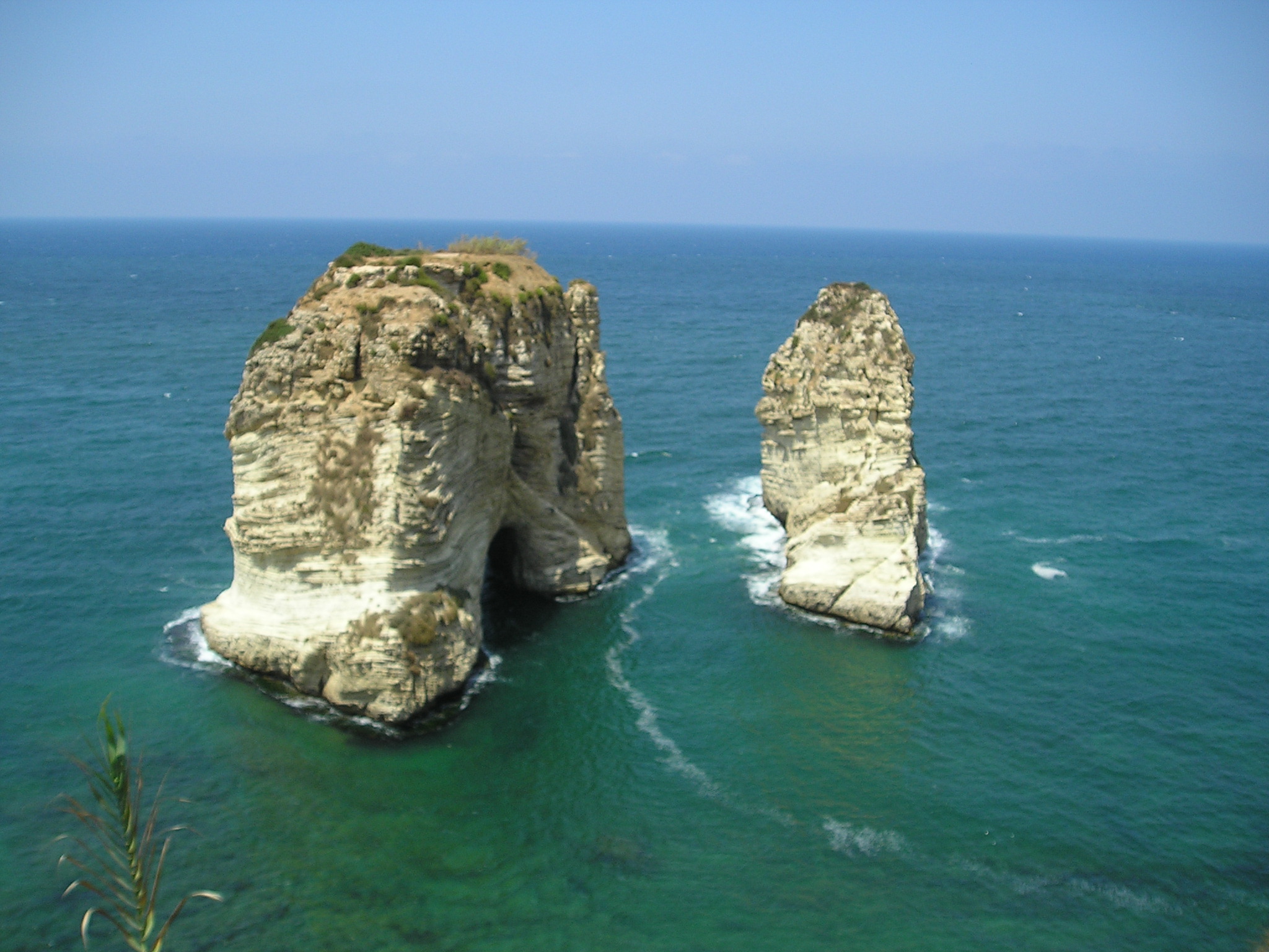
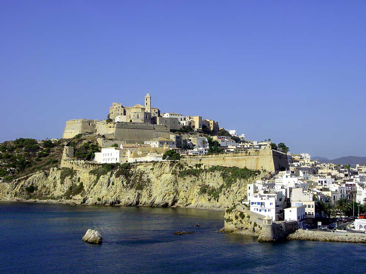
- Mediterranean Sea
-
"Mediterranean" redirects here. For other uses, see Mediterranean (disambiguation)."Mediterranean sea" redirects here. For the oceanographical term, see Mediterranean sea (oceanography).
Mediterranean Sea 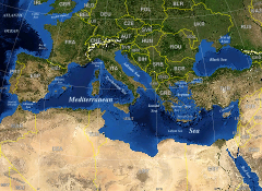
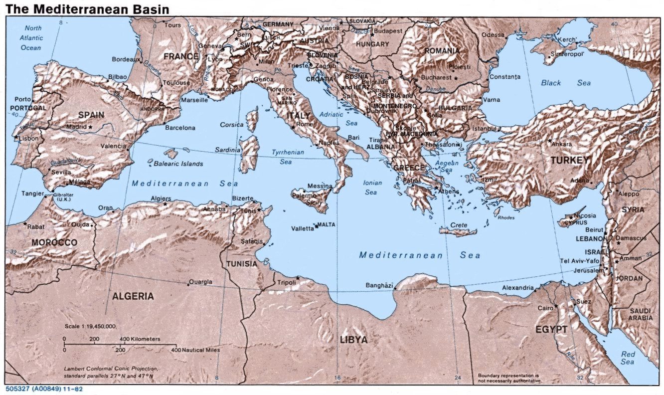
Composite satellite image of the Mediterranean Sea Coordinates 35°N 18°E / 35°N 18°ECoordinates: 35°N 18°E / 35°N 18°E Basin countries Albania, Algeria, Andorra, Austria, Belarus, Bosnia and Herzegovina, Bulgaria, Burundi, Central African Republic, Chad, (Republic of the) Congo, Croatia, Cyprus, Czech Republic, Egypt, Eritrea, Ethiopia, France, Georgia, Germany, Gibraltar, Greece, Hungary, Israel, Italy, Kenya, Kosovo, Lebanon, Libya, Liechtenstein, (Republic of) Macedonia, Malta, Monaco, Montenegro, Morocco, Niger, Palestinian territories, Romania, Russia, Rwanda, San Marino, Serbia, Slovakia, Slovenia, South Sudan, Spain, Sudan, Switzerland, Syria, Tanzania, Tunisia, Turkey, Uganda, Ukraine, Vatican City Surface area 2,500,000 km2 (970,000 sq mi) Average depth 1,500 m (4,900 ft) Max depth 5,267 m (17,280 ft) Residence time (of Ocean water) 80-100 years[1] Islands 3300+ The Mediterranean Sea is a sea connected to the Atlantic Ocean surrounded by the Mediterranean region and almost completely enclosed by land: on the north by Anatolia and Europe, on the south by North Africa, and on the east by the Levant. The sea is sometimes considered a part of the Atlantic Ocean, although it is usually identified as a completely separate body of water.
The name Mediterranean is derived from the Latin mediterraneus, meaning "inland" or "in the middle of the earth" (from medius, "middle" and terra, "earth"). It covers an approximate area of 2.5 million km² (965,000 sq mi), but its connection to the Atlantic (the Strait of Gibraltar) is only 14 km (8.7 mi) wide. In oceanography, it is sometimes called the Eurafrican Mediterranean Sea or the European Mediterranean Sea to distinguish it from mediterranean seas elsewhere.[2][3]
The Mediterranean Sea has an average depth of 1,500 m (4,900 ft) and the deepest recorded point is 5,267 m (17,280 ft) in the Calypso Deep in the Ionian Sea.
It was an important route for merchants and travelers of ancient times that allowed for trade and cultural exchange between emergent peoples of the region — the Mesopotamian, Persian, Egyptian, Phoenician, Carthaginian, Iberian, Greek and Byzantine, Roman and Italian, Illyrian, Thracian, Levantine, Gallic, Armenian, Arabic, Berber, Jewish, Aragonese, Slavic and Turkish cultures. The history of the Mediterranean region is crucial to understanding the origins and development of many modern societies. "For the three quarters of the globe, the Mediterranean Sea is similarly the uniting element and the centre of World History."[4]
Contents
Name
This video over the Mediterranean Sea was taken by the crew of Expedition 29 on board the International Space Station.
The term Mediterranean derives from the Latin word mediterraneus, meaning "in the middle of earth" or "between lands" (medius, "middle, between" + terra, "land, earth"). This is on account of the sea's intermediary position between the continents of Africa and Europe. The Greek name Mesogeios (Μεσόγειος), is similarly from μέσο, "middle" + γη, "land, earth").[5]
The Mediterranean Sea has been known by a number of alternative names throughout human history. For example the Romans commonly called it Mare Nostrum (Latin, "Our Sea"), and occasionally Mare Internum (Sallust, Jug. 17).
In the Bible, it was primarily known as the "Great Sea" (Num. 34:6,7; Josh. 1:4, 9:1, 15:47; Ezek. 47:10,15,20), or simply "The Sea" (1 Kings 5:9; comp. 1 Macc. 14:34, 15:11); however, it has also been called the "Hinder Sea", due to its location on the west coast of the Holy Land, and therefore behind a person facing the east, as referenced in the Old Testament, sometimes translated as "Western Sea", (Deut. 11:24; Joel 2:20). Another name was the "Sea of the Philistines" (Exod. 23:31), from the people occupying a large portion of its shores near the Israelites.
In Modern Hebrew, it has been called HaYyam HaTtikhon (הַיָּם הַתִּיכוֹן), "the middle sea", a literal adaptation of the German equivalent Mittelmeer.[citation needed] In Turkish, it is known as Akdeniz, "the white sea". In modern Arabic, it is known as al-Baḥr al-Abyaḍ al-Mutawassiṭ (البحر الأبيض المتوسط), "the White Middle Sea," while in Islamic and older Arabic literature, it was referenced as Baḥr al-Rūm (بحر الروم), or "the Roman/Byzantine Sea."
History
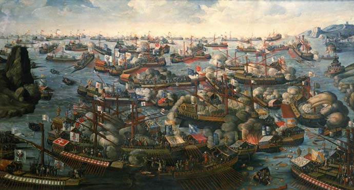
Main article: History of the Mediterranean region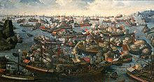 The Holy League naval victory of the Battle of Lepanto, 1571, the last battle to be fought primarily between galleys
As a sea around which some of the most ancient human civilisations were arranged, it has had a major influence on the history and ways of life of these cultures. It provided a way of trade, colonisation and war, and was the basis of life (via fishing and the gathering of other seafood) for numerous communities throughout the ages.[6]
The combination of similarly shared climate, geology and access to a common sea has led to numerous historical and cultural connections between the ancient and modern societies around the Mediterranean.
Two of the most notable Mediterranean civilisations in classical antiquity were the Greek city states and the Phoenicians. When Augustus founded the Roman Empire, the Mediterranean sea began to be called Mare Nostrum (literally:"Our Sea") by the Romans.
Darius I of Persia, who conquered Ancient Egypt built a canal linking Mediterranean to the Red Sea. Darius's canal was wide enough that two triremes could pass each other with oars extended, and required four days to traverse.[7]
The Roman empire began to crumble, however, in the fifth century and Rome collapsed after 476 AD. Temporarily the east was again dominant as the Byzantine Empire formed from the eastern half of the Roman one. Another power was rising in the east, that of Islam. At its greatest extent, the Arab Empire controlled 3/4 of the Mediterranean region.
Europe was reviving, however, as more organized and centralised states began to form in the later Middle Ages after the Renaissance of the 12th century.
Ottoman power continued to grow, and in 1453, the Byzantine Empire was extinguished with the fall of Constantinople. The growing naval prowess of the European powers confronted further rapid Ottoman expansion in the region when the Battle of Lepanto checked the power of the Ottoman navy. The development of oceanic shipping began to affect the entire Mediterranean, however. While once all trade from the east had passed through the region, the circumnavigation of Africa allowed spices and other goods to be imported directly to the Atlantic ports of western Europe.[8][9][10]
Geography
 A satellite image taken from the side of the Strait of Gibraltar. On the left, Europe; on the right, Africa
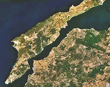 Dardanelles. North side is Gelibolu Peninsula-Europe, South side is Asia.
The Mediterranean Sea is connected to the Atlantic Ocean by the Strait of Gibraltar on the west and to the Sea of Marmara and the Black Sea, by the Dardanelles and the Bosporus respectively, on the east. The Sea of Marmara is often considered a part of the Mediterranean Sea, whereas the Black Sea is generally not. The 163 km (101 mi) long man-made Suez Canal in the southeast connects the Mediterranean Sea to the Red Sea.
Large islands in the Mediterranean include Cyprus, Crete, Euboea, Rhodes, Lesbos, Chios, Kefalonia, Corfu, Naxos and Andros in the eastern Mediterranean; Sardinia, Corsica, Sicily, Cres, Krk, Brač, Hvar, Pag, Korčula and Malta in the central Mediterranean; and Ibiza, Majorca and Minorca (the Balearic Islands) in the western Mediterranean.
The climate is a typical Mediterranean climate with hot, dry summers and mild, rainy winters. Crops of the region include olives, grapes, oranges, tangerines, and cork.
Extent
The International Hydrographic Organization defines the limits of the Mediterranean Sea as follows:[11]
The Mediterranean Sea is bounded by the coasts of Europe, Africa and Asia, from the Strait of Gibraltar on the West to the entrances to the Dardanelles and the Suez Canal on the East.
It is divided into two deep basins as follows:
Western Basin
On the West. A line joining the extremities of Cape Trafalgar (Spain) and Cape Spartel (Africa).
On the Northeast. The West Coast of Italy. In the Strait of Messina a line joining the North extreme of Cape Paci (15°42'E) with Cape Peloro, the East extreme of the Island of Sicily. The North Coast of Sicily.
On the East. A line joining Cape Lilibeo the Western point of Sicily (37°47′N 12°22′E / 37.783°N 12.367°E), through the Adventure Bank to Cape Bon (Tunisia).
Eastern Basin
On the West. The Northeastern and Eastern limits of the Western Basin.
On the Northeast. A line joining Kum Kale (26°11'E) and Cape Helles, the Western entrance to the Dardanelles.
On the Southeast. The entrance to the Suez Canal.
(It should be noted that the coast referred to as belonging to Palestine in this document dating to 1953 has been within the internationally recognised borders of the country known as Israel since 1948. Of the territories administered by the Palestinian Authority, only the Gaza Strip has a sea coast.)
Oceanography
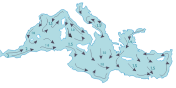 Predominant surface currents for June
Being nearly landlocked affects the Mediterranean Sea's properties; for instance, tides are very limited as a result of the narrow connection with the Atlantic Ocean. The Mediterranean is characterized and immediately recognised by its deep blue colour.
Evaporation greatly exceeds precipitation and river runoff in the Mediterranean, a fact that is central to the water circulation within the basin.[12] Evaporation is especially high in its eastern half, causing the water level to decrease and salinity to increase eastward.[13] This pressure gradient pushes relatively cool, low-salinity water from the Atlantic across the basin; it warms and becomes saltier as it travels east, then sinks in the region of the Levant and circulates westward, to spill over the Strait of Gibraltar.[14] Thus, seawater flow is eastward in the Strait's surface waters, and westward below; once in the Atlantic, this chemically distinct Mediterranean Intermediate Water can persist thousands of kilometres away from its source.[15]
Bordering countries
 Map of the Mediterranean Sea
Twenty-one modern states have a coastline on the Mediterranean Sea. They are:
- Europe (from west to east):
 Spain,
  France,
  Monaco,
  Italy,
  Malta,
  Slovenia,
  Croatia,
  Bosnia and Herzegovina,
  Montenegro,
  Albania,
  Greece and
  Turkey (East Thrace)
 - Asia (from north to south): Turkey (Anatolia),
 Cyprus,
  Syria,
  Lebanon,
  Israel,
  Egypt (the Sinai Peninsula)
 - Africa (from east to west): Egypt,
 Libya,
  Tunisia,
  Algeria and
  Morocco
Turkey and Egypt are transcontinental countries. The southernmost islands of Italy, the Pelagie islands, are geologically part of the African continent.
Several other territories also border the Mediterranean Sea (from west to east):
 British overseas territory of Gibraltar
 Spanish enclaves of Ceuta and Melilla and nearby islands
 British sovereign base area of Akrotiri and Dhekelia
 Turkish Republic of Northern Cyprus (disputed)
 Gaza Strip of the Palestinian Territories
Capital cities of sovereign countries and major cities (municipalities) with populations larger than 200,000 people bordering the Mediterranean Sea are:
Country Cities Spain Alicante, Badalona, Barcelona, Cartagena, Málaga, Palma, Valencia France Marseille, Montpellier, Nice Monaco Monaco* Italy Bari, Catania, Genoa, Messina, Naples, Palermo, Rome, Trieste, Venice Malta Valletta* Albania Durrës Greece Athens, Patras, Thessaloniki Cyprus Limassol Turkey Antalya, Istanbul, Iskenderun, Izmir, Izmit, Mersin, Tarsus Syria Lattakia Lebanon Beirut, Tripoli Israel Ashdod, Haifa, Rishon LeZion, Tel Aviv Palestinian territories Gaza City Egypt Alexandria, Damietta, Port Said Libya Benghazi, Khoms, Misrata, Tripoli Tunisia Sfax, Tunis Algeria Algiers, Annaba, Oran Morocco Tétouan, Tangiers Subdivisions
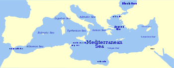
According to the International Hydrographic Organization (IHO), the Mediterranean Sea is subdivided into a number of smaller waterbodies, each with their own designation (from west to east):[11]
 Map of the Mediterranean Sea, showing the subdivisions of the IHO and some others.
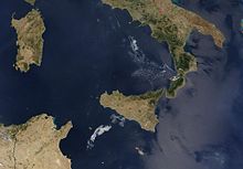 The two biggest islands of the Mediterranean, Sicily and Sardinia
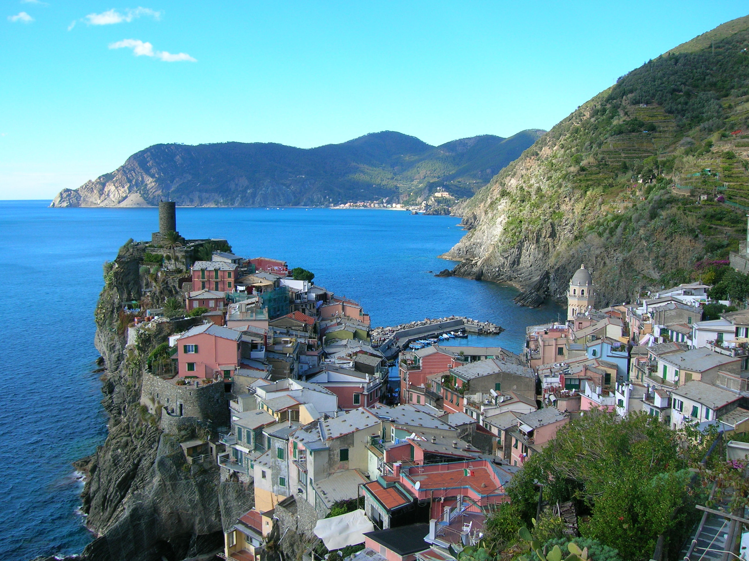
 View of the Cinque Terre Mediterranean shoreline, Italy
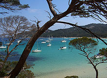

- the Strait of Gibraltar;
- the Alboran Sea, between Spain and Morocco;
- the Balearic Sea, between mainland Spain and its Balearic Islands;
- the Ligurian Sea between Corsica and Liguria (Italy);
- the Tyrrhenian Sea enclosed by Sardinia, Italian peninsula and Sicily;
- the Ionian Sea between Italy, Albania and Greece;
- the Adriatic Sea between Italy, Slovenia, Croatia, Bosnia and Herzegovina, Montenegro and Albania;
- the Aegean Sea between Greece and Turkey.
Other seas
Although not recognised by the IHO treaties, there are some other seas whose names have been in common use from the ancient times, or in the present:
- the Sea of Sardinia, between Sardinia and Balearic Islands, as a part of the Balearic Sea
- the Sea of Sicily between Sicily and Tunisia,
- the Libyan Sea between Libya and Crete,
- In the Aegean Sea,
- the Thracian Sea in its north,
- the Myrtoan Sea between the Cyclades and the Peloponnese,
- the Sea of Crete north of Crete,
- the Icarian Sea between Kos and Chios
- the Cilician Sea between Turkey and Cyprus
- the Levantine Sea at the eastern end of the Mediterranean
Other features
Many of these smaller seas feature in local myth and folklore and derive their names from these associations. In addition to the seas, a number of gulfs and straits are also recognised:
- the Saint George Bay in Beirut, Lebanon
- the Ras Ibn Hani cape in Latakia, Syria
- the Ras al-Bassit cape in northern Syria.
- the Minet el-Beida ("White Harbour") bay near ancient Ugarit, Syria
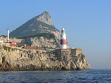
- the Strait of Gibraltar, connects the Atlantic Ocean to the Mediterranean Sea and separates Spain from Morocco
- the Bay of Gibraltar, at the southern end of the Iberian Peninsula
- the Gulf of Corinth, an enclosed sea between the Ionian Sea and the Corinth Canal
- the Pagasetic Gulf, the gulf of Volos, south of the Thermaic Gulf, formed by the Mount Pelion peninsula
- the Saronic Gulf, the gulf of Athens, between the Corinth Canal and the Mirtoan Sea
- the Thermaic Gulf, the gulf of Thessaloniki, located in the northern Greek region of Macedonia
- the Kvarner Gulf, Croatia
- the Gulf of Lion, south of France
- the Gulf of Valencia, east of Spain
- the Strait of Messina, between Sicily and the toe of Italy
- the Gulf of Genoa, northwestern Italy
- the Gulf of Venice, northeastern Italy
- the Gulf of Trieste, northeastern Italy
- the Gulf of Taranto, southern Italy
- the Gulf of Salerno, southwestern Italy
- the Gulf of Gaeta, southwestern Italy
- the Gulf of Squillace, southern Italy
- the Strait of Otranto, between Italy and Albania
- the Gulf of Haifa, between Haifa and Akko, Israel
- the Gulf of Sidra, between Tripolitania (western Libya) and Cyrenaica (eastern Libya)
- the Strait of Sicily, between Sicily and Tunisia
- the Corsica Channel, between Corsica and Italy
- the Strait of Bonifacio, between Sardinia and Corsica
- the Gulf of İskenderun, between İskenderun and Adana (Turkey)
- the Gulf of Antalya, between west and east shores of Antalya (Turkey)
- the Bay of Kotor, in south-western Montenegro and south-eastern Croatia
- the Malta Channel, between Sicily and Malta
10 Major islands
Main article: List of islands in the MediterraneanFlag Island Area in km² Population 
Sicily 25,460 5,048,995 
Sardinia 24,090 1,672,804 Cyprus 9,251 1,088,503 
Corsica 8,680 299,209 Crete 8,336 623,666 Euboea 3,684 218,032 
Majorca 3,640 869,067 Lesbos 1,632 90,643 Rhodes 1,400 117,007 Chios 842 51,936 Climate
Sea temperature
Sea temperature (°C) Jan Feb Mar Apr May Jun Jul Aug Sep Oct Nov Dec Marseille [2] 13 12 11 13 16 18 21 22 21 18 16 14 Barcelona [3] 13 13 12 14 17 20 23 25 23 20 17 15 Valencia [4] 14 13 14 15 17 21 24 26 24 21 18 15 Naples [5] 15 14 14 15 18 22 25 27 25 22 19 16 Malaga [6] 16 15 15 16 17 20 22 23 22 20 18 16 Gibraltar [7] 16 15 16 16 17 20 22 22 22 20 18 17 Athens [8] 16 15 15 16 18 21 24 24 24 21 19 18 Heraklion [9] 16 15 15 16 19 22 24 25 24 22 20 18 Malta [10] 16 16 15 16 18 21 24 26 25 23 21 18 Paphos [11] 18 17 17 18 20 24 26 27 26 24 22 19 Larnaca [12] 18 17 17 18 20 24 26 27 27 25 22 19 Limassol [13] 18 17 17 18 20 24 26 27 27 25 22 19 Alexandria [14] 18 17 17 18 20 23 25 26 26 25 22 20 Tel Aviv [15] 18 17 17 18 21 24 26 28 27 26 23 20 Geology
The geologic history of the Mediterranean is complex. It was involved in the tectonic break-up and then collision of the African and Eurasian plates. The Messinian Salinity Crisis occurred in the late Miocene (12 million years ago to 5 million years ago) when the Mediterranean dried up. Geologically the Mediterranean is underlain by oceanic crust.
The Mediterranean Sea has an average depth of 1,500 m (4,900 ft) and the deepest recorded point is 5,267 m (17,280 ft) in the Calypso Deep in the Ionian Sea. The coastline extends for 46,000 km (29,000 mi). A shallow submarine ridge (the Strait of Sicily) between the island of Sicily and the coast of Tunisia divides the sea in two main subregions (which in turn are divided into subdivisions), the Western Mediterranean and the Eastern Mediterranean. The Western Mediterranean covers an area of about 0.85 million km² (0.33 million mi²) and the Eastern Mediterranean about 1.65 million km² (0.64 million mi²).
Tectonic evolution
The geodynamic evolution of the Mediterranean Sea was provided by the convergence of European and African plates. This process was driven by the differential spreading along the Atlantic ridge, which led to the closure of the Tethys Ocean and eventually to the Alpine orogenesis. However, the Mediterranean also hosts wide extensional basins and migrating tectonic arcs, in response to its land-locked configuration.
According to a report published by Nature in 2009, scientists think that the Mediterranean Sea was mostly filled during a time period of less than two years, in a major flood (the Zanclean flood) that happened approximately 5.33 million years ago, in which water poured in from the Atlantic Ocean and through the Strait of Gibraltar, at a rate three times the current flow of the Amazon River.[16]
Eastern Mediterranean
In middle Miocene times, the collision between the Arabian microplate and Eurasia led to the separation between the Tethys and the Indian oceans. This process resulted in profound changes in the oceanic circulation patterns, which shifted global climates towards colder conditions. The Hellenic arc, which has a land-locked configuration, underwent a widespread extension for the last 20 Myr due to a slab roll-back process. In addition, the Hellenic Arc experienced a rapid rotation phase during the Pleistocene, with a counterclockwise component in its eastern portion and a clockwise trend in the western segment.
Central Mediterranean
The opening of small oceanic basins of the central Mediterranean follows a trench migration and back-arc opening process that occurred during the last 30 Myr. This phase was characterised by the anticlockwise rotation of the Corsica-Sardinia block, which lasted until the Langhian (ca.16 Ma), and was in turn followed by a slab detachment along the northern African margin. Subsequently, a shift of this active extentional deformation led to the opening of the Tyrrenian basin.
Western Mediterranean
Since Mesozoic to Tertiary times, during convergence between Africa and Iberia, the Betic-Rif mountain belts developed. Tectonic models for its evolution include: rapid motion of Alboran microplate, subduction zone and radial extensional collapse caused by convective removal of lithospheric mantle. The development of these intramontane Betic and Rif basins led to the onset of two marine gateways which were progressively closed during the late Miocene by an interplay of tectonic and glacio-eustatic processes.
Paleoenvironmental analysis
Its semi-enclosed configuration makes the oceanic gateways critical in controlling circulation and environmental evolution in the Mediterranean Sea. Water circulation patterns are driven by a number of interactive factors, such as climate and bathymetry, which can lead to precipitation of evaporites. During late Miocene times, a so-called "Messinian Salinity Crisis" (MSC hereafter) occurred, which was triggered by the closure of the Atlantic gateway. Evaporites accumulated in the Red Sea Basin (late Miocene), in the Carpatian foredeep (middle Miocene) and in the whole Mediterranean area (Messinian). An accurate age estimate of the MSC—5.96 Ma—has recently been astronomically achieved; furthermore, this event seems to have occurred synchronously. The beginning of the MSC is supposed to have been of tectonic origin; however, an astronomical control (eccentricity) might also have been involved. In the Mediterranean basin, diatomites are regularly found underneath the evaporite deposits, thus suggesting (albeit not clearly so far) a connection between their geneses.
The present-day Atlantic gateway, i.e. the Strait of Gibraltar, finds its origin in the early Pliocene. However, two other connections between the Atlantic Ocean and the Mediterranean Sea existed in the past: the Betic Corridor (southern Spain) and the Rifian Corridor (northern Morocco). The former closed during Tortonian times, thus providing a "Tortonian Salinity Crisis" well before the MSC; the latter closed about 6 Ma, allowing exchanges in the mammal fauna between Africa and Europe. Nowadays, evaporation is more relevant than the water yield supplied by riverine water and precipitation, so that salinity in the Mediterranean is higher than in the Atlantic. These conditions result in the outflow of warm saline Mediterranean deep water across Gibraltar, which is in turn counterbalanced by an inflow of a less saline surface current of cold oceanic water.
The Mediterranean was once thought to be the remnant of the Tethys Ocean. It is now known to be a structurally younger ocean basin known as Neotethys. The Neotethys formed during the Late Triassic and Early Jurassic rifting of the African and Eurasian plates.
Paleoclimate
Because of its latitudinal position and its land-locked configuration, the Mediterranean is especially sensitive to astronomically induced climatic variations, which are well documented in its sedimentary record. Since the Mediterranean is involved in the deposition of eolian dust from the Sahara during dry periods, whereas riverine detrital input prevails during wet ones, the Mediterranean marine sapropel-bearing sequences provide high-resolution climatic information. These data have been employed in reconstructing astronomically calibrated time scales for the last 9 Ma of the Earth's history, helping to constrain the time of past Geomagnetic Reversals.[17] Furthermore, the exceptional accuracy of these paleoclimatic records have improved our knowledge of the Earth's orbital variations in the past.
Ecology and biota
As a result of the drying of the sea during the Messinian Salinity Crisis,[18] the marine biota of the Mediterranean are derived primarily from the Atlantic Ocean. The North Atlantic is considerably colder and more nutrient-rich than the Mediterranean, and the marine life of the Mediterranean has had to adapt to its differing conditions in the five million years since the basin was reflooded.
The Alboran Sea is a transition zone between the two seas, containing a mix of Mediterranean and Atlantic species. The Alboran Sea has the largest population of Bottlenose Dolphins in the western Mediterranean, is home to the last population of harbour porpoises in the Mediterranean, and is the most important feeding grounds for Loggerhead Sea Turtles in Europe. The Alboran sea also hosts important commercial fisheries, including sardines and swordfish. In 2003, the World Wildlife Fund raised concerns about the widespread drift net fishing endangering populations of dolphins, turtles, and other marine animals.
Environmental threats
Biodiversity
Invasive species
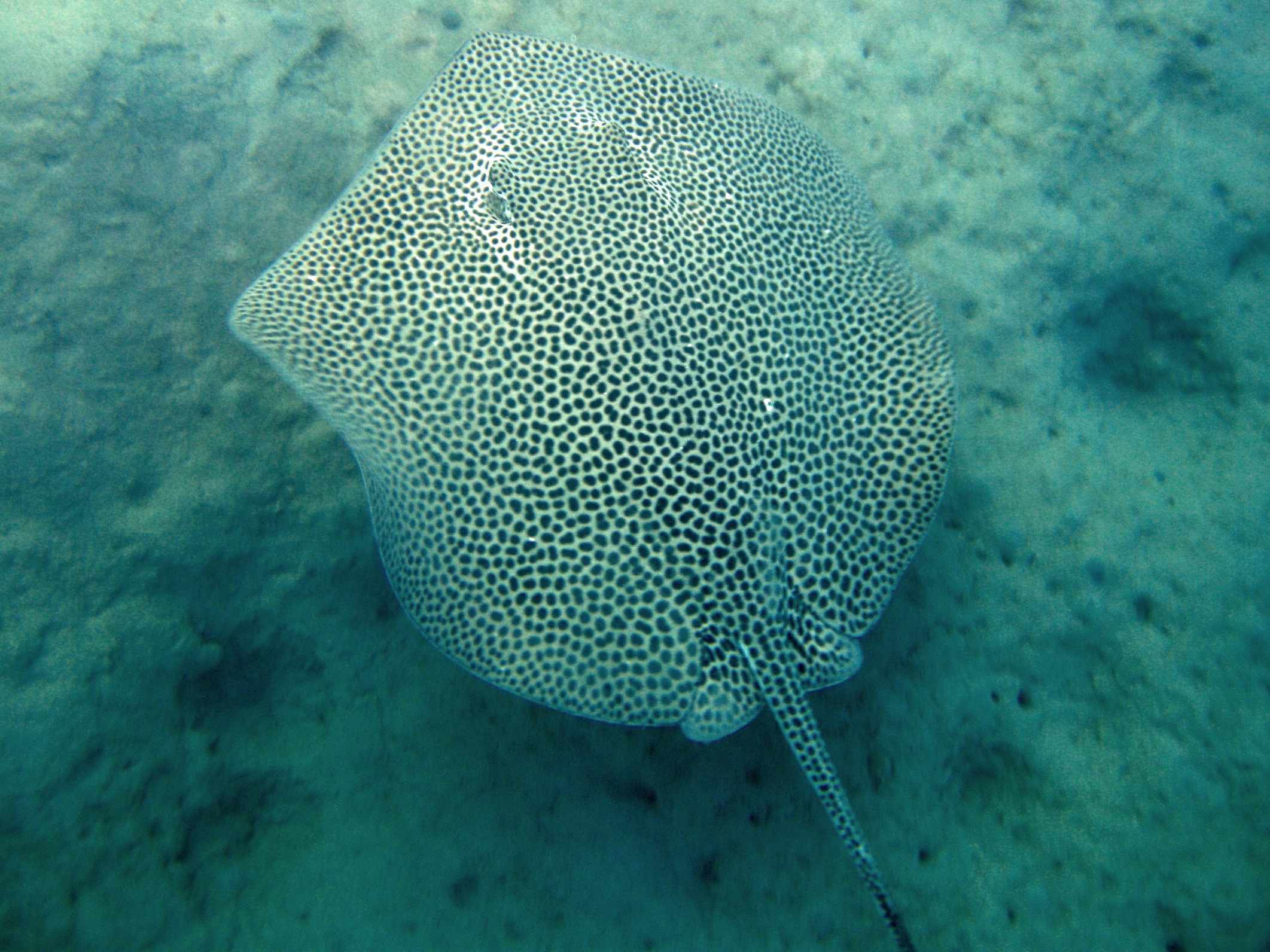
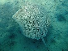 The Reticulate whipray, one of species that colonised the eastern Mediterranean Sea through the Suez Canal
The opening of the Suez Canal in 1869 created the first salt-water passage between the Mediterranean and Red Sea. The Red Sea is higher than the Eastern Mediterranean, so the canal serves as a tidal strait that pours Red Sea water into the Mediterranean. The Bitter Lakes, which are hyper-saline natural lakes that form part of the canal, blocked the migration of Red Sea species into the Mediterranean for many decades, but as the salinity of the lakes gradually equalized with that of the Red Sea, the barrier to migration was removed, and plants and animals from the Red Sea have begun to colonise the Eastern Mediterranean. The Red Sea is generally saltier and more nutrient-poor than the Atlantic, so the Red Sea species have advantages over Atlantic species in the salty and nutrient-poor Eastern Mediterranean. Accordingly, Red Sea species invade the Mediterranean biota, and not vice versa; this phenomenon is known as the Lessepsian migration (after Ferdinand de Lesseps, the French engineer) or Erythrean invasion. The construction of the Aswan High Dam across the Nile River in the 1960s reduced the inflow of freshwater and nutrient-rich silt from the Nile into the Eastern Mediterranean, making conditions there even more like the Red Sea and worsening the impact of the invasive species.
Invasive species have become a major component of the Mediterranean ecosystem and have serious impacts on the Mediterranean ecology, endangering many local and endemic Mediterranean species. A first look at some groups of exotic species show that more than 70% of the non-indigenous decapods and about 63% of the exotic fishes occurring in the Mediterranean are of Indo Pacific origin,[19] introduced into the Mediterranean through the Suez Canal. This makes the Canal as the first pathway of arrival of “alien” species into the Mediterranean. The impacts of some lessepsian species have proven to be considerable mainly in the Levantine basin of the Mediterranean, where they are replacing native species and becoming a “familiar sight”.
According to the International Union for Conservation of Nature definition, as well as Convention on Biological Diversity(CBD) and Ramsar Convention terminologies, they are alien species, as they are non-native (non-indigenous) to the Mediterranean Sea, and they are outside their normal area of distribution which is the Indo-Pacific region. When these species succeed in establishing populations in the Mediterranean sea, compete with and begin to replace native species they are “Alien Invasive Species”, as they are an agent of change and a threat to the native biodiversity. Depending on their impact, Lessepsian migrants are either alien or alien invasive species. In the context of CBD, “introduction" refers to the movement by human agency, indirect or direct, of an alien species outside of its natural range (past or present). The Suez Canal, being an artificial (man made) canal, is a human agency. Lessepsian migrants are therefore “introduced” species (indirect, and unintentional). Whatever wording is chosen, they represent a threat to the native Mediterranean biodiversity, because they are non-indigenous to this sea. In recent years, the Egyptian government's announcement of its intentions to deepen and widen the canal have raised concerns from marine biologists, fearing that such an act will only worsen the invasion of Red Sea species into the Mediterranean, facilitating the crossing of the canal for yet additional species.[20]
Arrival of new tropical Atlantic species
In recent decades, the arrival of exotic species from the tropical Atlantic has become a noticeable feature. Whether this reflects an expansion of the natural area of these species that now enter the Mediterranean through the Gibraltar strait, because of a warming trend of the water caused by Global Warming; or an extension of the maritime traffic; or is simply the result of a more intense scientific investigation, is still an open question. While not as intense as the “lessepsian” movement, the process deserves to be studied and monitored.
Sea-level rise
Europe may be less threatened by sea-level rise than many developing country regions. However, coastal ecosystems do appear to be threatened, especially enclosed seas such as the Baltic, the Mediterranean and the Black Sea. These seas have only small and primarily east-west orientated movement corridors, which may restrict northward displacement of organisms in these areas.[21] Sea level rise for the next century (2100) could be between 30 cm (12 in) and 100 cm (39 in) and temperature shifts of a mere 0.05-0.1°C in the deep sea are sufficient to induce significant changes in species richness and functional diversity.[22]
Pollution
 Marine debris on the coast of Tunisia
Pollution in this region has been extremely high in recent years. The United Nations Environment Programme has estimated that 650,000,000 t (720,000,000 short tons) of sewage, 129,000 t (142,000 short tons) of mineral oil, 60,000 t (66,000 short tons) of mercury, 3,800 t (4,200 short tons) of lead and 36,000 t (40,000 short tons) of phosphates are dumped into the Mediterranean each year.[23] The Barcelona Convention aims to 'reduce pollution in the Mediterranean Sea and protect and improve the marine environment in the area, thereby contributing to its sustainable development.'[24] Many marine species have been almost wiped out because of the sea's pollution. One of them is the Mediterranean Monk Seal which is considered to be among the world's most endangered marine mammals.[25]
The Mediterranean is also plagued by marine debris. A 1994 study of the seabed using trawl nets around the coasts of Spain, France and Italy reported a particularly high mean concentration of debris; an average of 1,935 items per km². Plastic debris accounted for 76%, of which 94% was plastic bags.[26]
Shipping
Some of the world’s busiest shipping routes are in the Mediterranean Sea. It is estimated that approximately 220,000 merchant vessels of more than 100 tonnes cross the Mediterranean Sea each year — about one third of the world’s total merchant shipping. These ships often carry hazardous cargo, which if lost would result in severe damage to the marine environment.
The discharge of chemical tank washings and oily wastes also represent a significant source of marine pollution. The Mediterranean Sea constitutes 0.7% of the global water surface and yet receives seventeen percent of global marine oil pollution. It is estimated that every year between 100,000 t (98,000 long tons) and 150,000 t (150,000 long tons) of crude oil are deliberately released into the sea from shipping activities.
Approximately 370,000,000 t (360,000,000 long tons) of oil are transported annually in the Mediterranean Sea (more than 20% of the world total), with around 250-300 oil tankers crossing the Sea every day. Accidental oil spills happen frequently with an average of 10 spills per year. A major oil spill could occur at any time in any part of the Mediterranean.[22]
Tourism
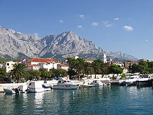
With a unique combination of pleasant climate, beautiful coastline, rich history and diverse culture the Mediterranean region is the most popular tourist destination in the world — attracting approximately one third of the world’s international tourists.
Tourism is one of the most important sources of income for many Mediterranean countries. It also supports small communities in coastal areas and islands by providing alternative sources of income far from urban centres. However, tourism has also played major role in the degradation of the coastal and marine environment. Rapid development has been encouraged by Mediterranean governments to support the large numbers of tourists visiting the region each year. But this has caused serious disturbance to marine habitats such as erosion and pollution in many places along the Mediterranean coasts.
Tourism often concentrates in areas of high natural wealth, causing a serious threat to the habitats of endangered Mediterranean species such as sea turtles and monk seals. It is ironic that tourism in this region is destroying the foundations of its own existence. And it is inevitable that the tourists will leave the Mediterranean as it becomes more depleted of its natural beauty.[22]
Overfishing
Fish stock levels in the Mediterranean Sea are alarmingly low. The European Environment Agency says that over 65% of all fish stocks in the region are outside safe biological limits and the United Nations Food and Agriculture Organisation, that some of the most important fisheries — such as albacore and bluefin tuna, hake, marlin, swordfish, red mullet and sea bream — are threatened.
There are clear indications that catch size and quality have declined, often dramatically, and in many areas larger and longer-lived species have disappeared entirely from commercial catches.
Large open water fish like tuna have been a shared fisheries resource for thousands of years but the stocks are now dangerously low. In 1999, Greenpeace published a report revealing that the amount of bluefin tuna in the Mediterranean had decreased by over 80% in the previous 20 years and government scientists warn that without immediate action the stock will collapse.
Aquaculture
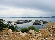 Aquaculture in western Greece
Aquaculture is expanding rapidly — often without proper environmental assessment — and currently accounts for 30% of the fish protein consumed worldwide. The industry claims that farmed seafood lessens the pressure on wild fish stocks, yet many of the farmed species are carnivorous, consuming up to five times their weight in wild fish.
Mediterranean coastal areas are already over exposed to human influence, with pristine areas becoming ever scarcer. The aquaculture sector adds to this pressure, requiring areas of high water quality to set up farms. The installation of fish farms close to vulnerable and important habitats such as seagrass meadows is particularly concerning.
Aquaculture production in the Mediterranean also threatens biodiversity through the introduction of new species to the region, the impact of the farms' organic and chemical effluents on the surrounding environment and coastal habitat destruction.
See also
- Babelmed, the site of the Mediterranean cultures
- Euro-Mediterranean Parliamentary Assembly
- Familial Mediterranean fever
- History of the Mediterranean region
- Holy League (Mediterranean)
- List of islands in the Mediterranean
- List of Mediterranean countries
- Mediterranean Basin
- Mediterranean climate
- Mediterranean diet
- Mediterranean forests, woodlands, and scrub
- Mediterranean Games
- Mediterranean race
- Mediterranean sea (oceanography)
- Mediterranean Union
- Piri Reis, early Mediterranean maps
- Seto Inland Sea, which is sometimes named the Japanese Mediterranean Sea
- Suez Canal
References
- ^ Pinet, Paul R. (2008). Invitation to Oceanography. Jones & Barlett Learning. p. 220. ISBN 0763759937. http://books.google.com/books?id=6TCm8Xy-sLUC&pg=PA220&lpg=PA220.
- ^ "Microsoft Word - ext_abstr_East_sea_workshop_TLM.doc" (PDF). http://www.ifremer.fr/lobtln/OTHER/ext_abstr_East_Sea_workshop_TLM.pdf. Retrieved 2010-04-23.
- ^ "Researchers predict Mediterranean Sea level rise - Headlines - Research – European Commission". Ec.europa.eu. 2009-03-19. http://ec.europa.eu/research/headlines/news/article_09_03_19_en.html. Retrieved 2010-04-23.
- ^ Georg Wilhelm Friedrich Hegel The Philosophy of History, p. 87, Dover Publications Inc., 1956 ISBN 0486201120; 1st ed. 1899
- ^ entry μεσόγαιος at Liddell & Scott
- ^ David Abulafia, The Great Sea: A Human History of the Mediterranean (Oxford University Press; 2011)
- ^ Rappoport, S. (Doctor of Philosophy, Basel). History of Egypt (undated, early 20th century), Volume 12, Part B, Chapter V: "The Waterways of Egypt," pages 248-257. London: The Grolier Society.
- ^ C.I. Gable - Constantinople Falls to the Ottoman Turks - Boglewood Timeline - 1998 - Retrieved 3 September 2011.
- ^ "History of the Ottoman Empire, an Islamic Nation where Jews Lived" - Sephardic Studies and Culture - Retrieved 3 September 20111.
- ^ Robert Guisepi - The Ottomans: From Frontier Warriors To Empire Builders - 1992 - History World International - Retrieved 3 September 2011.
- ^ a b "Limits of Oceans and Seas, 3rd edition". International Hydrographic Organization. 1953. http://www.iho-ohi.net/iho_pubs/standard/S-23/S23_1953.pdf. Retrieved 7 February 2010.
- ^ Pinet, Paul R. (1996), Invitation to Oceanography (3rd ed.), St Paul, MN: West Publishing Co., p. 202, ISBN 0314063390
- ^ Pinet 1996, p. 206.
- ^ Pinet 1996, pp. 206–207.
- ^ Pinet 1996, p. 207.
- ^ Mediterranean Sea filled in less than two years: study, AFP, December 9, 2009
- ^ FJ, Hilgen. Astronomical calibration of Gauss to Matuyama sapropels in the Mediterranean and implication for the Geomagnetic Polarity Time Scale, 104 (1991) 226-244 Earth and Planetary Science Letters, 1991.[1]
- ^ Hsu K.J., "When the Mediterranean Dried Up" Scientific American, Vol. 227, December 1972, p32
- ^ "IUCN Guidelines for the Prevention of Biodiversity Loss Caused by Alien Invasive Species". International Union for Conservation of Nature. 2000. http://www.issg.org/infpaper_invasive.pdf. Retrieved 2009-08-11.[dead link]
- ^ Galil, B.S. and Zenetos, A. (2002). A sea change: exotics in the eastern Mediterranean Sea, in: Leppäkoski, E. et al. (2002). Invasive aquatic species of Europe: distribution, impacts and management. pp. 325-336.
- ^ Nicholls, R.J.; Klein,R.J.T. (2005). Climate change and coastal management on Europe's coast, in: Vermaat, J.E. et al. (Ed.) (2005). Managing European coasts: past, present and future. pp. 199-226.
- ^ a b c "Other threats in the Mediterranean | Greenpeace International". Greenpeace.org. http://www.greenpeace.org/international/campaigns/oceans/marine-reserves/the-mediterranean/mediterranean-other-threats. Retrieved 2010-04-23.
- ^ "Pollution in the Mediterranean Sea. Environmental issues". Explorecrete.com. http://www.explorecrete.com/nature/mediterranean.html. Retrieved 2010-04-23.
- ^ "EUROPA". Europa.eu. http://europa.eu/scadplus/leg/en/lvb/l28084.htm. Retrieved 2010-04-23.
- ^ "Mediterranean Monk Seal Fact Files: Overview". Monachus-guardian.org. 1978-05-05. http://www.monachus-guardian.org/factfiles/medit01.htm. Retrieved 2010-04-23.
- ^ publications/docs/anl_oview.pdf "Marine Litter: An analytical overview". United Nations Environment Programme. 2005. http://www.unep.org/regionalseas/marinelitter publications/docs/anl_oview.pdf. Retrieved 2008-08-01.
External links
- Greenpeace campaign "Defending Our Mediterranean": Threats, Solutions and Photo Petition
- Planblue - Environment and Development in the Mediterranean Region
- Finding Nino By Marc Llewellyn - winner of the ASTW Travel Book of the Year Award, about the Mediterranean, finding oneself, and becoming a peasant farmer.
- [16] Mediterranean Sea Live ships traffic.
- Mediterranean Sea Microorganisms: 180+ images of Foraminifera
Categories:- Mediterranean
- Marine ecoregions
- Natural history of Europe
- European seas
- Europe (from west to east):


Wikimedia Foundation. 2010.