- Exeter
-
For other uses, see Exeter (disambiguation).
City of Exeter Clockwise: The Cathedral, The Clock Tower, Devon County Hall, Cathedral Close, The Iron Bridge.

City Council's Coat of ArmsMotto: Semper fidelis The District of Exeter shown within Devon
Coordinates: 50°43′18.48″N 3°32′1.02″W / 50.7218°N 3.5336167°WCoordinates: 50°43′18.48″N 3°32′1.02″W / 50.7218°N 3.5336167°W Sovereign state United Kingdom Constituent country England Region South West England Ceremonial and shire county Devon City status Time immemorial Non-metropolitan district 1974 Government – Type Exeter City Council – Lord Mayor Stella Brock – Members of Parliament Ben Bradshaw
Hugo Swire– HQ Civic Centre, Paris Street – Wards 18 – UK Parliament Exeter
East DevonArea – Total 18.2 sq mi (47.03 km2) Population (2009 estimate)[1] – Total 118,800 – Density 2,602.59/sq mi (3,142/km2) – Demonyms Exonian – Ethnicity (2001)[2] 97.64% WhiteTime zone GMT (UTC0) – Summer (DST) BST (UTC+1) Postcode district EX1-6 Area code(s) 01392 Website www.exeter.gov.uk Exeter (
 i/ˈɛksɨtər/ ek-si-tər) is a historic city in Devon, England. It lies within the ceremonial county of Devon, of which it is the county town as well as the home of Devon County Council. Currently the administrative area has the status of a non-metropolitan district, and is therefore under the administration of the County Council. The city is on the River Exe, about 37 miles (60 km) northeast of Plymouth, and 70 miles (110 km) southwest of Bristol. According to the 2001 Census, its population in that year was 111,076, while the mid-2009 estimate was 118,800.[1]
Exeter was the most south-westerly Roman fortified settlement in Britain. Its Exeter Cathedral, founded in the early 12th century, became Anglican at the time of the 16th century Reformation.
Exeter has been identified as one of the top ten most profitable locations for a business to be based.[3] The city has good transport links, with Exeter St David's railway station, Exeter Central railway station, the M5 motorway and Exeter International Airport connecting the city both nationally and internationally. Although a popular tourist destination, the city is not dominated by tourism.
Contents
History
Prehistoric and Roman times
Main article: Isca DumnoniorumSee also: DumnoniiThe favourable location of Exeter, on a dry ridge of land ending in a spur that overlooks a navigable river that was teeming with fish, and with fertile land nearby, suggests that it would have been a site that was occupied early.[4] The discovery of coins dating from the Hellenistic period in the city indicates the existence of a settlement that was trading with the Mediterranean region as early as 250 BC.[5]
The Latin name for Exeter, Isca Dumnoniorum ("Isca of the Dumnones or Devonians"), suggests that the city was of Celtic origin. This oppidum, (a Latin term meaning an important town), on the banks of the River Exe certainly existed prior to the foundation of the Roman city in about AD 50, however the name may have been suggested by a Celtic adviser to the Romans, rather than by the original inhabitants of the place.
 An illustration of Exeter in 1563, entitled Civitas Exoniae (vulgo Excester) urbs primaria in comitatu Devoniae
Such early towns, or proto-cities, had been a feature of pre-Roman Gaul as described by Julius Caesar in his Commentarii de Bello Gallico ("Commentaries on the Gallic Wars"), and it is possible that they existed in neighbouring Britannia as well. Isca is derived from a Brythonic Celtic word for flowing water, which was given to the Exe and, elsewhere, to the River Usk on which Caerleon in Monmouthshire stands. This element is clearly present in the Modern Welsh names for Exeter (Caer-wysg) and the River Exe (Afon Wysg). The Romans gave the city the name Isca Dumnoniorum in order to distinguish it from Isca Augusta, modern Caerleon. in 2010 two separate legionary camps dated at about the time of Vespasian were excavated at Saint Loyes on the Roman Road between Isca and Topsham adding evidence of military activity at the time of Vespasian before the Exeter site was consolidated.
Significant parts of the Roman wall remain, though most of the visible structure is later. Most of its route can be traced on foot. A substantial Roman baths complex was excavated in the 1970s,[6][7] but because of its proximity to the cathedral, it was not practicable to retain the excavation for public view. Exeter was also the southern starting point for the Fosse Way Roman road.
More than 1,000 Roman coins have been found in the city indicating its importance as a trading centre. The dates of these coins suggest that the city was at its most prosperous in the first half of the fourth century. However, virtually no coins dated after AD 380 have been found, suggesting a rapid decline.[8]
After the Romans left Britain in the early 5th century nothing is known of Exeter for about 270 years, until around 680 when a document about St Boniface reports that he was educated at the Abbey in Exeter.[9]
Celtic & Saxon times
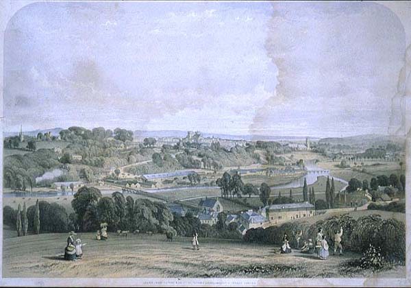
 Exeter in 1844. A print by William Spreat showing St David's shortly after its consecration in 1844
The Saxons arrived in Exeter after defeating the Britons at the Battle of Peonnum in Somerset in 658.[10] It is likely that amongst the ruins of the Roman city there was plenty of room for both peoples, and the Saxons allowed the Britons to continue to live in their own quarter of the city under their own laws. This was almost certainly in the same area as the ancient British settlement—in the locality of the present-day Bartholomew Street.[11] Until 1637 this street was known as Britayne in memory of the fact that it was once the British quarter.[12]
In 876 Exeter (then known as Escanceaster)[13] was attacked and briefly captured by the Danes. Alfred the Great drove them out the next summer,[14] and in the following years made Exeter one of the four burhs in Devon, repairing the Roman city walls in the process.[15] In 893 the city held off another siege by the Danes.[15]
In about 928 King Athelstan caused the walls to be thoroughly repaired and at the same time drove out the Britons from the city.[14] It is not known whether or not these Britons had lived in the city continuously since Roman times—they may have been immigrants from the countryside when Alfred made the city a burh.[16] According to William of Malmesbury, they were sent beyond the River Tamar, thereby fixing that river as the boundary of Devonshire, though Athelstan may have been restoring an old Dumnonian boundary.[17] The quarter vacated by the Britons was then apparently adapted as "the earl's burh", and was still named Irlesberi in the 12th century.[14]
In 1001 the Danes again failed to get into the city, but they were able to plunder it in 1003 because they were let in, for unknown reasons, by the French reeve of Emma of Normandy, who had been given the city as part of her dowry on her marriage to Æthelred the Unready the previous year.[14]
Medieval times
In 1067, possibly because Gytha Thorkelsdóttir, mother of King Harold, was living in the city, Exeter rebelled against William the Conqueror who promptly marched west and laid siege. After 18 days William accepted the city's honourable surrender in which he swore an oath not to harm the city or increase its ancient tribute. However, William quickly arranged for the building of Rougemont Castle to ensure the city's compliance in future. Properties owned by Saxon landlords were transferred into Norman hands, and on the death of Bishop Leofric in 1072, the Norman Osbern FitzOsbern was appointed his successor.[18]
In 1136, early in the Anarchy, Rougemont Castle was held against King Stephen by Baldwin de Redvers. Redvers submitted only after a three month siege, not when the three wells in the castle ran dry, but only once the large supplies of wine in the garrison that they were using for drinking, baking, cooking and for putting out the fires started by the besiegers, were exhausted.[19]
The city held a weekly market for the benefit of its citizens from at least 1213, and by 1281 Exeter was the only town in the south west to have three market days per week. There are also records of seven annual fairs, the earliest of which dates from 1130, and all of which continued until at least the early 16th century.[20]
Tudor and Stuart times
 Plaque on St Mary Steps Church commemorating the old West Gate and some of the military campaigns in which it featured
In 1537, the city was made a county corporate. In 1549 the city successfully withstood a month-long siege by the Prayer Book rebels. The Livery Dole Almshouses and Chapel at Heavitree were founded in March 1591 and finished in 1594. They can still be seen today in the street which bears the name Livery Dole.
The city's motto, Semper fidelis, is traditionally held to have been suggested by Elizabeth I, in acknowledgement of the city's contribution of ships to help defeat the Spanish Armada in 1588;[21] however its first documented use is in 1660.
Exeter was at first a Parliamentary town in the English Civil War in the largely Royalist South West, but it was captured by the Royalists on 4 September 1643, and it remained in their control until near the end of the war, being one of the final Royalist cities to fall into Parliamentary hands. During this period, Exeter was an economically powerful city, with a strong trade of wool. This was partly due to the surrounding area which was "more fertile and better inhabited than that passed over the preceding day" according to Count Lorenzo Magalotti who visited the city when he was 26 years old.[22] Magalotti writes of over thirty thousand people being employed in the county of Devon as part of the wool and cloth industries, merchandise that was sold to "the West Indies, Spain, France and Italy".[23] Celia Fiennes also visited Exeter during this period, in the early 1700s. She remarked on the "vast trade" and "incredible quantity" in Exeter, recording that "it turns the most money in a week of anything in England", between £10,000—£15,000.[24]
Georgian and Victorian times
 The High Street ca. 1895
Early in the Industrial Revolution, Exeter's industry developed on the basis of locally available agricultural products and, since the city's location on a fast-flowing river gave it ready access to water power, an early industrial site developed on drained marshland to the west of the city, at Exe Island. However when steam power replaced water in the 19th century, Exeter was too far from sources of coal (or iron) to develop further. As a result the city declined in relative importance, and was spared the rapid 19th century development that changed many historic European cities. Extensive canal redevelopments during this period further expanded Exeter's economy, with "vessels of 15 to 16 tons burthen [bringing] up goods and merchandise from Topsham to the City Quay".[25]
The first railway to arrive in Exeter was the Bristol and Exeter Railway that opened a station at St Davids on the western edge in 1844. The South Devon Railway Company extended the line westwards to Plymouth, opening their own smaller station at St Thomas, near the lower end of Fore Street. A more central railway station, that at Queen Street, was opened by the London and South Western Railway in 1860 when it opened its alternative route to London.
In 1832, the pestilence cholera, which had been erupting all across Europe had reached Exeter. The only known documentation of this event was written by Dr Thomas Shapter, one of the medical doctors present during the epidemic.[26] Butchers Lloyd Maunder moved to their present base in 1915, to gain better access to the Great Western Railway for transportation of meat products to London
Wartime and post-war times
Exeter was bombed by the German Luftwaffe in the Second World War, when a total of 18 raids between 1940 and 1942 flattened much of the city centre. In 1942, as part of the Baedeker Blitz and specifically in response to the RAF bombing of Lübeck, forty acres (160,000 m2) of the city, particularly adjacent to its central High Street and Sidwell Street, were levelled by incendiary bombing. Many historic buildings were destroyed, and others, including the grand Cathedral of St Peter in the heart of the city, were damaged.
Large areas of the city centre were rebuilt in the 1950s, when little attempt was made to preserve Exeter's ancient heritage. Damaged buildings were generally demolished rather than restored, and even the street plan was altered in an attempt to improve traffic circulation. The post-war buildings are generally perceived as being of little architectural merit, unlike many of those that they replaced, such as Bedford Circus and a section of the ancient city wall.
Despite some local opposition,[27] the Princesshay shopping centre has been redeveloped between the Cathedral Close and the High Street. The development was completed and opened on time on 20 September 2007.[28][29] There are 123 varied residential units incorporated into the new Princesshay.[30]
In order to enable people with limited mobility to enjoy the city, Exeter Community Transport Association provides shopmobility[31] for use by anyone suffering from short or long-term mobility impairment to access to the city centre and shopping facilities, events and meetings with friends and company.
Previously regarded as second only to Bath as an architectural site in southern England, since the 1942 bombing and subsequent reconstruction Exeter has been a city with some beautiful buildings rather than a beautiful city. As a result, although there is a significant tourist trade, Exeter is not dominated by tourism. In May 2008 there was an attempted terrorist attack on the Giraffe cafe in Princesshay.
Governance
 The Exeter Crown and County Courts Building.
 Exeter Civic Centre
Exeter is in two parliamentary constituencies, the majority of the city is in the Exeter constituency but two wards (St Loyes and Topsham) are in East Devon. Exeter itself is relatively marginal, and since World War II its Member of Parliament has usually been drawn from the governing party. The Exeter MP is Ben Bradshaw and Hugo Swire represents East Devon. Exeter is part of the South West England European constituency, which elects 6 MEPs.
Exeter's city council is a district authority, and shares responsibility for local government with the Devon County Council. Since 2003, no party has had a majority on the council. Exeter City Council's bid for the city to become a Unitary Authority was initially approved by ministers in February 2010. A judicial review was called by Devon County Council and the Court held that the Minister had acted unlawfully in granting Unitary status to Exeter at the same time, however, following the 2010 general election the new government announced in May 2010 that the reorganisation would be blocked.[32][33]
From Saxon times, it was in the hundred of Wonford.[34] Exeter has had a mayor since at least 1207 and until 2002, the city was the oldest 'Right Worshipful' Mayoralty in England. As part of the Queen's 2002 Golden Jubilee celebrations Exeter was chosen to receive the title of Lord Mayor. Councillor Granville Baldwin became the first Lord Mayor of Exeter on 1 May 2002 when Letters Patent were awarded to the city during a visit by the Queen. The Lord Mayor is elected each year from amongst the 40 Exeter city councillors and is non-political for the term of office.
Devon and Cornwall Constabulary have their headquarters based at Middlemoor in the east of the city.
Public services
Home Office policing in Exeter is provided by the Devon and Cornwall Constabulary.
The fire service is provided by the Devon and Somerset Fire and Rescue Service, which is headquartered at Clyst St. George near Exeter. It has two fire stations located at Danes Castle and Middlemoor.
The Royal Devon and Exeter NHS Foundation Trust has a large hospital located to the south east of the city centre. Ambulance services in Exeter are provided by South Western Ambulance Service NHS Trust. The West Trust Divisional HQ and 999 control is in Exeter which provides cover for Devon, Cornwall, Somerset and the Isles of Scilly.
Geography
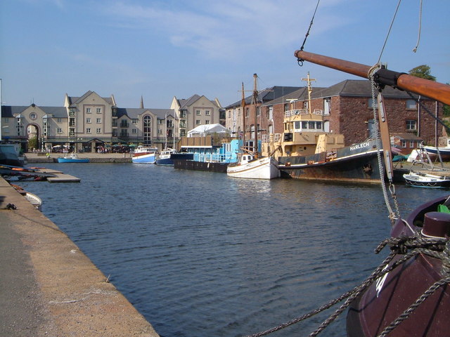
 The River Exe
The city of Exeter was established on the eastern bank of the River Exe on a ridge of land backed by a steep hill. It is at this point that the Exe, having just been joined by the River Creedy, opens onto a wide flood plain and estuary which results in quite common flooding. Historically this was the lowest bridging point of the River Exe which was tidal and navigable up to the city until the construction of weirs later in its history. This combined with the easily defensible higher ground of the ridge made the current location of the city a natural choice for settlement and trade. In George Oliver's The History of the City of Exeter, it is noted that the most likely reasons for the original settling of what would become modern Exeter was the "fertility of the surrounding countryside" and the area's "beautiful and commanding elevation [and] its rapid and navigable river".[35] Its woodland would also have been ideal for natural resources and hunting.
Exeter sits predominantly on sandstone and conglomerate geology, although the structure of the surrounding areas is varied.[36] The topography of the ridge which forms the backbone of the city includes a volcanic plug, on which the Rougemont Castle is situated. The Cathedral is located on the edge of this ridge and is therefore visible for a considerable distance.
Climate
Teignmouth[37] Climate chart (explanation) J F M A M J J A S O N D 1029483946811555126521595118113621145720136718118315984128113105Average max. and min. temperatures in °C Precipitation totals in mm Imperial conversion J F M A M J J A S O N D 448393.348382.751402.2544226047265521.469562.269562.665533.359483.353464.45041Average max. and min. temperatures in °F Precipitation totals in inches Exeter has cool wet winters and warm changeable summers with hot and cooler rainy spells. Temperatures do not vary much throughout the year. The hottest month is July with an average high of 21 C (70 F), and the coldest month is January with an average high of 8 C (46 F). January is the rainiest month with 93 mm of rain.
Climate data for Exeter, United Kingdom Month Jan Feb Mar Apr May Jun Jul Aug Sep Oct Nov Dec Year Average high °C (°F) 8
(46)8
(46)10
(50)13
(55)16
(61)19
(66)21
(70)21
(70)18
(64)15
(59)11
(52)9
(48)14.1
(57.3)Average low °C (°F) 2
(36)2
(36)3
(37)4
(39)7
(45)10
(50)12
(54)12
(54)10
(50)8
(46)4
(39)3
(37)6.4
(43.6)Precipitation mm (inches) 93
(3.66)71
(2.8)61
(2.4)50
(1.97)54
(2.13)47
(1.85)45
(1.77)54
(2.13)57
(2.24)73
(2.87)72
(2.83)87
(3.43)764
(30.08)Avg. rainy days 18 14 15 13 13 11 10 12 12 15 16 17 166 Source: World Meteorological Organisation (UN)[38] Demographics
The city has been expanding in size quite considerably in recent years, with a population estimate of 119,600 in 2006, up over 8,000 from the census in 2001. The racial makeup of the city is as follows (2005 Estimates):[39]
- White – 97.5%
- Asian – 1.4% (0.7% Indian, 0.4% Other, 0.2% Pakistani, 0.2% Bangladeshi)
- Mixed Race – 1.1% (0.4% Asian and White, 0.3% Black and White, 0.3% Other Mixed)
- Chinese – 0.6%
- Black – 0.4% (0.2% African,0.1% Caribbean,0.1% Other)
- Other – 0.5%
In the 2004–05 period the population of "White Other" increased by 24% from 2.9% to 3.6%[40] – higher than any other town or city in the United Kingdom[citation needed].
The Office for National Statistics estimated that Exeter's population in mid-2009 was 118,800.[1]
Economy
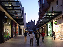 Princesshay Shopping Centre with Exeter Cathedral in the background
The city provides strong industries and services to a sizeable area. The Met Office, the main weather forecasting organisation for the United Kingdom and one of the most significant in the world, relocated from Bracknell in Berkshire to Exeter in early 2004. It is one of the three largest employers in the area (together with the University of Exeter and Devon County Council).
The city centre provides substantial shopping facilities. The High Street is mainly devoted to branches of national chains: A NEF survey in 2005 rated Exeter as the worst example of a clone town in the UK, with only a single independent store in the city's High Street, and less diversity (in terms of different categories of shop) than any other town surveyed. Three significant shopping areas that connect to the High Street provide a somewhat more varied menu. Princesshay, a post-war retail area connecting to the south side of the High Street was home to a number of independent stores prior to redevelopment in 2007, but is now also largely occupied by national chains. It is an innovative, varied development, and it is still intended that a number of the new units will be let to local independent stores. On the other side of the High Street, the partly undercover Guildhall shopping centre (a 1970s reconstruction following the second world war bombing) houses a mixture of national and more regional shops, and connects to the wholly enclosed Harlequins centre where smaller businesses predominate. Smaller streets off the High Street such as Gandy Street also offer a range of independent shops.
On 26 June 2004, Exeter was granted Fairtrade City status.
Although a popular tourist destination, the city is not dominated by tourism, with only 7% of employment dependent on tourism compared with 13% for Devon as a whole (2005 figures).[41]
Main sights
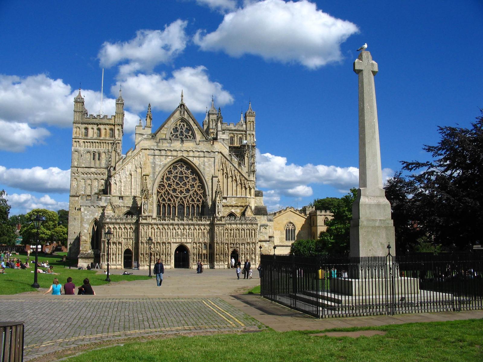
 Exeter Cathedral, City Centre
Among the notable buildings in Exeter are:
Religious buildings
- See also below, Religion
- The cathedral, founded in 1050 when the bishop's seat was moved from the nearby town of Crediton (birthplace of Saint Boniface) because Exeter's Roman walls offered better protection against "pirates", presumably Vikings. A statue of Richard Hooker, the 16th century Anglican theologian, who was born in Exeter, has a prominent place in the Cathedral Close.
- St Nicholas Priory in Mint Lane, the remains of a monastery, later used as a private house and now a museum owned by the city council.
- A number of medieval churches including St Mary Steps which has an elaborate clock.
- The Exeter Synagogue is the third oldest Synagogue in Britain, completed in 1763.
Secular buildings
 Exeter Clock Tower
- The ruins of Rougemont Castle, built soon after the Norman Conquest; later parts of the castle were still in use as an Assize court until early 2006 when a new Crown Courts building opened. A plaque near the ruined Norman gatehouse recalls that in 1685 Alice Molland, the last person executed for witchcraft in England, was imprisoned in Exeter. The future of the castle is at the moment uncertain, but moves are afoot to alter its use, possibly to a restaurant and housing.
- The Guildhall, which has medieval foundations and has been claimed to be the oldest municipal building in England still in use.[42]
- Mols Coffee House, a historic building in the Cathedral Close.
- The Guild of Tuckers and Weavers, a fine old building that is still used for smart functions.
- The Custom House in the attractive Quay area, which is the oldest brick building surviving in the city.
- "The House That Moved", a 14th-century Tudor building, earned its name in 1961 when it was moved from its original location on the corner of Edmund Street in order for a new road to be built in its place. Weighing more than twenty-one tonnes, it was strapped together and slowly moved a few inches at a time to its present day position.
- Parliament Street in the city centre is one of the narrowest streets in the World (see photograph).
- The Butts Ferry, an ancient cable ferry across the River Exe.
Many of these are built in the local dark red sandstone, which gives its name to the castle and the park that now surrounds it (Rougemont means red hill). The pavements on Queen Street are composed of the rock Diorite and exhibit some fine feldspar crystals, while those around Princesshay are composed of Granodiorite
Northernhay Gardens
Northernhay Gardens located just outside the castle, is the oldest public open space in the whole of England, being originally laid out in 1612 as a pleasure walk for Exeter residents. Much of Northernhay Gardens now represent Victorian design, with a beautiful display of trees, mature shrubs and bushes and plenty of flower beds. There are also many statues here, most importantly the war memorial by John Angel and the Deerstalker by E. B. Stephens. The Volunteer Memorial from 1895, also in the gardens, commemorates the formation of the 1st Rifle Volunteers in 1852. Other statues include John Dinham, Thomas Dyke Acland and Stafford Northcote (a local landowner who was a Victorian Chancellor of the Exchequer).
Transport
 Exeter St. David's Railway Station
 Exeter International Airport
 Exeter Canal Basin
Car
The M5 motorway to Bristol and Birmingham starts at Exeter, and connects at Bristol with the M4 to London and South Wales. The older A30 road provides a more direct route to London via the A303 and M3. The M5 is the modern lowest bridging point of the River Exe. Going westwards, the A38 connects Exeter to Plymouth and south east Cornwall, whilst the A30 continues via Okehampton to north and west Cornwall. Travel by car in the city is often difficult with regular jams centred on the Exe Bridges area. To address the problem, Devon County Council is considering the introduction of congestion charges.[43]
Bus
Exeter's main operator of local buses is Stagecoach South West, which operates most of the services in the city. Dartline is a minor operator in the City. Former Cooks Coaches were taken over by Stagecoach forming Stagecoach South West. Western Greyhound is also a main operator connecting Exeter to Cornwall, Somerset and many different places in South West England. The High Street, pedestrianised except for bus and bicycle traffic, serves as the main hub for local buses. Country and express services operate from the city's bus station, in Paris Street, which intersects the High Street at its eastern end; some also call at Exeter St Davids railway station for direct connection to train services.
Country bus services, mostly operated by Stagecoach, run from Exeter to most places in East and North Devon, but some are very infrequent. Regional express services run to Plymouth, Torbay, Bude, and along the Jurassic Coast to Lyme Regis and Weymouth, some operated by Stagecoach and others by First Bus. National Express operates long distance routes, for example to Heathrow and London.
Train
There are two main line railway routes from Exeter to London, the faster route via Taunton to London Paddington and the slower West of England Main Line via Salisbury to London Waterloo. Another main line, the Cross-Country Route, links Exeter with Bristol, Birmingham, the Midlands, Leeds, Northern England, and Scotland. Many trains on all three lines continue westwards from Exeter, variously serving Torbay, Plymouth and Cornwall. Local branch lines run to Paignton (see Riviera Line), Exmouth (see Avocet Line) and Barnstaple (see Tarka Line). There is also a summer weekend service to Okehampton for access to Dartmoor.
Exeter is served by two main railway stations. Exeter St Davids is served by all services, whilst Exeter Central is more convenient for the city centre but served only by local services and the main line route to London Waterloo. There are also six suburban stations, Topsham, St James Park, Exeter St Thomas, Polsloe Bridge, Pinhoe and Digby & Sowton, served only by local services.
Air
Exeter International Airport lies east of the city, and the local airline, previously called Jersey European and British European but now known as Flybe, is a significant local employer. The airport offers a range of scheduled flights to British and Irish regional airports and charter flights, including a seasonal service to Toronto, Canada. Connections to international hubs began with Paris Charles de Gaulle in 2005 and later a daily service to Amsterdam Schiphol Airport.
Canal
The Exeter Canal was completed in about 1566,[44] making it one of the oldest artificial waterways in Britain. It was cut to bypass weirs that had been built across the River Exe to prevent trade in the city and to force boats to unload at Topsham from where the Earls of Devon were able to exact large tolls to transport goods to Exeter. Originally 3 feet deep and 16 feet wide (0.9 m by 5 m), it ran 1.75 miles (2.8 km) from just below the Countess Weir to the centre of Exeter. It was later extended to Topsham, deepened and widened, and was successful until the middle of the 19th century since when its use gradually declined – the last commercial use was in 1972. However it is now widely used for leisure purposes, and the city basin is being included as part of a £24 million redevelopment scheme.
Education
 Exeter University Logo
 Laver Building, Exeter University
- The University of Exeter has two campuses in the city, both notable for their attractive parkland. It is one of the largest employers in the city.
- Exeter is one of the four main sites of the University of Plymouth
- The Peninsula Medical School, a joint operation of the two universities, has one of its main sites in Exeter
- St Loye's School of Health Studies, well known for training in occupational therapy has now been incorporated into the University of Plymouth.
- Exeter College is a major further education college. It operates as a sixth form for the entire maintained school sector in the city.
- For about 30 years the city of Exeter operated a maintained school system in which the divisions between phases came at different ages from most of the United Kingdom, with first, middle and high rather than infant, junior and secondary schools, so that children transferred between schools at the age of about 8 and 12 rather than 7 and 11. From 2005, however, it has adopted the more usual pattern, because of the pressures of the UK National Curriculum. The changeover back to the more typical structure led to a city-wide, PFI funded, rebuilding programme for the high schools and led to the changing of names for some schools. Following the reorganisation there are 25 primary schools, 4 referral schools, 3 special schools and 5 secondary schools within Exeter.[45] The secondary schools are:
- Isca College of Media Arts (formerly Priory High School)
- St James' School (formerly St James' High School)
- St Luke's (Church of England) Science & Sports College (formerly Vincent Thompson High School)
- St Peter's Church of England Aided School – A Language College
- West Exe Technology College (formerly St Thomas High School.
West Exe Technology College is the largest school in Exeter, and is achieving the second highest exam results in the county of Devon.
In addition:
- Exeter School[46] is the oldest of several independent schools in the city.
- Exeter tutorial college, a small independent college on Magdalen Road.
- Exeter is home to several substantial language schools
- Exeter is also home to the Royal West of England School for the Deaf & the West of England School for the Partially Sighted.
- The Atkinson Unit is a secure specialist residential and educational complex for children in care or remanded by the courts.
Religion
 St. David's Church, Exeter
 St. Michael's Church & Episcopal Building
There are many churches in Exeter belonging to different Christian denominations and an Anglican cathedral. It is the seat of the Bishop of Exeter. The present building was complete by about 1400, and has the longest uninterrupted vaulted ceiling in England, and other notable features. The Anglican churches form the Exeter Deanery.
Exeter Synagogue, located off Mary Arches Street, is the third oldest synagogue in Britain, completed in 1763. Exeter's mosque & Islamic Centre is on York Road, and serves the Southwest region as well as the city. A purpose-built mosque is currently being constructed on the same site.
According to the last census, in 2001 69.12% of the population stated their religion as Christian, which is lower than the regional average of 73.99% and the national average of 71.74%. All other religions were under 1%, which was slighter higher than regional averages, although much lower than national averages, except for Buddhism, which was slightly higher than the average. 20.45% stated as having no religion, which was higher than the regional average of 16.75% and the national average of 14.59 and the percentage of people not stating their religion was also slightly higher.[47]
Individual Anglican churches
John Betjeman (writing in 1958) selects St David's ("Caroë's best church"), St Martin's ("characteristic little city church, 15th century"), St Mary Steps ("medieval city church; font"), St Michael's ("Victorian, on a fine site"), and St. Thomas's ("fittings"). His coverage of St Mary Arches is more detailed: "worth seeing ... as the completest Norman church in Devon: beautifully light and airy after its restoration from the bombing in 1942. 18th-century altar arrangements. Memorials to Exeter worthies, 16th to 18th centuries."[48]
The churches include St David's, near Exeter St David's Station. It is a fine building by W. D. Caroe and was built between 1897 and 1900. The tower stands on the northeast side, and the whole design is, according to Nikolaus Pevsner, "highly picturesque". Many of the windows are by Kempe & Tower. St Edmund-on-the-Bridge was built on the Exe Bridge ca. 1230–40. Two arches of the bridge remain under the undercroft though the church was rebuilt in the Perpendicular style in 1835, using the old materials.
St Martin's is in the Cathedral Close; the plan is odd, and there are numerous items of church furniture, though these are not of high aesthetic value. St Mary Arches is a Norman church with aisles. St Mary Steps was originally by the West Gate of the city; the font is Norman, and there is a remarkable early clock. St Michael, Heavitree was built in 1844–46 and extended later in the century. St Pancras is of the 13th century and has a nave and chancel only; the font is Norman. The plan of St Petroc's church is highly unusual: a second chancel has been added facing north while the original chancel has another use and faces east. There are two aisles on the south, one of 1413 and another of the 16th century.
St Sidwell's church is by W. Burgess, 1812, in the Perpendicular style. St Stephen's church is partly of the 13th century but most of the structure is as rebuilt in 1826.[49] St Michael and All Angels Church on Mount Dinham has a spire which exceeds the height of the towers of Exeter Cathedral.
Sport
 St James Park, Exeter, the home of Exeter City F.C.
The city's leading football club, and only professional side, is Exeter City. The club became founder members of the Football League's new Third Division (south) in 1920, but have never progressed beyond the third tier of the English football league system and in 2003 were relegated to the Conference, reclaiming their place in 2008, before completing successive promotions to League One in 2009. Rugby union is popular in the South West: Exeter's clubs are the Exeter Chiefs[50] (who currently play in the Premiership having been promoted on 26 May 2010), Wessex and Exeter Saracens.[51] Exeter Cricket Club play in the Premier Division of the Devon Cricket League at both First and Second XI level. The University of Exeter has a strong reputation in sport and regularly wins or comes close to winning national trophies in inter-university sports. Exeter rowing Club enjoys much success both locally and nationally, and has a recorded history stretching back to the early 19th century. The City of Exeter Rowing Regatta is run annually in July, and is the oldest and biggest regatta in the South West, with racing first recorded on the river in the 1860s. The Devon & Exeter Squash club is one of the most active squash clubs in the region, annually hosting the Exeter Diamonds which is a professional team of world class players. The club also has a strong membership, high standards and a notable junior team. The Great West Run half marathon is run through the streets of Exeter in late April or early May each year Exeter's speedway team, Exeter Falcons, was founded in 1929 and were located at the County Ground until its closure in 2005. In a fixture during the 2004 season, they beat Rye House by the maximum score of 75–18 scoring 5-1s in every heat. Exeter Falcons are hoping to ride again in a proposed new location, possibly at Exeter Racecourse in 2008. The site was where Exeter Falcons legend Australian Jack Geran trained youngsters in the art of the shale sport on a speedway training track in the late 1970s and early-1980s. Speedway was also staged briefly at tracks in Alphington and Peamore after the Second World War. The history of Speedway in Exeter up to the mid-1950s has been recorded in three books by Tony Lethbridge. Rugby league team Exeter Centurions play in the South West Division of the Rugby League Conference. Exeter also has an archery club, Exeter Company of Archers, based at Exeter School.
Notable people from Exeter
- See List of people from Exeter and Category:People from Exeter
Culture
Literature
 Pyramid in High Street, Exeter
The Exeter Book, an original manuscript and one of the most important documents in Anglo-Saxon literature, is kept in the vaults of the cathedral. The Exeter Book dates back to the 10th century and is one of four manuscripts that between them contain virtually all the surviving poetry in Old English. It includes most of the more highly regarded shorter poems, some religious pieces, and a series of riddles, a handful of which are famously lewd. Some of the riddles are inscribed on a highly polished steel obelisk in the High Street, placed there on 30 March 2005.[52]
The Exon Domesday (so called from the preservation of the volume at Exeter), is a volume of Domesday Book that contains the full details which the original returns supplied, but only for part of south-west England, i.e. Cornwall, Devon, part of Somerset, part of Dorset and one manor of Wiltshire; it also contains a record of the geld of 1084 for the whole of these counties.[53][54][55]
One of Rosemary Sutcliff's best-known children's books, The Eagle of the Ninth, begins in Roman Isca Dumnoniorum. The Crowner John Mysteries by Bernard Knight are a series of books set in 12th century Exeter.
Theatre
The Northcott Theatre is located on the campus of the university and is one of relatively few provincial English theatres to maintain its own repertory company. Its annual open air Shakespeare performance in the grounds of Rougemont Castle is well regarded nationally. This theatre is the successor to the former Theatre Royal, Exeter.
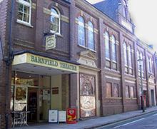 Barnfield Theatre
There are also two other theatre buildings. The Barnfield Theatre was converted in 1972 from the Barnfield Hall which was built towards the end of the 19th century by Exeter Literary Society. The theatre is a charity and is used as a venue for both amateur and professional theatrical companies. In January 2007 it received £200,000, about the same as the original cost to build it, to refurbish its interior. The New Theatre is the home of the Cygnet Training Theatre, a member of the Conference of Drama Schools. In addition, more innovative and contemporary performances, theatrical productions and dance pieces are programmed by Exeter Phoenix off Gandy Street in the City centre.
Music
There are two festivals each year, of all the arts but with a particular concentration of musical events: the annual "Vibraphonic"[56] festival held in March provides a fortnight of soul, blues, jazz, funk, reggae and electronic music. The largest orchestra based in Exeter is the EMG Symphony Orchestra[57] which presents regular concerts at the University of Exeter and in Exeter Cathedral.
Museums and galleries
- The city museum is the Royal Albert Memorial Museum in Queen Street. The museum is currently closed whilst undergoing extensive refurbishment. It is due to reopen in December 2011[58] The Museum also runs St Nicholas Priory which is just off Fore Street.
- Exeter Phoenix and the adjacent digital Media Centre occupies the former university site in Gandy Street and programmes international, national and outstanding regional artists.
- Spacex is a long established modern art gallery.
Newspapers
- Express and Echo, daily until 2 Sept 2011 when it became a weekly.
- The Exeter Times, formerly known as the Exeter Leader, weekly, free.
- Flying Post, weekly (discontinued 1917, but title revived in 1975 as an alternative (polemical) community magazine).
- The Western Morning News, a Plymouth-printed daily regional paper, is also popular.
Radio
BBC Radio Devon broadcasts to Exeter locally on FM (95.8) and AM (990 AM/MW), although the majority of programming comes from Plymouth. In the evenings, BBC Radio Devon joins the South West Regional service. Heart Exeter and Heart Torbay, formerly Gemini FM and Devonair, covers the city on 97.2 FM, with East Devon and Torbay using their own frequencies. Both Heart and BBC Devon broadcast from the St. Thomas transmitter, which also provides the city with television coverage; AM radio is broadcast from Pearce's Hill next to J31 of the M5. Other radio stations include Exeter FM, an easy listening station broadcasting on 107.3 FM, and VI, a station broadcasting from the West of England School and College on 1386 AM/MW. The University has a well established student station, Xpression FM, which broadcasts on 87.7 FM using two low-powered transmitters, although it can be heard over much of the north of the city.
Television
BBC Spotlight and ITV Westcountry provide Exeter with regional news outputs. The majority of the local BBC output originates in Plymouth, and ITV Westcountry is broadcast from Bristol. Both services have newsrooms is Exeter. The St Thomas and Stockland Hill Transmitter Station cover the city, with both transmitters now having completed the digital switchover.
Twinnings
Exeter is twinned with Rennes in France, Bad Homburg in Germany, Yaroslavl in Russia, and Terracina in Italy.[citation needed] The city also seeks to maintain a relationship with HMS Exeter.
While not formally twinned, the town of Exeter, California, USA, was named by a former resident of Exeter working on behalf of the Southern Pacific Railroad.[59]
See also
References
- ^ a b c "Population Statistics for Exeter". Office of National Statistics. http://www.exeter.gov.uk/index.aspx?articleid=1002. Retrieved 30 November 2010.
- ^ "Ethnic Group". Office for National Statistics. 9 October 2004. http://www.neighbourhood.statistics.gov.uk/dissemination/LeadTableView.do?a=3&b=276927&c=Exeter&d=13&e=15&g=436252&i=1001x1003x1004&m=0&r=1&s=1235683465023&enc=1&dsFamilyId=47. Retrieved 26 February 2009.
- ^ Dun & Bradstreet, 2001
- ^ Hoskins 2004, pp.4–5
- ^ Hoskins 2004, p.1
- ^ "Great Sites: Exeter Roman Baths". British Archaeology magazine. June 2002. http://www.britarch.ac.uk/ba/ba65/feat2.shtml. Retrieved 12 July 2008.
- ^ "The Roman Fortress at Exeter: the Roman Bath House". Archived from the original on 4 June 2008. http://web.archive.org/web/20080604101008/http://www.exeter.gov.uk/timetrail/02_romanfortress/bath_house.htm. Retrieved 12 July 2008.
- ^ Hoskins 2004, p.14
- ^ Hoskins 2004, p.15
- ^ Sellman 1985, p.16
- ^ Hoskins 2004, pp.15–16
- ^ Hoskins 2004, p.159
- ^ Eilert Ekwall (1981). The Concise Oxford Dictionary of English Place-names. Oxford University Press. pp. 171. ISBN 0-19-869103-3.
- ^ a b c d Hoskins 2004, p.23
- ^ a b Sellman 1985, p.17
- ^ Higham 2008, p.47
- ^ Higham 2008, p.19
- ^ Hoskins 2004, pp.26–27
- ^ Hoskins 2004, pp.31–32
- ^ Letters, Samantha. "Online Gazetteer of Markets and Fairs in England & Wales to 1516: Devon". Centre for Metropolitan History, Institute of Historical Research. http://www.history.ac.uk/cmh/gaz/devon.html#Exe. Retrieved 26 July 2009.
- ^ "Exeter's Coat of Arms". Exeter City Council website. http://www.exeter.gov.uk/index.aspx?articleid=3469. Retrieved 13 July 2008.
- ^ Gray 2000, p.16
- ^ Gray 2000, p.18
- ^ Gray 2000, p.31
- ^ Oliver, George (1861). History of the City of Exeter. pp. 107. ISBN 0217799973.
- ^ Shapter, Thomas (1848). The History of the Cholera in Exeter 1832. ISBN 0854096744.
- ^ "High Street revamp plans criticised". BBC News. 4 March 2003. http://news.bbc.co.uk/1/hi/england/2817257.stm. Retrieved 21 September 2007.
- ^ "Doors open at Princesshay". BBC Devon. 20 September 2007. http://www.bbc.co.uk/devon/content/articles/2007/09/19/princesshay_opening_day_feature.shtml. Retrieved 21 September 2007.
- ^ "Heaven for shoppers as Princesshay gets off to a flying start with huge crowds for opening day". Express & Echo. 21 September 2007. http://www.thisisexeter.co.uk/displayNode.jsp?nodeId=142326&command=displayContent&sourceNode=142321&contentPK=18452155&folderPk=79876&pNodeId=142331. Retrieved 21 September 2007.
- ^ "Key facts about Princesshay". Princesshay.com. Land Securities Group. http://www.princesshay.com/community/Keyfacts/index.aspx. Retrieved 21 September 2007.
- ^ "Shopmobility". Exeter Community Transport Association. http://www.exetercta.co.uk/shopmobility.html. Retrieved 13 July 2008.
- ^ "The Coalition: our programme for government" (PDF). HM Government, United Kingdom. 20 May 2010. http://www.direct.gov.uk/prod_consum_dg/groups/dg_digitalassets/@dg/@en/documents/digitalasset/dg_187876.pdf. Retrieved 24 May 2010.
- ^ Hennessy, Patrick (22 May 2010). "The Queen's Speech: Bill by Bill". The Daily Telegraph. http://www.telegraph.co.uk/news/newstopics/politics/liberaldemocrats/7753762/The-Queens-Speech-Bill-by-Bill.html. Retrieved 24 May 2010.
- ^ "THE HUNDREDS OF DEVON". GENUKI. http://genuki.cs.ncl.ac.uk/DEV/Hundreds.html. Retrieved 18 June 2011.
- ^ Oliver, George (1861). History of the City of Exeter. pp. 1. ISBN 0217799973.
- ^ DEFRA. "Southwest EDRP Geographical Area and Physical Context". http://www.defra.gov.uk/erdp/docs/swchapter/section11/topography.htm. Retrieved 13 July 2008.
- ^ "Teignmouth 1971–2000 averages". Met Office. http://www.metoffice.gov.uk/climate/uk/averages/19712000/sites/teignmouth.html. Retrieved 8 March 2008.
- ^ "World Weather Information Service – Exeter". July 2011. http://worldweather.wmo.int/010/c00034.htm. Retrieved 26 July 2011.
- ^ "Resident Population Estimates by Ethnic Group (Percentages), Area: Exeter (Local Authority)". Office for National Statistics. http://neighbourhood.statistics.gov.uk/dissemination/LeadTableView.do?a=3&b=276927&c=Exeter&d=13&e=13&g=436252&i=1001x1003x1004&m=0&r=1&s=1195991790357&enc=1&dsFamilyId=1812. Retrieved 13 July 2008.
- ^ "Exeter, Resident Population Estimates by Ethnic Group". Office for National Statistics. http://neighbourhood.statistics.gov.uk/dissemination/LeadTrendView.do?a=7&b=276927&c=Exeter&d=13&e=13&f=21833&g=436252&i=1001x1003x1004x1005&l=1812&o=198&m=0&r=1&s=1216456327983&enc=1&adminCompId=21833&variableFamilyIds=6365&xW=1128. Retrieved 19 July 2008.
- ^ South West Tourism (2006), The Value of Tourism in Devon 2005. Exeter: SWT
- ^ See for example: Hele's School Historical Society. (1947). Exeter—Then and Now. A. Wheaton & Co. p. 31.
- ^ "Drivers facing congestion charge". BBC News. 7 November 2006. http://news.bbc.co.uk/1/hi/england/devon/6125042.stm. Retrieved 13 July 2008.
- ^ Clew, Kenneth R. (1984). The Exeter Canal. Chichester: Phillimore. ISBN 0-85033-544-2.
- ^ "Schools, locations and details". Devon County Council website. http://www.devon.gov.uk/index/learning/schools/locations_and_details.htm. Retrieved 19 July 2008.
- ^ "Exeter School Website". http://www.exeterschool.devon.sch.uk. Retrieved 19 July 2008.
- ^ "Religion". United Kingdom Census 2001. Office for National Statistics. 1 April 2001. http://www.neighbourhood.statistics.gov.uk/dissemination/LeadTableView.do?a=7&b=276927&c=Exeter&d=13&e=15&g=436252&i=1001x1003x1004&m=0&r=1&s=1231680745917&enc=1&dsFamilyId=17. Retrieved 11 January 2009.
- ^ Betjeman, John, ed. (1968) Collins Pocket Guide to English Parish Churches; the South. London: Collins; p. 164
- ^ Pevsner, N. (1952) South Devon. Harmondsworth: Penguin Books; pp. 148–53
- ^ "Exeter Chiefs Website". http://www.exeterchiefs.co.uk. Retrieved 19 July 2008.
- ^ "Exeter Saracens Rugby Football Club Website". http://www.exetersaracens.co.uk/. Retrieved 19 July 2008.
- ^ The Riddle of the new Exeter Statue (retrieved 19 November 2010)
- ^ Thorn, C., et al. (1979) Cornwall. (Domesday; vol. 10.) Chichester: Phillimore
- ^ The Record Commission published the text in 1816 in vol. 3 of Domesday Book (including an account by Sir Henry Ellis). V. H. Galbraith gives a contents table of Exeter Domesday in his Domesday Book, 1974, pp. 184–88. R. W. Finn The Liber Exoniensis, 1964; and N. R. Ker Medieval Manuscripts in British Libraries, vol 2, pp. 800–07 are useful sources of information.
- ^ "Liber Exoniensis". http://www.domesdaybook.net/helpfiles/hs710.htm. Retrieved 24 April 2010.
- ^ "Vibraphonic 2011 website". Vibraphonic 2011 Festival website. http://www.vibraphonic2011.co.uk/.
- ^ "EMG Symphony Orchestra website". http://www.emgsymphonyorchestra.org. Retrieved 19 July 2008.
- ^ "Royal Albert Memorial Museum". RAM Museum Website. http://www.rammuseum.org.uk/.
- ^ City of Exeter, Accessed 6 August 2009.
Sources and further reading
- Gray, Todd (2000). Exeter: The Traveller's Tales. Exeter: The Mint Press. ISBN 1903356008.
- Higham, Robert (2008). Making Anglo-Saxon Devon. Exeter: The Mint Press. ISBN 978-1-903356-57-9.
- Hoskins, W. G. (2004). Two Thousand Years in Exeter (Revised and updated ed.). Chichester: Phillimore. pp. 23. ISBN 1-86077-303-6.
- Sellman, R.R. (1985). Aspects of Devon History (New ed.). Exeter: Devon Books. ISBN 0-86114-756-1.
- Sharp, Thomas (1946). Exeter Phoenix: A Plan for Rebuilding. London: The Architectural Press.
External links
- Exeter City Council
- History of Exeter from White's Devonshire Directory, 1850
- Exeter at the Open Directory Project
- Exeter travel guide from Wikitravel
 Districts of South West England
Devon Dorset Gloucestershire Somerset Unitary authorities Bath and North East Somerset · Bournemouth · Bristol · Cornwall · Isles of Scilly · North Somerset · Plymouth · Poole · South Gloucestershire · Swindon · Torbay · WiltshireCities of the United Kingdom England Bath · Birmingham · Bradford · Brighton and Hove · Bristol · Cambridge · Canterbury · Carlisle · Chester · Chichester · Coventry · Derby · Durham · Ely · Exeter · Gloucester · Hereford · Kingston upon Hull · Lancaster · Leeds · Leicester · Lichfield · Lincoln · Liverpool · London · Manchester · Newcastle upon Tyne · Norwich · Nottingham · Oxford · Peterborough · Plymouth · Portsmouth · Preston · Ripon · St Albans · Salford · Salisbury · Sheffield · Southampton · Stoke-on-Trent · Sunderland · Truro · Wakefield · Wells · Westminster · Winchester · Wolverhampton · Worcester · York
Scotland Wales Northern Ireland Ceremonial county of Devon Unitary authorities Boroughs or districts Major settlements - Ashburton
- Axminster
- Barnstaple
- Bideford
- Bovey Tracey
- Bradninch
- Brixham
- Buckfastleigh
- Budleigh Salterton
- Chagford
- Chudleigh
- Chulmleigh
- Colyton
- Crediton
- Cullompton
- Dartmouth
- Dawlish
- Exeter
- Exmouth
- Great Torrington
- Hartland
- Hatherleigh
- Holsworthy
- Honiton
- Ilfracombe
- Ivybridge
- Kingsbridge
- Kingsteignton
- Lynton
- Modbury
- Moretonhampstead
- Newton Abbot
- North Tawton
- Northam
- Okehampton
- Ottery St Mary
- Paignton
- Plymouth
- Plympton
- Princetown
- Salcombe
- Seaton
- Sidmouth
- South Molton
- Tavistock
- Teignmouth
- Tiverton
- Torquay
- Totnes
See also: List of civil parishes in Devon
Rivers Topics - Devon County Council
- Economy
- Flag
- History
- Notable people
- Dartmoor
- Exmoor
- Jurassic Coast
- Towns by population
- South West Coast Path
- Museums
Categories:- Exeter
- County towns in England
- Cities in South West England
- Local government in Devon
- Roman forts in Devon
- Staple ports
- Non-metropolitan districts of Devon
- Local government districts of South West England


Wikimedia Foundation. 2010.