- Benton County, Minnesota
-
Benton County, Minnesota 
Seal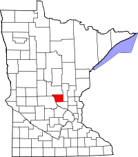
Location in the state of Minnesota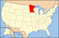
Minnesota's location in the U.S.Founded October 27, 1849 [1] Named for Thomas Hart Benton, a U.S. senator from Missouri from 1821 to 1851. Seat Foley Largest city Sauk Rapids Area
- Total
- Land
- Water
413.00 sq mi (1,070 km²)
408.28 sq mi (1,057 km²)
4.72 sq mi (12 km²), 1.14%Population
- (2010)
- Density
38,451
84/sq mi (32/km²)Time zone Central: UTC-6/-5 Website www.co.benton.mn.us Benton County is a county located in the U.S. state of Minnesota. As of 2010, the population was 38,451.[1] Its county seat is Foley[2]. Established in 1849, the county is one of the earliest in Minnesota [2].
Benton County is part of the St. Cloud Metropolitan Statistical Area.
Contents
Geography
According to the 2000 census, the county has a total area of 413.00 square miles (1,069.7 km2), of which 408.28 square miles (1,057.4 km2) (or 98.86%) is land and 4.72 square miles (12.2 km2) (or 1.14%) is water.[3]
Lakes
- Donovan Lake - vast majority in Minden Township, west edge in St. Cloud
- Graham Lake - Langola Township
- Little Rock Lake - south half in Watab Township, north half in Langola Township
- Mayhew Lake - Mayhew Lake Township
Source: United States Census Bureau 2007 TIGER/Line Shapefiles[4]
Major highways
Adjacent counties
- Mille Lacs County (northeast)
- Sherburne County (southeast)
- Stearns County (southwest)
- Morrison County (northwest)
Demographics
Historical populations Census Pop. %± 1850 418 — 1860 627 50.0% 1870 1,558 148.5% 1880 3,012 93.3% 1890 6,284 108.6% 1900 9,912 57.7% 1910 11,615 17.2% 1920 14,073 21.2% 1930 15,056 7.0% 1940 16,106 7.0% 1950 15,911 −1.2% 1960 17,287 8.6% 1970 20,841 20.6% 1980 25,187 20.9% 1990 30,185 19.8% 2000 34,226 13.4% 2010 38,451 12.3% U.S. Decennial Census As of the census[5] of 2000, there were 34,226 people, 13,065 households, and 8,518 families residing in the county. The population density was 84 people per square mile (32/km²). There were 13,460 housing units at an average density of 33 per square mile (13/km²). The racial makeup of the county was 96.22% White, 0.78% Black or African American, 0.52% Native American, 1.15% Asian, 0.05% Pacific Islander, 0.35% from other races, and 0.94% from two or more races. 0.90% of the population were Hispanic or Latino of any race. 47.8% were of German, 12.1% Polish and 8.8% Norwegian ancestry according to Census 2000.
There were 13,065 households out of which 35.30% had children under the age of 18 living with them, 52.10% were married couples living together, 8.80% had a female householder with no husband present, and 34.80% were non-families. 25.80% of all households were made up of individuals and 8.90% had someone living alone who was 65 years of age or older. The average household size was 2.56 and the average family size was 3.14.
In the county the population was spread out with 27.10% under the age of 18, 12.20% from 18 to 24, 31.00% from 25 to 44, 18.70% from 45 to 64, and 11.00% who were 65 years of age or older. The median age was 32 years. For every 100 females there were 99.60 males. For every 100 females age 18 and over, there were 96.30 males.
The median income for a household in the county was $41,968, and the median income for a family was $51,277. Males had a median income of $33,214 versus $22,737 for females. The per capita income for the county was $19,008. About 4.50% of families and 7.10% of the population were below the poverty line, including 6.30% of those under age 18 and 12.60% of those age 65 or over.
 Age pyramid of county residents based on 2000 U.S. census data.
On ePodunk : Benton County & Benton Cty. ancestry :
German - 42%; Polish - 13%; Norwegian - 9% (2000)Cities and towns
Cities Townships Unincorporated communities Ghost towns - Brennyville
- Bushville
- Duelm
- Fruitville
- Glendorado
- Granite Ledge
- Jakeville
- Mayhew
- North Benton
- East St. Cloud ‡
- Esteville ††
- Minden
† Only partly in Benton County.
‡ Annexed by St. Cloud.
†† Extended into Mille Lacs County.Climate and weather
Foley, Minnesota Climate chart (explanation) J F M A M J J A S O N D 0.72120.62771.639202.65633369444.278543.382593.880563.570472.557351.439220.8257Average max. and min. temperatures in °F Precipitation totals in inches Source: The Weather Channel[6] Metric conversion J F M A M J J A S O N D 17-6-1716-3-14394-7651317521710626128428159627138821863142354-621-4-14Average max. and min. temperatures in °C Precipitation totals in mm In recent years, average temperatures in the county seat of Foley have ranged from a low of 2 °F (−17 °C) in January to a high of 82 °F (28 °C) in July, although a record low of −43 °F (−42 °C) was recorded in January 1977 and a record high of 107 °F (42 °C) was recorded in July 1936. Average monthly precipitation ranged from 0.62 inches (16 mm) in February to 4.17 inches (106 mm) in June.[6]
See also
References
- ^ "2010 Census Redistricting Data (Public Law 94-171) Summary File". American FactFinder. United States Census Bureau. http://factfinder2.census.gov/faces/tableservices/jsf/pages/productview.xhtml?pid=DEC_10_PL_GCTPL2.ST05&prodType=table. Retrieved 25 April 2011.
- ^ "Find a County". National Association of Counties. http://www.naco.org/Counties/Pages/FindACounty.aspx. Retrieved 2011-06-07.
- ^ "Census 2000 U.S. Gazetteer Files: Counties". United States Census. http://www.census.gov/tiger/tms/gazetteer/county2k.txt. Retrieved 2011-02-13.
- ^ "United States Census Bureau 2007 TIGER/Line Shapefiles". http://www.census.gov/geo/www/tiger/tgrshp2007/tgrshp2007.html.
- ^ "American FactFinder". United States Census Bureau. http://factfinder.census.gov. Retrieved 2008-01-31.
- ^ a b "Monthly Averages for Foley, Minnesota". The Weather Channel. http://www.weather.com/weather/wxclimatology/monthly/graph/USMN0266. Retrieved 2011-11-06.
External links
- Benton County Government’s website
- Minnesota DOT's official highway map of Benton County
- Benton County Fair
- Benton County Historical Society and Museum - Located in Sauk Rapids, MN
- Sartell Historical Society - Sartell, MN
- MNGenUSGen Web Site for Benton County, Minnesota - Genealogy
- Sauk Rapids and Benton County - Images of America Series - Approximately 200 vintage photographs
- Benton County Map

Morrison County Mille Lacs County 
 Benton County, Minnesota

Stearns County Sherburne County Municipalities and communities of Benton County, Minnesota Cities 
Townships Alberta | Gilmanton | Glendorado | Graham | Granite Ledge | Langola | Mayhew Lake | Maywood | Minden | Sauk Rapids | St. George | Watab
Unincorporated
communitiesFootnotes ‡This populated place also has portions in an adjacent county or counties
Categories:- Minnesota counties
- Benton County, Minnesota
- St. Cloud metropolitan area
- Minnesota counties on the Mississippi River


Wikimedia Foundation. 2010.