- Minnesota River
-
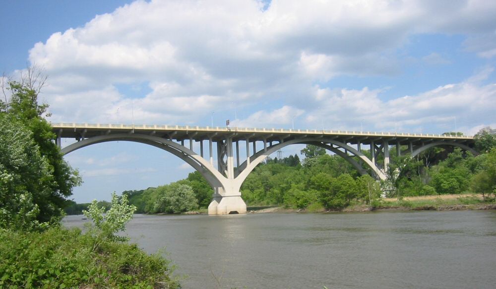
Minnesota River (Watpá Mnísota) River  The Mendota Bridge crossing the Minnesota River, just above its mouth
Country United States State Minnesota Cities Eden Prairie, MN, Mankato, MN, Shakopee, MN, Burnsville, MN, Eagan, MN, Le Sueur, MN Source Big Stone Lake - location Big Stone Lake, Big Stone County, MN - elevation 964 ft (294 m) Mouth Mississippi River - location Near Fort Snelling in Minnesota, Hennepin County, MN - elevation 690 ft (210 m) Length 370 mi (595 km) Basin 17,000 sq mi (44,030 km2) Discharge - average 4,414 cu ft/s (125 m3/s)  Map of the Minnesota River
The Minnesota River is a tributary of the Mississippi River, approximately 332 miles (534 km) long, in the U.S. state of Minnesota. It drains a watershed of nearly 17,000 square miles (44,000 km2), 14,751 square miles (38,200 km2) in Minnesota and about 2,000 sq mi (5,200 km2) in South Dakota and Iowa.
It rises in southwestern Minnesota, in Big Stone Lake on the Minnesota–South Dakota border just south of the Laurentian Divide at the Traverse Gap portage. It flows southeast to Mankato, then turns northeast. It joins the Mississippi south of the Twin Cities of Minneapolis and St. Paul, near the historic Fort Snelling. The valley is one of several distinct regions of Minnesota. Of Lakota language origin, the name Minnesota means "sky-tinted water or cloudy-sky water", from mní (often transcribed as "minne" or "mini") meaning "water" and sóta meaning "sky-tinted" or "cloudy sky", and, refers to the milky-brown color its waters take on when at flood stage. An illustration of the meaning of these words was shown by dropping a little milk into water. For over a century prior to the organization of the Minnesota Territory in 1849, the name St. Pierre (St. Peter) had been generally applied to the river by French and English explorers and writers. Minnesota River is shown on the 1757 edition of Mitchell Map as "Ouadebameniſsouté [Watpá Mnísota] or R. St. Peter". On June 19, 1852, acting upon a request from the Minnesota territorial legislature, the United States Congress decreed the aboriginal name for the river, Minnesota, to be the river’s official name and ordered all agencies of the federal government to use that name when referencing it.[1]
The valley that the Minnesota River flows in is up to five miles (8 km) wide and 250 feet (80 m) deep.[2] It was carved into the landscape by the massive glacial River Warren between 11,700 and 9,400 years ago at the end of the last ice age in North America. Pierre-Charles Le Sueur was the first European to visit the river.[citation needed] The Minnesota Territory, and later the state, were named for the river.
Contents
Commercial significance
The river valley is notable as the origin and center of the canning industry in Minnesota. In 1903 Carson Nesbit Cosgrove, an entrepreneur in Le Sueur presided at the organizational meeting of the Minnesota Valley Canning Company (later renamed Green Giant). By 1930, the Minnesota River valley had emerged as one of the country's largest producers of sweet corn. Green Giant had five canneries in Minnesota in addition to the original facility in Le Sueur. Cosgrove's son, Edward, and grandson, Robert also served as heads of the company over the ensuing decades before the company was swallowed by General Mills.[3] Several docks for barges exist along the river. Dried goods are transported to the ports of Minneapolis and Saint Paul, and then shipped down the Mississippi River.
Tributaries
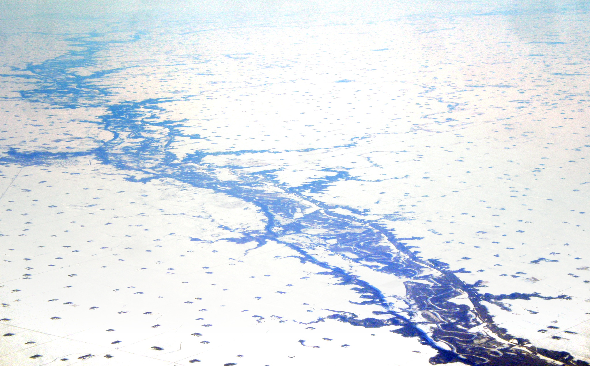
 The Minnesota River Valley and tributaries as seen from the air at Redwood Falls, Minnesota. The river occupies only a small portion of the wide valley carved by the Glacial River Warren.
Principal tributaries of the Minnesota River Order of entry River Location of confluence 11 Blue Earth River West side of Mankato 6 Chippewa River Montevideo 9 Cottonwood River Southeast of New Ulm 13 Credit River Scott County, just southeast of Minneapolis-Saint Paul 5 Lac qui Parle River Lac qui Parle State Park, 10 mi (15 km) northwest of Montevideo 10 Little Cottonwood River Cambria Township, 7 mi (11 km) southeast of New Ulm 1 Little Minnesota River Big Stone Lake in Browns Valley 4 Pomme de Terre River Marsh Lake in southwestern Swift County, 4 mi (6 km) southwest of Appleton 8 Redwood River Near Redwood Falls 12 Rush River 2.9 mi north of Le Sueur 2 Whetstone River Ortonville, near the South Dakota state line 3 Yellow Bank River Agassiz Township, 3 mi (5 km) southeast of Odessa 7 Yellow Medicine River Upper Sioux Agency State Park in Sioux Agency Township Cities and towns

See also
- List of Minnesota rivers
- List of crossings of the Minnesota River
Notes and references
- ^ "Minnesota State". Minnesota Historical Society. http://mnplaces.mnhs.org/upham/otheritem.cfm?PlaceNameID=2007&BookCodeID=67&County=0&SendingPage=Results.cfm. Retrieved 2010-03-21
- ^ Sansome, Minnesota Underfoot, pp. 118-19.
- ^ "The Cosgrove Years". Mayohouse.org. http://www.mayohouse.org/cosgrove.htm. Retrieved 2007-12-12.
Sources
- Sansome, Constance Jefferson (1983). Minnesota Underfoot: A Field Guide to the State's Outstanding Geologic Features. Stillwater, MN: Voyageur Press. ISBN 0-8965-8036-9
- Waters, Thomas F. (1977). The Streams and Rivers of Minnesota. Minneapolis: University of Minnesota Press. ISBN 0-8166-0960-8.
- Place Names: the Minnesota River
External links
- Drainage Area of the Minnesota River
- History of the Minnesota River Valley
- Minnesota River at Mankato - pictures and more information
Categories:- Minnesota River
- Regions of Minnesota
- Valleys of Minnesota
- Tributaries of the Mississippi River
- Geography of Blue Earth County, Minnesota
- Geography of Big Stone County, Minnesota
- Geography of Hennepin County, Minnesota
- Geography of Scott County, Minnesota
- Geography of Dakota County, Minnesota
- Geography of Le Sueur County, Minnesota
- Geography of Brown County, Minnesota


Wikimedia Foundation. 2010.