- Palo Alto, California
-
"Palo Alto" redirects here. For other uses, see Palo Alto (disambiguation).
City of Palo Alto — City — Palo Alto Skyline

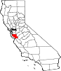
SealLocation in Santa Clara County and the state of California
Coordinates: 37°25′45″N 122°8′17″W / 37.42917°N 122.13806°WCoordinates: 37°25′45″N 122°8′17″W / 37.42917°N 122.13806°W Country  United States
State  California
County Santa Clara First Settled 1769 Incorporated as City April 16, 1894 Government – Type City Council Mayorship – Mayor Sid Espinosa[1] – Council Member Karen Holman – Council Member Larry Klein – Council Member Gail A. Price Area[2] – Total 25.787 sq mi (66.787 km2) – Land 23.884 sq mi (61.858 km2) – Water 1.903 sq mi (4.929 km2) 7.38% Elevation 30 ft (9 m) Population (2010) – Total 64,403 – Density 2,497.5/sq mi (964.3/km2) Time zone PST (UTC-8) – Summer (DST) PDT (UTC-7) ZIP codes 94301, 94303, 94306 Area code 650 FIPS code 06-55282 GNIS feature ID 0277572 Website www.cityofpaloalto.org Palo Alto (
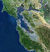
 /ˌpæloʊˈæltoʊ/; Spanish: palo: "pine" and alto: "tall") is a California charter city located in the northwest corner of Santa Clara County, in the San Francisco Bay Area of California, United States. The city shares its borders with East Palo Alto, Mountain View, Los Altos, Los Altos Hills, Stanford, Portola Valley, and Menlo Park. It is named after a redwood tree called El Palo Alto. The city includes portions of Stanford University, is headquarters to a number of Silicon Valley high-technology companies, including Hewlett-Packard, VMware, Tesla Motors, Ning, IDEO, Palantir Technologies, and Facebook, and has served as an incubator to several other high-technology companies, such as Google,[3] Logitech,[4] Intuit, Sun Microsystems,[5] and PayPal. As of the 2010 census, the city had a total population of 64,403 residents. Palo Alto was established by Leland Stanford when he established Stanford University, following the death of his son Leland Stanford Jr. on March 13, 1884. The tuition for Stanford back then was free.
History
Palo Alto's earliest recorded history stems from 1769, when Gaspar de Portolà noted an Ohlone settlement. This remains an area of known Indian mounds. A plaque is erected at Middlefield Road and Embarcadero Road to commemorate this area.
The city got its name from a stand of tall redwood trees, El Palo Alto, by the banks of the San Francisquito Creek bordering Menlo Park. One of these trees can still be found by the railroad trestle near Alma Street (the other was destroyed during a storm in the late 20th century). A plaque recounts the story of a 63-man, 200-horse expedition from San Diego to Monterey from November 7–11, 1769. The group overshot and reached the San Francisco Bay instead. Thinking the bay was too wide to cross, the group decided to turn around near el palo alto.
About 1827 Rafael Soto, tenth child and son of De Anza Expedition settler Ygnacio Soto and María Bárbara Espinosa de Lugo of Alta, California, came to stay with Máximo Martínez at his Rancho Corte de Madera for seven years. Located south of the San Francisquito Creek, west of today's I-280, Rancho Corte de Madera covered most of Portola Valley to Skyline Boulevard extending south to about Foothill College. In 1835, Rafael Soto and family settled near the San Francisquito Creek near Newell and Middlefield, selling goods to travelers. Rafael Soto died in 1839, but his wife, Maria Antonia Mesa, was granted Rancho Rinconada del Arroyo de San Francisquito in 1841.
Their daughter María Luisa Soto married in 1839, John Coppinger, who was the grantee of Rancho Cañada de Raymundo. Rancho Cañada de Raymundo was West of San Francisquito Creek, and began at Alambique Creek, the north border of Rancho Corte de Madera, and extended north, including present day Woodside. Bear Gulch Creek (Bear Creek) flowed on his land in Portola Valley. The rancho also abutted Buelna's grant near Skyline Boulevard and Matadero Creek. Upon Coppinger's death, Maria inherited it and later married a visiting boat captain, John Greer. Greer owned a home on the property that is now Town & Country Village on Embarcadero and El Camino Real. Greer Avenue and Court are named for him. To the west of Rafael Soto, near El Camino and following the Creek, was Rancho San Francisquito granted in 1839, to Antonio Buelna and wife Maria Concepcion.
To the south of the Sotos, the brothers, Secundino and Teodoro Robles, in 1849 bought Rancho Rincon de San Francisquito from José Peña, the 1841 grantee.[6] The grant extended from San Francisquito Creek, Alpine Road and Bishop Ln. (behind Stanford Shopping Center) and golf course. Then South along the Santa Cruz Foothills between Junipero Serra & Hwy 280 to the (Intersection of Matadero Creek/ Hillview /Miranda) & then SW near the intersection of Page Mill & Arastradero Rd. (where the Jone's House was), then east down Arastradero Rd. to the north property line of Alta Mesa Memorial Park and Terman Park. Follow the trail of what was once the old stage road over Adobe Creek/Yuegas Creek to El Camino Real & then east on San Antonio Rd. to the Bay marshes passing over the RR and what was once the Jeffry's House & Stables. The property then went along the bay to the Embarcadero, a major boundary in the day. Then up to the Stanford University gates, up Galvez and along Campus way to the hills near the golf course. The grant was bounded on the south by Mariano Castro's Rancho Pastoria de las Borregas grant across San Antonio Road. That's the Robles Rancho, about 80% of Palo Alto and Stanford University. It was whittled down by 1863 through courts to 6,981 acres (28.25 km2). Stories say their grand hacienda was built on the former meager adobe of José Peña near Ferne off San Antonio Road, midway between Middlefield and Alma Street.[7] Their hacienda hosted fiestas and bull fights. It was ruined in the 1906 earthquake and its lumber was used to build a large barn nearby which it is said lingered until the early 1950s. In 1853, they sold 250 acres (1.0 km2), comprising the present day Barron Park, Matadero Creek and Stanford Business Park, to Elisha Oscar Crosby, who coined Mayfield. In 1880 Secundino Robles, father to twenty-nine children, still lived near present day Sears store.
Many of the Spanish names in the Palo Alto area represent the local heritage and descriptive terms and former residents. Pena Court, Miranda Avenue, which was essentially Foothill Expwy was the married name of Juana Briones and the name occurs in Courts and Avenues others in Palo Alto to Mountain View in the quadrant where she owned vast areas between Stanford Univ., Grant Road in Mountain View and west of El Camino. Yerba Buena was to her credit. Rinconada was the major Mexican land grant name.
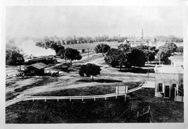
 University Avenue at the Circle with train steaming toward El Palo Alto, 1894
The township of Mayfield was formed in 1855, in what is now southern Palo Alto. Leland Stanford starting buying land in the area in 1876 for a horse farm, which became a university in 1891, dedicated to his son who died of typhoid fever at age 15 in 1884. In 1886, Stanford came to Mayfield, interested in founding his university there. He had a train stop created near his school on Mayfield's downtown street, Lincoln Street (now named California Avenue). However, he had one condition: alcohol had to be banned from the town. Known for its 13 rowdy saloons, Mayfield rejected his requests for reform. This led him to drive the formation of Palo Alto as a Temperance Towns in 1894 with the help of his friend Timothy Hopkins of the Southern Pacific Railroad who bought 740 acres (3.0 km2) of private land in 1887 for the new townsite. The Hopkins Tract, bounded by El Camino Real, San Francisquito Creek, Boyce, Channing, Melville, and Hopkins Avenues, and Embarcadero Road,[8] was proclaimed a local Heritage District during Palo's Alto Centennial in 1994. Stanford set up his university, Stanford University, and a train stop (on University Avenue) by his new town. With Stanford's support, saloon days faded and Palo Alto grew to the size of Mayfield. On July 2, 1925, Palo Alto voters approved the annexation of Mayfield and the two communities were officially consolidated on July 6, 1925. This saga explains why Palo Alto has two downtown areas: one along University Avenue and one along California Avenue.
The Mayfield News wrote its own obituary four days later:
It is with a feeling of deep regret that we see on our streets today those who would sell, or give, our beautiful little city to an outside community. We have watched Mayfield grow from a small hamlet, when Palo Alto was nothing more than a hayfield, to her present size … and it is with a feeling of sorrow that we contemplate the fact that there are those who would sell or give the city away.Many of Stanford University's first faculty members settled in the Professorville neighborhood of Palo Alto. Professorville, now a registered national historic district, is bounded by Kingsley, Lincoln, and Addison avenues and the cross streets of Ramona, Bryant, and Waverley. The district includes a large number of well preserved residences dating from the 1890s, including 833 Kingsley, 345 Lincoln and 450 Kingsley. 1044 Bryant was the home of Russell Varian, co-inventor of the Klystron tube. The Federal Telegraph laboratory site, situated at 218 Channing, is a California Historical Landmark recognizing Lee de Forest's 1911 invention of the vacuum tube and electronic oscillator at that location. While not open to the public, the garage that housed the launch of Hewlett Packard is located at 367 Addison Avenue. Hewlett Packard recently restored the house and garage. A second historic district on Ramona Street can be found downtown between University and Hamilton Avenues. The Palo Alto Chinese School is the oldest in the whole Bay Area.
Geography
Environmental features
 Guinda Street in Palo Alto
Palo Alto has a number of significant natural habitats, including estuarine, riparian, and oak forest. Many of these habitats are visible in Foothill Park, which is owned by the city. The Charleston Slough contains a rich marsh and littoral zone, providing feeding areas for a variety of shorebirds and other estuarine wildlife.[9]
Palo Alto is in the south-eastern section of the San Francisco Peninsula. It is bordered to the north by East Palo Alto, to the east by Mountain View, to the southeast and south by Los Altos and Los Altos Hills, to the southwest by Portola Valley, and to the west by Stanford and Menlo Park.
According to the United States Census Bureau, the city has a total area of 25.8 square miles (67 km2). 23.9 square miles (62 km2) of it is land and 1.9 square miles (4.9 km2) (or 7.38%) is water.
The official elevation is 56 feet (17 m) above sea level, but the city boundaries reach well into the peninsula hills. There are signs denoting the city limits on Skyline Boulevard (highway 35) and the Stevens Canyon trail (San Andreas fault rift zone).
Climate
Typical of the San Francisco Bay Area, Palo Alto has a Mediterranean Climate with cool, wet winters and warm, dry summers. Typically as the sun goes down the fog bank flows over the foothills to the west and covers the night sky, thus creating a blanket that helps trap the summer warmth absorbed during the day.
 Fog from the Pacific rolling over the Foothills
In January, average temperatures range from 38.5 °F (3.6 °C) to 57.4 °F (14.1 °C). In July, average temperatures range from 54.9 °F (12.7 °C) to 78.4 °F (25.8 °C). The record high temperature was 107 °F (42 °C) on June 15, 1961, and the record low temperature was 15 °F (−9 °C) on November 17, 2003. Temperatures reach 90°F (32°C) or higher on an average of 9.9 days. Temperatures drop to 32°F (0°C) or lower on an average of 16.1 days.
Due to the Santa Cruz Mountains to the west, there is a "rain shadow" in Palo Alto, resulting in an average annual rainfall of only 15.32 inches (389 mm). Measurable rainfall occurs on an average of 57 days annually. The wettest year on record was 1983 with 32.51 inches (826 mm) and the driest year was 1976 with 7.34 inches (186 mm). The most rainfall in one month was 12.43 inches (316 mm) in February 1998 and the most rainfall in one day was 3.75 inches (95 mm) on February 3, 1998. Measurable snowfall is rare in Palo Alto, but 1.5 inches (38 mm) fell on January 21, 1962.[10]
Climate data for Palo Alto Month Jan Feb Mar Apr May Jun Jul Aug Sep Oct Nov Dec Year Average high °F (°C) 57.3
(14.1)61.2
(16.2)64.2
(17.9)68.4
(20.2)73.0
(22.8)77.4
(25.2)78.4
(25.8)78.5
(25.8)78.2
(25.7)73.0
(22.8)64.4
(18.0)57.9
(14.4)69.3 Average low °F (°C) 38.5
(3.6)41.3
(5.2)43.2
(6.2)44.7
(7.1)48.6
(9.2)52.6
(11.4)54.9
(12.7)54.8
(12.7)52.6
(11.4)48.0
(8.9)42.7
(5.9)38.2
(3.4)46.7 Precipitation inches (mm) 3.21
(81.5)2.91
(73.9)2.22
(56.4).99
(25.1).37
(9.4).08
(2).02
(0.5).05
(1.3).17
(4.3).72
(18.3)1.74
(44.2)2.72
(69.1)15.20
(386.1)Source: [11] (The annual average high in degrees centigrade is 20,7°C and the average low 8,1°C.)
Local government
Palo Alto was incorporated in 1894, and in 1909 created, by municipal charter, a local government consisting of a fifteen-member City Council, with responsibilities for various governmental functions delegated to appointed committees. In 1950, the City adopted a Council-manager government. Several appointed committees continue to advise the City Council on specialized issues, such as land use planning, utilities, and libraries, but these committees no longer have direct authority over City staff. Currently, the City Council has only nine members.
The terms of the Mayor and Vice-Mayor are for one year and expire at the first meeting in January. The General Municipal Election is held on the first Tuesday after the first Monday in November, in odd-numbered years. Council terms are for four years. A former Mayor once described her position as "I get a parking spot; that's about it".[citation needed]
Politics
The city is strongly Democratic with 52% of those registered with any party being Democrats, versus 25% registered with the Republican Party.[12] In the state legislature Palo Alto is located in the 11th Senate District, represented by Democrat Joe Simitian, and in the 21st Assembly District, represented by Democrat Rich Gordon. Federally, Palo Alto is located in California's 14th congressional district, which has a Cook PVI of D+21[13] and is represented by Democrat Anna Eshoo.
Demographics
2010
The 2010 United States Census[14] reported that Palo Alto had a population of 64,403. The population density was 2,497.5 people per square mile (964.3/km²). The racial makeup of Palo Alto was 41,359 (64.2%) White, 1,197 (1.9%) African American, 121 (0.2%) Native American, 17,461 (27.1%) Asian, 142 (0.2%) Pacific Islander, 1,426 (2.2%) from other races, and 2,697 (4.2%) from two or more races. Hispanic or Latino of any race were 3,974 persons (6.2%).
The Census reported that 63,820 people (99.1% of the population) lived in households, 205 (0.3%) lived in non-institutionalized group quarters, and 378 (0.6%) were institutionalized.
There were 26,493 households, out of which 8,624 (32.6%) had children under the age of 18 living in them, 13,975 (52.7%) were opposite-sex married couples living together, 1,843 (7.0%) had a female householder with no husband present, 659 (2.5%) had a male householder with no wife present. There were 979 (3.7%) unmarried opposite-sex partnerships, and 188 (0.7%) same-sex married couples or partnerships. 7,982 households (30.1%) were made up of individuals and 3,285 (12.4%) had someone living alone who was 65 years of age or older. The average household size was 2.41. There were 16,477 families (62.2% of all households); the average family size was 3.04.
The population was spread out with 15,079 people (23.4%) under the age of 18, 3,141 people (4.9%) aged 18 to 24, 17,159 people (26.6%) aged 25 to 44, 18,018 people (28.0%) aged 45 to 64, and 11,006 people (17.1%) who were 65 years of age or older. The median age was 41.9 years. For every 100 females there were 95.7 males. For every 100 females age 18 and over, there were 93.0 males.
There were 28,216 housing units at an average density of 1,094.2 per square mile (422.5/km²), of which 14,766 (55.7%) were owner-occupied, and 11,727 (44.3%) were occupied by renters. The homeowner vacancy rate was 1.5%; the rental vacancy rate was 5.6%. 39,176 people (60.8% of the population) lived in owner-occupied housing units and 24,644 people (38.3%) lived in rental housing units.
2000
As of the census[15] of 2000, there were 58,598 people, 25,216 households, and 14,600 families residing in the city. The population density was 955.8/km² (2,475.3/mi²). There were 26,048 housing units at an average density of 424.9/km² (1,100.3/mi²). The racial makeup of the city was 75.76% white, 2.02% African American, 0.21% Native American, 17.22% Asian, 0.14% Pacific Islander, 1.41% from other races, and 3.24% from two or more races. Hispanic or Latino of any race were 4.65% of the population.
There were 25,216 households, of which 27.2% had resident children under the age of 18, 48.5% were married couples living together, 7.0% had a female householder with no husband present, and 42.1% were non-families. 32.6% of all households were made up of individuals and 10.8% had someone living alone who was 65 years of age or older. The average household size was 2.30 and the average family size was 2.95.
In the city the population was spread out with 21.2% under the age of 18, 4.9% from 18 to 24, 32.4% from 25 to 44, 25.9% from 45 to 64, and 15.6% who were 65 years of age or older. The median age was 40 years. For every 100 females there were 95.8 males. For every 100 females age 18 and over, there were 93.6 males.
According to a 2007 estimate, the median income for a household in the city was $119,046, and the median income for a family was $153,197.[16] Males had a median income of $91,051 versus $60,202 for females. The per capita income for the city was $56,257. About 3.2% of families and 4.8% of the population were below the poverty line, including 4.0% of those under age 18 and 5.0% of those age 65 or over. The difference between the household income and the family income can be explained by the fact that some areas of Palo Alto are populated by graduate students from Stanford University who do not live on the Stanford campus.
Housing
Palo Alto, north of Oregon Expressway, is filled with older homes, including Craftsman and California Colonials, some of which date back to the 1890s but most of which were built in the first four decades of the 20th century. South of Oregon Expressway, the homes, including many Joseph Eichler-designed or Eichler-style houses, were primarily built in the first 20 years after World War II.
While the city contains homes that now cost anywhere from $800,000 to well in excess of $40 million, much of Palo Alto's housing stock is in the style of California mid-century middle-class suburbia. It has highly rated public schools (see: Paly and Gunn), a high quality of life, and a vibrant downtown area. The median home sale price for all of Palo Alto was more than $1.3 Million in 2006.[17] and $1,363,000 in July 2009[18] Palo Alto ranks in as the 5th most expensive city in the United States, with an average home sales price of $1,677,000 as of 2007.[19] Palo Alto is by some measures the most expensive college town in the United States;[20] as a result, most Stanford University students live on campus.
Economy
Palo Alto serves as a central economic focal point of the Silicon Valley, and is home to more than 7,000 businesses employing more than 98,000 people.[21] Many prominent technology firms reside in the Stanford Research Park on Page Mill Road, while nearby Sand Hill Road in the adjacent city of Menlo Park is a notable hub of venture capitalists. The city's economy generally follows the economic trends of the rest of the Silicon Valley. Well-known companies and research facilities headquartered in Palo Alto include:[22]
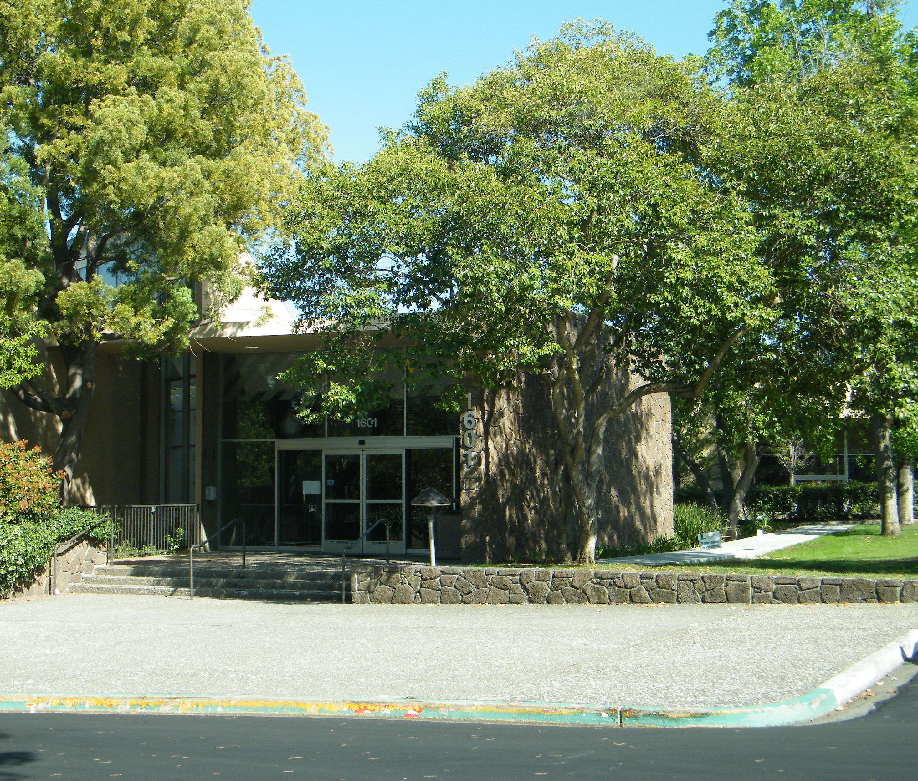
 The main entrance of the HP headquarters building
 The main headquarters of Facebook
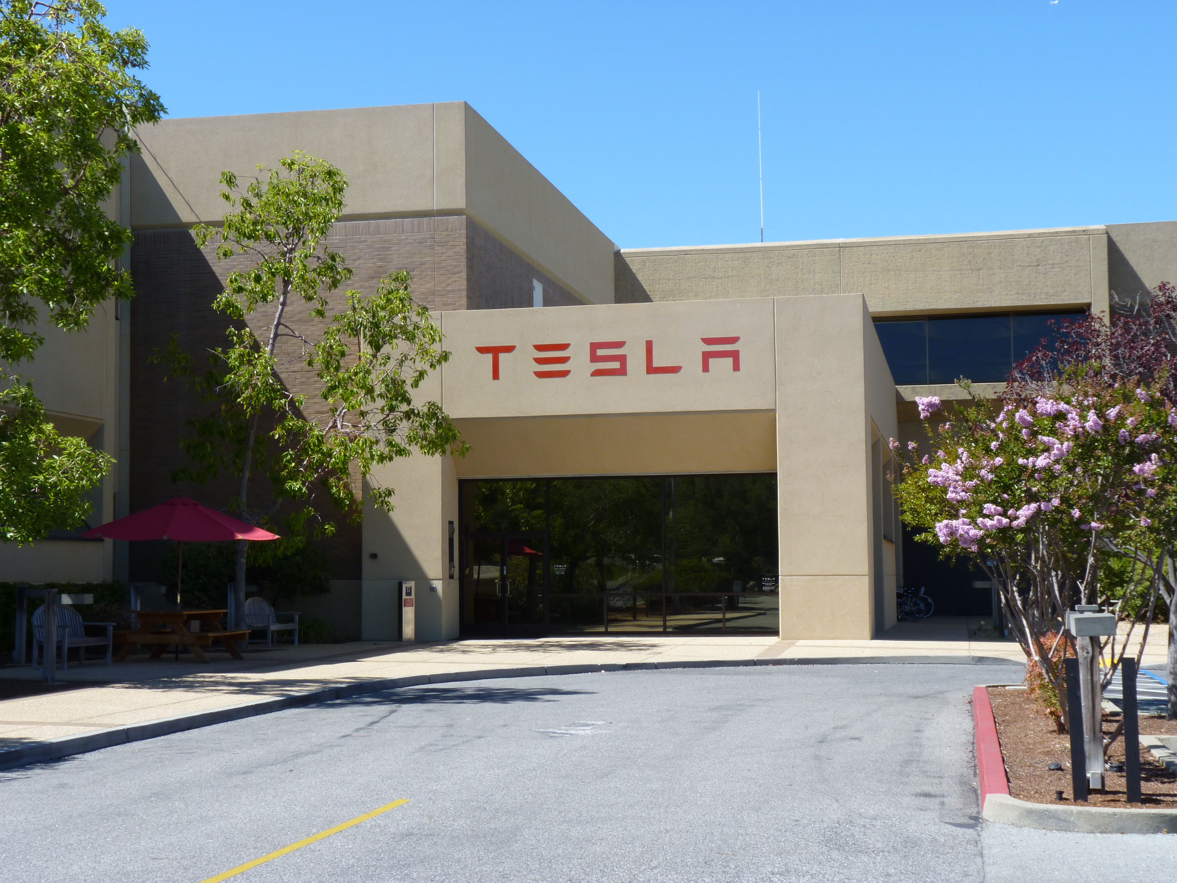
 The main entrance to the Tesla Motors headquarters
- Amazon.com's A9.com
- AOL Inc.
- Aricent
- Better Place
- CPI International
- Danger, Inc.
- Hewlett-Packard
- IDEO
- Mopay
- Nanosys[23]
- Ning
- PAIX
- Palantir Technologies
- Palo Alto Medical Foundation
- Palo Alto Research Center
- Socialtext
- Space Systems/Loral
- Tapulous
- Tesla Motors
- Tibco Software
- Varian Medical Systems
- VMware
- Wilson Sonsini Goodrich & Rosati
- MetricStream
Other notable companies with significant presences in Palo Alto include:
- Accenture (Former North American HQ. The main HQ now resides in Ireland)
- BMW (Technology)
- CNF Inc.
- Dell
- EPRI
- Genencor (based in Palo Alto)
- Groupon
- Lockheed Martin
- Merrill Lynch (largest office outside New York)
- Nokia Research Center
- Onlive
- Posedge Inc
- Rave Wireless (founded in Palo Alto)
- SAP AG (North American Labs)
- Schering-Plough Biopharma
- Skype
- The Wall Street Journal
In addition, Palo Alto has a lively retail and restaurant trade. Stanford Shopping Center, an upscale open air shopping center established in 1955, and downtown Palo Alto (centered on University Avenue) are popular eating venues and shopping destinations.
Palo Alto is also home to the first street-level Apple Store,[24] the first Apple mini store,[25] the first Whole Foods Market store on the West Coast,[26] and the first Victoria's Secret.[27] It was also home to the first Mrs. Fields Cookies store.[28]
Top employers
According to the City's 2010 Comprehensive Annual Financial Report,[29] the top employers in the city are:
# Employer # of Employees 1 Stanford University 10,101 2 Stanford University Medical Center/Hospital 5,569 3 Lucile Packard Children's Hospital 3,549 4 Veteran's Affairs Palo Alto Health Care System 3,500 5 Hewlett-Packard 2,001 6 Palo Alto Medical Foundation 2,000 7 Space Systems/Loral 1,700 8 Wilson Sonsini Goodrich & Rosati 1,500 9 Palo Alto Unified School District 1,336 10 City of Palo Alto 1,100 Utilities
Unlike surrounding communities, electric and gas service within city limits are provided by the city of Palo Alto. A minor exception is a rural portion of the city limits in hills area—west of Interstate 280 and along Page Mill Road—which gets gas and electric service from Pacific Gas and Electric Company (PG&E).
Water and Gas Services (WGS) operates gas and water distribution networks within the city limits. Natural gas is purchased from PG&E or third parties and delivered to Palo Alto via PG&E's gas transmission pipeline network. The city operates gas meters and the distribution pipelines. Water comes from city-operated watershed and wells, the Santa Clara Valley Water District, and the City and County of San Francisco Hetch Hetchy system. The city is located in Santa Clara Valley Water District, North Zone. Hetch Hetchy pipeline #3 and #4 pass through the city.
The city operates its own electric power distribution network and telemetry cable network. Interconnection points tie the city into PG&E's electric transmission system, which brings power from several sources to the city. A claim to fame is the city's exemption from rolling blackouts during the summer 2000 power shortages. Palo Alto is a member of a joint powers authority (the Northern California Power Agency), which cooperatively generates electricity for government power providers such as the City of Santa Clara, the City of Redding, and the Port of Oakland. Roughly the same group of entities operate the Transmission Agency of Northern California (TANC). TANC transports power (called wheeling) over its own lines from as far as British Columbia through an interconnection with the federal Bonneville Power Administration. A local oddity is a series of joint poles on Arastradero Road near Page Mill Road. The primary conductor cross arms are marked PGE and CPA (city of Palo Alto) to identify each utility's side of the shared cross arms.
Palo Alto has an ongoing community debate about the city providing fiber optic connectivity to all residences. A series of pilot programs were proposed. One proposal called for the city to install dark fiber which would be made live by a contractor.
Services traditionally attributed to a cable television provider were sold to a regulated commercial concern. Previously the cable system was operated by a cooperative called Palo Alto Cable Coop.
The former Regional Bell Operating Company in Palo Alto was Pacific Telephone. The company is now called AT&T and was previously called SBC and Pacific Bell. One of the earliest central office facilities switching Palo Alto calls is the historic Davenport central office (CO) at 529 Bryant St. The building was sold and is now the home of the Palo Alto Internet Exchange. The former CO building is marked by a bronze plaque and is located on the north side of Bryant Street between University Avenue and Hamilton Avenue. It was called Davenport after the exchange name at the introduction of dial telephone service in Palo Alto. For example, modern numbers starting with 325- were Davenport 5 in the 1950s and '60s. The Bryant CO, located at 37°26′44″N 122°09′39″W / 37.44556°N 122.16083°W, contained several floors of clattering Western Electric Step-by-Step switching equipment that historically handled calls for homes and businesses in Menlo Park, Atherton, East Palo Alto, and Palo Alto. The Step-by-Step office was scrapped and replaced by stored-program-controlled equipment at a different location about 1980. Stanford calls ran on a Step-by-Step Western Electric 701 PBX until the university purchased its own switch about 1980. It had the older, traditional Bell System 600 Hz+120 Hz dial tone. The old 497-number PBX, MDF, and battery string were housed in a steel building at 333 Bonair Siding. (The building still stands but Stanford's present-day PBX switch is elsewhere). From 1950s to 1980s, the bulk of Palo Alto calls were switched on Number 5 Crossbar systems. By the mid-1980s, these electromechanical systems had been junked. Under the Bell System's regulated monopoly, local coin telephone calls were ten cents until the early 1980s.
During the drought of the early 1990s, Palo Alto employed water waste patrol officers to enforce water saving regulations. The team, called "Gush Busters", patrolled city streets looking for broken water pipes and poorly managed irrigation systems. Regulations were set to stop restaurants from habitually serving water, run off from irrigation and irrigation during the day. The main goal of the team was to educate the public in ways to save water. Citations consisted of Friendly Reminder post cards and more formal notices. To help promote the conservation message, the team only used bicycles and mopeds.
Fire and police departments
 Palo Alto City Hall, as seen in 2004.
The city was among the first in Santa Clara County to offer advanced life support (ALS) paramedic-level (EMT-P) ambulance service. In an arrangement predating countywide paramedic service, Palo Alto Fire operates two paramedic ambulances which are theoretically shared with county EMS assets. The Palo Alto Fire Department is currently the only fire department in Santa Clara County that routinely transports patients. Rural Metro holds the Santa Clara County 911 contract and provides transportation in other cities. Enhanced 9-1-1 arrived in about 1980 and included the then-new ability to report emergencies from coin telephones without using a coin. Palo Alto Fire also provides service to the Stanford University campus.
The police station was originally housed in a stone building (still) marked Police Court at 450 Bryant St. The building is now a senior citizens center. In modern times, police are headquartered in the City Hall high rise. The Department is staffed by just under 100 sworn officers ranking from Chief, Captain, Lieutenant, Sergeant, Agent (corporal) and Officer. The staff is supplemented by approximately 10 Reserve Officers and professional staff to support the Police Department and the Animal Services organization.
School system
Public schools
The Palo Alto Unified School District provides public education for most of Palo Alto. According to the National Center for Education Statistics, Palo Alto has a student-teacher ratio of 14.9,[30] much lower than some surrounding communities. Juana Briones Elementary has a student/teacher ratio of 14.4.[31] The school board meets at 7 p.m. the 2nd and 4th Tuesdays of the month; the meetings are open to the public and city cast live on Government-access television (GATV) Cable TV Services Channel 28 in Palo Alto. Palo Alto students attend one of two high schools, the critically acclaimed Gunn High School or Palo Alto High School.There are also 3 middle schools, J.L.S., Jordan, and Terman.
The Los Altos School District and Mountain View-Los Altos Union High School District provide public education for the Monroe neighborhood portion of Palo Alto off El Camino Real south of Adobe Creek.
Private schools
- Bowman International School – a K-8 school founded in 1995 which emphasizes learning about different cultures.
- Castilleja School – an all-girls’ college preparatory school for grades 6-12.
- Challenge Summer School - Morrissey/Compton – Challenge is a five-week summer program for elementary students with mild to moderate learning or language disabilities. The program focuses on maintenance of academic skills, instruction in new strategies to succeed in school, and the continuing development of self-esteem.
- Challenger School – a K-8 School with extreme emphasis on academics
- Gideon Hausner Jewish Day School – a K-8 Jewish day school; school's name changed from Mid-Peninsula Jewish Community Day School (MPJCDS)[32]
- International School of the Peninsula – a Nursery-8 bilingual immersion school with two Palo Alto campuses. Offers two Nursery - 5 programs: Chinese-English and French-English, and an international middle school. Established in 1979.[33]
- Kehillah Jewish High School – a new preparatory high school with both secular and Jewish studies
- Keys School – a co-ed, independent K-8 school focused on learning for life
- Kitty Petty Institute – a preschool for disabled children
- Meira Academy - A Orthodox Jewish all-girls high school opening up the fall of 2011.
- Palo Alto Montessori School – an accredited preschool which has been educating 2–5 years olds since 1977.
- Pinewood School – located on Fremont Road in Los Altos Hills; most of the students are from Los Altos Hills/Los Altos area
- St Elizabeth Seton Extended – a Catholic school
- Palo Alto Chinese School - oldest Chinese school in Bay Area
- Stratford School – a K-5 school focused on all round development[34]
Libraries
The Palo Alto City Library has five branches, with a total of 265,000 items in their collections.[35] The library's mission is to enable people to explore library resources in order to enrich their lives with knowledge, information, and enjoyment. For Palo Alto library card holders, the main library web page also offers links to primary source databases with collections of magazine, newspaper, and other print articles. The Palo Alto City Library is also a member of the Northern California Digital Library, which allows card holders to browse and download the digital resources made available. Library cards are freely available for Palo Alto residents.
Media
The Palo Alto Daily Post publishes six days a week. Palo Alto Daily News, a unit of the San Jose Mercury News, publishes 5 days a week. Palo Alto Weekly is published Fridays. Palo Alto Times, a daily newspaper served Palo Alto and neighboring cities beginning in 1894. In 1979 it became the Peninsula Times Tribune. The newspaper ceased publication in 1993.[36]
KDOW 1220 AM began broadcasting in 1949 as KIBE; it later became KDFC, simulcasting classical KDFC-FM. As KDOW it broadcasts a business news format. The transmitter is in East Palo Alto near the western approach to Dumbarton Bridge with power of 5,000 watts daytime and 145 watts nighttime.
The Midpeninsula Community Media Center provides Public, educational, and government access (PEG) cable tv channels 26, 27, 28, 29, and 30.[37]
Among other programs, Palo Alto Institute runs a unique film festival, the Palo Alto International Film Festival, that focuses on the ways in which new technologies influence and are influenced by artistic revolution in media.
The movie "Palo Alto, CA" was filmed in the town and many landmarks can be seen in the background but the plot could be centered in any smaller town or city. [38]
Transportation
Roads
Palo Alto is served by two major freeways, Highway 101, and Interstate 280, and is traversed by the Peninsula's main north-south boulevard, El Camino Real (SR 82).
The city is also served indirectly by State Route 84 which traverses the Dumbarton Bridge to the north. None of the highways on the Peninsula side of the bridge have been upgraded to freeway status due to opposition from residents of Palo Alto, Atherton and Menlo Park. The freeway opponents fear that upgrading Highway 84 will encourage more people to live in Alameda County (where housing is more affordable) and commute to jobs in the mid-Peninsula area, thus increasing traffic in their neighborhoods to the south of the bridge. Also, Palo Alto has only one major crosstown arterial, Page Mill Road / Oregon Expressway, which completely connects the two freeways.
There are no parking meters in Palo Alto and all municipal parking lots and multi-level parking structures are free (limited to two or three hours any weekday 8am–5pm). Downtown Palo Alto has recently added many new lots to fill the overflow of vehicles.
Airport
Palo Alto is served by Palo Alto Airport of Santa Clara County (KPAO), one of the busiest single-runway general aviation airports in the country. It is used by many daily commuters who fly (usually in private singled engine aircraft) from their homes in the Central Valley to work in the Palo Alto area. Major airlines offer service through San Francisco airport (SFO), about 30 miles north, and San Jose (SJC), about 15 miles southeast.
Rail
Train service is available via Caltrain with service between San Francisco and San Jose and extending to Gilroy. Caltrain has two regular stops in Palo Alto, one at University Avenue (local and express) and the other at California Avenue (local only). A third, the Stanford station, located beside Alma Street at Embarcadero Road, is used to provide special services for occasional sports events (generally football) at Stanford Stadium. The University Avenue stop is the second most popular (behind 4th and King in San Francisco) on Caltrain's entire line.
Bus
The Santa Clara Valley Transportation Authority (VTA) provides primary bus service through Palo Alto with service to the south bay and Silicon Valley. The San Mateo County Transit District (SamTrans) provides service to San Mateo County to the north. The Stanford University Free Shuttle (Marguerite) provides a supplementary bus service to and from the campus, and the Palo Alto Free Shuttle (Crosstown and Embarcadero), which circulates frequently, and provides service to major points in Palo Alto, including the main library, downtown, the Municipal Golf Course, the Caltrain University Ave. Station, and both high schools.[7]
Cycling
Cycling is a popular mode of transportation in Palo Alto. It accounts for 7.5% of commute to work trips,[39] which is the third highest bicycle commute mode share among cities in the Bay Area, after Berkeley and Menlo Park. Since 2003, Palo Alto has received a Bicycle Friendly Community status of "Gold" from the League of American Bicyclists. The city's flat terrain and many quiet tree-shaded streets offer comfort and safety to cyclists, and the temperate climate makes year-round cycling possible. Palo Alto pioneered the bicycle boulevard concept in 1970s, enhancing residential Bryant Street to make it especially convenient for cyclists by removing stop signs, providing special traffic signals, and installing traffic calming devices and a bicycle bridge. However, busy arterial streets which often offer the fastest and most direct route to many destinations, are dangerous for cyclists due to high volumes of fast-moving traffic and the lack of bicycle lanes. El Camino Real, Alma Street, and Embarcadero and Middlefield roads, all identified as "high priorities" for adding bicycle lanes to improve safety by the Palo Alto Bicycle Transportation Plan in 2003, still contain no provisions for cyclists.
Sister cities
Palo Alto has six sister cities, as designated by Sister Cities International:
 Albi, France, since 1994
 Linköping, Sweden, since 1987
 Oaxaca, Mexico, since 1964
 Enschede, Netherlands, since 1980
 Palo, Philippines, since 1963
 Tsuchiura, Japan, since 2009[40]
In 1989, Palo Alto received a gift of a large, whimsical wooden sculpture called Foreign Friends (Fjärran Vänner)—of a man, woman, dog and bird sitting on a park bench—from Linköping. The sculpture was praised by some, called "grotesque" by others, and became a lightning rod for vandals. It was covered with a large addressed postcard marked "Return to Sender." A former Stanford University professor was arrested for attempting to light it on fire. It was doused with paint.[41]
When the original heads were decapitated on Halloween, 1993, the statue became a shrine—flowers bouquets and cards were placed upon it. Following an anonymous donation, the heads were restored. Within weeks, the restored heads were decapitated again, this time disappearing. The heads were eventually replaced with new ones, which generated even more distaste, as many deemed the new heads even less attractive.[citation needed]
A few months later, the man's arm was chopped off, the woman's lap was vandalized, the bird was stolen, and the replacements heads were decapitated and stolen.[citation needed]
The sculpture was removed from its location on Embarcadero Road and Waverley Avenue in 1995, dismantled, and placed in storage until it was destroyed in 2000. Ironically, the statue was designed not as a lasting work of art, but as something to be climbed on with a lifespan of 10 to 25 years.[citation needed]
Notable buildings and other points of interest
 Aerial view of Stanford University
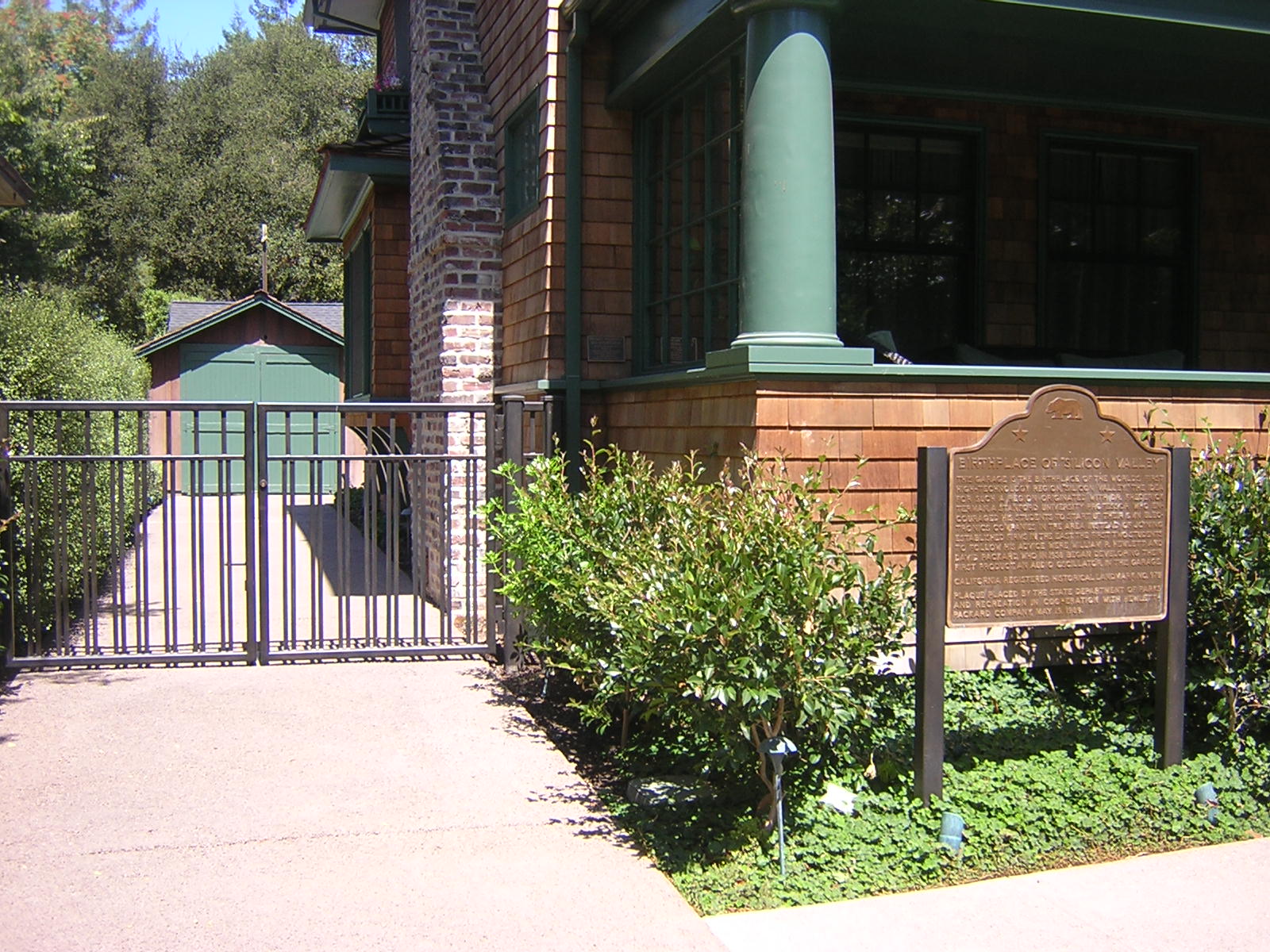
 Packard's garage, the birthplace of Silicon Valley
 Palo Alto Community House
 Frenchman's Tower on Old Page Mill Road
- Arastradero Preserve
- Arizona Cactus Garden
- Baylands Nature Preserve
- Cantor Arts Center
- Digital DNA, egg-shaped sculpture downtown
- Elizabeth Gamble Garden[42]
- Frenchman's tower[43]
- Former Community House in MacArthur Park at the intersection of University Avenue and El Camino Real; designed by Julia Morgan for the YWCA but first used as a social centre in Camp Fremont, Menlo Park during World War I; now a restaurant
- Institute of Transpersonal Psychology
- Lou Henry Hoover Girl Scout House[44]
- Matadero Creek
- Mental Research Institute (MRI)
- Packard's garage
- Palo Alto Art Center
- Palo Alto Airport, off Embarcadero East, is surrounded by numerous flying schools, and is a convenient bay area *
- Palo Alto Foothills Park
- Palo Alto Baylands Nature Preserve
- Palo Alto University
- Stanford Shopping Center
- Stanford University
- Stanford University Arboretum
- University Avenue (Downtown Palo Alto)
- Palo Alto Varsity Theater
- Papua New Guinea Sculpture Garden at Stanford [45]
- Stanford Terrace Inn [46] formerly Tiki Inn Motel [47]
- Stanford Theatre
- Saint Thomas Aquinas Parish
Notable people
Artists and entertainers
- William Ackerman, acoustic guitarist. He founded and ran for many years the influential New Age record label Windham Hill Records.
- Joan Baez, folk singer[48]
- Lindsey Buckingham, member of Fleetwood Mac
- The Grateful Dead, rock "jam" band (early incarnations of the band were based in Palo Alto)[49]
- The Donnas
- Yehuda Feldman
- Dave Franco, actor
- James Franco, actor, director, screenwriter, producer, artist, author
- Quinn Miller, actor, comedian, Hehmanist
- Teri Hatcher, born in Palo Alto, actress
- Amy Irving, actress*
- Stephan Jenkins, rock musician (Third Eye Blind)
- Ugly Kid Joe
- Ollie Johnston, Academy Award–winning Disney animator (Snow White and the Seven Dwarfs, Fantasia)[50]
- Kingston Trio
- Grace Slick, singer
- Serhiy Timoshenko,[51] Ukrainian famous architect and politician Anti-communist (member of Central Council of Ukraine), brother of Ukrainian scientist Stephen Timoshenko
- Alessandra Torresani, actress
- Shemar Moore, actor
Business leaders and entrepreneurs
- Sergey Brin, co-founder of Google.
- Debbi Fields, founder of Mrs. Fields Bakeries
- David Filo, co-founder of Yahoo!
- Steve Jobs, co-founder and former chairman and CEO of Apple Inc.
- Jawed Karim, co-founder of Youtube.
- Marissa Mayer, Vice President of Search Products & User Experience at Google
- William Hewlett, co-founder of technology company Hewlett-Packard
- Mark Hurd, past chairman, chief executive officer, and President of Hewlett-Packard.
- David Packard, co-founder of technology company Hewlett-Packard
- Larry Page, co-founder and CEO of Google.
- Romesh Wadhwani, founder and chairman of Symphony Technology Group
- Mark Zuckerberg, co-founder and CEO of Facebook.
- Owen Van Natta, COO of Facebook, CEO of Myspace, COO of Zynga.
- Elon Musk, CEO of TESLA Motors, Space X
Politicians and civil servants
- Ron Christie, former advisor to Vice President Dick Cheney and political pundit
- Herbert Hoover, the 31st President of the United States of America
- Jon Huntsman, Jr., former governor of Utah and U.S Ambassador of China
- Condoleezza Rice, former US Secretary of State
- Manabendra Nath Roy, Indian nationalist and revolutionary [52]
- Ron Wyden, US Senator
Novelists
- Erle Stanley Gardner, detective fiction author, creator of Perry Mason[53]
- Robert S. Gerleman, New York Times Adult Best Selling Author[54]
- Tad Williams, New York Times Adult Best Selling Author
Scientists
- Brian P. Hamachek, Nobel Prize of Medicine winner 1985[55][citation needed]
- Pamela Melroy, astronaut, second woman to command a space shuttle mission
- Perley Ason Ross, physicist who worked on essential problems in the behaviour of X-rays
- Robert Spinrad (1932–2009), computer pioneer as director of the Xerox Palo Alto Research Center.[56]
- William Shockley, Nobel laureate in physics and eugenicist[57]
Sports figures
- Matt Biondi, born in Palo Alto, Olympic swimmer, won a total of 11 Olympics medals (8 gold)
- Jim Harbaugh, football player and coach[58]
- Phil Hellmuth, professional poker player
- Katie Hoff, Palo Alto native, Olympic swimmer
- Dana Kirk, Olympic swimmer, coaches for Palo Alto Stanford Aquatics
- Tara Kirk, swam with Palo Alto Stanford Aquatics, Olympic swimmer, American Record holder 100 and 200 yard breaststroke
- Francie Larrieu-Smith, born in Palo Alto, long distance runner, first female athlete to make five Olympic teams
- Jeremy Lin, alumnus of Palo Alto High School and is currently a basketball player for the Golden State Warriors of the NBA
- Jim Loscutoff, basketball player who won seven NBA championships with the Boston Celtics[59][60]
- Steve Young, NFL hall-of-famer and former 49ers quarterback
Footnotes
- ^ "Mayor and City Council". City of Palo Alto. http://www.cityofpaloalto.org/depts/cou/. Retrieved 2009-05-08.
- ^ U.S. Census
- ^ [1]
- ^ [2]
- ^ Los Angeles Times. 2002-07-10. http://articles.latimes.com/2002/jul/10/business/fi-techbrfs10.5.
- ^ Bancroft plat survey link
- ^ Spanishtown Site
- ^ Palo Alto Comprehensive Plan, page L-3, http://www.cityofpaloalto.org/knowzone/city_projects/land_use/comprehensive_plan.asp, accessdate=2011-02-03
- ^ Jenks, 1976
- ^ Central California
- ^ "Period of Record Monthly Climate Summary, Palo Alto, California". Western Regional Climate Center. http://www.wrcc.dri.edu/cgi-bin/cliMAIN.pl?ca6646. Retrieved 2010-06-05.
- ^ "SD14 partisan registration". California State Senate. http://www.sen.ca.gov/ftp/SEN/senplan/SD11.HTM. Retrieved 2008-09-13.
- ^ "Partisan Voting Index: Districts of the 111th Congress". The Cook Political Report. http://www.cookpolitical.com/sites/default/files/pvistate.pdf. Retrieved 2009-08-20.
- ^ All data are derived from the United States Census Bureau reports from the 2010 United States Census, and are accessible on-line here. The data on unmarried partnerships and same-sex married couples are from the Census report DEC_10_SF1_PCT15. All other housing and population data are from Census report DEC_10_DP_DPDP1. Both reports are viewable online or downloadable in a zip file containing a comma-delimited data file. The area data, from which densities are calculated, are available on-line here. Percentage totals may not add to 100% due to rounding. The Census Bureau defines families as a household containing one or more people related to the householder by birth, opposite-sex marriage, or adoption. People living in group quarters are tabulated by the Census Bureau as neither owners nor renters. For further details, see the text files accompanying the data files containing the Census reports mentioned above.
- ^ "American FactFinder". United States Census Bureau. http://factfinder.census.gov. Retrieved 2008-01-31.
- ^ census.gov
- ^ Palo Alto Online Real Estate
- ^ DQNews - California Home Sale Price Medians by County and City
- ^ "2007 Coldwell Banker Home Price Comparison Index Reveals That $2.1 Million Separates Beverly Hills from Killeen, Texas". http://www.businesswire.com/portal/site/google/index.jsp?ndmViewId=news_view&newsId=20070926005351&newsLang=en. Retrieved 2009-08-20.
- ^ COLDWELL BANKER RANKS MAJOR COLLEGE FOOTBALL TOWN’S HOME AFFORDABILITY
- ^ Palo Alto Business Facts
- ^ Palo Alto Chamber of Commerce list of Major Employers (archived)
- ^ "Contact Us". Nanosys, Inc.. http://www.nanosysinc.com/contact_us/. Retrieved 26 April 2011.
- ^ Apple Stores - 2001–2003 - accessed November 30, 2010
- ^ [3]
- ^ [4]
- ^ [5]
- ^ [6]
- ^ City of Palo Alto CAFR
- ^ "District Detail for Palo Alto Unified". National Center for Educational Statistics. http://nces.ed.gov/ccd/districtsearch/district_detail.asp?Search=1&details=1&City=Palo+Alto&State=06&DistrictType=1&DistrictType=2&DistrictType=3&DistrictType=4&DistrictType=5&DistrictType=6&DistrictType=7&NumOfStudentsRange=more&NumOfSchoolsRange=more&ID2=0629610. Retrieved 2010-04-18.
- ^ School Detail for Briones (Juana) Elementary
- ^ Gideon Hausner Jewish Day School
- ^ International School of the Peninsula
- ^ Stratford School
- ^ Palo Alto City Library
- ^ THE MEDIA BUSINESS; Paper Closes In California, The New York Times, March 15, 1993.
- ^ Midpeninsula Community Media Center
- ^ IMDB entry, IMDB entry.
- ^ "American Community Survery, B08301", U.S. Census Bureau, 2003 and 2009.
- ^ Visiting Palo Alto
- ^ Palo Alto History>
- ^ Elizabeth Gamble Garden
- ^ Cady, Theron G. (1948), The Legend of Frenchmen's Tower, Peninsula Life Magazine: C-T Publishers, San Carlos, California, http://www.sfgenealogy.com/sanmateo/history/smcady_m.htm, retrieved August, 2011
- ^ Lou Henry Hoover Girl Scout House
- ^ http://www.stanford.edu/~mjpeters/png/
- ^ http://www.stanfordterraceinn.com
- ^ http://www.critiki.com/cgi-bin/location.cgi?loc_id=136
- ^ "The Joan Baez Web Pages - Chronology". http://www.joanbaez.com/chronology.html. Retrieved 2009-11-12.
- ^ "The Grateful Dead: Making the Scene in Palo Alto". Palo Alto Historical Society. http://www.paloaltohistory.com/gratefuldead.html. Retrieved 2009-08-20.
- ^ "Disney Legends web site - Legend Bio: Ollie Johnston, Animation". http://legends.disney.go.com/legends/detail?key=Ollie+Johnston. Retrieved 2009-03-14.
- ^ http://uk.wikipedia.org/wiki/Тимошенко_Сергій
- ^ Sibnarayan Ray, In Freedom's Quest: Life of M.N. Roy (Vol. 1: 1887-1922). Calcutta: Minerva Associates, 1998; pp. 46-47.
- ^ Nolan, William F.. 1 "Erle Stanley Gardner (1889–1970): Early Life". http://www.phantombookshop.com/erlestanleygardner/nolan2.htm 1. Retrieved 2009-03-14.
- ^ "Adult New York Times Best Seller Lists for 2008". http://www.hawes.com/2008/2008.htm.
- ^ "Winners of the Nobel Prize in Physiology or Medicine". Nobel Prize Internet Archive. http://almaz.com/nobel/medicine/medicine.html. Retrieved 2010-01-01.
- ^ Markoff, John. Robert Spinrad, a Pioneer in Computing, Dies at 77", The New York Times, September 6, 2009. Accessed September 9, 2009.
- ^ "The MOAH Neighborhood". Palo Alto Museum of American History. http://www.moah.org/exhibits/archives/house/neighborhood.html#shockley. Retrieved 2009-08-20.
- ^ "Stanford Official Athletic site - Bio: Jim Harbaugh". http://www.gostanford.com/sports/m-footbl/mtt/harbaugh_jim00.html. Retrieved 2009-11-12.
- ^ Horgan, John (2005-02-25). "The Last Roundup". Oakland Tribune. http://findarticles.com/p/articles/mi_qn4176/is_20050225/ai_n11832491. Retrieved 2009-11-12.[dead link]
- ^ Tennis, Mark (2003-04-03). "Mr. Basketball 2003: Trevor's Time". Scout.com. http://google.com/search?q=cache:txwinyg2P90J:hscalifornia.scout.com/2/103220.html+%22jim+loscutoff%22+%22palo+alto%22&cd=3&hl=en&ct=clnk&gl=us.
Further reading
- John Jenks, David Crimp, C. Michael Hogan et al., Engineering and Environmental Evaluations of Discharge to the Coast Casey Canal and Charleston Slough, prepared by Kennedy Jenks Engineers and Earth Metrics Inc. (1976)
- Santa Clara County Heritage Resource Inventory, Santa Clara County Historical Heritage Commission, published by Santa Clara County, San Jose, Ca., June 1979
- A description of high-tech life in Palo Alto around 1995 is found in the novel by Douglas Coupland, Microserfs.
- Coleman, Charles M., P. G. and E. of California: The Centennial Story of Pacific Gas and Electric Company 1852–1952, (New York: McGraw-Hill, 1952).
- Hanson, Warren D., San Francisco Water and Power: A History of the Municipal Water Department and Hetch Hetchy System, (San Francisco: San Francisco Public Utilities Communications Group, 2002).
- Map: PG&E Backbone Gas Transmission System, (San Francisco: Pacific Gas and Electric Co., undated).
- Map: Water Conveyance, Treatment, and Distribution System, (San Jose: Santa Clara Valley Water District, 1978).
- Earthquake Planning Scenario Special Publication #61, (Sacramento, California: State of California, Division of Mines and Geology, 1981).
- $117,730,000 Bond Offering: Transmission Agency of Northern California, (Sacramento, California: Transmission Agency of Northern California, 1992).
External links
- City of Palo Alto official website
- Palo Alto Chamber of Commerce
- Palo Alto History.Com
- Palo Alto Historical Association
- Palo Alto local portal
San Jose and Silicon Valley attractions Arboreta/Gardens Cultural American Musical Theatre of SJ · Ballet San Jose · Cathedral Basilica of St. Joseph · Choral Project · De Saisset Museum · Dr. Martin Luther King, Jr. Library · Gurdwara Sahib · Ira F. Brilliant Center for Beethoven Studies · Mexican Heritage Plaza · Opera San Jose · SJ City Hall · SJ Flea Market · SJ Improv · SJ Museum of Art · SJ Rep Theatre · Viet Museum · Villa Montalvo · Vivace Youth ChorusEvent venues Events BayCon · Cinequest Film Festival · FanimeCon · FurCon · LiveStrong Challenge · SJ Holiday Parade · SJ Jazz Festival · Stanford Jazz FestivalHistorical Parks/Trails Almaden Quicksilver County Park · Alum Rock Park · Bay Area Ridge Trail · Castle Rock State Park · Ed Levin Park · Grant Ranch Park · Guadalupe River Trail · Kelley Park · Lake Cunningham · Los Alamitos Creek Trail · Los Gatos Creek Trail · Plaza de César Chávez · Rancho San Antonio · Rosicrucian Park · Sanborn Park · SF Bay Trail · Shoreline Park · Stevens Creek Trail · Vasona ParkScience/Tech/Education Shopping Eastridge · Great Mall · Oakridge · PruneYard · San Antonio · Santana Row · Stanford · Vallco · Valley Fair · WestgateTheme parks & Tours Airship Ventures · Billy Jones Wildcat Railroad · Great America · Gilroy Gardens · Happy Hollow Park & Zoo · Raging WatersVineyards/Wineries San Francisco Bay Area Bodies of water Bodega Bay · Carquinez Strait · Clifton Forebay · Golden Gate · Grizzly Bay · Guadalupe River · Half Moon Bay · Lake Berryessa · Napa River · Oakland Estuary · Petaluma River · Richardson Bay · Richmond Inner Harbor · Russian River · San Francisco Bay · San Leandro Bay · San Pablo Bay · Sonoma Creek · Suisun Bay · Tomales Bay
Counties Alameda · Contra Costa · Marin · Napa · San Francisco · San Mateo · Santa Clara · Solano · Sonoma
Major cities Cities and towns
100k–250kCities and towns
25k–99kAlameda · Belmont · Benicia · Brentwood · Burlingame · Campbell · Castro Valley · Cupertino · Danville · Dublin · East Palo Alto · Foster City · Gilroy · Livermore · Los Altos · Los Gatos · Martinez · Menlo Park · Milpitas · Morgan Hill · Mountain View · Napa · Newark · Novato · Oakley · Pacifica · Palo Alto · Petaluma · Pittsburg · Pleasant Hill · Pleasanton · Redwood City · Rohnert Park · San Bruno · San Carlos · San Leandro · San Mateo · San Pablo · San Rafael · San Ramon · Saratoga · South San Francisco · Suisun City · Union City · Vacaville · Walnut Creek · Windsor
Cities and towns
5k–25kAlamo · Albany · Alum Rock · American Canyon · Ashland · Atherton · Bay Point · Blackhawk-Camino Tassajara · Cherryland · Clayton · Discovery Bay · Dixon · El Cerrito · El Sobrante · Emeryville · Fairview · Half Moon Bay · Healdsburg · Hercules · Hillsborough · Lafayette · Larkspur · Los Altos Hills · Millbrae · Mill Valley · Moraga · North Fair Oaks · Orinda · Piedmont · Pinole · San Anselmo · San Lorenzo · Sonoma · Stanford · Tamalpais-Homestead Valley
Sub-regions Municipalities and communities of Santa Clara County, California Cities and towns Campbell | Cupertino | Gilroy | Los Altos | Los Altos Hills | Los Gatos | Milpitas | Monte Sereno | Morgan Hill | Mountain View | Palo Alto | San Jose | Santa Clara | Saratoga | Sunnyvale
CDPs Alum Rock | Burbank | Cambrian Park | East Foothills | Fruitdale | Lexington Hills | Loyola | San Martin | Stanford
Unincorporated
communitiesBell Station | Casa Loma | Chemeketa Park | Coyote | Holy City | Loma Chiquita | Old Gilroy | New Almaden | Redwood Estates | Rucker | San Antonio Valley | Sargent | Sveadal
Ghost towns Categories:- Silicon Valley
- Palo Alto, California
- Academic enclaves
- Incorporated cities and towns in California
- Cities in Santa Clara County, California
- Cities in the San Francisco Bay Area
- University towns in the United States


Wikimedia Foundation. 2010.