- Los Altos Hills, California
Infobox Settlement
official_name = Town of Los Altos Hills, California
other_name =
native_name =
nickname =
settlement_type =Town
motto =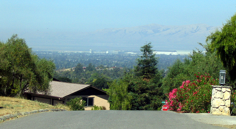
imagesize =
image_caption =
flag_size =
image_
seal_size =
image_shield =
shield_size =
image_blank_emblem =
blank_emblem_type =
blank_emblem_size =
flag_size =
image_
seal_size =
image_shield =
shield_size =
image_blank_emblem =
blank_emblem_type =
blank_emblem_size =
mapsize = 250x200px
map_caption = Location in Santa Clara County and the state ofCalifornia
mapsize1 =
map_caption1 =
image_dot_
dot_mapsize =
dot_map_caption =
dot_x =
dot_y =
pushpin_
pushpin_label_position =
pushpin_map_caption =
pushpin_mapsize =
subdivision_type = Country
subdivision_name =United States
subdivision_type1 = State
subdivision_name1 =California
subdivision_type2 = County
subdivision_name2 = Santa Clara
subdivision_type3 =
subdivision_name3 =
subdivision_type4 =
subdivision_name4 =
government_footnotes =
government_type =
leader_title =Mayor
leader_name = Craig A. T. Jones
leader_title1 =
leader_name1 =
leader_title2 =
leader_name2 =
leader_title3 =
leader_name3 =
leader_title4 =
leader_name4 =
established_title =
established_date =
established_title2 =
established_date2 =
established_title3 =
established_date3 =
area_magnitude = 1 E8
unit_pref =
area_footnotes =
area_total_km2 = 22.3
area_land_km2 = 22.3
area_water_km2 = 0.0
area_total_sq_mi = 8.6
area_land_sq_mi = 8.6
area_water_sq_mi = 0.0
area_water_percent =
area_urban_km2 =
area_urban_sq_mi =
area_metro_km2 =
area_metro_sq_mi =
area_blank1_title =
area_blank1_km2 =
area_blank1_sq_mi =
population_as_of = 2000
population_footnotes =
population_note =
population_total = 7902
population_density_km2 = 353.9
population_density_sq_mi = 917.2
population_metro =
population_density_metro_km2 =
population_density_metro_sq_mi =
population_urban =
population_density_urban_km2 =
population_density_urban_sq_mi =
population_blank1_title =
population_blank1 =
population_density_blank1_km2 =
population_density_blank1_sq_mi =
timezone = PST
utc_offset = -8
timezone_DST = PDT
utc_offset_DST = -7
latd = 37 |latm = 22 |lats = 17 |latNS = N
longd = 122 |longm = 8 |longs = 15 |longEW = W
elevation_footnotes =
elevation_m = 89
elevation_ft = 292
postal_code_type =ZIP code s
postal_code = 94022, 94024
area_code = 650
blank_name = FIPS code
blank_info = 06-43294
blank1_name = GNIS feature ID
blank1_info = 1659746
website = http://www.losaltoshills.ca.gov/
footnotes =
latitude = 37°22'17" N
longitude = 122°8'15" WLos Altos Hills (pronEng|lɑːs ˈæltoʊs ˈhɪlz) is an incorporated town in Santa Clara County,
California ,United States . The population was 7,902 at the 2000 census. It is one of the wealthiest places in theUnited States .trictly residential
The town has no commercial or industrial zones. The town government contracts with Santa Clara County for police and fire services (making it a so-called "
contract city " under California law). The town's onlyretail commercial operation is thebook store on the campus ofFoothill College . The town also does not have apost office orlibrary ; mail delivery is provided by post offices in nearby Los Altos, so the town shares the 94022 and 94024ZIP code s with Los Altos. Town residents desiring library services must visit county-operated libraries in nearby Los Altos or Cupertino.The town's zoning regulations are among the strictest in California, requiring a minimum lot size of one acre (4,000 m²), setbacks from the property boundary, and
easement s for public pathways. [Peraino, Kevin. "Gold in Them Thar Hills: Money isn't new to Los Altos. But this much new money is." "Newsweek ", 4 September 2000, p. 55.] [ [http://www.latc.com/2005/04/20/news/news5.html Los Altos Hills pathways map shows trails that dead-end or don't exist] April 20, 2005] Landowners are limited to one primary dwelling per lot, which effectively bans multifamily housing; this ban and the minimum lot size were upheld as constitutional by theU.S. Court of Appeals for the Ninth Circuit in 1974. ["Ybarra v. Town of Los Altos Hills", 503 F.2d 250, 254 (9th Cir. 1974).] The ban on commercial zones was upheld by theCalifornia Court of Appeal (First District) in 1973. ["Town of Los Altos Hills v. Adobe Creek Properties, Inc.", [http://online.ceb.com/calcases/CA3/32CA3d488.htm 32 Cal.App.3d 488] (1973).] The town is set in hilly terrain offering commanding views of theSan Francisco Bay Area . All these factors and the Bay Area's chronic housing shortage result in median home prices in excess of $3 million.In 2000, the largest house in Silicon Valley at that time was built in the town. Larger ones have since been built elsewhere. The building was officially assessed by the county government as having convert|18000|sqft|m2 of interior space [Kaplan, Tracey. "Be It Ever So Humble: The Biggest Of Santa Clara County's Homes." "
San Jose Mercury News ", 26 October 2000, sec. A, p. 1.] . The home is actually considerably larger due to below ground area that is not part of the official assessment. In reality, it remains one of largest homes in the area. Currently (2007) a home not a mile away is under construction that when finished will most likely retake the official honor of largest home in Santa Clara County. Estimates put its size at approximately convert|28000|sqft|m2.The town is also home to a
convent of the Daughters of Charity of St. Vincent de Paul. In 2002, seven profitablehospital s in the Catholic Healthcare West system formed their own system, the Daughters of Charity Health System, under the control of the Los Altos Hills convent.Geography
Los Altos Hills is located at coor dms|37|22|17|N|122|8|15|W|city (37.371390, -122.137605)GR|1.
According to the
United States Census Bureau , the town has a total area of 8.6 square miles (22.3 km²), all of it land.Both the Altamont and Monte Vista Faults pass through the town.
Demographics
As of the
census GR|2 of 2000, there were 7,902 people, 2,740 households, and 2,339 families residing in the town. Thepopulation density was 917.2 people per square mile (353.9/km²). There were 2,816 housing units at an average density of 326.9/sq mi (126.1/km²). The racial makeup of the town was 74.94% White, 0.59% African American, 0.09% Native American, 21.10% Asian, 0.09% Pacific Islander, 0.46% from other races, and 2.73% from two or more races. Hispanic or Latino of any race were 2.15% of the population.There were 2,740 households out of which 34.6% had children under the age of 18 living with them, 79.0% were married couples living together, 4.4% had a female householder with no husband present, and 14.6% were non-families. 10.5% of all households were made up of individuals and 4.9% had someone living alone who was 65 years of age or older. The average household size was 2.86 and the average family size was 3.02.
In the town the population was spread out with 23.6% under the age of 18, 4.0% from 18 to 24, 19.6% from 25 to 44, 35.8% from 45 to 64, and 17.0% who were 65 years of age or older. The median age was 47 years. For every 100 females there were 97.4 males. For every 100 females age 18 and over, there were 94.2 males.
The median income for a household in the town was $173,570, and the median income for a family was $181,865. Males had a median income of $200,000+ versus $178,288 for females. The
per capita income for the town was $92,840. About 1.2% of families and 1.9% of the population were below thepoverty line , including 2.5% of those under age 18 and 2.0% of those age 65 or over.Politics
In the state legislature Los Altos Hills is located in the 11th Senate District, represented by Democrat
Joe Simitian , and in the 21st Assembly District, represented by DemocratIra Ruskin . Federally, Los Altos Hills is located inCalifornia's 14th congressional district , which has a Cook PVI of D +18 [cite web | title = Will Gerrymandered Districts Stem the Wave of Voter Unrest? | publisher = Campaign Legal Center Blog | url=http://www.clcblog.org/blog_item-85.html | accessdate = 2008-02-10] and is represented by DemocratAnna Eshoo .The Town of Los Altos Hills has a politically active citizenry and a 5 member elected City Council. The Town has several volunteer committees reporting to the City Council covering issues such as Open Space, Pathways, Environmental Initiatives, Education, Historical, Parks and Recreation,Community Relations Committee,Emergency Communications Committee, Environmental Design and Protection, Finance and Investment, Westwind Community Barn. Political issues that have been prominent in recent years include the return of public education to the Town, expansion of parks and recreation services, adding cell phone towers, the management and financing of a historic horse barn, and several environmental issues, including greater recycling of trash.
Notable residents
*
Wallace Stegner
*David Packard
*Sabeer Bhatia
*Steve Young
*Steve Kirsch
*Barry Bonds (2001 to 2003)
*Jerry Yang
*Carly Fiorina
*Ellen Hancock
*Sehat Sutardja
*Jen-Hsun Huang
*Dr. Gaylord Hall DDS Many successful Silicon Valley executives reside here.Gallery
References
External links
Wikimedia Foundation. 2010.