- Portola Valley, California
Infobox Settlement
official_name = Portola Valley, California
other_name =
native_name =
nickname =
settlement_type =Town
motto =
imagesize =
image_caption =
flag_size =
image_
seal_size =
image_shield =
shield_size =
image_blank_emblem =
blank_emblem_type =
blank_emblem_size =
imagesize =
image_caption =
flag_size =
image_
seal_size =
image_shield =
shield_size =
image_blank_emblem =
blank_emblem_type =
blank_emblem_size =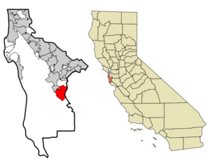
mapsize = 250x200px
map_caption = Location in San Mateo County and the state ofCalifornia
mapsize1 =
map_caption1 =
image_dot_
dot_mapsize =
dot_map_caption =
dot_x =
dot_y =
pushpin_
pushpin_label_position =
pushpin_map_caption =
pushpin_mapsize =
subdivision_type = Country
subdivision_name =United States
subdivision_type1 = State
subdivision_name1 =California
subdivision_type2 = County
subdivision_name2 = San Mateo
subdivision_type3 =
subdivision_name3 =
subdivision_type4 =
subdivision_name4 =
government_footnotes =
government_type =
leader_title =Mayor
leader_name =Ted Driscoll
leader_title1 =Vice Mayor
leader_name1 =Maryann Moise Derwin
leader_title2 =
leader_name2 =
leader_title3 =
leader_name3 =
leader_title4 =
leader_name4 =
established_title = Incorporated
established_date =1964
established_title2 =
established_date2 =
established_title3 =
established_date3 =
area_magnitude =
unit_pref =
area_footnotes =
area_total_km2 = 23.7
area_land_km2 = 23.7
area_water_km2 = 0
area_total_sq_mi = 9.2
area_land_sq_mi = 9.2
area_water_sq_mi = 0
area_water_percent = 0
area_urban_km2 =
area_urban_sq_mi =
area_metro_km2 =
area_metro_sq_mi =
area_blank1_title =
area_blank1_km2 =
area_blank1_sq_mi =
population_as_of = 2000
population_footnotes =
population_note =
population_total = 4462
population_density_km2 = 188.3
population_density_sq_mi = 485
population_metro =
population_density_metro_km2 =
population_density_metro_sq_mi =
population_urban =
population_density_urban_km2 =
population_density_urban_sq_mi =
population_blank1_title =
population_blank1 =
population_density_blank1_km2 =
population_density_blank1_sq_mi =
timezone = PST
utc_offset = -8
timezone_DST = PDT
utc_offset_DST = -7
latd = 37 |latm = 22 |lats = 30 |latNS = N
longd = 122 |longm = 13 |longs = 7 |longEW = W
elevation_footnotes =
elevation_m = 140
elevation_ft = 459
postal_code_type =ZIP code
postal_code = 94028
area_code = 650
blank_name = FIPS code
blank_info = 06-58380
blank1_name = GNIS feature ID
blank1_info = 1659786
website = http://www.portolavalley.net/
footnotes =Portola Valley is an incorporated town in San Mateo County,
California ,United States . The population was 4,462 at the 2000 census. It was named for Spanish explorerGaspar de Portola , who led the first party of Europeans to explore theSan Francisco Peninsula , in 1769.Portola Valley is one of the top twenty wealthiest towns in the United States of America. And also Portola Valley is considered one of the top ten most affluent towns in the United States of America. Portola Valley has a Median household income of over $200,000+ a year. GR|2
Notable Citizens
Bill Lane, the first mayor and one of the founders of Portola Valley, also served as Ambassador to
Japan andAustralia for the US, and the publisher ofSunset Magazine . [http://findarticles.com/p/articles/mi_qn4176/is_20061218/ai_n16895396] , [http://news-service.stanford.edu/pr/2005/pr-center-030205.html] .Operatic tenor
Richard Crooks (1900-1972), longtime host of "The Voice of Firestone" on network radio, lived in Portola Valley for many years until his death. In later years, he sang with the choir at the local Presbyterian church.Geography
Portola Valley is located at coor dms|37|22|30|N|122|13|7|W|city (37.375023, -122.218635)GR|1, on the eastern slope of the Peninsula Coastal Range of the
Santa Cruz Mountains . TheWindy Hill Open Space Preserve is on the town's southwest side and theJasper Ridge Biological Preserve is on the north side of town. It is off Interstate 280, near Woodside, just west of Palo Alto and Los Altos and south of Menlo Park, and is in a mostly wooded area, with some open plains.According to the
United States Census Bureau , the town has a total area of 9.2square mile s (23.7km² ), all land.Demographics
As of the
census GR|2 of 2000, there were 4,462 people, 1,700 households, and 1,268 families residing in the town. Thepopulation density was 487.5 people per square mile (188.3/km²). There were 1,772 housing units at an average density of 193.6/sq mi (74.8/km²). The racial makeup of the town was 92.92% White, 0.40% African American, 0.25% Native American, 3.99% Asian, 0.04% Pacific Islander, 0.96% from other races, and 1.43% from two or more races. Hispanic or Latino of any race were 3.34% of the population.There were 1,700 households out of which 29.8% had children under the age of 18 living with them, 69.2% were married couples living together, 4.0% had a female householder with no husband present, and 25.4% were non-families. 19.9% of all households were made up of individuals and 13.3% had someone living alone who was 65 years of age or older. The average household size was 2.58 and the average family size was 2.93.
In the town the population was spread out with 22.9% under the age of 18, 3.2% from 18 to 24, 19.4% from 25 to 44, 33.4% from 45 to 64, and 21.0% who were 65 years of age or older. The median age was 48 years. For every 100 females there were 96.8 males. For every 100 females age 18 and over, there were 91.7 males.
The median
income for a household in the town was $230,000, and the median income for a family was $265,000. Males had a median income of over $295,000 versus $150,000 or more for females. Theper capita income for the town was $235,000. About .8% of families and 1.4% of the population were below thepoverty line , including 3.3% of those under age 18 and none of those age 65 or over.chools
The Portola Valley School District has two public primary schools: Ormandale School (with grades K-3) and Corte Madera School (grades 4-8). Portola Valley is one of the few (perhaps only) school districts that has a school named after a race horse (Ormond).
Portola Valley is also home to a Roman Catholic Benedictine Order monastery and a private college-preparatory Roman Catholic boarding school,
Woodside Priory School , with grades 6-12.The nearest public secondary school is Woodside High School, located in neighboring Woodside. Many children attend other public and private institutions of higher learning across the area. These schools include and may not be limited to;
Woodside Priory School ,Menlo-Atherton High School ,Saint Francis High School (Mountain View) ,Menlo School ,Sacred Heart Preparatory (Atherton, California) , andCrystal Springs Uplands School .Politics
In the state legislature Portola Valley is located in the 8th Senate District, represented by Democrat
Leland Yee , and in the 21st Assembly District, represented by DemocratIra Ruskin . Federally, Portola Valley is located inCalifornia's 14th congressional district , which has a Cook PVI of D +18 [cite web | title = Will Gerrymandered Districts Stem the Wave of Voter Unrest? | publisher = Campaign Legal Center Blog | url=http://www.clcblog.org/blog_item-85.html | accessdate = 2008-02-10] and is represented by DemocratAnna Eshoo .External links
* [http://www.smcl.org Portola Valley Public Library - a branch of the San Mateo County Library]
Wikimedia Foundation. 2010.