- Santa Rosa, California
-
This article is about the city in Sonoma County. For the unincorporated area in Ventura County, northwest of Thousand Oaks, see Camarillo, California#Camrosa or Santa Rosa area. For the Channel Island off the coast of Santa Barbara County, see Santa Rosa Island, California.
City of Santa Rosa — City — Old Courthouse Square, Downtown Santa Rosa

logoLocation in Sonoma County and the state of California
Coordinates: 38°26′55″N 122°42′17″W / 38.44861°N 122.70472°WCoordinates: 38°26′55″N 122°42′17″W / 38.44861°N 122.70472°W[1] Country United States State California County Sonoma Incorporated March 26, 1868[2] Government - Type Council-Manager - Mayor Ernesto Olivares - City manager Kathy Millison Area[3] - Total 41.499 sq mi (107.481 km2) - Land 41.294 sq mi (106.95 km2) - Water 0.205 sq mi (0.531 km2) 0.49% Elevation[4] 164 ft (50 m) Population (2010) - Total 167,815 - Rank 1st in Sonoma County
26th in California
138th in the United States- Density 4,043.8/sq mi (1,561.3/km2) Time zone PST (UTC-8) - Summer (DST) PDT (UTC-7) ZIP codes 95401-95409 Area code(s) 707 FIPS code 06-70098 GNIS feature ID 1659601 Website ci.santa-rosa.ca.us Santa Rosa is the county seat of Sonoma County, California, United States. The 2010 census reported a population of 167,815. Santa Rosa is the largest city in California's Wine Country and fifth largest city in the San Francisco Bay Area, after San Jose, San Francisco, Oakland, and Fremont and 26th largest city in California.
History, growth and development
 The former Petaluma & Santa Rosa Railroad Station
The first known permanent European settlement of Santa Rosa was the homestead of the Carrillo family, in-laws to Mariano Guadalupe Vallejo, who settled the Sonoma pueblo and Petaluma area. In the 1830s, during the Mexican period, the family of María López de Carrillo built an adobe house on their Rancho Cabeza de Santa Rosa land grant, just east of what later became downtown Santa Rosa. Allegedly, however, by the 1820s, before the Carrillos built their adobe in the 1830s, Spanish and Mexican settlers from nearby Sonoma and other settlements to the south raised livestock in the area and slaughtered animals at the fork of the Santa Rosa Creek and Matanzas Creek, near the intersection of modern-day Santa Rosa Avenue and Sonoma Avenue. This is supposedly the origin of the name of Matanzas Creek as, because of its use as a slaughtering place, the confluence came to be called La Matanza.
By the 1850s, a Wells Fargo post and general store were established in what is now downtown Santa Rosa. In the mid-1850s, several prominent locals, including Julio Carrillo, son of Maria Carrillo, laid out the grid street pattern for Santa Rosa with a public square in the center, a pattern which largely remains as the street pattern for downtown Santa Rosa to this day despite changes to the central square, now called Old Courthouse Square.
In 1867, the county recognized Santa Rosa as an incorporated city and in 1868 the state officially confirmed the incorporation, making it officially the third incorporated city in Sonoma County, after Petaluma, incorporated in 1858, and Healdsburg, incorporated in 1867.
The U.S. Census records, among others, show that after California became a state, despite initially lagging behind nearby Petaluma in the 1850s and early 1860s, Santa Rosa grew steadily early on. According to the U.S. Census, in 1870 Santa Rosa was the eighth largest city in California, and county seat of one of the most populous counties in the state. Growth and development after that were never rapid, but were steady. As a result, the city continued to grow when other early population centers declined or stagnated, but by 1900 it had been, or was being, overtaken by many other newer population centers in the San Francisco Bay Area and Southern California. According to a 1905 article in the Press Democrat newspaper reporting on the "Battle of the Trains", the city had just over 10,000 people at the time.
The April 18, 1906 San Francisco Earthquake essentially destroyed the entire downtown, but the city's population did not greatly suffer. However, after that period the population growth of Santa Rosa, as with most of the area, was very slow.
Famed director Alfred Hitchcock filmed his thriller Shadow of a Doubt in Santa Rosa in 1943; the film, which has been released on VHS and DVD, gives glimpses of Santa Rosa in the 1940s. Many of the downtown buildings seen in the film no longer exist due to major reconstruction following the strong earthquakes in September 1969. However, some, like the rough-stone Northwestern Pacific Railroad depot and the prominent Empire Building (built in 1910 with a gold-topped clock tower), still survive. A scene at the bank was filmed at the corner of Fourth Street and Mendocino Avenue (at present day Old Courthouse square); sharp-eyed viewers can also identify the "KRESS" building on Fourth Street. However, the courthouse and bank are now gone.
Post World War II
 Old Courthouse Square is the heart of Downtown Santa Rosa. This is the Empire Building, completed in 1910 and a Sonoma County landmark. It was seen in Shadow of a Doubt by Alfred Hitchcock.
With the end of World War II in 1945, Santa Rosa would soon see substantial growth for the next 25 years. The population enlarged by 2/3 between 1950 and 1970, an average of 1,000 new residents a year over the 20 years. Some of the increase was from immigration, and some from annexation of portions of the surrounding area.
In 1958 the United States Office of Civil and Defense Mobilization designated Santa Rosa as one of its eight regional headquarters, with jurisdiction over Region 7, which included American Samoa, Arizona, California, Guam, Hawaii, Nevada, and Utah. Santa Rosa continued as a major center for civil defense activity (under the Office of Emergency Planning and the Office of Emergency Preparedness) until 1972 when the Federal Emergency Management Agency (FEMA) was created in its place, ending the civil defense's 69-year history.[5]
When the City Council adopted the City's first modern General Plan in 1991, the population was about 113,000. In the 21 years since 1970, Santa Rosa had grown by about 3,000 residents a year—triple the average growth during the previous twenty years.
Santa Rosa 2010, the 1991 General Plan, called for a population of 175,000 in 2010. The Council expanded the City's urban boundary to include all the land then planned for future annexation, and declared it would be Santa Rosa's "ultimate" boundary. The rapid growth that was being criticized as urban sprawl became routine infill development.
At the first five-year update of the plan, in 1996, the Council extended the planning period by ten years, renaming it Vision 2020 (updated to Santa Rosa 2020, and then again to Santa Rosa 2030 Vision), and added more land and population. Now the City projects a population of 195,000 in 2020.
Geography
Santa Rosa is located at 38°26′55″N 122°42′17″W / 38.448611°N 122.704722°W[1] in Sonoma County. According to the United States Census Bureau, the city has a total area of 41.50 sq mi (107.5 km2), of which 41.29 sq mi (106.9 km2) is land and 0.205 sq mi (0.5 km2) (0.49%) is water.[6]
The city is part of the North Bay region, which includes such cities as Petaluma, Rohnert Park, Windsor, and smaller cities as Sonoma, Healdsburg, Sebastopol. It lies along the US Route 101 corridor, approximately 55 miles (89 km) north of San Francisco, via the Golden Gate Bridge.
Santa Rosa lies on the Santa Rosa Plain; its eastern extremities stretch into the Valley of the Moon, and the Sonoma Creek watershed known as the Sonoma Valley, while its western edge lies in the Laguna de Santa Rosa catchment basin.
The city is in the watershed of Santa Rosa Creek, which rises on Hood Mountain and discharges to the Laguna de Santa Rosa. Tributary basins to Santa Rosa Creek lying significantly in the city are Brush Creek, Matanzas Creek, Colgan Creek and Piner Creek. Other water bodies within the city include Fountaingrove Lake, Lake Ralphine, and Santa Rosa Creek Reservoir.
The prominent visual feature is Hood Mountain seen to the east. To the southeast, Taylor Mountain and Sonoma Mountain are readily visible from much of the city.
Climate
Santa Rosa has cool, wet winters and warm, mostly dry summers. In the summer, fog and low overcast often moves in from the Pacific Ocean during the evenings and mornings. It usually clears to warm, sunny weather by late morning or noon before returning in the later evening but will occasionally linger all day. Average annual rainfall is 30.45 inches (773 mm), falling on 74 days annually. The wettest year was 1983 with 63.07 inches (1,602 mm) and the driest year was 1976 with 11.38 inches (289 mm). The most rainfall in one month was 19.42 inches (493 mm) in February 1998 and the most rainfall in 24 hours was 5.23 inches (133 mm) on December 19, 1981. Measurable snowfall is rare in the lowlands, but light amounts sometimes fall in the nearby mountains.
There are an average of 28.9 days with highs of 90°F (32°C) or more and an average of 30.2 days with lows of 32°F (0°C) or lower. The record high was 110 °F (43 °C) on September 13, 1971, and the record low was 15 °F (−9 °C) on December 13, 1932.[7]
Climate data for Santa Rosa Month Jan Feb Mar Apr May Jun Jul Aug Sep Oct Nov Dec Year Record high °F (°C) 85
(29)83
(28)87
(31)98
(37)100
(38)108
(42)110
(43)105
(41)110
(43)105
(41)92
(33)83
(28)110
(43)Average high °F (°C) 58
(14)63
(17)65
(18)70
(21)75
(24)80
(27)84
(29)83
(28)83
(28)77
(25)65
(18)57
(14)71.7
(22.0)Average low °F (°C) 37
(3)40
(4)41
(5)42
(6)46
(8)50
(10)51
(11)52
(11)51
(11)47
(8)42
(6)37
(3)44.7
(7.0)Record low °F (°C) 23
(−5)23
(−5)26
(−3)30
(−1)35
(2)38
(3)43
(6)42
(6)37
(3)30
(−1)23
(−5)16
(−9)16
(−9)Rainfall inches (mm) 6.2
(157)4.64
(117.9)4.34
(110.2)1.8
(46).31
(7.9).3
(8)0
(0)0
(0).6
(15)1.86
(47.2)4.8
(122)4.96
(126)29.81
(757.2)Source: [8] Seismicity
Santa Rosa lies atop the Healdsburg-Rodgers Creek segment of the Hayward-Rodgers Creek Fault System. The U.S. Geological Survey estimates a 20% chance of a magnitude 6.7 or greater earthquake on this segment by 2030.[9]
On April 14, 2005, the United States Geological Survey released a map detailing the results of a new tool that measures ground shaking during an earthquake. The map determined that the 1906 San Francisco earthquake was most powerful in an area between Santa Rosa and what is now Sebastopol, causing more damage in Santa Rosa (for its size) than any other city affected.[10]
Two earthquakes of magnitudes 5.6 and 5.7 shook Santa Rosa October 1, 1969, damaging about 100 structures. They were the strongest quakes to affect the city since 1906. The epicenters were about two miles (3 km) north of Santa Rosa.
Nature and wildlife
Due to its population, much of Santa Rosa's remaining undisturbed area is on its urban fringe. However, the principal wildlife corridors of Santa Rosa Creek and its tributaries, flow right through the heart of the town. Great blue herons, great egrets, snowy egrets and black-crowned herons nest in the trees of the median strip on West Ninth Street as well as along Santa Rosa Creek and downtown. Deer often are spotted roaming the neighborhoods nearer the eastern hills, as deep into town as Franklin Avenue and the McDonald area; flocks of wild turkeys are relatively common in some areas, and mountain lions are occasionally observed within the city limits. Raccoons and opossums are a common sight throughout the city, while foxes, and rabbits may be regularly seen in the more rural areas. In addition, the city borders and then wraps around the northern end of Annadel State Park, which itself extends into the Sonoma Mountains and Sonoma Valley. Annadel State Park also adjoins Spring Lake County Park and Howarth Park, forming one contiguous park system that enables visitors to venture into wild native habitats.
Neighborhoods
 Restaurants and other retail stores occupy several historic buildings in Santa Rosa's Railroad Square district in the downtown area, including these along Fourth Street.
Santa Rosa can be seen as divided into four quadrants: Northeast, Southeast, Southwest, and Northwest. U.S. Route 101 runs roughly north and south through the city, and divides it into east and west sides. State Route 12 runs roughly east and west, and divides the city into north and south sides.
Neighborhoods include:
- Bennett Valley
- Burbank Gardens Historic District[11]
- Cherry Street Historic District
- Coffey Park
- Country Club
- Dutton Ave
- Hidden Valley
- Juilliard Park
- Junior College[12]
- Lomita Heights
- Montgomery Village
- Moorland Avenue
- North Junior College[13]
- North West Santa Rosa
- Oakmont Village[14]
- Olive Park
- Ridgway Historic District
- Rincon Valley
- Roseland
- Santa Rosa Avenue
- South Park
- St. Rose Historic District[15]
- Stonegate
- Town & Country/Grace Tract
- West End Arts & Theater District
- West End Historic District[16]
- West Junior College
Demographics
Historical populations Census Pop. %± 1860 1,623 — 1870 2,898 78.6% 1880 3,616 24.8% 1890 5,220 44.4% 1900 6,673 27.8% 1910 7,817 17.1% 1920 8,758 12.0% 1930 10,636 21.4% 1940 12,605 18.5% 1950 17,902 42.0% 1960 31,027 73.3% 1970 50,006 61.2% 1980 82,658 65.3% 1990 113,313 37.1% 2000 147,595 30.3% 2010 167,815 13.7% source:[17] 2010
The 2010 United States Census[18] reported that Santa Rosa had a population of 167,815. The population density was 4,043.8 people per square mile (1,561.3/km²). The racial makeup of Santa Rosa was 119,158 (71.0%) White, 4,079 (2.4%) African American, 2,808 (1.7%) Native American, 8,746 (5.2%) Asian (1.1% Filipino, 1.1% Chinese, 0.8% Vietnamese, 0.6% Indian, 0.6% Cambodian, 0.5% Laotian, 0.3% Japanese, 0.3% Korean), 810 (0.5%) Pacific Islander, 23,723 (14.1%) from other races, and 8,491 (5.1%) from two or more races. Hispanic or Latino of any race were 47,970 persons (28.6%). Among the Hispanic population, 25.0% of Santa Rosa is Mexican, 0.8% Salvadoran, and 0.4% Puerto Rican.
The Census reported that 164,405 people (98.0% of the population) lived in households, 1,697 (1.0%) lived in non-institutionalized group quarters, and 1,713 (1.0%) were institutionalized.
There were 63,590 households, out of which 20,633 (32.4%) had children under the age of 18 living in them, 27,953 (44.0%) were opposite-sex married couples living together, 7,663 (12.1%) had a female householder with no husband present, 3,615 (5.7%) had a male householder with no wife present. There were 5,020 (7.9%) unmarried opposite-sex partnerships, and 757 (1.2%) same-sex married couples or partnerships. 18,021 households (28.3%) were made up of individuals and 7,474 (11.8%) had someone living alone who was 65 years of age or older. The average household size was 2.59. There were 39,231 families (61.7% of all households); the average family size was 3.18.
The population was spread out with 39,217 people (23.4%) under the age of 18, 15,982 people (9.5%) aged 18 to 24, 46,605 people (27.8%) aged 25 to 44, 43,331 people (25.8%) aged 45 to 64, and 22,680 people (13.5%) who were 65 years of age or older. The median age was 36.7 years. For every 100 females there were 95.2 males. For every 100 females age 18 and over, there were 92.2 males.
There were 67,396 housing units at an average density of 1,624.0 per square mile (627.0/km²), of which 34,427 (54.1%) were owner-occupied, and 29,163 (45.9%) were occupied by renters. The homeowner vacancy rate was 2.0%; the rental vacancy rate was 5.0%. 87,244 people (52.0% of the population) lived in owner-occupied housing units and 77,161 people (46.0%) lived in rental housing units.
Santa Rosa's growing Mexican population, while spread out through the city, is mainly concentrated within the southwest and northwest areas of Santa Rosa.[19][20] A sizable Salvadoran population is located in southwest Santa Rosa.
Santa Rosa's Southeast Asian communities, mainly Vietnamese, Laotians, and Cambodians, are mainly concentrated within the southwest neighborhoods of Bellevue Ranch, Stony Point, and Roseland, and the northwestern neighborhood of West Steele. The northeast neighborhoods of Skyhawk and Fountaingrove have the most populous Chinese communities.[21][22]
2000
As of the census of 2000, there were 63,153 households out of which 30.9% had children under the age of 18 living with them, 46.9% were married couples living together, 11.0% had a female householder with no husband present, and 37.3% were non-families. 27.8% of all households were made up of individuals and 11.9% had someone living alone who was 65 years of age or older. The average household size was 2.57 and the average family size was 3.14.
In the city the population is spread out with 24.3% under the age of 18, 9.5% from 18 to 24, 30.0% from 25 to 44, 22.3% from 45 to 64, and 13.9% who are 65 years of age or older. The median age is 36 years. For every 100 females there are 95.4 males. For every 100 females age 18 and over, there are 91.8 males.
The median income for a household in the city is $50,931, and the median income for a family is $59,659. Males have a median income of $40,420 versus $30,597 for females. The per capita income for the city is $24,495. 8.5% of the population and 5.1% of families are below the poverty line. Out of the total population, 9.5% of those under the age of 18 and 4.7% of those 65 and older are living below the poverty line.
Politics
In the state legislature Santa Rosa is located in the 2nd Senate District, represented by Democrat Noreen Evans, and in the 7th Assembly District, represented by Democrat Michael Allen. Federally, Santa Rosa is located in California's 6th congressional district, which has a Cook PVI of D +23[23] and is represented by Democrat Lynn Woolsey.
City image
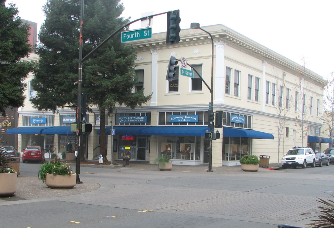
 The intersection of 4th & D, downtown Santa Rosa.
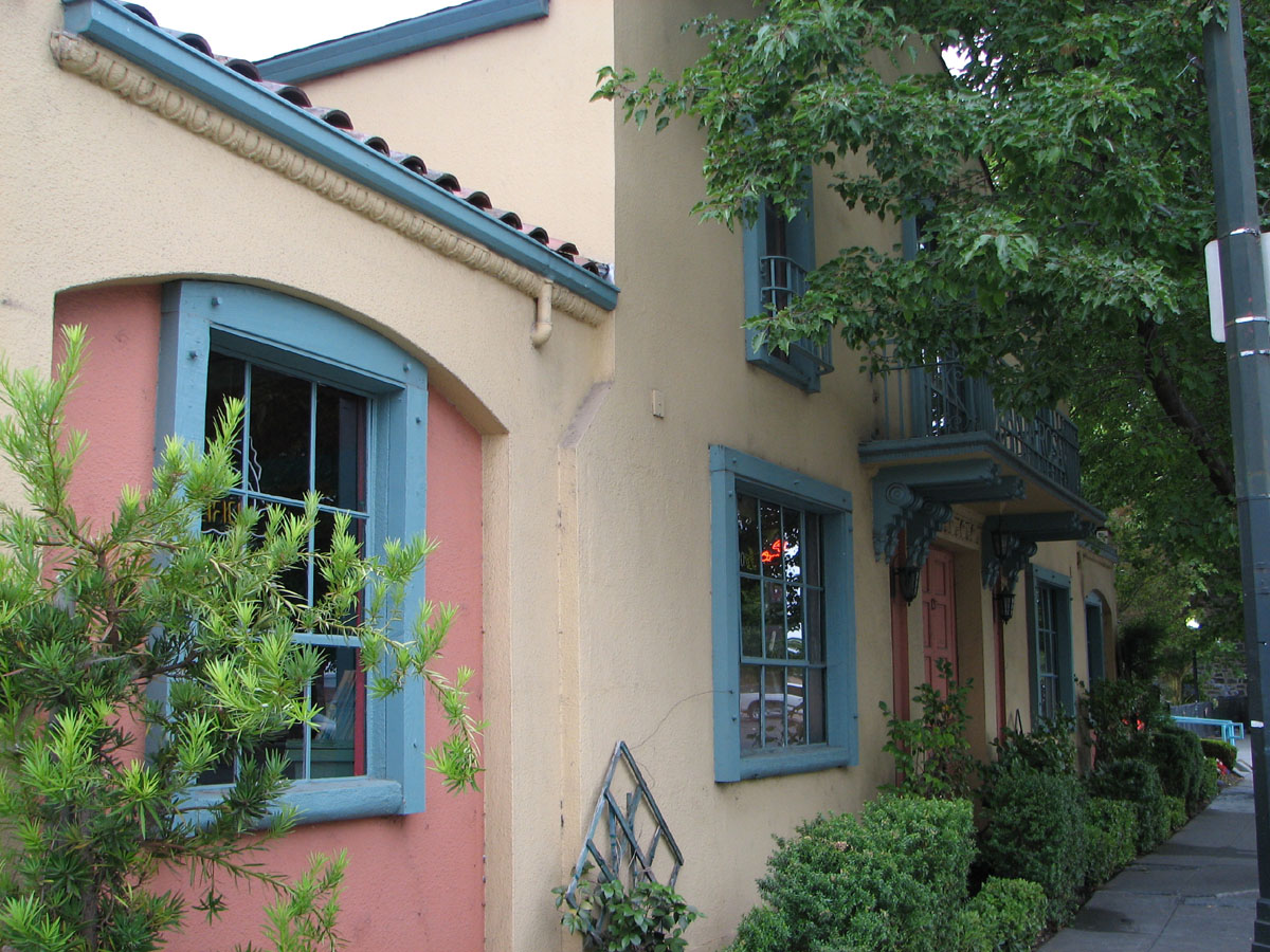
Horticulturalist Luther Burbank lived in Santa Rosa for over 50 years. He said of Sonoma County, "I firmly believe, from what I have seen, that this is the chosen spot of all this earth as far as Nature is concerned." For many years the City's slogan was "The City Designed For Living."
In early 2007, the Santa Rosa Chamber of Commerce, the City, and Santa Rosa Main Street (a Downtown booster group funded by the City), started searching for a new slogan, to "help the City of Santa Rosa discover its identity." The Chamber said it wants to develop "a strategic community message for marketing the city to visitors, residents, and businesses in the year 2007 and beyond."
History resources
The Sonoma State University Library, in Rohnert Park, holds the Gaye LeBaron Collection: 700 file folders of her research notes and primary source materials, containing some 10,000 documents.
Council goals/projects
The City Council has adopted these Strategic Planning Goals for 2007–2009:[24]
- Creating A Vital Downtown
- Thriving Diverse, Healthy, and Safe Neighborhoods
- Open Space and Recreational Activities
- Creating Additional Transportation Alternatives
- More Inclusive Community
- Deliver a Safe and Efficient Transportation System
- Develop Regional Gang Prevention and Intervention
- Maintain a Leadership Role in the Region for Environmental Initiatives
- Promote a Healthy and Growing Economic Base
- Provide Resources for Seniors and Youth
Sister cities
 Cherkasy, Ukraine
 Jeju City, South Korea
 Los Mochis, Mexico
Education
 Santa Rosa High School, the first high school in Santa Rosa and one of the oldest high schools in California.
Colleges
- Empire College
- Santa Rosa Junior College
- Sonoma State University
- University of San Francisco (USF) - Santa Rosa
School districts
- Bellevue Union
- Bennett Valley Union
- Mark West Union
- Oak Grove Union
- Piner-Olivet Union
- Rincon Valley Union
- Roseland
- Santa Rosa City Schools
- Wright
Private schools
- Cardinal Newman High School (9-12)
- Redwood Adventist Academy (K-12)
- Rincon Valley Christian School (K-12)
- Sonoma Academy (9-12)
- St. Eugene's Elementary School
- St. Luke's Elementary School
- St. Rose Elementary School
- Summerfield Waldorf School (K-12)
- Stuart School (K-8)
- Ursuline High School (9-12)
Libraries
The Sonoma County Library offers a Central Library in downtown Santa Rosa, a Northwest branch at Coddingtown Mall, and a Rincon Valley branch in east Santa Rosa. The Library is a member of the North Bay Cooperative Library System. The Santa Rosa Central Library, the largest branch of the Sonoma County Library system, has a Local History and Genealogy Annex, located behind the Central Library.[25]
The Sonoma County Public Law Library[26] is located at the Sonoma County Courthouse.
At Santa Rosa Junior College, the new four-story Frank P. Doyle Library[27] is a state-of-the-art facility. It houses the Library, Media Services, and Academic Computing Departments, as well as the College art gallery, tutorial center and Center for New Media, a multimedia production facility for SRJC faculty.
Museums
 City of Santa Rosa, A-26 Invader attack bomber built in 1944.
- The Pacific Coast Air Museum is located on the southeast corner of the Charles M. Schulz Sonoma County Airport, next to the airplane hangar used in the 1963 Hollywood all-star comedy movie, It's a Mad, Mad, Mad, Mad World.
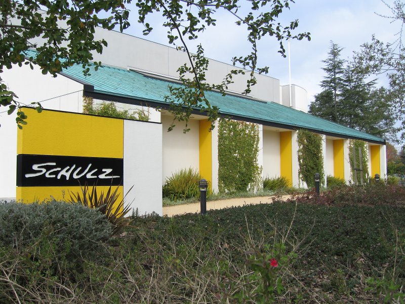
- Charles M. Schulz Museum
- Sonoma County Museum
- Luther Burbank Home and Gardens
- California Indian Museum and Cultural Center
Economy
Forbes Magazine ranked the Santa Rosa metropolitan area 185th out of 200, on its 2007 list of Best Places For Business And Careers.[28] It was second on the list five years before. The area was downgraded because of an increase in the cost of doing business, and reduced job growth—both blamed on increases in the cost of housing.
Top employers
According to the City's 2009 Comprehensive Annual Financial Report,[29] the top employers in the city are:
# Employer # of Employees 1 County of Sonoma 4,254 2 Kaiser Permanente 2,400 3 St. Joseph Health System 2,166 4 Agilent Technologies 1,400 5 Santa Rosa City Schools 1,345 6 City of Santa Rosa 1,329 7 Medtronic 1,200 8 Santa Rosa Junior College 1,175 9 Sutter Medical Center 1,097 10 Safeway 1,082 Santa Rosa is also home to notable smaller businesses such as Moonlight Brewing Company and Russian River Brewing Company.
Media
- KSRO radio (1350 kHz AM), a news & talk station based in Santa Rosa, featuring the popular variety talk show, "The Drive".
- The Press Democrat is the largest newspaper in California's north coastal strip between San Francisco and the Oregon border.
- North Bay Bohemian, a free weekly newspaper, specializing in food, arts, and entertainment.
- KEMO-TV TV50 is Santa Rosa's only private television station.
- KORB radio, headquartered in Santa Rosa and heard on translator K300AO (107.9 MHz FM).
- KBBF (89.1 FM) The first bilingual (Spanish-English), non-commercial, Latino/Chicano-operated radio station in the United States.
Tourism
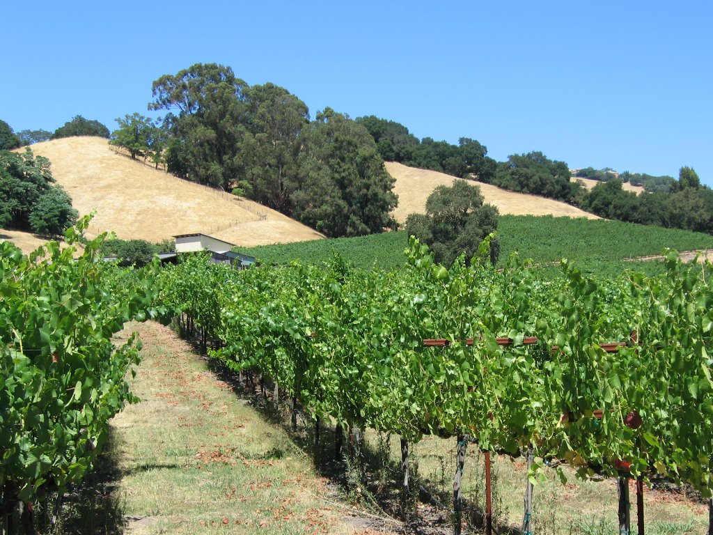
 While the most expansive vineyards in Sonoma County lie within the Alexander, Russian River and Sonoma Valleys, Santa Rosa is home to several vineyards such as this one near Fountain Grove.
Santa Rosa sits at the southwestern gateway to the Sonoma and Napa Valleys of California's famed Wine Country. Many wineries and vineyards are nearby, as well as the Russian River resort area, the Sonoma Coast along the Pacific Ocean, Jack London State Historic Park and the redwood trees of Armstrong Redwoods State Reserve.
The city sprawls along Highway 101, about an hour north of San Francisco and the Golden Gate Bridge. Airline service by Horizon Air, from the Charles M. Schulz - Sonoma County Airport, just north of Santa Rosa, is available to Las Vegas, Los Angeles, Portland, and Seattle. The City Council is also encouraging major new commercial and residential development along the planned Sonoma-Marin Area Rail Transit (SMART) railway from Larkspur to Cloverdale, parallel to Highway 101. SMART, scheduled to open in 2014, is funded by a sales tax surcharge passed by Sonoma and Marin voters in 2008.
The City Council pays the Santa Rosa Chamber of Commerce to operate the Santa Rosa Convention & Visitors Bureau.[30] The Chamber's visitors center is in the city-owned old railroad depot at the bottom of Fourth Street, in Historic Railroad Square. The SRC&VB has been a California Welcome Center since 2003.
Downtown Santa Rosa, including the central Old Courthouse Square and historic Railroad Square, is a shopping, restaurant, nightclub, and theater area. Downtown also includes City Hall, State, and Federal office buildings, many banks, and professional offices. The Santa Rosa Memorial Hospital medical center is just to the east.
The City Council funds a private booster group, Santa Rosa Main Street, which lobbies the city to revitalize the traditional business district. Three new mixed-use, high-rise buildings, and a new city parking garage, are under development. The Council and downtown business boosters hope condos atop the new buildings will house a population to keep the area active 24 hours a day.
The nearby towns of Bodega Bay, Calistoga, Guerneville, Healdsburg, Petaluma, Sebastopol, Sonoma and Windsor are popular with tourists and readily accessible from Santa Rosa.
 The Hotel La Rose, built in 1907, is a functioning historic hotel in downtown Santa Rosa.
Railroad Square is the portion of downtown that is on the west side of U.S. Route 101 and has the highest concentration of historic commercial buildings. Of particular note are the four rough-hewn stone buildings at its core, two of which are rare in that they predate the 1906 earthquake. They include the old Northwestern Pacific Railroad depot, prominently seen in the beginning and the end of the Alfred Hitchcock film Shadow of a Doubt, and the still-functioning Hotel La Rose, built in 1907 and registered as one of the National Trust for Historic Preservation Historic Hotels of America. The area contains numerous other historic buildings, such as the former Petaluma and Santa Rosa Railroad depot, and the Lee Bros. Building, both at the corner of 4th and Wilson Streets. Near it in the West End district are numerous other old buildings, including not only many old houses but the masonry DeTurk Winery complex, dating to the 1880s-1890s, and the DeTurk round barn. Also of note nearby is the former Del Monte Cannery Building, built in 1894. One of the oldest surviving commercial buildings in town, it was renovated into the 6th Street Playhouse in 2005.[31]
Local attractions
 The Charles M. Schulz Museum and Research Center on the corner of West Steele Lane and Hardies Lane, next to Snoopy's Home Ice skating rink.
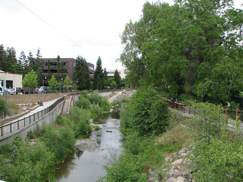
 Prince Memorial Greenway is a bicycle and pedestrian path through downtown Santa Rosa.
- Carrillo Adobe. Built in 1837 for Dona Maria Ignacio Lopez de Carrillo (General Mariano Vallejo's mother-in-law), the Carrillo Adobe was the first home on the site of the future Santa Rosa. The remains of the Carrillo home rest behind a cyclone fence off Montgomery Drive, on property owned by the Roman Catholic Diocese of Santa Rosa in California, adjacent to its Cathedral of St. Eugene.
- Luther Burbank Home and Gardens
- Charles M. Schulz Museum and Research Center
- Redwood Empire Ice Arena ("Snoopy's Home Ice")
- Sonoma County Museum
- Annadel State Park
- Spring Lake Regional Park
- Prince Memorial Greenway. This is a developed bicycle and pedestrian path along Santa Rosa Creek through downtown and out to the west of town. Near Railroad Square, it connects directly to the Joe Redota Trail, a paved path which goes to Sebastopol.[32]
- Railroad Square. With the highest concentration of historic commercial buildings in Santa Rosa, this portion of downtown is popular with tourists and locals alike.
- Historic residential neighborhoods. Although most of Santa Rosa's commercial buildings were destroyed in the 1906 earthquake, almost all of its numerous houses survived and most have survived to this day. As a result, Santa Rosa has a number of old neighborhoods in and around downtown, several historically designated. These contain numerous old homes, including many Victorians. Most of these are on quiet, often tree-lined streets.
Performing and visual arts
The performing arts in Santa Rosa are represented by Summer Repertory Theatre, the Santa Rosa Symphony, and the 6th Street Playhouse. Santa Rosa is the home of the North Bay Theater Group, an alliance of some 40 theater companies, theater departments and individual performance companies from five North Bay counties.
Summer Repertory Theater (SRT) is a complete and extensive practicum in all aspects of stage production. The program combines professional directing, design, and production staff with outstanding students in acting, design, technical theater, dance, music, and management. The ensemble mounts five productions, which are performed in full rotating Repertory six days a week beginning in mid June. Company members put theory to the test and learn to work in a professional system. SRT, located in the heart of the Sonoma County wine country, one hour north of San Francisco and forty-five minutes east of the beautiful Northern California coast is a well organized program.
The Santa Rosa Symphony, the city's professional orchestra, is currently under the direction of Bruno Ferrandis. Former conductor Jeffrey Kahane resigned from the post, which he held for ten years, to become music director of the Colorado Symphony Orchestra.
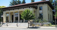 The Sonoma County Museum on 7th St., Downtown Santa Rosa. Completed in 1910, it was originally the Post Office and Federal Building.
The Santa Rosa Symphony education department consists of four youth ensembles categorized by their level of skill. The department provides classical music education to students across Sonoma County, who can audition for any of these groups. The three full orchestral ensembles, from lowest to highest are the Preparatory Orchestra, the Discovery Orchestra, and the Youth Orchestra. The chamber strings ensemble is known as the Young People's Chamber Orchestra.
The visual arts are represented by the Sonoma County Museum and numerous independent art galleries. The Arts Council of Sonoma County is based at the Museum.
Law enforcement and crime
The Santa Rosa Police Department currently has 259 employees, of which 172 are sworn peace officers. Its budget is more than $40,000,000, comprising more than one third of the city's entire General Fund Budget. Police shootings in 2007 led to calls for an independent civilian police review board.[33]
Notable natives and residents
See also Category: People from Santa Rosa, California. Luther Burbank Home and Gardens on the corner of Santa Rosa Avenue and Sonoma Avenue. Burbank's home rests on the property.
- Francis Boggs, actor, writer, and director
- Warren Boyd, television producer, drug counselor
- Luther Burbank, horticulturalist
- Shirlee Busbee, writer
- Maria Ygnacia Lopez de Carrillo was the first Mexican/Spanish settler and land grantee of Santa Rosa, establishing the Rancho Cabeza de Santa Rosa in 1838. She was also notable in California as a rare female land grantee; mother-in-law of Mariano Guadalupe Vallejo, a major Californio administrator who played a crucial role in California during both the Mexican and US periods; mother of Vallejo's wife, Francisca Maria Felipe Benicia, after whom the city of Benicia was named; grandmother of Romualdo Pacheco, California's only Californio state governor; and aunt of Californio administrators Andres Pico and Pio Pico.[34]
- Chad Channing, drummer for Nirvana.
- Robert X. Cringely, technology journalist
- Florian Dauenhauer of Santa Rosa founded Dauenhauer Manufacturing which is still located on 5th Street in Santa Rosa. Around 1940, he revolutionized the US hop industry by inventing a hop harvesting machine which mechanized what was a time-consuming, labor-intensive process and which is the basis for current hop harvesting. Unfortunately for the region, it helped destroy the region's once-thriving hop industry.[35][36]
- Rebecca De Mornay, film and television actress
- Frank Doyle, owner of the regionally significant Exchange Bank until his death in 1948, instrumental advocate of the creation of the Golden Gate Bridge (Doyle Drive, the southern approach to the bridge, memorializes his role), and creator of the endowment commonly known as the Doyle Trust, which holds controlling stock in the Bank in trust solely for the funding of scholarships for qualifying students attending the Santa Rosa Junior College. Because of the Doyle Trust, the Exchange Bank (still headquartered in Santa Rosa) can never be bought or sold.[37]
- William Mark Felt, Watergate informant known as "Deep Throat"
- Guy Fieri, celebrity chef
- Paul Gilger, author of the musical Showtune
- Thomas Lake Harris, mystic and prophet
- Chris Hayes, musician, member of Huey Lewis and the News
- Richard Heinberg, ecological journalist
- Dan Hicks, singer and songwriter
- Joseph and William Hunt, founders of Hunt's foods
- Levi Leipheimer, cyclist and three-time winner of the Tour of California
- Julie London, singer and actress
- Ray Luv, Bay Area Rapper. Native of the West 9th district.
- Kanaye Nagasawa (1852–1934) was a Japanese-American who became known as "The Grape King", "The Baron of Fountaingrove", and "The Japanese Wine King of California". He was a follower and adoptive son of Thomas Lake Harris. For his efforts to improve U.S.-Japanese relations, he was awarded the Order of the Rising Sun. Nagasawa Community Park is named after him.[38][39][40]
- Ernie Nevers, football star
- Vicky Nguyen, television reporter
- Stephan Pastis, cartoonist of Pearls Before Swine
- Robert Ripley, columnist of Ripley's Believe It or Not
- Stephanie St. James, is actress, singer, and disease advocate.
- Charles M. Schulz, cartoonist of Peanuts
- Pete Stringfellow, country music artist
- David Terrell, fighter
- Natalie Wood, film actress
- Jade Puget, guitarist for the band AFI
Film locations
Further information: Film locations in Sonoma County, California It's a Mad, Mad, Mad, Mad World airplane hangar
Santa Rosa has served as a location for many major films, including:
- The Happy Land (1943) Shot in Santa Rosa and Healdsburg. Natalie Wood's first movie, at age four.
- Shadow of a Doubt (1943) Alfred Hitchcock's personal favorite, filmed at Santa Rosa Railroad Depot, NWP Engine #140, Old Courthouse Square, Public Library, and McDonald Avenue. The 1991 telefilm involved eight weeks' filming on McDonald Avenue.
- The Sullivans (1944) Shot on Morgan Street.
- All My Sons (1948) Shot on McDonald Avenue.
- The Wonderful World of Disney The "Inky the Crow" episodes (beginning in the late 1960s) filmed in the Fountain Grove area.
- Storm Center (1956) Bette Davis spent six weeks on location at the Santa Rosa Main Library, which keeps a collection of clippings. It also includes scenes from downtown and a house on Walnut Ct.
- Pollyanna (1960) Featured the Mableton Mansion (also known as the McDonald Mansion), on McDonald Avenue.
- Little Dog Lost (1963) Filmed in Santa Rosa and Cloverdale.
- It's a Mad, Mad, Mad, Mad World (1963) The sequence involving the plane flying full bore, at about 150 knots, through an airplane hangar in less than a second, was shot at the Sonoma County Airport (in unincorporated Sonoma County between Santa Rosa and Windsor).
- The Candidate (1972) directed by Michael Ritchie was shot in Howarth Park and Schlumberger Gallery.
- Slither (1972) Highway 101 south of Santa Rosa, and Cloverdale.
- Steelyard Blues (1973) Shot in downtown Santa Rosa and at the Sonoma County Airport.
- Smile (1975) Shot at the Veterans Memorial Auditorium and many other nearby locations. Made into a 1986 Broadway musical of the same name with music by Marvin Hamlisch.
- Little Miss Marker (1980) Shot at the Sonoma County Fairgrounds.
- Shoot the Moon (1982) Used a real Carl's Jr. on Industrial Drive at Cleveland Avenue. Also filmed at Wolf House at Jack London State Park.
- Cujo (1983) Locations include Santa Rosa and Petaluma.
- Smooth Talk (1985) Locations include Santa Rosa shopping malls and Sebastopol.
- The Blue Yonder (1985, TV) "Lower" 4th Street (west of Highway 101) in Railroad Square.
- Peggy Sue Got Married (1986) Locations include Santa Rosa High School and Petaluma.
- Wildfire (1988) Wood Pontiac & Cadillac on Corby Avenue.
- Wired (1989) Filmed in Santa Rosa.
- Die Hard II (1990) Scenes shot at Santa Rosa Air Center.
- Shadow of a Doubt (1991, TV) McDonald Avenue and the Train Depot.
- Stop! Or My Mom Will Shoot! (1992) Shot over a four-week period at Santa Rosa Air Center.
- Phenomenon (1996) Used Santa Rosa Junior College as an establishing shot for UC Berkeley. Also used "The Wagon Wheel" bar off of Highway 101 for bar scenes.
- Scream (1996) A house on McDonald Avenue, a local grocery store and the Bradley Video Store on Piner Rd.
- Inventing the Abbotts (1997) Shot at Santa Rosa High School and in Petaluma.
- Mumford (1999) Shot at Santa Rosa Junior College, other Santa Rosa locations, and in Guerneville and Healdsburg.
- Bandits (2001) Locations included the Flamingo Hotel
- The Man Who Wasn't There (2001) Set in Santa Rosa.
- Cheaper by the Dozen (2003) Filmed in Railroad Square.
See also
- List of cities in California (by population)
- List of cities and municipalities in the San Francisco Bay Area
- List of municipalities in California
- List of urbanized areas in California (by population)
References
- ^ a b "US Gazetteer files: 2010, 2000, and 1990". United States Census Bureau. 2011-02-12. http://www.census.gov/geo/www/gazetteer/gazette.html. Retrieved 2011-04-23.
- ^ "Dates of incorporation". http://www.cacities.org/resource_files/20457.IncorpDateLO.doc. Retrieved 2008-07-11.
- ^ U.S. Census
- ^ U.S. Geological Survey Geographic Names Information System: Santa Rosa
- ^ "Records of the office of Emergency Preparedness". http://www.archives.gov/research/guide-fed-records/groups/396.html. Retrieved 2008-08-30.
- ^ U.S. Census
- ^ Central California
- ^ Forrey, Rip. "Climate data for various locations in Sonoma, Napa, Mendocino, Lake and Marin counties, California" (PDF). University of California Cooperative Extension Sonoma County. Archived from the original on 2007-06-30. http://web.archive.org/web/20070630163510/http://cesonoma.ucdavis.edu/hortic/pdf/climate_location_data.pdf. Retrieved 2007-11-30.
- ^ Quake06.org
- ^ "USGS.gov". USGS Release: USGS Produces New Map Showing Detailed Ground Shaking in Great San Francisco (Quake). http://www.usgs.gov/newsroom/article.asp?ID=693. Retrieved February 24, 2006.
- ^ Burbankgardens.org
- ^ SRJCneighbors.org
- ^ Northjcneigbors.wordpress.com
- ^ Oakmontvillage.com
- ^ Strosedistrict.org
- ^ SRwestend.com
- ^ "Historical Census Populations of Places, Towns, and Cities in California, 1850-2000". California Dept. of Finance. http://www.dof.ca.gov/research/demographic/reports/census-surveys/historical_1850-2000/documents/calhist2.xls. Retrieved 2009-07-17.
- ^ All data are derived from the United States Census Bureau reports from the 2010 United States Census, and are accessible on-line here. The data on unmarried partnerships and same-sex married couples are from the Census report DEC_10_SF1_PCT15. All other housing and population data are from Census report DEC_10_DP_DPDP1. Both reports are viewable online or downloadable in a zip file containing a comma-delimited data file. The area data, from which densities are calculated, are available on-line here. Percentage totals may not add to 100% due to rounding. The Census Bureau defines families as a household containing one or more people related to the householder by birth, opposite-sex marriage, or adoption. People living in group quarters are tabulated by the Census Bureau as neither owners nor renters. For further details, see the text files accompanying the data files containing the Census reports mentioned above.
- ^ "South Park, Santa Rosa’s vibrant, ever-changing corner". The Press Democrat. http://www.pressdemocrat.com/article/20090613/ARTICLES/906139924?p=4&tc=pg. Retrieved July 8, 2011.
- ^ "Roseland to build new elementary school". The Press Democrat. http://santarosa.towns.pressdemocrat.com/2011/04/news/roseland-to-build-new-elementary-school/. Retrieved July 8, 2011.
- ^ "2010 Census Interactive Population Search". American Factfinder. http://2010.census.gov/2010census/popmap/.
- ^ "American FactFinder Search". American Factfinder. http://factfinder2.census.gov/faces/tableservices/jsf/pages/productview.xhtml?pid=DEC_10_SF1_QTP8&prodType=table. Retrieved 2011-11-12.
- ^ "Will Gerrymandered Districts Stem the Wave of Voter Unrest?". Campaign Legal Center Blog. http://www.clcblog.org/blog_item-85.html. Retrieved 2008-02-10.
- ^ Ci.santa-rosa.ca.us
- ^ Sonomalibrary.org
- ^ Sonomacountylawlibrary.org
- ^ Santarosa.edu
- ^ Forbes.com
- ^ City of Santa Rosa CAFR
- ^ Visitsantarosa.com
- ^ DramaBiz magazine - Search Page
- ^ "Joe Rodota Trail". http://www.sonoma-county.org/parks/pk_rodta.htm. Retrieved 2009-03-23.
- ^ Santa Rosa Press Democrat, 3/30/07: Fatal police shootings rekindle review debate/Recent cases raise decade-old concerns over agencies' abilities to investigate each other
- ^ North Bay Regional & Special Collections | Ygnacia Lopez de Carrillo
- ^ "Hops, once king of county's crops, helped put region on map". Press Democrat. http://www.pressdemocrat.com/article/20080629/NEWS/806290301/1332/news06&title=Hops__once_king_of_county_s_crops__helped_put_region_on_map. Retrieved 2008-07-16.
- ^ "Dauenhauer Manufacturing: Our Founder". http://www.dmfg.com/our-founder. Retrieved September 26, 2010.
- ^ "The Legacy of Frank P. Doyle". http://www.santarosa.edu/app/paying-for-college/scholarship-office/frank-p-doyle/index.shtml. Retrieved October 22, 2010.
- ^ "74 Years Later, an Honor for California's First Japanese American Winemaker". Archived from the original on 2008-01-11. http://web.archive.org/web/20080111190414/http://www.pacificcitizen.org/content/2007/national/aug3-lin-nagasawa.htm. Retrieved 2008-01-03.
- ^ "PinotFile" (PDF). http://www.princeofpinot.com/pinotfile/06_31.pdf. Retrieved 2008-01-03.
- ^ "City Council Meeting Minutes, Agenda Item #11.1". 2007-05-01. http://ci.santa-rosa.ca.us/doclib/agendas_packets_minutes/Documents/20070501_CC_Minutes.html. Retrieved 2008-10-26.
External links
- Official website
- Santa Rosa, California at the Open Directory Project
- Sonoma State University local history collection

Windsor Mark West Calistoga Sebastopol 
Kenwood  Santa Rosa

Bloomfield Rohnert Park Sonoma Mountain Municipalities and communities of Sonoma County, California County seat: Santa Rosa Cities and towns Cloverdale | Cotati | Healdsburg | Petaluma | Rohnert Park | Santa Rosa | Sebastopol | Sonoma | Windsor

CDPs Bloomfield | Bodega | Bodega Bay | Boyes Hot Springs | Carmet | Cazadero | El Verano | Eldridge | Fetters Hot Springs-Agua Caliente | Forestville | Fulton | Geyserville | Glen Ellen | Graton | Guerneville | Jenner | Kenwood | Larkfield-Wikiup | Monte Rio | Occidental | Penngrove | Roseland | Salmon Creek | Sea Ranch | Sereno del Mar | Temelec | Timber Cove | Valley Ford
Unincorporated
communitiesAnnapolis | Asti | Camp Meeker | Duncans Mills | Freestone | Guernewood Park | Lakeville | Mark West | Mark West Springs | Rio Dell | Rio Nido | Schellville | Stewarts Point | Two Rock | Venado | Villa Grande | Vineburg
Indian reservations California county seats Consolidated city-county Municipalities Alturas | Auburn | Bakersfield | Colusa | Crescent City | El Centro | Eureka | Fairfield | Fresno | Hanford | Hollister | Jackson | Lakeport | Los Angeles | Madera | Martinez | Marysville | Merced | Modesto | Napa | Nevada City | Oakland | Oroville | Placerville | Red Bluff | Redding | Redwood City | Riverside | Sacramento | Salinas | San Bernardino | San Diego | San Jose | San Luis Obispo | San Rafael | Santa Ana | Santa Barbara | Santa Cruz | Santa Rosa | Sonora | Stockton | Susanville | Ukiah | Ventura | Visalia | Willows | Woodland | Yreka | Yuba City
CDPs Bridgeport | Downieville | Independence | Mariposa | Markleeville | Quincy | San Andreas | Weaverville
 State of California
Sacramento (capital) Topics Climate · Delegations · Deserts · Districts · Ecology · Elections · Environment · Geography · Government · History · Protected areas · Sports · Symbols · Transportation · Visitor attractions · Index of California-related articles
Society Californians · Culture · Crime · Demographics · Economy · Education · Politics
Regions Antelope Valley · Big Sur · Cascade Range · Central California · Central Coast · Central Valley · Channel Islands · Coachella Valley · Conejo Valley · Cucamonga Valley · Death Valley · East Bay (SF) · East County (SD) · Eastern California · Emerald Triangle · Gold Country · Great Basin · Greater Los Angeles · Greater Sacramento · Inland Empire · Lake Tahoe · Los Angeles Basin · Lost Coast · Metropolitan Fresno · Mojave · Mountain Empire · North Bay (SF) · North Coast · North County (SD) · Northern California · Owens Valley · Oxnard Plain · San Francisco Peninsula · Pomona Valley · Sacramento Valley · San Bernardino Valley · San Diego–Tijuana · San Fernando Valley · San Francisco Bay Area · San Gabriel Valley · San Joaquin Valley · Santa Clara Valley · Santa Clara River Valley · Santa Clarita Valley · Shasta Cascade · Sierra Nevada · Silicon Valley · South Bay (LA) · South Bay (SF) · South Bay (SD) · South Coast · Southern California · Southern Border Region · Tri-Valley · Upstate California · Victor Valley · Wine Country · Yosemite
Metro areas Bakersfield · Chico · El Centro · Fresno · Hanford–Corcoran · Los Angeles–Long Beach–Glendale · Madera · Modesto · Merced · Napa · Oakland–Fremont–Hayward · Oxnard–Thousand Oaks–Ventura · Redding · Riverside–San Bernardino–Ontario · Sacramento–Arden Arcade–Roseville · Salinas · San Diego–Carlsbad–San Marcos · San Francisco–San Mateo–Redwood City · San Jose–Sunnyvale–Santa Clara · San Luis Obispo–Paso Robles · Santa Ana–Anaheim–Irvine · Santa Barbara–Santa Maria–Goleta · Santa Cruz–Watsonville · Santa Rosa–Petaluma · Stockton · Vallejo–Fairfield · Visalia–Porterville · Yuba City
Micro areas Counties Alameda · Alpine · Amador · Butte · Calaveras · Colusa · Contra Costa · Del Norte · El Dorado · Fresno · Glenn · Humboldt · Imperial · Inyo · Kern · Kings · Lake · Lassen · Los Angeles · Madera · Marin · Mariposa · Mendocino · Merced · Modoc · Mono · Monterey · Napa · Nevada · Orange · Placer · Plumas · Riverside · Sacramento · San Benito · San Bernardino · San Diego · San Francisco · San Joaquin · San Luis Obispo · San Mateo · Santa Barbara · Santa Clara · Santa Cruz · Shasta · Sierra · Siskiyou · Solano · Sonoma · Stanislaus · Sutter · Tehama · Trinity · Tulare · Tuolumne · Ventura · Yolo · Yuba
Mayors of cities with populations exceeding 100,000 in California - Antonio Villaraigosa
(Los Angeles) - Jerry Sanders
(San Diego) - Chuck Reed
(San Jose) - Edwin M. Lee
(San Francisco) - Ashley Swearengin
(Fresno) - Kevin Johnson
(Sacramento) - Bob Foster
(Long Beach) - Jean Quan
(Oakland) - Harvey Hall
(Bakersfield) - Tom Tait
(Anaheim) - Miguel A. Pulido
(Santa Ana)
- Ronald O. Loveridge
(Riverside) - Ann Johnston
(Stockton) - Cheryl Cox
(Chula Vista) - Bob Wasserman
(Fremont) - Sukhee Kang
(Irvine) - Pat Morris
(San Bernardino) - Jim Ridenour
(Modesto) - Thomas E. Holden
(Oxnard) - Acquanetta Warren
(Fontana) - William H. Batey II
(Moreno Valley)^ - John Drayman
(Glendale)
- Cathy Green
(Huntington Beach)^ - Bob Kellar
(Santa Clarita)^ - William Dalton
(Garden Grove) - Susan Gorin
(Santa Rosa)^ - Jim Wood
(Oceanside) - Donald Kurth
(Rancho Cucamonga) - Paul S. Leon
(Ontario) - R. Rex Parris
(Lancaster) - Pat Hume
(Elk Grove) - James C. Ledford Jr.
(Palmdale) - Stan Skipworth
(Corona)^
- Dennis Donohue
(Salinas) - Elliot Rothman
(Pomona) - Frank Scotto
(Torrance) - Michael Sweeney
(Hayward) - Sam Abed
(Escondido) - Tony Spitaleri
(Sunnyvale) - Bill Bogaard
(Pasadena) - Carolyn Cavecche
(Orange) - F. Richard Jones
(Fullerton)^ - Jacqui Irwin
(Thousand Oaks)^ - Jesus Gamboa
(Visalia)
- Paul Miller
(Simi Valley) - William D. Shinn
(Concord)^ - Gina Garbolino
(Roseville) - Jamie L. Matthews
(Santa Clara) - Osby Davis
(Vallejo) - Rudy Cabriales
(Victorville) - Ernest Gutierrez
(El Monte) - Tom Bates
(Berkeley) - Rick Trejo
(Downey)^ - Eric R. Bever
(Costa Mesa)^ - James T. Butts, Jr.
(Inglewood)

^Mayor selected from city council
Other states: AL • AK • AZ • AR • CA • CO • CT • DE • FL • GA • HI • ID • IL • IN • IA • KS • KY • LA • ME • MD • MA • MI • MN • MS • MO • MT • NE • NV • NH • NJ • NM • NY • NC • ND • OH • OK • OR • PA • RI • SC • SD • TN • TX • UT • VT • VA • WA • WV • WI • WYCategories:- Cities in Sonoma County, California
- Cities in the San Francisco Bay Area
- County seats in California
- Santa Rosa, California
- Incorporated cities and towns in California


Wikimedia Foundation. 2010.