- National Register of Historic Places listings in Washington
-
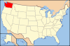
This is a list of properties and historic districts in Washington that are listed on the National Register of Historic Places. There are at least three listings in each of Washington's 39 counties.
The National Register of Historic Places (NRHP) recognizes buildings, structures, objects, sites, and districts of national, state, or local historic significance across the United States.[1][2] Out of approximately 84,000 NRHP sites nationwide, more than 1400 are in Washington.
The locations of National Register properties and districts (at least for all showing latitude and longitude coordinates below), may be seen in a Google map by clicking on "Map of all coordinates".[3]
The following are tallies of current listings by county.[4]
Current listings by county
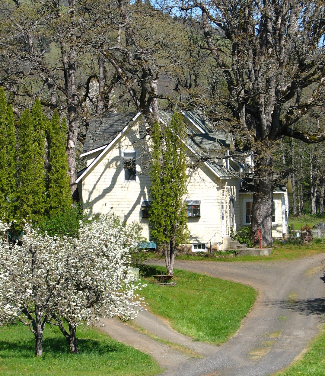
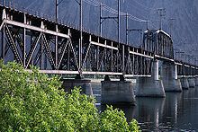 Beverly Railroad Bridge, in Kittitas County
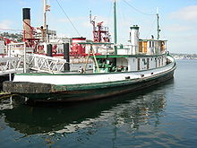 Arthur Foss (tugboat), in King County
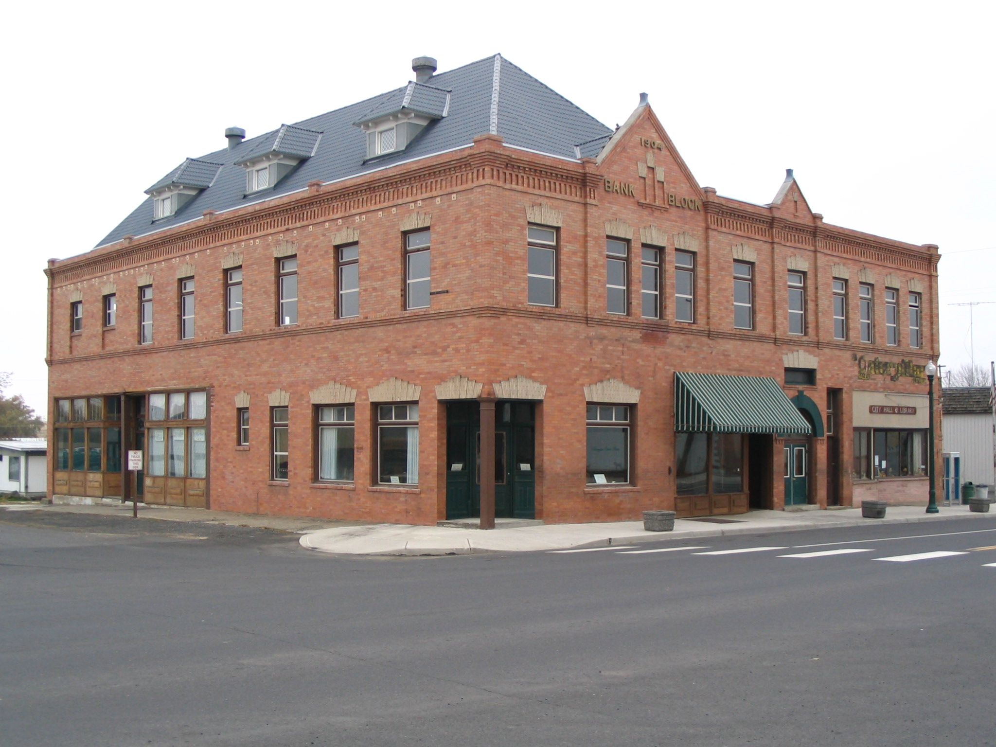
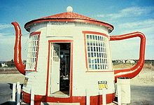 Teapot Dome Service Station, in Yakima County
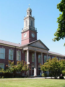 R. A. Long High School, in Cowlitz County
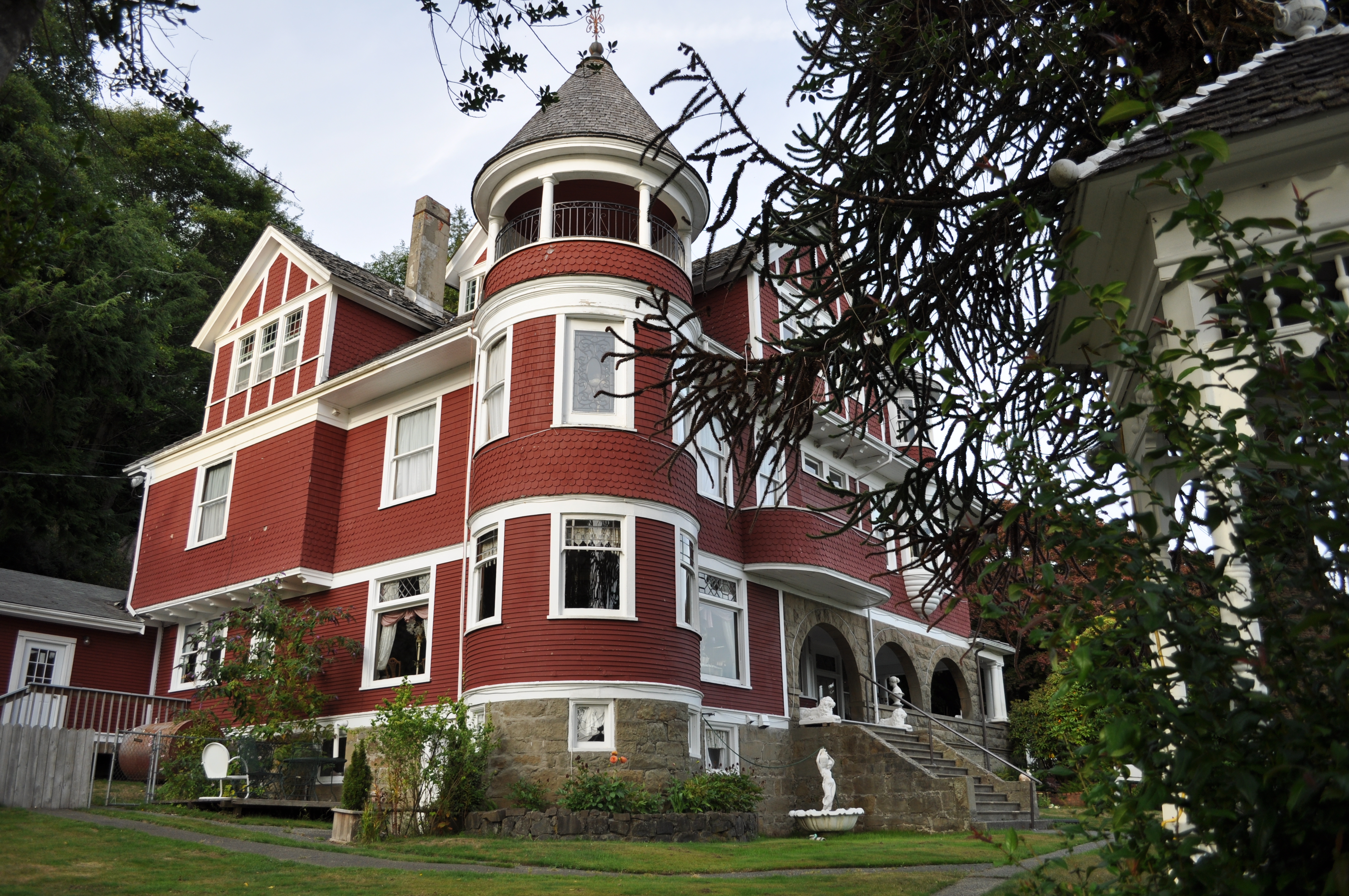
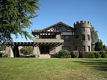 The Wells House, in Chelan County
County # of Sites 1 Adams 8 2 Asotin 9 3 Benton 15 4 Chelan 45 5 Clallam 48 6 Clark 39 7 Columbia 20 8 Cowlitz 29 9 Douglas 14 10 Ferry 10 11 Franklin 13 12 Garfield 3 13 Grant 10 14 Grays Harbor 20 15 Island 7 16 Jefferson 71 17.1 King: Seattle 169 17.2 King: Other 83 17.3 King County: Total 252 18 Kitsap 19 19 Kittitas 25 20 Klickitat 10 21 Lewis 33 22 Lincoln 11 23 Mason 13 24 Okanogan 15 25 Pacific 18 26 Pend Oreille 7 27 Pierce 185 28 San Juan 16 29 Skagit 28 30 Skamania 4 31 Snohomish 48 32 Spokane 130 33 Stevens 22 34 Thurston 67 35 Wahkiakum 5 36 Walla Walla 30 37 Whatcom 67 38 Whitman 33 39 Yakima 66 (duplicates): (13)[5] Total: 1,452 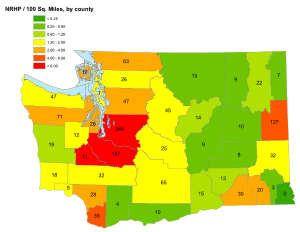
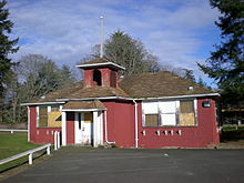 Custer School, in Pierce County
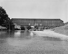 Grays River Covered Bridge, in Wahkiakum County
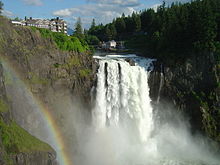 Snoqualmie Falls, in King County
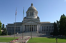 Washington State Capitol Historic District in Thurston County
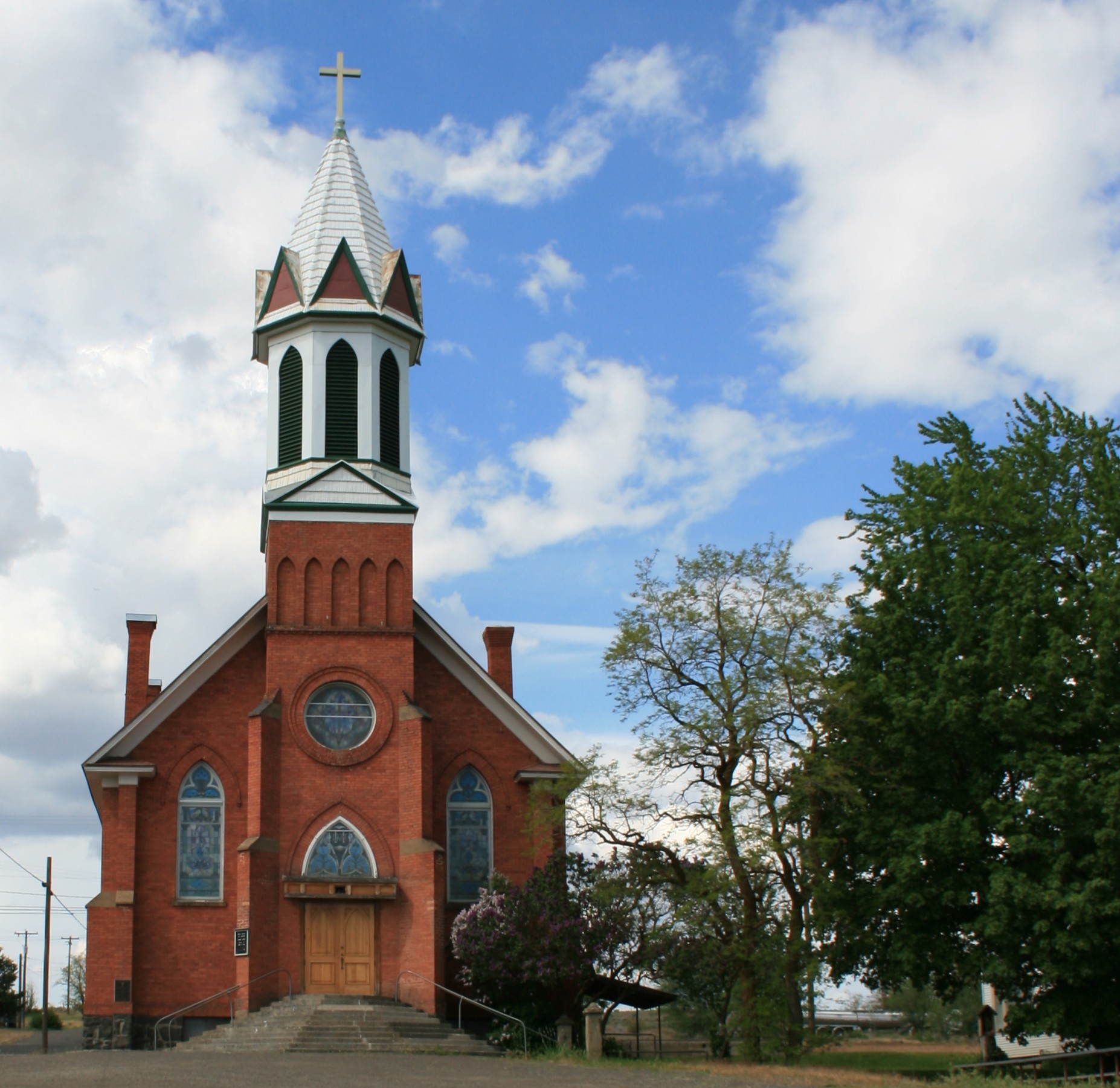
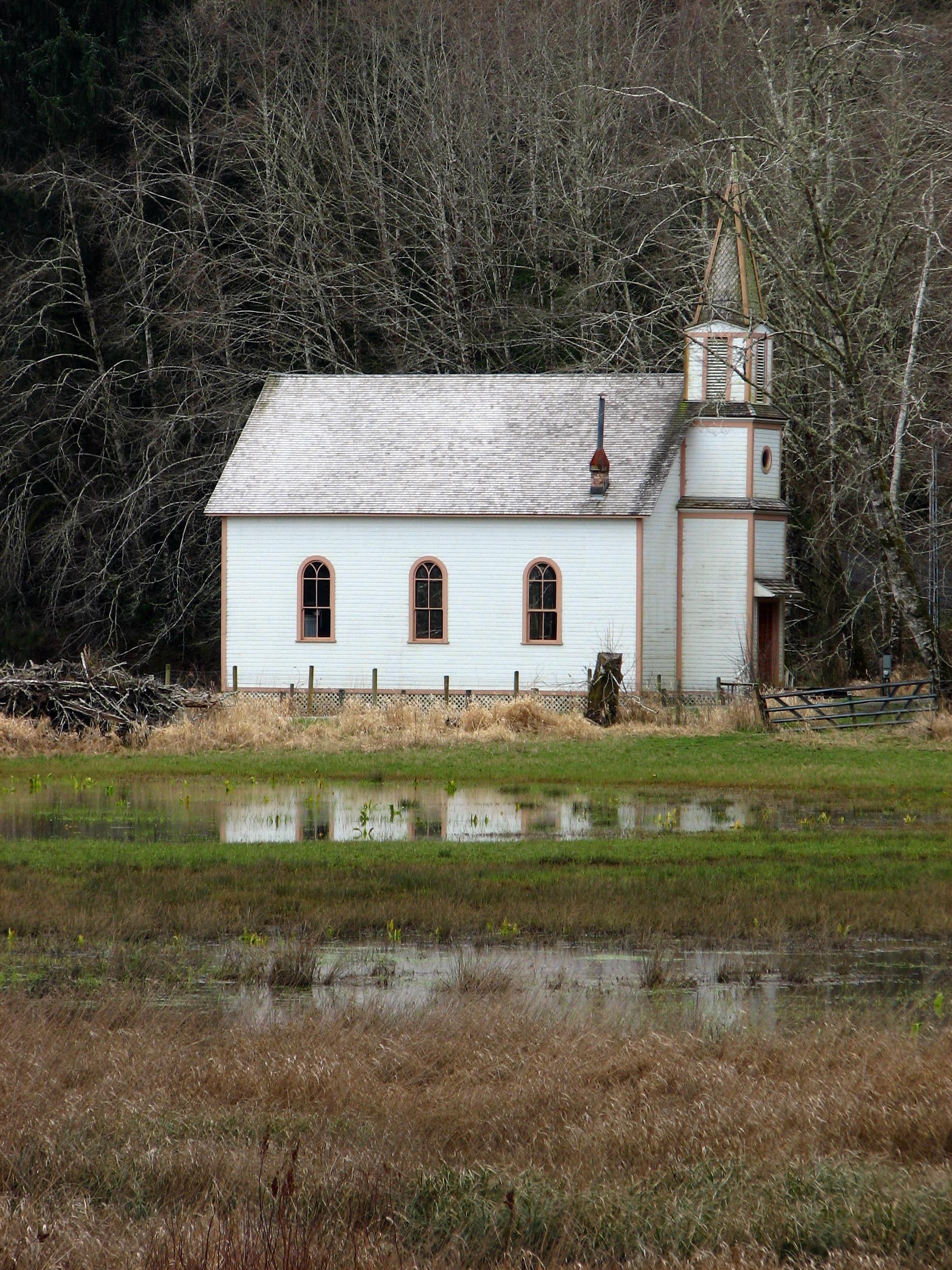
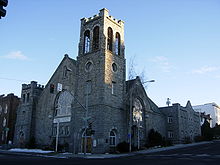 First Congregational Church, in Spokane County
-
- This National Park Service list is complete through NPS recent listings posted November 10, 2011.[6]
Adams County
[7] Landmark name [8] Image Date listed Location City or town Summary 1 Dr. Frank R. Burroughs House November 20, 1975 408 Main St.
47°07′29″N 118°22′59″W / 47.124722°N 118.383056°WRitzville 2 Denver and Rio Grande Western Railroad Business Car No. 101 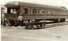
June 16, 1988 Bruce and Lee Rds.
46°50′18″N 119°03′00″W / 46.838333°N 119.05°WOthello 3 Nelson H. Greene House March 7, 1980 502 S. Adams St.
47°07′23″N 118°22′30″W / 47.123056°N 118.375°WRitzville 4 Ritzville Carnegie Library 
August 3, 1982 302 W. Main St.
47°07′32″N 118°22′54″W / 47.125556°N 118.381667°WRitzville Carnegie Libraries of Washington TR 5 Ritzville High School May 19, 1994 7th Ave., between Columbia and Division Sts.
47°07′25″N 118°22′15″W / 47.123611°N 118.370833°WRitzville 6 Ritzville Historic District 
May 2, 1990 Roughly bounded by Broadway, Division St., Railroad Ave., and Washington St.
47°07′37″N 118°22′46″W / 47.126944°N 118.379444°WRitzville 7 Seivers Brothers Ranchhouse and Barn June 19, 1979 SE of Lind on Providence Rd.
46°54′45″N 118°30′27″W / 46.9125°N 118.5075°WLind 8 Strap Iron Corral August 1, 1975 5 mi (8.0 km). N of Hooper on Harder Ranch
46°50′42″N 118°08′11″W / 46.845°N 118.136389°WHooper Asotin County
[7] Landmark name Image Date listed Location City or town Summary 1 Clarkston Public Library August 3, 1982 6th and Chestnut Sts.
46°24′38″N 117°02′39″W / 46.410556°N 117.044167°WClarkston Carnegie Libraries of Washington TR 2 Cloverland Garage May 2, 1986 CR 01050
46°15′08″N 117°15′00″W / 46.252222°N 117.25°WCloverland 3 Full Gospel Church January 19, 1972 1st and Monroe Sts.
46°20′29″N 117°03′00″W / 46.341389°N 117.05°WAsotin 4 Grande Ronde River Bridge March 28, 1995 WA 129 over the Grande Ronde R.
46°02′30″N 117°15′04″W / 46.041667°N 117.251111°WAsotin Bridges of Washington State MPS 5 Indian Timothy Memorial Bridge 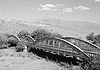
July 16, 1982 Spans Alpowa Creek
46°24′43″N 117°12′46″W / 46.411944°N 117.212778°WPomeroy Historic Bridges and Tunnels in Washington TR 6 Nez Perce Snake River Archeological District 
December 22, 1978 Address Restricted Asotin 7 Snake River Archeological District May 13, 1976 Address Restricted Asotin 8 US Post Office-Clarkston Main May 30, 1991 949 6th St.
46°24′40″N 117°02′39″W / 46.411111°N 117.044167°WClarkston 9 C. C. Van Arsdol House May 6, 1975 15th and Chestnut Sts.
46°24′38″N 117°04′04″W / 46.410556°N 117.067778°WClarkston Benton County
[7] Landmark name Image Date listed Location City or town Summary 1 Benton County Courthouse 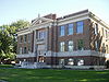
December 12, 1976 Dudley Ave. and Market St.
46°12′12″N 119°46′10″W / 46.203333°N 119.769444°WProsser 2 J. W. Carey House December 7, 1989 Byron Rd., W of Prosser
46°11′45″N 119°48′05″W / 46.195833°N 119.801389°WProsser 3 Glade Creek Site October 21, 1977 Address Restricted Prosser 4 Gold Coast Historic District March 7, 2005 Roughly bounded by Willis St., Davison Ave., Hunt Ave., Davison Ave., and George Washington Way
46°17′53″N 119°16′12″W / 46.298056°N 119.27°WRichland 5 Hanford B Reactor 
April 3, 1992 Near jct. of WA 24 and WA 240, Hanford Site
46°37′50″N 119°38′46″W / 46.630556°N 119.646111°WRichland Designated a National Historic Landmark August 19, 2008 6 Hanford Island Archeological Site August 28, 1976 Address Restricted Richland 7 Hanford North Archeological District August 28, 1976 Address Restricted Richland 8 Locke Island Archeological District August 28, 1976 Address Restricted Richland 9 Rattlesnake Springs Sites May 4, 1976 Address Restricted Richland 10 Ryegrass Archeological District January 31, 1976 Address Restricted Richland 11 Snively Canyon Archeological District August 28, 1976 Address Restricted Richland 12 Telegraph Island Petroglyphs March 10, 1975 Address Restricted Paterson 13 Tri-Cities Archaeological District October 29, 1984 Address Restricted Kennewick 14 US Post Office-Prosser Main August 7, 1991 1103 Meade Ave.
46°12′15″N 119°46′09″W / 46.204167°N 119.769167°WProsser 15 Wooded Island Archeological District July 19, 1976 Address Restricted Richland Chelan County
Clallam County
Clark County
Columbia County
Cowlitz County
Douglas County
[7] Landmark name Image Date listed Location City or town Summary 1 Badger Mountain Lookout 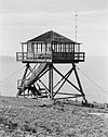
December 27, 1990 Near summit of Badger Mountain
47°30′37″N 120°14′34″W / 47.510278°N 120.242778°WEast Wenatchee vicinity. 2 William J. Canton House June 16, 1988 305 W. Ash St.
47°38′22″N 120°04′35″W / 47.639444°N 120.076389°WWaterville 3 Columbia River Bridge at Bridgeport 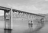
May 31, 1995 WA 17 over the Columbia River
48°00′04″N 119°39′13″W / 48.001111°N 119.653611°WBridgeport Bridges of Washington State MPS 4 Columbia River Bridge at Wenatchee 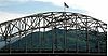
May 24, 1995 US 2 over the Columbia River
47°24′36″N 120°17′41″W / 47.41°N 120.294722°WWenatchee Bridges of Washington State MPS 5 Douglas County Courthouse 
September 5, 1975 Off U.S. 2
47°38′46″N 120°04′00″W / 47.646111°N 120.066667°WWaterville 6 Downtown Waterville Historic District May 19, 1988 Locust and Chelan Sts.
47°39′00″N 120°04′26″W / 47.65°N 120.073889°WWaterville 7 Gallaher House June 27, 1995 600 12th St.
48°00′28″N 119°40′31″W / 48.007778°N 119.675278°WMansfield 8 Lutheran St. Paul's Kirche April 12, 1982 Lake Ave.
47°37′21″N 120°00′13″W / 47.6225°N 120.003611°WDouglas 9 Nifty Theatre July 27, 1999 201 Locust
47°38′56″N 120°04′11″W / 47.648889°N 120.069722°WWaterville 10 Pangborn-Herndon Memorial Site March 16, 1972 3 mi (4.8 km). NE of East Wenatchee
47°26′35″N 120°16′45″W / 47.443056°N 120.279167°WEast Wenatchee 11 Rock Island Railroad Bridge July 30, 1975 SW of Rock Island over the Columbia River
47°22′02″N 120°09′09″W / 47.367222°N 120.1525°WRock Island 12 Christian Schmidt House December 9, 1994 391 L NW.
47°40′15″N 120°00′25″W / 47.670833°N 120.006944°WWaterville 13 Smith Hospital and Douglas County Press Building May 11, 1989 109 N. Chelan
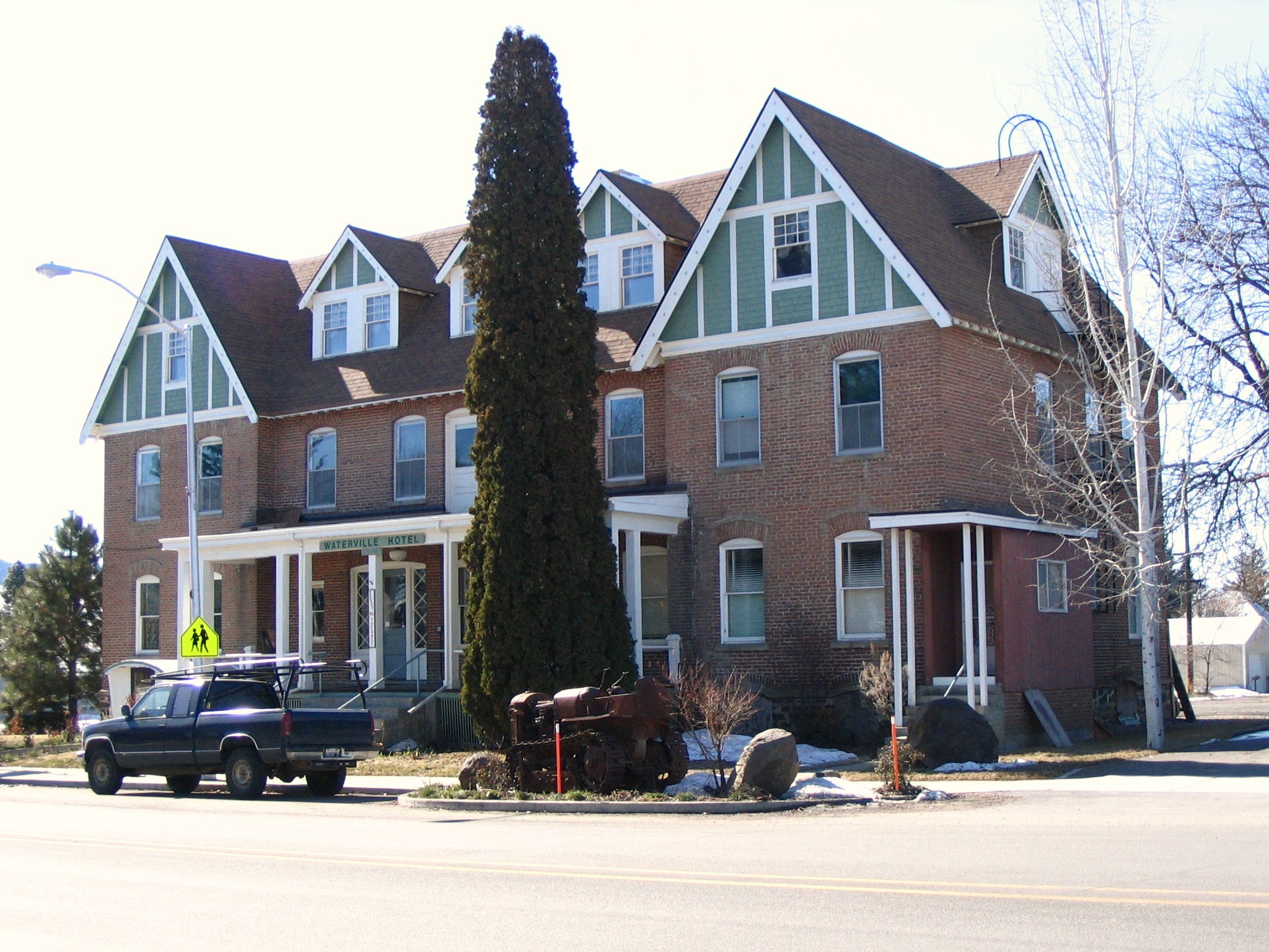
47°38′54″N 120°04′11″W / 47.648333°N 120.069722°WWaterville 14 Waterville Hotel 
October 18, 1984 102 S. Central St.
47°38′49″N 120°04′22″W / 47.646944°N 120.072778°WWaterville Ferry County
[7] Landmark name Image Date listed Location City or town Summary 1 Ansorge Hotel 
March 26, 1979 River St. and Railroad Ave.
48°53′02″N 118°35′51″W / 48.883889°N 118.5975°WCurlew 2 Barstow Bridge March 30, 1995 US 395 and Co. Rd. 4061 over the Kettle River
48°47′04″N 118°07′28″W / 48.784444°N 118.124444°WKettle Falls Bridges of Washington State MPS 3 Columbia River Bridge at Kettle Falls 
March 28, 1995 US 395 over the Columbia River
48°37′34″N 118°07′01″W / 48.626111°N 118.116944°WKettle Falls Bridges of Washington State MPS 4 Creaser Hotel 
April 12, 1982 664 Church Ln.
48°38′56″N 118°44′01″W / 48.648889°N 118.733611°WRepublic 5 Curlew Bridge 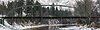
July 16, 1982 Spans Kettle River
48°53′08″N 118°36′01″W / 48.885556°N 118.600278°WCurlew Historic Bridges and Tunnels in Washington TR 6 Curlew School November 28, 1980 Off WA 4A
48°52′50″N 118°35′52″W / 48.880556°N 118.597778°WCurlew 7 Fairweather-Trevitt House 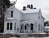
August 10, 2000 645 Kaufman
48°38′55″N 118°38′25″W / 48.648611°N 118.640278°WRepublic 8 Kettle Falls District November 20, 1974 Address Restricted Kettle Falls 9 St. Paul's Mission 
November 20, 1974 West of Kettle Falls on Lake Roosevelt
48°37′37″N 118°06′18″W / 48.626944°N 118.105°WKettle Falls 10 Jesse W. & Elizabeth Slagle House May 11, 2011 912 S. Keller St.
48°38′41″N 118°44′11″W / 48.644722°N 118.736389°WRepublic Franklin County
[7] Landmark name Image Date listed Location City or town Summary 1 Allen Rockshelter November 16, 1978 Address Restricted Pasco 2 Burr Cave December 15, 1978 Address Restricted Walker 3 Franklin County Courthouse 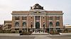
February 8, 1978 1016 N. 4th Ave..
46°14′14″N 119°05′44″W / 46.237222°N 119.095556°WPasco 4 Lower Snake River Archaeological District October 29, 1984 Address Restricted Pasco 5 Marmes Rockshelter 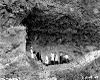
October 15, 1966 Under Lake Herbert G. West46°36′52″N 118°12′9″W / 46.61444°N 118.2025°W Lyons Ferry 6 James Moore House 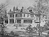
May 31, 1979 Off U.S. 12
46°13′43″N 119°08′04″W / 46.228611°N 119.134444°WPasco 7 Palouse Canyon Archaeological District October 29, 1984 Address Restricted Starbuck 8 Pasco Carnegie Library 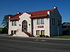
August 3, 1982 305 N. 4th Ave.
46°13′58″N 119°05′35″W / 46.232778°N 119.093056°WPasco Carnegie Libraries of Washington TR 9 Sacajawea State Park 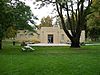
April 24, 2007 2503 Sacajawea Park Rd
46°12′00″N 119°02′26″W / 46.2°N 119.040556°WPasco 10 Savage Island Archeological District August 28, 1976 Address Restricted Richland 11 Strawberry Island Village Archeological Site August 21, 1980 Address Restricted Pasco 12 Tri-Cities Archaeological District October 29, 1984 Address Restricted Richland 13 Windust Caves Archaeological District October 29, 1984 Address Restricted Windust Garfield County
[7] Landmark name Image Date listed Location City or town Summary 1 Downtown Pomeroy Historic District 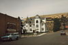
August 21, 2003 Roughly bounded by Main St., Tenth and Ninth Sts., Columbia St., and Sixth St.
46°28′28″N 117°35′56″W / 46.474444°N 117.598889°WPomeroy 2 Garfield County Courthouse 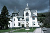
July 24, 1974 8th and Main Sts.
46°28′30″N 117°36′04″W / 46.475°N 117.601111°WPomeroy 3 Lewis and Clark Trail-Travois Road January 11, 1974 5 mi (8.0 km). E of Pomeroy, U.S. 12
46°27′52″N 117°28′23″W / 46.464444°N 117.473056°WPomeroy Grant County
[7] Landmark name Image Date listed Location City or town Summary 1 Bell Hotel September 15, 1997 210 W. Division St.
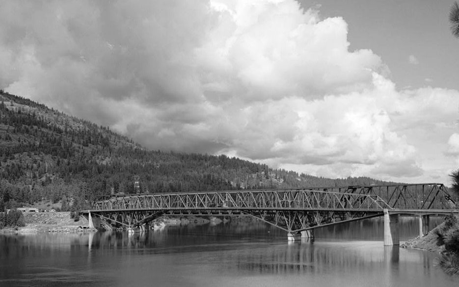
47°19′14″N 119°33′04″W / 47.320556°N 119.551111°WEphrata 2 Beverly Railroad Bridge 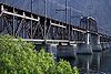
July 16, 1982 Spans Columbia River
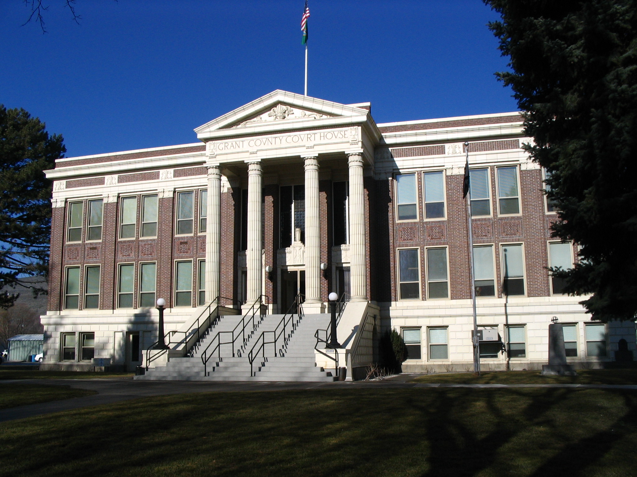
46°49′52″N 119°56′54″W / 46.831111°N 119.948333°WBeverly 3 Grant County Courthouse 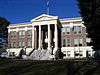
September 5, 1975 C St., NW
47°19′19″N 119°33′08″W / 47.321944°N 119.552222°WEphrata 4 Hartline School January 7, 2010 92 Chelan Street
47°41′12″N 119°06′30″W / 47.686667°N 119.108333°WHartline 5 Lind Coulee Archaeological Site January 21, 1974 Address Restricted Warden 6 Mesa 36 December 8, 1978 Address Restricted Soap Lake 7 Paris Archeological Site September 20, 1978 Address Restricted Richland 8 Samuel and Katherine Reiman House December 17, 2008 415 F. St. SW. Quincy 9 Stratford School October 25, 1990 Just off WA 7
47°25′36″N 119°16′24″W / 47.426667°N 119.273333°WStratford Rural Public Schools of Washington State MPS 10 Wilson Creek State Bank 
September 25, 1975 Off WA 7
47°25′23″N 119°07′14″W / 47.423056°N 119.120556°WWilson Creek Built in 1906. Currently houses local history museum. Grays Harbor County
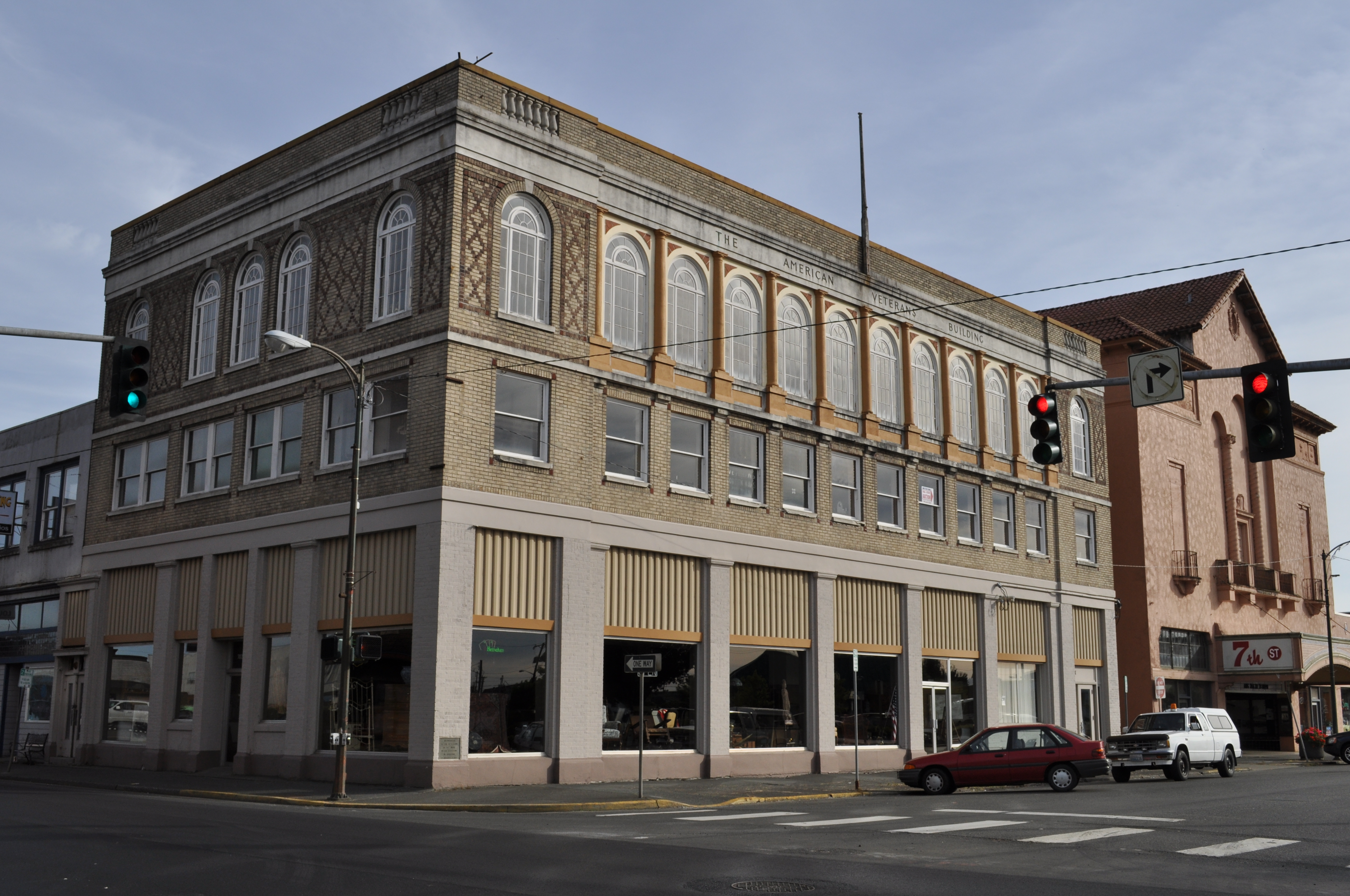
[7] Landmark name Image Date listed Location City or town Summary 1 American Veterans Building 
January 14, 2011 307 7th St.
46°58′40″N 123°53′07″W / 46.977778°N 123.885206°WHoquiam 2 Carnegie Library 
August 3, 1982 621 K St.
46°58′38″N 123°53′09″W / 46.977222°N 123.885833°WHoquiam Carnegie Libraries of Washington TR 3 Neil Cooney Mansion July 14, 1983 802 E. 5th St.
46°57′02″N 123°46′06″W / 46.950556°N 123.768333°WCosmopolis 4 Grays Harbor Light Station November 2, 1977 W of Westport
46°53′18″N 124°06′56″W / 46.888333°N 124.115556°WWestport 5 Judge Charles W. Hodgdon House April 27, 2005 717 Bluff
46°59′08″N 123°53′15″W / 46.985556°N 123.8875°WHoquiam 6 Hoquiam Olympic Stadium 
August 22, 2006 2811 Cherry St.
46°59′03″N 123°51′32″W / 46.984167°N 123.858889°WHoquiam 7 Hoquiam River Bridge 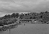
July 16, 1982 N of SR 12
46°58′32″N 123°52′32″W / 46.975556°N 123.875556°WHoquiam Historic Bridges and Tunnels in Washington TR 8 Hoquiam's Castle 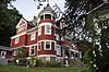
April 11, 1973 515 Chenault Ave.
46°59′04″N 123°53′16″W / 46.984444°N 123.887778°WHoquiam 9 Kestner Homestead July 13, 2007 Quinalt River Valley, .5 mi. N of Quinalt River Ranger Station, along west side of Kestner Creek, Quinalt sub-distr Port Angeles 10 Lake Quinault Lodge 
July 9, 1998 South Shore Rd.
47°28′01″N 123°50′50″W / 47.466944°N 123.847222°WLake Quinault 11 Joseph Lytle Home July 12, 1990 509 Chenault
46°59′03″N 123°53′24″W / 46.984167°N 123.89°WHoquiam 12 Masonic Temple-Hoquiam 
September 5, 2007 510 8th St.
46°58′38″N 123°53′14″W / 46.977222°N 123.887222°WHoquiam 13 Old McCleary Hotel August 1, 1996 42 Summit Rd.
47°03′45″N 123°16′07″W / 47.0625°N 123.268611°WMcCleary 14 Lachlin McTaggert House August 29, 1985 2240 L St.
46°58′42″N 123°53′34″W / 46.978333°N 123.892778°WHoquiam 15 Ole Mickelson Cabin May 6, 1993 Lot 46, S shore Lake Quinault, between Willaby Cr. and Falls Cr.
47°27′53″N 123°51′11″W / 47.464722°N 123.853056°WQuinault 16 F. Arnold Polson House and Alex Polson Grounds 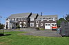
June 19, 1979 1611 Riverside Ave.
46°58′44″N 123°52′45″W / 46.978889°N 123.879167°WHoquiam 17 Seventh Street Theater 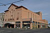
August 6, 1987 313 Seventh St.
46°58′36″N 123°53′07″W / 46.976667°N 123.885278°WHoquiam 18 SIERRA (motor ship) March 29, 1978 1401 Sargent Blvd.
46°58′31″N 123°48′02″W / 46.975278°N 123.800556°WAberdeen 19 US Post Office-Hoquiam Main 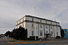
May 30, 1991 620 Eighth St.
46°58′30″N 123°53′11″W / 46.975°N 123.886389°WHoquiam 20 US Post Office-Montesano Main 
May 30, 1991 211 Pioneer Ave. N.
46°58′46″N 123°36′04″W / 46.979444°N 123.601111°WMontesano Island County
[7] Landmark name Image Date listed Location City or town Summary 1 Cama Beach Resort May 15, 2001 1880 SW Camano Dr.
48°08′36″N 122°30′37″W / 48.143333°N 122.510278°WCamano Island 2 Central Whidbey Island Historic District 
December 12, 1973 S of Oak Harbor, roughly 6 mi (9.7 km). either side of Coupeville
48°12′43″N 122°41′12″W / 48.211944°N 122.686667°WOak Harbor 3 Benjamin Loers House August 29, 1977 2046 Swantown Rd.
48°17′03″N 122°40′01″W / 48.284167°N 122.666944°WOak Harbor 4 Olympic Club May 28, 1991 230 1st St.
48°02′28″N 122°24′29″W / 48.041111°N 122.408056°WLangley 5 Site 45-IS-2 December 11, 2008 Address Restricted Camano Island Also known as the Cama Beach Archaeological Site. 6 Smith Island Light Station 
April 6, 1978 N of Port Townsend
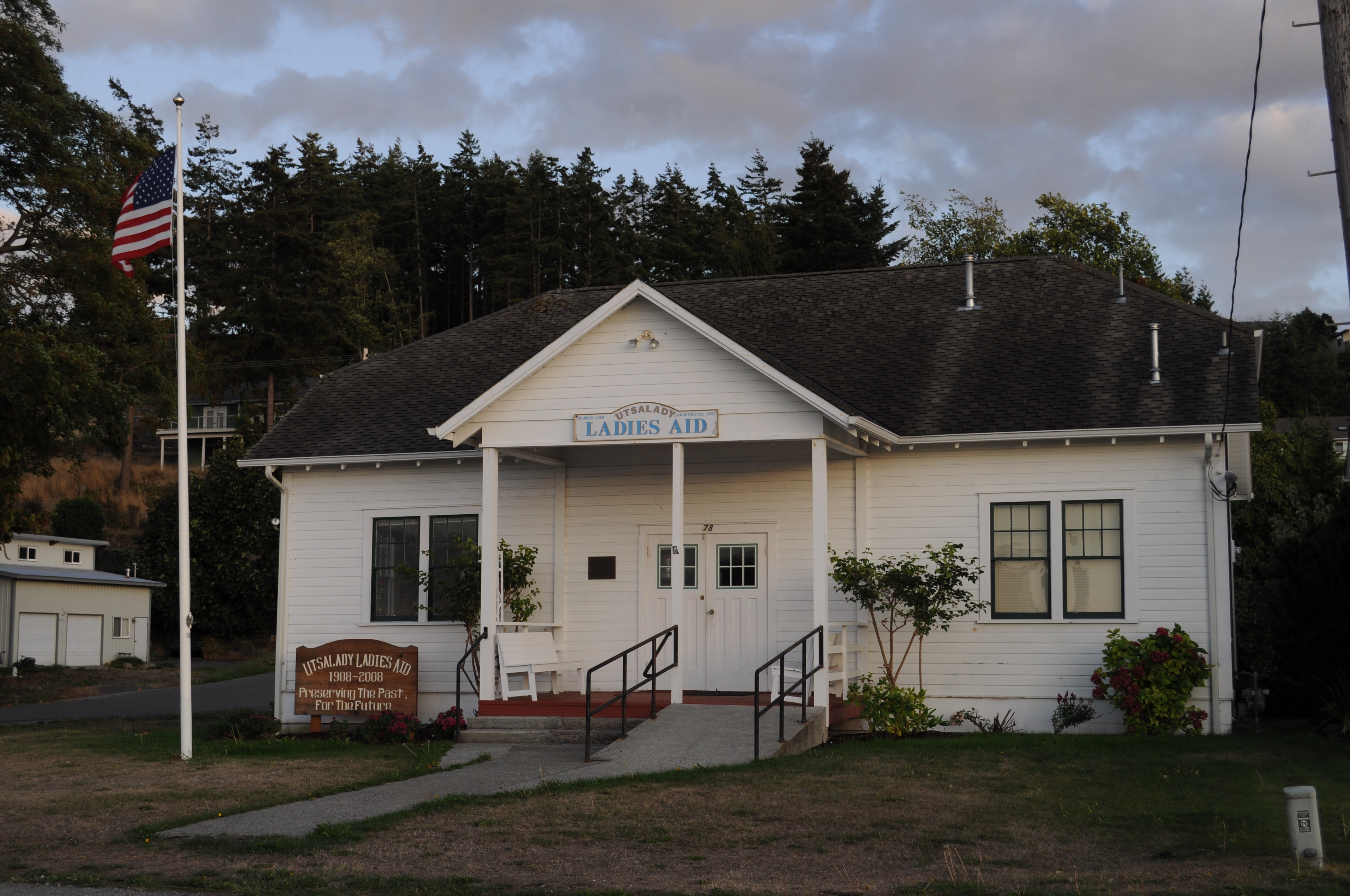
48°19′07″N 122°50′37″W / 48.318611°N 122.843611°WPort Townsend Lost due to erosion 7 Utsalady Ladies Aid Building 
September 25, 1998 79 Utsalady Rd.
48°15′08″N 122°28′37″W / 48.252222°N 122.476944°WCamano Island 7 Sergeant Clark House 
March 25, 1980 301 S. Main St.
48°12′34″N 122°41′08″W / 48.209444°N 122.685556°WCoupeville, Whidbey Island Built in 1892 by Thomas N. Richards and occupied for much of its early life by Sergeant Thomas Clark (Fort Casey) and his family. Jefferson County
King County
Kitsap County
Kittitas County
Klickitat County
[7] Landmark name Image Date listed Location City or town Summary 1 Appleton Log Hall 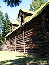
October 2, 1992 835 Appleton Rd.
45°48′36″N 121°16′30″W / 45.81°N 121.275°WAppleton 2 First Day Advent Christian Church 
September 26, 1991 Jct. of Maryhill Hwy. and Stonehenge Ave.
45°41′14″N 120°48′47″W / 45.687222°N 120.813056°WMaryhill 3 Goldendale Free Public Library 
August 3, 1982 131 W. Burgen
45°49′15″N 120°49′22″W / 45.820833°N 120.822778°WGoldendale Carnegie Libraries of Washington TR 4 Maryhill 
December 31, 1974 SW of Goldendale on U.S. 197
45°40′40″N 120°51′48″W / 45.677778°N 120.863333°WGoldendale 5 Charles Newell House 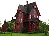
August 18, 1977 114 Sentinel St.
45°49′02″N 120°49′22″W / 45.817222°N 120.822778°WGoldendale 6 Rattlesnake Creek Site May 22, 1978 Address Restricted Husum 7 Rowland Basin Site July 11, 1996 Address Restricted Lyle 8 Trout Lake Tourist Club September 21, 2005 15 Guler Rd.
46°00′15″N 121°32′22″W / 46.004167°N 121.539444°WTrout Lake 9 Whitcomb Cabin 
June 10, 1975 100 Wildlife Refuge Rd., 6 mi (9.7 km). W of Glenwood
45°57′48″N 121°20′34″W / 45.963333°N 121.342778°WGlenwood 10 Wishram Indian Village Site 
March 16, 1972 Address Restricted The Dalles Lewis County
Lincoln County
[7] Landmark name Image Date listed Location City or town Summary 1 Almira Hotel March 15, 2006 3 N. Third Ave.
47°42′46″N 118°56′27″W / 47.712778°N 118.940833°WAlmira 2 Atlas E Missile Site 9 July 31, 2009 36000 Crescent Rd. N.
47°47′18″N 117°50′31″W / 47.788394°N 117.841822°WReardan 3 Fort Spokane Military Reserve 
November 23, 1988 Rt. 25
47°54′47″N 118°18′22″W / 47.913056°N 118.306111°WMiles 4 Goose Creek Rockshelter May 22, 1978 Address Restricted Wilbur 5 Harrington Bank Block and Opera House 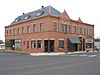
October 2, 1992 Jct. of Third and Willis Sts., NW corner
47°28′49″N 118°15′13″W / 47.480278°N 118.253611°WHarrington 6 Lincoln Hotel 
December 20, 2010 301 W. Sherlock St.
47°28′44″N 118°15′17″W / 47.478889°N 118.254722°WHarrington 7 Little Falls Hydroelectric Power Plant December 15, 1988 Spokane River
47°49′53″N 117°55′00″W / 47.831389°N 117.916667°WReardan 8 Long Lake Hydroelectric Power Plant 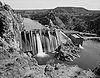
December 15, 1988 Spokane River
47°50′10″N 117°50′19″W / 47.836111°N 117.838611°WFord 9 Mary Queen of Heaven Roman Catholic Church 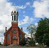
April 26, 1990 N. First and B St.
47°18′09″N 117°58′30″W / 47.3025°N 117.975°WSprague 10 Spokane River Bridge at Fort Spokane 
March 28, 1995 WA 25 over the Spokane R.
47°54′30″N 118°18′59″W / 47.908333°N 118.316389°WHunters Bridges of Washington State MPS 11 Spokane River Bridge at Long Lake Dam 
May 24, 1995 WA 231 over the Spokane R.
47°50′19″N 117°51′05″W / 47.838611°N 117.851389°WReardan Bridges of Washington State MPS Mason County
[7] Landmark name Image Date listed Location City or town Summary 1 Big Creek Archeological Site-45MS100 October 13, 1999 Address Restricted Hoodsport 2 Cushman No. 1 Hydroelectric Power Plant 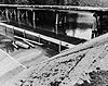
December 15, 1988 S end of Lake Cushman
47°25′11″N 123°13′16″W / 47.419722°N 123.221111°WHoodsport 3 Cushman No. 2 Hydroelectric Power Plant December 15, 1988 Skokomish River
47°22′59″N 123°10′42″W / 47.383056°N 123.178333°WHoodsport 4 Goldsborough Creek Bridge July 16, 1982 WA 3
47°12′34″N 123°05′57″W / 47.209444°N 123.099167°WShelton Historic Bridges and Tunnels in Washington TR 5 Harstine Island Community Hall March 16, 1989 North Island Dr. and Hartstene Island Dr.
47°16′35″N 122°53′10″W / 47.276389°N 122.886111°WHarstine Island 6 High Steel Bridge July 16, 1982 Spans Skokomish South Fork
47°22′05″N 123°16′44″W / 47.368056°N 123.278889°WShelton Historic Bridges and Tunnels in Washington TR 7 North Hamma Hamma River Bridge 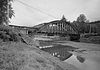
July 16, 1982 Spans North Hamma Hamma River
47°32′23″N 123°02′33″W / 47.539722°N 123.0425°WEldon Historic Bridges and Tunnels in Washington TR 8 Shelton Public Library and Town Hall July 14, 1983 5th St. and Railroad Ave.
47°12′48″N 123°06′11″W / 47.213333°N 123.103056°WShelton 9 Schafer State Park May 10, 2010 1365 W Schafer Park Rd.
47°05′59″N 123°28′21″W / 47.099614°N 123.472461°WElma 10 Simpson Logging Company Locomotive No. 7 and Peninsular Railway Caboose No. 700 January 12, 1984 3rd and Railroad Aves.
47°12′47″N 123°06′03″W / 47.213056°N 123.100833°WShelton 11 South Hamma Hamma River Bridge 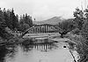
July 16, 1982 Spans South Hamma Hamma River
47°32′11″N 123°02′28″W / 47.536389°N 123.041111°WEldon Historic Bridges and Tunnels in Washington TR 12 taba das February 16, 2005 Address Restricted Potlatch 13 Vance Creek Bridge July 16, 1982 NW of Shelton
47°20′06″N 123°19′10″W / 47.335°N 123.319444°WShelton Historic Bridges and Tunnels in Washington TR Okanogan County
[7] Landmark name Image Date listed Location City or town Summary 1 Bonaparte Mountain Cabin April 20, 1981 E of Tonasket in Okanogan National Forest
48°47′06″N 119°07′17″W / 48.785°N 119.121389°WTonasket 2 Chief Joseph Memorial May 15, 1974 Near jct. of WA 10A and Cache Creek Rd.
48°10′08″N 118°58′34″W / 48.168889°N 118.976111°WNespelem 3 Columbia River Bridge at Bridgeport May 31, 1995 WA 17 over the Columbia R.
48°00′04″N 119°39′13″W / 48.001111°N 119.653611°WBridgeport 4 Early Winters Ranger Station Work Center 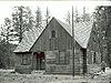
April 11, 1986 Okanogan National Forest
48°35′41″N 120°25′48″W / 48.594722°N 120.43°WWinthrop 5 Enloe Dam and Powerplant 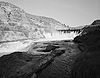
October 18, 1978 4 mi (6.4 km). (6.4 km) W of Oroville
48°57′57″N 119°30′03″W / 48.965833°N 119.500833°WOroville 6 Fort Okanogan, Sites of June 4, 1973 N of Bridgeport between the Columbia and Okanogan Rivers
48°05′59″N 119°43′06″W / 48.099722°N 119.718333°WBridgeport 7 Grand Coulee Bridge 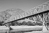
July 16, 1982 Spans Columbia River
47°57′56″N 118°58′53″W / 47.965556°N 118.981389°WGrand Coulee Historic Bridges and Tunnels in Washington TR 8 Lost Lake Guard Station April 11, 1986 Okanogan National Forest
48°50′42″N 119°02′54″W / 48.845°N 119.048333°WTonasket 9 Okanogan County Courthouse 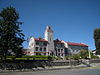
June 29, 1995 149 N. Third Ave.
48°21′55″N 119°34′49″W / 48.365278°N 119.580278°WOkanogan 10 Okanogan Project: Conconully Reservoir Dam September 6, 1974 S of Conconully
48°32′16″N 119°44′53″W / 48.537778°N 119.748056°WConconully 11 Parson Smith Tree March 16, 1972 40 mi (64 km). N of Winthrop on the Canadian border in Okanogan National Forest
49°00′05″N 120°33′10″W / 49.001389°N 120.552778°WWinthrop 12 Hiram F. Smith Orchard November 12, 1975 2 mi (3.2 km). N of Oroville on Osoyoos Lake
48°58′00″N 119°25′42″W / 48.966667°N 119.428333°WOroville 13 US Post Office-Okanogan Main 
May 30, 1991 212 Second Ave. N.
48°21′53″N 119°34′41″W / 48.364722°N 119.578056°WOkanogan 14 US Post Office-Omak Main 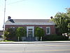
May 30, 1991 104 S. Main St.
48°24′34″N 119°31′40″W / 48.409444°N 119.527778°WOmak 15 Guy Waring Cabin March 19, 1982 285 Castle Ave.
48°28′36″N 120°10′50″W / 48.476667°N 120.180556°WWinthrop Pacific County
[7] Landmark name Image Date listed Location City or town Summary 1 Cape Disappointment Historic District 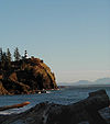
August 15, 1975 From .5 mi (0.80 km). S of Ilwaco to WA/OR boundary
46°17′01″N 124°03′37″W / 46.283611°N 124.060278°WIlwaco 2 Chinook Point 
October 15, 1966 5 mi (8.0 km). SE of Fort Columbia Historical State Park on U.S. 101
46°15′25″N 123°54′57″W / 46.256944°N 123.915833°WChinook 3 Colbert House 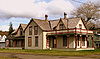
October 18, 1977 Quaker and Lake Sts.
46°18′31″N 124°02′06″W / 46.308611°N 124.035°WIlwaco 4 Columbia River Quarantine Station February 8, 1980 SW of Knappton on WA 401
46°16′15″N 123°49′40″W / 46.270833°N 123.827778°WKnappton 5 Klipsan Beach Life Saving Station 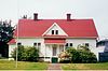
July 5, 1979 WA 103
46°27′53″N 124°03′09″W / 46.464722°N 124.0525°WKlipsan Beach 6 Lumber Exchange Building May 19, 1988 Robert Bush Dr./US 101 and Willapa Ave.
46°39′59″N 123°48′38″W / 46.666389°N 123.810556°WSouth Bend 7 Oysterville Historic District April 21, 1976 WA 103
46°32′51″N 124°01′39″W / 46.5475°N 124.0275°WOysterville 8 Pacific County Courthouse July 20, 1977 Cowlitz and Vine Sts.
46°39′46″N 123°48′33″W / 46.662778°N 123.809167°WSouth Bend 9 Raymond Public Library 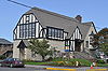
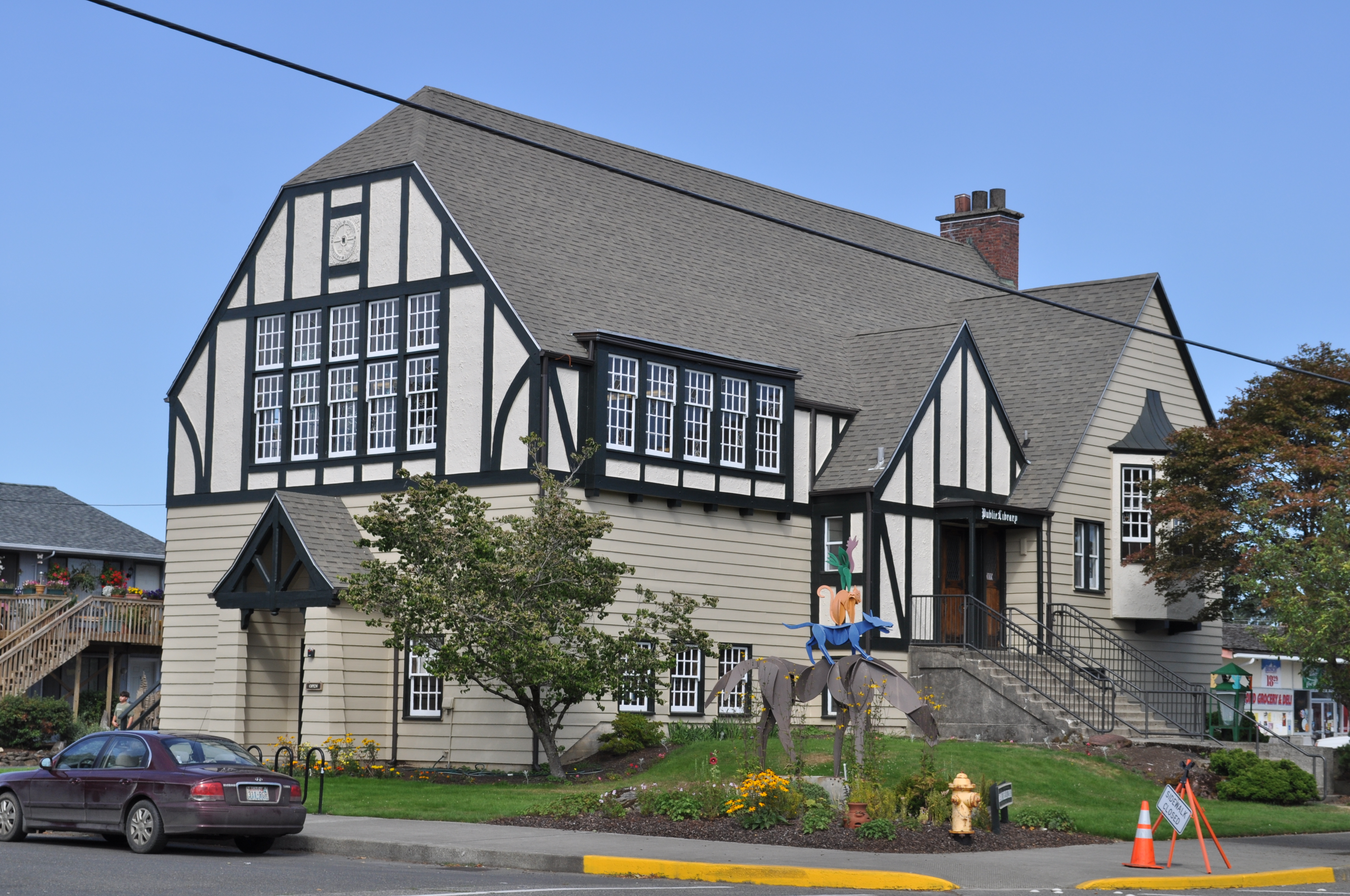
November 29, 1979 507 Duryea St.
46°41′40″N 123°43′45″W / 46.694444°N 123.729167°WRaymond 10 Raymond Theater 
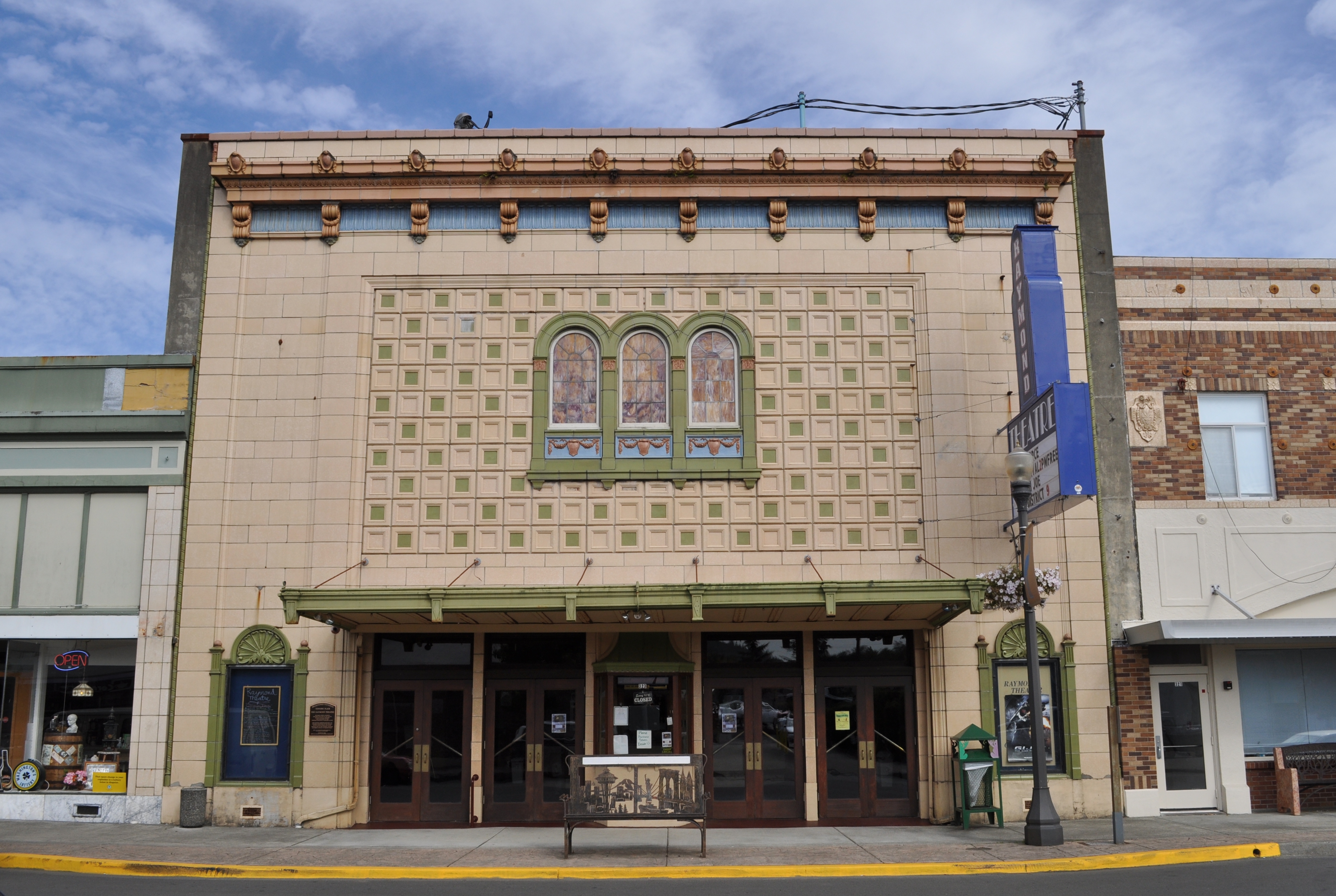
May 1, 1991 325 N. Third St.
46°41′11″N 123°43′43″W / 46.686389°N 123.728611°WRaymond 11 Russell House November 25, 1977 902 E. Water St.
46°39′47″N 123°46′55″W / 46.663056°N 123.781944°WSouth Bend 12 Peter Schulderman House May 19, 1988 Thirty-seventh and K Sts.
46°19′47″N 124°03′20″W / 46.329722°N 124.055556°WSeaview 13 Shelburne Hotel 
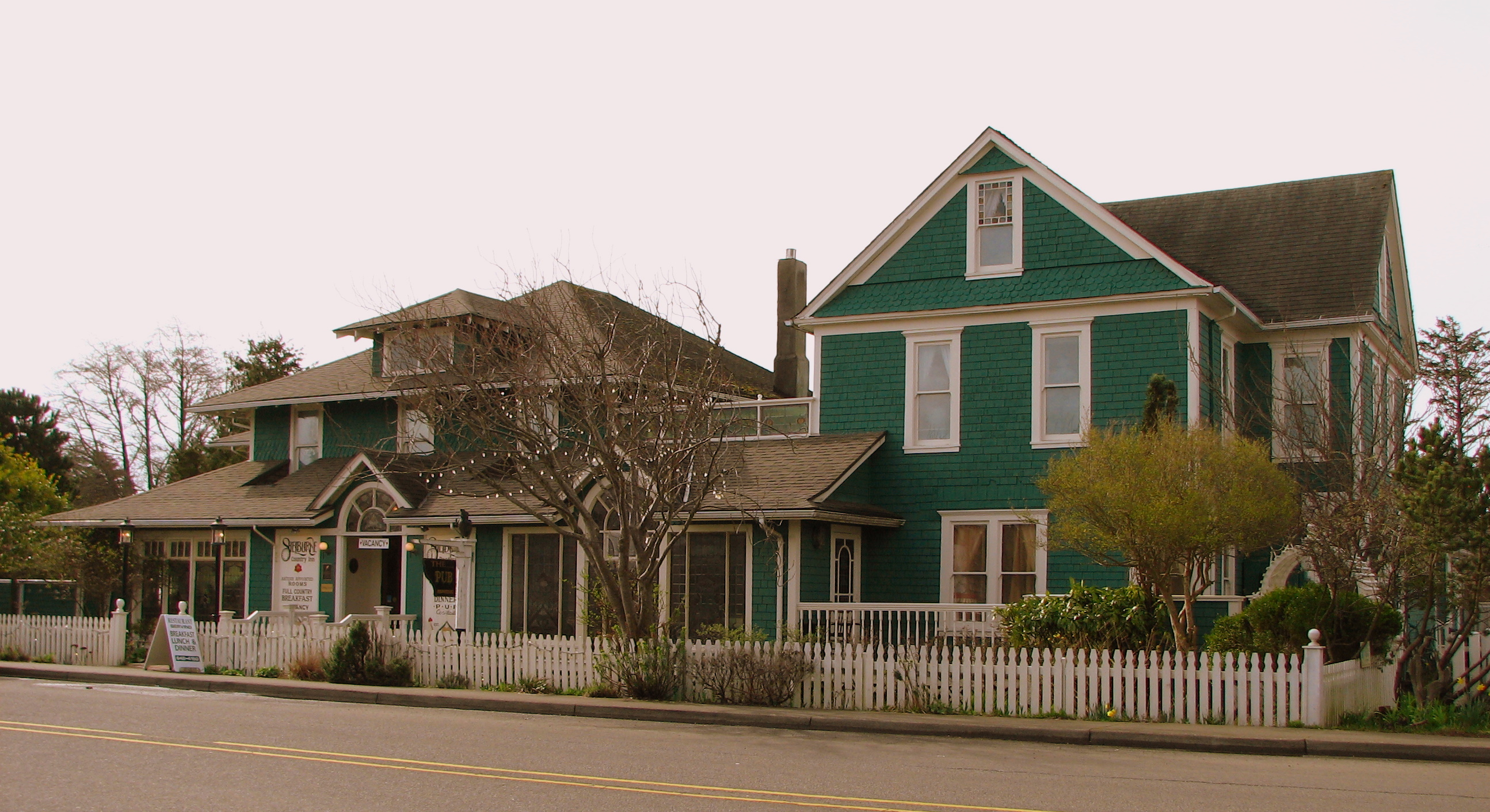
December 15, 1978 WA 103 and K St.
46°20′06″N 124°03′14″W / 46.335°N 124.053889°WSeaview 14 South Bend Carnegie Public Library August 3, 1982 W. 1st and Pacific Sts.
46°39′59″N 123°48′47″W / 46.666389°N 123.813056°WSouth Bend Carnegie Libraries of Washington TR 15 Tokeland Hotel 
April 11, 1978 Kindred Ave. and Hotel Rd.
46°42′31″N 123°59′00″W / 46.708611°N 123.983333°WTokeland 16 US Post Office-Raymond Main 
May 30, 1991 406 Duryea St.
46°41′11″N 123°43′50″W / 46.686389°N 123.730556°WRaymond 17 Willapa Bay Boathouse March 13, 1986 US Coast Guard Station, Willapa Bay
46°42′20″N 123°57′57″W / 46.705556°N 123.965833°WTokeland 18 The Wreckage September 18, 1979 256th Pl.
46°29′17″N 124°02′59″W / 46.488056°N 124.049722°WOcean Park Pend Oreille County
[7] Landmark name Image Date listed Location City or town Summary 1 Idaho and Wash. Northern RR Bridge July 16, 1982 Spans Pend Oreille River, off WA 31
48°46′50″N 117°24′33″W / 48.780556°N 117.409167°WMetaline Falls Historic Bridges and Tunnels in Washington TR 2 Lewis P. Larson House March 26, 1979 5th and Pend Oreille Blvd.
48°51′48″N 117°22′23″W / 48.863333°N 117.373056°WMetaline Falls 3 Metaline Falls School September 8, 1988 302 Park
48°51′40″N 117°22′26″W / 48.861111°N 117.373889°WMetaline Falls 4 Pend Oreille Mines and Metals Building August 29, 1997 103 S. Grandview St.
48°51′44″N 117°22′18″W / 48.862222°N 117.371667°WMetaline Falls 5 Dr. John and Viola Phillips House and Office January 3, 2006 S. 337 Spokane Ave.
48°10′49″N 117°02′45″W / 48.180278°N 117.045833°WNewport 6 United States Border Station January 31, 1997 Roughly bounded by WA 31 and the U.S.-Canadian border, Colville National Forest
48°59′58″N 117°18′00″W / 48.999444°N 117.3°WMetaline Falls 7 Washington Hotel March 26, 1979 5th and Washington St.
48°51′44″N 117°22′08″W / 48.862222°N 117.368889°WMetaline Falls Pierce County
San Juan County
[7] Landmark name Image Date listed Location City or town Summary 1 Alderbrook Farmhouse November 21, 1985 Point Lawrence Rd.
48°39′20″N 122°45′47″W / 48.655556°N 122.763056°WDoe Bay 2 Crow Valley School August 27, 1987 Crow Valley Rd.
48°40′04″N 122°56′42″W / 48.667778°N 122.945°WEastsound Built in 1888 in Eastsound. Now maintained by the Orcas Island Historical Museum.
Rural Public Schools of Washington State MPS3 Doe Bay General Store and Post Office May 8, 1986 End of County Rd.
48°38′29″N 122°46′45″W / 48.641389°N 122.779167°WDoe Bay, Orcas Island 4 Emmanuel Episcopal Church 
December 12, 1994 Main St.
48°41′40″N 122°54′22″W / 48.694444°N 122.906111°WEastsound Built in 1885. 5 Krumdiack Homestead April 29, 1993 North coast, between Fishery Pt. and Pt. Hammond
48°43′03″N 123°01′20″W / 48.7175°N 123.022222°WWaldron Island Also known as the Cook Property. 6 Little Red Schoolhouse June 19, 1973 Corner of Hoffman Cove and Neck Point Cove Rd.
48°34′22″N 122°57′43″W / 48.572778°N 122.961944°WShaw Island 7 Orcas Hotel 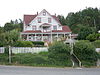
August 24, 1982 In Orcas
48°35′54″N 122°56′37″W / 48.598333°N 122.943611°WOrcas Built in 1904. 8 Patos Island Light Station 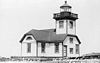
October 21, 1977 North of Eastsound on Patos Island
48°47′21″N 122°58′11″W / 48.789167°N 122.969722°WEastsound Built in 1893. 9 Port Stanley School December 9, 1994 Port Stanley Rd.
48°31′32″N 122°52′35″W / 48.525556°N 122.876389°WLopez Island 10 Roche Harbor August 29, 1977 Northern San Juan Island
48°36′32″N 123°09′01″W / 48.608889°N 123.150278°WSan Juan Island Founded in 1886, the district consists of 1,400 acres (5.7 km2) and 17 buildings. 11 Rosario 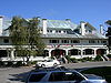
November 2, 1978 S of East Sound on Orcas Island
48°38′49″N 122°52′21″W / 48.646944°N 122.8725°WOrcas Island Now part of Moran State Park. 12 San Juan County Courthouse 
April 12, 1984 350 N. Court St.
48°32′09″N 123°01′01″W / 48.535833°N 123.016944°WFriday Harbor Built in 1906. 13 San Juan Island National Historic Site 
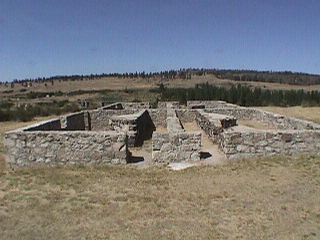
October 15, 1966 Between Haro Strait and San Juan Channel
48°34′57″N 123°9′1″W / 48.5825°N 123.15028°WFriday Harbor 14 San Juan Island, Lime Kiln Light Station 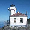
December 15, 1978 W of Friday Harbor on CR 1
48°30′56″N 123°09′00″W / 48.515556°N 123.15°WFriday Harbor Built in 1914. 15 San Juan Lime Company-Cowell's March 6, 2007 1567 West Side Rd. N Friday Harbor 16 Tharald Homestead January 17, 2002 Hoffman Cove Rd.
48°33′40″N 122°58′03″W / 48.561111°N 122.9675°WShaw Island Also known as the Ellis Farm. Skagit County
Skamania County
[7] Landmark name Image Date listed Location City or town Summary 1 Bonneville Dam Historic District 
April 9, 1986 Columbia River between Bradford and Cascade Islands off I-84 in Multnomah County, Oregon to WA 14 in Skamania County, WA
45°38′29″N 121°56′36″W / 45.64139°N 121.94333°WNorth Bonneville Built in the 1930s to harness the Columbia River for power generation, this was the first hydroelectric dam with a hydraulic drop sufficient to produce 500,000 kW of hydropower. The NHL district covers the dam and other elements of the federal dam project, including the #1 powerhouse, navigation lock, fish ladder, and hatchery. The site is also listed in Oregon. 2 North Bonneville Archeological District February 2, 1987 Address Restricted North Bonneville 3 Region Six Personnel Training Station August 28, 2007 Wind River Work Center, 1262 Hemlock Rd.
45°48′09″N 121°55′41″W / 45.8025°N 121.928056°WGifford Pinchot National Forest 4 Edward and Isabelle Underwood Farm – Five Oaks Farm 
January 10, 2008 851 Orchard Ln. Underwood Snohomish County
Spokane County
Stevens County
Thurston County
Wahkiakum County
[7] Landmark name Image Date listed Location City or town Summary 1 Columbia River Gillnet Boat February 14, 1978 Altoona Cannery
46°15′58″N 123°39′15″W / 46.266111°N 123.654167°WAltoona 2 Deep River Pioneer Lutheran Church 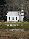
August 7, 1974 N of Deep River
46°21′35″N 123°40′55″W / 46.359722°N 123.681944°WDeep River 3 Grays River Covered Bridge 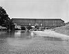
November 23, 1971 WA 4, 1.5 mi (2.4 km). E of Grays River
46°21′17″N 123°34′47″W / 46.354722°N 123.579722°WGrays River Historic Bridges and Tunnels in Washington TR 4 Pioneer Church April 11, 1973 Alley St.
46°12′06″N 123°22′56″W / 46.201667°N 123.382222°WCathlamet 5 Skamokawa Historic District 
April 21, 1976 WA 4
46°16′55″N 123°26′47″W / 46.281944°N 123.446389°WSkamokawa Walla Walla County
Whatcom County
Whitman County
Yakima County
See also
References
- ^ National Park Service (1997). "How to Apply the National Register Criteria for Evaluation". http://www.nps.gov/history/nr/publications/bulletins/nrb15/nrb15.pdf. Retrieved 2008-12-17.
- ^ National Park Service. "National Register Research". National Register of Historic Places. http://www.nps.gov/nr/research/index.htm. Retrieved 2008-12-17.
- ^ The latitude and longitude information provided in this table was derived originally from the National Register Information System, which has been found to be fairly accurate for about 99% of listings. For about 1% of NRIS original coordinates, experience has shown that one or both coordinates are typos or otherwise extremely far off; some corrections may have been made. A more subtle problem causes many locations to be off by up to 150 yards, depending on location in the country: most NRIS coordinates were derived from tracing out latitude and longitudes off of USGS topographical quadrant maps created under the North American Datum of 1927, which differs from the current, highly accurate WGS84 GPS system used by Google maps. Chicago is about right, but NRIS longitudes in Washington are higher by about 4.5 seconds, and are lower by about 2.0 seconds in Maine. Latitudes differ by about 1.0 second in Florida. Some locations in this table may have been corrected to current GPS standards.
- ^ These counts are based on entries in the National Register Information Database as of April 24, 2008 and new weekly listings posted since then on the National Register of Historic Places web site. There are frequent additions to the listings and occasional delistings and the counts here are approximate and not official. New entries are added to the official Register on a weekly basis. Also, the counts in this table exclude boundary increase and decrease listings which only modify the area covered by an existing property or district, although carrying a separate National Register reference number.
- ^ The following sites are listed in multiple counties: Beverly Railroad Bridge (Grant and Kittitas), Columbia River Bridge at Bridgeport (Chelan and Douglas), Columbia River Bridge at Wenatchee (Chelan and Douglas), Kettle Falls District (Ferry and Stevens), Little Falls Hydroelectric Power Plant (Ferry and Stevens), Long Lake Hydroelectric Power Plant (Lincoln and Stevens), Lower Snake River Archaeological District (Franklin and Walla Walla), Mount Rainier National Park (Lewis and Pierce), Rock Island Railroad Bridge (Chelan and Douglas), Spokane River Bridge at Long Lake Dam (Lincoln and Stevens), Stevens Pass Historic District (Chelan and King), Tri-Cities Archaeological District (Benton and Franklin) and Windust Caves Archaeological District (Franklin and Walla Walla)
- ^ "National Register of Historic Places: Weekly List Actions". National Park Service, United States Department of the Interior. Retrieved on November 10, 2011.
- ^ a b Numbers represent an ordering by significant words. Various colorings, defined here, differentiate National Historic Landmark sites and National Register of Historic Places Districts from other NRHP buildings, structures, sites or objects.
- ^ "National Register Information System". National Register of Historic Places. National Park Service. . http://nrhp.focus.nps.gov/natreg/docs/All_Data.html.
Further reading
- Roberts, George; Roberts, Jan (1999). Discover Historic Washington State, Gem Guides Book Company, ISBN 1889786071.
- Historic Places in Washington, Department of Archaeology and Historic Preservation, Olympia, Washington, 2008-10-01. The Washington Heritage Register includes all Washington sites on the National Register, plus numerous additional sites.
U.S. National Register of Historic Places Topics Lists by states Alabama • Alaska • Arizona • Arkansas • California • Colorado • Connecticut • Delaware • Florida • Georgia • Hawaii • Idaho • Illinois • Indiana • Iowa • Kansas • Kentucky • Louisiana • Maine • Maryland • Massachusetts • Michigan • Minnesota • Mississippi • Missouri • Montana • Nebraska • Nevada • New Hampshire • New Jersey • New Mexico • New York • North Carolina • North Dakota • Ohio • Oklahoma • Oregon • Pennsylvania • Rhode Island • South Carolina • South Dakota • Tennessee • Texas • Utah • Vermont • Virginia • Washington • West Virginia • Wisconsin • WyomingLists by territories Lists by associated states Other Lists by county Adams • Asotin • Benton • Chelan • Clallam • Clark • Columbia • Cowlitz • Douglas • Ferry • Franklin • Garfield • Grant • Grays Harbor • Island • Jefferson • King • Kitsap • Kittitas • Lewis • Lincoln • Mason • Okanogan • Pacific • Pend Oreille • Pierce • San Juan • Skagit • Skamania • Snohomish • Spokane • Stevens • Thurston • Wahkiakum • Walla Walla • Whatcom • Whitman • Yakima
Other lists Locations in the state of Washington Communities Cities · Towns · Census-designated places (CDPs) · Undesignated communities · Unrecognized communities · Indian reservationsGeography Regions · Other places · Bodies of waterOther Categories:- National Register of Historic Places in Washington (state)
- National Register of Historic Places lists by state
- Washington (state)-related lists
-


Wikimedia Foundation. 2010.