- National Register of Historic Places listings in Nevada
-
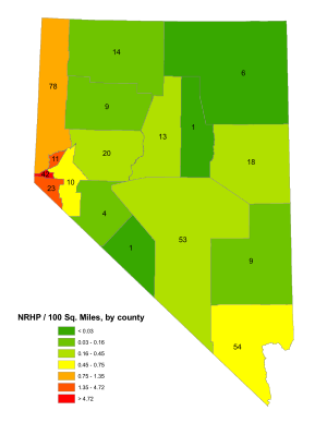
 Nevada's counties
This is a list of properties and historic districts in Nevada that are listed on the National Register of Historic Places. There is at least one listing in each of Nevada's 16 counties and one independent city.
The locations of National Register properties and districts (at least for all showing latitude and longitude coordinates below), may be seen in a Google map by clicking on "Map of all coordinates".[1]
Current listings by county
The following are approximate tallies of current listings by county. These counts are based on entries in the National Register Information Database as of April 24, 2008[2] and new weekly listings posted since then on the National Register of Historic Places web site.[3] There are frequent additions to the listings and occasional delistings and the counts here are approximate and not official. New entries are added to the official Register on a weekly basis.[4] Also, the counts in this table exclude boundary increase and decrease listings which only modify the area covered by an existing property or district, although carrying a separate National Register reference number.
 Eureka Locomotive, in Clark County
County # of Sites 1 Carson City 43 2 Churchill 20 3 Clark 56 4 Douglas 23 5 Elko 6 6 Esmeralda 1 7 Eureka 1 8 Humboldt 14 9 Lander 13 10 Lincoln 9 11 Lyon 10 12 Mineral 4 13 Nye 53 14 Pershing 9 15 Storey 12 16 Washoe 78 17 White Pine 18 (less duplicates) (6)[5] TOTAL 364  Nevada Governor's Mansion, Carson City
-
- This National Park Service list is complete through NPS recent listings posted November 10, 2011.[6]
Carson City
Churchill County
Landmark name Image Date listed Location City or Town Summary 1 Carson River Diversion Dam March 25, 1981 Carson River
39°29′50″N 118°59′57″W / 39.49722°N 118.99917°WFallon 2 Churchill County Courthouse September 23, 1992 10 Williams St.
39°28′30″N 118°46′51″W / 39.475°N 118.78083°WFallon 3 Churchill County Jail April 9, 2002 10 W. Williams Ave.
39°28′30″N 118°46′36″W / 39.475°N 118.77667°WFallon 4 Cold Springs Pony Express Station Ruins May 16, 1978 Address Restricted Frenchman 5 Cold Springs Station Site February 23, 1972 51 miles west of Austin on U.S. Route 50
39°23′31″N 117°51′12″W / 39.39194°N 117.85333°WAustin 6 The Cottage Schools June 10, 2008 255 E. Stillwater Ave. Fallon (School Buildings in Nevada MPS) 7 Robert L. Douglass House August 13, 2001 10 S. Carson St.
39°28′28″N 118°46′32″W / 39.47444°N 118.77556°WFallon 8 Fallon City Hall October 27, 2004 55 E. Williams Ave.
39°28′28″N 118°46′36″W / 39.47444°N 118.77667°WFallon 9 Federal Building and Post Office March 8, 2006 90 N. Maine St.
39°28′34″N 118°46′32″W / 39.47611°N 118.77556°WFallon 10 Fort Churchill and Sand Springs Toll Road November 24, 1997 Address Restricted Fallon 11 Grimes Point 
February 23, 1972 Along U.S. Route 50 about 7 miles east of Fallon
39°24′5.076″N 118°38′50.568″W / 39.40141°N 118.64738°W[7]Fallon Now associated with the Grimes Point National Recreation Trail 12 Harmon School May 23, 1989 Junction of Kirn Rd. and Harmon Rd.
39°29′26″N 118°41′17″W / 39.49056°N 118.68806°WFallon 13 Hazen Store January 28, 2002 600 Reno Highway
39°33′50″N 119°2′56″W / 39.56389°N 119.04889°WHazen 14 Holy Trinity Episcopal Church May 16, 2003 507 Churchill St.
39°28′12″N 118°46′29″W / 39.47°N 118.77472°WFallon 15 Humboldt Cave March 15, 1976 South of Lovelock off U.S. Route 40
39°52′53″N 118°43′21″W / 39.88139°N 118.7225°WLovelock 16 Lahontan Dam and Power Station 
March 25, 1981 Southwest of Fallon
39°27′45″N 119°3′53″W / 39.4625°N 119.06472°WFallon 17 Lovelock Cave May 24, 1984 Address Restricted Lovelock 18 Oats Park Grammar School May 2, 1990 167 E. Park St.
39°28′24″N 118°46′2″W / 39.47333°N 118.76722°WFallon 19 Sand Springs Station November 21, 1980 Address Restricted Fallon 20 Stillwater Marsh March 19, 1975 Address Restricted Fallon Clark County
Douglas County
Elko County
Landmark name Image Date listed Location City or Town Summary 1 Elko County Courthouse 
September 23, 1992 571 Idaho St.
40°50′1″N 115°45′42″W / 40.83361°N 115.76167°WElko 2 Gold Creek Ranger Station September 15, 1992 East of Mountain City in the Humboldt National Forest
41°45′4″N 115°40′29″W / 41.75111°N 115.67472°WMountain City 3 Lamoille Organization Camp June 14, 2007 Right fork of Lamoille Creek at the end of FS Rd. 122, Ruby Mountains Ranger District, in the Humboldt-Toiyabe National Forest Lamoille 4 Midas Schoolhouse July 21, 2004 2nd St., two blocks east of Main St.
41°14′32″N 116°47′39″W / 41.24222°N 116.79417°WMidas 5 Ruby Valley Pony Express Station March 10, 1975 1515 Idaho St.
40°50′33″N 115°45′4″W / 40.8425°N 115.75111°WElko 6 US Post Office-Elko Main February 28, 1990 275 3rd
40°49′48″N 115°45′47″W / 40.83°N 115.76306°WElko Esmeralda County
Landmark name Image Date listed Location City or Town Summary 1 Goldfield Historic District 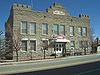
June 14, 1982 Roughly bounded by 5th St. and Miner, Spring, Crystal and Elliott Aves.
37°42′31″N 117°14′3″W / 37.70861°N 117.23417°WGoldfield Eureka County
Landmark name Image Date listed Location City or Town Summary 1 Eureka Historic District 
April 13, 1973 Along U.S. Route 50
39°30′47″N 115°57′53″W / 39.51306°N 115.96472°WEureka Humboldt County
Landmark name Image Date listed Location City or Town Summary 1 Adorno Station March 30, 1995 9535 U.S. Route 95, N.
41°27′28″N 117°48′2″W / 41.45778°N 117.80056°WWinnemucca 2 Applegate-Lassen Trail December 18, 1978 Trail extends from Rye Patch northwest to the state line
41°11′45″N 119°16′36″W / 41.19583°N 119.27667°WSulphur 3 Golconda School November 14, 1991 Junction of Morrison and 4th Sts.
40°57′10″N 117°29′17″W / 40.95278°N 117.48806°WGolconda 4 Humboldt County Courthouse 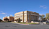
August 19, 1983 5th and Bridge Sts.
40°57′59″N 117°44′11″W / 40.96639°N 117.73639°WWinnemucca 5 Humboldt River Bridge March 30, 1995 N. Bridge St. over the Humboldt River
40°58′35″N 117°44′17″W / 40.97639°N 117.73806°WWinnemucca 6 Last Supper Cave December 6, 1975 Address Restricted Denio 7 Martin Hotel October 24, 2003 94 W. Railroad St.
40°58′15″N 117°43′50″W / 40.97083°N 117.73056°WWinnemucca 8 Micca House June 11, 1975 Bridge St.
41°29′34″N 117°31′54″W / 41.49278°N 117.53167°WParadise Valley 9 Paradise Valley Ranger Station June 19, 1996 355 S. Main St. in the Humboldt National Forest
41°29′20″N 117°32′1″W / 41.48889°N 117.53361°WParadise Valley 10 W.C. Record House August 27, 1980 146 W. 2nd St.
40°58′24″N 117°44′13″W / 40.97333°N 117.73694°WWinnemucca 11 Silver State Flour Mill May 13, 1976 7 miles east of Paradise Valley off State Route 8B
41°30′44″N 117°26′19″W / 41.51222°N 117.43861°WParadise Valley 12 US Post Office-Winnemucca Main February 28, 1990 4th and Melarkey Sts.
40°58′21″N 117°44′2″W / 40.9725°N 117.73389°WWinnemucca 13 Winnemucca Grammar School November 14, 1991 522 Lay St.
40°58′12″N 117°44′1″W / 40.97°N 117.73361°WWinnemucca 14 Winnemucca Hotel May 26, 2005 95 S. Bridge St.
40°58′28″N 117°44′15″W / 40.97444°N 117.7375°WWinnemucca Lander County
Landmark name Image Date listed Location City or Town Summary 1 Austin Cemetery August 14, 2003 Northern and southern sides of U.S. Route 50 near its junction with State Route 305
39°30′4″N 117°5′4″W / 39.50111°N 117.08444°WAustin 2 Austin City Hall August 14, 2003 90 South St.
39°29′33″N 117°4′15″W / 39.4925°N 117.07083°WAustin 3 Austin Historic District November 23, 1971 In Pony Canyon at the junction of State Route 8A and U.S. Route 50
39°29′37″N 117°4′15″W / 39.49361°N 117.07083°WAustin 4 Austin Masonic and Odd Fellows Hall August 14, 2003 105 Main St.
39°29′34″N 117°4′10″W / 39.49278°N 117.06944°WAustin 5 Austin Methodist Church August 14, 2003 135 Court St.
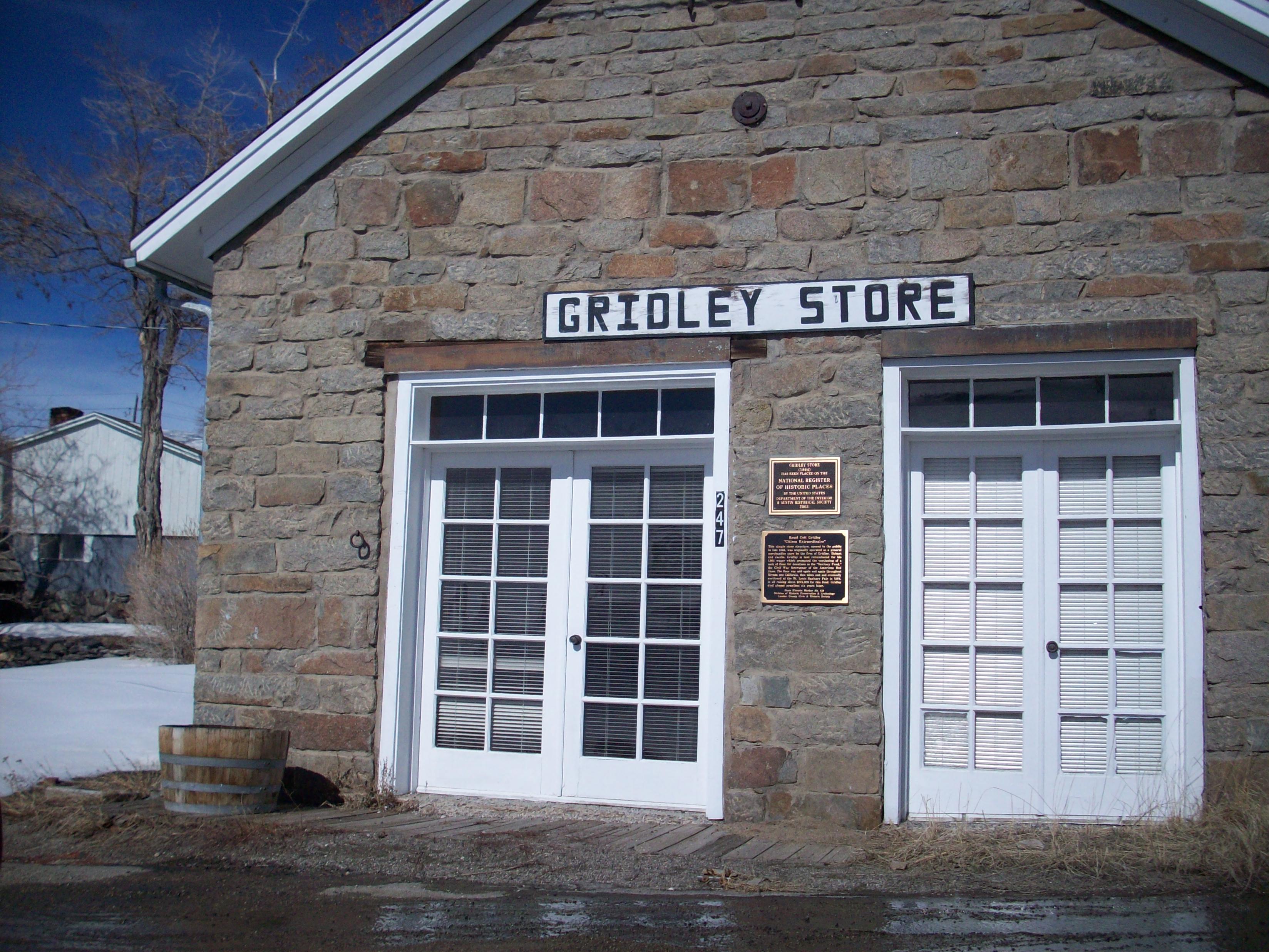
39°29′32″N 117°4′6″W / 39.49222°N 117.06833°WAustin 6 Gridley Store 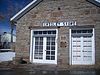
August 14, 2003 247 Water St.
39°29′23″N 117°3′44″W / 39.48972°N 117.06222°WAustin 7 Lander County Courthouse August 14, 2003 122 Main St.
39°29′31″N 117°4′11″W / 39.49194°N 117.06972°WAustin 8 Lander County High School July 20, 2000 130 6th St.
39°29′37″N 117°4′46″W / 39.49361°N 117.07944°WAustin 9 Nevada Central Turntable August 14, 2003 Off Austin Roping Arena Rd. on the southern side of U.S. Route 50
39°29′50″N 117°4′59″W / 39.49722°N 117.08306°WAustin 10 St. Augustine's Catholic Church August 14, 2003 113 Virginia St.
39°29′35″N 117°4′11″W / 39.49306°N 117.06972°WAustin 11 St. George's Episcopal Church August 14, 2003 156 Main St.
39°29′28″N 117°4′7″W / 39.49111°N 117.06861°WAustin 12 Stokes Castle 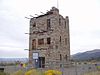
August 14, 2003 Along U.S. Route 50 west of Austin
39°29′37″N 117°4′45″W / 39.49361°N 117.07917°WAustin 13 Toquima Cave April 4, 2002 Humboldt-Toiyabe National Forest
39°11′13″N 116°47′12″W / 39.18694°N 116.78667°WAustin Lincoln County
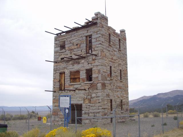
Landmark name Image Date listed Location City or Town Summary 1 1938 Lincoln County Courthouse 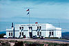
July 25, 2002 1 Main St.
37°56′13″N 114°27′2″W / 37.93694°N 114.45056°WPioche 2 Black Canyon Petroglyphs May 27, 1975 Address Restricted Alamo 3 Bristol Wells Town Site March 24, 1972 23 miles north of Pioche off U.S. Route 93
38°6′22″N 114°41′42″W / 38.10611°N 114.695°WPioche 4 Brown's Hall-Thompson's Opera House August 16, 1984 N. Main St.
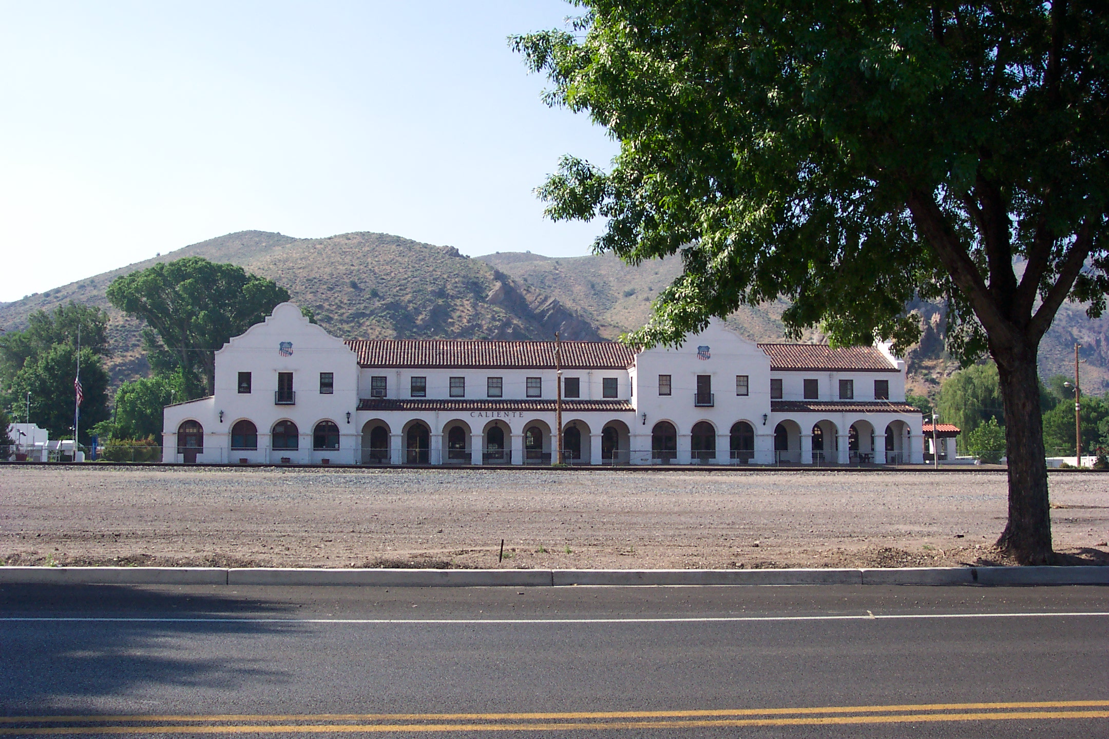
37°55′48″N 114°27′2″W / 37.93°N 114.45056°WPioche 5 Caliente Railroad Depot 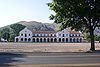
March 5, 1974 100 Depot Ave.
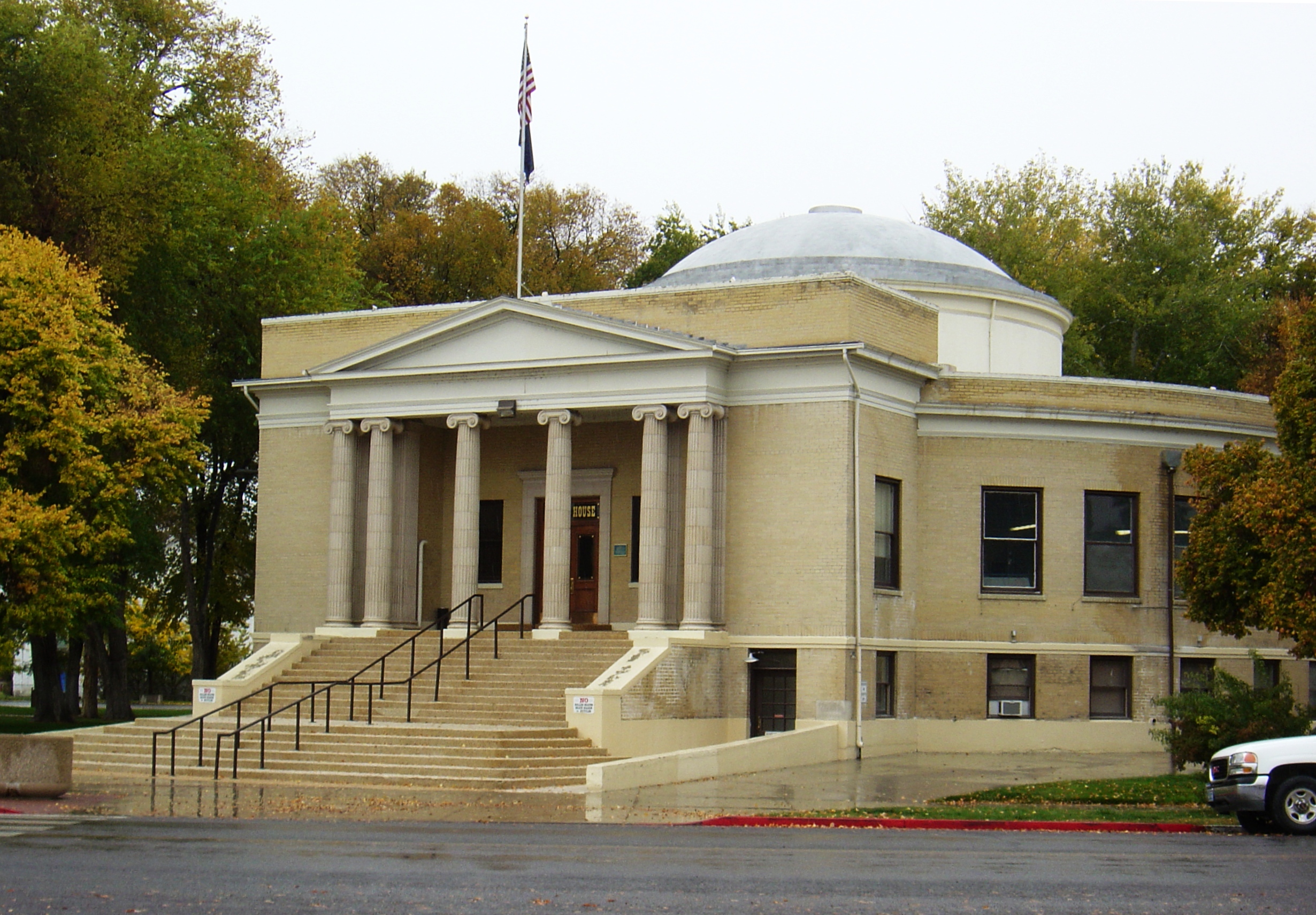
37°36′45″N 114°30′51″W / 37.6125°N 114.51417°WCaliente 6 Lincoln County Courthouse 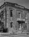
February 23, 1978 Lacour St.
37°55′54″N 114°27′7″W / 37.93167°N 114.45194°WPioche 7 Panaca Summit Archeological District March 19, 1990 Address Restricted Panaca 8 Smith Hotel-Cornelius Hotel June 10, 2008 100 Spring St. Caliente See this story. 9 White River Narrows Archeological District August 1, 1978 Address Restricted Hiko Lyon County
Landmark name Image Date listed Location City or Town Summary 1 Buckland Station December 29, 1997 7 miles south of the junction of U.S. Route 50 and State Route 95
39°17′40″N 119°15′2″W / 39.29444°N 119.25056°WStagecoach 2 East Walker River Petroglyph Site July 24, 1980 Address Restricted Yerington 3 Fernley and Lassen Railway Depot June 1, 2005 675 E. Main St.
39°36′21″N 119°14′12″W / 39.60583°N 119.23667°WFernley 4 Fernley Community Church May 16, 2003 80 S. Center St.
39°36′24″N 119°15′5″W / 39.60667°N 119.25139°WFernley 5 Fort Churchill 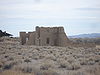
October 15, 1966 U.S. Route 95 Alternate, 8 miles south of U.S. Route 50
39°17′33″N 119°16′14″W / 39.2925°N 119.27056°WWeeks 6 I.O.O.F. Building, Mason Valley August 4, 1983 1 S. Main St.
38°59′2″N 119°10′11″W / 38.98389°N 119.16972°WYerington 7 Lyon County Courthouse 
March 24, 1983 31 S. Main St.
38°59′11″N 119°9′46″W / 38.98639°N 119.16278°WYerington 8 US Post Office-Yerington Main 
February 28, 1990 28 N. Main St.
38°59′17″N 119°9′42″W / 38.98806°N 119.16167°WYerington 9 Virginia City Historic District 
October 15, 1966 Virginia City and its environs
39°15′35″N 119°35′19″W / 39.25972°N 119.58861°WVirginia City Extends into Storey County 10 Yerington Grammar School August 16, 1984 112 N. California St.
38°59′3″N 119°9′32″W / 38.98417°N 119.15889°WYerington Mineral County
Landmark name Image Date listed Location City or Town Summary 1 Aurora 
July 30, 1974 Southwest of Hawthorne
38°17′21″N 118°53′57″W / 38.28917°N 118.89917°WHawthorne 2 Hawthorne USO Building February 18, 2005 950 E St.
38°31′55″N 118°37′20″W / 38.53194°N 118.62222°WHawthorne 3 Mineral County Courthouse January 29, 1982 551 C St.
38°31′31″N 118°37′23″W / 38.52528°N 118.62306°WHawthorne 4 Sixth Street School October 7, 1999 6th and C Sts.
38°32′22″N 118°37′31″W / 38.53944°N 118.62528°WHawthorne Nye County
Pershing County
Landmark name Image Date listed Location City or Town Summary 1 Applegate-Lassen Trail December 18, 1978 Trail extends from Rye Patch northwest to state line
41°11′45″N 119°16′36″W / 41.19583°N 119.27667°WBlack Rock Desert 2 Central Pacific Railroad Depot April 15, 2004 1005 W. Broadway Ave.
40°10′47″N 118°28′22″W / 40.17972°N 118.47278°WLovelock 3 Dave Canyon, Se'aquada, Table Mountain March 23, 2005 Address Restricted Lovelock 4 Leonard Rock Shelter October 15, 1966 Address Restricted Lovelock 5 Marzen House August 27, 1981 South of Lovelock
40°10′15″N 118°28′53″W / 40.17083°N 118.48139°WLovelock 6 Pershing County Courthouse 
May 13, 1986 400 Main St.
40°8′35″N 118°30′9″W / 40.14306°N 118.5025°WLovelock 7 Rye Patch Archeological Sites August 2, 1978 Address Restricted Lovelock 8 US Post Office-Lovelock Main February 28, 1990 390 Main St.
40°10′51″N 118°28′28″W / 40.18083°N 118.47444°WLovelock 9 Vocational-Agriculture Building October 24, 1991 1170 Elmhurst St.
40°14′46″N 118°32′57″W / 40.24611°N 118.54917°WLovelock Storey County
Landmark name Image Date listed Location City or Town Summary 1 Chollar Mansion August 5, 1993 565 S. D St.
39°18′10″N 119°39′3″W / 39.30278°N 119.65083°WVirginia City 2 Derby Diversion Dam 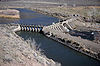
April 26, 1978 19 miles (30.4 km) east of Sparks on Interstate 80
39°35′9″N 119°26′49″W / 39.58583°N 119.44694°WSparks Extends into Washoe County 3 King-McBride Mansion 
September 4, 1998 26-28 S. Howard St.
39°18′38″N 119°39′3″W / 39.31056°N 119.65083°WVirginia City 4 Lagomarsino Petroglyph Site March 24, 1978 Address Restricted Virginia City 5 Marlette Lake Water System September 16, 1992 Roughly from Marlette Lake east to State Route 80
39°13′15″N 119°49′17″W / 39.22083°N 119.82139°WVirginia City 6 McCarthy House October 31, 1995 50 S. I St.
39°18′29″N 119°38′58″W / 39.30806°N 119.64944°WVirginia City 7 Parish House August 5, 1993 109 S. F St.
39°18′33″N 119°38′48″W / 39.30917°N 119.64667°WVirginia City 8 Piper's Opera House 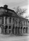
March 21, 1997 1, 3, and 5 N. B St.
39°18′39″N 119°39′6″W / 39.31083°N 119.65167°WVirginia City 9 Piper-Beebe House August 5, 1993 2 South A St.
39°18′40″N 119°38′59″W / 39.31111°N 119.64972°WVirginia City 10 Henry Piper House May 4, 2011 58 North B St.
39°18′43″N 119°35′59″W / 39.31194°N 119.59972°WVirginia City 11 C.J. Prescott House August 5, 1993 12 Hickey St.
39°18′12″N 119°39′1″W / 39.30333°N 119.65028°WVirginia City 12 Virginia City Historic District October 15, 1966 Virginia City and its environs
39°15′35″N 119°35′19″W / 39.25972°N 119.58861°WVirginia City Extends into Lyon County Washoe County
White Pine County
Landmark name Image Date listed Location City or Town Summary 1 American Legion Hall December 1, 1994 24 4th St.
39°24′13″N 114°46′42″W / 39.40361°N 114.77833°WMcGill 2 Baker Ranger Station 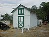
October 17, 1995 Great Basin National Park
39°0′53″N 114°7′23″W / 39.01472°N 114.12306°WBaker 3 Capital Theater August 5, 1993 460 Aultman St.
39°14′53″N 114°53′38″W / 39.24806°N 114.89389°WEly 4 Central Theater August 5, 1993 145 W. 15th Ave.
39°15′4″N 114°52′57″W / 39.25111°N 114.8825°WEly 5 East Ely Depot 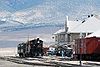
April 12, 1984 11th St.
39°15′33″N 114°52′6″W / 39.25917°N 114.86833°WEly 6 Ely L. D. S. Stake Tabernacle July 29, 1993 900 Aultman St.
39°14′56″N 114°53′16″W / 39.24889°N 114.88778°WEly 7 Fort Ruby October 15, 1966 Near Hobson on the western side of Ruby Lake Hobson 8 Fort Schellbourne February 23, 1972 43 miles north of Ely off U.S. Route 93 on State Route 2
39°47′21″N 114°41′6″W / 39.78917°N 114.685°WEly 9 Johnson Lake Mine Historic District 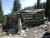
November 2, 1995 Great Basin National Park
38°56′32″N 114°17′44″W / 38.94222°N 114.29556°WBaker 10 Lehman Orchard and Aqueduct 
February 25, 1975 Great Basin National Park
39°0′22″N 114°13′5″W / 39.00611°N 114.21806°WBaker 11 McGill Drug Store 
August 17, 1998 11 4th St.
39°24′17″N 114°46′40″W / 39.40472°N 114.77778°WMcGill 12 Nevada Northern Railway East Ely Yards and Shops July 29, 1993 1100 Ave. A
39°15′36″N 114°52′7″W / 39.26°N 114.86861°WEly 13 Osceola (East) Ditch 
June 6, 1996 Starting 0.5 miles east of Grouse Canyon and running approximately 18 miles southeast to Lehman Creek in Great Basin National Park
39°1′48″N 114°17′26″W / 39.03°N 114.29056°WBaker 14 Rhodes Cabin 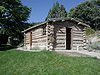
February 25, 1975 Great Basin National Park
39°0′20″N 114°13′9″W / 39.00556°N 114.21917°WBaker 15 Sunshine Locality January 30, 1978 Address Restricted Ely 16 US Post Office, Ely, Nevada October 7, 2005 415 5th St.
39°14′50″N 114°53′32″W / 39.24722°N 114.89222°WEly 17 Ward Charcoal Ovens 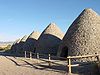
September 28, 1971 South of Ely off U.S. Route 6
39°2′16″N 114°50′49″W / 39.03778°N 114.84694°WEly 18 White Pine County Courthouse 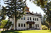
September 11, 1986 Campton St.
39°14′52″N 114°53′17″W / 39.24778°N 114.88806°WEly See also
References
- ^ The latitude and longitude information provided in this table was derived originally from the National Register Information System, which has been found to be fairly accurate for about 99% of listings. For about 1% of NRIS original coordinates, experience has shown that one or both coordinates are typos or otherwise extremely far off; some corrections may have been made. A more subtle problem causes many locations to be off by up to 150 yards, depending on location in the country: most NRIS coordinates were derived from tracing out latitude and longitudes off of USGS topographical quadrant maps created under the North American Datum of 1927, which differs from the current, highly accurate WGS84 GPS system used by Google maps. Chicago is about right, but NRIS longitudes in Washington are higher by about 4.5 seconds, and are lower by about 2.0 seconds in Maine. Latitudes differ by about 1.0 second in Florida. Some locations in this table may have been corrected to current GPS standards.
- ^ "National Register Information System". National Register of Historic Places. National Park Service. 2008-04-24. http://nrhp.focus.nps.gov/natreg/docs/All_Data.html.
- ^ "National Register of Historic Places: Weekly List Actions". National Park Service. http://www.cr.nps.gov/nr/nrlist.htm. Retrieved January 2, 2009.
- ^ Weekly List Actions, National Register of Historic Places website
- ^ The Marlette Lake Water System extends into three entities: Carson City, Storey County, and Washoe County; the Applegate-Lassen Trail extends into Humboldt, Pershing, and Washoe counties; the Derby Diversion Dam extends into Storey and Washoe counties and the Virginia City Historic District is in both Storey and Lyon counties.
- ^ "National Register of Historic Places: Weekly List Actions". National Park Service, United States Department of the Interior. Retrieved on November 10, 2011.
- ^ Location is derived from this Bureau of Land Management website; the NRIS lists it as "Address Restricted"
External links
- Nevada listings at nationalregisterofhistoricplaces.com
- Three Historic Nevada Cities: Carson City, Reno, Virginia City - details about more than 60 National Register properties
- Stewart Indian School
U.S. National Register of Historic Places Topics Lists by states Alabama • Alaska • Arizona • Arkansas • California • Colorado • Connecticut • Delaware • Florida • Georgia • Hawaii • Idaho • Illinois • Indiana • Iowa • Kansas • Kentucky • Louisiana • Maine • Maryland • Massachusetts • Michigan • Minnesota • Mississippi • Missouri • Montana • Nebraska • Nevada • New Hampshire • New Jersey • New Mexico • New York • North Carolina • North Dakota • Ohio • Oklahoma • Oregon • Pennsylvania • Rhode Island • South Carolina • South Dakota • Tennessee • Texas • Utah • Vermont • Virginia • Washington • West Virginia • Wisconsin • WyomingLists by territories Lists by associated states Other National Register of Historic Places in Nevada Carson City | Churchill | Clark | Douglas | Elko | Esmeralda | Eureka | Humboldt | Lander | Lincoln | Lyon | Mineral | Nye | Pershing | Storey | Washoe | White Pine
 State of Nevada
Topics - Delegations
- Geography
- Government
- History
- People
- Transportation
- Visitor attractions
Society - Crime
- Demographics
- Economy
- Education
- Politics
Regions - Black Rock Desert
- Eagle Valley
- Great Basin
- Lake Mead
- Lake Tahoe
- Las Vegas Valley
- Mojave Desert
- Pahranagat Valley
- Sierra Nevada
Metro areas - Las Vegas-Paradise
- Reno-Sparks
- Carson City
Counties Cities and
communities- Alamo
- Amargosa Valley
- Austin
- Baker
- Battle Mountain
- Beatty
- Boulder City
- Caliente
- Carlin
- Carson City
- Elko
- Ely
- Enterprise
- Eureka
- Fallon
- Fernley
- Gardnerville Ranchos
- Gerlach
- Goldfield
- Hawthorne
- Henderson
- Incline Village
- Las Vegas
- Laughlin
- Lovelock
- Mesquite
- Minden
- North Las Vegas
- Pahrump
- Paradise
- Pioche
- Primm
- Rachel
- Reno
- Spanish Springs
- Sparks
- Spring Creek
- Spring Valley
- Stateline
- Summerlin South
- Sun Valley
- Sunrise Manor
- Tonopah
- Virginia City
- West Wendover
- Winnemucca
- Whitney
- Winchester
- Yerington
Former counties Categories:- National Register of Historic Places in Nevada
- National Register of Historic Places lists by state
- Nevada-related lists
-


Wikimedia Foundation. 2010.