- Douglas County, Nevada
-
Douglas County, Nevada 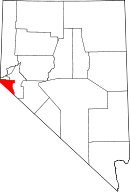
Location in the state of Nevada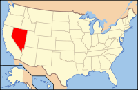
Nevada's location in the U.S.Founded 1861 Seat Minden Area
- Total
- Land
- Water
738 sq mi (1,911 km²)
710 sq mi (1,839 km²)
28 sq mi (73 km²), 3.77%PopulationEst.
- (2010)
- Density
46,997
57/sq mi (22/km²)Website www.douglascountynv.gov Douglas County is a county located in the northwestern part of the U.S. state of Nevada. As of 2000, the population was 41,259. As of 2010, the population was estimated to be 46,997.
Contents
History
Douglas County holds the first permanent settlement in Nevada. The town of Genoa was originally settled in 1851 by Mormon traders selling goods to settlers on their way to California. Named for Stephen A. Douglas, famous for his 1860 Presidential campaign and debates with Abraham Lincoln, Douglas County was one of the first nine counties formed in 1861 by the Nevada territorial legislature.
Law and government
The county seat is Minden, after having been moved from Genoa in 1915.
Various services run by the county include parks, law enforcement, road maintenance, building inspection, and the Minden-Tahoe Airport.
Fire protection and emergency medical services are provided by the Tahoe-Douglas Fire Protection District at the lake and the East Fork Fire and Paramedic Districts for the rest of the county.
Geography
Douglas County is in western Nevada in the western United States. Stretching from Carson Valley and running up into the Sierra Nevada, the county is bordered on the west by California, and contains about 13.2% of Lake Tahoe, which is split across the two states. Carson City, the state capital, lies to the north, and Lyon County to the east. The county also lies within the Greater Sacramento area.[1]
According to the U.S. Census Bureau, the county has a total area of 738 square miles (1,911.4 km2), of which 710 square miles (1,838.9 km2) is land and 28 square miles (72.5 km2) (3.77%) is water.
Major highways
 U.S. Route 50
 U.S. Route 395
 State Route 28
 State Route 88
 State Route 206
 State Route 207
 State Route 208
 State Route 756
Adjacent counties
- Carson City, Nevada - north
- Lyon County, Nevada - east
- Mono County, California - southeast
- Alpine County, California - south
- El Dorado County, California - west
- Placer County, California - northwest
National protected area
- Toiyabe National Forest (part)
Demographics
As of the census[2] of 2000, there were 41,259 people, 16,401 households, and 11,890 families residing in the county. The population density was 58 people per square mile (22/km²). There were 19,006 housing units at an average density of 27 per square mile (10/km²). The racial makeup of the county was 91.88% White, 0.31% Black or African American, 1.68% Native American, 1.25% Asian, 0.15% Pacific Islander, 2.54% from other races, and 2.19% from two or more races. 7.41% of the population were Hispanic or Latino of any race.
There were 16,401 households out of which 30.70% had children under the age of 18 living with them, 60.50% were married couples living together, 8.00% had a female householder with no husband present, and 27.50% were non-families. 20.70% of all households were made up of individuals and 6.60% had someone living alone who was 65 years of age or older. The average household size was 2.50 and the average family size was 2.88.
In the county the population was spread out with 24.00% under the age of 18, 5.50% from 18 to 24, 26.40% from 25 to 44, 28.90% from 45 to 64, and 15.20% who were 65 years of age or older. The median age was 42 years. For every 100 females there were 102.10 males. For every 100 females age 18 and over, there were 100.70 males.
The median income for a household in the county was $51,849, and the median income for a family was $57,092. Males had a median income of $40,436 versus $28,762 for females. The per capita income for the county was $27,288. About 5.80% of families and 7.30% of the population were below the poverty line, including 9.70% of those under age 18 and 5.30% of those age 65 or over.
Towns and population centers
- Gardnerville
- Gardnerville Ranchos
- Genoa
- Glenbrook
- Indian Hills
- Johnson Lane
- Kingsbury
- Minden
- Stateline
- Topaz Lake
- Zephyr Cove-Round Hill Village
Neighborhoods
- Buckeye
- Centerville
- Dresslerville
- East Valley
- Fish Springs
- Holbrook Junction
- Jack's Valley
- Johnson Lane
- Lake Village
- Lakeridge
- Lincoln Park
- Mottsville
- Mountain House
- Ruhenstroth
- Sheridan
- Skyland
- Summit Village
- Tahoe Village
- Topaz Ranch Estates
Education
Douglas County's education is managed by the Douglas County School District. It serves for all of Douglas County, having two main areas: Lake Tahoe & the Carson Valley. Douglas High School also serves most of the high school age students from Alpine County, California
Lake Tahoe
- George Whittell High School
- Zephyr Cove Elementary School
Carson Valley
- Douglas High School
- Carson Valley Middle School
- Pau-Wa-Lu Middle School
- Gardnerville Elementary School
- Minden Elementary School
- Jacks Valley Elementary School
- Piñion Hills Elementary School
- Gene L. Scarselli Elementary School
- C.C. Meneley Elementary School
Radio Stations in Douglas County
Movies filmed in Douglas County
- Smokin Aces
- Charley Varrick
- The Shootist
- Misery
- The Motel Life
Major industry in Douglas County
- Starbucks Roasting Plant
- GE
- Patmont Motor Werks
- The Bently Family of Companies
See also
References
- ^ "Table 2. Annual Estimates of the Population of Combined Statistical Areas: April 1, 2000 to July 1, 2009 (CBSA-EST2009-02)" (CSV). 2009 Population Estimates. United States Census Bureau, Population Division. 2010-03-23. http://www.census.gov/popest/metro/tables/2009/CBSA-EST2009-02.csv. Retrieved 2010-03-29.
- ^ "American FactFinder". United States Census Bureau. http://factfinder.census.gov. Retrieved 2008-01-31.
External links
- DouglasCountyNV.gov
- The Record Courier - Local Newspaper
- Carson Valley Chamber of Commerce & Visitors Authority
- Douglas County School District
- Carson Valley Area Weather

Placer County, California City of Carson City El Dorado County, California 
Lyon County  Douglas County, Nevada

Alpine County, California Mono County, California Municipalities and communities of Douglas County, Nevada CDPs 
Unincorporated
communitiesGenoa | Glenbrook | Mottsville | Sheridan
Greater Sacramento Counties Major City Cities
and
towns100k–200k25k–100kArden Arcade · Auburn · Carmichael · Citrus Heights · Davis · Folsom · Florin · Laguna · Lincoln · North Highlands · Orangevale · Parkway-South Sacramento · Rancho Cordova · Rocklin · West Sacramento · Woodland · Yuba City
10k–25kCameron Park · El Dorado Hills · Fair Oaks · Foothill Farms · Galt · Gardnerville Ranchos (NV) · Granite Bay · Grass Valley · La Riviera · Linda · Marysville · North Auburn · Olivehurst · Placerville · Rosemont · Rio Linda · South Lake Tahoe · South Yuba City · Truckee · Vineyard
Sub-regions Gold Country · Lake Tahoe · Sacramento Valley · Sierra Nevada · Yuba-Sutter Area
 State of Nevada
Topics - Delegations
- Geography
- Government
- History
- People
- Transportation
- Visitor attractions
Society - Crime
- Demographics
- Economy
- Education
- Politics
Regions - Black Rock Desert
- Eagle Valley
- Great Basin
- Lake Mead
- Lake Tahoe
- Las Vegas Valley
- Mojave Desert
- Pahranagat Valley
- Sierra Nevada
Metro areas - Las Vegas-Paradise
- Reno-Sparks
- Carson City
Counties Cities and
communities- Alamo
- Amargosa Valley
- Austin
- Baker
- Battle Mountain
- Beatty
- Boulder City
- Caliente
- Carlin
- Carson City
- Elko
- Ely
- Enterprise
- Eureka
- Fallon
- Fernley
- Gardnerville Ranchos
- Gerlach
- Goldfield
- Hawthorne
- Henderson
- Incline Village
- Las Vegas
- Laughlin
- Lovelock
- Mesquite
- Minden
- North Las Vegas
- Pahrump
- Paradise
- Pioche
- Primm
- Rachel
- Reno
- Spanish Springs
- Sparks
- Spring Creek
- Spring Valley
- Stateline
- Summerlin South
- Sun Valley
- Sunrise Manor
- Tonopah
- Virginia City
- West Wendover
- Winnemucca
- Whitney
- Winchester
- Yerington
Former counties Categories:- Nevada counties
- Douglas County, Nevada
- 1861 establishments


Wikimedia Foundation. 2010.