- Yakima, Washington
-
"Yakima" redirects here. For other uses, see Yakima (disambiguation).
Yakima — City — City of Yakima 

SealNickname(s): The Palm Springs of Washington Location of Yakima in Washington
Coordinates: 46°36′7″N 120°30′28″W / 46.60194°N 120.50778°W Country United States State Washington County Yakima Incorporated December 1, 1883 Government - Type Council-Manager - Manager Michael A. Morales - Mayor Micah Cawley (2010) - Asst Mayor Kathy Coffey (2010) Area - City 20.6 sq mi (53.4 km2) - Land 20.1 sq mi (67.7 km2) - Water 0.5 sq mi (1.2 km2) 2.33% Elevation 1,066 ft (325 m) Population (2010) - City 91,196 - Density 3,569.9/sq mi (1,378.0/km2) - Metro 261,102 Time zone PST (UTC-8) - Summer (DST) PDT (UTC-7) Zip Code 98901, 98902, 98903, 98904, 98907, 98908, 98909 Area code(s) 509 FIPS code 53-80010[1] GNIS feature ID 1509643[2] Website Official City Website Yakima (
 /ˈjækɨmɔː/ or /ˈjækɨmə/) is an American city southeast of Mount Rainier National Park and the county seat of Yakima County, Washington, United States, and the eighth largest city by population in the state itself. As of the 2010 census, the city had a total population of 91,196 and a metropolitan population of 243,231.[3] In addition, the unincorporated suburban areas of West Valley and Terrace Heights are considered a part of greater Yakima. With these cities included in the immediate area, population within 20 miles of the city is over 123,000.[4] According to the Washington State Office of Financial Management's July 1, 2008 estimate, the city has a population of 84,074.[5] Yakima is situated in the Yakima Valley, which is noted for being one of the best apple-producing areas in the world, a major wine region and produces approximately 75% of all hops grown in the USA.[6] The name originates from the Yakama Nation. The Yakama Indian Reservation is located to the south and southeast of the city of Yakima.
Contents
History
 Armistice Day on Yakima Avenue
The Yakama people were the first known inhabitants of the Yakima area, inhabiting the Yakima Valley. In 1805, the Lewis and Clark Expedition came to the area and discovered abundant wildlife and rich soil, prompting the settlement of homesteaders.[7] A Catholic Mission was established in Ahtanum, southwest of present-day Yakima, in 1847.[8] The arrival of settlers and their conflicts with the natives resulted in the Yakama Indian War of 1855. The U.S. Army established Fort Simcoe in 1856 near present-day White Swan as a response to the uprising. The Yakamas were defeated and relocated to the Yakama Indian Reservation. Yakima County was created in 1865. When bypassed by the Northern Pacific Railroad in December 1884, over 100 buildings were moved with rollers and horse teams to the nearby site of the depot. The new city was dubbed North Yakima and was officially incorporated and named the county seat on January 27, 1886. The name was changed to Yakima in 1918. Union Gap was the new name given to the original site of Yakima.
Geography
According to the United States Census Bureau, the city has a total area of 20.6 square miles (53 km2), of which, 20.1 square miles (52 km2) of it is land and 0.5 square miles (1.3 km2) of it (2.33%) is water. Yakima is 344.392 meters above mean sea level.
Yakima region
 Yakima, Washington as seen from the west.
The city of Yakima is located in the Upper Valley of Yakima County. The county is geographically divided by Ahtanum Ridge and Rattlesnake Ridge into two regions: the Upper (northern) and Lower (southern) valleys. Yakima is located in the more urbanized Upper Valley, and is the central city of the Yakima Metropolitan Statistical Area.
The cities of Selah and Union Gap lie immediately to the north and south of Yakima. In addition, the unincorporated suburban areas of West Valley and Terrace Heights are considered a part of greater Yakima. With these cities included in the immediate area, population within 20 miles of the city is over 123,000. Other nearby cities include Moxee, Tieton, Cowiche, Wiley City, Tampico, Gleed, and Naches in the Upper Valley, as well as Wapato, Toppenish, Zillah, Harrah, White Swan, Parker, Buena, Outlook, Granger, Mabton, Sunnyside, and Grandview in the Lower Valley. As of 2006, the estimated population of the metropolitan area is 233,105.
Bodies of water
The primary irrigation source for the Yakima Valley, the Yakima River, runs through Yakima from its source at Lake Keechelus in the Cascade Range to the Columbia River at Richland. In Yakima, the river is used for both fishing and recreation. A 10-mile (16 km) walking and cycling trail, a park, and a wildlife sanctuary are located at the river's edge.
The Naches River forms the northern border of the city. Several small lakes flank the northern edge of the city, including Myron Lake, Lake Aspen, Bergland Lake (private) and Rotary Lake (also known as Freeway Lake). These lakes are popular with fishermen and swimmers during the summer.
Climate
Yakima has a steppe climate (Köppen BSk) with a Mediterranean precipitation pattern. Winters are cold, with December the coolest month, with a mean temperature of 28.8 °F (−1.8 °C).[9] Snowfall occurs mostly in December and January, and averages 24.6 inches (62 cm).[9] There are 24 days per year in which the high does not surpass freezing, and 3.6 nights where the low reaches 0 °F (−17.8 °C) or lower.[9] Springtime warming is very gradual, with nighttime freezes ceasing by mid-May. Summer days are hot, reaching the mid to upper 80s °F (29-32 °C), but the diurnal range is very large, with lows falling into the upper 40s to low 50s °F (9-12 °C). Autumn cooling is very rapid, with freezes beginning in late September to early October. Due to the city's location in a rain shadow, precipitation, at an average of 8.26 inches (209.8 mm) annually, is low year-round,[9] but especially during summer. Extreme temperatures have ranged from −25 °F (−32 °C) in February 1950, to 110 °F (43 °C) in August 1971.[10]
Climate data for Yakima, Washington Month Jan Feb Mar Apr May Jun Jul Aug Sep Oct Nov Dec Year Record high °F (°C) 68
(20)69
(21)80
(27)92
(33)102
(39)105
(41)109
(43)110
(43)100
(38)88
(31)73
(23)67
(19)110
(43)Average high °F (°C) 37.7
(3.2)45.6
(7.6)56
(13)64.1
(17.8)72.4
(22.4)79.6
(26.4)87.2
(30.7)86.5
(30.3)77.6
(25.3)64.3
(17.9)47.7
(8.7)37.1
(2.8)63.0 Average low °F (°C) 20.5
(−6.4)24.7
(−4.1)28.9
(−1.7)33.2
(0.7)40
(4)46.2
(7.9)50.9
(10.5)50.1
(10.1)42.3
(5.7)32.9
(0.5)26.3
(−3.2)20.5
(−6.4)34.7 Record low °F (°C) −21
(−29)−25
(−32)−1
(−18)20
(−7)25
(−4)30
(−1)34
(1)35
(2)24
(−4)4
(−16)−13
(−25)−18
(−28)−25
(−32)Precipitation inches (mm) 1.17
(29.7)0.80
(20.3)0.70
(17.8)0.53
(13.5)0.51
(13)0.62
(15.7)0.22
(5.6)0.36
(9.1)0.39
(9.9)0.53
(13.5)1.05
(26.7)1.38
(35.1)8.26
(209.8)Snowfall inches (cm) 7.0
(17.8)3.3
(8.4)1.3
(3.3)0
(0)0
(0)0
(0)0
(0)0
(0)0
(0)0.2
(0.5)3.3
(8.4)9.5
(24.1)24.6
(62.5)Avg. precipitation days 9.4 7.7 6.9 5 5.6 4.8 2.6 2.7 3.5 4.5 8.8 9.4 70.9 Avg. snowy days 5.2 2.6 1.1 0 0 0 0 0 0 0.2 2.0 5.6 16.7 Source: NOAA,[9] The Weather Channel [10] Demographics
Main article: Demographics of YakimaHistorical populations Census Pop. %± 1890 1,535 — 1900 3,154 105.5% 1910 14,082 346.5% 1920 18,539 31.7% 1930 22,101 19.2% 1940 27,221 23.2% 1950 38,486 41.4% 1960 42,284 9.9% 1970 45,588 7.8% 1980 49,826 9.3% 1990 54,843 10.1% 2000 71,845 31.0% 2010 91,196 26.9% As of the census[1] of 2000, there were 71,845 people with 26,498 households, and 16,826 families residing in the city. The population density was 3,569.9 people per square mile (1,378.0/km²). There were 28,643 housing units at an average density of 1,423.2 per square mile (549.4/km²). The racial makeup of the city was 68.77% White, 33.70% Hispanic or Latino, 1.99% African American, 2.00% Native American, 1.20% Asian, 0.14% Pacific Islander, 21.97% from other races, and 3.92% from two or more races.
There were 26,498 households out of which 34.4% had children under the age of 18 living with them, 44.2% were married couples living together, 14.2% had a female householder with no husband present, and 36.5% were non-families. 30.3% of all households were made up of individuals and 14.0% had someone living alone who was 65 years of age or older. The average household size was 2.63 and the average family size was 3.29.
In the city the population was spread out with 29.4% under the age of 18, 10.8% from 18 to 24, 27.6% from 25 to 44, 18.2% from 45 to 64, and 14.0% who were 65 years of age or older. The median age was 31 years. For every 100 females there were 95.7 males. For every 100 females age 18 and over, there were 92.6 males.
The median income for a household in the city was $29,475, and the median income for a family was $34,798. Males had a median income of $29,647 versus $23,629 for females. The per capita income for the city was $15,920. About 17.1% of families and 22.4% of the population were below the poverty line, including 32.3% of those under age 18 and 12.0% of those age 65 or over.
Culture
Cultural activities and events take place throughout the year. The Yakima Valley Museum houses exhibits related to the region’s geology and history, a restored soda fountain, and periodic special exhibitions. Downtown Yakima’s historic Capitol Theatre and Seasons Performance Hall, as well as the West-side’s Allied Arts Center, present numerous musical and stage productions. The city is home to the Yakima Symphony Orchestra. The Yakima Area Arboretum is a botanical garden featuring species of both native and adapted non-native plants. Popular music tours, trade shows, and other large events are hosted at the Yakima SunDome in State Fair Park.
All America City Award
In 1994, the City of Yakima received the All-America City Award, given by the National Civic League. Ten U.S. cities receive this award per year.
Festivals
- Central Washington State Fair - at State Fair Park, held each fall in late September.
- Yakima Folklife Festival,[11] held the second week of July in Franklin Park.
- Yakima Farmer’s Market, on Sundays from May to October in Downtown Yakima.
- Fresh Hop Ale Festival,[12] each October in Downtown Yakima.
- Four-Play Hockey Tournament at the Yakima Ice Arena, held in February or March each year.
- Annual Rockin' New Year's Eve at the Millennium Plaza in front of the Capitol Theatre, held on New Year's Eve each year.
Sports
 The Sun Dome is the home to the Warriors.
- The Yakima Bears are a Northwest League (Class A minor league baseball) team that plays at Yakima County Stadium. The team was reestablished in 1990 after being inactive since 1966. It is currently an affiliate of the Arizona Diamondbacks.
- The Yakima Mavericks are a Minor League football team in the Pacific Football League and plays at Zaepfel Stadium.
- The Yakima Reds are a soccer team in the USL Premier Development League that plays at Marquette Stadium.
- The Yakima Valley Warriors, established in the 2009-2010 season, are an indoor football team in the American Indoor Football Association who play at the Yakima SunDome.
- The Yakima Beetles American Legion baseball team, 3-time World Champions.
Transportation
Roads and highways
 Welcome sign on I-82.
Interstate 82 is the primary way of reaching Yakima, but U.S. Route 12 crosses through the city from White Pass. U.S. Route 97 joins I-82 from Yakima for approximately 40 miles (64 km) north to Ellensburg. State Route 24 terminates at Yakima and is the primary means of reaching Moxee City and many of the area's agricultural areas to the east. State Route 821 terminates near Yakima and is also called Canyon Road because it passes through the Yakima River canyon. It is an alternate route to Ellensburg which bypasses the I-82 summit at Manastash Ridge.
Public transport
Yakima Transit services Yakima, Selah, and Terrace Heights.
Airport
Yakima's airport, McAllister Field, operates commercial air flights via Horizon Air to Seattle. Numerous private aircraft call the Yakima Airport home and several freight companies operate out of the airport. It is also a popular test site for military jets and Boeing Commercial Airplanes test flights. Located on the field is Cub Crafters, rebuilder of Piper Super Cubs for over 30 years, and a current FAR23 and Light Sport Aircraft manufacturer.
Economy
Yakima's growth in the 20th century was fueled primarily by agriculture. The Yakima Valley produces many fruit crops, including apples, peaches, pears, cherries, and melons. Many vegetables are also produced, including peppers, corn and beans. Many of the city's residents have come to the Valley out of economic necessity and to participate in the picking, processing, marketing and support services for the agricultural economy.
Largest employers in the Yakima area[13] Employer Type Persons employed 1. Yakima Valley Memorial Hospital Hospital 1,500 2. Yakima School District School district
(Education)1,453 3. Washington State Department of Social and Health Services State government
(Social services)1,400 4. Yakima County County government 1,200 5. Tree Top, Inc. Fruit processing 1,150 6. Yakima Regional Medical Center Hospital 841 7. City of Yakima Municipal government 711 8. Washington Beef, LLC Beef processing 620 9. Yakama Legends Casino Casino 619 10. Shields Bag & Printing Co. Printing/Packaging 575 11. Wal-Mart Department store 545 12. Borton & Sons Fruit & Cold Storage Fruit growing & shipping 524 13. Snokist Growers Cannery 521 14. Yakima Training Center United States Army
(Military)512 15. EPIC Social services 500 15. Washington State Department of Transportation State government 500 Downtown Yakima, along the retail hub of the region, has undergone many changes since the late 1990s. Three major department stores and an entire shopping mall that is now closed for business, have been replaced with Whirlpool Corporation and Adaptis call-centers and several hotels.
The retail core of the region has since shifted to the city of Union Gap, where a renovated shopping mall and other new retail businesses are flourishing. While some see big-box retail leaving the downtown area as a loss, others see it as an opportunity to recast the downtown area as a center for events, services, entertainment, and smaller, more personal shopping experiences. One part of this effort has been the Downtown Futures Initiative.[14] The DFI has provided for a street to storefront remodel along Yakima Avenue throughout the entire downtown core, and includes new pedestrian-friendly lighting, water fountains, planters, banner poles, new trees and hanging baskets, all of which complement the new paver-inlaid sidewalks.
The early 2000s have seen the return of the Sports Center Tavern, a local landmark, to Downtown Yakima, as well as the opening of The Hilton Garden Inn (built in the same location as one of the former anchor stores of the closed Yakima Mall), The Speakeasy Bar, Grill & Nightclub, Kana Winery, Donitelia Winery, Yakima Cellars Winery, Seasons Performance Hall, Essencia Bakery, De Siga Gallery, and The Barrel House. Developers have completed the Lofts condominiums in the former Bon Marche building, also once an anchor of the Yakima Mall.[15]
Events held downtown include Yakima Downtown New Year's Eve, a Cinco de Mayo celebration, Yakima Live music festival, Yakima Summer Kickoff Party, Fresh Hop Ale Fest,[12] a weekly Farmers' Market,[16] and the Hot Shots 3-on-3 Basketball Tournament.[17]
A bright spot in the economy of the Yakima Valley is the burgeoning wine industry, due in part to the Yakima Valley soil, which is very similar to the soil conditions of France. Over fifty wineries dot the Yakima Valley, covering more than 11,000 acres (45 km2).
The Japan Ground Self Defense Force conducts training annually in Yakima. Japanese soldiers train in Yakima because it allows for large-scale live fire maneuvers not available in Japan.
Tourism
In the early 2000's, the city of Yakima in conjunction with multiple city organizations has begun revitalization and preservation efforts in Downtown Yakima, formerly North Yakima. According to the City of Yakima, the Downtown Yakima Futures Initiative is in progress. This organization has tasked themselves with “making strategic public investments in sidewalks, lighting, landscaping. Those public investments will serve as economic development catalysts resulting in the further enhancement of the area by downtown business and property owners.” Out of four phases, one is completed. [1] Local businesses featuring regional produce, wines, and beers among other products are returning to the downtown area. These can be found at numerous restaurants and shops mainly on Front Street, Yakima Avenue, 1st Street and they include Track 29 across from the old Train Depot, the Barrel House Restaurant [2], Gilbert Cellars [3] located in the historic Lund Building as well as the historic Capitol Theater and Larson Buildings. [4] One tourist attraction is a pair of historic trolleys that operates each summer along five miles (8 km) of tracks of the former Yakima Valley Transportation Company through the Yakima Gap connecting Yakima and Selah. The Yakima Valley Trolleys organization was incorporated in 2001 to operate the railroad for the City of Yakima. Present and future generations are able to experience an early-American street railway almost exactly as it was 100 years ago and come to understand the important role transit held in developing the City of Yakima as well as the rest of the industrialized world. 2010
Education
The city of Yakima is served in the field of education by three K-12 public school districts, several private schools, and three post-secondary schools.
High schools
Public schools
There are five high schools in the Yakima School District.
- Davis High School, a 4A high school with about 2,100 students
- Eisenhower High School, a 4A high school with about 1,900 students
- Stanton Academy
- Yakima Online High School
- Yakima has a branch of the Christa McAuliffe Academy, which is a Washington ALE Public School ACHIEVE Online. It offers World-Wide K-12 on-line education from their offices in Yakima. Christa McAuliffe Academy was founded to honor the "first teacher in space", and the tragic loss of the Space Shuttle Challenger in 1986. Students and staff at Christa McAuliffe Academy are actively engaged in carrying on what Christa started: education that ventures beyond the normal boundaries and empowers the drive for discovery of things unknown. They salute Christa McAuliffe and Barbara Morgan, the teacher-turned-astronaut on the August 8, 2007, flight of the Space Shuttle Endeavour, as great role models.
Outside the city:
- West Valley High School, which is in the West Valley School District. It is a division 3A school with a total student population of just over 1,500.
- On the eastern side of the city, just east of Terrace Heights, is East Valley High School, which is in the East Valley School District. It is a 2A school with about 1,000 students in the student body.
Homeschooling
Yakima is home to over 250 homeschooling families, and CAPE, the Christian Association of Parent Education, established in 1981, is a 501c(3) nonprofit organization and the central resource group for several co-operative learning groups, as well as hosting an annual Family Learning Conference and field trips.
Yakima Organized Unschoolers, The Yakima chapter of Unschooling United is a support group for Unschooling families and welcomes unschoolers regardless of their religious affiliation.
Private schools
- La Salle High School, located in Union Gap, is a Catholic high school in the 1A division and enrolls about 200 students
- Riverside Christian School, located near East Valley High School, is a private K-12 Christian school. Riverside Christian is also a 2B school with around 200 students in grades 9-12.
- Yakima Adventist Christian School serves Kindergarten through 10th grade.
- St. Paul Cathedral School, is a private K-8 school with roughly 250 students.
- St. Joseph Marquette, is a private Pre-K-8th grade school. Has about the same number of students as St. Paul's.
- St. John of Kronstadt Orthodox School, is a private school.
- Oakridge Montessori school, serves 18 months through 8th grade.
- Westpark Christian Academy, serves Preschool-12th grade, with around 80 students.
Selah Covenant Christian School and Agapeland Preschool serve preschool-4th grade with around 100 students.
Post-secondary schools
Located in the middle of Yakima is the Yakima Valley Community College, otherwise known as YVCC. Yakima Valley Community College is one of the oldest community colleges in the state of Washington. Founded in 1928, the college has a long tradition of quality in teaching and in its commitment to students. Yakima Valley Community College is a public, two-year institution of higher education which is a part of one of the best comprehensive community college systems in the nation. As such, the college offers programs in adult basic education, English-as-a-second-language, lower division arts and sciences, professional and technical education, and community services. Yakima Valley Community College employs a talented and dedicated faculty whose primary interest is in delivering the best possible instruction to students.
Perry Technical Institute is a private, non-profit school of higher learning located in the city since 1939. Students there can learn trades such as Automotive Technology, Instrumentation, Information Technology, HVAC, Electrical, Graphic Design, Machining, Office Administration, Medical Coding, and Legal Assistant/Paralegal.
The Pacific Northwest University of Health Sciences was completed in 2008. The university is home for nine to eleven health science related colleges. The first college on the 42.5-acre (172,000 m2) campus is home to the first medical school approved in the Pacific Northwest in over sixty years and trains physicians with an osteopathic emphasis. The mission of the medical school is to train primary care physicians who are committed to serving the rural and underserved communities throughout the Pacific Northwest. The college is housed in a state-of-the-art 45,000-square-foot (4,200 m2) facility.[18] It opened in the fall of 2008.[19]
Media
Radio
- 88.5 FM - KYVT, College radio
- 89.5 FM - KSOH, Christian radio
- 89.9 FM - KQBE, Christian radio
- 90.3 FM - KNWY, National Public Radio
- 91.1 FM - KYPL, Christian radio
- 91.9 FM - KDNA, Noncommercial Spanish Language Public Radio
- 92.9 FM - KDBL, Country
- 94.5 FM - KATS, Active Rock
- 96.9 FM - KZTA, Regional Mexican
- 98.7 FM - KLES, Spanish Contemporary
- 99.3 FM - KQMY, Adult Contemporary
- 99.7 FM - KHHK, Rhythmic Contemporary Hit Radio
- 100.9 FM - KARY, Oldies
- 103.1 FM - KYKV, Christian Radio/klove
- 104.1 FM - KXDD, Country
- 105.7 FM - KRSE, 80's 90's and Now
- 107.1 FM - KNIG, Talkhi:)
- 107.3 FM - KFFM, Rhythmic Contemporary
- 930 AM - KYAK, Christian radio
- 980 AM - KBBO (AM), Talk radio
- 1020 AM - KYXE, Regional Mexican
- 1280 AM - KIT, Talk radio
- 1390 AM - KJOX, Sports radio
- 1460 AM - KUTI, Classic country
- 1610 AM - WQBV569, Traveler's Information Station
Television
- Channel 2 - KUNW-CA Univision
- Channel 12 - YES-TV,(YV-Tech TV Station)
- Channel 23 - KNDO, NBC
- Channel 29.1 - KIMA-TV, CBS
- Channel 29.2 - KIMA-DT2 , The CW
- Channel 35.1 - KAPP, ABC
- Channel 35.2 - KAPP-DT2, MyNetworkTV
- Channel 39.1 - KWYT, Azteca America
- Channel 39.2 - KWYT, Mexicanal
- Channel 39.3 - KWYT, Hispanavision
- Channel 41 - KCYU-LD, Fox
- Channel 47 - KYVE, PBS
Print
- Yakima Herald-Republic
- Yakima Business Journal
- Yakima Valley Business Times
- Yakima Family Times
- Viva, Yakima Valley's Hispanic Newspaper
Documentary
Notable current and former residents
- Oleta Adams, singer
- Jamie Allen, Seattle Mariners baseball player (1983)
- Mario Batali, Celebrity Chef
- Jerry Burling, Former KIMA-TV on-air announcer, Winner, National Prime Time Emmy Award (1977) [5]
- Raymond Carver, author
- Charles Carter, Olympic and Professional Boxer [6]
- Beverly Cleary, author
- Harlond Clift, Major League Baseball player (1934–45)
- Cary Conklin, NFL Football player (1992–1995)
- Garret Dillahunt, actor
- Dr. Dan Doornink, NFL football player (1978–1985)
- William O. Douglas, U.S. Supreme Court associate justice (1939–1975)
- Dave Edler, Former Major League Baseball Player, City of Yakima Mayor
- Tom Ewing, Former Host, "Bar 29 Ranch," KIMA-TV Western Program
- Scott Hatteberg, Major League Baseball player
- Bob Heironimus, alleged portrayer of Bigfoot in the infamous Patterson film
- Joe Hipp, Professional Boxing (former NABF Heavyweight Champion 1994)
- Damon Huard, NFL Football player (1998-Current)
- Robert Ivers, Film and TV star. Later newsman on KAPP and KNDO TV.
- Basil James, Jockey (won the 1942 Preakness)
- Sam Kinison, actor/comedian
- Keith Hunter Jesperson, serial killer
- Larry Knechtel, Grammy award winning musician
- Jake Kupp, NFL Football player (1964–1975) and 1969 Pro Bowl player
- Craig Kupp, NFL Football player (1991) Phoenix Cardinals
- Robert Lucas, Jr., Nobel prize winning economist
- Barbara La Marr, actor/writer
- Kyle MacLachlan, actor
- Debbie Macomber, author
- Phil Mahre, Olympics medal-winning skier and twin brother of Steve Mahre
- Steve Mahre, Olympic medal-winning skier and twin brother of Phil Mahre
- Mitch Meluskey, Major League Baseball player (1998–2003)
- James "Jimmy" Nolan, Jr., Former Host, "Uncle Jimmy's Clubhouse," KIMA-TV (1953–1978)
- Arvo Ojala, Hollywood actor and quick-draw artist
- Jim Pomeroy, Motocross racer, elected to AMA Hall of Fame in 1999.
- Gary Puckett, 1960s pop artist of Gary Puckett & The Union Gap
- Pete Rademacher, Olympic and Professional Boxer, Gold Medal, Heavyweight Division, 1956 Melbourne Olympics
- Will Sampson, actor/artist
- Kurt Schulz, NFL football player
- Brad Sinsel, Leader of the rock band TKO (band) (1977–2001)
- Mel Stottlemyre, Major League Baseball player for the Yankees, Mets and Astros
- Mel Stottlemyre, Jr., Major League Baseball player and son of Mel Stottlemyre Sr.
- Todd Stottlemyre, Major League Baseball player with the Blue Jays, Athletics and Cardinals, son of Mel Stottlemyre Sr. and brother of Mel Stottlemyre Jr.
- Taylor Stubblefield, collegiate football player, NCAA All-Time receptions leader and former pre-season NFL wide receiver for the Panthers and Rams.
- Thelma Johnson Streat Artist (1911–1959)
- Bob Wells, Major League Baseball player for the Mariners, Twins, and Phillies
- Christopher Wiehl, actor
- Lis Wiehl, author and legal analyst for the Fox News Channel
- Chief Yowlachie (birth name: Daniel Simmons) (1891–1966), Native American actor
- Don Mosebar, NFL Los Angeles/Oakland Raiders Center (1983-1995)
In popular culture
Due to its rather humorous-sounding name, Yakima has been used in a number of productions
- In an episode of Cheers, Eddie LeBec phones Carla Tortelli from the bus station in Yakima while touring with his ice show.
- In an episode of Seinfeld, Jerry, George, and Elaine are all at the diner, and Jerry mentions sarcastically that Elaine is dating a man from Yakima. The man was actually from Seattle.
- In the movie Extreme Days, the guys go to Yakima to visit Corey Ng's grandparents.
- In the movie Ray, one of Ray Charles' concerts takes place in Yakima.
- In the Kenan & Kel episode "Housesitter", Chris mentions going to (a fictional) "Yakima Springs" with his mother.
- In an episode of iCarly, Carly's grandfather comes to take her to his home in Yakima because he thinks that Carly's brother Spencer has not been responsible enough with her. The name of the city is not quite pronounced correctly in the episode.
- The first episode of the travel show Travel Scene Investigators was filmed in Yakima.
- A legendary Chicken-Wolf-Moose-Pig sighted in the Yakima Valley in 1978 (as stated on the side of the cereal box) known as the "Bigg Mixx" inspired Kellogg's cereal to design a brand "Bigg Mixx" cereal no longer in production (1990-91 only).
- Seattle's KING-TV (seen in Western Canada on Cable TV) has done many segments on the city and region with its Northwest Backroads show.
- In the 2006 movie "Outsourced" the lead character Todd Anderson, played by Josh Hamilton, says his parents live in Yakima.
Dr. Stenfan Bradley - Associate Professor of History and African American Studies at St. Louis University, MO.
Sister cities
References
- ^ a b "American FactFinder". United States Census Bureau. http://factfinder.census.gov. Retrieved 2008-01-31.
- ^ "US Board on Geographic Names". United States Geological Survey. 2007-10-25. http://geonames.usgs.gov. Retrieved 2008-01-31.
- ^ "U.S. Census Bureau Delivers Washington's 2010 Census Population Totals, Including First Look at Race and Hispanic Origin Data for Legislative Redistricting" (.xls). U.S. Census Bureau. 2011-02-23. http://www.census.gov/newsroom/releases/archives/2010_census/cb11-cn45.html. Retrieved 2011-03-26.
- ^ "State and City Quickfacts". U.S. Census Bureau. http://quickfacts.census.gov/qfd/states/53/5380010.html. Retrieved 2006-11-13.
- ^ "Official July 1, 2008 Population Estimates". Office of Financial Management. 2006-06-29. http://www.ofm.wa.gov/pop/april1/default.asp. Retrieved 2007-07-14.
- ^ "American Hop Museum". http://www.americanhopmuseum.org/history.htm. Retrieved 2009-03-05.
- ^ "City of Yakima History". City of Yakima. http://www.ci.yakima.wa.us/tour/history/. Retrieved 2006-12-28.
- ^ "St. Joseph's Mission, Ahtanum Valley, Tampico vicinity, Yakima County, WA". Historic American Buildings Survey/Historic American Engineering Record. http://memory.loc.gov/cgi-bin/ampage?collId=pphhdatapage&fileName=wa/wa0100/wa0127/data/hhdatapage.db&recNum=1&itemLink=D?hh:24:./temp/~pp_uYcR::. Retrieved 2007-01-11.
- ^ a b c d e "NCDC: U.S. Climate Normals". National Oceanic and Atmospheric Administration. July 2011. http://cdo.ncdc.noaa.gov/climatenormals/clim20/wa/459465.pdf. Retrieved 2010-05-15.
- ^ a b "Average Weather for Yakima, WA - Temperature and Precipitation". The Weather Channel. http://www.weather.com/weather/wxclimatology/monthly/graph/USWA0502. Retrieved 2010-05-15.
- ^ "Yakima Folklife Festival". http://www.yakimafolklife.org. Retrieved 2009-03-05.
- ^ a b "Fresh Hop Ale Festival". http://www.freshhopalefestival.com/. Retrieved 2009-03-05.
- ^ "The Yakima Economy". Greater Yakima Chamber of Commerce. Archived from the original on 2006-10-05. http://web.archive.org/web/20061005065104/http://www.yakima.org/custom2.asp?pageid=1940. Retrieved 2007-01-11.
- ^ "Downtown Futures Initiative". http://www.yakimafutures.com. Retrieved 2009-03-05.
- ^ Kellogg, Aaron (November 16, 2006). "Unused Mall To Become Upscale Apartments". KIMA news. http://www.kimatv.com/news/local/4663006.html. Retrieved 2007-02-03.
- ^ "Farmers' Market". http://www.yakimafarmersmarket.org/index.php. Retrieved 2009-03-05.
- ^ "Hot Shots 3-on-3 Basketball Tournament". http://www.yakimahotshots.org/. Retrieved 2009-03-05.
- ^ "New osteopathic school planned for Yakima". Puget Sound Business Journal. April 14, 2005. http://www.bizjournals.com/seattle/stories/2005/04/11/daily27.html. Retrieved 2007-02-03.
- ^ "Pacific Northwest University of Health Sciences". http://www.pnwu.org. Retrieved 2007-12-08.
Further reading
- Lyman, William Denison (1919). History of the Yakima Valley, Washington : comprising Yakima, Kittitas, and Benton counties. S.J. Clarke.Available online through the Washington State Library's Classics in Washington History collection
External links
- Official City Website
- Official Visitors and Convention Bureau
- Photographs of the area from the library and local museum presented online
- Committee for Downtown Yakima
Coordinates: 46°36′7″N 120°30′28″W / 46.60194°N 120.50778°W
Municipalities and communities of Yakima County, Washington County seat: Yakima Cities 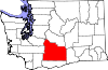
Towns CDPs Ahtanum | Eschbach | Gleed | Satus | Summitview | Terrace Heights | White Swan
Unincorporated
communitiesIndian reservation Footnotes ‡This populated place also has portions in an adjacent county or counties
Categories:- Cities in Washington (state)
- Yakima, Washington
- Populated places in Yakima County, Washington
- County seats in Washington (state)
- Populated places established in 1847


Wikimedia Foundation. 2010.