- National Oceanic and Atmospheric Administration
-
National Oceanic and Atmospheric Administration NOAA 
Agency overview Formed October 3, 1970 Jurisdiction Federal government of the United States Headquarters Silver Spring, MD Annual budget US$4.5 billion (2009)
US$4.9 billion (est. 2010)
US$5.6 billion (est. 2011)Agency executive Jane Lubchenco, Administrator Parent agency Department of Commerce Website noaa.gov The National Oceanic and Atmospheric Administration (NOAA), pronounced /ˈno(ʊ).ə/, like "noah", is a scientific agency within the United States Department of Commerce focused on the conditions of the oceans and the atmosphere. NOAA warns of dangerous weather, charts seas and skies, guides the use and protection of ocean and coastal resources, and conducts research to improve understanding and stewardship of the environment. In addition to its civilian employees, NOAA research and operations are supported by 300 uniformed service members who make up the NOAA Commissioned Officer Corps. The current Under Secretary of Commerce for Oceans and Atmosphere at the Department of Commerce, and the agency's Administrator, is Dr. Jane Lubchenco, nominated by President Barack Obama and confirmed by the United States Senate on March 19, 2009.[1]
Vision, mission, and goals
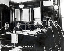 National Weather Service meteorologists preparing a forecast, early 20th century
NOAA's strategic vision is "an informed society that uses a comprehensive understanding of the role of the oceans, coasts, and atmosphere in the global ecosystem to make the best social and economic decisions."
The agency's mission is "to understand and predict changes in the Earth's environment and conserve and manage coastal and marine resources to meet our nation's economic, social, and environmental needs."
In support of its vision and mission, NOAA has four goals to guide its suite of operations. Each goal corresponds to activities focusing on ecosystems, climate, weather and water, and commerce and transportation. Specifically, NOAA operates to:
- Ensure the sustainable use of resources and balance competing uses of coastal and marine ecosystems, recognizing both their human and natural components.
- Understand changes in climate, including global climate change and the El Niño phenomenon, to ensure that Americans can plan and respond properly.
- Provide data and forecasts for weather and water cycle events, including storms, droughts, and floods.
- Provide weather, climate, and ecosystem information to make sure individual and commercial transportation is safe, efficient, and environmentally sound.
Purpose and function
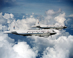 Two NOAA WP-3D Orions.
NOAA plays several specific roles in society, the benefits of which extend beyond the US economy and into the larger global community:
- A Supplier of Environmental Information Products. NOAA supplies information to its customers and partners pertaining to the state of the oceans and the atmosphere. This is clearly manifest in the production of weather warnings and forecasts through the National Weather Service, but NOAA's information products extend to climate, ecosystems, and commerce as well.
- A Provider of Environmental Stewardship Services. NOAA is also the steward of U.S. coastal and marine environments. In coordination with federal, state, local, tribal, and international authorities, NOAA manages the use of these environments, regulating fisheries and marine sanctuaries as well as protecting threatened and endangered marine species.
- A Leader in Applied Scientific Research. NOAA is intended to be a source of accurate and objective scientific information in the four particular areas of national and global importance identified above: ecosystems, climate, weather and water, and commerce and transportation.
Recognizing that it is essential that we understand the challenges that we face as part of the Earth system in order to create appropriate solutions, NOAA conducts an end-to-end sequence of activities, beginning with scientific discovery and resulting in a number of critical environmental services and products. The five "fundamental activities" are:
- Monitoring and observing Earth systems with instruments and data collection networks.
- Understanding and describing Earth systems through research and analysis of that data.
- Assessing and predicting the changes of these systems over time.
- Engaging, advising, and informing the public and partner organizations with important information.
- Managing resources for the betterment of society, economy and environment.
History and organizational structure
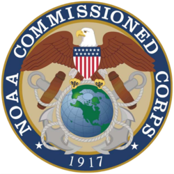 Seal of the NOAA Commissioned Corps
NOAA was formed on October 3, 1970, after Richard Nixon proposed creating a new department to serve a national need "… for better protection of life and property from natural hazards … for a better understanding of the total environment … [and] for exploration and development leading to the intelligent use of our marine resources …" NOAA formed a conglomeration of three existing agencies that were among the oldest in the federal government. They were the United States Coast and Geodetic Survey, formed in 1807; the Weather Bureau, formed in 1870; and the Bureau of Commercial Fisheries, formed in 1871. NOAA was established within the Department of Commerce via the Reorganization Plan No. 4 of 1970. With its ties to the United States Coast and Geodetic Survey, NOAA celebrated 200 years of service in 2007.
NOAA works toward its mission through six major line offices, in addition to more than a dozen staff offices:[2]
Line Offices
- The National Environmental Satellite, Data and Information Service (NESDIS)
- The National Marine Fisheries Service (NMFS)
- The National Ocean Service (NOS)
- The National Weather Service (NWS)
- Office of Oceanic and Atmospheric Research (OAR)
- Office of Program Planning and Integration (PPI)
Staff Offices
- Office of the Federal Coordinator for Meteorology
- Office of Marine and Aviation Operations
- NOAA Central Library
NOAA Corps
NOAA research and operational activities are supported by a uniformed service, the NOAA Corps. They are a commissioned officer corps of men and women who operate NOAA ships and aircraft, and serve in scientific and administrative posts.
National Weather Service (NWS)
 Seal of the National Weather ServiceMain article: National Weather Service
The National Weather Service (NWS) is tasked with providing "weather, hydrologic, and climate forecasts and warnings for the United States, its territories, adjacent waters and ocean areas, for the protection of life and property and the enhancement of the national economy." This is done through a collection of national and regional centers, and more than 120 local weather forecast offices (WFOs). They are charged with issuing weather forecasts, advisories, watches, and warnings on a daily basis. They issue more than 734,000 weather and 850,000 river forecasts, and more than 45,000 severe weather warnings annually. NOAA data is also relevant to the issues of global warming and ozone depletion. The NWS operates NEXRAD, a nationwide network of Doppler weather radars which can detect precipitation and their velocities. Many of their products are broadcast on NOAA Weather Radio, a network of radio transmitters that broadcasts weather forecasts, severe weather statements, watches and warnings 24 hours a day.
National Ocean Service (NOS)
Main article: National Ocean ServiceThe National Ocean Service (NOS), part of the National Oceanic and Atmospheric Administration within the U.S. Department of Commerce, is focused on ensuring that ocean and coastal areas are safe, healthy, and productive. NOS scientists, natural resource managers, and specialists serve America by ensuring safe and efficient marine transportation, promoting innovative solutions to protect coastal communities, and conserving marine and coastal places.
The National Ocean Service is composed of program offices, programs, and staff offices:
Program Offices
- Center for Operational Oceanographic Products and Services (CO-OPS)
- NOAA Coastal Services Center (CSC)
- National Centers for Coastal Ocean Science (NCCOS)
- Office of Coast Survey (OCS)
- Office of National Geodetic Survey (NGS)
- Office of National Marine Sanctuaries (ONMS)
- Office of Ocean and Coastal Resource Management (OCRM)
- Office of Response and Restoration (OR&R)
Programs
- NOAA Integrated Ocean Observing System (IOOS) Program
Staff Offices
- International Program Office (IPO)
- Management and Budget Office (M&B)
National Environmental Satellite, Data, and Information Service (NESDIS)
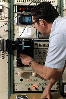 NOAA engineer at work
The National Environmental Satellite, Data, and Information Service (NESDIS) was created by NOAA to operate and manage the United States environmental satellite programs, and manage the data gathered by the NWS and other government agencies and departments. Data collected by the NWS, U.S. Navy, U.S. Air Force, the Federal Aviation Administration, and meteorological services around the world, are housed at the National Climatic Data Center in Asheville, North Carolina. NESDIS also operates the National Geophysical Data Center (NGDC) in Boulder, Colorado, the National Oceanographic Data Center (NODC) in Silver Spring, Maryland, the National Snow and Ice Data Center (NSIDC) and the National Coastal Data Development Center (NCDDC) which are used internationally by environmental scientists.
NESDIS also runs the:
- Office of Systems Development (OSD)
- Office of Satellite Operations (OSO)
- Office of Satellite Data Processing & Distribution (OSDPD)
- Satellite Applications and Research (STAR) formerly the Office of Research & Applications
- Joint Polar Satellite System Program Office
- GOES-R Program Office
- International & Interagency Affairs Office
- Office of Space Commercialization
The service operates and manages many geosynchronous satellites and polar orbiting satellites. In 1960 TIROS-1, NOAA's first owned and operated geostationary satellite was launched. In 1983 NOAA assumed operational responsibility for LANDSAT satellite system. In 1984 the Tropical Ocean-Global Atmosphere program (TOGA) program began.
In 1977 the Pacific Marine Environmental Laboratory (PMEL) deployed the first successful moored equatorial current meter – the beginning of the Tropical Atmosphere/Ocean (TAO) array. In 1979 NOAA's first polar-orbiting environmental satellite was launched.
Current operational satellites include: NOAA-15, NOAA-16, NOAA-17, NOAA-18 and NOAA-19 (launched 2/6/2009).
National Marine Fisheries Service (NMFS)
Main article: National Marine Fisheries ServiceFisheries, which was initiated in 1871 to protect, study, manage and restore fish. The NMFS has a marine fisheries research lab in Woods Hole, Massachusetts and is home to one of NOAA's five fisheries science centers.
Its law enforcement agency is the National Oceanic and Atmospheric Administration Fisheries Office for Law Enforcement based in Silver Spring, Maryland.
Office of Oceanic and Atmospheric Research (OAR)
Main article: Office of Oceanic and Atmospheric ResearchNOAA's research, conducted through the Office of Oceanic and Atmospheric Research (OAR), is the driving force behind NOAA environmental products and services that protect life and property and promote economic growth. Research, conducted in OAR laboratories and by extramural programs, focuses on enhancing our understanding of environmental phenomena such as tornadoes, hurricanes, climate variability, solar flares, changes in the ozone, air pollution transport and dispersion,[3][4] El Niño/La Niña events, fisheries productivity, ocean currents, deep sea thermal vents, and coastal ecosystem health. NOAA research also develops innovative technologies and observing systems.
The NOAA Research network consists of 7 internal research laboratories, extramural research at 30 Sea Grant university and research programs, six undersea research centers, a research grants program through the Climate Program Office, and 13 cooperative institutes with academia. Through NOAA and its academic partners, thousands of scientists, engineers, technicians, and graduate students participate in furthering our knowledge of natural phenomena that affect the lives of us all.
The Air Resources Laboratory (ARL) is one of the laboratories in the Office of Oceanic and Atmospheric Research. It studies processes and develops models relating to climate and air quality, including the transport, dispersion, transformation and removal of pollutants from the ambient atmosphere. The emphasis of the ARL's work is on data interpretation, technology development and transfer. The specific goal of ARL research is to improve and eventually to institutionalize prediction of trends, dispersion of air pollutant plumes, air quality, atmospheric deposition, and related variables.
National Geodetic Survey
Main article: U.S. National Geodetic SurveyThe National Geodetic Survey is the primary surveying organization in the United States.
National Integrated Drought Information System
Main article: National Integrated Drought Information SystemNOAA is the lead federal agency for the National Integrated Drought Information System (NIDIS).
Program Planning and Integration (PPI)
The Office of Program Planning and Integration was established in June 2002 as the focus for a new corporate management culture at NOAA. PPI was created to address the needs to:
- Foster strategic management among NOAA Line and Staff Offices, Goal Teams, Programs, and Councils,
- Support planning activities through greater opportunities for active participation of employees, stakeholders, and partners,
- Build decision support systems based on the goals and outcomes set in NOAA's strategic plan, and
- Guide managers and employees on program and performance management, the National Environmental Policy Act, and socioeconomic analysis.
Intergovernmental Panel on Climate Change
Since 2001 the organization has hosted the senior staff and recent chair, Susan Solomon, of the Intergovernmental Panel on Climate Change's working group on climate science.[5]
Flag
 The National Oceanic and Atmospheric Administration flag, flown as a distinguishing mark by all commissioned NOAA ships.
The NOAA flag is a modification of the flag of one of its predecessor organizations, the United States Coast and Geodetic Survey. The Coast and Geodetic Survey's flag, authorized in 1899 and in use until 1970, was blue, with a white circle centered in it and a red triangle centered within the circle. It symbolized the use of triangulation in surveying, and was flown by ships of the Survey.
When NOAA was established in 1970 and the Coast and Geodetic Survey's assets became a part of NOAA, NOAA based its own flag on that of the Coast and Geodetic Survey. The NOAA flag is in essence the Coast and Geodetic Survey flag, with the NOAA logo—a circle divided by the silhouette of a seabird into an upper dark blue and a lower light blue section, but with the "NOAA" legend omitted—centered within the red triangle. NOAA ships in commission display the NOAA flag; those with only one mast fly it immediately beneath the ship's commissioning pennant or the personal flag of a civilian official or flag officer if one is aboard the ship, while multimasted vessels fly it at the masthead of the forwardmost mast.[6] NOAA ships fly the same ensign as United States Navy ships but fly the NOAA flag as a distinguishing mark to differentiate themselves from Navy ships.
See also
- Robert Ballard
- Center for Environmental Technology (CET)
- Endangered Species Act
- Federation of Earth Science Information Partners (ESIP Federation)
- Marine Mammal Protection Act
- National Oceanic and Atmospheric Administration Commissioned Corps
- Minerals Management Service
- NOAA's Environmental Real-time Observation Network
- NOAA's Virtual World Program
- Volcanic Ash Advisory Center
- Weather Modification Operations and Research Board
- Office of Naval Research
- United States Naval Research Laboratory
- University-National Oceanographic Laboratory System
- List of auxiliaries of the United States Navy
- Center for Ocean Solutions
References
- ^ U.S. Senate: Nominations Confirmed. Accessed March 21st, 2009.
- ^ NOAA Organizations
- ^ Turner, D.B. (1994). Workbook of atmospheric dispersion estimates: an introduction to dispersion modeling (2nd Edition ed.). CRC Press. ISBN 1-56670-023-X. CRCpress.com
- ^ Beychok, M.R. (2005). Fundamentals Of Stack Gas Dispersion (4th Edition ed.). author-published. ISBN 0-9644588-0-2. www.air-dispersion.com
- ^ Pearce, Fred, The Climate Files: The Battle for the Truth about Global Warming, (2010) Guardian Books, ISBN 978-0-85265-229-9, p. XVIII.
- ^ Sea Flags: National Oceanic and Atmospheric Administration
External links
Independent agencies Agriculture Commerce National Institute of Standards and Technology (NIST), National Oceanic and Atmospheric Administration (NOAA)Defense Defense Advanced Research Projects Agency (DARPA), Army Research Laboratory (ARL), Naval Research Laboratory (NRL), Office of Naval Research (ONR), Air Force Research Laboratory (AFRL), Coast Guard Research & Development Center (CG RDC)Energy Office of Science (DOE SC), Advanced Research Projects Agency-Energy (ARPA-E), National LaboratoriesHealth and Human Services Homeland Security Interior Veterans Affairs Veterans Health Administration Office of Research and Development (ORD)Policy-making bodies United States government agencies involved in environmental science United States Environmental Protection Agency • National Aeronautics and Space AdministrationDepartment of the Interior Department of Commerce National Oceanic and Atmospheric Administration • National Weather Service • National Ocean Service • National Geodetic Survey • National Marine Fisheries Service • Office of Oceanic and Atmospheric ResearchDepartment of Energy Energy Efficiency and Renewable Energy • Energy Information Administration • Federal Energy Regulatory Commission • Biological and Environmental Research • Office of Environmental ManagementDepartment of Agriculture Farm Service Agency • Foreign Agricultural Service • Risk Management Agency • Food Safety and Inspection Service • Forest Service • Natural Resources Conservation Service • Rural Business-Cooperative Service • Office of Community Development • Rural Housing Service • Rural Utilities Service • Food and Nutrition Service • Center for Nutrition Policy and Promotion • Agricultural Marketing Service • Animal and Plant Health Inspection Service • Grain Inspection, Packers and Stockyards Administration • Agricultural Research Service • Cooperative State Research, Education, and Extension Service • Economic Research Service • National Agricultural Statistics Service • Agricultural Stabilization and Conservation ServiceDepartment of Health
and Human ServicesCategories:- National Oceanic and Atmospheric Administration
- Satellite operators
- Government agencies established in 1970
- United States Department of Commerce agencies
- Environmental data


Wikimedia Foundation. 2010.