- British Columbia
-
British Columbia
Colombie-Britannique (French)

Flag Coat of arms Motto: Latin: Splendor sine occasu
(English: Splendour without diminishment)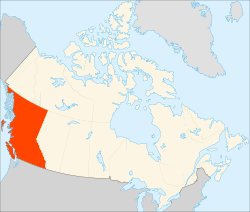
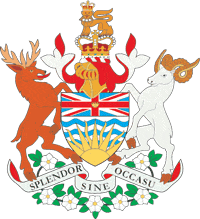
Capital Victoria Largest city Vancouver Largest metro Metro Vancouver Official languages English (de facto, not de jure) Demonym British Columbian[1] Government Type Constitutional monarchy Lieutenant-Governor Steven Point Premier Christy Clark (BC Liberal) Legislature Legislative Assembly of British Columbia Federal representation in Canadian parliament House seats 36 Senate seats 6 Confederation 20 July 1871 (7th) Area Ranked 5th Total 944,735 km2 (364,764 sq mi) Land 925,186 km2 (357,216 sq mi) Water (%) 19,549 km2 (7,548 sq mi) (2.1%) Population Ranked 3rd Total (2010) 4,510,858 (est.)[2] Density 4.7 /km2 (12 /sq mi) GDP Ranked 4th Total (2009) C$191.006 billion[3] Per capita C$41,689 (7th) Abbreviations Postal BC ISO 3166-2 CA-BC Time zone UTC−8 & −7 Postal code prefix V Flower Pacific Dogwood Tree Western Red Cedar Bird Steller's Jay Website www.gov.bc.ca Rankings include all provinces and territories British Columbia
 i/ˌbrɪtɪʃ kəˈlʌmbiə/ (B.C. or BC) (French: la Colombie-Britannique, C.-B.) is the westernmost of Canada's provinces and is known for its natural beauty, as reflected in its Latin motto, Splendor sine occasu ("Splendour without Diminishment"). Its name was chosen by Queen Victoria in 1858. In 1871, it became the sixth province of Canada.
The capital of British Columbia is Victoria, the fifteenth largest metropolitan region in Canada. The largest city is Vancouver, the third-largest metropolitan area in Canada, the largest in Western Canada, and the third-largest in the Pacific Northwest. In 2009, British Columbia had an estimated population of 4,419,974 (about two and a half million of whom were in Greater Vancouver). The province is currently governed by the BC Liberal Party, led by Premier Christy Clark, who became leader as a result of the party election on February 26, 2011.
British Columbia's economy is largely resource-based. It is the endpoint of transcontinental highways and railways and the site of major Pacific ports, which enable international trade. Because of its mild weather, and despite the fact that less than 5% of its land is arable, the province is agriculturally rich, particularly in the Fraser and Okanagan Valleys. Its climate encourages outdoor recreation and tourism, though its economic mainstay has long been resource extraction, principally logging and mining.
Contents
Etymology
The province's name was chosen by Queen Victoria when the Colony of British Columbia, i.e. "the Mainland", became a British colony in 1858.[4] It refers to the Columbia District, the British name for the territory drained by the Columbia River, in southeastern British Columbia, which was the namesake of the pre-Oregon Treaty Columbia Department of the Hudson's Bay Company. Queen Victoria chose British Columbia to distinguish what was the British sector of the Columbia District from that of the United States ("American Columbia" or "Southern Columbia"), which became the Oregon Territory in 1848 as a result of the treaty.
Geography
Main article: Geography of British Columbia British Columbia's geography is epitomized by the variety and intensity of its physical relief, which has defined patterns of settlement and industry since colonization.
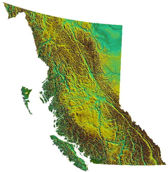
British Columbia is bordered by the Pacific Ocean on the west, by the U.S. state of Alaska on the northwest as well as parts of the west, on the north by the Yukon and the Northwest Territories, on the east by the province of Alberta, and on the south by the U.S. states of Washington, Idaho, and Montana. The current southern border of British Columbia was established by the 1846 Oregon Treaty, although its history is tied with lands as far south as California. British Columbia's land area is 944,735 square kilometres (364,800 sq mi). British Columbia's rugged coastline stretches for more than 27,000 kilometres (17,000 mi), and includes deep, mountainous fjords and about six thousand islands, most of which are uninhabited.
British Columbia's capital is Victoria, located at the southeastern tip of Vancouver Island. The province's most populous city is Vancouver, which is not on Vancouver Island but rather is located in the southwest corner of the mainland (an area often called the Lower Mainland). Other major cities include Surrey, Burnaby, Coquitlam, Richmond, Delta, and New Westminster in the Lower Mainland; Abbotsford, Pitt Meadows, Maple Ridge and Langley in the Fraser Valley; Nanaimo on Vancouver Island; and Kelowna and Kamloops in the Interior. Prince George is the largest city in the northern part of the province, while a village northwest of it, Vanderhoof, is near the geographic centre of the province.[5]
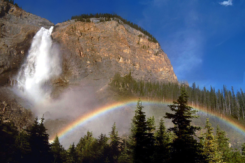
The Coast Mountains and the Inside Passage's many inlets provide some of British Columbia's renowned and spectacular scenery, which forms the backdrop and context for a growing outdoor adventure and ecotourism industry. Seventy-five percent of the province is mountainous (more than 1,000 metres (3,300 ft) above sea level); 60% is forested; and only about 5% is arable.
The Okanagan area is one of several wine-growing regions in Canada and also produces ciders; other wine regions in British Columbia include the Cowichan Valley on Vancouver Island, and the Fraser Valley. The cities of Kamloops and Penticton, and rural towns of Oliver, and Osoyoos have some of the warmest and longest summer climates in Canada, although their temperature ranges are exceeded by the warmer Fraser Canyon towns of Lillooet and Lytton, where shade temperatures on summer afternoons often surpass 40 °C (104 °F) but with very low humidity.
Much of the western part of Vancouver Island and the rest of the coast is covered by temperate rainforest. The province's mainland away from the coastal regions is not as moderated by the Pacific Ocean and ranges from desert and semi-arid plateau to the range and canyon districts of the Central and Southern Interior to boreal forest and sub-arctic prairie in the Northern Interior.
A few Southern Interior valleys have short cold winters with infrequent heavy snow, while those in the Cariboo, the southern part of the Central Interior, are colder because of their altitude and latitude, but without the intensity or duration experienced at similar latitudes elsewhere in Canada. The northern two-thirds of the province is largely unpopulated and undeveloped, and is mostly mountainous except east of the Rockies, where the Peace River District, in the northeast of the province contains BC's portion of the Canadian Prairies.
Climate

As a result of Kuroshio Current (also known as the Japan Current), which crosses the North Pacific Ocean, coastal British Columbia has a mild, rainy oceanic climate. Due to the blocking presence of successive mountain ranges, the Interior of the province has a semi-arid climate with certain locations receiving less than 250mm (10") in annual precipitation. The annual mean temperature in the most populated areas of the province are above 10 °C (50 °F), the mildest anywhere in Canada.
Winters can be severe in the Interior and the North. For example, the average overnight low in Prince George (roughly located in the middle of the province) in January is −14 °C (7 °F). The coldest temperature in British Columbia was recorded in Smith River, where it dropped to −58.9 °C (−74 °F),[citation needed] one of the coldest readings recorded anywhere in North America. Southern Interior valleys have shorter winters with brief bouts of cold. Heavy snowfall occurs in the Coast, Columbia and Rocky Mountains providing healthy bases for skiers.
On the Coast, rainfall, sometimes relentless heavy rain, dominates in winter because of consistent barrages of cyclonic low-pressure systems from the North Pacific, but on occasion (and not every winter) heavy snowfalls and below freezing temperatures arrive when modified arctic air reaches coastal areas for typically short periods. On the opposite extreme, summers in the Southern Interior valleys are hot, for example in Osoyoos the July Maximum averages 32 °C (90 °F), hot weather sometimes moves towards the Coast or to the far North. Temperatures have gone over 40 °C (104 °F) in the past, with the record high being held in Lytton, when the temperature rose to 44.4 °C (111.9 °F) on July 16, 1941.[6]
The extended summer dryness often creates conditions that spark forest fires, from dry-lightning or man-made causes. Coastal areas are generally milder and dry during summer, under the influence of stable anti-cyclonic high pressure much of the time. Many areas of the province are often covered by a blanket of heavy cloud and low fog during winter, despite sunny summers. Annual sunshine hours vary from 2200 near Cranbrook and Victoria to less than 1300 sun hours per year in Prince Rupert, located on the North Coast, just south of the Alaska Panhandle.
Parks and protected areas
Main articles: List of protected areas of British Columbia and List of British Columbia Provincial Parks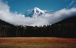
There are 14 designations of parks and protected areas in the province that reflects the different administration and creation of these areas in a modern context. There are 141 ecological Reserves, 35 provincial marine parks, 7 Provincial Heritage Sites, 6 National Historic Sites of Canada, 4 National Parks and 3 National Park Reserves. 12.5% (114,000 km2 (44,000 sq mi)) of British Columbia is currently considered protected under one of the 14 different designations that includes over 800 distinct areas.
British Columbia contains seven of Canada's national parks:
- Glacier National Park
- Gulf Islands National Park Reserve
- Gwaii Haanas National Park Reserve and Haida Heritage Site
- Kootenay National Park
- Mount Revelstoke National Park
- Pacific Rim National Park Reserve
- Yoho National Park
British Columbia also contains a large network of provincial parks, run by BC Parks of the Ministry of Environment. British Columbia's provincial parks system is the second largest parks system in Canada (the largest is Canada's National Parks system).
Another tier of parks in British Columbia are regional parks, which are maintained and run by regional districts.
In addition to these areas, over 47,000 km2 (18,000 sq mi) of arable land are protected by the Agricultural Land Reserve.
Fauna
Much of the province is wild or semi-wild, so that populations of many mammalian species that have become rare in much of the United States still flourish in British Columbia. Watching animals of various sorts, including a very wide range of birds, has also long been popular. Bears (grizzly, black, and the Kermode bear or spirit bear—only found in British Columbia) live here, as do deer, elk, moose, caribou, big-horn sheep, mountain goats, marmots, beavers, muskrat, coyotes, wolves, mustelids (such as wolverines, badgers and fishers), Cougar, eagles, ospreys, herons, Canada geese, swans, loons, hawks, owls, ravens, Harlequin Ducks, and many other sorts of ducks. Smaller birds (robins, jays, grosbeaks, chickadees, and so on) also abound.
Healthy populations of many sorts of fish are found in the waters (including salmonids such as several species of salmon, trout, char, and so on.). Besides salmon and trout, sport-fishers in B.C. also catch halibut, steelhead, bass, and sturgeon. On the coastlines, Harbor Seals and river otters are common. Cetacean species native to the coast include the Orca, Gray Whale, Harbour Porpoise, Dall's Porpoise, Pacific White-sided Dolphin and Minke Whale.

British Columbian introduced species include: common dandelion, ring-necked pheasant, Pacific oyster, brown trout, black slug, European Starling, cowbird, knapweed, bullfrog, purple loosestrife, Scotch broom, European earwig, tent caterpillar, sowbug, gray squirrel, Asian longhorn beetle, English ivy, Fallow Deer, thistle, gorse, Norway rat, crested mynah, and Asian or European gypsy moth.
Some endangered species in British Columbia are: Vancouver Island marmot, Spotted Owl, American White Pelican, and badgers.
Type of organism Red-listed species in BC Total number of species in BC Freshwater fish 24 80 Amphibians 5 19 Reptiles 6 16 Birds 34 465 Terrestrial mammals 1 1 Marine mammals 3 29 Plants 257 2333 Butterflies 12 187 Dragonflies 9 35087 As of 2001[7]
Ecozones
Environment Canada subdivides British Columbia into a system of 6 ecozones:
- Pacific Marine
- Pacific Maritime
- Boreal Cordillera
- Montane Cordillera
- Taiga Plains
- Boreal Plains Ecozones.
History
Main article: History of British ColumbiaFur trade and colonial era
The discovery of stone tools on the Beatton River near Fort St. John date human habitation in British Columbia to at least 11,500 years ago. The Indigenous peoples of the Pacific Northwest Coast spread throughout the region, achieving a high population density; at the time of European contact, nearly half the aboriginal people in present-day Canada lived in the region. During the 1770s, smallpox killed at least 30% of the Pacific Northwest First Nations.[8] This epidemic was the first and the most devastating of a number that were to follow, other than the Great Smallpox Epidemic of 1862 which killed off 50% of the native population in that year.[9]

The arrival of Europeans began around the mid-18th century, as fur traders entered the area to harvest sea otters. While it is thought that Sir Francis Drake may have explored the British Columbian coast in 1579,[dubious ] it was Juan Francisco de la Bodega y Quadra who completed the first documented voyage, which took place in 1775. In doing so, Quadra reasserted the Spanish claim for the Pacific coast, first made by Vasco Núñez de Balboa in 1513. The explorations of James Cook in 1778 and George Vancouver in 1792-93 established British jurisdiction over the coastal area north and west of the Columbia River. In 1793, Sir Alexander Mackenzie was the first European to journey across North America overland to the Pacific Ocean, inscribing a stone marking his accomplishment on the shoreline of Dean Channel near Bella Coola. His expedition theoretically established British sovereignty inland, and a succession of other fur company explorers charted the maze of rivers and mountain ranges between the Canadian Prairies and the Pacific. Mackenzie and these other explorers—notably John Finlay, Simon Fraser, Samuel Black, and David Thompson—were primarily concerned with extending the fur trade, rather than political considerations. In 1794, by the third of a series of agreements known as the Nootka Conventions, Spain conceded its claims of exclusivity in the Pacific. This opened the way for formal claims and colonization by other powers, including Britain, but because of the Napoleonic Wars there was little British action on its claims in the region until later.
The establishment of trading posts under the auspices of the North West Company and the Hudson's Bay Company (HBC), effectively established a permanent British presence in the region. The Columbia District, broadly defined as being south of 54°40 north latitude, (the southern limit of Russian America) and north of Mexican Controlled California west of the Rocky Mountains was, by the Anglo-American Convention of 1818, under the "joint occupancy and use" of citizens of the United States and subjects of Britain (which is to say, the fur companies). This co-occupancy was ended with the Oregon Treaty of 1846.
The major supply route was the York Factory Express between Hudson Bay and Fort Vancouver. Some of the early outposts grew into settlements, communities, and cities. Among the places in British Columbia that began as fur trading posts are Fort St. John (established 1794); Hudson's Hope (1805); Fort Nelson (1805); Fort St. James (1806); Prince George (1807); Kamloops (1812); Fort Langley (1827); Fort Victoria (1843); Yale (1848); and Nanaimo (1853). Fur company posts that became cities in what is now the United States include Vancouver, Washington (Fort Vancouver), formerly the "capital" of Hudson's Bay operations in the Columbia District, Colville, Washington and Walla Walla, Washington (old Fort Nez Percés).
With the amalgamation of the two fur trading companies in 1821, the region now comprising British Columbia existed in three fur trading departments. The bulk of the central and northern interior was organized into the New Caledonia district, administered from Fort St. James. The interior south of the Thompson River watershed and north of the Columbia was organized into the Columbia District, administered from Fort Vancouver on the lower Columbia River. The northeast corner of the province east of the Rockies, known as the Peace River Block, was attached to the much larger Athabasca District, headquartered in Fort Chipewyan, in present day Alberta.
Until 1849, these districts were a wholly unorganized area of British North America under the de facto jurisdiction of HBC administrators. Unlike Rupert's Land to the north and east, however, the territory was not a concession to the company. Rather, it was simply granted a monopoly to trade with the First Nations inhabitants. All that was changed with the westward extension of American exploration and the concomitant overlapping claims of territorial sovereignty, especially in the southern Columbia basin (within present day Washington and Oregon). In 1846, the Oregon Treaty divided the territory along the 49th parallel to the Georgia Strait, with the area south of this boundary (excluding Vancouver Island and the Gulf Islands) transferred to sole American sovereignty. The Colony of Vancouver Island was created in 1849, with Victoria designated as the capital. New Caledonia, as the whole of the mainland rather than just its north-central Interior came to be called, continued to be an unorganized territory of British North America, "administered" by individual HBC trading post managers.
With the Fraser Canyon Gold Rush in 1858, an influx of Americans into New Caledonia prompted the colonial office to formally designate the mainland as the Colony of British Columbia, with New Westminster as its capital. A series of gold rushes in various parts of the province followed, the largest being the Cariboo Gold Rush in 1862, forcing the colonial administration into deeper debt as it struggled to meet the extensive infrastructure needs of far-flung boom communities like Barkerville and Lillooet, which sprang up overnight. The Vancouver Island colony was facing financial crises of its own, and pressure to merge the two eventually succeeded in 1866.
Rapid growth and development
 Lord Strathcona drives the Last Spike of the Canadian Pacific Railway, at Craigellachie, 7 November 1885. Completion of the transcontinental railroad was a condition of entry into Confederation.
The Confederation League, including such figures as Amor De Cosmos, John Robson, and Robert Beaven, led the chorus pressing for the colony to join Canada, which had been created out of three British North American colonies in 1867 (the Province of Canada, Nova Scotia and New Brunswick). Several factors motivated this agitation, including the fear of annexation to the United States, the overwhelming debt created by rapid population growth, the need for government-funded services to support this population, and the economic depression caused by the end of the gold rush.
With the agreement by the Canadian government to extend the Canadian Pacific Railway to British Columbia and to assume the colony's debt, British Columbia became the sixth province to join Confederation on 20 July 1871. The borders of the province were not completely settled until 1903, however, when the province's territory shrank somewhat after the Alaska boundary dispute settled the vague boundary of the Alaska Panhandle.
Population in British Columbia continued to expand as the province's mining, forestry, agriculture, and fishing sectors were developed. Mining activity was particularly notable throughout the Mainland, particularly in the Boundary Country, in the Slocan, in the West Kootenay around Trail, the East Kootenay (the southeast corner of the province), the Fraser Canyon, the Cariboo, the Omineca and the Cassiar, so much so a common epithet for the Mainland, even after provincehood, was "the Gold Colony". Agriculture attracted settlers to the fertile Fraser Valley, and cattle ranchers and later fruit growers came to the drier grasslands of the Thompson River area, the Cariboo, the Chilcotin, and the Okanagan. Forestry drew workers to the lush temperate rainforests of the coast, which was also the locus of a growing fishery.
The completion of the railway in 1885 was a huge boost to the province's economy, facilitating the transportation of the region's considerable resources to the east. The milltown of Granville, known as Gastown, near the mouth of the Burrard Inlet was selected as the terminus of the railway, prompting the incorporation of the City as Vancouver in 1886. The completion of the Port of Vancouver spurred rapid growth, and in less than fifty years the city surpassed Winnipeg, Manitoba, as the largest in Western Canada. The early decades of the province were ones in which issues of land use—specifically, its settlement and development—were paramount. This included expropriation from First Nations people of their land, control over its resources, as well as the ability to trade in some resources (such as the fishery).
Establishing a labour force to develop the province was problematic from the start, and British Columbia was the locus of immigration from Europe, China, and Japan. The influx of a non-Caucasian population stimulated resentment from the dominant ethnic groups, resulting in agitation (much of it successful) to restrict the ability of Asian people to immigrate to British Columbia through the imposition of a head tax. This resentment culminated in mob attacks against Chinese and Japanese immigrants in Vancouver in 1887 and 1907. By 1923, almost all Chinese immigration had been blocked except for merchants, professionals, students and investors.
Meanwhile, the province continued to grow. In 1914, the last spike of a second transcontinental rail line, the Grand Trunk Pacific, linking north-central British Columbia from the Yellowhead Pass through Prince George to Prince Rupert was driven at Fort Fraser. This opened up the North Coast and the Bulkley Valley region to new economic opportunities. What had previously been an almost exclusively fur trade and subsistence economy soon became a locus for forestry, farming, and mining.
1920s through 1940s
When the men returned from World War I, they discovered the recently enfranchised women of the province had helped vote in the prohibition of liquor in an effort to end the social problems associated with the hard-core drinking that Vancouver and the rest of the province was famous for until the war. Because of pressure from veterans, prohibition was quickly relaxed so that the "soldier and the working man" could enjoy a drink, but widespread unemployment among veterans was hardened by many of the available jobs being taken by European immigrants and disgruntled veterans organized a range of "soldier parties" to represent their interests, variously named Soldier-Farmer, Soldier-Labour, and Farmer-Labour Parties. These formed the basis of the fractured labour-political spectrum that would generate a host of fringe leftist and rightist parties, including those who would eventually form the Co-operative Commonwealth and the early Social Credit splinter groups.

The advent of prohibition in the United States created new opportunities, and many found employment or at least profit in cross-border liquor smuggling. Much of Vancouver's prosperity and opulence in the 1920s results from this "pirate economy", although growth in forestry, fishing and mining continued. The end of U.S. prohibition, combined with the onset of the Great Depression, plunged the province into economic destitution. Compounding the already dire local economic situation, tens of thousands of men from colder parts of Canada swarmed into Vancouver, creating huge hobo jungles around False Creek and the Burrard Inlet rail yards, including the old Canadian Pacific Railway mainline right-of-way through the heart of the city's downtown (at Hastings and Carrall). Increasingly desperate times led to intense political organizing efforts, an occupation of the main Post Office at Granville and Hastings which was violently put down by the police and an effective imposition of martial law on the docks for almost three years. A Vancouver contingent for the On-to-Ottawa Trek was organized and seized a train, which was loaded with thousands of men bound for the capital but was met by a Gatling gun straddling the tracks at Mission; the men were arrested and sent to work camps for the duration of the Depression.[10]
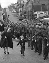
There were some signs of economic life beginning to return to normal towards the end of the 1930s, but it was the onset of World War II which transformed the national economy and ended the hard times of the Depression. Because of the war effort, women entered the workforce as never before.
British Columbia has long taken advantage of its location on the Pacific Ocean to have close relations with East Asia. However, this has often caused friction between cultures which have caused occasional displays of animosity toward Asian immigrants. This was most manifest during the Second World War when many people of Japanese descent were relocated or interned in the Interior of the province.
Coalition and the post-War boom
During World War II the mainstream BC Liberal and BC Conservative Parties of British Columbia united in a formal coalition government under new Liberal leader John Hart, who replaced Duff Pattullo when the latter failed to win a majority in the 1941 election. While the Liberals won the most number of seats, they actually received fewer votes than the socialist Co-operative Commonwealth Federation (CCF). Pattullo was unwilling to form a coalition with the rival Conservatives led by Royal Maitland and was replaced by Hart who formed a coalition cabinet made up of five Liberal and three Conservative ministers.[11] The CCF was invited to join the coalition but refused.[11]
The pretext for continuing the coalition after the end of World War II was to prevent the CCF, which had won a surprise victory in Saskatchewan in 1944, from ever coming to power in British Columbia. The CCF's popular vote was high enough in the 1945 election that they were likely to have won three-way contests and could have formed government. However, the coalition prevented that by uniting the anti-socialist vote.[11] In the post-war environment the government initiated a series of infrastructure projects, notably the completion of Highway 97 north of Prince George to the Peace River Block, a section called the John Hart Highway and also public hospital insurance.
In 1947 the reins of the Coalition were taken over by Byron Ingemar Johnson. The Conservatives had wanted their new leader Herbert Anscomb to be premier, but the Liberals in the Coalition refused. Johnson led the coalition to the highest percentage of the popular vote in British Columbia history (61%) in the 1949 election. This victory was attributable to the popularity of his government's spending programmes, despite rising criticism of corruption and abuse of power. During his tenure, major infrastructure continued to expand, and the agreement with Alcan to build the Kemano-Kitimat hydro and aluminum complex was put in place. Johnson achieved popularity for flood relief efforts during the 1948 flooding of the Fraser Valley, which was a major blow to that region and to the province's economy.
Increasing tension between the Liberal and Conservative coalition partners led the Liberal Party executive to vote to instruct Johnson to terminate the arrangement. Johnson ended the coalition and dropped his Conservative cabinet ministers, including Deputy Premier and Finance Minister Herbert Anscomb, precipitating the general election of 1952.[11] A referendum on electoral reform prior to this election had instigated an elimination ballot (similar to a preferential ballot), where voters could select second and third choices. The intent of the ballot, as campaigned for by Liberals and Conservatives, was that their supporters would list the rival party in lieu of the CCF, but this plan backfired when a large group of voters from all major parties, including the CCF, voted for the fringe British Columbia Social Credit Party (Socreds), who wound up with the largest number of seats in the House (19), only one seat ahead of the CCF, despite the CCF having 34.3% of the vote to Social Credit's 30.18%.
The Social Credit Party, led by rebel former Conservative MLA W. A. C. Bennett, formed a minority government backed by the Liberals and Conservatives (with 6 and 4 seats respectively). Bennett began a series of fiscal reforms, preaching a new variety of populism as well as waxing eloquent on progress and development, laying the ground for a second election in 1953 in which the new Bennett regime secured a majority of seats, with 38% of the vote. Secure with that majority, Bennett returned the province to the first-past-the-post system thereafter, which is still in use today.
Growth of government in the economy
 Premier W. A. C. Bennett and his wife accompany Princess Margaret in Victoria, August 1958. Bennett's Socreds governed the province for an unprecedented twenty years
With the election of the Social Credit Party, British Columbia embarked a phase of rapid economic development. Bennett and his party governed the province for the next twenty years, during which time the government initiated an ambitious programme of infrastructure development, fuelled by a sustained economic boom in the forestry, mining, and energy sectors.
During these two decades, the government nationalized British Columbia Electric and the British Columbia Power Company, as well as smaller electric companies, renaming the entity BC Hydro. By the end of the 1960s, several major dams had been begun or completed in—among others—the Peace, Columbia, and Nechako River watersheds. Major transmission deals were concluded, most notably the Columbia River Treaty between Canada and the United States. The province's economy was also boosted by unprecedented growth in the forest sector, as well as oil and gas development in the province's northeast.
The 1950s and 1960s were also marked by development in the province's transportation infrastructure. In 1960, the government established BC Ferries as a crown corporation, in order to provide a marine extension of the provincial highway system. That system was improved and expanded through the construction of new highways and bridges, and paving of existing highways and provincial roads.
Vancouver and Victoria become cultural centres as poets, authors, artists, musicians, as well as dancers, actors, and haute cuisine chefs flocked to the beautiful scenery and warmer temperatures. Similarly, these cities have either attracted or given rise to their own noteworthy academics, commentators, and creative thinkers.[citation needed] Tourism also began to play an important role in the economy. The rise of Japan and other Pacific economies was a great boost to British Columbia's economy.
Politically and socially, the 1960s brought a period of significant social ferment. The divide between the political left and right, which had prevailed in the province since the Depression and the rise of the labour movement, sharpened as so-called free enterprise parties coalesced into the defacto coalition represented by Social Credit—in opposition to the social democratic New Democratic Party, the successor to the Co-operative Commonwealth Federation. As the province's economy blossomed, so did labour-management tensions. Tensions emerged, also, from the counterculture movement of the late 1960s, of which Vancouver and Nanaimo were centres. The conflict between hippies and Vancouver mayor Tom Campbell was particularly legendary, culminating in the so-called Gastown Riots of 1971. By the end of the decade, with social tensions and dissatisfaction with the status quo rising, the Bennett government's achievements could not stave off its growing unpopularity.
1970s and 1980s
On August 27, 1969, the Social Credit Party was re-elected in a general election for what would be Bennett's final term in power. At the start of the 1970s, the economy was quite strong because of rising coal prices and an increase in annual allowable cuts in the forestry sector. However, BC Hydro reported its first loss, which was the beginning of the end for Bennett and the Social Credit Party.[12]
The Socreds were forced from power in the August 1972 election, paving the way for a provincial New Democratic Party (NDP) government under Dave Barrett. Under Barrett, the large provincial surplus soon became a deficit,[citation needed] although changes to the accounting system makes it likely that some of the deficit was carried over from the previous Social Credit regime and its "two sets of books", as WAC Bennett had once referred to his system of fiscal management. The brief three year ("Thousand Days") period of NDP governance brought several lasting changes to the province, most notably the creation of the Agricultural Land Reserve, intended to protect farmland from redevelopment, and the Insurance Corporation of British Columbia, a crown corporation charged with a monopoly on providing single-payer basic automobile insurance.
 This stylized version of the flag of BC was introduced by the Bennett government in the early 1980s. It remained as the logo of the government of BC for 20 years.
Perceptions that the government had instituted reforms either too swiftly or that were too far-reaching, coupled with growing labour disruptions led to the ouster of the NDP in the 1975 general election. Social Credit, under W.A.C. Bennett's son, Bill Bennett, was returned to office. Under the younger Bennett's government, 85% of the province's land base was transferred from Government Reserve to management by the Ministry of Forests, reporting of deputy ministers was centralized to the Premier's Office, and NDP-instigated social programs were rolled back, with then-Human Resources Minister infamously demonstrating a golden shovel to highlight his welfare policy, although the new-era Socreds also reinforced and backed certain others instigated by the NDP—notably the creation of the Resort Municipality of Whistler, whose special status including Sunday drinking, then an anomaly in BC.
Also during the "MiniWac" regime (a reference to his father's acronym-cum-nickname, WAC) certain money-losing Crown-owned assets were "privatized" in a mass giveaway of shares in the British Columbia Resources Investment Corporation, "BCRIC", with the "Brick shares" soon becoming near-worthless. Towards the end of his tenure in power, Bennett oversaw the completion of several megaprojects meant to stimulate the economy and win votes - unlike most right-wing parties, British Columbia's Social Credit actively practiced government stimulation of the economy. Most notable of these was the winning of a world's fair for Vancouver, which came in the form of Expo 86, to which was tied the construction of the Coquihalla Highway and Vancouver's SkyTrain system. The Coquihalla Highway project became the subject of a scandal after revelations that the premier's brother bought large tracts of land needed for the project before it was announced to the public, and also because of graft investigations of the huge cost overruns on the project. Both investigations were derailed in the media by a still further scandal, the Doman Scandal, in which the Premier and millionaire backer Herb Doman were investigated for insider-trading and securities fraud. Nonetheless, the Socreds were re-elected in 1979 under Bennett, who led the party until 1986.
 The Coquihalla Highway. The road was one of the legacies of the Expo 86 World's fair. The creation of the toll highway sparked controversy.
As the province entered a sustained recession, Bennett's popularity and media image were in decline. On April 1, 1983, Premier Bennett overstayed his constitutional limits of power by exceeding the legal tenure of a government, and the Lieutenant-Governor, Henry Pybus Bell-Irving, was forced to call Bennett to Government House to resolve the impasse, and an election was called for April 30, while in the meantime government cheques were covered by special emergency warrants as the Executive Council no longer had signing authority because of the constitutional crisis. Campaigning on a platform of moderation, and backed by the support and computer-organization tactics of the Big Blue Machine from Ontario and other consultants who were electoral lobbyists for the American Republican Party, Bennett won an unexpected majority.
After several weeks of silence in the aftermath, a sitting of the House was finally called and in the speech from the Throne the Socreds instituted a programme of fiscal cutbacks dubbed "restraint", which had been a buzzword for moderation during the campaign. The programme included cuts to "motherhood" issues of the left, including the human rights branch, the offices of the Ombudsman and Rentalsman, women's programs, environmental and cultural programs, while still supplying mass capital infusions to corporate British Columbia. This sparked a backlash, with tens of thousands of people in the streets the next day after the budget speech, and through the course of a summer repeated large demonstrations of up to 100,000 people.
This became known as the 1983 Solidarity Crisis, from the name of the Solidarity Coalition, a huge grassroots opposition movement mobilized, consisting of organized labour and community groups, with the British Columbia Federation of Labour forming a separate organization of unions, Operation Solidarity, under the direction of Jack Munro, then-President of the International Woodworkers of America (IWA), the most powerful of the province's resource unions. Tens of thousands participated in protests and many felt that a general strike would be the inevitable result unless the government backed down from its policies they had claimed were only about restraint and not about recrimination against the NDP and the left. Just as a strike at Pacific Press ended, which had crippled the political management of the public agenda by the publishers of the province's major papers, the movement collapsed after an apparent deal was struck by union leader and IWA president, Jack Munro and Premier Bennett.[13]
A tense winter of blockades at various job sites around the province ensued, as among the new laws were those enabling non-union labour to work on large projects and other sensitive labour issues, with companies from Alberta and other provinces brought in to compete with union-scale British Columbia companies. Despite the tension, Bennett's last few years in power were relatively peaceful as economic and political momentum grew on the megaprojects associated with Expo, and Bennett was to end his career by hosting Prince Charles and Lady Diana on their visit to open Expo 86. His retirement being announced, a Social Credit convention was scheduled for the Whistler Resort, which came down to a three-way shooting match between Bud Smith, the Premier's right-hand man but an unelected official, Social Credit party grande dame Grace McCarthy, and the charismatic but eccentric Bill Vander Zalm.
Bill Vander Zalm became the new Socred leader when Smith threw his support to him rather than see McCarthy win, and led the party to victory in the election later that year. Vander Zalm was later involved in a conflict of interest scandal following the sale of Fantasy Gardens, a Christian and Dutch culture theme park built by the Premier, to Tan Yu, a Filipino Chinese gambling kingpin. There were also concerns over Yu's application to the government for a bank licence, and lurid stories from flamboyant realtor Faye Leung of a party in the "Howard Hughes Suite" on the top two floors of the Bayshore Inn, where Tan Yu had been staying, with reports of a bag of money in a brown paper bag passed from Yu to Vander Zalm during the goings-on. These scandals forced Vander Zalm's resignation, and Rita Johnston became premier of the province. Johnston presided over the end of Social Credit power, calling an election which led to the reducing of the party's caucus to only two seats, and the revival of the long-defunct British Columbia Liberal Party as Opposition to the victorious NDP under former Vancouver mayor Mike Harcourt.
In 1988, David Lam was appointed by the Queen of Canada as British Columbia’s twenty-fifth Lieutenant-Governor, and was the Province's first Lieutenant-Governor of Chinese origin.
1990s to present
Johnston lost the 1991 general election to the NDP, under the leadership of Mike Harcourt, a former mayor of Vancouver. The NDP's unprecedented creation of new parkland and protected areas was popular, and helped boost the province's growing tourism sector. However, the economy continued to struggle against the backdrop of a weak resource economy. Housing starts and an expanded service sector saw growth overall through the decade, despite political turmoil. Harcourt ended up resigning over "Bingogate"—a political scandal involving the funnelling of charity bingo receipts into party coffers in certain ridings. Harcourt was not implicated, but he resigned nonetheless in respect of constitutional conventions calling for leaders under suspicion to step aside. Glen Clark, a former president of the BC Federation of Labour, was chosen the new leader of the NDP, which won a second term in 1996. More scandals dogged the party, most notably the Fast Ferry Scandal involving the province trying to develop the shipbuilding industry in British Columbia. An allegation (never substantiated) that the Premier had received a favour in return for granting a gaming licence led to Clark's resignation as Premier. He was succeeded on an interim basis by Dan Miller who was in turn followed by Ujjal Dosanjh following a leadership convention.
In the 2001 general election Gordon Campbell's BC Liberals defeated the NDP party, gaining 77 out of 79 seats total seats in the provincial legislature. Campbell instituted various reforms and removed some of the NDP's policies including scrapping the "fast ferries" project, lowering income taxes, and the controversial sale of BC Rail to CN Rail. Campbell was also the subject of criticism after he was arrested for driving under the influence during a vacation in Hawaii. However, Campbell still managed to lead his party to victory in the 2005 general election, against a substantially strengthened NDP opposition. Campbell won a third term in the British Columbia general election, 2009, marking the first time in 23 years that a premier has been elected to a third term.
The province successfully won a bid to host the 2010 Winter Olympics in Vancouver and Whistler, with Olympic organizers winning a referendum held in the city of Vancouver.
British Columbia has also been significantly affected by demographic changes within Canada and around the world. Vancouver (and to a lesser extent some other parts of British Columbia) was a major destination for many of the immigrants from Hong Kong who left the former UK colony (either temporarily or permanently) in the years immediately prior to its handover to the People's Republic of China. British Columbia has also been a significant destination for internal Canadian migrants. This has been the case throughout recent decades, because of its image of natural beauty, mild climate and relaxed lifestyle, but is particularly true during periods of economic growth. As a result, British Columbia has moved from approximately 10% of Canada's population in 1971 to approximately 13% in 2006. Trends of urbanization mean that the Greater Vancouver area now includes 51% of the Province's population, followed in second place by Greater Victoria with 8%. These two metropolitan regions have traditionally dominated the demographics of BC.
Demographics
 Welcome sign at the province's boundaryMain article: Demographics of British ColumbiaSee also: List of cities in Canada#British Columbia, List of communities in British Columbia, and List of municipalities in British Columbia
Year Population Five Year
% changeTen Year
% changeRank Among
Provinces1851 55,000 n/a n/a 6 1861 51,524 n/a −6.3 6 1871 36,247 n/a −35.3 7 1881 49,459 n/a 36.4 8 1891 98,173 n/a 98.5 8 1901 178,657 n/a 82.0 6 1911 392,480 n/a 119.7 6 1921 524,582 n/a 33.7 6 1931 694,263 n/a 32.3 6 1941 817,861 n/a 17.8 3 1951 1,165,210 n/a 42.5 3 1956 1,398,464 20.0 n/a 3 1961 1,629,082 16.5 39.8 3 1966 1,873,674 15.0 34.0 3 1971 2,184,620 16.6 34.1 3 1976 2,466,610 12.9 31.6 3 1981 2,744,467 11.3 25.6 3 1986 2,883,370 5.1 16.9 3 1991 3,282,061 13.8 19.6 3 1996 3,724,500 13.5 29.2 3 2001 3,907,738 4.9 19.1 3 2006 4,113,487 5.3 10.4 3 Religious groups in BC (1991 & 2001) & Canada (2001) 1991 BC % 2001 BC % 2001 Canada % BC 2001 number Total population 100% 100% 100% 3,868,875 No religious affiliation 30.0% 35.1% 35.9% 1,388,300 includes Agnostic, Atheist, Humanist, and No religion, and other responses, such as Darwinism, and so on. Protestant 41.9% 31.4% 29% 1,213,295 Catholic 18.3% 17.2% 15% 675,320 includes Roman Catholic, Eastern Catholic . Christian Orthodox 0.7% 0.9% 2% 35,655 Christian n. i. e. 2.7% 5.2% 3% 200,345 Includes mostly answers of 'Christian', not otherwise stated Sikh 2.3% 3.5% 1% 135,310 Buddhist 1.1% 2.2% 1% 85,540 Muslim 0.8% 1.5% 2% 56,220 Hindu 0.6% 0.8% 1% 31,500 Jewish 0.5% 0.5% 1% 21,230 Eastern religions 0.3% 0.1% 9,970 includes Baha'i, Eckankar, Jains, Shinto, Taoist, Zoroastrian and Eastern religions, not identified elsewhere Other religions 0.4% 0.2% 16,205 includes Aboriginal spirituality, Pagan, Wicca, Unity – New Thought – Pantheist, Scientology, Rastafarian, New Age, Gnostic,and so on. The largest denominations by number of adherents according to the 2001 census were none (atheist, agnostic, and so on.) with 1,388,300 (35.9%); protestant with 1,213,295 (31.4%); the Roman Catholic Church with 675,320 (17%); the United Church of Canada with 361,840 (9%); and the Anglican Church of Canada with 298,375 (8%).[18]
Ethnic groups and languages
The following statistics represent both single (for example, "German") and multiple (for example, "Chinese-Canadian") responses to the 2006 Census, and thus do not add up to 100%. All items are self-identified.[19]
Ethnic Origin Population Percent English 1,207,245 29.6% Scottish 828,145 20.3% Canadian 720,200 17.7% Irish 618,120 15.2% German 561,570 13.8% Chinese 432,435 10.6% French 361,215 8.9% East Indian 232,370 5.7% Ukrainian 197,265 4.8% Dutch (Netherlands) 196,420 4.8% North American Indian 193,060 4.7% Italian 143,155 3.5% Norwegian 129,420 3.2% Polish 128,360 3.2% Russian 114,105 2.8% Welsh 104,275 2.6% Swedish 104,025 2.6% Filipino 94,255 2.3% British 74,145 1.8% American (USA) 66,765 1.6% Ethnic Origin Population Percent Métis 62,570 1.5% Danish 56,125 1.4% Spanish 52,640 1.3% Korean 51,860 1.3% Hungarian 49,870 1.2% Austrian 46,620 1.1% Japanese 41,585 1.0% Portuguese 34,660 0.9% Vietnamese 30,835 0.8% Jewish 30,830 0.8% Finnish 29,875 0.7% Iranian 29,265 0.7% Swiss 28,240 0.7% Romanian 25,670 0.6% Icelandic 22,110 0.5% Greek 21,770 0.5% Czech 21,150 0.5% Croatian 18,815 0.5% Punjabi 18,525 0.5% Belgian 17,510 0.4%
Though just 1.8% refer to their origins as being "British", a majority 57.3% of the population of British Columbia claim their ethnic origin as being from one of the British nations (England, Scotland or Wales). Another 15.2% refer to their ethnicity as "Irish", though not distinguishing between Northern Ireland and the Republic of Ireland.Of the provinces, British Columbia had the highest proportion of visible minorities, representing 24.8% of its population.[20] Asians are by far the largest visible minority demographic, with many of the Lower Mainland's large cities having sizable Chinese, South Asian, Japanese, Filipino, and Korean communities.
Also present in large numbers relative to other regions of Canada (except Toronto), and ever since the province was first settled (unlike Toronto), are many European ethnicities of the first and second generation, notably Germans, Scandinavians, Yugoslavs and Italians. Third-generation Europeans are generally of mixed lineage, and traditionally intermarried with other ethnic groups more than in any other Canadian province. First-generation Britons remain a strong component of local society despite limitations on immigration from Britain since the ending of special status for British subjects in the 1960s.
Of the 4,113,847 population counted by the 2006 census, 4,074,385 people completed the section about language. Of these 4,022,045 gave singular responses to the question regarding mother tongue. The languages most commonly reported were the following:
Language Number of
native speakersPercentage of
singular responsesEnglish 2,875,770 71.5% Chinese languages 342,920 8.5% Punjabi 158,750 4.0% German 86,690 2.2% French 54,745 1.4% Tagalog (Filipino) 50,425 1.3% Korean 46,500 1.2% Spanish 34,075 0.9% Persian 28,150 0.7% Italian 27,020 0.7% Dutch 26,355 0.7% Vietnamese 24,560 0.7% Hindi 23,240 0.6% Japanese 20,040 0.5% Russian 19,320 0.5% Polish 17,565 0.4% Portuguese 14,385 0.4% Ukrainian 12,285 0.3% Hungarian 10,670 0.3% Croatian 8,505 0.2% Language Number of
native speakersPercentage of
singular responsesArabic 8,440 0.2% Urdu 7,025 0.2% Danish 6,720 0.2% Greek 6,620 0.2% Gujarati 6,565 0.2% Romanian 6,335 0.2% Serbian 6,180 0.2% Czech 6,000 0.1% Finnish 4,770 0.1% Athabaskan languages 3,500 0.1% Slovak 3,490 0.1% Norwegian 3,275 0.1% Tamil 3,200 0.1% Salish languages 3,190 0.1% Ilocano 3,100 0.1% Malay 3,100 0.1% Bisayan languages 3,035 0.1% Swedish 2,875 0.1% Turkish 2,255 0.1% Tsimshianic languages 2,125 0.1%
Numerous other languages were also counted, but only languages with more than 2,000 native speakers are shown.
(Figures shown are for the number of single language responses and the percentage of total single-language responses)[21]Cities
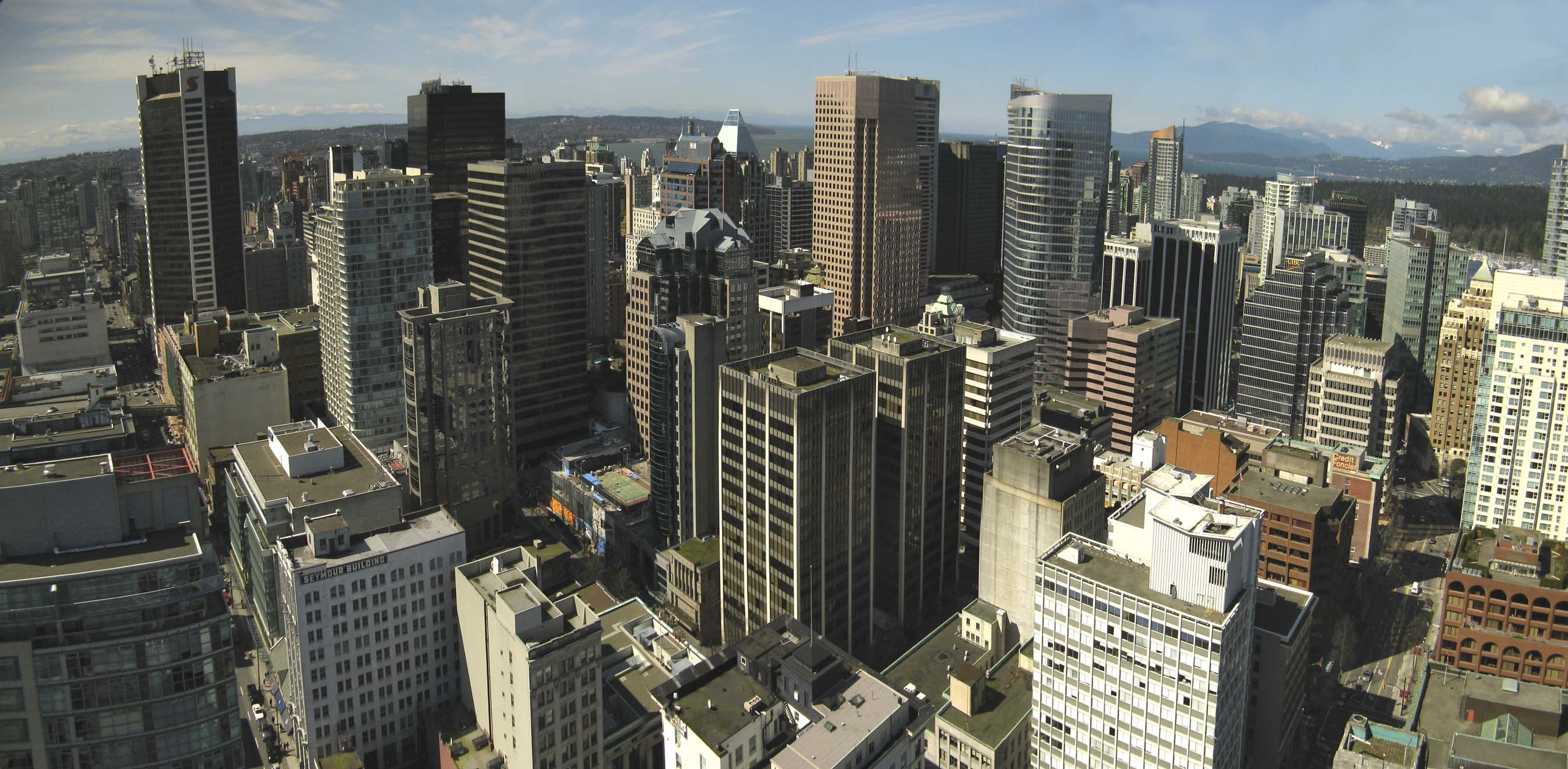
 Vancouver SkylineSee also: Regional districts of British Columbia
Half of all British Columbians live in the Metro Vancouver area, which includes Vancouver, Surrey, New Westminster, West Vancouver, North Vancouver (city), North Vancouver (district municipality), Burnaby, Coquitlam, Port Coquitlam, Maple Ridge, Langley (city), Langley (district municipality), Delta, Pitt Meadows, White Rock, Richmond, Port Moody, Anmore, Belcarra, Lions Bay and Bowen Island, with adjacent unincorporated areas represented in the regional district as the electoral area known as Greater Vancouver Electoral Area A. Seventeen Indian reserves are located in the metropolitan area but are outside the jurisdiction of the regional district and not represented in its government. Also in the metropolitan area but not represented in the regional district are the University Endowment Lands.
The second largest concentration of British Columbia population is located at the southern tip of Vancouver Island, which is made up of the 13 municipalities of Greater Victoria, Victoria, Saanich, Esquimalt, Oak Bay, View Royal, Highlands, Colwood, Langford, Central Saanich/Saanichton, North Saanich, Sidney, Metchosin, Sooke, which are part of the Capital Regional District. The metropolitan area also includes several Indian reserves (the governments of which are not part of the regional district). Almost half of the Vancouver Island population is located in Greater Victoria.
Ten Largest Metropolitan Areas in BC by Population[22][23] Community (includes metro areas) 2006 1996 Vancouver 2,215,200 1,831,665 Victoria 330,088 304,287 Kelowna 162,276 136,349 Abbotsford 159,020 136,480 Kamloops 92,882 85,407 Nanaimo 92,361 82,691 Prince George 83,225 87,731 Fort St. John 81,000 68,000 Chilliwack 80,892 66,254 Vernon 55,418 49,701 Courtenay 49,214 46,297 Ten Largest Municipalities in BC by Population Municipality 2006 1996 Vancouver 578,041 514,008 Surrey (Metro Vancouver) 394,976 304,477 Burnaby (Metro Vancouver) 202,799 179,209 Richmond (Metro Vancouver) 174,461 148,867 Abbotsford 123,864 104,403 Coquitlam (Metro Vancouver) 114,565 101,820 Saanich (Greater Victoria) 108,265 101,388 Kelowna 106,707 89,422 Delta (Metro Vancouver) 96,723 95,411 Langley Township (Metro Vancouver) 93,726 80,179 Other municipalities include: Campbell River, Chilliwack, Colwood, Courtenay, Cranbrook, Dawson Creek, Fernie, Fort St. John, Kimberley, Langford, Maple Ridge, Mission, Parksville, North Cowichan, Penticton, Port Alberni, Prince George, Prince Rupert, Quesnel, Terrace, Vernon, Victoria (provincial capital), Williams Lake
Economy
 A view of the Vancouver's downtown core. Vancouver is the business capital of British Columbia.
British Columbia has a resource dominated economy, centred on the forestry industry but also with increasing importance in mining. Employment in the resource sector has fallen steadily, and new jobs are mostly in the construction and retail/service sectors. With its film industry known as Hollywood North, the Vancouver region is the third-largest feature film production location in North America, after Los Angeles and New York City.[24]
The economic history of British Columbia is replete with tales of dramatic upswings and downswings, and this boom and bust pattern has influenced the politics, culture and business climate of the province. Economic activity related to mining in particular has widely fluctuated with changes in commodity prices over time, with documented costs to community health.[25]
British Columbia's GDP is the fourth largest in Canada at C$197.93 billion in 2008. GDP per capita stands at C$45,150.[26] British Columbia’s total debt will rise 16% to C$47.8 billion in the 2010-11 fiscal year, or 24.3% of GDP.[27]
Transportation
Transportation played a huge role in British Columbia history. The Rocky Mountains and the ranges west of them constituted a significant obstacle to overland travel until the completion of the transcontinental railway in 1885. The Peace River Canyon through the Rocky Mountains was the route that the earliest explorers and fur traders used. Fur trade routes were only marginally used for access to British Columbia through the mountains. Travel from the rest of Canada before 1885 meant the difficulty of overland travel via the United States, around Cape Horn or overseas from Asia. Nearly all travel and freight to and from the region occurred via the Pacific Ocean, primarily through the ports of Victoria and New Westminster.
Until the 1930s, rail was the only means of overland travel to and from the rest of Canada; travellers using motor vehicles needed to journey through the United States. With the construction of the Inter-Provincial Highway in 1932 (now known as the Crowsnest Pass Highway), and later the Trans-Canada Highway, road transportation evolved into the preferred mode of overland travel to and from the rest of the country.
Roads and highways
Main article: List of British Columbia provincial highways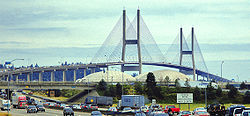
Because of its size and rugged, varying topography, British Columbia requires thousands of kilometres of provincial highways to connect its communities. British Columbia's roads systems were notoriously poorly maintained and dangerous until a concentrated programme of improvement was initiated in the 1950s and 1960s. There are now freeways in the Lower Mainland and Central Interior of the province, and much of the rest of the province is accessible by well-maintained two lane arterial highways with additional passing lanes in mountainous areas. The building and maintenance of provincial highways is the responsibility of the provincial government.
There are only five major routes to the rest of Canada. From south to north they are: BC Highway 3 through the Crowsnest Pass, the Vermilion Pass and the Kicking Horse Pass, the latter being used by the Trans-Canada Highway entering Alberta through Banff National Park, the Yellowhead Highway through Jasper National Park, and Highway 2 through Dawson Creek. There are also several highway crossings to the adjoining American states of Washington, Idaho, and Montana. The longest highway is Highway 97, running 2,081 km (1,293 mi) from the British Columbia-Washington border at Osoyoos north to Watson Lake, Yukon and which includes the British Columbia portion of the Alaska Highway.
Public transit
Prior to 1979, surface public transit was administered by BC Hydro, the provincially owned electricity utility. Subsequently, the province established BC Transit to oversee and operate all municipal transportation systems. In 1998, the Greater Vancouver Transportation Authority (TransLink) (now South Coast British Columbia Transportation Authority), a separate authority for routes within the Greater Vancouver Regional District was established.
Public transit in British Columbia consists mainly of diesel buses, although Vancouver is also serviced by a fleet of trolleybuses. Several experimental buses are being tested such as hybrid buses that has both gasoline and electric engines. TransLink operates SkyTrain, a rapid transit system serving Vancouver, Burnaby, New Westminster, North Surrey and Richmond. Presently, extensions of the line east to Coquitlam and Port Moody (the Evergreen Line) are being developed. In 2009, the Canada Line light rail line was completed, linking Vancouver International Airport to downtown Vancouver and to the existing SkyTrain network.
Rail
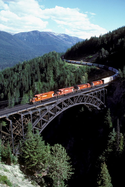
 CPR train traversing the Stoney Creek Bridge.
Rail development expanded greatly in the decades after the completion of the Canadian Pacific Railway in 1885 and was the chief mode of long-distance surface transportation until the expansion and improvement of the provincial highways system began in the 1950s. Two major routes through the Yellowhead Pass competed with the Canadian Pacific Railway—the Grand Trunk Pacific, terminating at Prince Rupert, and the Canadian National Railway, terminating at Vancouver.
The Pacific Great Eastern line supplemented this service, providing a north-south route between Interior resource communities and the coast. The Pacific Great Eastern (later known as British Columbia Railway and now owned by Canadian National Railway) connects Fort St James, Fort Nelson, and Tumbler Ridge with North Vancouver. The E&N Railway, rebranded as Southern Railway of Vancouver Island, serves the commercial and passenger train markets of Vancouver Island by owning the physical rail lines.
Water
BC Ferries was established as a provincial crown corporation in 1960 to provide passenger and vehicle ferry service between Vancouver Island and the Lower Mainland as a cheaper and more reliable alternative to the service operated by the Canadian Pacific Railway. It now operates 25 routes among the islands of British Columbia, as well as between the islands and the mainland. Ferry service to Washington is offered by the Washington State Ferries (between Sidney and Anacortes) and Black Ball Transport (between Victoria and Port Angeles, Washington). Ferry service over inland lakes and rivers is provided by the provincial government.
Commercial ocean transport is of vital importance. Major ports are located at Vancouver, Roberts Bank (near Tsawwassen), Prince Rupert, and Victoria. Of these, the Port of Vancouver is the most important, being the largest in Canada and the most diversified in North America. Vancouver, Victoria, and Prince Rupert are also major ports of call for cruise ships. In 2007, a large maritime container port was opened in Prince Rupert with an inland sorting port located in Prince George.
Air
Main article: List of airports in British ColumbiaThere are over 200 airports located throughout British Columbia, the major ones being the Vancouver International Airport, the Victoria International Airport, the Kelowna International Airport, and the Abbotsford International Airport, the first three of which each served over 1,000,000 passengers in 2005. Vancouver International Airport is the 2nd busiest airport in the country with an estimated 17.9 million travellers passing through in 2008.
Government and politics
Main articles: Politics of British Columbia and Monarchy in British Columbia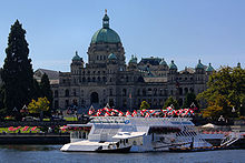 The British Columbia Parliament Buildings in Victoria
The Lieutenant-Governor of British Columbia, Steven Point, is the Queen of Canada's representative in the Province of British Columbia. During the absence of the Lieutenant-Governor, the Governor General in Council may appoint an administrator to execute the duties of the office. In practice, this is usually the Chief Justice of British Columbia.[28]
British Columbia has an 85-member elected Legislative Assembly, elected by the plurality voting system, though in recent years there has been significant debate about switching to a single transferable vote system.
The province is governed by the Liberal Party under Premier Christy Clark. The previous election saw then Premier Gordon Campbell win a third straight majority government in May 2009, taking 49 seats to the opposition New Democratic Party's 35. Campbell had previously led the largest landslide election in British Columbia history in 2001, with 77 of 79 seats, but the legislature has been more evenly divided between Liberals and NDP following the 2005 (46 of 79) and 2009 (49 of 85) provincial elections. The New Democratic Party (NDP) and its predecessor the CCF have been the main opposition force to business-oriented parties since the 1930s and have ruled majority governments 1972-1975 and 1991-2001. The Green Party of British Columbia plays a larger role in the politics of British Columbia than Green Parties do in most other jurisdictions in Canada. However, after a breakthrough election in 2001 (12.39%), the party's vote share has declined (2005 – 9.17%, 2009 – 8.09%).
The British Columbia Liberal Party is not related to the federal Liberal Party and does not share the same ideology. Instead, the BC Liberal party is a rather diverse coalition, made up of the remnants of the Social Credit Party, many federal Liberals, federal Conservatives, and those who would otherwise support right-of-centre or free enterprise parties. Historically, there have commonly been third parties present in the legislature (including the Liberals themselves from 1952 to 1975), but there are presently none.
Prior to the rise of the Liberal Party, British Columbia's main political party was the British Columbia Social Credit Party which ruled British Columbia for 20 continuous years. While sharing some ideology with the current Liberal government, they were more right-wing although undertook nationalization of various important monopolies, notably BC Hydro and BC Ferries. In an April 2008 poll by polling firm Ipsos-Reid, the BC Liberals were shown as having the support of 49% of voters, compared to 32% for the NDP.[29]
 The meeting chamber of the provincial legislative assembly
British Columbia is known for having politically active labour unions who have traditionally supported the NDP or its predecessor, the CCF.
British Columbia's political history is typified by scandal and a cast of colourful characters, beginning with various colonial-era land scandals and abuses of power by early officials (such as those that led to McGowan's War in 1858–59). Notable scandals in Social Credit years included the Robert Bonner Affair, the Fantasy Gardens scandal which forced Premier Bill Vander Zalm to resign and ended the Social Credit era, the Bingogate scandal which brought down NDP Premier Mike Harcourt, the alleged scandal named Casinogate which drove NDP Premier Glen Clark to resign. A variety of scandals have plagued the current Liberal government, but with little apparent effect on the electorate, including the Premier's arrest for drunk driving in Maui and the resignation of various cabinet ministers because of conflict-of-interest allegations. A Christmas Eve raid on the Parliament Buildings in Victoria, including the Premier's Office, has resulted in charges only for ministerial aides, although key cabinet members from the time have since resigned. The case, currently in preliminary hearings in the courts and relating to the sale of BC Rail to an American company, may not reach trial because of the mass of evidence and various procedural problems.
Recreation
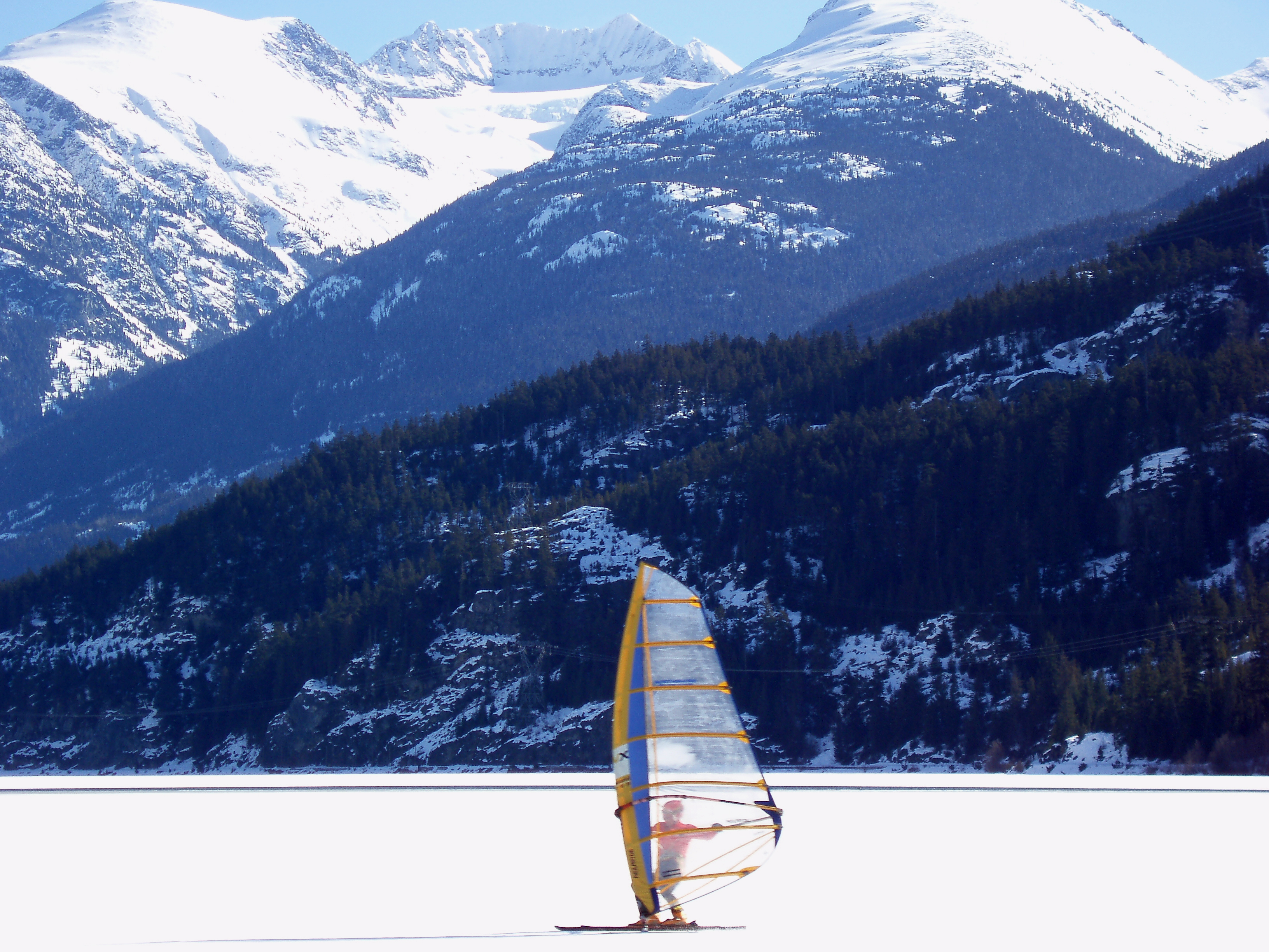
 Ice sailing in Whistler
Given its varied mountainous terrain and its coasts, lakes, rivers, and forests, British Columbia has long been enjoyed for pursuits like hiking and camping, rock climbing and mountaineering, hunting and fishing.
Water sports, both motorized and non-motorized, are enjoyed in many places. Sea kayaking opportunities abound on the British Columbia coast with its fjords. Whitewater rafting and kayaking are popular on many inland rivers. Sailing and sailboarding are widely enjoyed.
In winter, cross-country and telemark skiing are much enjoyed, and in recent decades high-quality downhill skiing has been developed in the Coast Mountain range and the Rockies, as well as in the southern areas of the Shuswap Highlands and the Columbia Mountains. Snowboarding has mushroomed in popularity since the early 1990s. The 2010 Winter Olympics downhill events were held in Whistler Blackcomb area of the province, while the indoor events were conducted in the Vancouver area.
In Vancouver and Victoria (as well as some other cities), opportunities for joggers and bicyclists have been developed. Cross-country bike touring has been popular since the ten-speed bike became available many years ago. Since the advent of the more robust mountain bike, trails in more rugged and wild places have been developed for them. Some of the province's retired rail beds have been converted and maintained for hiking, biking, and cross-country skiing. Longboarding is also a popular activity because of the hilly geography of the region.
Horseback riding is enjoyed by many British Columbians. Opportunities for trail riding, often into especially scenic areas, have been established for tourists in numerous areas of the province.
British Columbia also has strong participation levels in many other sports, including golf, tennis, soccer, hockey, Canadian football, rugby union, lacrosse, baseball, softball, basketball, curling and figure skating. British Columbia has produced many outstanding athletes, especially in aquatic and winter sports.
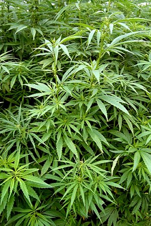
 A crop of Cannabis Sativa, or "BC Bud".
Consistent with both increased tourism and increased participation in diverse recreations by British Columbians has been the proliferation of lodges, chalets, bed and breakfasts, motels, hotels, fishing camps, and park-camping facilities in recent decades.
In certain areas, there are businesses, non-profit societies, or municipal governments dedicated to promoting ecotourism in their region. A number of British Columbia farmers offer visitors to combine tourism with farm work, for example, through the WWOOF Canada program.[30]
Recreational cannabis
See also: Cannabis in British ColumbiaA 2004 study (published 2006) by the University of Victoria Centre for Addictions Research of BC and Simon Fraser University Applied Research on Mental Health and Addictions indicated cannabis use is more widespread among British Columbians than other Canadians.[31] However, a United Nations report published in July 2007 actually placed Quebec as the highest consumption province, citing 15.8% of Quebecers having used marijuana in a single year, versus 14.1% of Canadians nationally,[32] and resulted in Canada being placed first in the industrialized world in marijuana use. With the actual growing of marijuana, British Columbia is responsible for 40% of all cannabis produced in Canada.[33]
See also
- Outline of British Columbia
- Bibliography of British Columbia
- Index of British Columbia-related articles
- List of designated places in British Columbia
- List of people from British Columbia
- List of regions of Canada: British Columbia
References
- ^ According to the Oxford Guide to Canadian English Usage (ISBN 0-19-541619-8; p. 335), BCer(s) is an informal demonym that is sometimes used for residents of BC.
- ^ "Canada's population estimates: Table 2 Quarterly demographic estimates". Statcan.gc.ca. 2010-06-28. http://www.statcan.gc.ca/daily-quotidien/100628/t100628a2-eng.htm. Retrieved 2010-06-30.
- ^ "Statistics Canada Gross domestic product, expenditure-based, by province and territory". http://www40.statcan.ca/l01/cst01/econ15.htm.
- ^ Ged Martin, "The Naming of British Columbia," Albion: A Quarterly Journal Concerned with British Studies, Vol. 10, No. 3 (Autumn, 1978), pp. 257–263 in JSTOR
- ^ "Vanderhoof". Tourism BC. http://www.hellobc.com/en-CA/RegionsCities/Vanderhoof.htm. Retrieved 2007-04-26.
- ^ "Daily Data Report for July 1941". Climate.weatheroffice.gc.ca. 2010-09-21. http://climate.weatheroffice.gc.ca/climateData/dailydata_e.html?timeframe=2&Prov=CA&StationID=966&Year=1941&Month=7&Day=26. Retrieved 2011-02-22.
- ^ BC Ministry of Sustainable Resource Management, Conservation Data Centre
- ^ Lange, Greg (2003-01-23). "Smallpox epidemic ravages Native Americans on the northwest coast of North America in the 1770s.". Historylink.org. http://www.historylink.org/essays/output.cfm?file_id=5100. Retrieved 2011-02-22.
- ^ "Plagues and Peoples on the Northwest Coast". .h-net.msu.edu. http://www2.h-net.msu.edu/reviews/showrev.php?id=4547. Retrieved 2011-02-22.
- ^ Carved From Wood; Mission BC 1861-1992, Andreas Schroeder, publ. The Mission Foundation (1992) ISBN 1550561316m, ISBN 978-1550561319, ASIN: B000B8XZNA
- ^ a b c d Hans J. Michelmann, David E. Smith, Cristine De Clercy Continuity And Change in Canadian Politics: Essays in Honour of David E. Smith, University of Toronto Press (2006), page 184
- ^ Elections BC (1998). "Electoral History of British Columbia 1871–1986". Archived from the original on 2006-10-20. http://web.archive.org/web/20061020072258/http://www.llbc.leg.bc.ca/public/PubDocs/bcdocs/37907/electoral_history.pdf. Retrieved 2007-04-26.
- ^ Palmer, Bryan (1987). Solidarity: The Rise and Fall of an Opposition in British Columbia. Vancouver: New Star Books. ISBN.
- ^ "Statistics Canada — Population". http://www40.statcan.ca/l01/cst01/demo62k.htm.
- ^ Canada's population. Statistics Canada. Retrieved 2006-09-28.
- ^ Statistics Canada.
- ^ Statistics Canada.
- ^ "Religions in Canada". 2.statcan.ca. http://www12.statcan.ca/english/census01/products/highlight/Religion/Page.cfm?Lang=E&Geo=PR&View=1a&Code=59&Table=1&StartRec=1&Sort=2&B1=59&B2=All. Retrieved 2011-02-22.
- ^ "2006 Canadian Census". http://www12.statcan.ca/english/census06/data/topics/RetrieveProductTable.cfm?ALEVEL=3&APATH=3&CATNO=&DETAIL=0&DIM=&DS=99&FL=0&FREE=0&GAL=0&GC=99&GK=NA&GRP=1&IPS=&METH=0&ORDER=1&PID=92333&PTYPE=88971&RL=0&S=1&SUB=0&ShowAll=No&StartRow=1&Temporal=2006&Theme=80&VID=0&VNAMEE=&VNAMEF=&GID=838062.
- ^ "Statistics Canada. "Canada’s Ethnocultural Mosaic, 2006 Census: Provinces and territories"".
- ^ Detailed Mother Tongue (148), Single and Multiple Language Responses (3) and Sex (3) for the Population of Canada, Provinces, Territories, Census Metropolitan Areas and Census Agglomerations, 2006 Census – 20% Sample Data. 2007. http://www12.statcan.ca/english/census06/data/topics/RetrieveProductTable.cfm?ALEVEL=3&APATH=3&CATNO=&DETAIL=0&DIM=&DS=99&FL=0&FREE=0&GAL=0&GC=99&GK=NA&GRP=1&IPS=&METH=0&ORDER=1&PID=89186&PTYPE=88971&RL=0&S=1&ShowAll=No&StartRow=1&SUB=701&Temporal=2006&Theme=70&VID=0&VNAMEE=&VNAMEF=&GID=838062.
- ^ Statistics Canada (2002). Statistics Canada "Population and Dwelling Counts, for Canada, Provinces and Territories, Census Metropolitan Areas and Census Agglomerations". http://www12.statcan.ca/english/census01/products/standard/popdwell/Table-CMA-P.cfm?T=1&SR=1&PR=59&S=3&O=D Statistics Canada. Retrieved 2007-04-26.
- ^ Indian reserve populations are not included in these figures
- ^ Vancouver Economic Development (2005). "Film and TV". Archived from Film and Development the original on 2007-01-01. http://web.archive.org/web/20070101014505/http://vancouvereconomic.com/key_sectors/film_tv.htm. Retrieved 2007-04-26.
- ^ University of British Columbia (September 2006). "Hard on Health of Mining Communities". http://www.publicaffairs.ubc.ca/ubcreports/2005/05oct06/mining.html. Retrieved 2007-04-26.
- ^ "Gross domestic product, expenditure-based, by province and territory". 0.statcan.gc.ca. 2009-11-10. http://www40.statcan.gc.ca/l01/cst01/econ15-eng.htm. Retrieved 2010-06-30.
- ^ "British Columbia sets budget, eyes Olympic costs". Reuters. March 2, 2010.
- ^ Executive Power in the Provinces under the Constitutional Act, 1867.
- ^ S. 23 of the Constitution Act (British Columbia) requires elections to be held on the second Tuesday in May every fourth year after May 2005. Constitution Act. Retrieved 2009-04-06.
- ^ "WWOOF — Willing Workers on Organic Farms, Canada". http://wwoof.ca/.
- ^ "Cannabis Use Highest in BC". http://communications.uvic.ca/releases/release.php?display=release&id=758.
- ^ "Quebec gone to pot". http://www.canada.com/montrealgazette/news/story.html?id=89dd1b3f-eaf2-4945-99d9-de420f19dbd5&k=64745.
- ^ "Canada leads 'rich' world in using marijuana: UN". http://www.canada.com/vancouversun/news/story.html?id=21fd2469-4720-417e-b4ff-9e889f5588e8.
- "British Columbia". BC Geographical Names. http://apps.gov.bc.ca/pub/bcgnws/names/39106.html.
Further reading
- Akrigg, G. P. V; Akrigg, Helen B (1997), British Columbia place names, Univ. of British Columbia Press, ISBN 0774806362, http://books.google.ca/books?id=9IP4V-Hyt-4C&lpg=PP1&dq=British%20Columbia&pg=PP1#v=onepage&q&f=true
- Barman, Jean (2007), The West beyond the West: a history of British Columbia, Univ. of Toronto Press, ISBN 0802093094, http://books.google.ca/books?id=JbYe6fCOSTAC&lpg=PA3&dq=British%20Columbia&pg=PP1#v=onepage&q&f=true
- Dawson, Michael (2005), Selling British Columbia: Tourism and Consumer Culture, 1890-1970, Univ. of British Columbia Press, ISBN 9780774810555, http://books.google.ca/books?id=LMzgxL7WhzAC&lpg=PP1&dq=British%20Columbia&pg=PP1#v=onepage&q&f=true
- Foster, Leslie T (2007), People, politics, and child welfare in British Columbia, Univ. of British Columbia Press, ISBN 9780774813723, http://books.google.ca/books?id=c598qbT6gBMC&lpg=PA251&dq=British%20Columbia&pg=PP1#v=onepage&q&f=true
- Harris, R Cole (1997), The resettlement of British Columbia : essays on colonialism and geographical change, Univ. of British Columbia Press, ISBN 0774805889, http://books.google.ca/books?id=TzvH3MCYTm4C&lpg=PP1&dq=British%20Columbia&pg=PP1#v=onepage&q&f=true
- McKee, Christopher (2000), Treaty talks in British Columbia: negotiating a mutually beneficial future, Univ. of British Columbia Press, ISBN 0774808241, http://books.google.ca/books?id=51FVXiNA7okC&lpg=PA120&dq=British%20Columbia&pg=PP1#v=onepage&q&f=true
- McGillivray, Brett (2000), Geography of British Columbia: people and landscapes in transition, Univ. of British Columbia Press, ISBN 0774807849, http://books.google.ca/books?id=MWL_6b7dUrkC&lpg=PP1&dq=British%20Columbia&pg=PP1#v=onepage&q&f=true
- Muckle, Robert James (1998), The First Nations of British Columbia: an anthropological survey, Univ. of British Columbia Press, ISBN 077480663X, http://books.google.ca/books?id=8zBQ951iVncC&lpg=PP1&dq=British%20Columbia&pg=PP1#v=onepage&q&f=true
- Thirkell, Fred; Bob Scullion (2002), British Columbia 100 years ago: portraits of a province, Heritage House Pub, ISBN 1894384490, http://books.google.ca/books?id=rPbtpsZF5aEC&lpg=PP1&dq=British%20Columbia&pg=PP1#v=onepage&q&f=true
- Ver Berkmoes, Ryan; John Lee (2007), Guide to "British Columbia", Lonely Planet, ISBN 9781741045840, http://books.google.ca/books?id=yfFTSXftIOcC&lpg=PP1&dq=British%20Columbia&pg=PP1#v=onepage&q&f=true
External links
- Tourism British Columbia official website
- British Columbia at the Open Directory Project
- Provincial Archives including online photo database
- Vancouver Public Library; Historical Photographs of BC & the Yukon
- B.C. Multicultural Photographs from the Vancouver Public Library – searchable photo database
- BC Govt online map archive
Categories:- British Columbia
- Provinces and territories of Canada
- States and territories established in 1871
- Pacific Northwest


Wikimedia Foundation. 2010.