- Andes
-
This article is about the mountain range in South America. For other uses, see Andes (disambiguation).
Andes (Quechua: Anti(s/kuna)) Range 
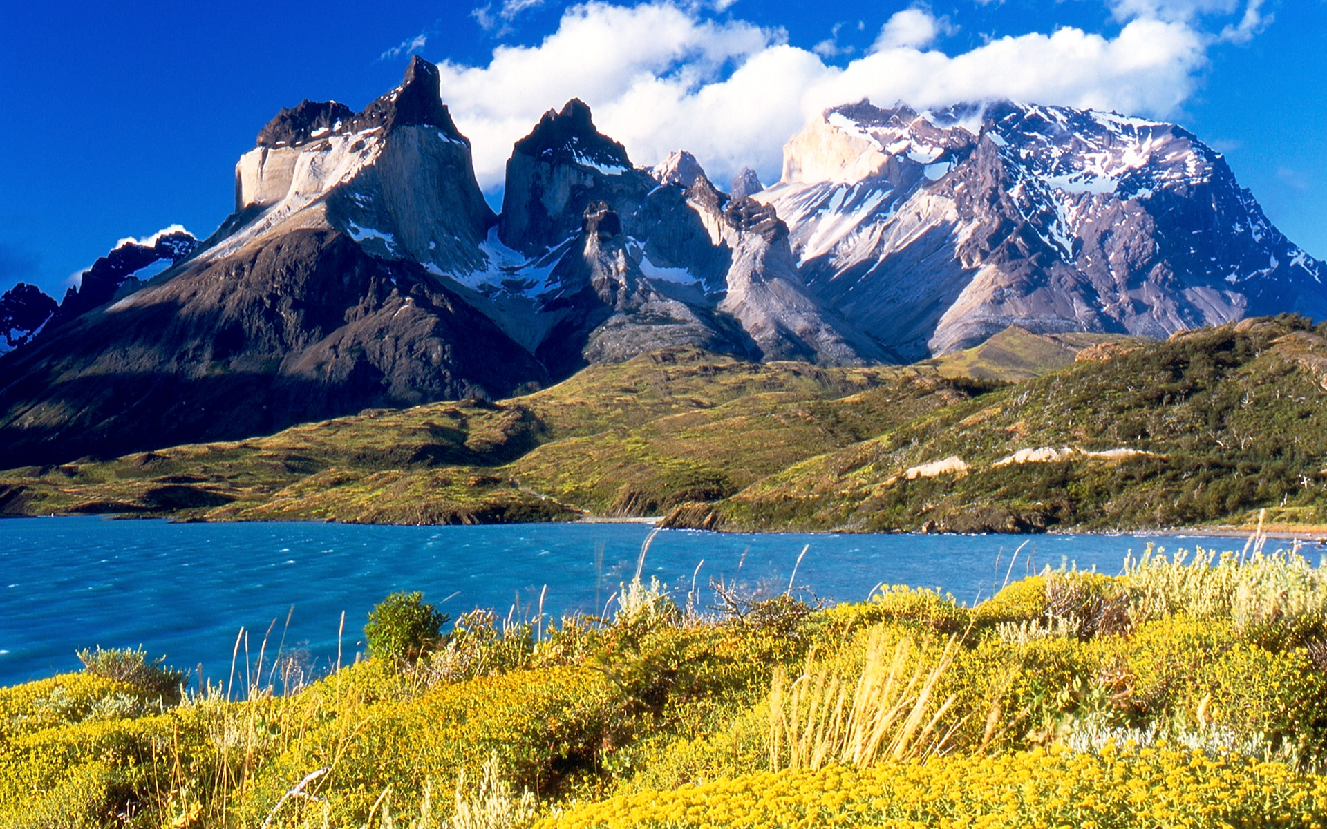
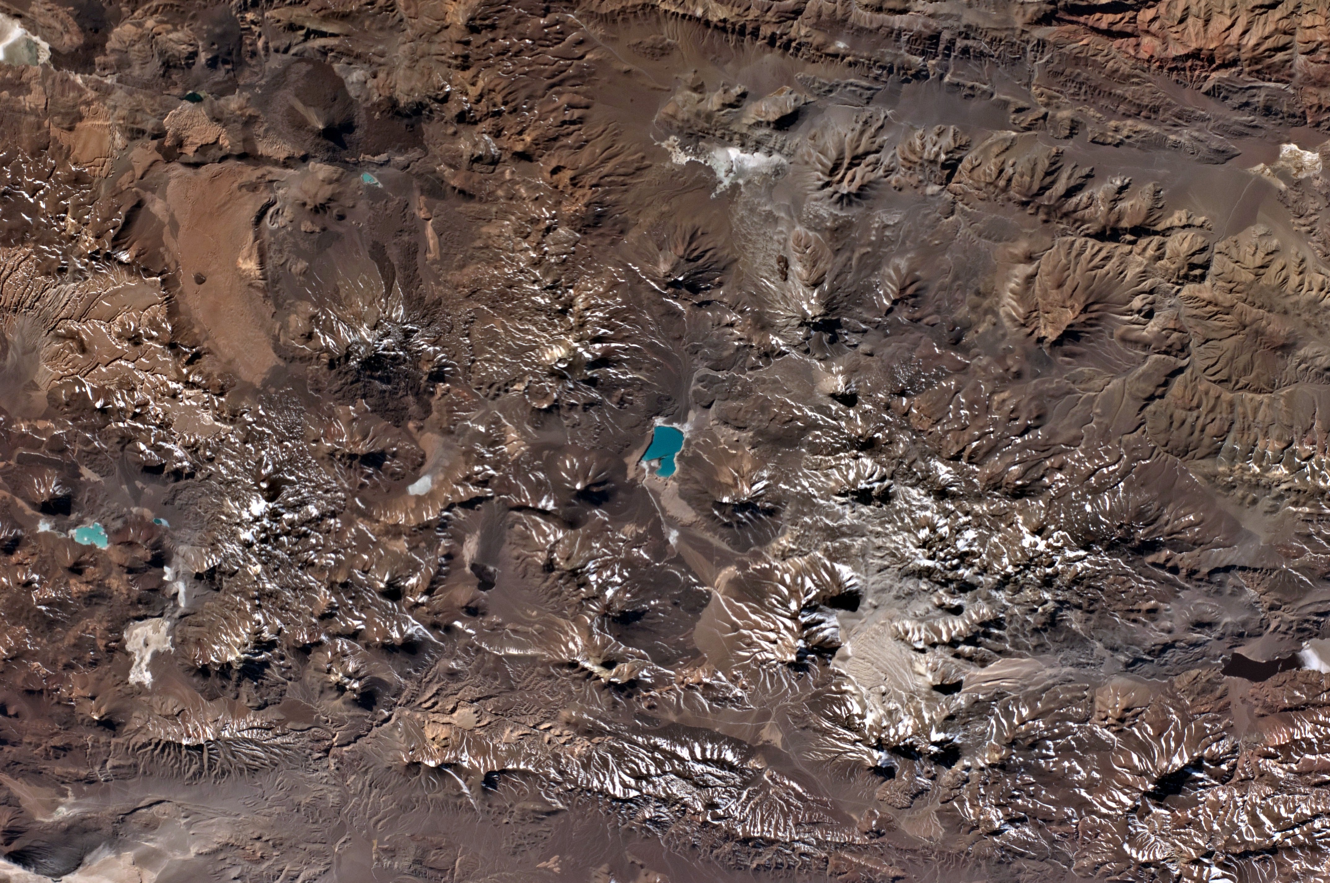
Countries Argentina, Bolivia, Chile, Colombia, Ecuador, Peru, Venezuela Cities Bogotá, Santiago, Medellín, La Paz, Cali, Quito, Pasto, Bucaramanga, Arequipa, Mendoza, Cuenca, Cochabamba, Pereira, Ibagué, Salta, Manizales Highest point Aconcagua - location Las Heras Department, Mendoza, Argentina - elevation 6,962 m (22,841 ft) - coordinates 32°39′10″S 70°0′40″W / 32.65278°S 70.01111°W Length 7,000 km (4,350 mi) Width 500 km (311 mi)  Composite satellite image of the southern Andes
The Andes is the world's longest continental mountain range. It is a continual range of highlands along the western coast of South America. This range is about 7,000 km (4,300 mi) long, about 200 km (120 mi) to 700 km (430 mi) wide (widest between 18 degrees South and 20 degrees South latitude), and of an average height of about 4,000 m (13,000 ft).
Along its length, the Andes is split into several ranges, which are separated by intermediate depressions. The Andes is the location of several high plateaux – some of which host major cities such as Quito, Bogotá, Arequipa, Medellín, Sucre, and La Paz.
The so-called Altiplano plateau is the world's second-highest plateau following the Tibetan plateau. The Andes extend from north to south through seven South American countries; Argentina, Bolivia, Chile, Colombia, Ecuador, Peru and Venezuela.
The Andes range is the world's highest mountain range outside of the continent of Asia. The highest peak, Mt. Aconcagua, rises to an elevation of about 6,962 m (22,841 ft) above sea level. The peak of Chimborazo in the Ecuadorean Andes is farther from the centre of the Earth than any other location on the Earth's surface. This is because of the equatorial bulge that results from the Earth's rotation. The world's highest volcanoes are in the Andes, including Ojos del Salado on the Chile-Argentina frontier which rises to 6,893 m (22,615 ft), and over 50 other volcanoes that rise above 6,000 m.
Contents
Name
The etymology of the word Andes has been debated. The major consensus is that it derives from the Quechua word anti, which means "high crest". Others believe that Andes comes from Anti Suyu, one of the four regions of the Inca empire. It is more likely however that the word Antisuyo derives from the use of Anti to designate mountain chains. Derivation from the Spanish andén (in the sense of cultivation terrace) has also been proposed, yet considered very unlikely.
Geography
 Aerial view of Aconcagua.
The Andes can be divided into three sections:
I. The Southern Andes in Argentina and Chile;
II. The Central Andes, including the Chilean and Peruvian cordilleras and parts of Bolivia;
III. The Northern Andes in Venezuela, Colombia, and Ecuador that consists of two parallel ranges, the Cordillera Occidental and the Cordillera Oriental. In Colombia, north of its the border with Ecuador, the Andes split in three parallel ranges, the western, central, and eastern ranges. (The cordillera occidental, central, and oriental).In the northern part of the Andes, the isolated Sierra Nevada de Santa Marta range is often considered to be part of the Andes. The eastern range of Colombia is the only one that extends to Venezuela.[1] The term cordillera comes from the Spanish word meaning "cuerda", meaning "rope". The Andes range is about 200 km (124 mi) wide throughout its length, except in the Bolivian flexure where it is about 640 kilometres (398 mi) wide. The islands of the Dutch Caribbean Aruba, Bonaire, and Curaçao, which lie in the Caribbean Sea off the coast of Venezuela, were thought to represent the submerged peaks of the extreme northern edge of the Andes range, but ongoing geological studies indicate that such a simplification does not do justice to the complex tectonic boundary between the South-American and Caribbean plates.[2]
Geology
Geology of the Andes 
Orogenies Pampean orogeny Famatinian orogeny Gondwanide orogeny Andean orogeny Fold-thrust belts Central Andean | Patagonian
Batholiths Peruvian Coastal | North Patagonian | South Patagonian Subducted structures Antarctic Plate | Carnegie Ridge | Chile Rise | Farallon Plate (formerly) | Juan Fernández Ridge | Nazca Plate | Nazca Ridge
Faults Gastre | Liquiñe-Ofqui | Magallanes-Fagnano
Andean Volcanic Belt Northern Zone| Peruvian flat-slab | Central Zone | Pampean flat-slab | Southern Zone | Patagonian Gap | Austral Zone
Paleogeographic terminology Arequipa-Antofalla Terrane | Chilenia | Chiloé Block | Cuyania | Iapetus Ocean | Madre de Dios Terrane | Mejillonia | Pampia
This section requires expansion. The Andes are a Mesozoic – Tertiary orogenic belt of mountains along the Pacific Ring of Fire, a zone of volcanic activity that encompasses the Pacific rim of the Americas as well as the Asia-Pacific region. The Andes are the result of plate tectonics processes, caused by the subduction of oceanic crust beneath the South American plate. The main cause of the rise of the Andes is the compression of western rim of the South American Plate due to the subduction of the Nazca Plate and the Antarctic Plate. To the east, the Andes range is bounded by several sedimentary basins such as Orinoco, Amazon Basin, Madre de Dios and Gran Chaco which separates the Andes from the ancient cratons in eastern South America. In the south the Andes shares a long boundary with the former Patagonia Terrane. To the west, the Andes end at the Pacific Ocean, although the Peru-Chile trench can be considered its ultimate western limit. From a geographical approach the Andes are considered to have their western boundaries marked by the appearance of coastal lowlands and a less rugged topography.
Orogeny
The western rim of the South American Plate has been the place of several pre-Andean orogenies since at least the of the late Proterozoic and early Paleozoic when several terranes and microcontinents collided and amalgamated with the ancient cratons of eastern South America, by then the South American part of Gondwana.
The formation of the modern Andes began with the events of the Triassic when Pangea began to break up and several rifts developed. It continued through the Jurassic Period. It was during the Cretaceous Period that the Andes began to take its present form, by the uplifting, faulting and folding of sedimentary and metamorphic rocks of the ancient cratons to the east. The rise of the Andes has not been constant and different regions have had different degrees of tectonic stress, uplift, and erosion.
Tectonic forces above the subduction zone along the entire west coast of South America where the Nazca Plate and a part of the Antarctic Plate are sliding beneath the South American Plate continue to produce an ongoing orogenic event resulting in minor to major earthquakes and volcanic eruptions to this day. In the extreme south a major transform fault separates Tierra del Fuego from the small Scotia Plate. Across the 1,000 km (620 mi) wide Drake Passage lie the mountains of the Antarctic Peninsula south of the Scotia Plate which appear to be a continuation of the Andes chain.[citation needed]
Volcanism
Main article: Andean Volcanic Belt
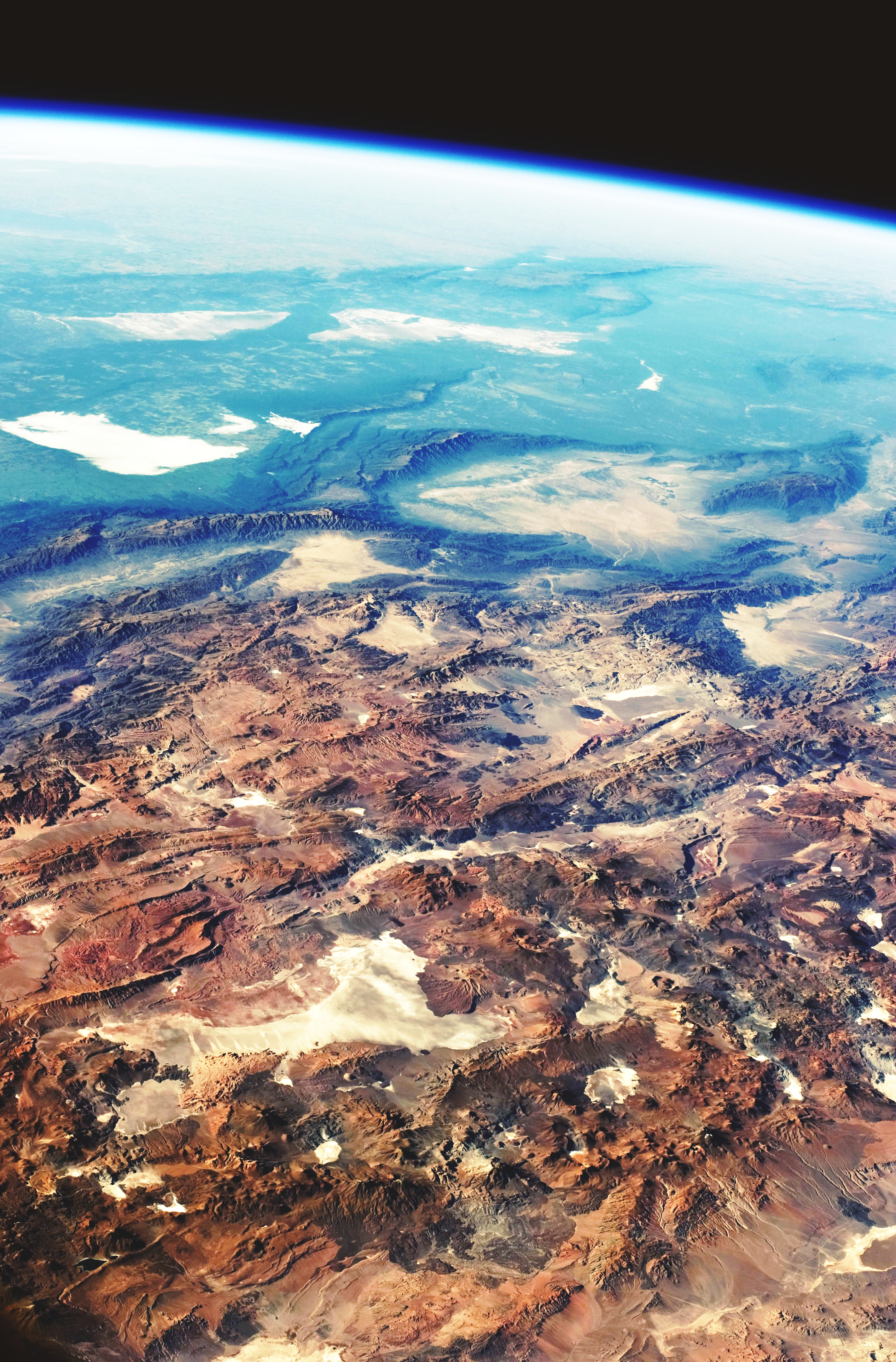
 Astronaut photograph with the high plains of the Andes Mountains in the foreground, with a line of young volcanoes facing the much lower Atacama Desert.
The Andes range has many active volcanoes, which are distributed in four volcanic zones separated by areas of inactivity. The Andean volcanism is a result of subduction of the Nazca Plate and Antarctic Plate underneath the South American Plate. The belt is subdivided into four main volcanic zones that are separated from each other by volcanic gaps. The volcanoes of the belt are diverse in terms of activity style, products and morphology. While some differences can be explained by which volcanic zone a volcano belongs to, there are significant differences inside volcanic zones and even between neighboring volcanoes. Despite being a type location for calc-alkalic and subduction volcanism, the Andean Volcanic Belt has a large range of volcano-tectonic settings, such as rift systems and extrensional zones, transpressional faults, subduction of mid-ocean ridges and seamount chains apart from a large range on crustal thicknesses and magma ascent paths, and different amount of crustal assimilations.
Ore deposits and evaporites
The Andes mountains host large ore and salt deposits and some of its eastern fold and thrust belt acts as traps for commercially exploitable amounts of hydrocarbons. In the forelands of the Atacama desert some of the largest porphyry copper mineralizations occurs making Chile and Peru the first and second largest exporters of copper in the world. Porphyry copper in the western slopes of the Andes has been generated by hydrothermal fluids (mostly water) during the cooling of plutons or volcanic systems. The porphyry mineralization further benefited from the dry climate that let them largely out of the disturbing actions of meteoric water. The dry climate in the central western Andes have also led to the creation of extensive saltpeter deposits which were extensively mined until the invention of synthetic nitrates. Yet another result of the dry climate are the salars of Atacama and Uyuni, the first one being the largest source of lithium today and the second the world’s largest reserve of the element. Early Mesozoic and Neogene plutonism in Bolivias Cordillera Central created the Bolivian tin belt as well as the famous, now depleted, deposits of Cerro Rico de Potosí.
Climate and hydrology
See also: Tropical Andes, Dry Andes, and Wet Andes Central Andes
 Astronaut photograph of the Central Andes
The climate in the Andes varies greatly depending on location, altitude, and proximity to the sea. Temperature, atmospheric pressure and humidity decrease in higher elevations. The southern section is rainy and cool, the central Andes are dry. The northern Andes are typically rainy and warm, with an average temperature of 18 °C (64 °F) in Colombia. The climate is known to change drastically in rather short distances. Rainforests exist just miles away from the snow covered peak Cotopaxi. The mountains have a large effect on the temperatures of nearby areas. The snow line depends on the location. It is at between 4,500 and 4,800 m (14,800–15,800 ft) in the tropical Ecuadorian, Colombian, Venezuelan, and northern Peruvian Andes, rising to 4,800–5,200 m (15,800–17,060 ft) in the drier mountains of southern Peru south to northern Chile south to about 30°S, then descending to 4,500 m (14,760 ft) on Aconcagua at 32°S, 2,000 m (6,600 ft) at 40°S, 500 m (1,640 ft) at 50°S, and only 300 m (980 ft) in Tierra del Fuego at 55°S; from 50°S, several of the larger glaciers descend to sea level.[3]
The Andes of Chile and Argentina can be divided in two climatic and glaciological zones; the Dry Andes and the Wet Andes. Since the Dry Andes extends from the latitudes of Atacama Desert to the area of Maule River, precipitation is more sporadic and there are strong temperature oscillations. The line of equilibrium may shift drastically over short periods of time, leaving a whole glacier in the ablation area or in the accumulation area.
In the high Andes of central Chile and Mendoza Province rock glaciers are larger and more common than glaciers; this is due to the high exposure to solar radiation.[4]
Flora
The Andean region cuts across several natural and floristc regions due to is large extension from Caribbean Venezuela to cold, windy and wet Cape Horn passing trough hyperarid Atacama Desert. Rainforests used to encircle much of the northern Andes but are now greatly diminished, especially in the Chocó and inter-Andean valleys of Colombia. As a direct opposite of the humid Andean slopes are the relatively dry Andean slopes in most of western Peru, Chile and Argentina. Along with several Interandean Valles, they are typically dominated by deciduous woodland, shrub and xeric vegetation, reaching the extreme in the slopes near the virtually lifeless Atacama Desert.
About 30,000 species of vascular plants live in the Andes with roughly half being endemic to the region, surpassing the diversity of any other hotspot.[5] The small tree Cinchona pubescens, a source of quinine which is used to treat malaria, is found widely in the Andes as far south as Bolivia. Other important crops that originated from the Andes are tobacco and potatoes. The high-altitude Polylepis forests and woodlands are found in the Andean areas of Colombia, Ecuador, Peru, Bolivia and Chile. These trees, by locals referred to as Queñua, Yagual and other names, can be found at altitudes of 4,500 m (14,760 ft) above sea level. It remains unclear if the patchy distribution of these forests and woodlands is natural, or the result of clearing which began during the Incan period. Regardless, in modern times the clearance has accelerated, and the trees are now considered to be highly endangered, with some believing that as little as 10% of the original woodland remains.[6]
Fauna
 A male Andean Cock-of-the-rock, a species found in humid Andean forests.
 Herds of alpacas on the mountain Ausangate hillside.Main article: Fauna of the Andes
The Andes is rich in fauna: With almost 3,500 species, of which roughly 2/3 are endemic to the region, the Andes is the most important region in the world for amphibians.[5] The diversity of animals in the Andes is high, with almost 600 species of mammals (13% endemic), more than 1,700 species of birds (about 1/3 endemic), more than 600 species of reptile (about 45% endemic), and almost 400 species of fish (about 1/3 endemic).[5]
The Vicuña and Guanaco can be found living in the Altiplano, while the closely related domesticated Llama and Alpaca are widely kept by locals as pack animals and for their meat and wool. The nocturnal chinchillas, two threatened members of the rodent order, inhabit the Andes' alpine regions. The Andean Condor, the largest bird of its kind in the Western Hemisphere, occurs throughout much of the Andes but generally in very low densities. Other animals found in the relatively open habitats of the high Andes include the huemul, cougar, foxes in the genus Pseudalopex, and, for birds, certain species of tinamous (notably members of the genus Nothoprocta), Andean Goose, Giant Coot, flamingos (mainly associated with hypersaline lakes), Lesser Rhea, Andean Flicker, Diademed Sandpiper-plover, miners, sierra-finches and diuca-finches.
Lake Titicaca hosts several endemics, among them the highly endangered Titicaca Flightless Grebe and Titicaca Water Frog. A few species of hummingbirds, notably some hillstars, can be seen at altitudes above 4,000 m (13,100 ft), but far higher diversities can be found at lower altitudes, especially in the humid Andean forests ("cloud forests") growing on slopes in Colombia, Ecuador, Peru, Bolivia and far northwestern Argentina. These forest-types, which includes the Yungas and parts of the Chocó, are very rich in flora and fauna, although few large mammals exists, exceptions being the threatened Mountain Tapir, Spectacled Bear and Yellow-tailed Woolly Monkey.
Birds of humid Andean forests include mountain-toucans, quetzals and the Andean Cock-of-the-rock, while mixed species flocks dominated by tanagers and Furnariids commonly are seen - in contrast to several vocal but typically cryptic species of wrens, tapaculos and antpittas.
A number of species such as the Royal Cinclodes and White-browed Tit-spinetail are associated with Polylepis, and consequently also threatened.
Human activity
 Map showing cultural influence in the Andes.
The Andes mountains form a north-south axis of cultural influences. A long series of cultural development culminated in the expansion of the Inca civilization and Inca Empire in the central Andes during the 15th century. The Incas formed this civilization through imperialistic militarism as well as careful and meticulous governmental management.[7] The government sponsored the construction of aqueducts and roads in addition to preexisting installations. Some of these constructions are still in existence today.
Devastated by European diseases to which they had no immunity, and civil wars, in 1532 the Incas were defeated by an alliance composed of tens of thousands allies from nations they had subjugated (e.g. Huancas, Chachapoyas, Cañaris) and a small army of 180 Spaniards led by Francisco Pizarro. One of the few Inca sites the Spanish never found in their conquest was Machu Picchu, which lay hidden on a peak on the eastern edge of the Andes where they descend to the Amazon. The main surviving languages of the Andean peoples are those of the Quechua and Aymara language families. Woodbine Parish and Joseph Barclay Pentland surveyed a large part of the Bolivian Andes from 1826 to 1827.
In modern times, the largest Andean cities are Bogota, Colombia, with a population of about eight million, La Paz, Bolivia, and Quito, Ecuador.
Transportation
 Troncal 7 (Trans-Andes Highway) in the Venezuelan Andes.
Several major cities exist either in the Andes or in the foothills, among which are Bogotá and Cali, Colombia; Quito, Ecuador; Mérida, Venezuela; La Paz, Bolivia; Santiago, Chile, and Cusco, Peru. These and most other cities and large towns are now connected with asphalt-paved roads, while smaller towns are often connected by dirt roads, which may require a four-wheel-drive vehicle.[1]
The rough terrain has historically put the costs of building highways and railroads that cross the Andes out of reach of most neighboring countries, even with modern civil engineering practices. For example, the main cross over the Andes between Argentina and Chile is still accomplished through the Paso Internacional Los Libertadores, and only recently the ends of some highways that came rather close to one another from the east and the west have been connected[8]. Much of the transportation of passengers is done via airline.
For decades, Chile claimed ownership of land on the eastern side of the Andes. However, these claims were given up in about 1870 during the War of the Pacific between Chile, and the allied Bolivia and Peru, in a diplomatic deal to keep Argentina out of the war. The Chilean Army and Chilean Navy defeated the combined forces of Bolivia and Peru, and Chile took over Bolivia's only province on the Pacific Coast, and some land from Peru, also - that was returned to Peru later. Bolivia has been a landlocked country ever since then.
However, if Chile had kept some land to the east, the difficulties in transportation between east and west would have been enormous. There has also been bad blood between Bolivia and Chile ever since 1870, and these two countries have not had diplomatic relations since about 1974.
Because of the tortuous terrain in places, villages and towns in which motorized vehicles are of little use are still present. Locally, the relatives of the camel, the llama and the alpaca continue to carry out important uses as pack animals, but this use has generally diminished in modern times.
Agriculture
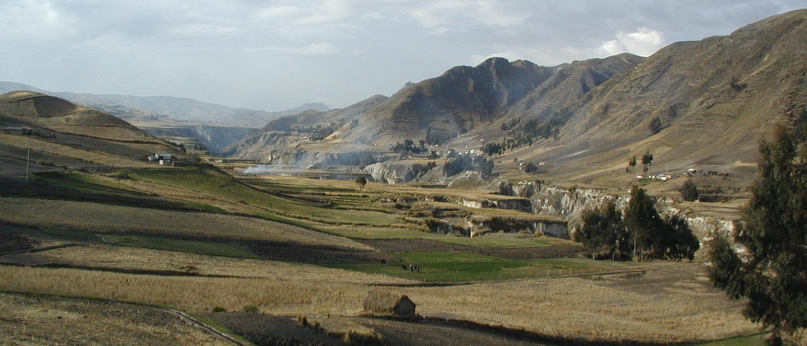
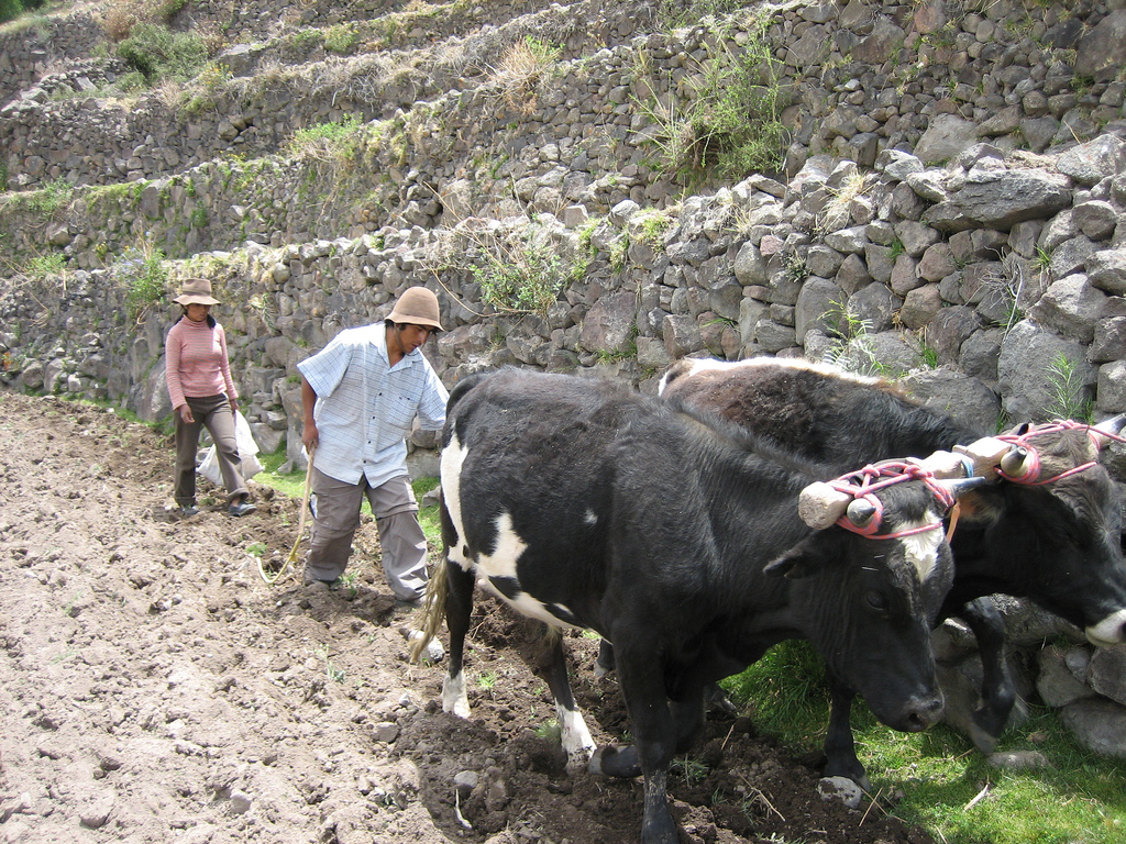
 Photograph of young Peruvian farmers sowing maize and beans.
The ancient peoples of the Andes such as the Incas have practiced irrigation techniques for over 6,000 years. Because of the mountain slopes, terracing has been a common practice. Terracing, however, was only extensively employed after Incan imperial expansions to fuel their expanding realm. The potato holds a very important role as an internally consumed staple crop. Maize was also an important crop for these people. However, they were mainly used for the production of the culturally important chicha. Currently, tobacco, cotton and coffee are the main export crops. Coca, despite eradication programmes in some countries, remains an important crop for legal local use in a mildly stimulating herbal tea, and, both controversially and illegally, for the production of cocaine.
Mining
The Andes rose to fame for its mineral wealth during the Spanish conquest of South America. Although Andean Amerindian peoples crafted ceremonial jewelry of gold and other metals the mineralizations of the Andes were first mined in large scale after the Spanish arrival. Potosí in present-day Bolivia was one of the principal mines of the Spanish Empire in the New World. Río de la Plata and Argentina derive their names from the silver of Potosí.
Currently, mining in the Andes of Chile and Peru place these countries as the 1st and 3rd major producers of copper in the world. The Bolivian Andes produce principally tin although historically silver mining had a huge impact on the economy of 17th century Europe.
There is a long history of mining in the Andes, from the Spanish silver mines in Potosí in the 16th century to the vast current porphyry copper deposits of Chuquicamata and Escondida in Chile and Toquepala in Peru. Other metals including iron, gold and tin in addition to non-metallic resources are also important.
Peaks
Main article: List of mountains in the AndesThis list contains some of the major peaks in the Andes mountain range. The highest peak is Aconcagua of Argentina (see below).
Argentina
Main article: List of mountains in Argentina- Aconcagua, 6,962 m (22,841 ft)
- Cerro Bonete, 6,759 m (22,175 ft)
- Galán, 5,912 m (19,396 ft)
- Mercedario, 6,720 m (22,047 ft)
- Pissis, 6,795 m (22,293 ft)
-

Tronador, Argentina/Chile
Border between Argentina and Chile
- Cerro Bayo, 5,401 m (17,720 ft)
- Cerro Chaltén, 3,375 m (11,073 ft) or 3,405 m, Patagonia, also known as Cerro Fitz Roy
- Cerro Escorial, 5,447 m (17,871 ft)
- Cordón del Azufre, 5,463 m (17,923 ft)
- Falso Azufre, 5,890 m (19,324 ft)
- Incahuasi, 6,620 m (21,719 ft)
- Lastarria, 5,697 m (18,691 ft)
- Llullaillaco, 6,739 m (22,110 ft)
- Maipo, 5,264 m (17,270 ft)
- Marmolejo, 6,110 m (20,046 ft)
- Ojos del Salado, 6,893 m (22,615 ft)
- Olca, 5,407 m (17,740 ft)
- Sierra Nevada de Lagunas Bravas, 6,127 m (20,102 ft)
- Socompa, 6,051 m (19,852 ft)
- Nevado Tres Cruces, 6,749 m (south summit) (III Region)
- Tronador, 3,491 m (11,453 ft)
- Tupungato, 6,570 m (21,555 ft)
- Nacimiento, 6,492 m (21,299 ft)
-

Torres del Paine, Chile -

Llullaillaco, Argentina/Chile -

Camino de Alta Montaña, Argentina/Chile
Bolivia
- Ancohuma, 6,427 m (21,086 ft)
- Cabaray, 5,860 m (19,226 ft)
- Chacaltaya, 5,421 m (17,785 ft)
- Huayna Potosí, 6,088 m (19,974 ft)
- Illampu, 6,368 m (20,892 ft)
- Illimani, 6,438 m (21,122 ft)
- Macizo de Larancagua, 5,520 m (18,110 ft)
- Macizo de Pacuni, 5,400 m (17,720 ft)
- Nevado Anallajsi, 5,750 m (18,865 ft)
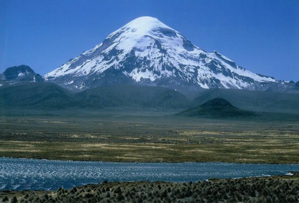
- Nevado Sajama, 6,542 m (21,463 ft)
- Patilla Pata, 5,300 m (17,390 ft)
- Tata Sabaya, 5,430 m (17,815 ft)
Border between Bolivia and Chile
- Acotango, 6,052 m (19,856 ft)
- Cerro Minchincha, 5,305 m (17,405 ft)
- Irruputuncu, 5,163 m (16,939 ft)
- Licancabur, 5,920 m (19,423 ft)
- Olca, 5,407 m (17,740 ft)
- Parinacota, 6,348 m (20,827 ft)
- Paruma, 5,420 m (17,782 ft)
- Pomerape, 6,282 m (20,610 ft)
-

Licancabur, Bolivia/Chile
Chile
Main article: List of mountains in Chile- Monte San Valentin, 4,058 m (13,314 ft)
- Cerro Paine Grande, c.2,750 m (9,022 ft)
- Cerro Macá, c.2,300 m (7,546 ft)
- Monte Darwin, c.2,500 m (8,202 ft)
- Volcan Hudson, c.1,900 m (6,234 ft)
- Cerro Castillo Dynevor, c.1,100 m (3,609 ft)
- Mount Tarn, c.825 m (2,707 ft)
- Polleras, 5,993 m (19,662 ft)
-

Santiago de Chile on the western slopes of a snowcapped Andes
-

View of Cuernos del Paine in Torres del Paine National Park
Colombia
- Pico Cristóbal Colón, 5,775 m (18,947 ft)
- Nevado del Huila, 5,365 m (17,602 ft)
- Nevado del Ruiz, 5,321 m (17,457 ft)
- Nevado del Tolima, 5,205 m (17,077 ft)
- Pico Pan de Azucar, 5,200 m (17,060 ft)
- Ritacuba Negra, 5,320 m (17,454 ft)
- Nevado del Cumbal, 4,764 m (15,630 ft)
- Cerro Negro de Mayasquer, 4,445 m (14,583 ft)
- Ritacuba Blanco, 5,410 m (17,749 ft)
- Nevado del Quindío, 5,215 m (17,110 ft)
- Purace, 4,655 m (15,272 ft)
- Santa Isabel, 4,955 m (16,257 ft)
- Doña Juana, 4,150 m (13,615 ft)
- Galeras, 4,276 m (14,029 ft)
- Azufral. 4,070 m (13,353 ft)
-

Ritacuba blanco the highest peak of Cordillera Oriental, Colombia.
-

Nevado del Ruiz, Colombia
Ecuador
- Antisana, 5,752 m (18,871 ft)
- Cayambe, 5,790 m (18,996 ft)
- Chimborazo, 6,268 m (20,564 ft)
- Corazón, 4,790 m (15,715 ft)
- Cotopaxi, 5,897 m (19,347 ft)
- El Altar, 5,320 m (17,454 ft)
- Illiniza, 5,248 m (17,218 ft)
- Pichincha, 4,784 m (15,696 ft)
- Quilotoa, 3,914 m (12,841 ft)
- Reventador, 3,562 m (11,686 ft)
- Sangay, 5,230 m (17,159 ft)
- Tungurahua, 5,023 m (16,480 ft)
- Titicacha, 5,035 m (16,519 ft)
-

Chimborazo near Riobamba, Ecuador.
-

Cayambe, Ecuador.
Peru
- Alpamayo, 5,947 m (19,511 ft)
- Artesonraju, 6,025 m (19,767 ft)
- Carnicero, 5,960 m (19,554 ft)
- El Misti, 5,822 m (19,101 ft)
- El Toro, 5,830 m (19,127 ft)
- Huandoy, 6,395 m (20,981 ft)
- Huascarán, 6,768 m (22,205 ft)
- Jirishanca, 6,094 m (19,993 ft)
- Nevado de Huaytapallana, 5,557 m (18,232 ft)
- Pumasillo, 5,991 m (19,656 ft)
- Rasac, 6,040 m (19,816 ft)
- Rondoy, 5,870 m (19,259 ft)
- Sarapo, 6,127 m (20,102 ft)
- Seria Norte, 5,860 m (19,226 ft)
- Siula Grande, 6,344 m (20,814 ft)
- Yerupaja, 6,635 m (21,768 ft)
- Yerupaja Chico, 6,089 m (19,977 ft)
-

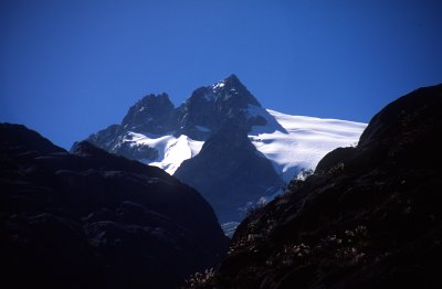
Alpamayo, Peru
-

Huandoy, Peru
Venezuela
- Pico Bolívar, 4,981 m (16,342 ft)
- Pico Humboldt, 4,940 m (16,207 ft)
- Pico Bonpland, 4,880 m (16,010 ft)
- Pico La Concha, 4,870 m (15,978 ft)
- Pico Piedras Blancas, 4,740 m (15,551 ft)
-

Pico Bolívar, Venezuela
-

Pico Humboldt, Venezuela
See also
- Andean Geology - a scientific journal
- Andesite line
- Apu (god)
- Cordillera Mountains in the Philippines
- Mountain Passes of the Andes
Notes
- ^ a b Andes travel map
- ^ "Upper mantle structure beneath the Caribbean-South American plate boundary from surface wave tomography". JOURNAL OF GEOPHYSICAL RESEARCH, VOL. 114, B01312, 13 PP., 2009 doi:10.1029/2007JB005507. Archived from the original on 2010-06-05. http://web.archive.org/web/20100605003245/http://www.gseis.rice.edu/Reprints/047_MillerEL09JGR.pdf. Retrieved 2010-11-21.
- ^ "Climate of the Andes". http://www.blueplanetbiomes.org/andes_climate_page.htm. Retrieved 2007-12-09.
- ^ Jan-Christoph Otto, Joachim Götz, Markus Keuschnig, Ingo Hartmeyer, Dario Trombotto, and Lothar Schrott (2010). Geomorphological and geophysical investigation of a complex rock glacier system - Morenas Coloradas valley (Cordon del Plata, Mendoza, Argentina)
- ^ a b c Tropical Andes - biodiversityhotspots.org
- ^ "Plants of the Andes". http://www.blueplanetbiomes.org/andes_plant_page.htm. Retrieved 2007-12-09.
- ^ D'Altroy, Terence N. The Incas. Blackwell Publishing, 2003
- ^ "Jujuy apuesta a captar las cargas de Brasil en tránsito hacia Chile by Emiliano Galli". La Nación newspaper. http://www.lanacion.com.ar/1159492-jujuy-apuesta-a-captar-las-cargas-de-brasil-en-transito-hacia-chile. Retrieved 2011-07-22.
References
- John Biggar, The Andes: A Guide For Climbers, 3rd. edition, 2005, ISBN 0-9536087-2-7
- Tui de Roy, The Andes: As the Condor Flies. 2005, ISBN 1-55407-070-8
- Fjeldså, J., & N. Krabbe (1990). The Birds of the High Andes. Zoological Museum, University of Copenhagen, Copenhagen. ISBN 87-88757-16-1
- Fjeldså, J. & M. Kessler. 1996. Conserving the biological diversity of Polylepis woodlands of the highlands on Peru and Bolivia, a contribution to sustainable natural resource management in the Andes. NORDECO, Copenhagen.
External links
- Andes geology (University of Arizona)
- Climate and animal life of the Andes
- Regions and Microclimates in the Andes
- http://www.peaklist.org/WWlists/ultras/southamerica.html Complete list of mountains in South America with a prominence of at least 1,500 m (4,920 ft)
Subfields of physical geography  Categories:
- Mountain ranges of South America
- Biodiversity hotspots
- Regions of South America
- Physiographic divisions
- Andes


Wikimedia Foundation. 2010.