- Colonia del Sacramento
-
Colonia del Sacramento — Capital city — Basilica del Sanctísimo Sacramento
 Colonia del Sacramento
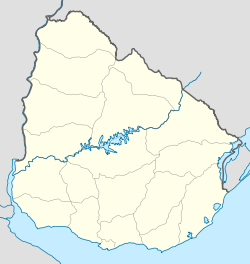
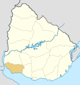
Coordinates: 34°28′17″S 57°50′39″W / 34.47139°S 57.84417°WCoordinates: 34°28′17″S 57°50′39″W / 34.47139°S 57.84417°W Country  Uruguay
Department Colonia Department Founded 1680 Founder Manuel Lobo Elevation 27 m (89 ft) Population (2004) - Total 21,714 Time zone UTC -3 Postal code 70000 Area code(s) +598 452 Colonia del Sacramento (formerly the Portuguese Colónia do Sacramento) is a city in southwestern Uruguay, by the Río de la Plata, facing Buenos Aires, Argentina. It is the oldest town in Uruguay and capital of the departamento of Colonia. It has a population of around 22,000.
It is renowned for its historic quarter, a World Heritage Site. Modern Colonia del Sacramento produces textiles and has a free trade zone, in addition to a polytechnic centre and various government buildings.
Contents
Population
In 2004 Colonia del Sacramento had a population of 21,714.[1]
Year Population 1963 13,337 1975 17,046 1985 19,102 1996 22,200 2004 21,714 Source: Instituto Nacional de Estadística de Uruguay[2]
History
Founded in 1680 by Portugal as Colónia do Sacramento, the colony was later disputed by the Spanish who settled on the opposite bank of the river at Buenos Aires. The colony was conquered by José de Garro in 1680, but returned to Portugal the next year. It was conquered again by the Spanish in March 1705 after a siege of five months, but given back in the Treaty of Utrecht. Another attack during the Spanish-Portuguese War, 1735-1737, failed.
It kept changing hands from crown to crown due to treaties such as the Treaty of Madrid in 1750 and the Treaty of San Ildefonso in 1777, until it remained with the Spanish. It then transferred to Portuguese control again, being later incorporated in Brazil after 1816, when the entire Banda Oriental (Uruguay) was seized by the government of the United Kingdom of Portugal, Brazil and the Algarves and renamed the Cisplatina province.
Now part of the independent country of Uruguay, Colonia del Sacramento has expanded to the north and east, but the original Barrio Histórico (historic quarter) retains its irregular, terrain-fitting street plan built by the Portuguese, contrasting with the wider, orthogonal calles in the newer Spanish area.
Timeline of rule
The rule from 1680 to present (with flag of the period) is:
From To Rule Reason for Handover 1680 1680  Portugal
 conquered by José de Garro 1680 1681  Spain
SpainProvisional Treaty of Lisbon 1681 1705 Portugalconquered in the War of Spanish Succession 1705 1713  Spain
SpainTreaty of Utrecht 1714 1762  Portugal
First Cevallos expedition 1762 1763 SpainTreaty of Paris (1763) 1763 1777 PortugalSecond Cevallos expedition 1777 1811  Spain
SpainRevolt led by José Gervasio Artigas 1811 1817  Liga Federal
Luso-Brazilian invasion 1817 1822  Portugal
Brazilian Declaration of Independence 1822 1828  Brazil
Argentina-Brazil War 1828 present  Uruguay
Colonia del Sacramento Climate chart (explanation) J F M A M J J A S O N D 922720972620116241795211583171261148641387615969171110620131092216712518Average max. and min. temperatures in °C Precipitation totals in mm Source: Zoover (in Portuguese) Imperial conversion J F M A M J J A S O N D 3.681683.879684.675633.770593.363542.457462.55546359482.763524.268554.372612.87764Average max. and min. temperatures in °F Precipitation totals in inches Climate
Colonia del Sacramento has a mild humid subtropical climate, described by the Köppen climate classification as Cfa. Summers are warm and winters are cool, with relatively frequent frosts and fog. The precipitation is evenly distributed throughout the year, with an average of 1,039 mm (40.91 in), and the annual average temperature is 17 °C (63 °F).
Points of interest
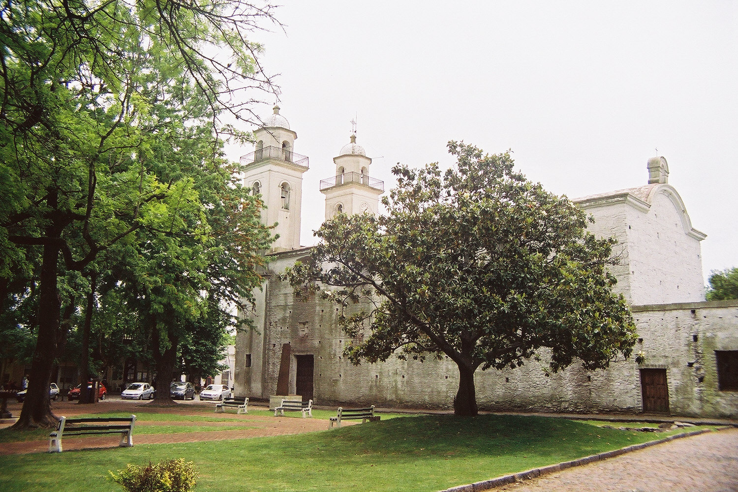
The Barrio Histórico (historic quarter) section of Colonia del Sacramento is designated a World Heritage Site by UNESCO. It is a popular tourist attraction for visitors from Buenos Aires, and there is frequent ferry service across the Río de la Plata between the two cities, with fast ferries completing the journey in just 50 minutes. The historical section of Colonia, which has some cobblestone streets built by the Portuguese in the 17th century, is within walking distance of the ferry terminal. Among the notable visitor attractions around the tree-lined Plaza Mayor (main square) are:
Historic Quarter of the City of Colonia del Sacramento * UNESCO World Heritage SiteCountry Uruguay Type Cultural Criteria iv Reference 747 Region ** Latin America and the Caribbean Inscription history Inscription 1995 (19th Session) * Name as inscribed on World Heritage List
** Region as classified by UNESCO- Portón de Campo – the City Gate and wooden drawbridge
- Lighthouse and convent ruins of the 17th century Convent of San Francisco
- Basilica del Sanctísimo Sacramento – the Basilica of the Holy Sacrament, built of stone by the Portuguese in 1808
- Portuguese Museum – constructed in the 18th century, it exhibits Portuguese furnishings, jewelry, uniforms and old maps of Portuguese naval expeditions
- Casa de Nacarello – an 18th century Portuguese house
- Municipal Museum – rebuilt by the Spanish in 1835 as the Casa del Almirante Brown, it exhibits artifacts and documents of the city's different periods and cultures
- Viceroy's House – the Casa del Virrey, reconstructed from the original ruins
- Iglesia Matriz – the oldest church in Uruguay, dating from 1695–99
- Plaza de toros Real de San Carlos, a Bullring included in an old tourist complex now abandoned.
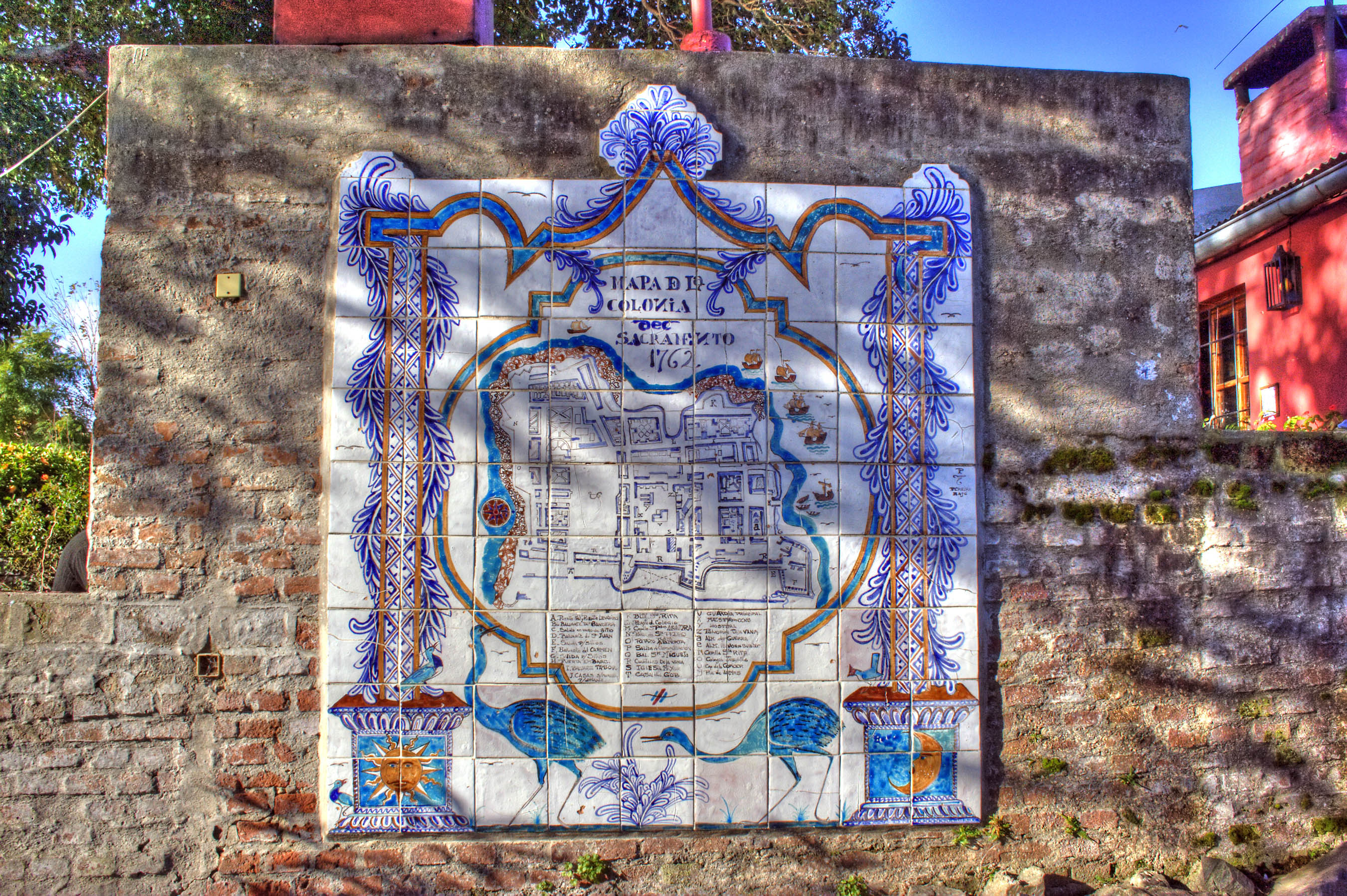
Gallery
- Views of the ''Barrio Histórico''
-

Map of the Old City in ceramic tiles
-

View of the historic district from the top of the lighthouse
-

Portón de Campo, the City Gate
-

Another view of the City Gate
-

Lighthouse at Colonia del Sacramento
-

Calle San Pedro, a typical street in the historic district
-

The 1866 Wharf of Colonia
-

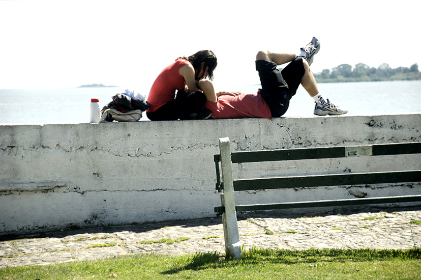
On the river wall at the banks of the Río de la Plata.
Transportation
Colonia del Sacramento is served by three ferry boat lines from Buenos Aires, Argentina: "Buquebus", "Seacat Colonia" and "Colonia Express".
Two principal highways terminate at Colonia: Highway #1 connects Colonia to Montevideo and points east; Highway #21 connects to points north, including the Aarón de Anchorena National Park, 30 kilometres (19 mi) distant, and Fray Bentos. There is also a local airport which can receive light aircraft. There is a project in planning to lengthen the runway and recommence flights to Buenos Aires (this was done in the past)and other cities within Uruguay.
The city is served by Laguna de los Patos International Airport located 17km from Colonia along route 1.
Consular representation
Argentina maintains a consulate in Colonia del Sacramento.
Twin town/sister city
See also
References
- ^ "2004 Census of Colonia department" (XLS). INE. 2004. http://www.ine.gub.uy/fase1new/Colonia/Cuadro7_05.XLS. Retrieved 27 June 2011.
- ^ "1963–1996 Statistics / C" (DOC). Instituto Nacional de Estadística de Uruguay. 2004. http://www.ine.gub.uy/biblioteca/toponimico/TOPOletraC.doc. Retrieved 27 June 2011.
- ^ (Portuguese) Cidades-irmãs de Pelotas terão espaço na Fenadoce, Prefeitura Municipal de Pelotas - accessed on June 4, 2007.
External links
- Article on Colonia del Sacramento, Official Portal of the Uruguayan Government
- 360° Virtual Tours of Colonia del Sacramento - Uruguay360.com.uy
- Tourist information about Colonia del Sacramento
- Tourist guide about Colonia del Sacramento – photos, hosting and attractions of Colonia del Sacramento attractions
- Colonia del Sacramento Website
- INE map of Colonia del Sacramento
 Coast of Colonia
Resorts
and
LandformsBrisas del Plata • Santa Regina (Playa Robert) • Los Pinos - Playa Fomento (Britopolis, Blanca Arena) • (Pta del Rosario, Boca del Rosario, Playa Charrua) • Juan Lacaze • Artilleros (Pta Artilleros, Playa Artilleros) - Santa Ana (Playa Santa Ana) - El Ensueño (Puerto Platero) • Riachuelo (Playa & Pta del Islote, Playa El Calabrés) • Colonia del Sacramento (Puerto de Colonia, Barrio Historico, Muelle del Yates, Playa de Colonia, Playa Real de San Carlos) • (Parque Anchorea, Barra de San Juan, Pta Francesca, Pta Pereira) • Puerto Inglés (Pta & Puerto Conchillas) • (Pta Martin Chico, Pta Dorado) • Carmelo (Pta Piedras, Playa Seré, Playa Coralito) • Zagarzazú (Playa Zagarzazú, Puerto Camacho) • Nueva Palmira (Pta Gorda, Puerto de N.Palmira, Playa de los Argentinos, Playa Higuerita, Playa Eolo, Playa Corbacho, Playa Los Vascos, Balneario Brisas del Uruguay)
Glossary : Balneario = Resort , Barra = Mouth (of river) , Barrio = Neighbourhood , Playa = Beach , Puerto = Port , Punta (or Pta) = Point, Small Peninsula Colonia Department of UruguayCapital: Colonia del SacramentoTowns and
villagesArrivillaga • Barker • Carmelo • Colonia del Sacramento • Colonia Valdense • Conchillas • El Semillero • Florencio Sánchez • Fomento • Horqueta • Juan Lacaze • La Paz • Los Pinos • Miguelete • Nueva Helvecia • Nueva Palmira • Ombúes de Lavalle • Rosario • Tarariras • Zagarzazú
Sights Portuguese Empire North Africa15th century
1415–1640 Ceuta
1458–1550 Alcácer Ceguer (El Qsar es Seghir)
1471–1550 Arzila (Asilah)
1471–1662 Tangier
1485–1550 Mazagan (El Jadida)
1487– middle 16th century Ouadane
1488–1541 Safim (Safi)
1489 Graciosa16th century
1505–1769 Santa Cruz do Cabo
de Gué (Agadir)
1506–1525 Mogador (Essaouira)
1506–1525 Aguz (Souira Guedima)
1506–1769 Mazagan (El Jadida)
1513–1541 Azamor (Azemmour)
1515 São João da Mamora (Mehdya)
1577–1589 Arzila (Asilah)Sub-Saharan Africa15th century
1455–1633 Arguin
1470–1975 Portuguese São Tomé1
1474–1778 Annobón
1478–1778 Fernando Poo (Bioko)
1482–1637 Elmina (São Jorge
da Mina)
1482–1642 Portuguese Gold Coast
1496–1550 Madagascar (part)
1498–1540 Mascarene Islands16th century
1500–1630 Malindi
1500–1975 Portuguese Príncipe1
1501–1975 Portuguese E. Africa
(Mozambique)
1502–1659 St. Helena
1503–1698 Zanzibar
1505–1512 Quíloa (Kilwa)
1506–1511 Socotra
1557–1578 Portuguese Accra
1575–1975 Portuguese W. Africa
(Angola)
1588–1974 Cacheu2
1593–1698 Mombassa (Mombasa)17th century
1642–1975 Portuguese Cape Verde
1645–1888 Ziguinchor
1680–1961 São João Baptista de Ajudá
1687–1974 Portuguese Bissau2
18th century
1728–1729 Mombassa (Mombasa)
1753–1975 Portuguese São Tomé and Príncipe
19th century
1879–1974 Portuguese Guinea
1885–1975 Portuguese Congo1 Part of São Tomé and Príncipe from 1753. 2 Part of Portuguese Guinea from 1879. Southwest Asia16th century
1506–1615 Gamru (Bandar-Abbas)
1507–1643 Sohar
1515–1622 Hormuz (Ormus)
1515–1648 Quriyat
1515–? Qalhat
1515–1650 Muscat
1515?–? Barka
1515–1633? Julfar (Ras al-Khaimah)
1521–1602 Bahrain (Muharraq and Manama)
1521–1529? Qatif
1521?–1551? Tarut Island
1550–1551 Qatif
1588–1648 Matrah17th century
1620–? Khor Fakkan
1621?–? As Sib
1621–1622 Qeshm
1623–? Khasab
1623–? Libedia
1624–? Kalba
1624–? Madha
1624–1648 Dibba Al-Hisn
1624?–? Bandar-e KongIndian subcontinent15th century
1498–1545 Laccadive Islands
(Lakshadweep)16th century
Portuguese India
· 1500–1663 Cochim (Kochi)
· 1502–1661 Quilon (Coulão/Kollam)
· 1502–1663 Cannanore (Kannur)
· 1507–1657 Negapatam (Nagapatnam)
· 1510–1962 Goa
· 1512–1525 Calicut (Kozhikode)
· 1518–1619 Chaul
· 1523–1662 Mylapore
· 1528–1666 Chittagong
· 1531–1571 Chalium
· 1534–1601 Salsette Island
· 1534–1661 Bombay (Mumbai)
· 1535–1739 Baçaím (Vasai-Virar)
· 1536–1662 Cranganore (Kodungallur)
· 1540–1612 Surat
· 1548–1658 Tuticorin (Thoothukudi)16th century (continued)
Portuguese India (continued)
· 1559–1962 Daman and Diu
· 1568–1659 Mangalore
· 1579–1632 Hugli
· 1598–1610 Masulipatnam (Machilipatnam)
1518–1521 Maldives
1518–1658 Portuguese Ceylon (Sri Lanka)
1558–1573 Maldives
17th century
Portuguese India
· 1687–1749 Mylapore
18th century
Portuguese India
· 1779–1954 Dadra and Nagar HaveliEast Asia and Oceania16th century
1511–1641 Portuguese Malacca
1512–1621 Ternate
· 1576–1605 Ambon
· 1578–1650 Tidore
1512–1665 Makassar
1553–1999 Portuguese Macau
1571–1639 Decima (Dejima, Nagasaki)17th century
1642–1975 Portuguese Timor (East Timor)1
19th century
Portuguese Macau
· 1864–1999 Coloane
· 1849–1999 Portas do Cerco
· 1851–1999 Taipa
· 1890–1999 Ilha Verde
20th century
Portuguese Macau
· 1938–1941 Lapa and Montanha (Hengqin)1 1975 is the year of East Timor's Declaration of Independence and subsequent invasion by Indonesia. In 2002, East Timor's independence was recognized by Portugal & the world.
North America and the North Atlantic Ocean16th century
1500–1579? Terra Nova (Newfoundland)
1500–1579? Labrador
1516–1579? Nova ScotiaCentral and South America16th century
1500–1822 Brazil
1536–1620 Portuguese Barbados17th century
1680–1777 Nova Colônia do Sacramento
19th century
1808–1822 Cisplatina (Uruguay)Categories:- Colonia del Sacramento
- Colonia Department
- Populated places in the Colonia Department
- Populated places established in 1680
- Former Portuguese colonies
- Portugal–Spain relations
- World Heritage Sites in Uruguay
- Tourism in Uruguay


Wikimedia Foundation. 2010.