- Metropolitan Borough of Southwark
-
Southwark Motto: United to serve 
Southwark within the County of LondonGeography Status Metropolitan borough 1911/1931 area 1,132 acres (4.58 km2) 1961 area 1,131 acres (4.58 km2) HQ Walworth Road History Created 1900 Abolished 1965 Succeeded by London Borough of Southwark Demography 1911 population
- 1911 density191,907
169/acre1931 population
- 1931 density171,695
152/acre1961 population
- 1961 density86,249
76/acrePolitics Governance Southwark Borough Council 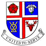
Coat of arms of the borough councilThe Metropolitan Borough of Southwark was a metropolitan borough in the County of London from 1900 to 1965. It was created to cover the western section of the ancient borough of Southwark and formed the northwestern part of the current London Borough of Southwark. In common with the rest of inner London, the borough experienced a steady decline in population throughout its existence. The borough council made an unsuccessful attempt to gain city status in 1955.
Contents
Name and boundaries
The borough was one of two created in the Southwark area by the London Government Act 1899. It was formed from the areas of three local authorities: St Saviours District Board of Works (the civil parishes of Southwark Christchurch and Southwark St Saviours) and the incorporated vestries of Newington and Southwark St George the Martyr. The remaining, eastern, part of Southwark (the parishes of St John Horsleydown and St Olave & St Thomas) was combined with Bermondsey and Rotherhithe.[1]
The legislation did not name the two boroughs. Instead this responsibility was given to the commissioners who were appointed under the act to simplify the boundaries between the new municipalities. Representatives for the various vestries gave their suggestions: St Saviour's District Board suggested "Southwark" for the western borough, denying that the eastern borough had a "co-equal" claim to the name. Representatives of the Collegiate Church of St Saviour supported the district board. It was pointed out that a new diocese was soon to be established with the collegiate church becoming the cathedral. This, it was reasoned, would make the new borough the "City of Southwark".[2]
Newington Vestry believed that the borough should bear their name as they were the "predominant partner" in the merger in terms of population, acreage, rateable value and municipal property, and that the council was likely to be based in their district. The name "Walworth" was also proposed as the area had Roman associations and also appeared in early written histories.[2]
The commissioners originally suggested that "West Southwark" might be acceptable, with the neighbouring borough bearing the name "East Southwark". The vestry of St John Horsleydown proposed naming the boroughs as "Southwark St Saviour's" and "Southwark St Olave's", a suggestion supported by the London County Council.[2] A decision was finally made on 25 January 1900, with the western borough becoming "Southwark" and the eastern borough as Bermondsey.[3]
The existing boundaries were found to be "very unsatisfactory". Accordingly they were realigned, for the most part following the centre of roads. Guy's Hospital, which had been divided between three parishes, was entirely taken into the borough.[4]
In 1955 the borough council unsuccessfully petitioned for the grant of city status.[5]
Districts
It included the areas now known as:
Abolition
The London Government Act 1963 abolished both the County of London and the metropolitan boroughs. In their place were created Greater London, which was divided into 32 London Boroughs, formed by the merger of existing authorities. On 1 April 1965 the London Borough of Southwark was formed by the amalgamation of the three metropolitan boroughs of Southwark, Camberwell and Bermondsey.[1]
Area and population
The Borough had an area of 1,131 acres (4.6 km2). The population from the Census was:
Civil Parishes 1801-1899
Year[6] 1801 1811 1821 1831 1841 1851 1861 1871 1881 1891 1901 Population 62,669 78,219 99,562 116,006 134,225 152,371 173,900 175,049 195,164 202,693 206,160 Gallery
-

Metropolitan Borough of Southwark Town Hall, previously the Vestry Hall of St Mary, Newington
References
- ^ a b Youngs, Frederic A, Jr. (1979). Guide to the Local Administrative Units of England, Vol.I: Southern England. London: Royal Historical Society. p. 645. ISBN 0901050679.
- ^ a b c "The New London Boroughs". The Times: p. 12. 1 December 1899.
- ^ "The New London Boroughs". The Times: p. 11. 26 January 1900.
- ^ "The New London Boroughs". The Times: p. 12. 30 November 1899.
- ^ J V Beckett, City Status in the British Isles 1830 - 2002, London, 2005
- ^ Statistical Abstract for London, 1901 (Vol. IV); Census tables for Metropolitan Borough of Southwark
Local government districts abolished or transferred by the London Government Act 1963 London · CC Battersea · Bermondsey · Bethnal Green · Camberwell · Chelsea · Deptford · Finsbury · Fulham · Greenwich · Hackney · Hammersmith · Hampstead · Holborn · Islington · Kensington · Lambeth · Lewisham · Paddington · Poplar · Shoreditch · Southwark · St. Marylebone · St. Pancras · Stepney · Stoke Newington · Wandsworth · Westminster · Woolwich
Constituent parts of Greater LondonEssex Barking · Chigwell (part) · Chingford · Dagenham · East Ham · Hornchurch · Ilford · Leyton · Romford · Walthamstow · Wanstead and Woodford · West Ham
Hertfordshire Middlesex · CC Acton · Brentford and Chiswick · Ealing · Edmonton · Enfield · Feltham · Finchley · Friern Barnet · Harrow · Hayes and Harlington · Hendon · Heston and Isleworth · Hornsey · Ruislip-Northwood · Southall · Southgate · Tottenham · Twickenham · Uxbridge · Wembley · Willesden · Wood Green · Yiewsley and West Drayton
Kent Surrey Transfers Categories:- Metropolitan boroughs of the County of London
- History of Southwark
- 1900 establishments in the United Kingdom
- 1965 disestablishments
-


Wikimedia Foundation. 2010.