- Nicasio, California
-
For the community where Nicasio Station was located, see San Geronimo, California."Nicasio" redirects here. For people with that name, see Nicasius (disambiguation).See also: Rancho Nicasio
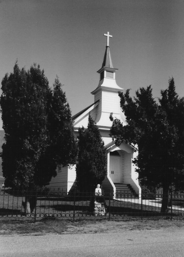
Nicasio — census-designated place — St. Mary's Church, Nicasio, California. Location in California
 Nicasio
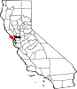
Coordinates: 38°03′42″N 122°41′55″W / 38.06167°N 122.69861°WCoordinates: 38°03′42″N 122°41′55″W / 38.06167°N 122.69861°W Country  United States
State  California
County Marin County Area[1] – Total 1.305 sq mi (3.380 km2) – Land 1.305 sq mi (3.380 km2) – Water 0 sq mi (0 km2) 0% Elevation[2] 194 ft (59 m) Population (2010) – Total 96 – Density 73.6/sq mi (28.4/km2) Time zone Pacific (PST) (UTC-8) – Summer (DST) PDT (UTC-7) ZIP Code 94946 Area code(s) 415 GNIS feature IDs 1659226; 2628764 U.S. Geological Survey Geographic Names Information System: Nicasio, California; U.S. Geological Survey Geographic Names Information System: Nicasio, California Nicasio is a census-designated place[3] in Marin County, California.[2] It is located 8 miles (13 km) west-southwest of Novato,[4] at an elevation of 194 feet (59 m).[2] The population was 96 at the 2010 census.
Nicasio (ni-kash'-oh, or ni-cah'-see-oh) is a contiguous area of unincorporated land in west Marin County. The Nicasio region encompasses approximately 25,000 acres (100 km²) and has no legally defined political boundaries. Geographically it is a hydrologic zone containing the four main drainages of Nicasio Creek up to the ridgelines defining their basin. This includes: the south fork of Nicasio Creek extending from Moon Hill, along the ridge separating Nicasio from San Geronimo and Samuel P. Taylor parks, and extending northwest towards the northern end of Platform Bridge Road; the east fork of Nicasio Creek extending from Loma Alta and the ridge on the north side of Sir Francis Drake Boulevard, extending up through Big Rock and up towards Big-Rock Ridge; the Halleck Creek drainage, up to the ridges separating Nicasio from Lucas Valley and Novato; the northern drainages extending along the ridgelines of Rocky Ridge, Hicks Mountain and Black Mountain.
A major landmark in the area is the man-made Nicasio Reservoir. Nicasio is scenically very attractive with forested and open ridgelines surrounding a wide rolling valley. The area along Lucas Valley Road follows a narrow valley with mostly forested hillsides above it. Oak, bay, and fir trees are common in the area, and along some of the creeks stands of redwoods are still found. Wildlife is abundant. Three main roads cross the area: Lucas Valley Road, Nicasio Valley Road, and the Point Reyes-Petaluma Road. Important pieces of public land in the surrounding area include Point Reyes National Seashore, portions of the Golden Gate National Recreation Area, and Samuel P. Taylor State Park.
Within the Nicasio area are about 250 homes located on approximately 350 parcels. Much of the land is still used for agricultural purposes including beef and dairy cattle grazing, small-scale truck farming (including organic farming), and the raising of forage. Several small vineyards have also been recently established. Next to Rancho Nicasio within the town of Nicasio is an organic farm, AllStar Organics, owned and operated by Janet Brown and Marty Jacobson; Janet is the vice-president of Marin Organic, Marin County's non-profit organic association. Just north of Nicasio Reservoir is Fairlea Ranch, [1], where pedigree longhorn cattle are raised. The most significant non-agricultural business within Nicasio is George Lucas’ Skywalker Ranch, a part of Lucasfilm Ltd. Population estimates for the area range from about 600 to about 900 people. According to a 2004 Forbes Magazine real estate survey, Nicasio is the 23rd most expensive zip code in the US.
Centrally located in this area is the small village of Nicasio itself. The village is in area code 415. The town center has a post office (zip code 94946), a general store, a tiny real estate office, St. Mary’s Church (established in 1867), a baseball field located in the town square, Rancho Nicasio, which is a bar/restaurant/live music establishment, a Druid's Hall, as well as a number of private homes. The town was founded in the early 19th century to support local agricultural, timber, and fishing activities. The town once boasted the twenty-two room Hotel Nicasio, which opened in 1867 but burned down in December 1940. Just north of town on Nicasio Valley Road is a beautiful red-painted one-room schoolhouse that opened in 1871. The building is currently a listed historical landmark. The Nicasio post office opened in 1871, closed in 1899, and re-opened in 1900.[4]
A detailed history of the region was published in 2008. The book is titled: Nicasio; The Historic Valley at the Center of Marin, and was written by Dewey Livingston. It is available from the Nicasio Historical Society, P.O. Box 111, Nicasio, CA, 94946.
Contents
Geography
Nicasio is located at geographical coordinates 38° 3′ 43" N 122° 41′ 55" W.[2]
Demographics
The 2010 United States Census[5] reported that Nicasio had a population of 96. The population density was 73.6 people per square mile (28.4/km²). The racial makeup of the CDP was 97.9% White and 2.1% African American. 7.3% of the population was Hispanic or Latino of any race.
The Census reported that 100% of the population lived in households.
There were 35 households, out of which 15 (42.9%) had children under the age of 18 living in them, 19 (54.3%) were opposite-sex married couples living together, 6 (17.1%) had a female householder with no husband present, 3 (8.6%) had a male householder with no wife present. There were 2 (5.7%) unmarried opposite-sex partnerships, and 0 (0%) same-sex married couples or partnerships. 6 households (17.1%) were made up of individuals and 4 (11.4%) had someone living alone who was 65 years of age or older. The average household size was 2.74. There were 28 families (80.0% of all households); the average family size was 3.07.
The population was spread out with 28 people (29.2%) under the age of 18, 5 people (5.2%) aged 18 to 24, 21 people (21.9%) aged 25 to 44, 29 people (30.2%) aged 45 to 64, and 13 people (13.5%) who were 65 years of age or older. The median age was 42.5 years. For every 100 females there were 113.3 males. For every 100 females age 18 and over, there were 88.9 males.
There were 41 housing units at an average density of 31.4 per square mile (12.1/km²), of which 80.0% were owner-occupied, and 20.0% were occupied by renters. The homeowner vacancy rate was 0%; the rental vacancy rate was 12.5%. 81.3% of the population lived in owner-occupied housing units and 18.8% lived in rental housing units.
Notable residents
- José Calistro
- Jerry Garcia, guitarist for the Grateful Dead, at time of his death in August 1995
- Peggy Rathmann, writer of Caldecott Medal-winning Officer Buckle and Gloria
- George Lucas
Filming location
- The People (1972), made-for-TV movie starring William Shatner. Locations include St. Mary's Church and the town square.
- Shoot the Moon (1982), starring Albert Finney and Diane Keaton.
- Village of the Damned (1995), locations including Nicasio School and homes and regions in Nicasio.
Politics
In the state legislature Nicasio is located in the 3rd Senate District, represented by Democrat Mark Leno, and in the 6th Assembly District, represented by Democrat Jared Huffman. Federally, Nicasio is located in California's 6th congressional district, represented by Democrat Lynn Woolsey.
References
- ^ U.S. Census
- ^ a b c d U.S. Geological Survey Geographic Names Information System: Nicasio, California
- ^ U.S. Geological Survey Geographic Names Information System: Nicasio, California
- ^ a b Durham, David L. (1998). California's Geographic Names: A Gazetteer of Historic and Modern Names of the State. Quill Driver Books. p. 672. ISBN 9781884995149.
- ^ All data are derived from the United States Census Bureau reports from the 2010 United States Census, and are accessible on-line here. The data on unmarried partnerships and same-sex married couples are from the Census report DEC_10_SF1_PCT15. All other housing and population data are from Census report DEC_10_DP_DPDP1. Both reports are viewable online or downloadable in a zip file containing a comma-delimited data file. The area data, from which densities are calculated, are available on-line here. Percentage totals may not add to 100% due to rounding. The Census Bureau defines families as a household containing one or more people related to the householder by birth, opposite-sex marriage, or adoption. People living in group quarters are tabulated by the Census Bureau as neither owners nor renters. For further details, see the text files accompanying the data files containing the Census reports mentioned above.
External links
West Marin Villages Bolinas • Dillon Beach • Dogtown • Inverness • Inverness Park • Lagunitas • Marshall • Millerton • Muir Beach • Nicasio • Olema • Pt. Reyes Station • Stinson Beach • TomalesGeography Audubon Canyon • Bolinas Lagoon • Bolinas Ridge • Bonita Channel • Centissima Reef • Copper Mine Gulch • Drakes Bay • Drakes Estero • Gull Rock • Pirates Cove • Point Reyes • Kent Island • Nicasio Creek • Nicasio Reservoir • Olema Valley • Rancho Punta de los Reyes Sobrante • Rodeo Lagoon • Rodeo Cove • Tennessee Cove • Tomales Bay • Sears RockParks and transportation Municipalities and communities of Marin County, California Cities and towns Belvedere | Corte Madera | Fairfax | Larkspur | Mill Valley | Novato | Ross | San Anselmo | San Rafael | Sausalito | Tiburon
CDPs Alto | Black Point-Green Point | Bolinas | Dillon Beach | Inverness | Kentfield | Lagunitas-Forest Knolls | Lucas Valley-Marinwood | Marin City | Muir Beach | Nicasio | Point Reyes Station | San Geronimo | Santa Venetia | Sleepy Hollow | Stinson Beach | Strawberry | Tamalpais-Homestead Valley | Tomales | Woodacre
Unincorporated
communitiesAlmonte | Bel Marin Keys | Belvedere Island | Bivalve | Black Point | Blakes Landing | Burdell | California Park | Cerro | Chapman | Cypress Grove | Dewitt | Dogtown | El Campo | Fallon | Five Brooks | Forest Knolls | Gallinas | Greenbrae | Hamlet | Harbor Point | Homestead Valley | Ignacio | Inverness Park | Jewell | Kent Woodlands | Lagunitas | Lairds Landing | Las Gallinas | Los Ranchitos | Lucas Valley | Manzanita | Marconi | Marinwood | Marshall | McDonald | McNears Beach | Meadowsweet | Millerton | Murray Park | Nicks Cove | Ocean Roar | Old Town | Olema | Paradise Cay | Reed | Reynolds | Sacramento Landing | Saint Vincent | San Antonio | San Quentin | Seahaven | Shafter | Strawberry Manor | Tamalpais Valley | Tamalpais Valley Junction | Tocaloma | Vincent Landing | Waldo
Ghost towns Categories:- West Marin
- Census-designated places in Marin County, California
- Unincorporated communities in California


Wikimedia Foundation. 2010.