- Cetronia, Pennsylvania
-
Cetronia is an unincorporated community in South Whitehall Township, Lehigh County, Pennsylvania, United States, near the city of Allentown. State Route 1002 (Tilghman Street), Pennsylvania Route 309, and Cedar Crest Boulevard run through Cetronia.
Interstate 78 runs southwest of Cetronia prior to its merge with PA Route 309. Interstate 476, the Northeast Extension of the Pennsylvania Turnpike, forms the informal boundary between this area and the Kuhnsville area just to the west. US 22, the Lehigh Valley Thruway, runs north of Cetronia, forming an informal boundary with the Crackersport and Walbert area to the north. I-476 has an interchange with US 22 at the western edge of Cetronia, which uses the Allentown zip code of 18104. [1]
Coordinates: 40°35′12″N 75°31′47″W / 40.58667°N 75.52972°W
External links

Orefield Orefield ; Walbert South Whitehall Township Kuhnsville 
Allentown  Cetronia

Krocksville Dorneyville, Wescosville Allentown Lehigh Valley States Counties Three Cities Cities and towns
100k-250kCities and towns
50k-99kCities and towns
10-50kBethlehem Township • Easton • Emmaus • Forks Township • Hanover Township • Lehigh Township • Lower Macungie Township • Lower Saucon Township • North Whitehall Township • Palmer Township • Phillipsburg • Salisbury Township • South Whitehall Township • Upper Macungie Township • Upper Saucon Township • Whitehall TownshipPeople List of people from the Lehigh ValleyMunicipalities and communities of Lehigh County, Pennsylvania County seat: Allentown Cities 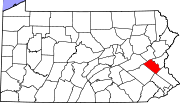
Boroughs Alburtis | Catasauqua | Coopersburg | Coplay | Emmaus | Fountain Hill | Macungie | Slatington
Townships Hanover | Heidelberg | Lower Macungie | Lower Milford | Lowhill | Lynn | North Whitehall | Salisbury | South Whitehall | Upper Macungie | Upper Milford | Upper Saucon | Washington | Weisenberg | Whitehall
CDPs Unincorporated
communitiesBreinigsville | Cementon | Center Valley | Cetronia | Colesville‡ | Dorneyville | East Texas | Egypt | Fogelsville | Hensingersville‡ | Hosensack | Ironton | Kuhnsville | Lanark | Laurys Station | Lehigh Gap‡ | Limeport | Lynnport | Neffs | New Tripoli | New Smithville | Newtown | Old Zionsville | Orefield | Pleasant Corners | Powder Valley | Schoenersville‡ | Shimerville | Slatedale | Summit Lawn | Trexlertown | Vera Cruz | Wescosville | West Catasauqua | Zionsville
Footnotes ‡This populated place also has portions in an adjacent county or counties
Categories:- Pennsylvania geography stubs
- Populated places in Lehigh County, Pennsylvania
- Unincorporated communities in Pennsylvania

Wikimedia Foundation. 2010.