- Chester County, Pennsylvania
-
Chester County, Pennsylvania 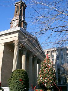

Seal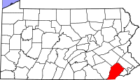
Location in the state of Pennsylvania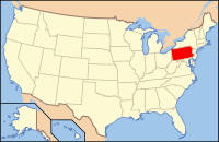
Pennsylvania's location in the U.S.Founded November 1682 Seat West Chester Largest city West Chester Area
- Total
- Land
- Water
760 sq mi (1,968 km²)
756 sq mi (1,958 km²)
4 sq mi (10 km²), 0.51%Population
- (2010)
- Density
498,886
660/sq mi (254.7/km²)Website www.chesco.org Chester County is a county located in the U.S. state of Pennsylvania. As of 2010, the population was 498,886. The county seat is West Chester. It is the highest-income county in Pennsylvania and 24th highest in the nation as measured by median household income (as of 2010).[1] Chester County is home to many communities that comprise the westernmost extent of the wealthy Main Line suburbs.
Chester County is one of the three original counties of Pennsylvania created by William Penn in 1682. It is named for Cheshire, England. It is part of the Delaware Valley area, and is the only Delaware Valley county in Pennsylvania that does not border Philadelphia, though it is close.
Contents
History
Chester, Philadelphia, and Bucks were the three original Pennsylvania counties created by William Penn on August 24, 1682.[2] At that time, Chester County's borders were Philadelphia County to the north, the western edge of the colony (approximately the Susquehanna River) to the west, the Delaware River to the east, and Delaware and Maryland to the south. Chester County replaced the Pennsylvania portion of New Netherland/New York’s Upland, which was officially eliminated when Pennsylvania was chartered on March 4, 1681, but did not actually cease to exist until June of that year.[3][4] Much of the Welsh Tract was in eastern Chester County and Welsh place names continue to predominate there.
The fourth county in the state, Lancaster County, was formed from Chester County on May 10, 1729. On March 11, 1752, Berks County was formed from the northern section of Chester County, as well as parts of Lancaster and Philadelphia Counties.
The original Chester County seat was the naval shipbuilding city of Chester. However, it became part of Delaware County when that county was formed from the eastern portion of the Chester County on September 26, 1789. This took the county seat out of Chester County, so West Chester became the new county seat that year, and has remained so to the present.
Much of the history of Chester County arises from its location between Philadelphia and the Susquehanna River. The first road to "the West" (meaning Lancaster County) passed through the central part of Chester County; with some re-alignments, it became the Lincoln Highway and later U.S. Route 30. This road is still named Lancaster Avenue in most of the Chester county towns it runs through. The first railroad (which became the Pennsylvania Railroad) followed much the same route, and the Reading Railroad progressed up the Schuylkill River to Reading. Industry tended to concentrate along the rail lines. In time, easy transportation allowed workers to commute to urban jobs, and the rise of the suburbs followed. To this day, the built-up areas form "fingers" extending along lines of transportation.
The Battle of Brandywine was fought at what is now the southeastern fringe of the county, and the Valley Forge encampment was at the northeastern edge. The former Valley Forge Army Hospital, constructed during World War II, was one of the largest military hospitals in the United States.
Geography
According to the U.S. Census Bureau, the county has a total area of 762 square miles (1,973.6 km2), of which 758 square miles (1,963.2 km2) is land and 4 square miles (10.4 km2) (0.51%) is water. The topography consists of rolling hills and valleys and it is part of the region known as the Piedmont.
Watersheds which service Chester County include the Octoraro Creek, the Brandywine Creek, the Chester Creek, and the Schuylkill River. Many of the soils are fertile, rich loam as much as twenty-four inches thick, resulting with its temperate climate.[citation needed] Because of its close proximity to the Philadelphia area, Chester County has experienced large "waves" of development due to suburbanization. Although development in Chester County has increased, agriculture is still a large form of income for the county. In fact the number of horse farms is increasing in the county.[citation needed] Mushroom growing is a specialty in the southern portion of the county.
Adjacent counties
- Berks County (north)
- Montgomery County (northeast)
- Delaware County (east)
- New Castle County, Delaware (southeast)
- Cecil County, Maryland (south)
- Lancaster County (west)

Berks County Montgomery County Lancaster County 
Delaware County  Chester County, Pennsylvania

Cecil County, Maryland New Castle County, Delaware National protected area
State parks
Demographics
Historical populations Census Pop. %± 1790 27,829 — 1800 32,093 15.3% 1810 39,596 23.4% 1820 44,451 12.3% 1830 50,910 14.5% 1840 57,515 13.0% 1850 66,438 15.5% 1860 74,578 12.3% 1870 77,805 4.3% 1880 83,481 7.3% 1890 89,377 7.1% 1900 95,695 7.1% 1910 109,213 14.1% 1920 115,120 5.4% 1930 126,629 10.0% 1940 135,626 7.1% 1950 159,141 17.3% 1960 210,608 32.3% 1970 278,311 32.1% 1980 316,660 13.8% 1990 376,396 18.9% 2000 433,501 15.2% 2010 498,886 15.1% [5][6] As of the 2010 census, the county was 85.5% White, 6.1% Black or African American, 0.2% Native American or Alaskan Native, 3.9% Asian, 0.0% Native Hawaiian, 1.8% were two or more races, and 2.4% were some other race. 6.5% of the population were Hispanic or Latino.
As of the census[7] of 2000, there were 433,501 people, 157,905 households, and 113,375 families residing in the county. The population density was 573 people per square mile (221/km²). There were 163,773 housing units at an average density of 217 per square mile (84/km²). The racial makeup of the county was 89.21% White, 6.24% Black or African American, 0.15% Native American, 1.95% Asian, 0.03% Pacific Islander, 1.35% from other races, and 1.06% from two or more races. 3.72% of the population were Hispanic or Latino of any race. 18.0% were of Irish, 17.3% German, 13.1% Italian, 10.1% English and 5.6% American ancestry according to Census 2000. 91.4% spoke English and 3.7% Spanish as their first language.
There were 157,905 households out of which 35.10% had children under the age of 18 living with them, 60.50% were married couples living together, 8.10% had a female householder with no husband present, and 28.20% were non-families. 22.60% of all households were made up of individuals and 7.60% had someone living alone who was 65 years of age or older. The average household size was 2.65 and the average family size was 3.15.
In the county, the population was spread out with 26.20% under the age of 18, 7.90% from 18 to 24, 30.40% from 25 to 44, 23.80% from 45 to 64, and 11.70% who were 65 years of age or older. The median age was 37 years. For every 100 females there were 96.40 males. For every 100 females age 18 and over, there were 93.10 males.
The median income for a household in the county was $65,295, and the median income for a family was $76,916 (these figures had risen to $80,818 and $97,894 respectively as of a 2007 estimate[8]). Males had a median income of $51,223 versus $34,854 for females. The per capita income for the county was $31,627. About 3.10% of families and 5.20% of the population were below the poverty line, including 5.10% of those under age 18 and 5.50% of those age 65 or over.
The region was originally occupied by the Lenni Lenape people who greeted European settlers in the seventeenth century with amity and kindness. British settlers were mostly English, Scotch-Irish and Welsh in ethnicity. As time passed, the region has had large influxes of Germans, Africans, Eastern Europeans, Italians, Puerto Ricans, and, more recently, Mexicans.
Chester County is the fastest growing county in the Delaware Valley and one of the fastest growing in the entire Northeastern section of the United States.
Politics
Presidential elections results Year GOP Dems 2008 45.0% 112,266 54.2% 135,150 2004 52.0% 120,306 47.5% 109,708 2000 53.4% 100,080 43.7% 82,047 1996 48.7% 77,029 41.0% 64,783 1992 43.7% 74,002 35.2% 59,643 1988 67.0% 93,522 32.1% 44,853 1984 70.1% 92,221 29.6% 38,870 1980 60.9% 73,046 28.6% 34,307 1976 60.4% 67,686 38.1% 42,712 1972 68.4% 72,726 29.3% 31,118 1968 57.2% 56,073 33.3% 32,606 1964 45.5% 40,280 54.1% 47,940 1960 63.6% 53,059 36.2% 30,167 As of November 2008, there are 326,689 registered voters in Chester County.[9]
- Republican: 150,300 (46.01%)
- Democratic: 125,198 (38.32%)
- Other Parties: 51,191 (15.67%)
Chester County has been, and remains, very reliably Republican at the county level. In recent elections, however, it has been trending Democratic. In 2000 Al Gore lost it by almost 10 percent but in 2004 George W. Bush defeated John Kerry by a much smaller margin of only 4.5 percent. Bob Casey Jr. carried it by 10% when he unseated incumbent Republican US Senator Rick Santorum in 2006. In 2008, Chester County sided with the rest of Pennsylvania and voted for Barack Obama by a much larger margin of 9%, making him the first Democrat to carry it in a Presidential election since 1964. However, the trend was broken in 2009, when the Republican candidates swept all county row offices winning with an average margin of 20%.
Democrats have also made gains in Chester County state legislative seats in recent elections. Democrat Andy Dinniman picked up the 19th Senate District in May 2006 in the special election to replace the late Robert Thompson. Democrat Barbara McIlvaine Smith picked up the open 156th House district in November 2006, winning by only 28 votes and tipping the State-House majority to the Democrats. This was the first time that a Democrat had served part of Chester County as State Representative since Jim Gerlach (now serving the majority of the county in Congress) unseated Sam Morris in 1990. In 2008, two more open House seats in the county went Democratic---to Tom Houghton in the 13th and Paul Drucker in the 157th. In 2010, however, Chester County swung back to the right, with Republicans Dan Truitt (who defeated McIlvaine Smith), Warren Kampf (who defeated Drucker), and John Lawrence (who defeated Houghton) all elected to the State House.
Government
Chester County is administered by a three-person Board of Commissioners, who serve four-year terms. Elections occur in the odd-numbered years that precede U.S. Presidential elections, with the next election falling in 2011. The Commissioners have selective policy-making authority to provide certain local services and facilities on a county-wide basis. Accordingly, the commissioners are responsible for the management of the fiscal and administrative functions of the county.
Commissioners
Office Holder Party County Commissioner Ryan A. Costello, Esq. Republican County Commissioner Terence Farrell Republican County Commissioner Kathi Cozzone Democratic Other elected officials
Office Holder Party Clerk of Courts Frank McElwaine Republican Controller Valentino F. DiGiorgio, III Republican Coroner Dr. Steven Dickter, M.D. Republican District Attorney Joe Carroll Republican Jury Commissioner Martha S. Smith Democratic Jury Commissioner Mimi H. Sack Republican Prothonotary Bryan Walters Republican Recorder of Deeds Ryan A. Costello Republican Register of Wills Paula Gowen Republican Sheriff Carolyn Bunny Welsh Republican Treasurer Ann Duke, Esq. Republican United States House of Representatives
District Representative Party 6 Jim Gerlach Republican 7 Pat Meehan Republican 16 Joe Pitts Republican United States Senate
Senator Party Bob Casey Democrat Pat Toomey Republican Pennsylvania House of Representatives
District Representative Party 13 John Lawrence Republican 26 Tim Hennessey Republican 155 Curt Schroder Republican 156 Dan Truitt Republican 157 Warren Kampf Republican 158 Chris Ross Republican 160 Stephen Barrar Republican 167 Duane Milne Republican 168 Tom Killion Republican Pennsylvania State Senate
District Representative Party 9 Dominic F. Pileggi Republican 19 Andy Dinniman Democratic 26 Edwin Erickson Republican 36 Michael Brubaker Republican 44 John C. Rafferty, Jr. Republican 48 Mike Folmer Republican Municipalities
 Map of Chester County, Pennsylvania with Municipal Labels showing Cities and Boroughs (red), Townships (white), and Census-designated places (blue).
Under Pennsylvania law, there are four types of incorporated municipalities: cities, boroughs, townships, and, in at most two cases, towns. The post office uses community names and boundaries that usually do not correspond to the townships, and usually only have the same names as the municipalities for the cities and boroughs. The names used by the post office are generally used by residents to describe where they live. The following cities, boroughs and townships are located in Chester County:
Cities
Boroughs
Townships
- Birmingham Township
- Caln Township
- Charlestown Township
- East Bradford Township
- East Brandywine Township
- East Caln Township
- East Coventry Township
- East Fallowfield Township
- East Goshen Township
- East Marlborough Township
- East Nantmeal Township
- East Nottingham Township
- East Pikeland Township
- East Vincent Township
- East Whiteland Township
- Easttown Township
- Elk Township
- Franklin Township
- Highland Township
- Honey Brook Township
- Kennett Township
- London Britain Township
- London Grove Township
- Londonderry Township
- Lower Oxford Township
- New Garden Township
- New London Township
- Newlin Township
- North Coventry Township
- Penn Township
- Pennsbury Township
- Pocopson Township
- Sadsbury Township
- Schuylkill Township
- South Coventry Township
- Thornbury Township
- Tredyffrin Township
- Upper Oxford Township
- Upper Uwchlan Township
- Uwchlan Township
- Valley Township
- Wallace Township
- Warwick Township
- West Bradford Township
- West Brandywine Township
- West Caln Township
- West Fallowfield Township
- West Goshen Township
- West Marlborough Township
- West Nantmeal Township
- West Nottingham Township
- West Pikeland Township
- West Sadsbury Township
- West Vincent Township
- West Whiteland Township
- Westtown Township
- Willistown Township
Census-designated place
Census-designated places are geographical areas designated by the U.S. Census Bureau for the purposes of compiling demographic data. They are not actual jurisdictions under Pennsylvania law.
Education
Colleges and universities
- Cheyney University of Pennsylvania (partially in Delaware County)
- Delaware County Community College (Exton and Downingtown Campuses)
- Immaculata University
- Lincoln University
- Penn State Great Valley
- Valley Forge Christian College
- West Chester University of Pennsylvania
 Map of Chester County, Pennsylvania Public School Districts
Public school districts
- Avon Grove School District
- Coatesville Area School District
- Downingtown Area School District
- Great Valley School District
- Kennett Consolidated School District
- Octorara Area School District
- Owen J. Roberts School District
- Oxford Area School District
- Phoenixville Area School District
- Spring-Ford Area School District
- Tredyffrin-Easttown School District
- Twin Valley School District
- Unionville-Chadds Ford School District
- West Chester Area School District
Charter Schools
- Achievement House Charter School grades 9-12, Exton
- Avon Grove Charter School grades K-12, West Grove
- Chester County Family Academy Charter School grades K-2, West Chester
- Collegium Charter School grades K-12, Exton
- Graystone Academy Charter School grades K-8, Coatesville
- Pennsylvania Leadership Cyber Charter School PreK-12, West Chester
- Renaissance Academy Charter School grades K-12, Phoenixville
- Sankofa Academy Charter School grades 5-8, West Chester
- 21st Century Cyber Charter School grades 6-12. Downingtown.
There are 11 public cyber charter schools and 144 bricks and mortar charter schools in Pennsylvania that are available for free statewide, to children K-12. See: Education in Pennsylvania.[10]
Independent schools
- Bishop Shanahan High School (Archdiocese of Philadelphia)
- Center for Arts and Technology (Administered by Chester County Intermediate Unit)
- Church Farm School (now called CFS the School at Church Farm)
- Delaware Valley Friends School
- Devon Preparatory School
- Goshen Friends School (West Chester, Pennsylvania)
- Kimberton Waldorf School (Kimberton, Pennsylvania)
- London Grove Friends Kindergarten (Kennett Square, Pennsylvania)
- Malvern Preparatory School
- The Concept School - 6th through 12th Grade
- Upattinas School (Glenmoore, Pennsylvania)
- Villa Maria Academy (Malvern, Pennsylvania)
- West Fallowfield Christian School
- West Chester Friends School
- Westtown School
- Windsor Christian Academy - K through 6th Grade
- Windsor Christian Preschool
- Upland Country Day School (UCDS) - Pre-K through 9th Grade
Religion
Chester County is home to a number of historic Quaker buildings, including Birmingham, Birmingham Orthodox, Bradford, Caln, Old Kennett, Parkersville, and Uwchlan meeting houses. Other historic religious buildings include St. Malachi Church, southeastern Pennsylvania's oldest active Catholic mission church, and the Episcopalian St. Mary's, St. Paul's, St. Peter's churches, and Washington Memorial Chapel. Also found in Chester County are the First Presbyterian Church of West Chester, and Beth Israel Congregation of Chester County, a Conservative synagogue.
Library system
The Chester County Library System in southeastern Pennsylvania was organized in 1965. It is a federated system composed of a District Center Library in Exton and seventeen member libraries. The system provides materials and information for life, work and pleasure.
Notable people
- James Smith born 1719 - Signer to the United States Declaration of Independence.
- Thomas Wharton Jr. born 1735 - Served as the first President of Pennsylvania (an office akin to Governor) following the Declaration of Independence from Great Britain.
- William (Amos) Wilson born c1762 - famous folklore figure known as The Pennsylvania Hermit.
- Jesse B. Aikin born 1808 - The first to produce a song book with a seven-shape note system.
- Thomas Buchanan Read born 1822 - Poet and portrait painter.
- Isaac Israel Hayes born 1832 - Arctic explorer and physician.
- Franklin MacVeagh born 1837 - Banker and Secretary of the US Treasury.
- Mifflin E. Bell born 1847 - Architect who served from 1883 to 1886 as Supervising Architect of the US Treasury Department.
- Charles Follen McKim born 1847 - One of the most prominent American Beaux-Arts architects of the late nineteenth century.
- William Thomas Smedley born 1858 - Artist; member of the National Academy of Design
- Scott Brunner born 1957 - NFL Quarterback during the 1980s.
- Bam Margera born 1979 - Professional skateboarder, television and radio personality, and daredevil.
- N.C. Wyeth, 1882–1945; son Andrew Wyeth, 1917–2009; grandson Jamie Wyeth, born 1946-; artists.
See also
- List of municipal authorities in Chester County, Pennsylvania
- National Register of Historic Places listings in Chester County, Pennsylvania
- Kaolin Mushroom Farms
References
- ^ http://www.philly.com/philly/news/breaking/20100309_On_Richest_Counties_list__Only_1_near_Philly.html
- ^ Commonwealth of Pennsylvania (1852—1935). Pennsylvania Archives. 9 Series, 109 Volumes. Philadelphia, Pennsylvania and Harrisburg, Pennsylvania. pp. Series 2, Volume 5: 739–744.
- ^ Armstrong, Edward; Editor (1860). Record of the Court at Upland, in Pennsylvania, 1676 to 1681. Memoirs of the Historical Society of Pennsylvania Volume 7. pp. 196.
- ^ Swindler, William F., Editor (1973-1979). Sources and Documents of United States Constitutions. 10 Volumes. Dobbs Ferry, New York: Oceana Publications. pp. Vol. 8: 243.
- ^ http://factfinder2.census.gov
- ^ http://mapserver.lib.virginia.edu/
- ^ "American FactFinder". United States Census Bureau. http://factfinder.census.gov. Retrieved 2008-01-31.
- ^ http://factfinder.census.gov/servlet/ACSSAFFFacts?_event=Search&geo_id=05000US36079&_geoContext=01000US%7C04000US36%7C05000US36079&_street=&_county=chester+county&_cityTown=chester+county&_state=04000US42&_zip=&_lang=en&_sse=on&ActiveGeoDiv=geoSelect&_useEV=&pctxt=fph&pgsl=050&_submenuId=factsheet_1&ds_name=ACS_2007_3YR_SAFF&_ci_nbr=null&qr_name=null®=null%3Anull&_keyword=&_industry=
- ^ Commonwealth of Pennsylvania Department of State. "November 2008 Voter Registration Statistics" (XLS). http://www.dos.state.pa.us/elections/lib/elections/055_voter_registration_statistics/currentstats/currentvotestats.xls. Retrieved 2008-11-03.
- ^ Pennsylvania Department of Education. "Charter Schools in Pennsylvania". http://www.portal.state.pa.us/portal/server.pt/community/charter_schools/7356/charter_schools_in_pennsylvania/508152. Retrieved February 9, 2011.
External links
- Chester County Home Page
- Chester County Government Meeting Minutes and local news at TownWatcher
- Chester County Press Newspapers & Magazines
- Chester County Fire and EMS
Municipalities and communities of Chester County, Pennsylvania City 
Boroughs Atglen | Avondale | Downingtown | Elverson | Honey Brook | Kennett Square | Malvern | Modena | Oxford | Parkesburg | Phoenixville | South Coatesville | Spring City | West Chester | West Grove
Townships Birmingham | Caln | Charlestown | East Bradford | East Brandywine | East Caln | East Coventry | East Fallowfield | East Goshen | East Marlborough | East Nantmeal | East Nottingham | East Pikeland | East Vincent | East Whiteland | Easttown | Elk | Franklin | Highland | Honey Brook | Kennett | London Britain | London Grove | Londonderry | Lower Oxford | New Garden | New London | Newlin | North Coventry | Penn | Pennsbury | Pocopson | Sadsbury | Schuylkill | South Coventry | Thornbury | Tredyffrin | Upper Oxford | Upper Uwchlan | Uwchlan | Valley | Wallace | Warwick | West Bradford | West Brandywine | West Caln | West Fallowfield | West Goshen | West Marlborough | West Nantmeal | West Nottingham | West Pikeland | West Sadsbury | West Vincent | West Whiteland | Westtown | Willistown
CDPs Unincorporated
communitiesBirchrunville | Bucktown | Chester Springs | Cheyney | Cossart | Coventryville | Daylesford | Eagle | Embreeville | Ercildoun | Hopewell | Kemblesville | Kimberton | Knauertown | Landenberg | Lower Hopewell | Ludwigs Corner | Marshallton | Mortonville | Nottingham | Pughtown | Southeastern | Strafford | Strickersville | Sugartown | Unionville | Valley Forge | Wayne | Willowdale | Yellow Springs
Delaware Valley Counties Atlantic • Berks • Bucks • Burlington • Camden • Cape May • Cecil • Chester • Cumberland • Delaware • Gloucester • Mercer • Montgomery • New Castle • Ocean • Philadelphia • Salem
Major cities Cities and towns
50k-99kBensalem • Camden • Cherry Hill • Gloucester Township • Levittown • Reading • Trenton • Vineland • WilmingtonCities and towns
25k-50kCategories:- Pennsylvania counties
- Chester County, Pennsylvania
- States and territories established in 1682


Wikimedia Foundation. 2010.