- Monroe County, Pennsylvania
-
Monroe County, Pennsylvania 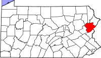
Location in the state of Pennsylvania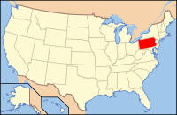
Pennsylvania's location in the U.S.Founded April 1, 1836 Seat Stroudsburg Largest city East Stroudsburg Area
- Total
- Land
- Water
617 sq mi (1,598 km²)
608 sq mi (1,575 km²)
9 sq mi (23 km²), 1.44%Population
- (2010)
- Density
169,842
279/sq mi (107.8/km²)Website www.co.monroe.pa.us Monroe County is a county in the U.S. state of Pennsylvania. Named in honor of James Monroe, the fifth president of the United States, the county is located in the east of the state, along its border with New Jersey. As of 2010, the population was 169,842. Its county seat is Stroudsburg.[1] The county is home to East Stroudsburg University. Monroe County is one of the fastest growing counties in the State of Pennsylvania. Not only has the population increased by nearly 20 percent, but the commercial retail has grown a lot as well. There are many new shopping centers and even more are planned and are currently being planned at this time.
Contents
Geography
According to the U.S. Census Bureau, the county has a total area of 617 square miles (1,599 km²), of which 608 square miles (1,576 km²) is land and 9 square miles (23 km²) (1.44%) is water. Monroe County was formed from the northern section of Northampton County.
Adjacent counties
- Wayne County (north)
- Pike County (northeast)
- Sussex County, New Jersey (northeast)
- Warren County, New Jersey (east)
- Northampton County (south)
- Carbon County (west)
- Luzerne County (northwest)
- Lackawanna County (northwest)

Luzerne County, Lackawanna County Wayne County Pike County, Sussex County, New Jersey Carbon County 
Warren County, New Jersey  Monroe County, Pennsylvania

Northampton County National protected areas
- Delaware Water Gap National Recreation Area (part)
- Middle Delaware National Scenic River (part)
Demographics
Historical populations Census Pop. %± 1840 9,879 — 1850 13,270 34.3% 1860 16,758 26.3% 1870 18,362 9.6% 1880 20,175 9.9% 1890 20,111 −0.3% 1900 21,161 5.2% 1910 22,941 8.4% 1920 24,295 5.9% 1930 28,286 16.4% 1940 29,802 5.4% 1950 33,773 13.3% 1960 39,567 17.2% 1970 45,422 14.8% 1980 69,409 52.8% 1990 95,709 37.9% 2000 138,687 44.9% 2010 176,842 27.5% [2][3] As of the census[4] of 2010, there are 176,567 people, 49,454 households, and 36,447 families residing in the county. The population density was 228 people per square mile (88/km²). There were 67,581 housing units at an average density of 111 per square mile (43/km²). The racial makeup of the county was 72.1% White, 15.6% Black or African American, 0.21% Native American, 3.2% Asian, 0.03% Pacific Islander, 2.42% from other races, and 1.99% from two or more races. 19.9% of the population were Hispanic or Latino of any race. 19.9% were of German, 16.8% Italian, 14.5% Irish, 5.4% Polish, 5.1% American and 5.1% English ancestry according to Census 2000. It is one of the fastest growing counties in the nation.
There were 49,454 households out of which 36.20% had children under the age of 18 living with them, 60.70% were married couples living together, 8.80% had a female householder with no husband present, and 26.30% were non-families. 20.20% of all households were made up of individuals and 7.80% had someone living alone who was 65 years of age or older. The average household size was 2.73 and the average family size was 3.16.
In the county, the population was spread out with 26.80% under the age of 18, 8.60% from 18 to 24, 28.80% from 25 to 44, 23.50% from 45 to 64, and 12.30% who were 65 years of age or older. The median age was 37 years. For every 100 females there were 97.60 males. For every 100 females age 18 and over, there were 94.40 males.
Politics
Party registration leans toward the Democratic Party a result of continued migration to the county by former New York City residents, many of whom are Democrats. While in the 2004 U.S. presidential election the county was carried by Republican George W. Bush by a margin of four votes, Democrat Barack Obama carried Monroe County in the 2008 U.S. presidential election by a 17 point margin, 58% to 41%. The other three 2008 statewide Democratic candidates also carried the county handily.
As of November 2008, there are 113,960 registered voters in Monroe County [1].
- Democratic: 53,801 (47.21%)
- Republican: 38,905 (34.14%)
- Other Parties: 21,254 (18.65%)
County commissioners
- John Moyer, Chairman, Republican
- Charles Garris, Republican
- Suzanne McCool, Democratic
Other county offices
- Controller, Marlo Merhige, Republican
- Coroner, Dave Thomas, Republican
- Jury Commissioner, Pam Bisbing, Republican
- District Attorney, E. David Christine, Jr., Republican
- Prothonotary, George Warden, Republican
- Recorder of Deeds and Register of Wills, Helen Diecidue, Republican
- Sheriff, Todd Martin, Republican
- Treasurer, Claudette Seager, Democratic
State Representatives
- Michael B. Carroll, Democratic, 118th district
- Michael Peifer, Republican, 139th district
- Mario Scavello, Republican, 176th district
- Rosemary Brown, Republican, 189th district
State Senators
- Raphael J. Musto, Democratic, 11th district
- Pat Browne, Republican, 16th district
- Lisa Boscola, Democratic, 18th district
- Lisa Baker, Republican, 20th district
- Robert J. Mellow, Democratic, 22nd district
- Dave Argall, Republican, 29th district
US Representative
- Lou Barletta, Republican, 11th district
U.S. Senators
- Robert P. Casey, Jr., Democratic
- Pat Toomey, Republican
Governor
- Tom Corbett, Republican
Transportation
Public transportation throughout the county is provided by the "Pocono Pony", operated by the Monroe County Transit Authority.
Municipalities
 Map of Monroe County, Pennsylvania with Municipal Labels showing Boroughs (red), Townships (white), and Census-designated places (blue).
Under Pennsylvania law, there are four types of incorporated municipalities: cities, boroughs, townships, and, in at most two cases, towns. The following cities, boroughs and townships are located in Monroe County:
Boroughs
Townships
- Pocono Township
- Polk Township
- Price Township
- Ross Township
- Smithfield Township
- Stroud Township
- Tobyhanna Township
- Tunkhannock Township
Census-designated places
Census-designated places are geographical areas designated by the U.S. Census Bureau for the purposes of compiling demographic data. They are not actual jurisdictions under Pennsylvania law. Other unincorporated communities, such as villages and large private housing communities, may be listed here as well.
- Arlington Heights
- Brodheadsville
- Effort
- Emerald Lakes
- Indian Mountain Lake
- Mountainhome
- Penn Estates
- Pocono Pines
- Saylorsburg
- Sierra View
- Sun Valley
Education
 Map of Monroe County, Pennsylvania Public School Districts
Colleges and universities
Public school districts
- East Stroudsburg Area School District
- Pleasant Valley School District
- Pocono Mountain School District
- Stroudsburg Area School District
Other Notable Resources
In addition to its rich cultural heritage, Monroe County is home to the Pennsylvania portion of the Delaware Water Gap National Recreation Area, Sullivan Trail (The portion of the route of General John Sullivan's famous march of 1778 from Easton to New York that reaches from Tannersville to Pocono Pines. This trail leads to the road that scales Big Pocono Mountain, one of the highest points in the Poconos that offers magnificent vistas.), Sanofi-Pasteur (manufacturer of vaccines), Pocono Raceway (home of two major NASCAR events held annually), Camelbeach Water Park and Ski Area, Shawnee Mountain Ski Area, The Crossings Factory Stores (named the number one outlet center in North America by the Outlet Retail Merchants Association (ORMA) for 2000–2001), three state parks (Big Pocono State Park, Gouldsboro State Park and Tobyhanna State Park), and Tobyhanna Army Depot (a major element of the Communications-Electronics Command and the largest Communications-Electronics repair, overhaul and fabrication facility in the Department of Defense).
See also
- List of municipal authorities in Monroe County, Pennsylvania
- National Register of Historic Places listings in Monroe County, Pennsylvania
References
- ^ "Find a County". National Association of Counties. http://www.naco.org/Counties/Pages/FindACounty.aspx. Retrieved 2011-06-07.
- ^ http://factfinder2.census.gov
- ^ http://mapserver.lib.virginia.edu/
- ^ "American FactFinder". United States Census Bureau. http://factfinder.census.gov. Retrieved 2008-01-31.
Municipalities and communities of Monroe County, Pennsylvania Boroughs 
Townships Barrett | Chestnuthill | Coolbaugh | Eldred | Hamilton | Jackson | Middle Smithfield | Paradise | Pocono | Polk | Price | Ross | Smithfield | Stroud | Tobyhanna | Tunkhannock
CDPs Unincorporated
communitiesBartonsville | Canadensis | Cresco | Effort | Gilbert | Jonas | Long Pond | Marshalls Creek | Pocono Manor | Pocono Summit | Skytop | Swiftwater | Tannersville | Tobyhanna
Categories:- Pennsylvania counties
- 1836 establishments in the United States
- Populated places established in 1836
- Monroe County, Pennsylvania
- The Poconos


Wikimedia Foundation. 2010.