- Cary, North Carolina
-
Town of Cary — Town — 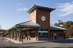
Flag
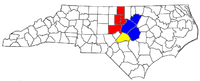
SealLocation of Cary shown within North Carolina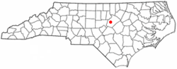
Coordinates: 35°46′44″N 78°48′1″W / 35.77889°N 78.80028°WCoordinates: 35°46′44″N 78°48′1″W / 35.77889°N 78.80028°W Country United States State North Carolina Counties Wake, Chatham Founded 1750 Incorporated April 6, 1871 Government – Mayor Harold Weinbrecht Area – Total 43.5 sq mi (112.6 km2) – Land 42.1 sq mi (109 km2) – Water 1.4 sq mi (3.6 km2) 3.17% Elevation 480 ft (146 m) Population (2010) – Total 135,234 – Density 3,141/sq mi (1,213.5/km2) Time zone EST (UTC-5) – Summer (DST) EDT (UTC-4) ZIP Code 27511-27513, 27518, 27519 Area code(s) 919 FIPS code 37-10740[1] GNIS feature ID 1019552[2] Website www.townofcary.org Cary (
 /ˈkɛəri/) is a large town and suburb of Raleigh, North Carolina in Wake and Chatham counties in the U.S. state of North Carolina. Located almost entirely in Wake County, it is the second largest municipality in that county and the third largest municipality in The Triangle after Raleigh and Durham. The town's population was 94,536 at the 2000 census, but the Census Bureau reported that its population had grown to 135,234 by 2010 (an increase of 43.1%), making it the largest town and seventh largest municipality statewide.[3] According to the US Census Bureau, Cary was the 5th fastest growing municipality in the United States between September 1, 2006, and September 1, 2007.[4]
Raleigh, Durham, and Chapel Hill make up the three primary cities of the Research Triangle metropolitan region even though today Cary is the 3rd largest city in the metropolitan area. The regional nickname of "The Triangle" originated after the 1959 creation of the Research Triangle Park, primarily located in Durham County, four miles from downtown Durham. RTP is bordered on three sides by the city of Durham and is roughly midway between the cities of Raleigh and Chapel Hill, and three major research universities of NC State University, Duke University, and UNC-Chapel Hill.
Effective June 6, 2003 the U.S. Office of Management and Budget redefined the Federal Statistical Areas and dismantled what had been for decades the Raleigh-Durham-Chapel Hill, MSA and split them into two separate MSAs, even though the region still functions as a single metropolitan area. This resulted in the formation of the Raleigh-Cary, NC MSA and the Durham-Chapel Hill, NC MSA.
The Research Triangle region encompasses the U.S. Census Bureau's Combined Statistical Area (CSA) of Raleigh-Durham-Cary in the central Piedmont region of North Carolina. As of Census 2010 the population of the Raleigh-Durham-Cary CSA was 1,749,525. The Raleigh-Cary Metropolitan Statistical Area (MSA) as of Census 2010 was 1,130,490.
Contents
Geography
Located in the Piedmont region of the eastern United States, Cary is near North Carolina's Research Triangle. It is edged on the north and east by Raleigh, on the north and west by Research Triangle Park and Morrisville, on the south by Apex and Holly Springs, and on the west by the Jordan Lake area. The topography of the town is hilly.
Cary is in the Humid Subtropical climate zone. It receives hot summers and mildly cold winters, with an average of 7 inches of snow a year. Temperature extremes here range from the negatives to over 100 degrees Fahrenheit.
Hurricanes and Tropical Storms affect Cary, usually after weakening substantially from being over land. Some, such as Hurricane Fran in 1996, can still cause great damage in the area.[5] Nearly all of Cary is in western Wake County, with neighborhood-sized sections in the northeast corner of Chatham County.[6]
According to the United States Census Bureau, the town has a total area of 43.5 square miles (112.6 km²). 42.1 square miles (109.0 km²) of it is land and 1.4 square miles (3.6 km²) of it (3.17%) is water. More recent Cary records show that as of 2007 the town has a total area of 52.79 mi².[5]
History
 Page-Walker Hotel (now local history museum).
Today's Cary began in 1750 as a settlement called Bradford's Ordinary. About 100 years later, the construction of the North Carolina Railroad between New Bern and Hillsborough went through the town, linking Bradford's Ordinary to a major transportation route.
Allison Francis "Frank" Page is credited with founding the town. Page was a Wake County farmer and lumberman. He and his wife, Catherine "Kate" Raboteau Page bought 300 acres (1.2 km2) surrounding the railroad junction in 1854 and named his development Cary, after Samuel Fenton Cary (a former Ohio congressman and prohibitionist he admired). Page became a railroad agent and a town developer. He laid out the first streets in Cary and built a sawmill, a general store and a post office (Page became the first Postmaster). In 1868, Page built a hotel to serve railroad passengers coming through Cary. Cary was incorporated on April 6, 1871, with Page becoming the first mayor.[7] In 1879, the Raleigh and Augusta Air-Line Railroad (later the Seaboard, now CSX Transportation) arrived in Cary from the southwest, creating Fetner Junction just north of downtown and spurring further growth.
In the early years Cary adopted zoning and other ordinances on an ad-hoc basis to control growth and give the town structure. Beginning in 1971, the town created Planned Unit Development (PUD) zoning to accommodate population growth related to the growth of Research Triangle Park nearby. A PUD allows a developer to plan an entire community before beginning development, thus allowing future residents to be aware of where churches, schools, commercial and industrial areas will be located well before such use begins. Kildaire Farms, a 967-acre (3.9 km2) Planned Unit Development in Cary, was North Carolina's first PUD. It was developed on the Pine State Dairy Farm by Thomas F. Adams, Jr. Adams named a section of Kildaire Farms "Farmington Woods" in their honor. The local government has placed a high value on creating an aesthetically pleasing town.
Demographics
Historical populations Census
yearPopulation 1940 1,141 - 1950 1,496 (+31%) 1960 3,356 (+124%) 1970 7,640 (+128%) 1980 21,763 (+185%) 1990 43,858 (+102%) 2000 94,536 (+116%) 2010 135,234 (+45%) According to the 2010 Census, there were 135,234 people and 55,303 households in the city. The racial makeup of Cary was 73.1% White, 8.0% African American, 0.4% Native American, 13.1% Asian, 0.0% Pacific Islander, and 2.6% were from two or more races. People of Hispanics or Latino origin made up 7.7% of the population.
Prosperity
In terms of higher education, 68.0% of adult residents in Cary (ages 25 and older) hold an associate degree or higher, and 60.7% of adults possess a baccalaureate degree or higher. Cary has one of the lowest crime rates in the state for municipalities of its size.[8] The home ownership rate (owner-occupied housing units to total units) is 72.8%.
In 2001, the town of Cary was declared the fourth safest of 327 large municipalities in the nation in the 8th Annual Morgan Quitno Safest (And Most Dangerous) City Award.[9]
Cary's reputation as a bedroom community for affluent transplants from outside the South has led to humorous backronyms for its name such as "Concentrated Area of Relocated Yankees."[10] Data from the 2000 Census shows 29.2% of Cary residents are native to North Carolina. 55.2% were born in other states. Additionally, 15.6% of the town's population were born outside the United States.[11]
Government
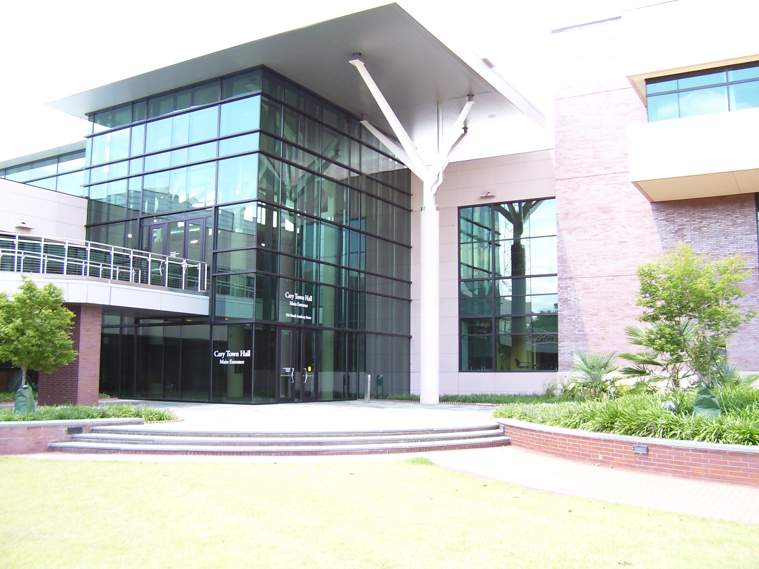
 Cary Town Hall.
Cary has a council-manager government; the mayor and council members serve a four year term, with half of the council seats being up for election each odd-numbered year. Four of the six council seats are elected by district; the remaining two seats are at-large representatives.
The current town council consists of Mayor Harold Weinbrecht and Representatives Jennifer Robinson (District A), Don Frantz (District B), Jack W. Smith (District C), Gale Adcock (District D), Erv Portman (at-large), and Julie Aberg Robison (at-large).
On October 9, 2007, Harold Weinbrecht defeated then-mayor Ernie McAlister in the Cary, North Carolina, mayoral election of 2007. Citizen concern over the affect rapid growth was having on the town, especially on roads, schools, and the environment, led to McAlister's ouster.[12]
On December 26, 2009, The Nation published an article on secret prisons in the United States run by Immigration and Customs Enforcement where suspected illegal immigrants can be held indefinitely before deportation. It was alleged that at least one of these secret federal prisons is located in an office building in Cary.[13] A part of the federal government’s Department of Homeland Security, ICE has leased an office in Cary off Evans Road for more than 10 years. This location does not house detainees overnight. Other than protesters picketing the facility, there have been no issues associated with the Cary ICE office. [14]
Mayors
- From 1871 to Present
Read left to right.
Name Years Name Years Name Years Name Years A. F. Page[15] 1871 J. H. Adams 1884 R. J. Harrison 1887 John Nugeer 1897 E. C. Hayes 1900 A.R. McGarrity 1902 R. J. Harrison 1903 H. B. Jordan 1903 N. C. Hines 1910 J. M. Templeton, Jr. 1912 G. S. Leacock 1914 T. H. Taylor 1916 W. G. Crowder 1916 E. P. Bradshaw 1921 W. H. Atkins 1921-25 G. H. Jordan 1925 E. P. Bradshaw 1925 Dr. F. R. Yarborough 1927-28 A. N. Jackson 1928-29 H. H. Waddell 1929-33 Dr. J. P. Hunter 1933-35 M. T. Jones 1935 T. W. Addicks 1935 L. L. Raines 1935-37 R. W. Mayton 1935-37 Robert G. Setzer 1947-49 H. Waldo Rood 1949-61 Dr. W. H. Justice 1961-62 James Hogarth 1962-63 Dr. E. B. Davis 1963-69 Joseph R. Veasey 1969-71 Fred G. Bond 1971-83 Harold D. Ritter 1983-87 Koka E. Booth[16] 1987–1999 Glen Lang 1999–2003 Ernie McAlister 2003–2007 Harold Weinbrecht 2007–present Climate
Climate data for Cary, NC Month Jan Feb Mar Apr May Jun Jul Aug Sep Oct Nov Dec Year Record high °F (°C) 80
(27)84
(29)94
(34)95
(35)99
(37)104
(40)105
(41)105
(41)104
(40)98
(37)88
(31)81
(27)105
(41)Average high °F (°C) 50
(10)54
(12)62
(17)72
(22)79
(26)86
(30)89
(32)87
(31)81
(27)72
(22)62
(17)53
(12)70.6 Average low °F (°C) 30
(−1)32
(0)39
(4)46
(8)55
(13)64
(18)69
(21)67
(19)61
(16)48
(9)40
(4)33
(1)48.7 Record low °F (°C) −9
(−23)−2
(−19)11
(−12)23
(−5)29
(−2)38
(3)48
(9)46
(8)37
(3)19
(−7)11
(−12)0
(−18)−9
(−23)Precipitation inches (mm) 4.02
(102.1)3.47
(88.1)4.03
(102.4)2.8
(71)3.79
(96.3)3.42
(86.9)4.29
(109)3.78
(96)4.26
(108.2)3.18
(80.8)2.97
(75.4)3.04
(77.2)43.05
(1,093.5)Source: http://www.weather.com/outlook/health/fitness/wxclimatology/monthly/graph/USNC0107[17] Economy
Notable businesses
 Cary Chamber of Commerce.
- SAS Institute - Large software company and Cary's largest employer
- 3Dsolve - Simulation software used in training by military, recently purchased by Lockheed Martin
- Cotton Incorporated - Industry trade-group.
- Epic Games - Video game developer
- Infineon Technologies - Physical, engineering and biological research
- IntelliScanner Corporation - Home and small business organization products
- Lord Corporation - Diversified technology company
- Dex One - Directory and mailing list publisher
- Western Wake Medical Center - Private hospital
- LexisNexis - Legal/Government research, software and professional services
- Deere & Company - Lawn care and turf products Manufacturing.
- Research In Motion - Makers of Blackberry smartphones.
- Deutsche Bank Global Technologies - Support operations for Deutsche Bank AG.
- The Pantry - Convenience store
Top Employers
According to the Town's 2009 Comprehensive Annual Financial Report,[18] the top employers in the city are:
# Employer # of Employees 1 SAS Institute 4,320 2 Cary Towne Center 2,540 3 Verizon 1,800 4 WakeMed 1,157 5 Town of Cary 1,126 6 American Airlines Reservation Center 1,067 7 Kellogg 770 8 Charles River Laboratories 750 9 Deere & Company 400 10 Global Knowledge 370 Education
Public schools
Cary public schools were established in the late 19th century and are now part of the Wake County Public School System, the largest public school system in North Carolina.
- High Schools
- Cary High School
- Green Hope High School
- Middle Creek High School
- Panther Creek High School
- Middle Schools
- Davis Drive Middle School
- East Cary Middle School
- Mills Park Middle School
- Reedy Creek Middle School
- West Cary Middle School
- Elementary Schools
- Adams Elementary School
- Briarcliff Elementary School
- Carpenter Elementary School
- Cary Elementary School
- Davis Drive Elementary School
- Farmington Woods Elementary School
- Green Hope Elementary School
- Highcroft Drive Elementary School
- Kingswood Elementary School
- Mills Park Elementary School
- Northwoods Elementary School
- Oak Grove Elementary School
- Penny Road Elementary School
- Reedy Creek Elementary School
- Turner Creek Elementary School
- Weatherstone Elementary School
Private schools
- Cary Academy, private middle/high school
- Cary Christian School
- Grace Christian School
- Hopewell Academy
- Saint Michael the Archangel Catholic School
- Resurrection Lutheran School, K-8th grade
Higher education
Transportation
Public transit
Public transit within the town is provided by C-Tran, with six fixed-routes. There is also a door-to-door service for the elderly (55+) and riders with disabilities. Triangle Transit operates fixed-route buses that serve the metropolitan region and connect to the local municipal transit systems in Raleigh, Durham and Chapel Hill.
Intercity rail
Amtrak's Silver Star, Carolinian and Piedmont passenger trains stop at the Cary Amtrak station. They offer service to Charlotte, New York City, Miami, and intermediate points.
Bicycle
The League of American Bicyclists has designated Cary one of the fourteen recipients of the first Bicycle-Friendly Community awards for "providing safe accommodation and facilities for bicyclists and encouraging residents to bike for transportation and recreation".[19]
The Maine-to-Florida U.S. Bicycle Route #1 passes through suburban Cary, as does N.C. Bicycle Route #2, the "Mountains to Sea" route.
Pedestrian
Cary Greenways and Trails maintains a network of sidewalks and paved trails connecting neighborhoods and parks throughout the town.[19] These greenways place strict requirements on environmental conditions to preserve a park-like atmosphere. In addition, standard sidewalks and paths exist throughout the town.
Air
The Raleigh-Durham International Airport, located north of Cary via Interstate-40 between Cary, Raleigh and Durham, serves Cary and the greater Research Triangle metropolitan region. Raleigh-Durham offers more than 35 destinations, serving approximately 9 million passengers per year.
Freeways and primary routes
Main article: North Carolina Highway System- Interstate 40
- U.S. 1
- US 64
- State Highway 54
- State Highway 55
- State Highway 540
- Cary Parkway
- Kildaire Farm Road
- Walnut Street (which appears on some maps as Cary-Macedonia Road)
- High House Road
- Harrison Avenue
- Maynard Road Loop
- Davis Drive (links to Research Triangle Park)
- Holly Springs Road
Public recreation
 Cary Tennis Park
- Koka Booth Amphitheatre at Regency Park
- Page-Walker Hotel
- WakeMed Soccer Park, where the Carolina RailHawks play.
- William B. Umstead State Park
- USA Baseball National Training Complex
- Thomas Brooks Park
- Sk8 Cary Skate Park
- Fred G. Bond Metropolitan Park
- Hemlock Bluffs Nature Preserve
- MacDonald Woods Park[20]
Tennis
- Cary Tennis Park
- Kildare Farms Racquet & Swim Club
- Anne L. Jones Park
- Robert V. Godbold Park
- Middle Creek School Park
Golf
- Lochmere Golf Club
- Prestonwood Country Club
- Macgregor Downs Country Club
- SAS Championship
Events
Cultural
- Lazy Daze Arts & Crafts Festival[21]
- Spring Daze Arts & Crafts Festival
- Cary Diwali Celebration - Festival of Light
- Ritmo Latino Music, Art and Dance Festival
- NC Eid Festival[22]
Sports
- 2010 NCAA Division I Women's Soccer College Cup
- 2010 NCAA Division II Baseball Championship
- 2011 NCAA Division III Men’s and Women’s Cross Country Championships
- 2012 NCAA Division III Men’s and Women’s Tennis Championships
Honors and designations
- Money Magazine Best Place to Live #5 in the Nation[23]
- Cary is also home of the USAB National Training Complex[24]
Sister cities
Cary has four sister cities, as designated by Sister Cities International:
 Markham, Ontario, Canada
 County Meath, Ireland
 Hsinchu City, Taiwan
 Le Touquet, France
Notable people
- Jesse Boulerice – former National Hockey League player
- Marshall Brain – founder of the HowStuffWorks website
- Bobby Clampett – former professional golfer and broadcaster
- James Goodnight – co-founder and CEO of SAS Institute
- Walter Hines Page – former United States ambassador to the United Kingdom
- John Sall – co-founder of SAS Institute
- Aaron Ward – former National Hockey League player
- Glen Wesley – former National Hockey League player
- Kay Yow – former head coach of the women's basketball team at North Carolina State University
- Kayde Puckett – Professional Fitness Athlete International Federation of BodyBuilders
See also
References
- ^ "American FactFinder". United States Census Bureau. http://factfinder.census.gov. Retrieved 2008-01-31.
- ^ "US Board on Geographic Names". United States Geological Survey. 2007-10-25. http://geonames.usgs.gov. Retrieved 2008-01-31.
- ^ "Subcounty population estimates: North Carolina 2000-2009" (CSV). United States Census Bureau, Population Division. 2010-06-22. http://www.census.gov/popest/cities/files/SUB-EST2009_37.csv. Retrieved 2010-09-30.
- ^ New Orleans Population Continues Katrina Recovery; Houston Leads in Numerical Growth, U.S. Census Bureau News, 2008-07-10
- ^ a b "About Cary". Cary, North Carolina. http://www.townofcary.org/New_to_Cary_/About_Cary_272.htm. Retrieved 2010-05-23.
- ^ "Town of Cary Municipal Limits within Chatam County". Chatham County Planning Department. http://www.co.chatham.nc.us/dept/planning/planning_dept/Joint_Planning/Cary/misc/Cary_11x17.pdf.
- ^ "Looking Back". Cary, North Carolina. http://www.townofcary.org/New_to_Cary_/About_Cary_272/Looking_Back.htm. Retrieved 2010-05-23.
- ^ Bourne, Joel. "Suburbia Unbound". National Geographic. http://www.nationalgeographic.com/ngm/0106/feature7/index.html. Retrieved 2007-04-16.
- ^ "Cary Superlatives". US Census Bureau. http://www.townofcary.org/New_to_Cary_/About_Cary_272/superlatives.htm. Retrieved 2010-05-23.
- ^ "America's most unusual planned communities". CNN Money. http://realestate.yahoo.com/promo/americas-most-unusual-planned-communities. Retrieved 2010-07-28.
- ^ "Money Magazine Article - Part 2". Cary Chamber of Commerce. http://www.carychamber.com/money2.html. Retrieved 2010-05-23.[dead link]
- ^ Carlson, Kelcey (2007-10-09). "Town of CaryWeinbrecht Wins Upset in Cary Mayoral Race". WRAL News (Capitol Broadcasting Company). http://www.wral.com/news/local/politics/story/1908306/. Retrieved 2010-05-23.
- ^ Stevens, Jacqueline (2009-12-16). "America's Secret ICE Castles". The Nation (Katrina vanden Heuvel). http://www.thenation.com/article/americas-secret-ice-castles. Retrieved 2010-07-20.
- ^ http://www.townofcary.org/Departments/Administration/pio/factsheet-caryice.htm
- ^ Cary History: Frank Page, CaryCitizen, April 22, 2010.
- ^ Profile: Former Cary Mayor Koka Booth, CaryCitizen, June 30, 2010.
- ^ Weather Channel. "Cary, NC Weather". Weather Channel. http://www.weather.com/outlook/health/fitness/wxclimatology/monthly/graph/USNC0107. Retrieved 2010-04-05.
- ^ Town of Cary CAFR
- ^ a b "Greenways". Cary, North Carolina. http://townofcary.org/Departments/Parks__Recreation___Cultural_Resources/Parks_and_Greenways/Greenways.htm. Retrieved 2010-05-23.
- ^ Cary Parks: MacDonald Woods, CaryCitizen, November 3, 2010.
- ^ "All About Lazy Daze". Cary Citizen. http://www.carycitizen.com/2010/08/17/all-about-lazy-daze/.
- ^ NC Eid Festival
- ^ "Best Places to Live". CNN. http://money.cnn.com/magazines/moneymag/bplive/2006/snapshots/PL3710740.html. Retrieved 2010-05-23.
- ^ "USAB National Training Complex". USA Baseball. 2010-03-22. http://web.usabaseball.com/news/article.jsp?ymd=20080618&content_id=33892&vkey=news_usab. Retrieved 2010-08-14.
External links
Municipalities and communities of Chatham County, North Carolina Towns Cary‡ | Goldston | Pittsboro | Siler City

CDP Unincorporated
communitiesBear Creek | Bells | Bennett | Bonlee | Brickhaven | Bynum | Carbonton | Corinth | Crutchfield Crossroads | Farrington | Gulf | Harpers Crossroads | Haywood | Lockville | Moncure | Seaforth | Silk Hope | Wilsonville
Footnotes ‡This populated place also has portions in an adjacent county or counties
Municipalities and communities of Wake County, North Carolina Cities 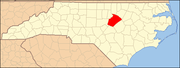
Towns Apex | Cary‡ | Clayton‡ | Fuquay-Varina | Garner | Holly Springs | Knightdale | Morrisville‡ | Rolesville | Wake Forest‡ | Wendell | Zebulon‡
Townships Bartons Creek | Buckhorn | Cary | Cedar Fork | Holly Springs | House Creek | Leesville | Little River | Marks Creek | Meredith | Middle Creek | Neuse | New Light | Panther Branch | Raleigh | St. Mary's | St. Matthew's | Swift Creek | Wake Forest | White Oak
Unincorporated
communitiesAuburn | Bonsal | Carpenter | Chestnut Hills | Clegg | Eagle Rock | Falls | Feltonville | Forestville | Friendship | Green Level | Holland | Hopkins | Kennebec | Lizard Lick | McCullers Crossroads | Neuse | New Hill | Riley Hill | Shotwell | Stony Hill | Swift Creek | Willow Spring
Footnotes ‡This populated place also has portions in an adjacent county or counties
Other significant cities Counties Major universities Miscellaneous - Anthony Foxx
(Charlotte)
- Bill Knight
(Greensboro)
- Bill Bell
(Durham)
- Anthony G. Chavonne
(Fayetteville)
- Harold Weinbrecht
(Cary)
- Rebecca Smothers
(High Point)
 State capital: Raleigh
Other states: AL • AK • AZ • AR • CA • CO • CT • DE • FL • GA • HI • ID • IL • IN • IA • KS • KY • LA • ME • MD • MA • MI • MN • MS • MO • MT • NE • NV • NH • NJ • NM • NY • NC • ND • OH • OK • OR • PA • RI • SC • SD • TN • TX • UT • VT • VA • WA • WV • WI • WYCategories:- Towns in North Carolina
- Cary, North Carolina
- Populated places established in 1750


Wikimedia Foundation. 2010.