- Harnett County, North Carolina
-
Harnett County, North Carolina 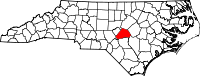
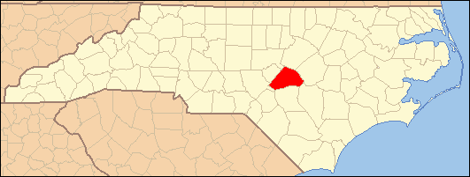
Location in the state of North Carolina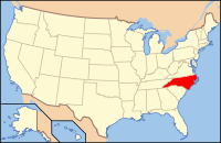
North Carolina's location in the U.S.Founded 1855 Seat Lillington Area
- Total
- Land
- Water
601 sq mi (1,557 km²)
595 sq mi (1,541 km²)
6 sq mi (16 km²), 1.05%Population
- (2010)
- Density
114,678
153/sq mi (59/km²)Website www.harnett.org Harnett County is a county located in the state of North Carolina, USA. As of 2010, the population was 114,678. Its county seat is Lillington[1].
Contents
History
Formed from Cumberland County in 1855. Named for American Revolutionary war hero Cornelius Harnett, who was also a delegate to the Continental Congress. The first settlers came to the region the mid 1720's, and were followed by the Highland Scots. The Scots settled in the foothills rather than in the rich alluvial soil area of the coastal plain. After the defeat by the British of Bonny Prince Charles at Culloden, the Scots came up the Cape Fear River in ever increasing numbers and settled in western Harnett County. The British also settled along the banks of the Cape Fear River in the coastal area, generally from Erwin to Wilmington.
During the Revolutionary War the Scots, who were forced to take ironclad vows never again to take up arms against the British, were considered as traitors. Since their activity assisted the British against the Continental Army, public executions were not uncommon. One site near Lillington was the scene of a mass execution of "Scots Traitors."
One of the last battles of the Civil War took place at Averasboro near Erwin. General Sherman's army, on its March to the Sea, defeated the army of General Hardee and proceeded eastward. The centennial celebration of that event was held at the site of the battlefield in 1965.
Law and government
Harnett County is a member of the regional Mid-Carolina Council of Governments.
Geography
According to the U.S. Census Bureau, the county has a total area of 601 square miles (1,556.6 km2), of which 595 square miles (1,541.0 km2) is land and 6 square miles (15.5 km2) (1.05%) is water.
Townships
The county is divided into sixteen townships: Anderson Creek, Averasboro, Barbecue, Black River, Buckhorn, Duke, Grove, Hectors Creek, Johnsonville, Lillington, Neills Creek, Stewarts Creek, and Upper Little River.
Adjacent counties
- Wake County, North Carolina - north-northeast
- Johnston County, North Carolina - east
- Sampson County, North Carolina - southeast
- Cumberland County, North Carolina - south
- Moore County, North Carolina - southwest
- Lee County, North Carolina - northwest
- Chatham County, North Carolina - north-northwest

Lee County Wake County Chatham County| 
Johnston County  Harnett County, North Carolina

Moore County Cumberland County Sampson County Demographics
As of the census[2] of 2000, there were 91,025 people, 33,800 households, and 24,099 families residing in the county. The population density was 153 people per square mile (59/km²). There were 38,605 housing units at an average density of 65 per square mile (25/km²). The racial makeup of the county was 71.13% White, 22.50% Black or African American, 0.87% Native American, 0.65% Asian, 0.07% Pacific Islander, 3.21% from other races, and 1.57% from two or more races. 5.86% of the population were Hispanic or Latino of any race.
There were 33,800 households out of which 36.00% had children under the age of 18 living with them, 53.20% were married couples living together, 13.50% had a female householder with no husband present, and 28.70% were non-families. 23.30% of all households were made up of individuals and 8.50% had someone living alone who was 65 years of age or older. The average household size was 2.61 and the average family size was 3.07.
In the county the population was spread out with 27.00% under the age of 18, 10.60% from 18 to 24, 32.10% from 25 to 44, 19.90% from 45 to 64, and 10.40% who were 65 years of age or older. The median age was 32 years. For every 100 females there were 97.40 males. For every 100 females age 18 and over, there were 95.00 males.
The median income for a household in the county was $35,105, and the median income for a family was $41,176. Males had a median income of $30,265 versus $22,283 for females. The per capita income for the county was $16,775. About 11.30% of families and 14.90% of the population were below the poverty line, including 17.20% of those under age 18 and 19.40% of those age 65 or over.
As of 2010 Census the population of Harnett County had risen to 114,678.
Cities and Towns
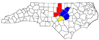
 Map of Harnett County, North Carolina With Municipal and Township Labels
Unincorporated communities
See also
- National Register of Historic Places listings in Harnett County, North Carolina
- USS Harnett County (LST-821)
References
- ^ "Find a County". National Association of Counties. http://www.naco.org/Counties/Pages/FindACounty.aspx. Retrieved 2011-06-07.
- ^ "American FactFinder". United States Census Bureau. http://factfinder.census.gov. Retrieved 2008-01-31.
External links
Municipalities and communities of Harnett County, North Carolina City 
Towns Angier | Broadway‡ | Coats | Erwin | Lillington
Townships Anderson Creek | Averasboro | Barbecue | Black River | Buckhorn | Duke | Grove | Hectors Creek | Johnsonville | Lillington | Neills Creek | Stewarts Creek | Upper Little River
CDP Unincorporated
communitiesAnderson Creek | Barbecue | Barclaysville | Bunnlevel | Cape Fear | Chalybeate Springs | Cokesbury | Duncan | Fonville | Johnsonville | Harnett | Kipling | Luart | Mamers | Olivia | Overhills | Pineview | Rawls | Ryes | Seminole | Shawtown | Spout Springs | Turlington
Footnotes ‡This populated place also has portions in an adjacent county or counties
Other significant cities Counties Major universities Miscellaneous Categories:- North Carolina counties
- Harnett County, North Carolina
- Research Triangle, North Carolina
- 1855 establishments in the United States


Wikimedia Foundation. 2010.