- Burlington, North Carolina
-
City of Burlington — City — 
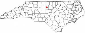
SealNickname(s): Hosiery Center of the South Motto: I'll Tell The World Location of Burlington within North Carolina
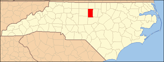
Coordinates: 36°5′23″N 79°26′44″W / 36.08972°N 79.44556°WCoordinates: 36°5′23″N 79°26′44″W / 36.08972°N 79.44556°W Country United States State North Carolina Counties Alamance. Founded 1857 (Company Shops) Founded 1886 (Burlington) Incorporated February 14, 1893 Government – Mayor Ronnie K. Wall Area – City 21.3 sq mi (55.3 km2) – Land 21.3 sq mi (55.1 km2) – Water 0.1 sq mi (0.2 km2) 0.28% – Urban 64 sq mi (103 km2) Elevation 633 ft (193 m) Population (2010) – City 49,963 – Density 2,111/sq mi (815/km2) – Urban 94,248 – Metro 148,053 – Metro density 1,472/sq mi (915/km2) Time zone EST (UTC-5) – Summer (DST) EDT (UTC-4) ZIP Code 27215, 27216, 27217 Area code(s) 336 FIPS code 37-09060[1] GNIS feature ID 0982279[2] Daily Newspaper Web Site www.TheTimesNews.com Website www.BurlingtonNC.gov Burlington is a city in Alamance and Guilford counties in the U.S. state of North Carolina. It is the principal city of the Burlington, North Carolina Metropolitan Statistical Area which encompasses all of Alamance County, in which most of the city is located. The population was 49,963 at the 2010 census, which makes Burlington the 17th largest city in North Carolina. The Metropolitan Statistical Area population was nearly 150,000 in 2008.
Contents
Geography
Burlington is located at 36°5′23″N 79°26′44″W / 36.08972°N 79.44556°W (36.089636, -79.445578).[3]
According to the United States Census Bureau, the city has a total area of 21.3 square miles (55 km2), of which, 21.3 square miles (55 km2) of it is land and 0.1 square miles (0.26 km2) of it (0.28%) is water.
Parks
There are a variety of parks that can be found in Burlington. These parks include Joe Davidson Park, Cedar Rock Park, and the Burlington City Park. All of these parks have a variety of things to do. Upon visiting these parks, one can find things like baseball fields, basketball courts, soccer fields, playgrounds, and tennis courts.
Early history
Alamance County was created when Orange County was partitioned in 1849. Early settlers included several groups of Quakers, many of which remain active in the Snow Camp area, German farmers, and Scots-Irish immigrants. Alamance County, where Burlington is located, is the site of several skirmishes that were part of the American Revolution. These include the War of the Regulation, which took place prior to the actual Revolution, when citizens rebelled against the corrupt British Colonial Government, the Battle of Lindley's Mill, the Battle of Clapp's Mill, and Pyle's Defeat.
The Holt family was instrumental in building several different textile mills in Burlington and the surrounding towns. These textile mills provided much of the economic base on which the county would grow.
The need of the North Carolina Railroad in the 1850s to locate land where they could build, repair and do maintenance on its track was the genesis of Burlington, North Carolina. The Company selected a piece of land slightly west of present day Graham, North Carolina.
By the time the shops were completed in 1857, the village had grown to twenty-seven buildings. Thirty-nine white men, twenty Negro slaves and two free Negroes were employed in or around the shops. The employees and their families needed to live within walking distance; hence, a town began to develop. The town was called “Company Shops”.
Sale of town lots soon started, but not surprisingly, the sale of lots was slow until after the Civil War. By 1864, Company Shops numbered about 300 persons.
In 1886, the North Carolina Railroad Company transferred its operations to Spencer, NC. The railroad offices and shops at Company Shops were closed. With the railroad shops no longer operated there, the citizens of Company Shops decided a new name was needed. In February 1887 a committee of the town’s leading citizens selected “Burlington”.
The city of Burlington was incorporated and a charter was issued by the State Legislature on February 14, 1893.
Demographics
Historical populations Census Pop. %± 1880 817 — 1890 1,716 110.0% 1900 3,692 115.2% 1910 4,808 30.2% 1920 5,952 23.8% 1930 9,737 63.6% 1940 12,198 25.3% 1950 24,560 101.3% 1960 33,199 35.2% 1970 35,930 8.2% 1980 37,266 3.7% 1990 39,498 6.0% 2000 44,917 13.7% Est. 2008 50,857 [4] 13.2% As of the census[1] of 2000, there were 44,917 people, 18,280 households, and 11,754 families residing in the city. The population density was 2,111.0 people per square mile (815.0/km²). There were 19,567 housing units at an average density of 919.6 per square mile (355.0/km²). The racial makeup of the city was 66.27% White, 25.05% African American, 0.34% Native American, 1.71% Asian, 0.04% Pacific Islander, 5.16% from other races, and 1.44% from two or more races. Hispanic or Latino of any race were 10.07% of the population.
There were 18,280 households out of which 29.0% had children under the age of 18 living with them, 45.1% were married couples living together, 14.9% had a female householder with no husband present, and 35.7% were non-families. 30.3% of all households were made up of individuals and 12.2% had someone living alone who was 65 years of age or older. The average household size was 2.40 and the average family size was 2.96.
In the city the population was spread out with 23.7% under the age of 18, 8.9% from 18 to 24, 29.0% from 25 to 44, 21.4% from 45 to 64, and 17.0% who were 65 years of age or older. The median age was 37 years. For every 100 females there were 88.7 males. For every 100 females age 18 and over, there were 85.0 males.
The median income for a household in the city was $35,301, and the median income for a family was $45,441. Males had a median income of $31,697 versus $22,466 for females. The per capita income for the city was $19,640. About 9.7% of families and 13.7% of the population were below the poverty line, including 18.1% of those under age 18 and 14.6% of those age 65 or over.
Education
The local school system is known as the Alamance-Burlington School System, which was created by a merger between the Alamance County School System and the Burlington City School System in 1996.
Local public schools in Burlington include:
- Southern Alamance High School
- Hugh M Cummings High School
- Walter M. Williams High School
- Sellars-Gunn Education Center
- Broadview Middle School
- Turrentine Middle School
- R. Homer Andrews Elementary
- Eastlawn Elementary
- Grove Park Elementary
- Hillcrest Elementary
- E. M. Holt Elementary
- Pleasant Grove Elementary
- Marvin B. Smith Elementary
- Elon Elementary
- Western Alamance Middle School
- Western Alamance High School
- Eastern Alamance High School
- Altamahaw-Ossipee Elementary
- Highland Elementary
Private Schools include:
Transportation
Amtrak's Carolinian and Piedmont train connects Burlington with the cities of New York, Philadelphia, Baltimore, Washington, Richmond, Raleigh and Charlotte. The Amtrak station is situated at 101 North Main Street.
Burlington is a short drive to Piedmont Triad International Airport in Greensboro and Raleigh-Durham International Airport in Morrisville. The city is almost centrally located between these two major North Carolina airports.
Burlington has no public busing system. It relies on the BioBus from nearby Elon University
Sports
The Burlington Royals, a rookie-level farm team of Major League Baseball's Kansas City Royals, have played in Burlington since 2006. The team is based at Burlington Athletic Stadium. Prior to 2006 team was known as the Burlington Indians, functioning as a farm team of the Cleveland Indians since 1985.
Business
LabCorp has its headquarters and several testing facilities in Burlington. LabCorp is Alamance County's largest employer, employing over 3,000 people in the county.
Honda Aero, a subsidiary of Honda, recently announced that it will move its corporate headquarters to Burlington and build a $27 million plant at the Burlington-Alamance Regional Airport where it will build its HF120 jet engines for use in very light jets.
Biscuitville, a regional fast food chain, is based in Burlington.
Burlington is also the operations headquarters for Gold Toe Brands, a manufacturer of socks.
The Times-News is Burlington's only daily newspaper, and the area's dominant media outlet.
National Agents Alliance has its headquarters in Burlington.
Shopping
I-40/85 and US 70 corridors. The city's only indoor mall, Holly Hill Mall is located at the intersection of Huffman Mill Road and Church Street (US 70). An outdoor mall, Alamance Crossing, opened in 2007 at Interstate 40/85 and University Drive. Just off I-85/40 at Exit 145 is North Carolina's original outlet mall, Burlington Outlet Village(formerly BMOC). The first shopping center in Burlingon and Alamance County was Cum-Park Plaza on North Church Street.[5]
See also
- The Times-News (Burlington, North Carolina)
- I-85 Corridor
- Piedmont Triad
References
- ^ a b "American FactFinder". United States Census Bureau. http://factfinder.census.gov. Retrieved 2008-01-31.
- ^ "US Board on Geographic Names". United States Geological Survey. 2007-10-25. http://geonames.usgs.gov. Retrieved 2008-01-31.
- ^ "US Gazetteer files: 2010, 2000, and 1990". United States Census Bureau. 2011-02-12. http://www.census.gov/geo/www/gazetteer/gazette.html. Retrieved 2011-04-23.
- ^ "Population Estimates". U.S. Census Bureau. http://www.census.gov/popest/cities/SUB-EST2008-4.html. Retrieved 2009-09-01.
- ^ "Events that shaped the county". The Times News. 2007-07-24. http://www.thetimesnews.com/news/burlington_4265___article.html/many_new.html. Retrieved 2008-06-20.
External links
- Official Burlington, NC website
- TheTimesNews.com - Burlington, NC Primary Newspaper website
- Burlington/Alamance County Convention & Visitors Bureau
- Alamance-Burlington School System
Municipalities and communities of Alamance County, North Carolina Cities 
Towns Elon | Gibsonville‡ | Green Level | Haw River | Ossipee | Swepsonville
Village CDPs Unincorporated
communitiesBellemont | Carolina | Dogwood Acres | Eli Whitney | Glencoe | Hawfields | Mandale | McCray | Mount Hermon | Pleasant Grove | Snow Camp | Union Ridge
Footnotes ‡This populated place also has portions in an adjacent county or counties
Municipalities and communities of Guilford County, North Carolina Cities Archdale‡ | Burlington‡ | Greensboro | High Point‡

Towns Gibsonville‡ | Jamestown | Kernersville‡ | Oak Ridge | Pleasant Garden | Sedalia | Stokesdale | Summerfield | Whitsett
CDPs Unincorporated
communitiesBrowns Summit | Climax | Colfax | Julian | Monticello
Footnotes ‡This populated place also has portions in an adjacent county or counties
 State of North Carolina
Topics - Climate
- Culture
- Economy
- Education
- Geography
- History
- Music
- North Carolinians
- Politics
- State Parks
- Wildlife
- Visitor attractions
Regions Larger cities Smaller cities - Albemarle
- Apex
- Asheboro
- Burlington
- Chapel Hill
- Conover
- Eden
- Elizabeth City
- Goldsboro
- Graham
- Havelock
- Henderson
- Hendersonville
- Hickory
- Kannapolis
- Kings Mountain
- Kinston
- Laurinburg
- Lenoir
- Lexington
- Lumberton
- Monroe
- Morganton
- New Bern
- Newton
- Reidsville
- Roanoke Rapids
- Rocky Mount
- Salisbury
- Sanford
- Shelby
- Statesville
- Thomasville
- Waynesville
- Wilson
Major towns - Beaufort
- Boone
- Carrboro
- Clayton
- Conover
- Cornelius
- Dunn
- Fuquay-Varina
- Garner
- Harrisburg
- Holly Springs
- Hope Mills
- Huntersville
- Indian Trail
- Kernersville
- Knightdale
- Leland
- Matthews
- Midland
- Mint Hill
- Mooresville
- Morehead City
- Morrisville
- Mount Pleasant
- Oxford
- Shallotte
- Smithfield
- Southern Pines
- Tarboro
- Wake Forest
Counties - Alamance
- Alexander
- Alleghany
- Anson
- Ashe
- Avery
- Beaufort
- Bertie
- Bladen
- Brunswick
- Buncombe
- Burke
- Cabarrus
- Caldwell
- Camden
- Carteret
- Caswell
- Catawba
- Chatham
- Cherokee
- Chowan
- Clay
- Cleveland
- Columbus
- Craven
- Cumberland
- Currituck
- Dare
- Davidson
- Davie
- Duplin
- Durham
- Edgecombe
- Forsyth
- Franklin
- Gaston
- Gates
- Graham
- Granville
- Greene
- Guilford
- Halifax
- Harnett
- Haywood
- Henderson
- Hertford
- Hoke
- Hyde
- Iredell
- Jackson
- Johnston
- Jones
- Lee
- Lenoir
- Lincoln
- Macon
- Madison
- Martin
- McDowell
- Mecklenburg
- Mitchell
- Montgomery
- Moore
- Nash
- New Hanover
- Northampton
- Onslow
- Orange
- Pamlico
- Pasquotank
- Pender
- Perquimans
- Person
- Pitt
- Polk
- Randolph
- Richmond
- Robeson
- Rockingham
- Rowan
- Rutherford
- Sampson
- Scotland
- Stanly
- Stokes
- Surry
- Swain
- Transylvania
- Tyrrell
- Union
- Vance
- Wake
- Warren
- Washington
- Watauga
- Wayne
- Wilkes
- Wilson
- Yadkin
- Yancey
Categories:- Burlington, North Carolina
- Populated places in Alamance County, North Carolina
- Populated places in Guilford County, North Carolina
- Cities in North Carolina
- Populated places established in 1857
Wikimedia Foundation. 2010.