- N4 road (Ireland)
-
N4 road
Location Primary
destinations:(bypassed routes in italics)
Road network
M4 motorway
Route information Part of 
Length: 62 km (39 mi) Existed: 1994–2003 – present History: Completed in2005 Major junctions From: Lucan 

To: Kinnegad Location Primary
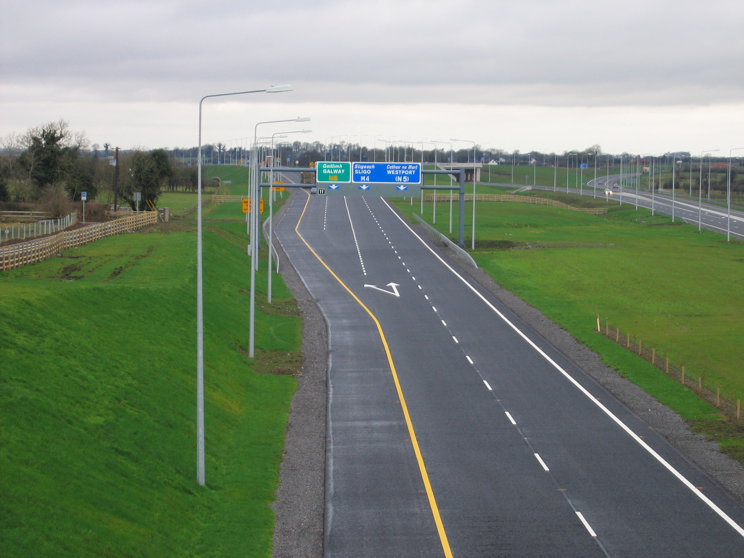
destinations:Leixlip, Kilcock, Enfield Road network  The 2+2 section of the N4.
The N4 road is a national primary road in Ireland, running from Dublin to the northwest of Ireland and Sligo town. The M6 to Galway diverges from this route after Kinnegad, while the N5 to Castlebar and Westport diverges at Longford town. The section of the N4 that is motorway standard is designated the M4 motorway.
Contents
Road standard
The road is a dual carriageway from O'Connell Bridge, Dublin to Mullingar (including the motorway section). The section following the north and south quays in Dublin between O'Connell Bridge and Heuston Station has the River Liffey as its median.[1] It continues as dual-carriageway with several signal controlled junctions until it intersects with the M50 motorway at Junction 7. This is also Junction 1 of the N/M4. The Liffey Valley Shopping Centre is located at junction 2. The road has three lanes and a bus lane in each direction between the M50 and start of the M4 at Leixlip. The N4 is the only one of the main inter-urban national routes whose dual carriageway section runs right into the city centre.
Heading west, the PPP motorway section (see below) ends west of Kinnegad, 5 km of road built to motorway standard (i.e. grade separated, no junctions and no median crossings) connects the M4 to an 5 km stretch of low-grade dual-carriageway with crossings which connects in turn to the Mullingar bypass. The Mullingar bypass is grade separated and to near-motorway standard. From Mullingar to Edgeworthstown, the road is wide single carriageway with hard shoulders. Between Edgeworthstown and Longford, there is a lower standard single carriageway road. Between Longford and Rooskey single carriageway continues at a higher standard. Dromod and Rooskey were bypassed in late 2007. This section of road consists of 3 roundabouts and Type 2 Dual Carriageway, i.e.: 2 lanes in each direction and no hard shoulder. The road becomes near-motorway standard dual carriageway again at Collooney, approaching Sligo town.
Map of route
M4 motorway
The section from Leixlip to west of Kinnegad is the M4 motorway. The first section of this motorway (Leixlip - Kilcock) was opened in 1994.
Tolled Section of the M4 Motorway
Under the Government announcement of the pilot projects on 1 June 1999 this project was to be assessed by the NRA for its suitability to be advanced as a Public-private partnership (PPP). Subsequently the project was included as one of the projects approved under Tranche II of the PPP Roads programme as announced by the NRA in June 2000. The project involved the construction of 39 km of motorway from Kinnegad to Kilcock and is an extension of the Kilcock-Maynooth-Leixlip motorway on the N4/N6 Sligo/Galway to Dublin route. The Motorway by-passes the towns of Enfield and Kinnegad.
The PPP contract was awarded in March 2003 to the EuroLink Consortium (SIAC Construction Ltd and Cintra - Concesiones de Infraestrucutras de Transporte S.A.) and allows for them to collect tolls for 30 years from that date.
This tolled section from (Kilcock - Kinnegad) opened on 12 December 2005, and is the second most expensive toll road in Ireland (after the Dublin Port Tunnel). A toll of €2.90 (as of 19 May 2009) for cars is charged at a toll plaza just west of Kilcock and at smaller toll plazas at on and off ramps at Enfield. Between Enfield and Kinnegad no further access to the M4 is possible.
Eurolink operate this toll scheme, the first in Ireland not operated by NTR plc. From 2005 to 2007, Eurolink started to accept several tags issued by other motorways such as M1, M8, eTrip and Dublin Port Tunnel tags. Finally on 14 June 2007 NTR plc joined the Nationwide Electronic Toll Payment System introducing their popular EazyPass tags on the system and allowing all other Toll Plazas in the Country (different from those owned by NTR plc) to accept them [1], meaning that each toll company's electronic tag will work on all toll roads in the State.
In the 1 July 2006 edition of the Meath Chronicle it was claimed that up to 10% of the €420 million road project had "to be ripped up and replaced" shortly after it opened due to rushed construction, however this cost would have had to be carried by the toll operators, not the state, as per the contract.
The bypassed former N4 road, has been reclassified as the R148.
Motorway Route
(Note: Junction numbers are being reassigned). Currently, Junction 2a is the only motorway junction number in the Republic of Ireland to have a letter, as it was constructed later between the present junctions 2 and 3, although a Junction 3A also exists on the N7 dual carriageway. New tourist signage at this junction refers to it as Junction 6, though the original directional signage has as of 2008[update] not been altered. As of March 2008 junction 1 has appeared on the recently erected sign at the newly reconstructed junction with the M50. Also maps on the National Roads Authority website for the Leixlip to M50 upgrade show new numbers for the junctions and count from the M50 westwards [2]
The Mullingar bypass also has a separate set of junction numbers beginning with J9.
Junctions
N4 National Primary Route (Dual Carriageway) Westbound exit Junction Eastbound exit M50 motorway  : Dublin Port, Bray and ALL OTHER ROUTES (M50)
M50 motorway : Dublin Port, Bray and ALL OTHER ROUTES (M50)Liffey Valley Interchange: Clondalkin, Liffey Valley Shopping Centre (R113) 
Liffey Valley Interchange: Clondalkin, Liffey Valley Shopping Centre (R113) Ballydowd Interchange: Lucan, Baldonnel (R136), 
Ballydowd Interchange: Lucan, Baldonnel (R136), Newcastle Road Interchange: Lucan, Newcastle (R120), 
Newcastle Road Interchange: Lucan, Newcastle (R120), Dodsboro 
Lucan, Dodsboro, R835 Leixlip Interchange: Leixlip (R148) Celbridge (R403) 
Leixlip Interchange: Leixlip (R148) Celbridge (R403) M4 motorway Westbound exit Junction Eastbound exit Leixlip West, Celbridge West R449 
Leixlip West, Celbridge West R449 Maynooth, Clane, Naas 
Maynooth, Naas Kilcock, Clane R407 
Kilcock, Clane R407 
Enfield, Edenderry R402 
Enfield, Edenderry R402 Enfield services Services Enfield services Kinnegad R401 
Kinnegad R401 Galway, Athlone (M6  )
)No access Kinnegad 
Kinnegad End of motorway 
Start of motorway Road continues as N4 for Mullingar, Longford, (N5), Sligo Motorway reclassification
On 28 August 2009 the Department of Transport implemented the second round of proposed reclassifications of dual carraigeways as motorways under the Roads Act 2007. A short section of the N4, between Kinnegad (J12) and McNead's Bridge (J13) was affected by this. This extended the M4 westward by 6.8 km.
Bypasses
 Travelling East along the newly upgraded Lucan Bypass in west Dublin.
- Palmerstown – 1987[citation needed]
- Lucan – 1988
- Chapelizod - 1990
- Leixlip, Maynooth, Kilcock – 1994
- Mullingar – 1994
- Longford – June 1995
- Drumsna, Jamestown – 1997
- Collooney, Ballisodare – January 1998
- Boyle, Ballinafad – 1998-1999
- Sligo (Partially) – September 2005
- Enfield, Kinnegad – December 2005
- Edgeworthstown – June 2006
- Dromod, Roosky – December 2007
Upgrades
 J11; M6/M4 junction (prior to redesignation of the N6 → M6).
In July 2009 an upgrade of the section between the M50 junction and the Leixlip interchange was completed. On this section the road is three lanes in each direction, the median crossings have been removed and the junction with the R120 is now a fully grade-separated junction. Private accesses and some left turns remain preventing the section from being designated a motorway. The speed limit is 80 km/h. [2] There are now no signal controlled junctions on the N/M4 between Palmerstown and the Sligo throughpass.
Planned improvements to the route
 N4 between Kinnegad and Mullingar; former N4 (now R148) in left of picture. (This section was redesignated as motorway in August 2009)
- N4 at The Downs, east of Mullingar; 5 km upgraded dual carriageway ; at constraints study stage, existing road is low quality dual carriageway[3]
- Mullingar bypass to Longford; 40 km dual carriageway ; at constraints study stage[4]
- Dromod to Carrick on Shannon; 11 km; at feasibility study stage[5]
- Carrick on Shannon Bypass; 10 km; preliminary design stage[6]
- Cortober to Castlebaldwin; 28 km retro upgrade of standard single carriageway road to 2+1 road; at constraints study stage[7]
- Collooney to Castlebaldwin; 15 km greenfield 2+2 road; at preliminary design stage[8]
- Sligo Western Relief Road; 8 km; at feasibility study stage[9]
- The motorway-style dual carriageway of the N4, running from Collooney - 15 km outside Sligo - to Summerhill in Sligo town is expected to be re-classified as Motorway in the near future.[citation needed]
See also
- Roads in Ireland
- Motorways in Ireland
- National secondary road
- Regional road
References
- Roads Act 1993 (Classification of National Roads) Order 2006 – Department of Transport
- Roads Act, 1993 (Classification of National Roads) (Kilkock – Kinnegad Route) Order, 2003
- Eurolink Motorway M4 website
- ^ Roads Act 1993 (Classification of National Roads Order) 2006 http://www.transport.ie/upload/general/7616-0.pdf
- ^ Map of Leixlip to M50 Upgrade http://www.nra.ie/RoadSchemeActivity/SouthDublinCountyCouncil/N4LeixliptoM50Junction/Map,11578,en.pdf
- ^ N4 The Downs Grade Separation
- ^ N4 Mullingar to Longford
- ^ N4 Carrick on Shannon to Dromod
- ^ N4 Carrick on Shannon Bypass
- ^ N4 Cortober to Castlebaldwin
- ^ N4 Collooney to Castlebaldwin
- ^ N4 Sligo Western Relief Road
Roads in Ireland Motorways National primary roads National secondary roads Regional roads (R101–R399) R101 · R102 · R103 · R104 · R105 · R106 · R107 · R108 · R109 · R110 · R111 · R112 · R113 · R114 · R115 · R116 · R117 · R118 · R119 · R120 · R121 · R122 · R123 · R124 · R125 · R126 · R127 · R128 · R129 · R130 · R131 · R132 · R133 · R134 · R135 · R136 · R148 · R149 · R150 · R151 · R152 · R153 · R154 · R155 · R156 · R157 · R158 · R159 · R160 · R161 · R162 · R163 · R164 · R165 · R166 · R167 · R168 · R169 · R170 · R171 · R172 · R173 · R174 · R175 · R176 · R177 · R178 · R179 · R180 · R181 · R182 · R183 · R184 · R185 · R186 · R187 · R188 · R189 · R190 · R191 · R192 · R193 · R194 · R195 · R196 · R197 · R198 · R199 · R200 · R201 · R202 · R203 · R204 · R205 · R206 · R207 · R208 · R209 · R210 · R211 · R212 · R213 · R214 · R229 · R230 · R231 · R232 · R233 · R234 · R235 · R236 · R237 · R238 · R239 · R240 · R241 · R242 · R243 · R244 · R245 · R246 · R247 · R248 · R249 · R250 · R251 · R252 · R253 · R254 · R255 · R256 · R257 · R258 · R259 · R260 · R261 · R262 · R263 · R264 · R265 · R266 · R267 · R268 · R277 · R278 · R279 · R280 · R281 · R282 · R283 · R284 · R285 · R286 · R287 · R288 · R289 · R290 · R291 · R292 · R293 · R294 · R295 · R296 · R297 · R298 · R299 · R310 · R311 · R312 · R313 · R314 · R315 · R316 · R317 · R318 · R319 · R320 · R321 · R322 · R323 · R324 · R325 · R326 · R327 · R328 · R329 · R330 · R331 · R332 · R333 · R334 · R335 · R336 · R337 · R338 · R339 · R340 · R341 · R342 · R343 · R344 · R345 · R346 · R347 · R348 · R349 · R350 · R351 · R352 · R353 · R355 · R356 · R357 · R358 · R359 · R360 · R361 · R362 · R363 · R364 · R365 · R366 · R367 · R368 · R369 · R370 · R371 · R372 · R373 · R374 · R375 · R376 · R377 · R378 · R379 · R389 · R390 · R391 · R392 · R393 · R394 · R395 · R396 · R397 · R398 · R399Regional roads (R400–R699) R400 · R401 · R402 · R403 · R404 · R405 · R406 · R407 · R408 · R409 · R410 · R411 · R412 · R413 · R414 · R415 · R416 · R417 · R418 · R419 · R420 · R421 · R422 · R423 · R424 · R425 · R426 · R427 · R428 · R429 · R430 · R431 · R432 · R433 · R434 · R435 · R436 · R437 · R438 · R439 · R440 · R441 · R442 · R443 · R444 · R445 · R446 · R448 · R449 · R458 · R459 · R460 · R461 · R462 · R463 · R464 · R465 · R466 · R467 · R468 · R469 · R470 · R471 · R472 · R473 · R474 · R475 · R476 · R477 · R478 · R479 · R480 · R481 · R482 · R483 · R484 · R485 · R486 · R487 · R488 · R489 · R490 · R491 · R492 · R493 · R494 · R495 · R496 · R497 · R498 · R499 · R500 · R501 · R502 · R503 · R504 · R505 · R506 · R507 · R509 · R510 · R511 · R512 · R513 · R514 · R515 · R516 · R517 · R518 · R519 · R520 · R521 · R522 · R523 · R524 · R525 · R526 · R527 · R548 · R549 · R550 · R551 · R552 · R553 · R554 · R555 · R556 · R557 · R558 · R559 · R560 · R561 · R563 · R564 · R565 · R566 · R567 · R568 · R569 · R570 · R571 · R572 · R573 · R574 · R575 · R576 · R577 · R578 · R579 · R580 · R581 · R582 · R583 · R584 · R585 · R586 · R587 · R588 · R589 · R590 · R591 · R592 · R593 · R594 · R595 · R596 · R597 · R598 · R599 · R600 · R601 · R602 · R603 · R604 · R605 · R606 · R607 · R608 · R609 · R610 · R611 · R612 · R613 · R614 · R615 · R616 · R617 · R618 · R619 · R620 · R621 · R622 · R623 · R624 · R626 · R627 · R628 · R629 · R630 · R631 · R632 · R633 · R634 · R635 · R637 · R638 · R639 · R659 · R660 · R661 · R662 · R663 · R664 · R665 · R666 · R667 · R668 · R669 · R670 · R671 · R672 · R673 · R674 · R675 · R676 · R677 · R678 · R679 · R680 · R681 · R682 · R683 · R684 · R685 · R686 · R687 · R688 · R689 · R690 · R691 · R692 · R693 · R694 · R695 · R696 · R697 · R698 · R699Regional roads (R700–R940) R700 · R701 · R702 · R703 · R704 · R705 · R706 · R707 · R708 · R709 · R710 · R724 · R725 · R726 · R727 · R729 · R730 · R731 · R733 · R734 · R735 · R736 · R737 · R738 · R739 · R740 · R741 · R742 · R743 · R744 · R745 · R746 · R747 · R748 · R749 · R750 · R751 · R752 · R753 · R754 · R755 · R756 · R757 · R758 · R759 · R760 · R761 · R762 · R763 · R764 · R765 · R766 · R767 · R768 · R769 · R770 · R772 · R773 · R774 · R801 · R802 · R803 · R804 · R805 · R806 · R807 · R808 · R809 · R810 · R811 · R812 · R813 · R814 · R815 · R816 · R817 · R818 · R819 · R820 · R821 · R822 · R824 · R825 · R826 · R827 · R828 · R829 · R830 · R831 · R833 · R834 · R835 · R836 · R837 · R838 · R839 · R840 · R841 · R842 · R843 · R846 · R847 · R848 · R849 · R851 · R852 · R853 · R854 · R855 · R857 · R858 · R859 · R860 · R863 · R864 · R865 · R866 · R867 · R868 · R870 · R871 · R873 · R874 · R875 · R876 · R877 · R880 · R883 · R884 · R885 · R886 · R887 · R888 · R889 · R890 · R891 · R895 · R896 · R898 · R899 · R900 · R901 · R902 · R903 · R904 · R906 · R907 · R908 · R909 · R910 · R911 · R913 · R914 · R915 · R916 · R917 · R918 · R919 · R920 · R921 · R922 · R923 · R924 · R925 · R926 · R927 · R928 · R929 · R930 · R931 · R932 · R933 · R934 · R935 · R936 · R937 · R940Transport in Dublin Air Rail Tram*Road Bus corridorsR101 · R102 · R103 · R104 · R105 · R106 · R107 · R108 · R109 · R110 · R111 · R112 · R113 · R114 · R115 · R116 · R117 · R118 · R119 · R120 · R121 · R122 · R123 · R124 · R125 · R126 · R127 · R128 · R129 · R130 · R131 · R132 · R133 · R134 · R135 · R136 · R148 · R156 · R403 · R445 · R761 · R810 · R817 · R821 · R822 · R824 · R825 · R826OtherWater CanalsPortsAgencies *=Tram systems no longer run. Information in parentheses shows the operator(s)Categories:- National primary roads in the Republic of Ireland
- Roads in County Dublin
- Roads in County Kildare
- Roads in County Meath
- Roads in County Westmeath
- Roads in County Longford
- Roads in County Leitrim
- Roads in County Roscommon
- Roads in County Sligo


Wikimedia Foundation. 2010.