- Albany, California
-
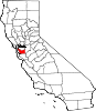
City of Albany — City — Motto: Northern Gateway to Alameda County Location in Alameda County and the state of California
Coordinates: 37°53′13″N 122°17′52″W / 37.88694°N 122.29778°WCoordinates: 37°53′13″N 122°17′52″W / 37.88694°N 122.29778°W Country  United States
State  California
County Alameda County Government – Senate Loni Hancock (D) – Assembly Nancy Skinner (D) Area[1] – Total 5.465 sq mi (14.155 km2) – Land 1.788 sq mi (4.632 km2) – Water 3.677 sq mi (9.524 km2) 67.28% Elevation 43 ft (13 m) Population (2010) – Total 18,539 – Density 10,368/sq mi (1,309.7/km2) Time zone PST (UTC-8) – Summer (DST) PDT (UTC-7) ZIP codes 94706, 94707, 94710 Area code(s) 510 FIPS code 06-00674 GNIS feature ID 1657902 Website http://www.albanyca.org Albany (formerly Ocean View) is a city in Alameda County, California, United States. The population was 18,539 at the 2010 census.
Contents
History
In 1908, a group of local women protested the dumping of Berkeley garbage in their community. Armed with two shotguns and a twenty-two-caliber rifle, they confronted the drivers of the wagons near what is now the corner of San Pablo Avenue and Buchanan Street. The women told the drivers of the horse-drawn garbage wagons to go home, which they did quickly and without complaint. Shortly thereafter, the residents of the town voted to incorporate as the City of Ocean View. In 1909, voters changed the name of the city, primarily to distinguish the city from the adjacent section of Berkeley which had previously been named Ocean View. On a vote of 38 to 6 the city was renamed in honor of Albany, New York, the birthplace of the city's first mayor, Frank Roberts. [2]
Geography
According to the United States Census Bureau, the city has a total area of 5.5 square miles (14 km2), of which, 1.8 square miles (4.7 km2) of it is land and 3.7 square miles (9.6 km2) of it (67.28%) is water.
The principal shopping street in Albany is Solano Avenue, which cuts across the city from west to east. Another important street is San Pablo Avenue, which travels from north to south.
Albany is located on the eastern shore of San Francisco Bay, bordering the city of Berkeley to the south and east, and the Contra Costa County cities of El Cerrito and Richmond to the north. Albany's northern and southern borders are defined by two creeks, Codornices Creek on the south and Cerrito Creek on the north. Cerrito Creek takes its name from "El Cerrito de San Antonio", now known as Albany Hill. The hill's unusual location near the bay shore makes it a prominent landmark in the East Bay. The rest of the city is relatively flat by Bay Area standards, except for a small area near the base of the Berkeley Hills.
Albany's waterfront has undergone significant man-made changes; the most prominent landform is now the Albany Bulb, a former garbage landfill jutting out into San Francisco Bay. The bulb was the site of a small art colony and shanty town until it was cleared to turn the area into part of the new Eastshore State Park.[3][4][5]
University Village, a housing unit of the University of California Berkeley, is located in Albany.[6]


A bayside view of the Golden Gate Bridge from Albany. Demographics
The 2010 United States Census[7] reported that Albany had a population of 18,539. The population density was 3,392.1 people per square mile (1,309.7/km²). The racial makeup of Albany was 10,128 (54.6%) White, 645 (3.5%) African American, 88 (0.5%) Native American, 5,790 (31.2%) Asian, 37 (0.2%) Pacific Islander, 607 (3.3%) from other races, and 1,244 (6.7%) from two or more races. Hispanic or Latino of any race were 1,891 persons (10.2%).
The Census reported that 18,454 people (99.5% of the population) lived in households, 74 (0.4%) lived in non-institutionalized group quarters, and 11 (0.1%) were institutionalized.
There were 7,401 households, out of which 2,909 (39.3%) had children under the age of 18 living in them, 3,801 (51.4%) were opposite-sex married couples living together, 883 (11.9%) had a female householder with no husband present, 295 (4.0%) had a male householder with no wife present. There were 341 (4.6%) unmarried opposite-sex partnerships, and 123 (1.7%) same-sex married couples or partnerships. 1,862 households (25.2%) were made up of individuals and 593 (8.0%) had someone living alone who was 65 years of age or older. The average household size was 2.49. There were 4,979 families (67.3% of all households); the average family size was 3.00.
The population was spread out with 4,630 people (25.0%) under the age of 18, 1,006 people (5.4%) aged 18 to 24, 6,154 people (33.2%) aged 25 to 44, 4,902 people (26.4%) aged 45 to 64, and 1,847 people (10.0%) who were 65 years of age or older. The median age was 37.0 years. For every 100 females there were 90.8 males. For every 100 females age 18 and over, there were 86.9 males.
There were 7,889 housing units at an average density of 1,443.5 per square mile (557.3/km²), of which 3,574 (48.3%) were owner-occupied, and 3,827 (51.7%) were occupied by renters. The homeowner vacancy rate was 1.0%; the rental vacancy rate was 6.2%. 9,070 people (48.9% of the population) lived in owner-occupied housing units and 9,384 people (50.6%) lived in rental housing units.
Economy
The major retail and business areas in Albany are Solano Avenue, which is a pedestrian-oriented street lined with mainly small shops, restaurants, and services; San Pablo Avenue, which is more automobile-oriented; and an area near the Eastshore Freeway, which the city is trying to attract big-box stores and offices, and currently houses a two-story Target store.
Albany is the site of Golden Gate Fields, the only horse racing track in the Bay Area.
Real estate prices have been rising steeply in recent years until the 2008 financial crisis and recession. The median price of a single family home and condo in Census 2000, June 2007, November 2009 and July 2011 were $334,800, $687,500, $610,000 and $590,000 respectively.[8]
Education
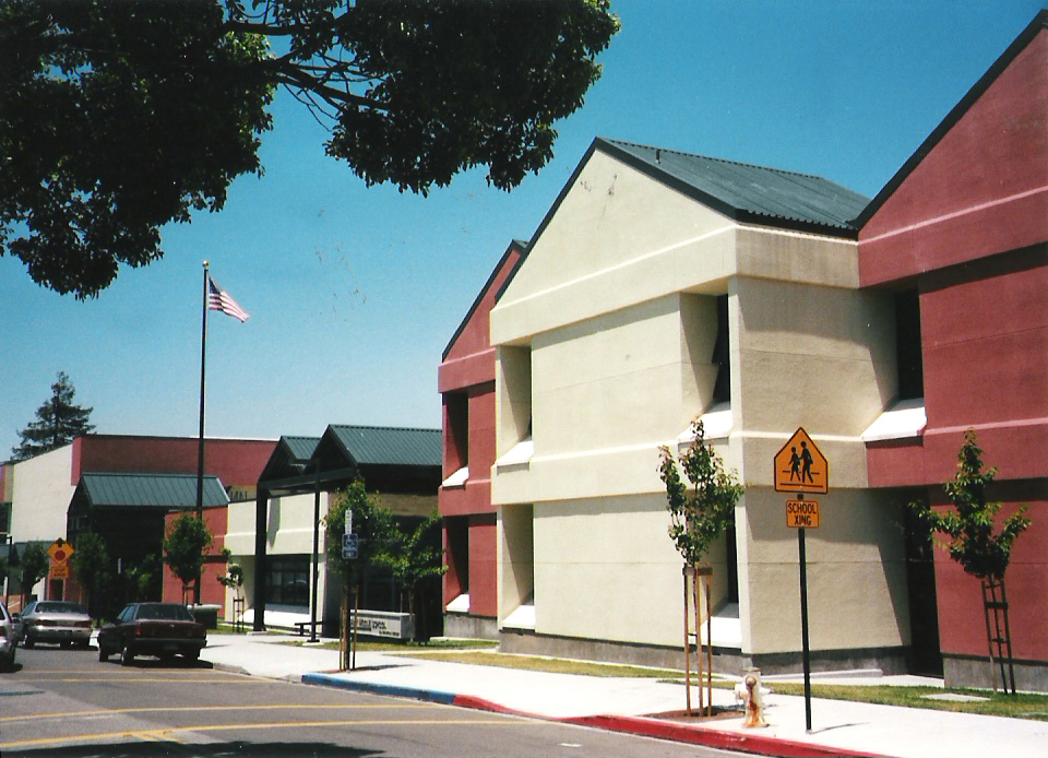
 Albany Middle School, 2006
Public schools in Albany are operated by the Albany Unified School District, a special-purpose district whose borders match the city's. The school district operates three elementary schools, one middle school, one traditional high school, and one continuation high school, in addition to an adult school. Albany High School is known as one of the best public schools of the San Francisco Bay Area for its academic excellence. The high school had a graduation rate of 92.1%, according to the 2009-10 School Accountability Report Card for the prior academic year.[9]
There are two private high schools in Albany: Tilden Preparatory School (formerly School for Independent Learners) on Solano Avenue and St. Mary's College High School, whose campus straddles the border with Berkeley, CA.
The University of California, Berkeley owns a large student housing complex in Albany, University Village, which is primarily used for family housing.
Arts, culture, and recreation
The Solano Stroll, an annual street festival held on Solano Avenue in Albany and Berkeley, attracts more than 250,000 visitors on the second Sunday of September. The event was started in 1975 by The Iris store owner and Solano Avenue Association founder Ira Klein as a "thank you party" from Solano Avenue business owners to customers.[10] The Library of Congress designated the Solano Stroll as a "National Local Legacy" in 2001.[10]
Albany also has a large little league, which draws children from around the area. The Albany Little League has gone to state tournaments with their junior and Majors levels. In 2008, Albany won its first championship in the Little League.
Albany is home to Golden Gate Fields, the only commercial racetrack in the Bay Area, as well as a the Eastshore State Park which skirts the San Francisco Bay, and the Albany Bulb.
Albany also boasts its very advanced school music program. High school music groups, both instrumental and choral, have performed in at least a superior manner at the CMEA, Reno Jazz, and other festivals. The Albany High School Jazz Band was also accepted the Essentially Ellington festival at the Lincoln Center in New York, New York in 2010. Albany was one of 15 schools accepted into the festival.
Friends of Five Creeks is an all-volunteer group working hands-on for clean water and healthy watersheds.
The Albany Strollers & Rollers group was founded in 2004 to address safety hazards to bicyclists in the Albany area and to improve bicycle awareness.
See also
References
- ^ U.S. Census
- ^ Albany City Chamber of Commerce
- ^ "Albany Shuts Down Homeless Camp / Squatters leave site of future park". The San Francisco Chronicle. August 31, 1999. http://www.sfgate.com/cgi-bin/article.cgi?f=/c/a/1999/08/31/MN1338.DTL.
- ^ Costantinou, Marianne (June 1, 1999). "Shak dwellers told to go". The San Francisco Chronicle. http://www.sfgate.com/cgi-bin/article.cgi?f=/e/a/1999/06/01/NEWS15130.dtl.
- ^ "Albany Waterfront Topic Page". Albany Patch. April 21, 2011. http://albany.patch.com/columns/albany-waterfront.
- ^ "University Village Master Plan." University of California, Berkeley. June 2004. 1. Retrieved on October 2, 2011.
- ^ All data are derived from the United States Census Bureau reports from the 2010 United States Census, and are accessible on-line here. The data on unmarried partnerships and same-sex married couples are from the Census report DEC_10_SF1_PCT15. All other housing and population data are from Census report DEC_10_DP_DPDP1. Both reports are viewable online or downloadable in a zip file containing a comma-delimited data file. The area data, from which densities are calculated, are available on-line here. Percentage totals may not add to 100% due to rounding. The Census Bureau defines families as a household containing one or more people related to the householder by birth, opposite-sex marriage, or adoption. People living in group quarters are tabulated by the Census Bureau as neither owners nor renters. For further details, see the text files accompanying the data files containing the Census reports mentioned above.
- ^ DataQuick Real Estate Headlines and Statistics, Accessed September 29 2011
- ^ "Albany High School Overview". Albany Patch. April 21, 2011. http://albany.patch.com/listings/albany-high-school#pdf-522901.
- ^ a b Berkeley News, Chris Treadway, Berkeley Voice/West County Times, 9/12/2008, Solano Stroll A Local Institution, Accessed October 22 2010
External links
Municipalities and communities of Alameda County, California Cities Alameda | Albany | Berkeley | Dublin | Emeryville | Fremont | Hayward | Livermore | Newark | Oakland | Piedmont | Pleasanton | San Leandro | Union City
CDPs Ashland | Castro Valley | Cherryland | Fairview | San Lorenzo | Sunol
Unincorporated
communitiesAlbrae | Altamont | Asco | Baumberg | Brightside | Brookshire | Carpenter | Dougherty | Dresser | East Pleasanton | Farwell | Hall Station | Halvern | Kilkare Woods | Komandorski Village | Lorenzo Station | Mattos | Mendenhall Springs | Midway | Mountain House | Mowry Landing | Radum | San Ramon Village | Scotts Corner | Sorenson | Verona
Former settlements Alden | Alvarado | Ann | Decoto | Drawbridge | Eden Landing | Elliot | Goecken | Greenville | Hacienda | Hayward Heath | Laddville | Larkin's Landing | Mallard | Melita | Merienda | Monte Vista | Remillard | Robert | Russell City | Stokes Landing | Tesla
 State of California
Topics - Climate
- Delegations
- Deserts
- Districts
- Ecology
- Elections
- Environment
- Geography
- Government
- History
- Protected areas
- Sports
- Symbols
- Transportation
- Visitor attractions
- Index of California-related articles
Society Regions - Antelope Valley
- Big Sur
- Cascade Range
- Central California
- Central Coast
- Central Valley
- Channel Islands
- Coachella Valley
- Conejo Valley
- Cucamonga Valley
- Death Valley
- East Bay (SF)
- East County (SD)
- Eastern California
- Emerald Triangle
- Gold Country
- Great Basin
- Greater Los Angeles
- Greater Sacramento
- Inland Empire
- Lake Tahoe
- Los Angeles Basin
- Lost Coast
- Metropolitan Fresno
- Mojave
- Mountain Empire
- North Bay (SF)
- North Coast
- North County (SD)
- Northern California
- Owens Valley
- Oxnard Plain
- San Francisco Peninsula
- Pomona Valley
- Sacramento Valley
- San Bernardino Valley
- San Diego–Tijuana
- San Fernando Valley
- San Francisco Bay Area
- San Gabriel Valley
- San Joaquin Valley
- Santa Clara Valley
- Santa Clara River Valley
- Santa Clarita Valley
- Shasta Cascade
- Sierra Nevada
- Silicon Valley
- South Bay (LA)
- South Bay (SF)
- South Bay (SD)
- South Coast
- Southern California
- Southern Border Region
- Tri-Valley
- Upstate California
- Victor Valley
- Wine Country
- Yosemite
Metro areas - Bakersfield
- Chico
- El Centro
- Fresno
- Hanford–Corcoran
- Los Angeles–Long Beach–Glendale
- Madera
- Modesto
- Merced
- Napa
- Oakland–Fremont–Hayward
- Oxnard–Thousand Oaks–Ventura
- Redding
- Riverside–San Bernardino–Ontario
- Sacramento–Arden Arcade–Roseville
- Salinas
- San Diego–Carlsbad–San Marcos
- San Francisco–San Mateo–Redwood City
- San Jose–Sunnyvale–Santa Clara
- San Luis Obispo–Paso Robles
- Santa Ana–Anaheim–Irvine
- Santa Barbara–Santa Maria–Goleta
- Santa Cruz–Watsonville
- Santa Rosa–Petaluma
- Stockton
- Vallejo–Fairfield
- Visalia–Porterville
- Yuba City
Micro areas Counties - Alameda
- Alpine
- Amador
- Butte
- Calaveras
- Colusa
- Contra Costa
- Del Norte
- El Dorado
- Fresno
- Glenn
- Humboldt
- Imperial
- Inyo
- Kern
- Kings
- Lake
- Lassen
- Los Angeles
- Madera
- Marin
- Mariposa
- Mendocino
- Merced
- Modoc
- Mono
- Monterey
- Napa
- Nevada
- Orange
- Placer
- Plumas
- Riverside
- Sacramento
- San Benito
- San Bernardino
- San Diego
- San Francisco
- San Joaquin
- San Luis Obispo
- San Mateo
- Santa Barbara
- Santa Clara
- Santa Cruz
- Shasta
- Sierra
- Siskiyou
- Solano
- Sonoma
- Stanislaus
- Sutter
- Tehama
- Trinity
- Tulare
- Tuolumne
- Ventura
- Yolo
- Yuba
Categories:- Albany, California
- 1909 establishments in the United States
- Cities in Alameda County, California
- Cities in the San Francisco Bay Area
- Incorporated cities and towns in California
- Populated places established in 1909


Wikimedia Foundation. 2010.