- Kings County, California
-
County of Kings — County — 
SealLocation in the state of California California's location in the United States
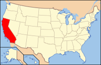
Country  United States
State  California
Region San Joaquin Valley Metro area Hanford-Corcoran Incorporated 1893 County seat Hanford Largest city Hanford Area – Total 1,391.49 sq mi (3,603.9 km2) – Land 1,390.99 sq mi (3,602.6 km2) – Water 0.50 sq mi (1.3 km2) Population (2011) – Total 153,365 – Density 110.2/sq mi (42.6/km2) Time zone Pacific Standard Time (UTC-8) – Summer (DST) Pacific Daylight Time (UTC-7) Website countyofkings.com Kings County is a county located in the Central Valley of the U.S. state of California. It is located in a rich agricultural region. Kings County is also home to NAS Lemoore, which is the U.S. Navy's newest and largest master jet air station. The county seat is Hanford. The United States Census Bureau defines Kings County as encompassing the entire Hanford–Corcoran Metropolitan Statistical Area (MSA Code 25260). The population was 152,982 at the time of the 2010 U.S. Census. According to the California Department of Corrections and Rehabilitation, the county's population included 18,640 state prison inmates as of March 31, 2010.[1] The California Department of Finance estimated that Kings County's population was 153,365 as of January 1, 2011.[2]
Contents
History
The area was inhabited for thousands of years by indigenous peoples. It was colonized by Spain, Mexico and the United States.
An 1805 expedition probably led by Spanish Army Lieutenant Gabriel Moraga recorded discovering the river, which they named El Rio de los Santos Reyes (River of the Holy Kings) after the Three Wise Men of the Bible.[3] At the time of the United States conquest in 1848, the new government changed the name to Kings River.[3]
In 1880, a dispute over land titles between settlers and the Southern Pacific Railroad resulted in a bloody gun battle on a farm 5.6 mi (9.0 km) northwest of Hanford; seven men died. This event became known as the Mussel Slough Tragedy.
Kings County was formed in 1893 from the western part of Tulare County.[3] In 1909, by an act of the state legislature, 208 square miles (540 km2) of Fresno County territory was added to the northwest portion of Kings County.[4]
Settlers reclaimed Tulare Lake and its wetlands for agricultural development. In surface area, it was formerly the largest body of freshwater west of the Great Lakes, and supported a large population of migratory birds as well as local birds and wildlife. Monoculture has sharply reduced habitat for many species.
In 1928, oil was discovered in the Kettleman Hills located in the southwestern part of Kings County. The Kettleman North Dome Oil Field became one of the most productive oil fields in the United States.[5]
In 1933 during the Great Depression, cotton pickers in the southern San Joaquin Valley, mostly migrant Mexican workers, went on strike. During the strike, 3,500 striking farm workers lived in a four-acre camp on the land of a small farmer on the outskirts of Corcoran. Ultimately, the federal government intervened to force both sides to negotiate a settlement.[6]
Lemoore Army Airfield was established for training and defense during World War II. In 1961, the U.S. Navy opened NAS Lemoore 9 miles (14 km) west of Lemoore, not far from the earlier site.
The completion of the California Aqueduct in the early 1970s brought needed water for agriculture and domestic use to the westside of the county.
Historic sites
- Kingston
- Mussel Slough Tragedy
- El Adobe de los Robles Rancho built by Daniel Rhoads
Geography
According to the 2000 census, the county has a total area of 1,391.49 square miles (3,603.9 km2), of which 1,390.99 square miles (3,602.6 km2) (or 99.96%) is land and 0.50 square miles (1.3 km2) (or 0.04%) is water.[7]
Kings County is bordered on the north and northwest by Fresno County, on the east by Tulare County, on the south by Kern County and a small part of San Luis Obispo County and on the west by Monterey County.
Most of the historic Tulare Lake was within Kings County. Although reclaimed for farming late in the 19th century, it was the largest freshwater lake west of the Great Lakes.
Cities and towns
Rural communities
- Grangeville
- Guernsey
- Halls Corner
- Hardwick
- Hub
- Island District
- Lakeside
Proposed new city
- Quay Valley Ranch
Indian reservation
Adjacent counties
- Kern County, California - south
- Tulare County, California - east
- Fresno County, California - north, northwest
- Monterey County, California - west
- San Luis Obispo County, California - southwest
Transportation infrastructure
Major highways
Public transportation
Kings Area Rural Transit (KART) operates regularly scheduled fixed route bus service, vanpool service for commuters and Dial-A-Ride (demand response) services throughout Kings County as well as to Fresno.[8]
Amtrak trains stop in Corcoran and Hanford.
Orange Belt Stages provides inter-city bus service to and from Hanford. Connections with Greyhound can be made in Visalia or Paso Robles.
Airports
Hanford Municipal Airport is a general aviation airport located just southeast of Hanford. The privately-owned airport in Avenal is the home of the Central California Soaring Club.[9]
Economy
The economy is based on agriculture. Other important employers include NAS Lemoore, the U.S. Navy's largest master jet base and the California Department of Corrections and Rehabilitation which operates three state prisons in Kings County.
At the time of the 2000 census, the median income for a household in the county was $35,749, and the median income for a family was $38,111. Males had a median income of $31,700 versus $24,772 for females. The per capita income for the county in 2000 was $15,848. By 2009, according to the U.S Bureau of Economic Analysis, average per capita income had reached $30,646 in Kings County compared with $42,395 in California as a whole.[10] The 2000 census reported that about 15.8% of families and 19.5% of the population were below the poverty line, including 25.9% of those under age 18 and 8.8% of those age 65 or over. In 2003, Kings County had the lowest per capita income in the state of California.[11]
The homeownership rate was 54.2% at the time of the 2010 census.[12]
Taxable sales in 2007 totaled $1.33 billion.[13]
Kings County has not escaped the effects of the late 2000s recession. The unemployment rate in October 2011 was 14.6%, up from 10.1% in July 2008.[14] According to the California Employment Development Department, as of January 2011, civilian employment totaled 49,200 and an additional 11,000 people were unemployed. Many residents of Kings County were employed in services (30,100 persons, including 14,600 government employees) and agriculture (5,700 employees) as well as in some manufacturing enterprises (3,400 employees) and construction (800 employees).[[15] Median household income fell over 8% from an estimated $48,419 in 2007 to $44,506 in 2009 according to the U.S. Census Bureau’s American Community Survey. Jeffrey Michael, director of the Business Forecasting Center at the University of the Pacific, stated in an October 2010 newspaper interview that nearly half of Kings County's personal earnings come from government jobs, which pay more than agricultural employment. From 2007 to 2009, government jobs held steady while the county's agricultural sector took the biggest hit. Kings County's dairy industry dropped from $670 million in milk sold in 2008 to $411 million in 2009 - a 39% drop.[16] By mid-2009, the price paid to milk producers had dropped to a point that was far below the cost of production according to a July 2009 quote from Bill Van Dam, CEO of the Alliance of Western Milk Producers.[17] By December 2010, milk prices had increased to about $13 per hundredweight from a low of below $10 in 2009. However, the price of corn used for feed had increased because of its use by the ethanol industry. Van Dam was quoted that month as saying that at current prices, dairy operators are at or close to the break-even point.[18]
Politics
Kings County vote
by party in presidential electionsYear GOP DEM Others 2008 56.2% 19,710 42.1% 14,747 1.8% 618 2004 65.4% 21,003 33.7% 10,833 0.9% 274 2000 57.8% 16,377 39.0% 11,041 3.2% 917 1996 47.9% 12,368 43.6% 11,254 8.5% 2,193 1992 41.6% 10,673 38.9% 9,982 19.5% 4,996 1988 56.4% 12,118 42.6% 9,142 1.0% 222 1984 64.1% 13,364 35.1% 7,324 0.8% 160 1980 55.4% 10,531 38.4% 7,299 6.3% 1,191 1976 49.7% 8,263 48.4% 8,061 1.9% 318 1972 56.5% 10,509 39.1% 7,274 4.4% 812 1968 43.1% 7,796 47.8% 8,643 9.2% 1,662 1964 30.5% 5,753 69.4% 13,073 0.1% 14 1960 42.3% 6,991 57.1% 9,439 0.6% 92 1956 42.3% 6,195 57.5% 8,417 0.3% 40 1952 49.2% 7,708 50.1% 7,850 0.7% 113 1948 37.2% 4,289 60.0% 6,909 2.8% 323 1944 34.2% 3,468 65.0% 6,591 0.7% 75 1940 31.8% 3,911 67.4% 8,307 0.8% 102 1936 23.7% 2,226 75.1% 7,062 1.2% 116 1932 26.7% 2,009 69.1% 5,191 4.2% 318 1928 51.5% 2,947 47.2% 2,701 1.3% 73 1924 50.0% 2,812 19.7% 1,109 30.3% 1,693 1920 59.6% 2,806 34.1% 1,604 6.3% 297 In January 2008, the Kings County Clerk reported that of 45,444 registered voters, 21,685 were Republicans and 16,664 were Democrats.[19]
Kings has long been a strongly Republican county in Presidential elections. The last Democratic candidate for President to win the county was Hubert Humphrey in 1968.
Kings County is part of California's California's 20th congressional district, which is held by Democrat Jim Costa. The county is represented in the California State Senate by Democrat Michael Rubio and in the California State Assembly by Republican David Valadao.
On Nov. 4, 2008 Kings County voted 73.7 % for Proposition 8 which amended the California Constitution to ban same-sex marriages.
Demographics
Historical populations Census Pop. %± 1900 9,871 — 1910 16,230 64.4% 1920 22,031 35.7% 1930 25,385 15.2% 1940 35,168 38.5% 1950 46,768 33.0% 1960 49,954 6.8% 1970 64,610 29.3% 1980 73,738 14.1% 1990 101,469 37.6% 2000 129,461 27.6% 2010 152,982 18.2% [20][21][22] 2010
The 2010 United States Census reported that Kings County had a population of 152,982. The racial makeup of Kings County was 83,027 (54.3%) White, 11,014 (7.2%) African American, 2,562 (1.7%) Native American, 5,620 (3.7%) Asian, 271 (0.2%) Pacific Islander, 42,996 (28.1%) from other races, and 7,492 (4.9%) from two or more races. Hispanic or Latino of any race were 77,866 persons (50.9%).[23]
The U.S. Census does not identify how many residents are illegal immigrants. However, the Public Policy Institute of California issued a report in July 2011, which estimated there were 9,000 unauthorized immigrants living in Kings County in 2008, which would be 5.8% of the county’s population.[24]
Population reported at 2010 United States Census The County Total
PopulationWhite African
AmericanNative
AmericanAsian Pacific
Islanderother
racestwo or
more racesHispanic
or Latino
(of any race)Kings County 152,982 83,027 11,014 2,562 5,620 271 42,996 7,492 77,866 Incorporated
cityTotal
PopulationWhite African
AmericanNative
AmericanAsian Pacific
Islanderother
racestwo or
more racesHispanic
or Latino
(of any race)Avenal 15,505 6,044 1,625 186 108 6 7,188 348 11,130 Corcoran 24,813 8,940 3,725 349 193 17 10,979 610 15,545 Hanford 53,967 33,713 2,632 712 2,322 53 11,599 2,936 25,419 Lemoore 24,531 13,925 1,566 333 2,010 102 4,935 1,660 9,820 Census-designated
placeTotal
PopulationWhite African
AmericanNative
AmericanAsian Pacific
Islanderother
racestwo or
more racesHispanic
or Latino
(of any race)Armona 4,156 2,058 99 64 85 13 1,597 240 2,784 Grangeville 469 393 15 5 5 0 41 10 145 Hardwick 138 63 5 0 0 0 67 3 86 Home Garden 1,761 652 221 63 50 8 677 90 1,189 Kettleman City 1,439 478 4 8 1 0 887 61 1,383 Lemoore Station 7,438 4,883 729 70 560 53 418 725 1,445 Stratford 1,277 574 16 17 19 1 617 33 1,069 Unincorporated
communitiesTotal
PopulationWhite African
AmericanNative
AmericanAsian Pacific
Islanderother
racestwo or
more racesHispanic
or Latino
(of any race)All others not CDPs (combined) 17,488 11,304 377 755 267 18 3,991 776 7,851 2000
As of the 2000 census, there were 129,461 people, 34,418 households, and 26,983 families residing in the county. However, the California Department of Finance estimates that the population had grown 154,434 as of January 1, 2008.[25] The population density based on the 2000 census was 36/km² (93/sq mi). There were 36,563 housing units at an average density of 26 per square mile (10/km²). The racial makeup of the county was 53.68% White, 8.30% Black or African American, 1.68% Native American, 3.07% Asian, 0.19% Pacific Islander, 28.28% from other races, and 4.79% from two or more races. 43.61% of the population were Hispanic or Latino of any race. 7.1% were of Portuguese, 6.2% German, 5.3% Irish and 5.1% American ancestry according to Census 2000. 63.6% spoke English, 30.9% Spanish, 1.4% Tagalog, 1.4% Portuguese and 1.3% Samoan as their first language.
There were 34,418 households out of which 46.4% had children under the age of 18 living with them, 58.0% were married couples living together, 14.3% had a female householder with no husband present, and 21.6% were non-families. 17.0% of all households were made up of individuals and 6.8% had someone living alone who was 65 years of age or older. The average household size was 3.18 and the average family size was 3.56.
In the county the population was spread out with 29.0% under the age of 18, 11.8% from 18 to 24, 35.0% from 25 to 44, 16.8% from 45 to 64, and 7.4% who were 65 years of age or older. The median age was 30 years in 2000, which had increased to 31.1 by the time of the 2010 census.[26] For every 100 females there were 134.8 males. For every 100 females age 18 and over, there were 148.8 males. The ratio may be attributed to the presence of three men's state prisons in the county.
Culture
Kings County has a large annual celebraton held each May called Kings County Homecoming Week.[27]
Government
Kings County is a general law county under the California Constitution. That is, it does not have a county charter. The county is governed by a five-member Board of Supervisors. Supervisors are elected by districts for four-year terms. There are no term limits in effect. The Chairman and Vice-Chairman are elected annually by the Board of Supervisors from among its members. On January 3, 2011, the Board elected Supervisor Tony Barba as Chairman and Supervisor Richard Fagundes as Vice-Chairman to serve during 2011. Other Supervisors include Doug Verboon, Richard Valle and Joe Neves.[28]
The Board of Supervisors appoints a County Administrative Officer. Currently, that office is held by Larry Spikes.[29]
See also
- California census statistical areas
- National Register of Historic Places listings in Kings County, California
References
- ^ http://www.cdcr.ca.gov/Reports_Research/Offender_Information_Services_Branch/Monthly/Monthly_Tpop1a_Archive.html accessed November 20, 2011
- ^ http://www.dof.ca.gov/research/demographic/reports/estimates/e-1/view.php accessed November 20, 2011
- ^ a b c Hoover, p. 132
- ^ Brown, Robert L. (1940). History of Kings County. A. H. Cawston. p. 53.
- ^ Brown, Robert L. (1940). History of Kings County. A. H. Cawston. p. 123.
- ^ Weber, Devra (1994). Dark Sweat. White Gold: California Farm Workers, Cotton and the New Deal. Berkeley and Los Angeles, California: University of California Press. pp. 79–111. ISBN 0-520-20710-6.
- ^ "Census 2000 U.S. Gazetteer Files: Counties". United States Census. http://www.census.gov/tiger/tms/gazetteer/county2k.txt. Retrieved 2011-02-13.
- ^ http://www.mykartbus.com/ accessed 5-9-10
- ^ http://www.soaravenal.com/ accessed 1-13-08
- ^ Fresno Bee, May 15, 2011
- ^ US Department of Commerce Study, 2003
- ^ Fresno Bee, May 15, 2011
- ^ http://www.labormarketinfo.edd.ca.gov/ accessed 7-18-09
- ^ http://www.labormarketinfo.edd.ca.gov/?pageid=133 accessed November 20, 2011
- ^ http://www.calmis.ca.gov/file/lfmonth/hanf$pds.pdf accessed April 10, 2011
- ^ Hanford Sentinel, October 2–3, 2010
- ^ Hanford Sentinel, July 11, 2009
- ^ Hanford Sentinel, December 18, 2010
- ^ Hanford Sentinel, January 13, 2008
- ^ http://www.census.gov/population/www/censusdata/cencounts/files/ca190090.txt
- ^ http://factfinder2.census.gov
- ^ http://mapserver.lib.virginia.edu/
- ^ "2010 Census P.L. 94-171 Summary File Data". United States Census Bureau. http://www2.census.gov/census_2010/01-Redistricting_File--PL_94-171/California/.
- ^ http://www.ppic.org/main/publication.asp?i=986 accessed July 30, 2011
- ^ California Department of Finance, Table E-2, California County Population Estimates and Percent Change, Revised July 1, 2000 through Provisional July 1, 2006
- ^ Fresno Bee, May 15, 2011
- ^ accessed 5-9-10
- ^ [1] accessed 1-7-11
- ^ http://www.countyofkings.com/admin/index.htm accessed 1-13-08
- Hoover, Mildred Brooke; Douglas E. Kyle (1990). Historic Spots in California. Stanford University Press. ISBN 9780804717342. http://books.google.com/books?id=p2WrAAAAIAAJ&printsec=frontcover.
External links
- Kings County website
- 2010 Kings County Crop Report
- Kings County Community Health Status Report, 2008-2009
- Kings County history website operated by the Kings County Office of Education
- Kings County Economic Development Corporation website
- Kings Classifieds - Free Online Classifieds for Kings County, California

Fresno County Fresno County Monterey County 
Tulare County  Kings County, California

San Luis Obispo County Kern County Municipalities and communities of Kings County, California Cities 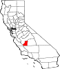
CDPs Armona | Grangeville | Hardwick | Home Garden | Kettleman City | Lemoore Station | Stratford
Unincorporated
communitiesGhost towns Categories:- California counties
- Kings County, California
- Metropolitan areas of California
- San Joaquin Valley
- Counties of the United States with Hispanic majority populations


Wikimedia Foundation. 2010.