- Mariposa County, California
-
County of Mariposa — County — Mariposa County Courthouse

SealLocation in the state of California California's location in the United States
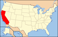
Country  United States
State  California
Region Sierra Nevada Incorporated 1850 County seat Mariposa Area – Total 1,462.79 sq mi (3,788.6 km2) – Land 1,451.12 sq mi (3,758.4 km2) – Water 11.67 sq mi (30.2 km2) Population (2010) – Total 18,251 – Density 12.5/sq mi (4.8/km2) Time zone Pacific Standard Time (UTC-8) – Summer (DST) Pacific Daylight Time (UTC-7) Website www.mariposacounty.org Mariposa County is a county in the U.S. state of California, located in the western foothills of the Sierra Nevada mountains. It lies north of Fresno, east of Merced, and southeast of Stockton. As of the 2010 census, the population was 18,251 up from 17,130 at the 2000 census. The county seat is Mariposa.
The county's eastern half is the central portion of Yosemite National Park.
There are no incorporated cities in Mariposa County; however, there are three communities recognized as census-designated places for statistical purposes. It also has the distinction of having no permanent traffic lights anywhere in the county.
Contents
History
Mariposa County was one of the original counties of California, created at the time of statehood in 1850. While it began as the state's largest county, over time territory that was once part of Mariposa was ceded to twelve other counties: Fresno, Inyo, Kern, Kings, Los Angeles, Madera, Merced, Mono, San Benito, San Bernardino, San Luis Obispo, and Tulare. Thus, Mariposa County is known as the "Mother of Counties".[1]
The county took its name from Mariposa Creek, which was so named by Spanish explorers in 1806, when they discovered a great cluster of butterflies ("mariposas" in Spanish and Portuguese) in the foothills of the Sierras. Each year, the first weekend in May, residents mark the annual arrival of migrating Monarch butterflies with a "Butterfly Days" festival and parade.
The Gold Rush
Mariposa County is located at the southern end of California's Mother Lode region. During the California Gold Rush, great quantities of the prized mineral were found and extracted, first in local stream-beds and later in hard rock mines. One of the most notable beneficiaries of this wealth was the famed explorer and 1856 Republican presidential candidate, John C. Frémont, for whom the local hospital is named. (Jessie Street, in the town of Mariposa, is named for Fremont's wife, Jessie Benton Frémont, who came to Mariposa to live with him.)
Many aspects of the area's mining history are depicted in exhibits at two local museums: the Mariposa History Museum, located in the town of Mariposa; and the California Mining and Mineral Museum, located at the Mariposa Fairgrounds (2 miles east of Mariposa on Highway 49).
Geography and natural history
 "The Dragon", crystalline gold from the Colorado Quartz Mine, Mariposa County. Collections of Houston Museum of Natural Science.
According to the 2000 census, the county has a total area of 1,462.79 square miles (3,788.6 km2), of which 1,451.12 square miles (3,758.4 km2) (or 99.20%) is land and 11.67 square miles (30.2 km2) (or 0.80%) is water.[2] Along the banks of the Merced River is found the sole habitat for the Limestone salamander, a rare species endemic to Mariposa County.
National protected areas
- Sierra National Forest (part)
- Stanislaus National Forest (part)
- Yosemite National Park (part)
Communities
Census-designated places
- Bear Valley
- Bootjack
- Buck Meadows
- Catheys Valley
- Coulterville
- El Portal
- Greeley Hill
- Hornitos
- Mariposa
- Midpines
- Wawona
- Yosemite Valley
Other unincorporated places
- Foresta
- Jerseydale
- Lush Meadows
- Mt. Bullion
- Oak Grove Estates
- Ponderosa Basin
Adjacent counties
- Tuolumne County, California - north
- Merced County, California - west
- Madera County, California - south, east
- Stanislaus County, California - northwest by a corner
Transportation infrastructure
Major highways
Public transportation
- Mariposa County Transit provides dial-a-ride and some fixed route service
- Yosemite Area Regional Transit System (YARTS) provides service along State Routes 120 and 140 to Yosemite National Park.
Airports
Mariposa Yosemite Airport is a general aviation airport. The nearest airports with scheduled flights are in Fresno and Merced.
Demographics
Historical populations Census Pop. %± 1850 4,379 — 1860 6,243 42.6% 1870 4,572 −26.8% 1880 4,339 −5.1% 1890 3,787 −12.7% 1900 4,720 24.6% 1910 3,956 −16.2% 1920 2,775 −29.9% 1930 3,233 16.5% 1940 5,605 73.4% 1950 5,145 −8.2% 1960 5,064 −1.6% 1970 6,015 18.8% 1980 11,108 84.7% 1990 14,302 28.8% 2000 17,130 19.8% 2010 18,251 6.5% [3][4][5] 2010
The 2010 United States Census reported that Mariposa County had a population of 18,251. The racial makeup of Mariposa County was 16,103 (88.2%) White, 138 (0.8%) African American, 527 (2.9%) Native American, 204 (1.1%) Asian, 26 (0.1%) Pacific Islander, 508 (2.8%) from other races, and 745 (4.1%) from two or more races. Hispanic or Latino of any race were 1,676 persons (9.2%).[6]
Population reported at 2010 United States Census The County Total
PopulationWhite African
AmericanNative
AmericanAsian Pacific
Islanderother
racestwo or
more racesHispanic
or Latino
(of any race)Mariposa County 18,251 16,103 138 527 204 26 508 745 1,676 Census-designated
placeTotal
PopulationWhite African
AmericanNative
AmericanAsian Pacific
Islanderother
racestwo or
more racesHispanic
or Latino
(of any race)Buck Meadows 31 23 0 0 0 0 5 3 7 Catheys Valley 825 730 6 12 12 1 33 31 80 Coulterville 201 181 0 5 1 0 0 14 20 El Portal 474 434 1 9 5 0 5 20 28 Fish Camp 59 57 0 0 1 0 0 1 3 Greeley Hill 915 847 7 14 1 6 11 29 53 Hornitos 75 66 0 2 1 0 0 6 5 Lake Don Pedro 1,077 979 7 18 12 2 18 41 109 Mariposa 2,173 1,895 10 105 30 0 59 74 215 Midpines 1,204 990 4 63 7 0 97 43 208 Wawona 169 138 2 3 4 0 8 14 12 Yosemite Valley 1,035 831 28 31 31 7 70 37 123 Unincorporated
communitiesTotal
PopulationWhite African
AmericanNative
AmericanAsian Pacific
Islanderother
racestwo or
more racesHispanic
or Latino
(of any race)All others not CDPs (combined) 8,928 8,004 71 230 86 10 170 357 729 2000
As of the census[7] of 2000, there were 17,130 people, 6,613 households, and 4,490 families residing in the county. The population density was 12 people per square mile (5/km²). There were 8,826 housing units at an average density of 6 per square mile (2/km²). The racial makeup of the county was 88.93% White, 0.67% Black or African American, 3.51% Native American, 0.71% Asian, 0.13% Pacific Islander, 2.67% from other races, and 3.38% from two or more races. 7.76% of the population were Hispanic or Latino of any race. 17.8% were of German, 13.4% English, 12.7% Irish and 6.7% American ancestry according to Census 2000. 96.0% spoke English and 3.5% Spanish as their first language.
There were 6,613 households out of which 25.6% had children under the age of 18 living with them, 55.8% were married couples living together, 8.0% had a female householder with no husband present, and 32.1% were non-families. 26.5% of all households were made up of individuals and 11.2% had someone living alone who was 65 years of age or older. The average household size was 2.37 and the average family size was 2.86.
In the county the population was spread out with 21.6% under the age of 18, 6.9% from 18 to 24, 25.1% from 25 to 44, 29.2% from 45 to 64, and 17.2% who were 65 years of age or older. The median age was 43 years. For every 100 females there were 104.7 males. For every 100 females age 18 and over, there were 105.4 males.
The median income for a household in the county was $34,626, and the median income for a family was $42,655. Males had a median income of $31,194 versus $25,440 for females. The per capita income for the county was $18,190. About 10.5% of families and 14.8% of the population were below the poverty line, including 16.5% of those under age 18 and 9.0% of those age 65 or over.
Politics
Presidential election results Year GOP DEM Others 2008 55.2% 4,880 42.6% 3,766 2.3% 199 2004 60.2% 5,215 37.6% 3,251 2.2% 192 2000 58.5% 4,727 34.9% 2,816 6.6% 531 1996 50.0% 3,976 36.7% 2,920 13.3% 1,053 1992 36.0% 2,982 36.5% 3,023 27.5% 2,282 1988 54.5% 3,768 43.4% 2,998 2.1% 144 1984 61.2% 3,989 36.8% 2,399 2.0% 130 1980 55.0% 3,082 33.7% 1,889 11.4% 637 1976 46.6% 2,012 48.5% 2,093 4.9% 212 1972 56.2% 2,122 39.3% 1,487 4.5% 170 1968 49.9% 1,496 39.6% 1,187 10.5% 314 1964 42.6% 1,264 57.4% 1,704 1960 54.0% 1,599 45.2% 1,338 0.9% 26 Mariposa is a strongly Republican county in Presidential and congressional elections. The last Democrat to win a majority in the county was Lyndon Johnson in 1964 but the last Democrat to win the county was Bill Clinton in 1992 who won a plurality.
Mariposa is part of California's 19th congressional district, which is held by Republican Jeff Denham. In the state legislature Mariposa is in the 25th Assembly district, which is held by Republican Kristin Olsen, and the 14th Senate district, which is held by Republican Tom Berryhill.
On Nov. 4, 2008 Mariposa County voted 62.3 % for Proposition 8 which amended the California Constitution to ban same-sex marriages.
Environment
In late July, 2008, authorities forced the evacuation of about 300 homes, in the wake of the wildfires in the area.
See also
- List of school districts in Mariposa County, California
- National Register of Historic Places listings in Mariposa County, California
- Valley and Sierra Miwok people
- Yokut people (Mariposan)
References
- ^ "Mariposa: Mother Of Counties". Superior Court of California, County of Mariposa. http://mariposacourt.org/HistoryMother.htm. Retrieved 2009-05-17.
- ^ "Census 2000 U.S. Gazetteer Files: Counties". United States Census. http://www.census.gov/tiger/tms/gazetteer/county2k.txt. Retrieved 2011-02-13.
- ^ http://www.census.gov/population/www/censusdata/cencounts/files/ca190090.txt
- ^ http://factfinder2.census.gov
- ^ http://mapserver.lib.virginia.edu/
- ^ "2010 Census P.L. 94-171 Summary File Data". United States Census Bureau. http://www2.census.gov/census_2010/01-Redistricting_File--PL_94-171/California/.
- ^ "American FactFinder". United States Census Bureau. http://factfinder.census.gov. Retrieved 2008-01-31.
External links
- Mariposa County official website
- Yosemite / Mariposa County Tourism Bureau
- Daily News and Photos of Mariposa County
- History and Genealogy of Mariposa County

Stanislaus County Tuolumne County Merced County 
Madera County  Mariposa County, California

Madera County Municipalities and communities of Mariposa County, California CDPs Bear Valley | Bootjack | Buck Meadows | Catheys Valley | Coulterville | El Portal | Fish Camp | Greeley Hill | Hornitos | Lake Don Pedro | Mariposa | Midpines | Wawona | Yosemite Valley

Unincorporated
communitiesBagby | Barrett | Ben Hur | Blanchard | Briceburg | Bridgeport | Buena Vista | Clearing House | Curry Village | Darrah | Dogtown | Elliott Corner | Foresta | Granite Springs | Hayward | Hite Cove | Incline | Indian Gulch | Jerseydale | Mormon Bar | Mount Bullion | North Wawona | Ponderosa Basin | South Wawona | Yosemite Village | Yosemite West
Former
settlementsAgua Fria | Bondville | Chinquapin | Drum | Eightmile | Elevenmile | Elkhorn | Emory | Hokokwito | Kocher | Kumaini | Macheto | Minear | Mount Ophir | Newtown | Notomidula | Opie | Phillip's Flat | Quartzburg | Ridleys Ferry | Sakaya | Sloss | Wenger | Wiskala | Yosemite Mill
Categories:- California counties
- Mariposa County, California


Wikimedia Foundation. 2010.