- Unincorporated area
-
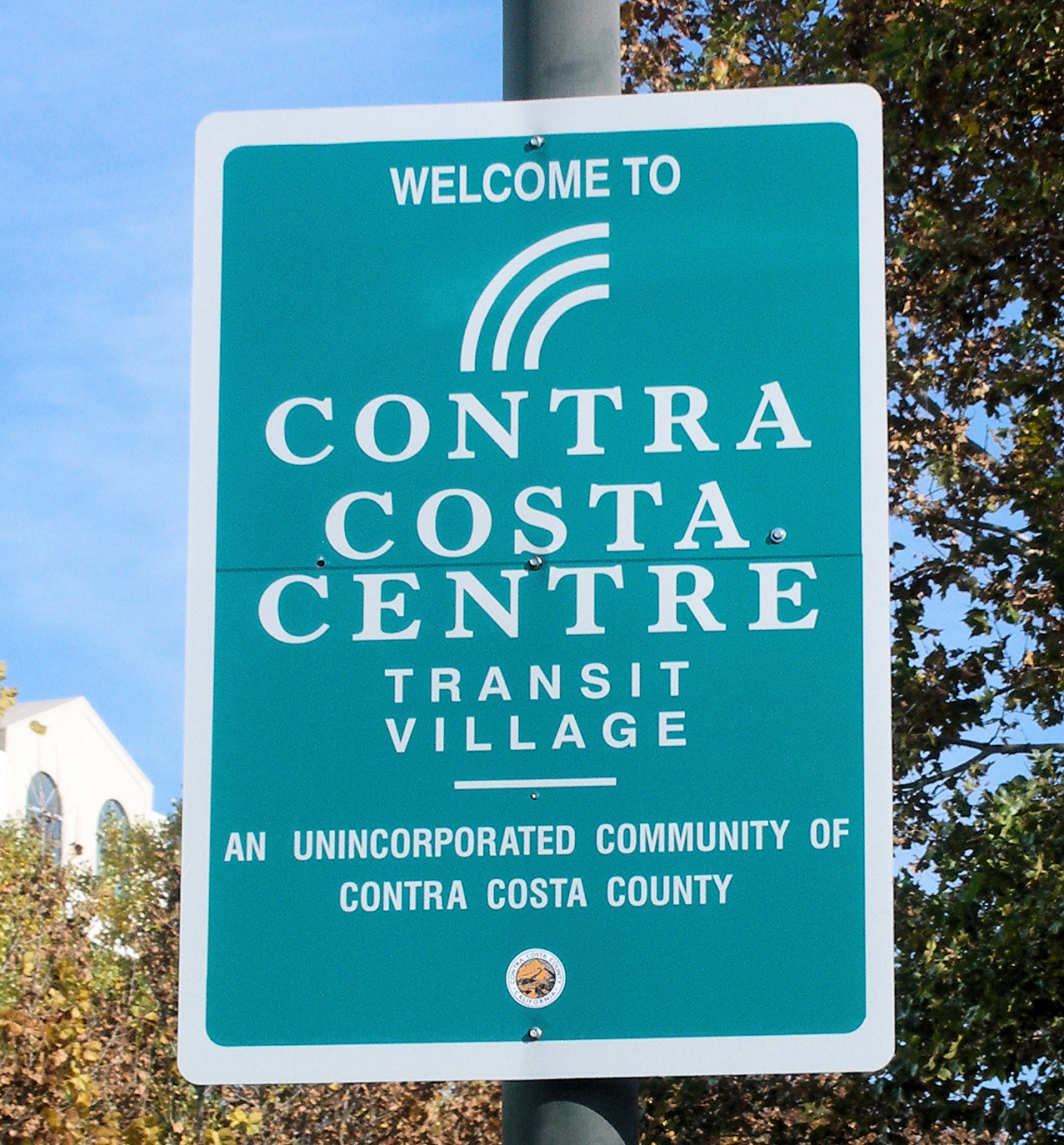
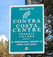 Sign at Contra Costa Centre Transit Village, an unincorporated community in Contra Costa County, California, north of the city of Walnut Creek.
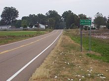
 Sign at Pine Valley, an unincorporated community in San Diego County, California, United States, east of San Diego.
In law, an unincorporated area is a region of land that is not a part of any municipality.
To "incorporate" in this context means to form a municipal corporation, a city, town, or village with its own government. An unincorporated community is usually not subject to or taxed by a municipal government. Such regions are generally administered by default as a part of larger administrative divisions, such as a township, borough, county, state, province, canton, parish, or country.
Occasionally small towns disincorporate, such as when they become fiscally insolvent, and services become the responsibility of a higher administration. An example is Cabazon, California, which disincorporated in 1972.
Contents
By country
Australia
In Australia, the unincorporated areas are places outside municipal council boundaries, usually in remote areas. Some are of vast area but tiny population. Until 30 June 2008, there were large unincorporated areas in the Northern Territory with over 9,000 kilometres (5,600 mi) of roads in those areas[1] with 92 percent of the territory area and 16.5 percent of its population. With the reform of local government on 1 July 2008, these shares dropped to 1.45 percent of the area and 4.0 percent of the population. The remaining unincorporated areas in the Northern Territory are the Unincorporated Top End Region (Finniss-Mary, the largest), the Darwin Rates Act Area (East Arm), Nhulunbuy, Alyangula in the northern region, and Yulara in the southern region.[2]
Sixty percent of the area of South Australia is in the unincorporated Outback Areas Community Development Trust. The far west and north of New South Wales is called the Unincorporated Far West Region, which is sparsely populated and barely warrants an elected council. A civil servant in the state capital manages such matters as are necessary. The second unincorporated area of this state is Lord Howe Island.
The Australian Capital Territory lacks any form of local government, and so in a sense the whole territory is an unincorporated area. However, the ACT government takes on the responsibilities of a local government, and Canberra is the only sizeable community in the territory.
The other state to have unincorporated areas is Victoria,[2] which has two small unincorporated areas in Alpine Shire, and one in Shire of Mansfield (all of which are ski resorts), as well as some small offshore islands. The complete list is:[2]
- Elizabeth Island
- Falls Creek Alpine Resort
- French Island
- Gabo Island
- Lady Julia Percy Island
- Lake Mountain Alpine Resort
- Mount Baw Baw Alpine Resort
- Mount Buller Alpine Resort
- Mount Hotham Alpine Resort
- Mount Stirling Alpine Resort
Unlike the United States and some other countries, Australia only has one level of local government beneath the State's. Thus, aside from these special or very sparsely populated areas almost all of Australia will be in one local government area or another. Local government areas (LGAs) often contain many towns, townships and even cities; while many larger cities (like Melbourne and Sydney) are distributed over many local government areas. The boundary, style and even name of an incorporated area therefore do not necessarily correspond to the boundary, type or name of any settlement.
Finally, in Australia the placenames in mail addresses are the suburbs and localities which are declared by the local council, but often cross LGA boundaries. In unincorporated areas, they are declared by the relevant authority. Thus, the question of address in unincorporated areas does not arise as it does in the U.S.
Canada
In Canada, depending on the province, an unincorporated settlement is one that does not have a municipal council that governs solely over the settlement. It is usually, but not always, part of a larger municipal government. This can range from small hamlets to large urbanized areas that are similar in size to towns and cities.
For example, the urban service areas of Fort McMurray and Sherwood Park, of the Regional Municipality of Wood Buffalo and Strathcona County respectively, would be the fifth and sixth largest cities in Alberta if they were incorporated.
In British Columbia, unincorporated settlements lie outside municipal boundaries entirely, and are administered directly by regional/county-level governments similar to the American system.
Unincorporated settlements with a population of between 100 and 1,000 residents may have the status of designated place in Canadian census data.[3]
Some unincorporated settlements which are not part of a larger municipality—particularly those in very remote areas—may have some types of municipal services provided to them by a quasi-governmental agency such as a local services board.
Germany
Since Germany has no administrative level comparable to the townships of other countries, the vast majority of the country is organized in municipalities, often consisting of multiple settlements which are not considered to be unincorporated. Because these settlements lack a council of their own, there is usually an Ortsvorsteher (village president) appointed by the larger municipality, except in the very smallest villages.
As of December 31, 2007[update], Germany had 248 uninhabited unincorporated areas (of which 214 are located in Bavaria), called gemeindefreie Gebiete or singular gemeindefreies Gebiet, not belonging to any municipality, consisting mostly of forested areas. There are also three inhabited unincorporated areas, all of which serve as military proving grounds: Osterheide and Lohheide in Lower Saxony, and Gutsbezirk Münsingen in Baden-Württemberg. They have fewer than 2,000 inhabitants in total. Gutsbezirk Münsingen, after losing its inhabited parts to neighboring municipalities effective January 1, 2011, is uninhabited now.[4]
Netherlands
The Netherlands has had regular periods with unincorporated land when newly reclaimed land polders fall dry. Unincorporated land is since medieval times administered by an appointed officer with the name Landdrost or Drossaart. Also, Elten and Tudderen, both annexed from Germany after World War II, were governed by a Landdrost until they were ceded to Germany in 1963.
The last period with unincorporated land started in 1967 when the dyke around Southern Flevoland was closed. It however requires several years before the polder is genuinely accessible for cultivation and construction of roads and homes can start, as in the first years the soil is equivalent to quick sand. During the initial period of inhabitation a special, government appointed officer is installed, who is called Landdrost. During the administrative office of a Landdrost there is no municipal council.
In 1975 the first homes in what is now the city of Almere were built and from 1976 till 1984 the area was governed by the Landdrost as the executive of the Openbaar Lichaam Zuidelijk Flevoland (Public Body Southern Flevoland). In 1984 the Landdrost became the first mayor of the new city Almere. Since that date the Netherlands does not have any unincorporated land areas.
The Openbaar Lichaam remained however, only governing the water body of the Markermeer. After the municipal division of the Wadden Sea (1985), the territorial waters in the North Sea (1991) and the IJsselmeer (1994), also all water bodies are now part of a municipality[5] and there are no unincorporated areas in the Netherlands anymore. The Openbaar Lichaam Zuidelijk Flevoland was dissolved in 1996.
United States
In local government in the United States, an unincorporated area generally refers to the part of a county which is outside of any municipality. Most states have granted some form of home rule, so that county commissions (or boards or councils) have the same powers in these areas as city councils or town councils have in their respective incorporated areas.[6] Some states instead put these powers in the hands of townships, which are minor civil divisions of each county, and are called "towns" in some states. Some American states have no unincorporated land areas; these include New Jersey, Connecticut, and Rhode Island although these states all have communities that are not separately incorporated but are part of a larger municipality.
An unincorporated community is one general term for a geographic area having a common social identity without benefit of municipal organization or official political designation (i.e., incorporation as a city or town). There are two main types of unincorporated communities:
- a neighborhood or other community existing within one or across multiple existing incorporated areas (i.e., cities or towns). In this sense, a community is part of a municipal government, but not separately incorporated from it. For example, Hyannis, Massachusetts, is an unincorporated village within the town of Barnstable.
- a neighborhood or other community existing outside of an incorporated municipal government. In this sense, the community is outside of any municipal government, and entirely unincorporated. Three examples are Nutbush, Tennessee, Perry Park, Kentucky, and Bena, Minnesota, small rural settlements of low population.
Due to differences in state laws regarding the incorporation of communities, there is a great variation in the distribution and nature of unincorporated areas. Unincorporated regions are essentially non-existent in the six New England states and New Jersey. Nearly all of the land in New England (and all of the land in New Jersey) is part of an incorporated area of some type. In these areas, types (and official names) of local government entities can vary. In New England, local municipalities are known as towns, and are administered by a form of direct democracy, such as the open town meeting or representative town meeting. Larger towns in New England may be incorporated as cities, with some form of mayor-council government. In New Jersey multiple types exist as well, such as city, township, town, borough or village, but these differences are in the structure of the legislative branches, not in the powers or functions of the entities themselves.
On the opposite end of the spectrum is the Virginia "strong county" model.[7] Virginia and other states with this model, such as Alabama, Maryland, and Tennessee, set strict requirements on incorporation or grant counties and townships broad powers that in other states are carried out by cities, creating a disincentive to incorporate, and thus have large, urbanized areas which have no municipal government below the county or township level.
Meanwhile, in other mid-Atlantic states, such as New York and Pennsylvania, a "hybrid" model[7] that tries to "balance" the two approaches is prevalent,[8] with differing allocations of power between municipalities and counties exists.
Throughout the USA, some large cities have annexed all surrounding unincorporated areas, creating what are known as consolidated city–county forms of government (e.g., Jacksonville, Florida, or Nashville, Tennessee). In areas of sparse population the majority of the land in any given state may be unincorporated.
Some states, including North Carolina and others, grant extraterritorial jurisdiction to cities and towns (but rarely villages), so that they may control zoning for a limited distance into adjacent unincorporated areas, often as a precursor (and sometimes as a legal requirement) to later annexation of those areas. This is especially useful in rural counties which have no zoning at all, or only spot zoning for unincorporated communities.
In California, all counties except the City and County of San Francisco have unincorporated areas. Even in highly populated counties, the unincorporated portions may contain a large number of inhabitants. In Los Angeles County, the county government estimates the population of its unincorporated areas to exceed one million people.[9] Despite having 88 incorporated cities and towns, including the state's most populous, 65% of the land in Los Angeles County is unincorporated, this mostly consisting of Angeles National Forest and sparsely populated regions to its north.[10]
In the context of the insular areas of the United States, the word "unincorporated" means that the territory has not been formally and irrevocably incorporated into the United States. (See: United States territory.) Unincorporated insular areas are therefore potentially subject to being sold or otherwise transferred to another power, or, conversely, being granted independence. However, neither fate seems likely to occur in the foreseeable future to the five remaining major unincorporated U.S. insular areas: American Samoa, Puerto Rico, Guam, the U.S. Virgin Islands, or the Northern Mariana Islands.
U.S. mail delivery
Many unincorporated communities are also recognized as acceptable place names for use in mailing addresses by the United States Postal Service (indeed, some have their own post offices), and the United States Census Bureau uses the names of some unincorporated communities for its census-designated places (CDPs) for which it tabulates census data. The borders used by the census bureau for the CDP seldom align exactly with the borders of either the hamlet or the postal district.
However, the USPS is very conservative about recognizing new place names for use in mailing addresses, and typically only does so when a place incorporates. The original place name associated with a ZIP code is still maintained as the "default" place name, even though the name of the newly-incorporated place is more accurate. As an example, Sandy Springs is one of the most populated places in Georgia, but is served by a branch of the Atlanta post office. Only after the city was incorporated in 2005 has "Sandy Springs" been approved by the USPS for use in mailing addresses, though "Atlanta" remains the default name. Accordingly, "Atlanta" is the only accepted place name for mailing addresses in the nearby unincorporated town of Vinings, also served by a branch of the Atlanta post office, even though Atlanta is in a different county. In contrast, neighboring Mableton has not been incorporated in nearly a century, but has its own post office and thus "Mableton" is the only acceptable place name for mailing addresses in the town.
If an unincorporated area becomes incorporated, it may be split among ZIP codes, and its new name may be recognized as "acceptable" for use with some or all of them in mailing addresses, as has been the case in Johns Creek and Milton, Georgia. However, if an incorporated area disincorporates, this has no effect on whether a place name is "acceptable" in a mailing address or not, as is the case with Lithia Springs. ZIP code boundaries often ignore political boundaries, so the appearance of a place name in a mailing address alone does not indicate whether the place is incorporated or unincorporated.
Countries without unincorporated places
Many countries, especially those with many centuries of history using multiple tiers of local government, do not use the concept of an unincorporated place.
- In the United Kingdom the whole of the country, rural and urban, has been covered by a two or three-tier system of local government for many centuries (although many of the larger conurbations now have single tier or unitary local governments). However, there are still unadopted roads which are usually residential cul-de-sacs that are independent to the local government.[citation needed]
- The Spanish Constitution of 1978 says that the land is divided into Autonomous Communities, provinces and municipalities. Each of those entities have certain powers determined by law. Autonomous Communities and municipalities are enabled to appellate any public decision which violates their autonomy from the other entities (i.e. State or Autonomous Community power) before the Constitutional Court. Nevertheless, some regions (like Navarra) have some unincorporated areas. The largest of these, the Bardenas Reales has a surface of 418 km2 and is governed by a board with representatives of 20 bordering municipalities, a valley in the Pyrenees and a monastery, all of which have rights of use in the area.
- In South Africa the latest constitution gave every place in the country democratically elected third-tier government.
- Likewise the whole of the territories of Austria, Belgium, Denmark,[11] Finland, France (except for some small overseas possessions), Italy, Netherlands, Norway (though a handful of unincorporated cities exist within ordinary municipalities), Poland, Portugal, Serbia, Slovenia, Sweden and Switzerland (with exceptions[12]), Czech Republic and Slovakia (with the exception of the military areas, which are administered directly by state government) are divided into communes.
- In Brazil and Mexico, all land must belong to a municipality. Even large uninhabited areas, such as forests or grasslands, are by law part of the nearest "city". This is because in Latin America, a "municipality" is the equivalent of what in the United States and Canada is called a "County".
- In Croatia, every piece of land belongs either to a city (grad) or to a municipality (općina).
- In the Philippines, every piece of land belongs either to a city (lungsod) or to a municipality (bayan).
- In France, the territory is subdivided into 36,685 municipalities.[13] An elected council and a mayor form the governing body of a municipality.
See also
- Census-designated place
- County island
- Unparished area, an area of England, United Kingdom that is not within any civil parish, however this is very different to being unincorporated for example London, the capital is almost entirely unparished but would not be considered unincorporated.
References
- ^ Loraine Braham (10am. 25 August 2004). "Building Healthier Communities – Report". Full Text Transcript, Ministerial Reports, Northern Territory Legislative Assembly. http://notes.nt.gov.au/lant/hansard/hansard9.nsf/WebFullTextTranscript/9455789384640fe369256f1b007e0153?OpenDocument. Retrieved 2007-02-08.
- ^ a b c "Local Government Areas and Statistical Local Areas - Alphabetic". Australian Standard Geographical Classification (ASGC), Jul 2008. Australian Bureau of Statistics. 26 September 2008. http://www.abs.gov.au/AUSSTATS/abs@.nsf/DetailsPage/1216.0Jul%202008?OpenDocument. Retrieved 31 January 2011.
- ^ More information on Designated place. Statistics Canada. 2009.
- ^ [1]
- ^ Gemeentegrenzen in Nederland: een juridisch, technisch en kadastraal onderzoek, Ad van der Meer, 2007
- ^ "A surge toward home rule". History of County Government Part II. National Association of Counties. http://www.naco.org/Counties/Pages/HistoryofCountyGovernmentPartII.aspx. Retrieved 31 January 2011.
- ^ a b "About Counties". History of County Government Part I. National Association of Counties. http://www.naco.org/Counties/Pages/HistoryofCountyGovernmentPartI.aspx. Retrieved 31 January 2011.
- ^ "County Government". Illinois Association of County Board Members. 2007. http://www.ilcounty.org/news/22-3.html. Retrieved 31 January 2011.
- ^ "Estimated Population - Unincorporated Areas". LACounty.gov. County of Los Angeles. February 2008. http://ceo.lacounty.gov/forms/Estimate%20Unincorp.pdf. Retrieved 31 January 2011.
- ^ "Unincorporated Areas". LACounty.gov. County of Los Angeles. http://portal.lacounty.gov/wps/portal/!ut/p/c1/04_SB8K8xLLM9MSSzPy8xBz9CP0os3gLAwgwsjAJdDMw8nG1CPU0NTYyMDMCykfilg80I6A7HGQfHv2mBOTNIPIGOICjgb6fR35uqn6kfpQ5LlPcjQz0I3NS0xOTK_ULciMMMgMyAgEleb29/dl2/d1/L2dJQSEvUUt3QS9ZQnB3LzZfODAwMDAwMDAyT01RNjAyTExKRUdSNzMwSzA!/. Retrieved 31 January 2011.
- ^ Denmark in fact has one unincorporated area, the former naval fortress Ertholmene with less than 100 inhabitants, which is still governed directly by the Ministry of Defence.
- ^ Switzerland also has a few exceptions as described by the Swiss federal statistical office (see Gemeindefreie Gebiete in here)
- ^ insee.fr
Categories:- Local government
- Unincorporated communities in the United States
- Urban studies and planning terminology


Wikimedia Foundation. 2010.