- Fortuna, California
-
For the former town with this name in Fresno County, see Fargo, California.
City of Fortuna — City — Location in Humboldt County and the state of California
Coordinates: 40°35′53″N 124°09′26″W / 40.59806°N 124.15722°WCoordinates: 40°35′53″N 124°09′26″W / 40.59806°N 124.15722°W Country  United States
State  California
County Humboldt Government – Type Mayor-Council – Mayor Patrick Whitchurch (Fortuna) Area[1] – Total 4.845 sq mi (12.549 km2) – Land 4.845 sq mi (12.549 km2) – Water 0 sq mi (0 km2) 0% Elevation[2] 66 ft (20 m) Population (2010) – Total 11,926 – Density 2,461.5/sq mi (950.4/km2) Time zone Pacific (PST) (UTC-8) – Summer (DST) PDT (UTC-7) ZIP code 95540 Area code(s) 707 FIPS code 06-25296 GNIS feature ID 0277520 Website friendlyfortuna.com/ Fortuna (formerly, Slide, Springville)[3] is a city in western-central Humboldt County, California, United States. The population was 11,926 at the 2010 census, up from 10,497 at the 2000 census. The city lies on the northeast shore of the Eel River (approximately 9 miles (14 km) from where it enters the Pacific Ocean), and is on U.S. Route 101.
Contents
History
 Fortuna's Main Street in the 1940s
The settlement was originally called "Slide", for Slide Hill, in 1874. Named for the slide that was a fixture on the northeast side of the Eel River and the southwest portion of Christian Ridge just to the northwestern edge of town. But, in 1875, the name was changed to "Springville" during the construction of the Springville Mill, a lumber and saw mill for the nearby redwood forests, named so because of the numerous springs in the area. The mill was being built by the Springville Mill Company, and its owners Henry Rohner (namesake of neighboring Rohnerville), Alexander Masson, M. N. Weber and G. F. Gushaw. Springville was originally a company town (belonging to the Springville Mill) and the few people that resided there all worked for the mill. By the late 1870s, Springville was large enough to warrant a post office, but there already existed a town called Springville, California (now part of Camarillo, in Ventura County) in the state of California. The post office was named Slide on May 24, 1876. In 1884 the residents petitioned the state legislature for the name of "Fortuna", Spanish for "fortune" and Latin for "chance", and by July 3, 1888 the name was changed to Fortuna.[4][5][6]
The name was chosen when settlers saw the proximity of the forests, the river and its valley, and the Pacific Ocean, as ideal for enjoying the quality of life, and felt "fortunate" to live there.[4] It is believed that a local minister and real estate agent, wanting to sell lots to newcomers, came up with the name as a marketing gimmick.[5]
Electricity came to Fortuna in 1883 when W. J. Swortzel and George W. Williams (Swortzel & Williams), owners of the Springville Mill Company, built a $4,000 power plant.[5] Some of the local saw mills already had electric power, and by providing power to the mills, Swortzel & Williams saw the opportunity to also provide inexpensive electric lighting to the people of the town.[7] The town was incorporated on February 20, 1906, and because of the Eel River became known for its excellent agricultural in vegetable crops, berries and fruits, and for the fresh fish from the river. Although agricultural was expanding, the lumber industry is what started the town and would continue as the main source of local income for some time.[4]
Rohnerville (formerly Eel River Township), a town started to service miners looking for gold was competing with Fortuna to be the leading township in the area. The miners would come by ship to Eureka, and then head up the Eel River to the junction with the Van Duzen River, where the miners headed east up the Van Duzen River Valley in into Trinity County. Rohnerville was at this junction and looked to proper on selling supplies to the miners. But, when the railroad chose to put their station in neighboring Fortuna, it set both towns fate.[8]
The Eel River and Eureka Railroad was built in 1884 to provide Humboldt Bay shipping access to lumber mills and farms of the lower Eel River. Atchison, Topeka and Santa Fe Railway reorganized Fortuna's railroad as the San Francisco and Northwestern Railway in 1903 and then completed the Northwestern Pacific Railroad to San Francisco in 1914.[9] Fortuna became the rail hub for smaller communities like Alton, Fernbridge, Ferndale, Hydesville, Newburg, Port Kenyon, Rohnerville, and Waddington.[4]
Since Fortuna's first beginnings in the 1800s, its nickname has been "The Friendly City."[8]
The Slide post office opened in 1876, and changed its name to Fortuna in 1888.[3]
Geography
According to the United States Census Bureau, the city has a total area of 4.8 square miles (12 km2), all of it land.
Fortuna is located seven miles (11 km) from the Pacific coast within the Eel River Valley of Humboldt County in Northwest California. The community is affected by coastal weather patterns with the Pacific Ocean to the west. Fortuna is served by Hwy 101 providing direct access to San Francisco 253 miles (407 km) to the south and to Eureka (County Seat) 14 miles (23 km) to the north. The western terminus of Hwy 36 intersects Hwy 101 one-mile (1.6 km) south of the city limits. Fortuna is surrounded by National, State and County Redwood parks, and is the gateway to the Sequoia Giant Redwood forests of Northern California. Sequoia sempervirens grow as high as a 30-story building and live to be 2,500 years old. It is humbling to stand in a redwood grove cathedral and realize these trees were alive when the Romans ruled the world. The 33-mile (53 km) Avenue of the Giants drive offers one of the most spectacular views of the Redwoods as it brings visitors through grove after grove. Stops include Founders Grove, the Visitor Center near Weott and several places that provide trail access.
Demographics
Historical populations Census Pop. %± 1910 883 — 1920 986 11.7% 1930 1,239 25.7% 1940 1,413 14.0% 1950 1,762 24.7% 1960 3,523 99.9% 1970 4,203 19.3% 1980 7,591 80.6% 1990 8,788 15.8% 2000 10,497 19.4% 2010 11,926 13.6% source:[10] 2010
The 2010 United States Census[11] reported that Fortuna had a population of 11,926. The population density was 2,461.4 people per square mile (950.3/km²). The racial makeup of Fortuna was 9,686 (81.2%) White, 73 (0.6%) African American, 444 (3.7%) Native American, 106 (0.9%) Asian, 9 (0.1%) Pacific Islander, 1,065 (8.9%) from other races, and 543 (4.6%) from two or more races. Hispanic or Latino of any race were 2,032 persons (17.0%).
The Census reported that 11,665 people (97.8% of the population) lived in households, 189 (1.6%) lived in non-institutionalized group quarters, and 72 (0.6%) were institutionalized.
There were 4,688 households, out of which 1,509 (32.2%) had children under the age of 18 living in them, 2,135 (45.5%) were heterosexual married couples living together, 579 (12.4%) had a female householder with no husband present, 279 (6.0%) had a male householder with no wife present. There were 363 (7.7%) unmarried heterosexual partnerships, and 38 (0.8%) homosexual married couples or partnerships. 1,368 households (29.2%) were made up of individuals and 683 (14.6%) had someone living alone who was 65 years of age or older. The average household size was 2.49. There were 2,993 families (63.8% of all households); the average family size was 3.06.
The population was spread out with 2,937 people (24.6%) under the age of 18, 1,192 people (10.0%) aged 18 to 24, 2,681 people (22.5%) aged 25 to 44, 3,050 people (25.6%) aged 45 to 64, and 2,066 people (17.3%) who were 65 years of age or older. The median age was 38.1 years. For every 100 females there were 93.1 males. For every 100 females age 18 and over, there were 89.7 males.
There were 4,991 housing units at an average density of 1,030.1 per square mile (397.7/km²), of which 2,747 (58.6%) were owner-occupied, and 1,941 (41.4%) were occupied by renters. The homeowner vacancy rate was 1.7%; the rental vacancy rate was 6.2%. 6,821 people (57.2% of the population) lived in owner-occupied housing units and 4,844 people (40.6%) lived in rental housing units.
2000
As of the census[12] of 2000, there were 10,497 people, 4,185 households, and 2,778 families residing in the city. The population density was 2,179.9 people per square mile (840.9/km²). There were 4,414 housing units at an average density of 916.7 per square mile (353.6/km²). The racial makeup of the city was 88.39% White, 0.45% Black or African American, 2.91% Native American, 0.97% Asian, 0.17% Pacific Islander, 3.95% from other races, and 3.16% from two or more races. 10.45% of the population were Hispanic or Latino of any race.
There were 4,185 households out of which 31.9% had children under the age of 18 living with them, 49.6% were married couples living together, 12.3% had a female householder with no husband present, and 33.6% were non-families. 28.1% of all households were made up of individuals and 14.1% had someone living alone who was 65 years of age or older. The average household size was 2.45 and the average family size was 2.98.
In the city the population was spread out with 26.0% under the age of 18, 8.6% from 18 to 24, 25.7% from 25 to 44, 22.3% from 45 to 64, and 17.3% who were 65 years of age or older. The median age was 38 years. For every 100 females there were 91.4 males. For every 100 females age 18 and over, there were 87.8 males.
The median income for a household in the city was $31,129, and the median income for a family was $38,867. Males had a median income of $32,414 versus $23,327 for females. The per capita income for the city was $16,574. About 12.1% of families and 17.4% of the population were below the poverty line, including 24.8% of those under age 18 and 4.6% of those age 65 or over.
Economy
According to the City's 2008 Comprehensive Annual Financial Report,[13] the top employers in the city are the City of Fortuna, Eel River Disposal, Fortuna Motors, Fortuna Union Elementary School District, Fortuna Union High School District, Redwood Memorial Hospital, Rohnerville School District, Safeway, St. Luke Healthcare and Rehabilitation Center and Wendt Construction.
Politics
In the state legislature Fortuna is located in the 2nd Senate District, represented by Democrat Noreen Evans, and in the 1st Assembly District, represented by Democrat Wesley Chesbro. Federally, Fortuna is located in California's 1st congressional district.
Culture
 Twenty thousand visitors fill the town during Fortuna's Redwood AutoXpo
Along with being known as "Sunny Fortuna"[1], the City has a large number of events and festivals including the Daffodil Festival, Art & Wine in the Park, the Annual Fortuna Rodeo, the Redwood AutoXpo, the Logging Competition, Civil War Days, and Apple Harvest, the Hops in Humboldt festival, the Fortuna Concert Series and holiday events including concerts and parades with performances by Scotia Band Brass Choir and Saxophone Quartet. Additionally, the Eel River is the locale for the Paddle to the Headwaters canoe race.
References
- ^ U.S. Census
- ^ U.S. Geological Survey Geographic Names Information System: Fortuna, California
- ^ a b Durham, David L. (1998). California's Geographic Names: A Gazetteer of Historic and Modern Names of the State. Quill Driver Books. p. 62. ISBN 9781884995149.
- ^ a b c d Fortuna's History: the Road To The Friendly City - Page 1. - Fortuna Chamber of Commerce
- ^ a b c "The Road to the Friendly City: A Brief History of Fortuna. - Sunny Fortuna
- ^ Carranco, Lynwood. - "OK, What's This Place Called, Really?". - The Redwood Country. - (c/o Sunny Fortuna).
- ^ The Fortuna Electric Light Works. - Sunny Fortuna
- ^ a b Fortuna's History: the Road To The Friendly City - Page 2. - Fortuna Chamber of Commerce
- ^ Stindt, Fred A. (1978). The Northwestern Pacific Railroad: Redwood Empire Route (3rd Edition ed.). Kelseyville, California: Fred A. Stindt. pp. 40–41,126&136. ASIN: B0007F4A2M.
- ^ "Historical Census Populations of Places, Towns, and Cities in California, 1850-2000". California Dept. of Finance. http://http://www.dof.ca.gov/research/demographic/state_census_data_center/historical_census_1850-2010/view.php. Retrieved 2011-11-12.
- ^ All data are derived from the United States Census Bureau reports from the 2010 United States Census, and are accessible on-line here. The data on unmarried partnerships and same-sex married couples are from the Census report DEC_10_SF1_PCT15. All other housing and population data are from Census report DEC_10_DP_DPDP1. Both reports are viewable online or downloadable in a zip file containing a comma-delimited data file. The area data, from which densities are calculated, are available on-line here. Percentage totals may not add to 100% due to rounding. The Census Bureau defines families as a household containing one or more people related to the householder by birth, opposite-sex marriage, or adoption. People living in group quarters are tabulated by the Census Bureau as neither owners nor renters. For further details, see the text files accompanying the data files containing the Census reports mentioned above.
- ^ "American FactFinder". United States Census Bureau. http://factfinder.census.gov. Retrieved 2008-01-31.
- ^ City of Fortuna CAFR
External links
- City of Fortuna Official city government website
- Fortuna Website
- Fortuna Chamber of Commerce
- Humboldt Beacon, Eel River Valley News Weekly
- Humboldt Sentinel
Municipalities and communities of Humboldt County, California Cities 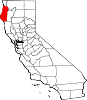
CDPs Alderpoint | Bayview | Benbow | Big Lagoon | Cutten | Fieldbrook | Fields Landing | Garberville | Humboldt Hill | Hydesville | Indianola | Loleta | McKinleyville | Manila | Miranda | Myers Flat | Myrtletown | Orick | Phillipsville | Pine Hills | Redcrest | Redway | Samoa | Scotia | Shelter Cove | Weott | Westhaven-Moonstone | Willow Creek
Unincorporated
communitiesAlton | Bayside | Blocksburg | Bracut | Brainard | Briceland | Bridgeville | Bucksport | Calville | Carlotta | Crannell | Dinsmore | Elk River | Englewood | Fairhaven | Fernbridge | Fort Seward | Freshwater | Freshwater Corners | Fruitland | Glendale | Holmes | Honeydew | Hoopa | Johnsons | King Salmon | Kneeland | Korbel | Maple Creek | Metropolitan | Moonstone | Orleans | Patricks Point | Pepperwood | Petrolia | Pine Hill | Port Kenyon | Ridgewoods Heights | Riverside Park | Rohnerville | Rosewood | Shively | Stafford | Sunny Brae | Weitchpec | Westhaven | Whitethorn
Indian
reservationsBig Lagoon Rancheria | Blue Lake Rancheria | Hoopa Valley Indian Reservation | Yurok Indian Reservation
Ghost towns Acorn | Albeeville | Apyu | Aranimokw | Arekw | Atsepar | Bald Hills | Blaine | Brock Creek | Bryan | Bryant | Buck's Port | Camp 4 Flat | Camp 19 | Camp Grant | Centerville | Chinits | Cleveland | Daby's Ferry | Dark Canyon | Dinty | Dyer Place | Eddyville | Elinor | Elk Grove | Elk Prairie | Erner | Ertlerger | Eshpeu | Frank | Gans | Hadley | Hartsook | Honsading | Humboldt City | Iaqua | Kokaman | Kworatem | Lippitt | Lockharts | Lone Star | Loolego | Luffenholtz | Mandala | Martins Ferry | McDuff | Meridian | Mountain View | Mower | Myrtle Grove | Northern Redwood Camp | Oketo | Opegoi | Ore'q | Panamenik | Pasara | Pekwan | Pekwuteu | Robinson's Ferry | Scribner | Shanamkarak | Showers Pass | Shregegon | Shumig | Skelly | Smith | Tanoak | Three Cabins | Tsofkara | Tsurau | West Humboldt | Wilder
Categories:- Incorporated cities and towns in California
- Cities in Humboldt County, California


Wikimedia Foundation. 2010.