- Salmon River (Idaho)
-
Salmon River  Salmon River in Sawtooth NRA
Nickname: River of No Return Country United States State Idaho Tributaries - left Yankee Fork, Panther Creek, (MiddleFork Salmon River) - right East Fork Salmon River, Pahsimeroi River, Lemhi River, North Fork Salmon River Cities Salmon, Challis Source Sawtooth Range - elevation 9,220 ft (2,810 m) [1] - coordinates 43°47′48″N 114°46′36″W / 43.79667°N 114.77667°W [2] Mouth Snake River - elevation 903 ft (275 m) [1] - coordinates 45°51′23″N 116°47′37″W / 45.85639°N 116.79361°W [2] Length 425 mi (684 km) [3] Basin 14,000 sq mi (36,260 km2) Discharge for White Bird - average 11,060 cu ft/s (313 m3/s) [4] - max 129,000 cu ft/s (3,653 m3/s) - min 1,000 cu ft/s (28 m3/s)  Map of the Salmon River, showing its tributary Middle Fork Salmon River, and its connection to the Columbia River via the Snake River
 Map of the Salmon River watershed with Little Salmon, South Fork, Middle Fork and Lemhi Rivers
The Salmon River is located in Idaho in the northwestern United States. The Salmon is also known as The River of No Return. It flows for 425 miles (684 km) through central Idaho, draining 14,000 square miles (36,260 km2) and dropping more than 7,000 feet (2,134 m) between its headwaters, near Galena Summit above the Sawtooth Valley in the Sawtooth National Recreation Area, and its confluence with the Snake River. Its discharge is 11,060 cubic feet (313 m3) per second.[5] It is the largest tributary of the Snake River, ahead of the Clearwater River. Cities located along the Salmon River include Stanley, Clayton, Challis, Salmon, Riggins, and White Bird. Redfish Lake and Little Redfish Lake near Stanley flow into the river via Redfish Lake Creek.
Contents
Course
The headwaters of the Salmon River are in the mountains of central and eastern Idaho (Lemhi Range, Sawtooth, Salmon River Mountains, Clearwater and Bitterroot Range). The main fork of the Salmon is joined by the Yankee Fork, East Fork, Pahsimeroi, Lemhi, North Fork, Middle Fork, South Fork, and Little Salmon Rivers before emptying into the Snake River on the Oregon-Idaho border, north of Hells Canyon, 15 miles (24 km) south of Washington and 40 miles (64 km) south of Lewiston. The Middle Fork of the Salmon River is one of the premier recreational rafting and kayaking rivers in the world.
Ten miles (16 km) downstream (west) of its confluence with the Middle Fork, the Salmon River becomes the dividing line for the two time zones in Idaho: Mountain time to the south, Pacific time to the north, bisecting the state at approximately 45.5 degrees north latitude.
History
Anthropology
The Salmon River area has been home to people for at least the last 8,000 years.[6] Much of the area was inhabited by several tribes, including the Nez Perce. The river was a rich source of food for the indigenous people of the area, who relied on the abundant salmon species and other wildlife.
Corps of Discovery
In August 1805, just after crossing the continental divide, Lewis and Clark ventured down the Salmon River, but found it to be too rough to be navigable. Clark wrote:[7]
 Columbia River Basin
"...I shall in justice to Capt. Lewis who was the first white man ever on this fork of the Columbia Call this Louis's river. ...The Westerly fork of the Columbia River [the present Salmon River] is double the size of the Easterley fork [the present Lemhi River] & below those forks the river is ...100 yards [100 m] wide, it is very rapid & Sholey water Clear but little timber."
The honor didn't last long; by 1810 maps of the area were already referring to "Louis' River" as the Salmon. Clark had thought that the Salmon River was the Snake River, thus he called it the "Westerly fork of the Columbia". The Snake River retained the variant name "Lewis River" or "Lewis Fork" longer than did the Salmon.
Gold
In the 1860s, placer deposits of gold were found along the river, and a gold rush began. Miners came to the area, causing clashes with the Nez Perce on their ancestral tribal lands. Many historic and present day mines (including dredging operations) can be seen while traveling along the river.
Recreation

Several national forests and Sawtooth National Recreation Area provide for numerous recreation opportunities within the river's watershed. Two segments (the Middle Fork and a section of the main Salmon River) are protected as National Wild and Scenic Rivers. Today, the Salmon is a popular destination for whitewater kayaking, canoeing or rafting. The Middle Fork, more than 100 miles (160 km) long, travels through the Frank Church-River of No Return Wilderness Area. The South Fork flows through Payette National Forest. The main fork raft trip run is slightly less than 100 miles (160 km) and ends south of White Bird, although the stretch of river is 125 miles (200 km). Single and multiple day trips on the river are available and offer beautiful views of wildlife and scenery. The river canyon allows for magnificent views of the complex geology of the region. The Middle Fork of the Salmon River is known as one of the best catch and release fly fisheries in the nation.
Campgrounds along the river are available and offer stunning views of the river. Hiking and mountain biking are popular in the area.
Wildlife
Salmon River Canyon 1945 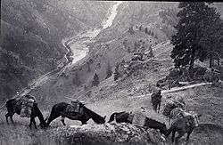
U. S. Coast & Geodetic Survey
of Oscar Risvold Salmon River, north of Riggins
 Breached Sunbeam Dam on the Salmon
 Yankee Fork of the Salmon
 Yankee Fork Gold Dredge
The Salmon River historically produced 45% percent of all the steelhead (salmon) and 45 percent of all the spring and summer chinook salmon in the entire Columbia River Basin. The Salmon River basin contains most (up to 70 percent) of the remaining salmon and steelhead habitat in the Columbia River Basin. Despite the abundant salmon habitat in the river, these fish have been declining, in large part because of the effects of four federal reservoirs and dams on the lower Snake and Columbia rivers.
- Fish - Several fish hatcheries are located on rivers which join the Salmon.
- Brook Trout-invasive
- Bull trout
- Cutthroat trout
- Rainbow trout
- Salmon- chinook, sockeye
- Smallmouth bass
- Steelhead
- Sculpin
- Sturgeon
- Mammals
References
- ^ a b Google Earth elevation for GNIS coordinates.
- ^ a b U.S. Geological Survey Geographic Names Information System: Salmon River, USGS, GNIS
- ^ Salmon River, The Columbia Gazetteer of North America
- ^ Water Resources Data, Idaho, 2005, USGS
- ^ http://pubs.usgs.gov/wdr/2005/wdr-id-05-1/ Water Resources Data, Idaho, 2005
- ^ "Salmon River - Idaho". National Wild & Scenics Rivers. http://www.rivers.gov/wsr-salmon-main.html. Retrieved 2009-01-10.
- ^ "18 - Forks of Louis's River". Salmon-Challis National Forest - Lewis & Clark Interactive Tour. U. S. Forest Service. http://www.fs.fed.us/r4/sc/recreation/lewis-clark/maptext.shtml. Retrieved 2009-01-10.
External links
- Salmon River - Salmon River, Info Hub
- Visit Idaho.org - Idaho Rivers
- Salmon River (National Wild and Scenic Rivers site)
- Middle Fork of the Salmon (National Wild and Scenic Rivers site)
Categories:- Lewis and Clark Expedition
- Rivers of Idaho
- Canyons and gorges of Idaho
- Landforms of Idaho County, Idaho
- Landforms of Lemhi County, Idaho
- Landforms of Custer County, Idaho
- Landforms of Blaine County, Idaho
- Tributaries of the Snake River
- Fish - Several fish hatcheries are located on rivers which join the Salmon.


Wikimedia Foundation. 2010.