- Idaho Falls, Idaho
-
Idaho Falls — City — Idaho Falls Greenbelt

Seal
Coordinates: 43°29′30″N 112°1′57″W / 43.49167°N 112.0325°WCoordinates: 43°29′30″N 112°1′57″W / 43.49167°N 112.0325°W Country United States State Idaho County Bonneville Founded 1864 Incorporated 1891 Government – Mayor Jared Fuhriman Area – City 17.4 sq mi (45.0 km2) – Land 17.1 sq mi (44.2 km2) – Water 0.3 sq mi (0.8 km2) Elevation 4,705 ft (1,434 m) Population (as of 2010[update]) – City 56,813 – Density 2,972.2/sq mi (1,292.6/km2) – Metro 130,374 Time zone Mountain (UTC-7) – Summer (DST) Mountain (UTC-6) Area code(s) 208 FIPS code 16-39700 GNIS feature ID 0396684 Website www.idahofallsidaho.gov Idaho Falls is a city in and the county seat of Bonneville County, Idaho, United States, and the largest city in Eastern Idaho[1]. As of the 2010 census, the population of Idaho Falls was 56,813, with a metro population of 130,374.[2]
Idaho Falls is the principal city of the Idaho Falls, Idaho Metropolitan Statistical Area and the Idaho Falls-Blackfoot, Idaho Combined Statistical Area. It is the state's largest city outside the Boise metropolitan area and the third-largest metro area behind Boise City-Nampa and Coeur d'Alene, which is connected to the larger Spokane, Washington.
The city serves as a hub to all of eastern Idaho and much of western Wyoming. Due to its relative economic vitality, high quality of life, and proximity to world-class outdoor recreation, it is often featured in various publications' lists of "best places to live." The area is served by the Idaho Falls Regional Airport and is home to the Idaho Falls Chukars minor league baseball team.
Contents
History
 Taylor's Bridge, c.1870
Montana Trail origins
What became Idaho Falls was the site of Taylor’s Crossing on the Montana Trail, a timber frame bridge built across the Snake River. The 1865 bridge was built by Matt Taylor, a Montana Trail freighter, who built a toll bridge across a narrow black basaltic gorge of the river that succeeded a ferry seven miles upstream by a few years.[3] Taylor’s bridge served the new tide of westward migration and travel in the region that followed the military suppression of Shoshone resistance at the Bear River Massacre near Preston, Idaho in 1863. The bridge improved travel for settlers moving north and west and for miners, freighters, and others seeking riches in the gold fields of Idaho and Montana, especially, the boom towns of Bannack and Virginia City in western Montana.
Eagle Rock
Mail service postmarks indicate by 1866 the emerging town had become known as Eagle Rock. The name was derived from an isolated basalt island in the Snake River, seven miles upstream at 43°36.112′N 112°3.528′W / 43.601867°N 112.0588°W in the Snake River that was the nesting site for approximately twenty eagles. Previous to Taylor's bridge, in 1864, Harry Rickets built and operated a ferry at this location[3][4] and so this area of crossing at the Snake River was already known as Eagle Rock to those that did business or that traveled on the Montana Trail. A private bank (the fourth in Idaho), a small hotel, a livery stable, and an eating house also sprang up at the bridge in 1865 along with the post office and stage station.
 Utah & Northern Bridge, c.1880, looking north, or upriver, with railroad shops in background.
There had been a few cattle and sheep ranchers in the area for years. In 1874 water rights were established on nearby Willow Creek and the first grain harvested but settlement was sparse consisting of only a couple of families and small irrigation ditches. The first child of European descent born at Eagle Rock was delivered in 1874.
The winds of change blew in the form of the Utah and Northern Railway that came north from Utah through Eagle Rock to cross the Snake River at the same narrow gorge as the wooden bridge. The U&NR was building its road to the large new copper mines at Butte, Montana with the backing of robber baron Jay Gould as Union Pacific Railroad had purchased the U&NR only a few years prior.[5] Grading crews reached Eagle Rock in late 1878 and by early 1879 a wild camp-town with dozens of tents and shanties moved to Eagle Rock with the usual collection of saloons, dancehalls, and gambling holes. The railroad company had 16 locomotives and 300 train cars working between Logan, Utah and the once quiet stage stop. A new iron railroad bridge was fabricated in Athens, Pennsylvania at a cost of $30,000 and shipped, by rail, to the site and erected in April and May 1879.[6] The bridge was 800 feet (240 m) long and in two spans with an island in the center. The camp-town moved on but Eagle Rock, the little town at the wooden bridge, now had regular train service and was the site for several of the railroad’s buildings, shops, and facilities expanding and completely transforming the town.
Settlers began homesteading the Upper Snake River Valley as soon as the railroad came through. The first of the new settlers carved out homesteads to the north at Egin (near present day Parker) and at Pooles Island (near present day Menan).[7] Large scale settlement ensued and in a decade there appeared roads, bridges, dams and irrigation canals that brought most of the Upper Snake River Valley under cultivation. In 1887, following the construction of the Oregon Short Line, most of the railroad facilities were removed to Pocatello where the new line branched off the U&NR but Eagle Rock was fast becoming the commercial center of an agricultural empire.
 Idaho Falls on the Snake River with the Idaho Falls Idaho Temple in the background
Idaho Falls
In 1891 the town voted to change its name to Idaho Falls, in reference to the rapids that existed below the bridge (the rapids were enhanced to falls some years later). In 1895 the largest irrigation canal in the world, the Great Feeder, began diverting water from the Snake River and aided in converting tens of thousands of acres of desert into green farmland in the vicinity of Idaho Falls. The area grew sugar beets, potatoes, peas, grains, and alfalfa and became one of the most productive regions of the United States.
In 1949, the Atomic Energy Commission opened the National Reactor Testing Station in the desert west of the city, and on Dec. 20, 1951, a nuclear reactor produced useful electricity for the first time in history. There have been more than 50 unique nuclear reactors built at the facility for testing. All but three are shut down now.
On January 3, 1961, the site was the scene of the only fatal nuclear reactor incident in U.S. history. A main nuclear control rod was removed from the SL-1 reactor, causing the reactor to become prompt-critical resulting in a power excursion. Three people died in the reactor room, and when rescue workers arrived to recover the bodies, they emitted 500 R/hr. The force of the explosion was so severe that one body had to be removed from the ceiling, where it was pinned by a control rod ejected from the reactor. The three men were buried in lead coffins and that entire section of the site was buried.[8]
The Idaho National Laboratory (INL), as it is now known, remains a major economic engine for the city of Idaho Falls, employing more than 8,000 people and functioning as an internationally renowned research center. INL operates and manages the world famous Advanced Test Reactor (ATR).
Economy
 Red Lion Hotel along the Greenbelt
Idaho Falls serves as a regional hub for health care, travel and business in eastern Idaho.
The community's economy was mostly agriculturally focused until the opening of the National Reactor Testing Station in the desert west of Idaho Falls in 1949. The city subsequently became largely dependent on high-income jobs from the Idaho National Laboratory (INL), known locally simply as "The Site." The laboratory made several cutbacks in 1993. Since then the town has added call centers, a growing retail, entertainment, and restaurant sector, and a regional medical center.
Idaho Falls was named by Business Week as one of the 2010 List of "Best Places to Raise Kids". In addition, Forbes.com selected Idaho Falls as one of the "2010 Best Small Places for Business & Careers". Also Money.CNN.com included Idaho Falls as one of their "Top 100 Cities in 2010".
Idaho Falls has become a regional business hub. It hosts the headquarters of the United Potato Growers of Idaho and District 7 of the Idaho Department of Health and Welfare. It is also the home to several small to medium sized national corporations such as North Wind, Inc., Melaleuca, Inc and Press-A-Print.
The median home price in Idaho Falls was $224,800 in January 2007.[9]
Idaho Falls, Idaho / U.S. avg:[9]
- Area population 122,995 / 647,500
- Median home price $224,800 / $235,000
- Cost-of-living index 99.8 / 100.0
- Unemployment rate 2.7% / 4.6%
- Job growth—5 years 18.84% / 4.90%
- Job growth—1 year 2.74% / 1.66%
- Median household income $47,719 / $46,326
Culture
Idaho Falls has established itself as a regional cultural destination. The Willard Art Center, The Colonial Theatre and Civic Auditorium[10] are home to year-round, diverse musical concerts, plays, and events. The greenbelt along the Snake River hosts many community events, such as the Melaleuca Freedom Celebration (on the Fourth of July),[11] the Roaring Youth Jam, and the Farmers' Market, among others.
The Museum of Idaho[12] is a regional attraction which showcases local artifacts and history. It also brings in major traveling exhibits such as dinosaur bones, Gutenberg Bibles, Titanic remnants, and "Bodies: the Exhibition." Idaho Falls is the first city of its size to house the popular attraction.
Downtown Idaho Falls once struggled as the city expanded eastward, but it has been revitalized in recent years due to the efforts of local business owners, the City of Idaho Falls, and other organizations such as the Downtown Development Corporation[13] and the Idaho Falls Chamber of Commerce. Today, it is home to a handful of locally owned shops, stores, restaurants, galleries, theaters, and future revitalization efforts.
The city attracts many tourists visiting nearby Yellowstone and Grand Teton National Parks, Jackson Hole, and the world-class fishing on the Snake River. Due to its proximity to so many outdoor destinations, Idaho Falls was recently named to National Geographic's list of "100 Best Adventure Towns".[14]
Greenbelt
 Snake River seen through trees along the greenbelt
Idaho Falls has an extensive greenbelt, or riverbelt, along miles of the Snake River that flows through the center of the city. It is maintained by the City of Idaho Falls, and often receives donations and grants which allow for occasional expansion.
The Idaho Falls Redevelopment Agency (IFRA) is pursuing plans to expand the greenbelt near the interchange of Memorial Drive and Broadway, and going north to "E" Street. This will extend the activity area of the greenbelt, and create a closer proximity for the public to access local Historic Downtown merchants.
Neighborhoods
 "A" Street, downtown
Notable Idaho Falls neighborhoods include:
- Historic Downtown - Downtown lies along the east side of the river between Memorial Drive (on the greenbelt) and Yellowstone Avenue. More eateries, wineries, shops, and art centers are popping up downtown each year. Many community events occur in and around downtown, particularly concerts, art shows, the renowned Fourth of July fireworks celebration, and a farmers' market on Saturday mornings.
- The Numbered Streets - The numbered streets area was the first planned neighborhood in Idaho Falls. The tree-lined streets run west and east between South Boulevard and Holmes Avenue. Traffic on the odd-numbered streets travels east, and west on the even-numbered streets. This area has recently become a desirable location because of the re-development of nearby Historic Downtown. Kate Curley Park is located in the neighborhood, as is the Wesley W. Deist Aquatic Center, and the Eleventh Street Historic District.
- West Side - Across the Snake River to the west, this area has more of a small-town feel, as it lacks the congestion and activity of the east side. The north portion of the west side was established in the 1960s with homes, and saw more overall growth up until the '80s. Today, the west side is expected to boom in population and commercial activity due to major developments such as Taylor Crossing and Snake River Landing, as well as the Areva uranium enrichment facility planned west of the city. The west side also houses Idaho Falls Regional Airport as well as the entirety of I-15's brief jaunt through the city.
Geography and climate
The elevation of Idaho Falls is 4,700 feet (1,400 m).
According to the United States Census Bureau, the city has a total area of 17.4 square miles (45 km2), of which, 17.1 square miles (44 km2) of it is land and 0.3 square miles (0.78 km2) of it (1.67%) is water.
Idaho Falls experiences a continental climate (Köppen Dfb). with cold winters and warm, dry summers.
Climate data for Idaho Falls, ID Month Jan Feb Mar Apr May Jun Jul Aug Sep Oct Nov Dec Year Record high °F (°C) 57
(14)63
(17)75
(24)85
(29)95
(35)100
(38)104
(40)100
(38)95
(35)87
(31)73
(23)60
(16)104
(40)Average high °F (°C) 29.7
(−1.3)36.6
(2.6)47.6
(8.7)58.7
(14.8)67.9
(19.9)77.8
(25.4)86.0
(30.0)85.8
(29.9)75.1
(23.9)61.4
(16.3)43.0
(6.1)31.3
(−0.4)58.41
(14.67)Daily mean °F (°C) 21.1
(−6.1)26.7
(−2.9)36.2
(2.3)45.0
(7.2)53.3
(11.8)61.9
(16.6)68.7
(20.4)67.9
(19.9)58.2
(14.6)46.8
(8.2)33.1
(0.6)22.4
(−5.3)45.11
(7.28)Average low °F (°C) 12.5
(−10.8)16.8
(−8.4)24.8
(−4.0)31.3
(−0.4)38.7
(3.7)46.0
(7.8)51.4
(10.8)49.9
(9.9)41.3
(5.2)32.2
(0.1)23.2
(−4.9)13.4
(−10.3)31.79
(−0.12)Record low °F (°C) −29
(−34)−34
(−37)−15
(−26)9
(−13)20
(−7)28
(−2)34
(1)31
(−1)18
(−8)7
(−14)−12
(−24)−29
(−34)−34
(−37)Precipitation inches (mm) 1.25
(31.8)1.01
(25.7)1.33
(33.8)1.27
(32.3)2.01
(51.1)1.18
(30)0.74
(18.8)0.93
(23.6)0.94
(23.9)1.12
(28.4)1.17
(29.7)1.26
(32)14.21
(360.9)Source no. 1: NOAA (normals, 1971-2000)[15] Source no. 2: The Weather Channel (Records)[16] Demographics
Historical populations Census Pop. %± 1880 300 — 1890 938 212.7% 1900 1,262 34.5% 1910 4,827 282.5% 1920 8,064 67.1% 1930 9,429 16.9% 1940 15,024 59.3% 1950 19,218 27.9% 1960 33,161 72.6% 1970 35,776 7.9% 1980 39,739 11.1% 1990 43,929 10.5% 2000 50,730 15.5% 2010 56,813 12.0% source:[17][18] The 2000 census[19] reported there were 50,730 people, 18,793 households, and 13,173 families residing in the city, though MSN real estate reports an area population of 110,220. The population density was 2,972.2 people per square mile (1,147.4/km²). There were 19,771 housing units at an average density of 1,158.4 per square mile (447.2/km²). The racial makeup of the city was 92.09% White, 0.62% African American, 0.76% Native American, 1.05% Asian, 0.06% Pacific Islander, 3.81% from other races, and 1.61% from two or more races. Hispanic or Latino of any race were 7.18% of the population.
There were 18,793 households out of which 37.5% had children under the age of 18 living with them, 56.5% were married couples living together, 10.2% had a female householder with no husband present, and 29.9% were non-families. 25.3% of all households were made up of individuals and 9.1% had someone living alone who was 65 years of age or older. The average household size was 2.65 and the average family size was 3.21.
In the city the population was spread out with 30.3% under the age of 18, 10.1% from 18 to 24, 27.6% from 25 to 44, 20.9% from 45 to 64, and 11.1% who were 65 years of age or older. The median age was 32 years. For every 100 females there were 97.9 males. For every 100 females age 18 and over, there were 94.8 males.
The median income for a household in the city was $40,512, and the median income for a family was $47,431. Males had a median income of $39,082 versus $23,001 for females. The per capita income for the city was $18,857. About 7.8% of families and 10.9% of the population were below the poverty line, including 12.7% of those under age 18 and 6.3% of those age 65 or over.
The top five ethnic groups in Idaho Falls are:[20]
- English - 22%
- German - 16%
- Irish - 7%
- Mexican - 5%
- Swedish - 4%
In a 2008 estimate, it was found that Idaho Falls had a violent crime rate of 0.9 times the national average and a property crime rate of 0.97 times the national average.
Higher education
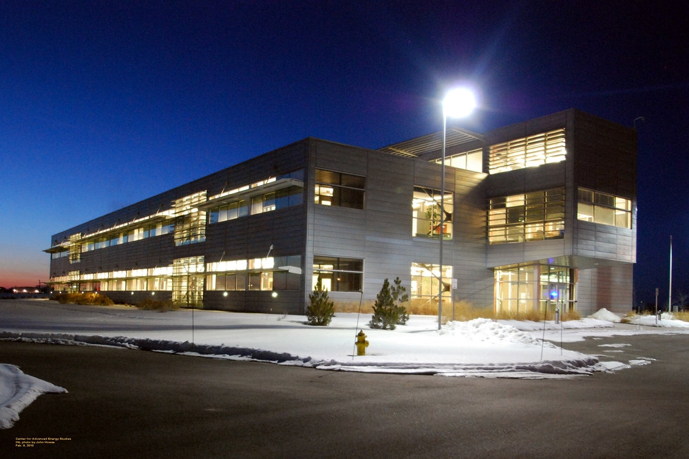
 Center for Advanced Energy Studies
Despite originally being selected as the site for both the University of Idaho and Ricks College (now BYU-Idaho), according to a USA Today article, Idaho Falls is now the largest city in the United States without a traditional college.
Idaho Falls is home to a few higher ed options, including Eastern Idaho Technical College, established in 1969 as a vocational-technical college. Stevens-Henager College and University of Phoenix have also opened local resource centers in order to aid students in online degree programs.
A unique satellite campus called University Place features dual enrollment for students in both Pocatello-based Idaho State University and Moscow-based University of Idaho. Students generally earn core classes at University Place and then transfer to ISU's or UI's main campus to finish their degrees. However, a few dozen degree programs, both undergraduate and graduate, are fully offered at University Place. The campus also boasts high-tech facilities such as the Center for Advanced Energy Studies (CAES). CAES is run by a partnership of Idaho's three research universities (UI, ISU, Boise State) and the Idaho National Laboratory.
Despite the current lack of a traditional college, a relatively high percentage of residents hold advanced degrees and perform significant research, largely thanks to the presence of the INL.
K-12 Education
Idaho Falls is divided into two public school districts: Idaho Falls School District 91 and Bonneville Joint School District 93. District 91, the primary school district, covers the western half of Bonneville County and most of urban Idaho Falls. District 93 covers most of the eastern half of Bonneville County, including Ammon and Iona, and buses high school students from distant areas including Swan Valley and Irwin.
The two school districts have a total of four major public high schools and two alternative high schools. The District 91 high schools are Idaho Falls High School, Skyline High School, and Emerson High School, the alternative high school. The District 93 high schools are Hillcrest High School, Bonneville High School, and Lincoln High School, the alternative high school.
Each fall, the varsity football teams from Idaho Falls and Skyline high schools compete in the Emotion Bowl at Idaho Falls' Ravsten Stadium, which is shared by the two schools[21] The winning team and its fans traditionally paint the goalposts of the stadium in their school colors (orange for I.F. and blue for Skyline) after each Emotion Bowl.[22]
The junior high schools in District 91 are Clair E. Gale Junior High School, Taylorview Junior High School, and Eagle Rock Junior High School. In District 93, the middle schools are Sandcreek Middle School, Rocky Mountain Middle School, and Telford Academy Alternative Middle School.
The Idaho Falls area also offers four public charter school options: Taylor's Crossing Public Charter School, White Pine Charter School, Monticello Montessori Public Charter School, and Odessey High Charter School. There are currently 25 public elementary schools, including A. H. Bush, District 91's Magnet School for Math and Science.[23] Additionally, numerous private schools provide educational opportunities at varying grade levels.
Notable people
- Chandler Brossard - beat novelist, author of Who Walk in Darkness
- Billy Butler - first baseman, Kansas City Royals. In 2009, became one of only seven men under 23 ever to hit 50 doubles in one MLB season.
- Gregory C. Carr - telecommunications pioneer and philanthropist. Currently notable as head of Gorongosa National Park restoration in Mozambique.
- Barzilla W. Clark, Governor of Idaho 1937-1939. Served as Mayor of Idaho Falls, 1913–15, 1926-36.
- Mike Crapo - U.S. Senator (R-ID), serving since 1998
- Dame Darcy - avant-garde cartoonist and author of Meatcake
- Jared Gold - fashion designer, featured on America's Next Top Model
- Gregg Hale - Guitar player for Multi-platinum selling British band Spiritualized.
- Mary Kornman - Actress, best known for her leading role in the popular Our Gang comedies.
- Yo Murphy - former CFL/NFL wide receiver. Played at Idaho Falls High School.
- Wilson Rawls - novelist, author of popular children's books Where the Red Fern Grows and Summer of the Monkeys
- Brandi Sherwood - model and actor who became Miss Teen USA, Miss Idaho USA, and Miss USA
- John L. Smith - renowned former NCAA head football coach at Michigan State, Louisville, Utah State, and Idaho
- Daxter Lussier - professional skateboarder best known for his feature parts in "The Storm" and "Black Cat" skate movies. First skateboarder to grind 15+ stairs.
- Oscar Ramiro Ortega-Hernandez - allegedly a would-be presidential assassin
Sister city
Idaho Falls has a sister city, as designated by Sister Cities International:
References
- ^ "Find a County". National Association of Counties. http://www.naco.org/Counties/Pages/FindACounty.aspx. Retrieved 2011-06-07.
- ^ Table 4: Annual Estimates of the Population for Incorporated Places in Idaho, Listed Alphabetically: April 1, 2000 to July 1, 2006 (SUB-EST2006-04-16) Accessed 16 July 2007
- ^ a b MD Beal, A History of Southeastern Idaho, 1942, p. 218.
- ^ http://www.idahohistory.net/Reference%20Series/0071.pdf |EAGLE ROCK FERRY
- ^ Colorado Rail Annual No. 15, 1981, pp 31-39.
- ^ Deseret News, 1879-07-17 p. article "Utah and Northern" describes the scene at Eagle Rock and describes the new railroad bridge
- ^ The Snake River Fork County, Louis J. Clements and Harold S. Forbush, 1972 pp 25-27.
- ^ http://www.cddc.vt.edu/host/atomic/accident/critical.html
- ^ a b "10 low-cost locales where jobs are plentiful". http://web.archive.org/web/20080115051955re_/realestate.msn.com/Buying/Article2.aspx?cp-documentid=3863709. Retrieved 2009-05-04.
- ^ Civic Auditorium
- ^ Melaleuca Freedom Celebration
- ^ Museum of Idaho
- ^ Downtown Development Corporation
- ^ Adventure Town: Idaho Falls, Idaho
- ^ "Climatography of the United States NO.81". National Oceanic and Atmospheric Administration. http://cdo.ncdc.noaa.gov/climatenormals/clim81/IDnorm.pdf. Retrieved January 16, 2011.
- ^ "Monthly Averages for Idaho Falls, ID". The Weather Channel. http://www.weather.com/outlook/travel/businesstraveler/wxclimatology/monthly/USID0120. Retrieved January 16, 2011.
- ^ Moffatt, Riley. Population History of Western U.S. Cities & Towns, 1850-1990. Lanham: Scarecrow, 1996, 94.
- ^ "Subcounty population estimates: Idaho 2000-2007" (CSV). United States Census Bureau, Population Division. 2009-03-18. http://www.census.gov/popest/cities/files/SUB-EST2007-16.csv. Retrieved 2009-05-09.
- ^ "American FactFinder". United States Census Bureau. http://factfinder.census.gov. Retrieved 2008-01-31.
- ^ Idaho Falls - Idaho Falls - Ancestry & family history - ePodunk
- ^ "The Emotion Bowl". IdahoSports.com. http://www.idahosports.com/east/articles/RivalGames.asp. Retrieved 2009-05-23.[dead link]
- ^ "2008 Great American Rivalry Preview: SKYLINE VS. IDAHO FALLS". iHigh.com. http://www.ihigh.com/school13673/article_1596.html. Retrieved 2009-05-23.
- ^ "A. H. Bush, District 91's Magnet School for Math and Science". http://www3.d91.k12.id.us/documents/bushbrochure.pdf.
External links
Municipalities and communities of Bonneville County, Idaho County seat: Idaho FallsCities 
CDP Lincoln
Unincorporated
communitiesBeachs Corner | Osgood
Footnotes ‡This populated place also has portions in an adjacent county or counties
 State of Idaho
Topics - Index
- Geography
- Government
- Delegations
- Governors
- History
- Symbols
- Images
- People
- Visitor Attractions
Society Regions Larger
cities- Boise
- Coeur d'Alene
- Idaho Falls
- Lewiston
- Meridian
- Nampa
- Pocatello
- Twin Falls
Smaller
citiesCounties - Ada
- Adams
- Bannock
- Bear Lake
- Benewah
- Bingham
- Blaine
- Boise
- Bonner
- Bonneville
- Boundary
- Butte
- Camas
- Canyon
- Caribou
- Cassia
- Clark
- Clearwater
- Custer
- Elmore
- Franklin
- Fremont
- Gem
- Gooding
- Idaho
- Jefferson
- Jerome
- Kootenai
- Latah
- Lemhi
- Lewis
- Lincoln
- Madison
- Minidoka
- Nez Perce
- Oneida
- Owyhee
- Payette
- Power
- Shoshone
- Teton
- Twin Falls
- Valley
- Washington
Categories:- Idaho Falls, Idaho
- Cities in Idaho
- Populated places in Bonneville County, Idaho
- County seats in Idaho
- Populated places established in 1864
- Idaho Falls metropolitan area


Wikimedia Foundation. 2010.