- Chatham, Massachusetts
-
Chatham, Massachusetts — Town — Central Chatham, April 2010

SealLocation in Barnstable County in Massachusetts
Coordinates: 41°40′55″N 69°57′37″W / 41.68194°N 69.96028°WCoordinates: 41°40′55″N 69°57′37″W / 41.68194°N 69.96028°W Country United States State Massachusetts County Barnstable Settled 1665 Incorporated 1712 Government – Type Open town meeting Area – Total 24.4 sq mi (63.2 km2) – Land 16.2 sq mi (42.0 km2) – Water 8.2 sq mi (21.2 km2) Elevation 46 ft (14 m) Population (2000) – Total 6,625 – Density 408.4/sq mi (157.7/km2) Time zone Eastern (UTC-5) – Summer (DST) Eastern (UTC-4) ZIP code 02633 Area code(s) 508 / 774 FIPS code 25-12995 GNIS feature ID 0618250 Website www.chatham-ma.gov Chatham is a town in Barnstable County, Massachusetts, United States, Barnstable County being coextensive with Cape Cod. The population was 6,625 at the 2000 census. Chatham is home to the Monomoy National Wildlife Refuge, located on Monomoy, and to Monomoy Theatre.
For geographic and demographic information on specific parts of the town of Chatham, please see the articles on Chatham (CDP) and West Chatham.
Contents
History
Native American tribes who lived in the area before European colonization include the Nauset, specifically the Manomoy or Monomoy people. "Manamoyik" was a Nauset village located near present-day Chatham. Explorer Samuel de Champlain landed here in 1606, contacting (and skirmishing with) the Nauset. English settlers first settled in Chatham in 1665, and the town was incorporated in 1712, naming it after Chatham, Kent, England. Located at the "elbow" of Cape Cod, the community became a shipping, fishing, and whaling center. Chatham's early prosperity would leave it with a considerable number of 18th century buildings, whose charm helped it develop into a popular summer resort.
Chatham is home to the Chatham Lighthouse, which was established by President Thomas Jefferson in 1808 to protect the ships circling the Cape. Originally consisting of two lights, the pair were moved back and rebuilt in 1877. The second was moved to Eastham to become the Nauset Light in 1923, after both were upgraded to rotating lights. Today, the keeper's house is home to a Coast Guard station which tends the light.
Although urban sprawl has started to invade the country and even parts of Cape Cod, the town of Chatham still boasts a quaint and walkable Main Street. Main Street is home to numerous family-owned and -operated shops, restaurants, and businesses. The main shopping area features pedestrian-friendly crosswalks, on-street parallel parking, and some parking lots that are off Main Street. During the summer, concerts are held in a gazebo on Main Street, and not far from the shops is where the Chatham Anglers baseball team plays.
Historical sites and museums
- Atwood House (1752)
- Chatham Railroad Museum (1887)
- Old Grist Mill (1797)
- Caleb Nickerson House (1772)
- Josiah Mayo House (c. 1820)
Geography
 Chatham Lighthouse during Hurricane Earl on September 3rd, 2010
According to the United States Census Bureau, the town has a total area of 24.4 square miles (63.2 km²), of which, 16.2 square miles (42.0 km²) of it is land and 8.2 square miles (21.2 km²) of it (33.55%) is water. The town's villages include Chatham proper, Chatham Port, North Chatham, South Chatham, and West Chatham. Chatham is bordered by Harwich to the west, Pleasant Bay and Harwich to the north, the Atlantic Ocean to the east, and Nantucket Sound to the south. The town is 56 kilometers (35 mi) south of Provincetown and east of the Sagamore Bridge, 32 kilometers (20 mi) east of Barnstable, and 137 kilometers (85 mi) southeast of Boston.
The mainland portion of the town is typical of Cape Cod, with several ponds, brooks, rivers, harbors, and inlets around the town. The town includes two narrow strips of land, the northern of which is the southern part of the Cape Cod National Seashore, which serve as a barrier between the Atlantic and the mainland. There are several islands, including Strong Island, Tern Island (which is a sanctuary), Morris Island, Stage Island, and Monomoy Island (a 7-1/4 mile long island south of the corner of the town which is home to the Monomoy National Wildlife Refuge).
Transportation
All five roads that exit Chatham cross into Harwich. The two state routes that pass through the town are Route 28 and the southern end of Route 137. Route 28 circles through the center of town before exiting and heading toward Route 6A, joining that route until the roads end at the Orleans Rotary.
Rail no longer extends to the town; the route is now a portion of one of the several bicycle paths that pass through the town.
The town is the home to the Chatham Municipal Airport, which provides local service to other small airports on the Cape and Islands. The nearest national and international air service can be reached at Logan International Airport in Boston.
Demographics
Historical populations Year Pop. ±% 1850 2,439 — 1860 2,710 +11.1% 1870 2,411 −11.0% 1880 2,250 −6.7% 1890 1,954 −13.2% 1900 1,749 −10.5% 1910 1,564 −10.6% 1920 1,737 +11.1% 1930 1,931 +11.2% 1940 2,136 +10.6% 1950 2,457 +15.0% 1960 3,273 +33.2% 1970 4,554 +39.1% 1980 6,071 +33.3% 1990 6,579 +8.4% 2000 6,625 +0.7% 2001* 6,726 +1.5% 2002* 6,776 +0.7% 2003* 6,826 +0.7% 2004* 6,809 −0.2% 2005* 6,791 −0.3% 2006* 6,768 −0.3% 2007* 6,772 +0.1% 2008* 6,757 −0.2% 2009* 6,751 −0.1% 2010 6,125 −9.3% * = population estimate.
Source: United States Census records and Population Estimates Program data.[1][2][3][4][5][6][7][8][9][10] Chatham Lighthouse, 2007
As of the census[11] of 2000, there were 6,625 people, 3,160 households, and 1,886 families residing in the town. The population density was 408.4 people per square mile (157.7/km²). There were 6,743 housing units at an average density of 415.7 per square mile (160.5/km²). The racial makeup of the town was 96.03% White, 1.77% Black or African American, 0.18% Native American, 0.27% Asian, 0.02% Pacific Islander, 0.92% from other races, and 0.82% from two or more races. Hispanic or Latino of any race were 1.00% of the population.
During the summer months (generally Memorial Day through Labor Day), the population of the town triples to approximately 20,000, not counting the additional transient tourist population hosted by the town's many hotels, inns, motels, and bed and breakfasts. While the tourist industry is very strong in Chatham, fishing still represents the town's main industry.
There were 3,160 households out of which 15.3% had children under the age of 18 living with them, 51.2% were married couples living together, 6.0% had a female householder with no husband present, and 40.3% were non-families. 34.7% of all households were made up of individuals and 18.8% had someone living alone who was 65 years of age or older. The average household size was 2.00 and the average family size was 2.52.
In the town the population was spread out with 13.3% under the age of 18, 4.4% from 18 to 24, 19.8% from 25 to 44, 28.2% from 45 to 64, and 34.3% who were 65 years of age or older. The median age was 54 years. For every 100 females there were 89.3 males. For every 100 females age 18 and over, there were 85.4 males.
The local K-12 school system has approximately 700 students, making for average high school grade sizes between 30 and 40 students.
The median income for a household in the town was $45,519, and the median income for a family was $56,750. Males had a median income of $41,064 versus $30,365 for females. The per capita income for the town was $28,594. About 1.9% of families and 4.8% of the population were below the poverty line, including 5.1% of those under age 18 and 3.7% of those age 65 or over.
Government
Chatham is represented in the Massachusetts House of Representatives as a part of the Fourth Barnstable district, which includes (with the exception of Brewster) all the towns east and north of Harwich on the Cape. The town is represented in the Massachusetts Senate as a part of the Cape and Islands District, which includes all of Cape Cod, Martha's Vineyard, and Nantucket except the towns of Bourne, Falmouth, Sandwich, and a portion of Barnstable.[12]
The town is patrolled by the Second (Yarmouth) Barracks of Troop D of the Massachusetts State and the Chatham Police Department. Chatham also provides Chatham Fire Rescue, a 24 hour fully staffed fire department.[13]
On the national level, Chatham is a part of Massachusetts's 10th congressional district and is represented by William R. Keating. The state's senior (Class I) member of the United States Senate, re-elected in 2008, is John Kerry. The junior (Class II) Senator is Scott Brown.
Chatham is governed by the open town meeting form of government, led by an executive secretary and a board of selectmen. The town operates its own police department, which is headquartered (along with the fire department) near the center of town. There is also a branch firehouse in South Chatham. The town has four post offices, all located at various points along Route 28. The town is home to the Eldredge Public Library, named for its benefactor and designed by a student of H. H. Richardson. The town operates several piers, beaches, boat landings and recreation areas throughout town. The nearest hospital is Cape Cod Hospital in Hyannis.
Education
Chatham operates its own school system for the town's 700 students. The Chatham Elementary School serves students from pre-kindergarten through fourth grade, the Chatham Middle School serves students from fifth through eighth grade, and Chatham High School serves grades nine through twelve. Chatham's athletics teams are known as the Blue Devils, and wear blue and white. Additionally, high school students may attend Cape Cod Regional Technical School in Harwich free of charge. Other private schools are located in nearby Brewster and Harwich.
Notable residents
- Zered Bassett, pro skateboarder, grew up in Chatham
- Shirley Booth, actress
- Louis D. Brandeis, Supreme Court justice
- Bernard Cornwell, best selling author
- Franklin Cover, late actor
- Jamie D'Antona, professional baseball player
- David Drumm former CEO of Anglo Irish Bank[14]
- Todd Eldredge, champion figure skater
- Bobby Hackett, musician
- Julie Harris, actress
- Joseph C. Lincoln, author of Cape Cod Stories
- Joseph Lord, Puritan pastor
- Martha MacCallum, Fox News Channel anchor
- Harry Connick Jr., Singer, Songwriter and Actor
- Sandra Day O'Connor, Supreme Court Justice; has a residence in Chatham
- Sara Pennypacker, children's book author
- Christopher Seufert, film director/photographer
- Archelaus Smith, Nova Scotia pioneer
- Bob Staake, cartoonist & illustrator
- Tisquantum (Squanto)died in Chatham,MA and is buried in an unmarked grave on Burial Hill, overlooking Ryder's Cove.
- Allen St. Pierre Executive Director of the National Organization for the Reform of Marijuana Laws, grew up in Chatham
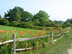
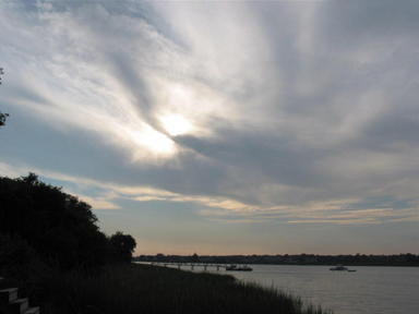
Gallery
References
- ^ "TOTAL POPULATION (P1), 2010 Census Summary File 1, All County Subdivisions within Massachusetts". United States Census Bureau. http://factfinder2.census.gov/bkmk/table/1.0/en/DEC/10_SF1/P1/0400000US25.06000. Retrieved September 13, 2011.
- ^ "Massachusetts by Place and County Subdivision - GCT-T1. Population Estimates". United States Census Bureau. http://factfinder.census.gov/servlet/GCTTable?_bm=y&-geo_id=04000US25&-_box_head_nbr=GCT-T1&-ds_name=PEP_2009_EST&-_lang=en&-format=ST-9&-_sse=on. Retrieved July 12, 2011.
- ^ "1990 Census of Population, General Population Characteristics: Massachusetts". US Census Bureau. December 1990. Table 76: General Characteristics of Persons, Households, and Families: 1990. 1990 CP-1-23. http://www.census.gov/prod/cen1990/cp1/cp-1-23.pdf. Retrieved July 12, 2011.
- ^ "1980 Census of the Population, Number of Inhabitants: Massachusetts". US Census Bureau. December 1981. Table 4. Populations of County Subdivisions: 1960 to 1980. PC80-1-A23. http://www2.census.gov/prod2/decennial/documents/1980a_maABC-01.pdf. Retrieved July 12, 2011.
- ^ "1950 Census of Population". Bureau of the Census. 1952. Section 6, Pages 21-10 and 21-11, Massachusetts Table 6. Population of Counties by Minor Civil Divisions: 1930 to 1950. http://www2.census.gov/prod2/decennial/documents/23761117v1ch06.pdf. Retrieved July 12, 2011.
- ^ "1920 Census of Population". Bureau of the Census. Number of Inhabitants, by Counties and Minor Civil Divisions. Pages 21-5 through 21-7. Massachusetts Table 2. Population of Counties by Minor Civil Divisions: 1920, 1910, and 1920. http://www2.census.gov/prod2/decennial/documents/41084506no553ch2.pdf. Retrieved July 12, 2011.
- ^ "1890 Census of the Population". Department of the Interior, Census Office. Pages 179 through 182. Massachusetts Table 5. Population of States and Territories by Minor Civil Divisions: 1880 and 1890. http://www2.census.gov/prod2/decennial/documents/41084506no553ch2.pdf. Retrieved July 12, 2011.
- ^ "1870 Census of the Population". Department of the Interior, Census Office. 1872. Pages 217 through 220. Table IX. Population of Minor Civil Divisions, &c. Massachusetts. http://www2.census.gov/prod2/decennial/documents/1870e-05.pdf. Retrieved July 12, 2011.
- ^ "1860 Census". Department of the Interior, Census Office. 1864. Pages 220 through 226. State of Massachusetts Table No. 3. Populations of Cities, Towns, &c.. http://www2.census.gov/prod2/decennial/documents/1860a-08.pdf. Retrieved July 12, 2011.
- ^ "1850 Census". Department of the Interior, Census Office. 1854. Pages 338 through 393. Populations of Cities, Towns, &c.. http://www2.census.gov/prod2/decennial/documents/1850c-11.pdf. Retrieved July 12, 2011.
- ^ "American FactFinder". United States Census Bureau. http://factfinder.census.gov. Retrieved 2008-01-31.
- ^ Index of Legislative Representation by City and Town, from Mass.gov
- ^ Station D-2, SP Yarmouth
- ^ "Irish bank's ex-CEO sits out crisis on Cape". The Boston Globe (Boston) 277 (102). April 12, 2010.
External links
- Chatham travel guide from Wikitravel
- Town of Chatham Website
- The Cape Cod Chronicle
- Chatham Chamber of Commerce tourist information
- Chatham Online Guide.
- Archive of Historical and Contemporary Chatham Photos
- Eldredge Public Library
- Chatham Cultural Council
- Chatham Media Archive
- Monomoy National Wildlife Refuge
- Chatham Public Schools
- Chatham A's
Municipalities and communities of Barnstable County, Massachusetts City 
Towns CDPs Bourne | Brewster | Buzzards Bay | Chatham | Dennis | Dennis Port | East Dennis | East Falmouth | East Harwich | East Sandwich | Falmouth | Forestdale | Harwich Center | Harwich Port | Mashpee Neck | Monomoscoy Island | Monument Beach | New Seabury | North Eastham | North Falmouth | Northwest Harwich | Orleans | Pocasset | Popponesset Island | Popponesset | Provincetown | Sagamore | Sandwich | Seabrook | Seconsett Island | South Dennis | South Yarmouth | Teaticket | West Chatham | West Dennis | West Falmouth | West Yarmouth | Woods Hole | Yarmouth Port
Other
villagesBarnstable Village | Centerville | Cotuit | Craigville | Hyannis | Marstons Mills | Menauhant | North Harwich | North Truro | Osterville | Pleasant Lake | South Harwich | West Barnstable | West Harwich
Categories:- Chatham, Massachusetts
- Towns in Barnstable County, Massachusetts


Wikimedia Foundation. 2010.