- Mashpee Neck, Massachusetts
-
Mashpee Neck, Massachusetts — CDP — Coordinates: 41°36′37″N 70°27′54″W / 41.61028°N 70.465°WCoordinates: 41°36′37″N 70°27′54″W / 41.61028°N 70.465°W Country United States State Massachusetts County Barnstable Area – Total 1.4 sq mi (3.7 km2) – Land 1.3 sq mi (3.3 km2) – Water 0.2 sq mi (0.5 km2) Elevation 39 ft (12 m) Population (2000) – Total 901 – Density 715.4/sq mi (276.2/km2) Time zone Eastern (EST) (UTC-5) – Summer (DST) EDT (UTC-4) FIPS code 25-39152 GNIS feature ID 1877295 Mashpee Neck is a census-designated place (CDP) in the town of Mashpee in Barnstable County, Massachusetts, United States. The population was 901 at the 2000 census.
Geography
Mashpee Neck is located at 41°36′37″N 70°27′54″W / 41.61028°N 70.465°W (41.610357, -70.465072)[1].
According to the United States Census Bureau, the CDP has a total area of 3.7 km² (1.4 mi²). 3.3 km² (1.3 mi²) of it is land and 0.5 km² (0.2 mi²) (12.50%) is water.
Demographics
At the 2000 census[2], there were 901 people, 352 households and 260 families residing in the CDP. The population density was 276.1/km² (715.4/mi²). There were 518 housing units at an average density of 158.7/km² (411.3/mi²). The racial makeup of the CDP was 92.90% White, 2.66% African American, 0.89% Native American, 0.89% Asian, 0.11% Pacific Islander, 0.44% from other races, and 2.11% from two or more races. Hispanic or Latino of any race were 0.55% of the population.
There were 352 households of which 34.1% had children under the age of 18 living with them, 61.9% were married couples living together, 9.4% had a female householder with no husband present, and 25.9% were non-families. 21.0% of all households were made up of individuals and 8.2% had someone living alone who was 65 years of age or older. The average household size was 2.56 and the average family size was 3.01.
Age distribution was 27.5% under the age of 18, 2.4% from 18 to 24, 31.1% from 25 to 44, 26.2% from 45 to 64, and 12.8% who were 65 years of age or older. The median age was 38 years. For every 100 females there were 105.7 males. For every 100 females age 18 and over, there were 98.5 males.
The median household income was $50,726, and the median family income was $53,750. Males had a median income of $47,169 versus $35,568 for females. The per capita income for the CDP was $24,329. About 2.1% of families and 5.5% of the population were below the poverty line, including 3.6% of those under age 18 and 18.7% of those age 65 or over.
References
- ^ "US Gazetteer files: 2010, 2000, and 1990". United States Census Bureau. 2011-02-12. http://www.census.gov/geo/www/gazetteer/gazette.html. Retrieved 2011-04-23.
- ^ "American FactFinder". United States Census Bureau. http://factfinder.census.gov. Retrieved 2008-01-31.
Municipalities and communities of Barnstable County, Massachusetts City 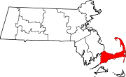
Towns CDPs Bourne | Brewster | Buzzards Bay | Chatham | Dennis | Dennis Port | East Dennis | East Falmouth | East Harwich | East Sandwich | Falmouth | Forestdale | Harwich Center | Harwich Port | Mashpee Neck | Monomoscoy Island | Monument Beach | New Seabury | North Eastham | North Falmouth | Northwest Harwich | Orleans | Pocasset | Popponesset Island | Popponesset | Provincetown | Sagamore | Sandwich | Seabrook | Seconsett Island | South Dennis | South Yarmouth | Teaticket | West Chatham | West Dennis | West Falmouth | West Yarmouth | Woods Hole | Yarmouth Port
Other
villagesBarnstable Village | Centerville | Cotuit | Craigville | Hyannis | Marstons Mills | Menauhant | North Harwich | North Truro | Osterville | Pleasant Lake | South Harwich | West Barnstable | West Harwich
Categories:- Census-designated places in Barnstable County, Massachusetts
- Mashpee, Massachusetts

Wikimedia Foundation. 2010.