- Claycomo, Missouri
-
Claycomo, Missouri — Village — Location of Claycomo, Missouri
Coordinates: 39°12′2″N 94°29′22″W / 39.20056°N 94.48944°WCoordinates: 39°12′2″N 94°29′22″W / 39.20056°N 94.48944°W Country United States State Missouri County Clay Area – Total 2.5 sq mi (6.5 km2) – Land 2.5 sq mi (6.5 km2) – Water 0.0 sq mi (0.0 km2) Elevation 807 ft (246 m) Population (2000) – Total 1,267 – Density 506.0/sq mi (195.4/km2) Time zone Central (CST) (UTC-6) – Summer (DST) CDT (UTC-5) ZIP code 64119 Area code(s) 816 FIPS code 29-14554[1] GNIS feature ID 0715915[2] Website http://www.claycomo.org/ Claycomo is a village in Clay County, Missouri, United States. The village’s name is formed from Clay, co (County), and mo (Missouri). The population was 1,267 at the 2000 census. Ford Motor Company has a plant here, assembling the Ford F-Series trucks and Ford Escape and Mazda Tribute SUVs.
Geography
Claycomo is located at 39°12′2″N 94°29′22″W / 39.20056°N 94.48944°W (39.200507, -94.489404)[3].
According to the United States Census Bureau, the village has a total area of 2.5 square miles (6.5 km2), all of it land.
Demographics
As of the census[1] of 2000, there were 1,267 people, 596 households, and 345 families residing in the village. The population density was 506.0 people per square mile (195.7/km²). There were 626 housing units at an average density of 250.0 per square mile (96.7/km²). The racial makeup of the village was 94.55% White, 2.29% African American, 0.39% Native American, 0.71% Asian, 0.39% from other races, and 1.66% from two or more races. Hispanic or Latino of any race were 2.37% of the population.
There were 596 households out of which 22.1% had children under the age of 18 living with them, 41.9% were married couples living together, 11.9% had a female householder with no husband present, and 42.1% were non-families. 36.1% of all households were made up of individuals and 10.6% had someone living alone who was 65 years of age or older. The average household size was 2.10 and the average family size was 2.72.
In the village the population was spread out with 19.7% under the age of 18, 9.2% from 18 to 24, 27.9% from 25 to 44, 26.5% from 45 to 64, and 16.7% who were 65 years of age or older. The median age was 40 years. For every 100 females there were 96.7 males. For every 100 females age 18 and over, there were 95.4 males.
The median income for a household in the village was $39,271, and the median income for a family was $44,861. Males had a median income of $29,531 versus $23,990 for females. The per capita income for the village was $20,000. About 4.3% of families and 4.7% of the population were below the poverty line, including 10.6% of those under age 18 and 5.7% of those age 65 or over.
References
- ^ a b "American FactFinder". United States Census Bureau. http://factfinder.census.gov. Retrieved 2008-01-31.
- ^ "US Board on Geographic Names". United States Geological Survey. 2007-10-25. http://geonames.usgs.gov. Retrieved 2008-01-31.
- ^ "US Gazetteer files: 2010, 2000, and 1990". United States Census Bureau. 2011-02-12. http://www.census.gov/geo/www/gazetteer/gazette.html. Retrieved 2011-04-23.
Kansas City Metropolitan Area's cities and counties Central city 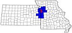
Largest cities (over 100,000 in 2000) Medium-sized cities (10,000 to 100,000 in 2000) Blue Springs • Belton • Excelsior Springs • Gladstone • Grandview • Lansing • Leawood • Leavenworth • Lee's Summit • Lenexa • Liberty • Merriam • Ottawa • Prairie Village • Raymore • Raytown • ShawneeCounties Municipalities and communities of Clay County, Missouri Cities Avondale | Excelsior Springs‡ | Gladstone | Glenaire | Holt‡ | Independence‡ | Kansas City‡ | Kearney | Liberty | Lawson‡ | Missouri City | Mosby | North Kansas City | Pleasant Valley | Smithville‡ | Sugar Creek‡

Villages Birmingham | Claycomo | Excelsior Estates‡ | Oaks | Oakview | Oakwood | Oakwood Park | Prathersville | Randolph
Townships Chouteau | Fishing River | Gallatin | Kearney | Liberty | Platte | Washington
Unincorporated
communityFootnotes ‡This populated place also has portions in an adjacent county or counties
Categories:- Villages in Clay County, Missouri


Wikimedia Foundation. 2010.