- National Register of Historic Places listings in Putnam County, New York
-
 Location of Putnam County in New York
List of the National Register of Historic Places listings in Putnam County, New York
This is intended to be a complete list of properties and districts listed on the National Register of Historic Places in Putnam County, New York. The locations of National Register properties and districts (at least for all showing latitude and longitude coordinates below) may be seen in a Google map by clicking on "Map of all coordinates".[1] One of the properties, Manitoga, is further designated a National Historic Landmark of the United States.
-
- This National Park Service list is complete through NPS recent listings posted November 18, 2011.[2]
Contents: Counties in New York Albany (Albany) – Allegany – Bronx – Broome – Cattaraugus – Cayuga – Chautauqua – Chemung – Chenango – Clinton – Columbia – Cortland – Delaware – Dutchess – Erie (Buffalo) – Essex – Franklin – Fulton – Genesee – Greene – Hamilton – Herkimer – Jefferson – Kings (Brooklyn) – Lewis – Livingston – Madison – Monroe (Rochester) – Montgomery – Nassau – New York (Manhattan – Below 14th Street, 14th to 59th Streets, 59th to 110th Streets, Above 110th Street, Islands) – Niagara – Oneida – Onondaga (Syracuse) – Ontario – Orange – Orleans – Oswego – Otsego – Putnam – Queens – Rensselaer – Richmond (Staten Island) – Rockland – Saratoga – Schenectady – Schoharie – Schuyler – Seneca – St. Lawrence – Steuben – Suffolk – Sullivan – Tioga – Tompkins – Ulster – Warren – Washington – Wayne – Westchester (New Rochelle, Peekskill, Yonkers) – Wyoming – Yates Listings county-wide
Landmark name Image Date listed Location City or Town Summary 1 The Birches 
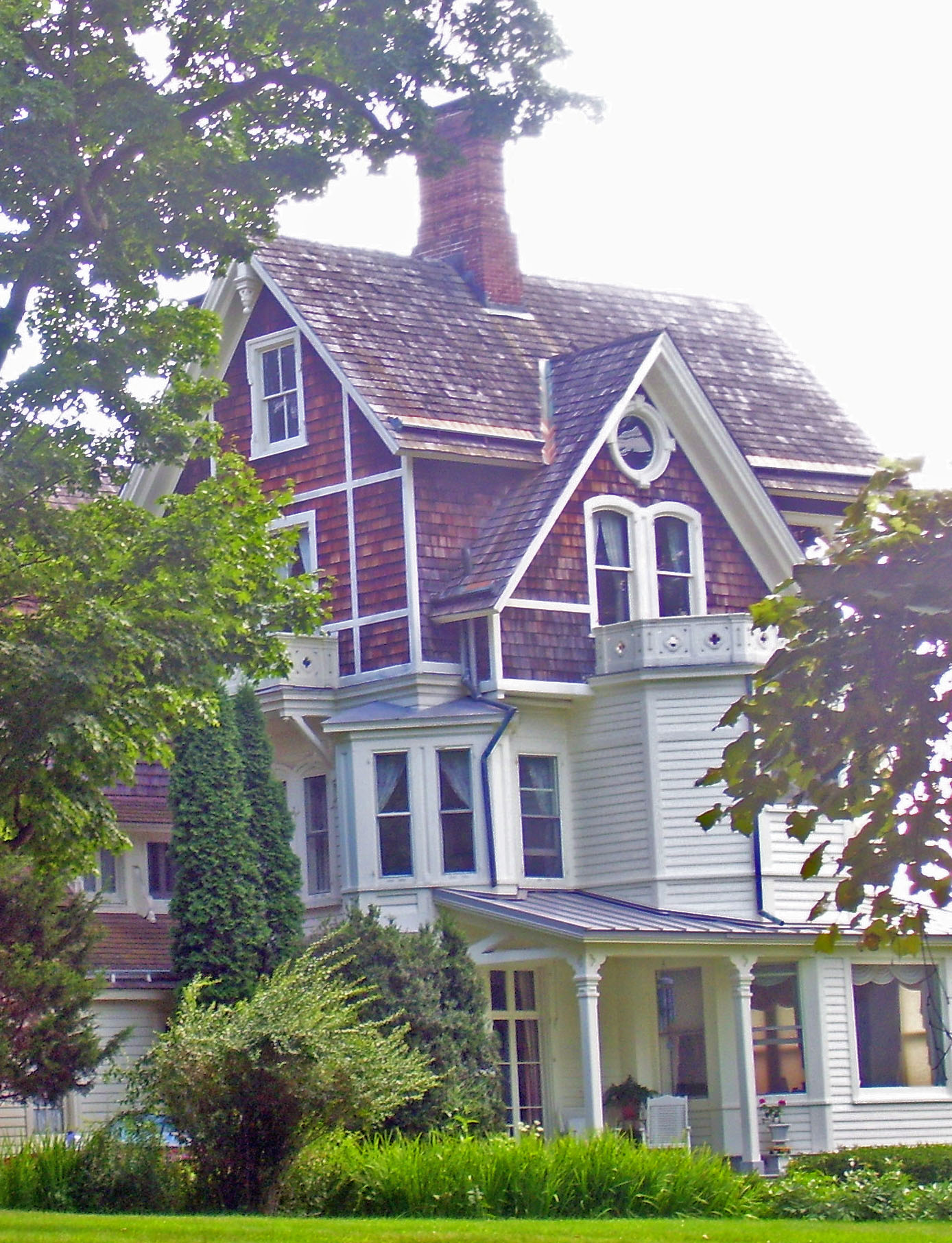
November 23, 1982 Cat Rock Rd.
41°22′31″N 73°56′38″W / 41.37528°N 73.94389°WGarrison 1882 Victorian Gothic house designed for Illinois Central president William Osborn; used as honeymoon house by both his sons. One of Ralph Adams Cram's earliest works 2 Boscobel 
November 7, 1977 N of Garrison on NY 9D
41°24′39″N 73°56′22″W / 41.41083°N 73.93944°WGarrison Outstanding example of Federal style mansion, built by States Dyckman in 1808, with many original furnishings. Moved upriver from original site at Montrose and restored after several years in state storage when FDR Veterans Hospital was built on original site. 3 Walter Brewster House 
October 4, 1978 Oak St.
41°23′42″N 73°36′59″W / 41.395°N 73.61639°WBrewster Home of village founder; only Greek Revival home in county with a two-story colonnade 4 Castle Rock 
December 12, 1977 NY 9D
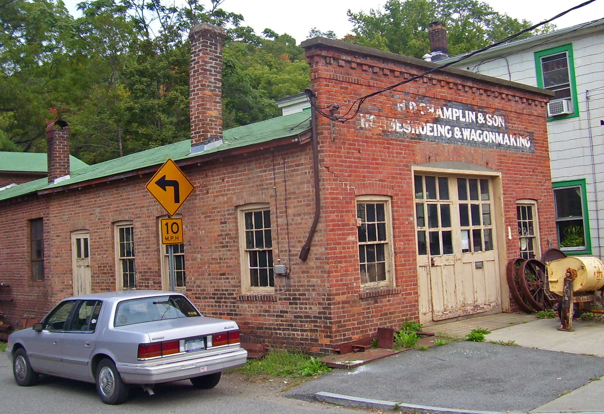
41°22′6″N 73°56′28″W / 41.36833°N 73.94111°WGarrison Eclectic mountaintop estate built by J. Morgan Slade for William Osborn in 1881; a major Hudson Highlands landmark ever since 5 H. D. Champlin & Son Horseshoeing and Wagonmaking 
November 23, 1982 286 Main St.
41°25′29″N 73°56′49″W / 41.42472°N 73.94694°WNelsonville Late 19th-century commercial structure preserved nearly intact 6 Cold Spring Cemetery Gatehouse 
November 23, 1982 Peekshill Rd.
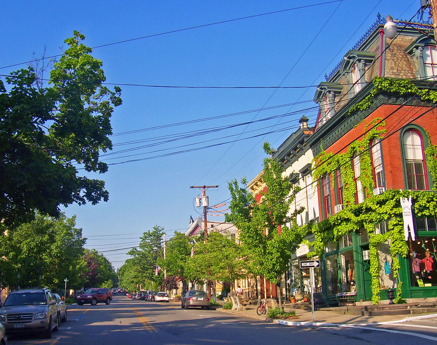
41°25′20″N 73°56′41″W / 41.42222°N 73.94472°WNelsonville 1862 Gothic Revival gatehouse with unusual roof styling; one of the earliest uses of that style in the Highlands 7 Cold Spring Historic District 
November 23, 1982 Roughly Main, Fair, Chestnut Sts., and Paulding Ave.
41°25′4″N 73°57′15″W / 41.41778°N 73.95417°WCold Spring Well-preserved core of late 19th-century riverside town 8 DeRham Farm 
March 28, 1980 N of Garrison on Indian Brook Rd.
41°24′20″N 73°56′12″W / 41.40556°N 73.93667°WGarrison Early 19th-century gentleman farmer's complex on Hudson 9 J. Y. Dykman Flour and Feed Store 
November 23, 1982 289 Main St.
41°25′28″N 73°56′48″W / 41.42444°N 73.94667°WNelsonville Most ornate commercial building in Nelsonville, dating to mid-19th century 10 J. Y. Dykman Store 
November 23, 1982 255 Main St.
41°25′24″N 73°56′57″W / 41.42333°N 73.94917°WNelsonville Ornate facade on ca. 1890 building now used as antique map store 11 Eagle's Rest 
November 23, 1982 NY 9-D
41°23′46″N 73°56′14″W / 41.39611°N 73.93722°WPhilipstown Former estate of New York Yankees' owner Jacob Ruppert; now Saint Basil Academy 12 Fair Lawn 
November 23, 1982 NY 9-D
41°24′56″N 73°56′37″W / 41.41556°N 73.94361°WCold Spring 1860 home built for painter Thomas Prichard Rossiter; later modified by others. 13 First Baptist Church of Cold Spring 
November 23, 1982 Main St.
41°25′22″N 73°56′59″W / 41.42278°N 73.94972°WNelsonville Built in 1833; oldest church building in Philipstown and only frame church in Hudson Highlands 14 First National Bank of Brewster 
January 7, 1988 Main St.
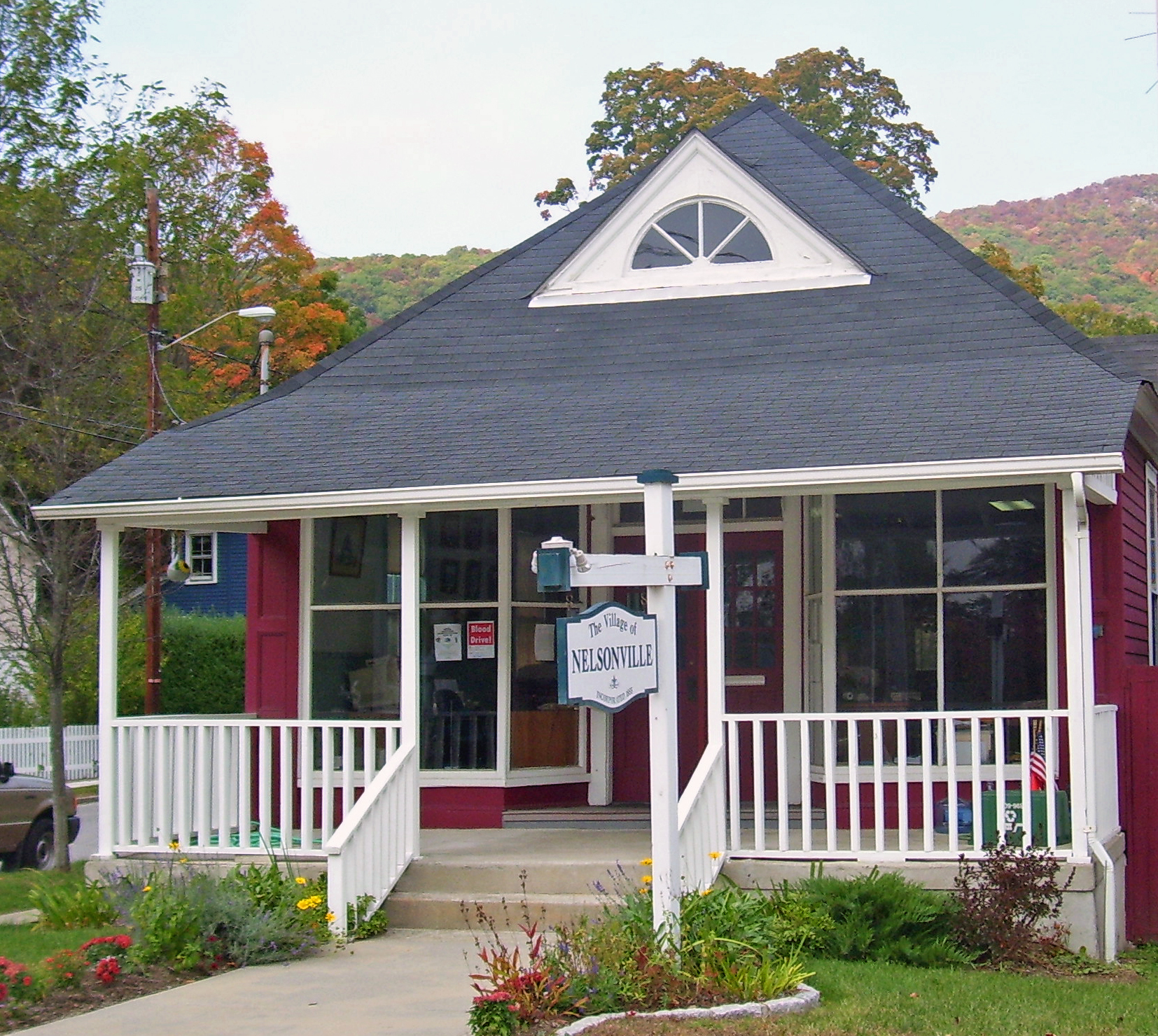
41°23′40″N 73°37′10″W / 41.39444°N 73.61944°WBrewster Intact Queen Anne-style building from late 19th century later used as by Southeast town hall; still home to some town departments 15 Fish and Fur Club 
November 23, 1982 258 Main St.
41°25′26″N 73°56′56″W / 41.42389°N 73.94889°WNelsonville 1905 rustic sportsmen's clubhouse is now Nelsonville Village Hall 16 Garrison Grist Mill Historic District 
December 23, 1993 Jct. of NY 9D and Upper Station Rd.
41°22′30″N 73°56′46″W / 41.375°N 73.94611°WGarrison Four colonial-era buildings, among the oldest in Garrison, preserved amid a golf course 17 Garrison Landing Historic District 
November 23, 1982 Bounded by Hudson River and NY Central RR Tracks
41°22′58″N 73°56′52″W / 41.38278°N 73.94778°WGarrison Mid-19th century commercial area by train station; used for Gay Nineties Yonkers in 1969 film version of Hello, Dolly 18 Garrison Union Free School 
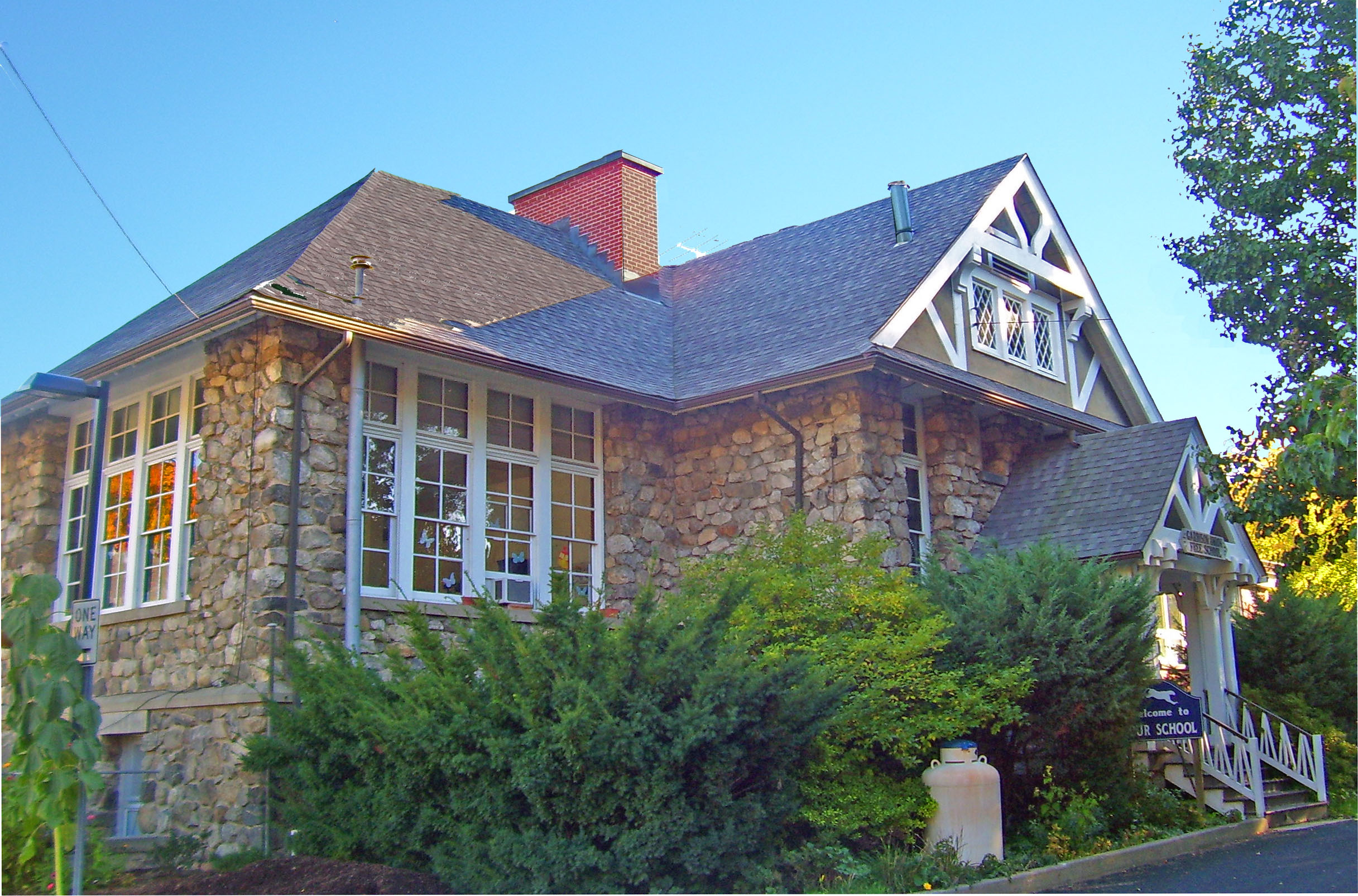
November 23, 1982 NY 9-D
41°22′49″N 73°56′20″W / 41.38028°N 73.93889°WGarrison K-8 school built of local stone in 1908 to house public school that dates to 1793 19 Gilead Cemetery 
December 1, 1988 Mechanic St.
41°24′30″N 73°40′25″W / 41.40833°N 73.67361°WCarmel A century and a half of graves dating from mid-18th century, including Revolutionary War spy Enoch Crosby and politician Joel Frost; unusually large collection of funerary art illustrates changes in Protestant view of death. 20 Glenfields 
November 23, 1982 Old Manitou Rd.
41°21′3″N 73°57′12″W / 41.35083°N 73.95333°WPhilipstown Ca. 1870 estate of Archibald Gracie King, designed by Cornwall firm Mead and Taft 21 The Grove November 21, 2008 12 Grove Ct.
41°25′8.04″N 73°57′0.36″W / 41.4189°N 73.9501°WCold Spring New listing; refnum# 08001080 22 House at 249 Main Street 
July 31, 1989 249 Main St.
41°25′24″N 73°56′58″W / 41.42333°N 73.94944°WNelsonville Ca. 1870 home combines Italianate and Carpenter Gothic design elements 23 House at 3 Crown Street 
November 23, 1982 3 Crown St.
41°25′26″N 73°57′1″W / 41.42389°N 73.95028°WNelsonville Sophisticated 1868 Italianate brick residence 24 Hurst-Pierrepont Estate November 23, 1982 NY 9-D
41°22′45″N 73°56′19″W / 41.37917°N 73.93861°WGarrison 25 Hustis House 
November 23, 1982 328 Main St.
41°25′37″N 73°56′32″W / 41.42694°N 73.94222°WNelsonville Intact late 19th-century foundry worker housing 26 Indian Brook Road Historic District 
August 19, 1993 Jct. of Indian Brook Rd. and US 9
41°24′55″N 73°54′54″W / 41.41528°N 73.915°WGarrison Former rural hamlet of Nelson's Corner, one of the few pre-industrial ones with its plan and buildings largely intact 27 Mandeville House 
November 23, 1982 Lower Station Hill Rd.
41°22′36″N 73°56′43″W / 41.37667°N 73.94528°WPhilipstown Built in 1735; oldest house in Garrison. Used as headquarters by Israel Putnam during Revolution; later home to Richard Upjohn, whose Gothic changes were mostly removed in the 1920s. 28 Manitoga 
November 15, 1996 Jct. of NY 9D and Manitou Rd.
41°20′50″N 73°58′52″W / 41.34722°N 73.98111°WGarrison Estate of 20th-century industrial designer Russel Wright features house designed to be sustainable and blend into landscape; one of the earliest American houses to do so. To date, Putnam County's only National Historic Landmark 29 Montrest 
November 23, 1982 Late Gate Rd.
41°25′43″N 73°56′7″W / 41.42861°N 73.93528°WPhilipstown 1868 summer home of New York City art dealer 30 Moore House November 23, 1982 Nelson Ln.
41°22′49″N 73°56′16″W / 41.38028°N 73.93778°WGarrison 31 Normandy Grange 
November 23, 1982 NY 9-D
41°23′31″N 73°55′53″W / 41.39194°N 73.93139°WPhilipstown Evans Dick liked this 1905 Norman-style gatehouse complex to his never-completed nearby estate more than the estate itself. 32 Old Albany Post Road 
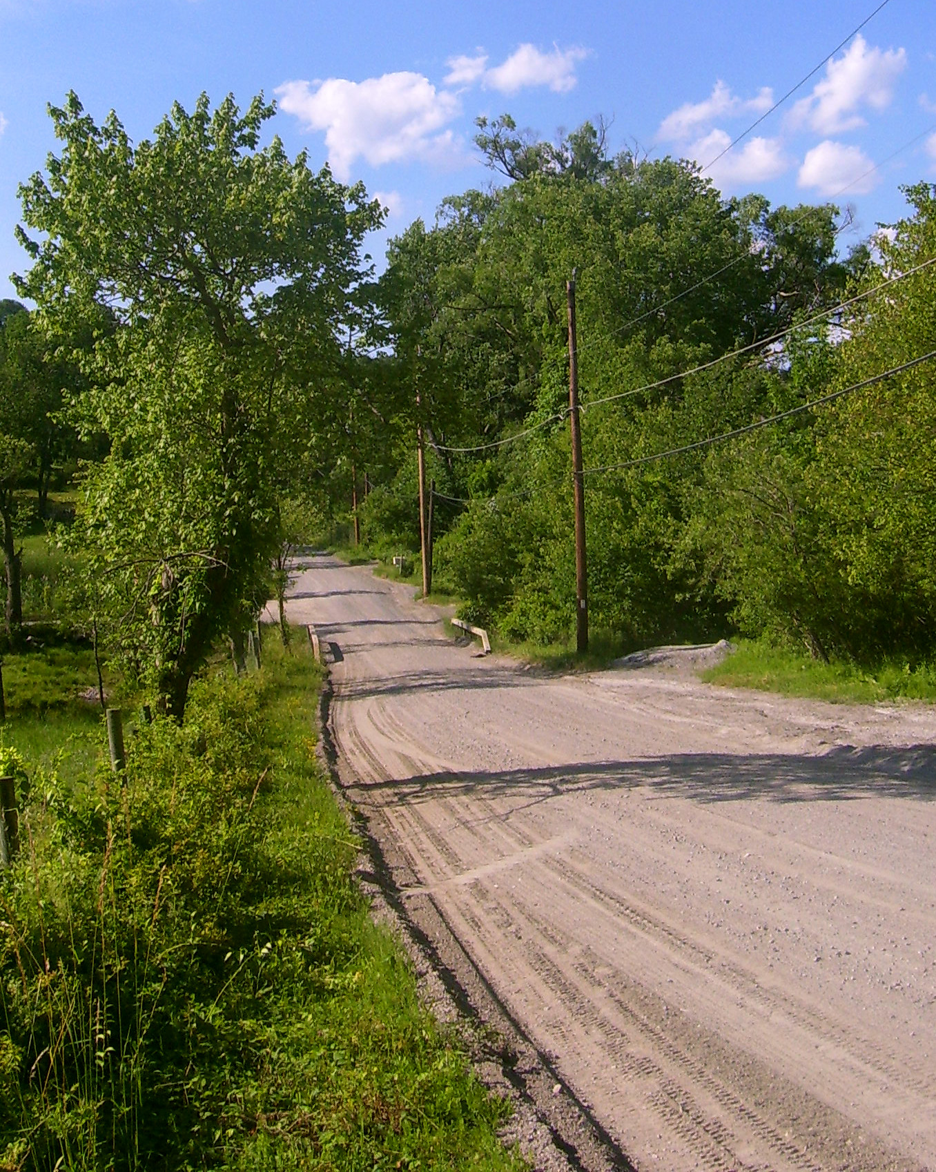
July 8, 1982 Off US 9
41°20′27″N 73°54′16″W / 41.34083°N 73.90444°WPhilipstown Unpaved 6.6-mile (10.6 km) section of original Albany Post Road, with original mileposts, dating to mid-17th century. One of the oldest dirt roads still in use in the U.S. 33 Old Southeast Church 
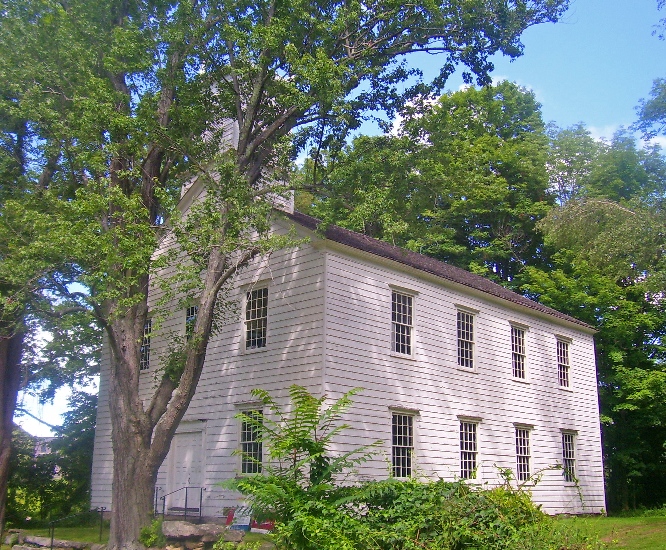
July 24, 1972 N of Brewster on NY 22 off Putnam Lake Rd.
41°25′53″N 73°34′29″W / 41.43139°N 73.57472°WBrewster 1794 church, renovated after 1830, is one of the few remaining buildings from Doanesville, commercial center of eastern county prior to railroad 34 Old Southeast Town Hall 
July 24, 1979 Main St.
41°23′39″N 73°37′4″W / 41.39417°N 73.61778°WBrewster Early yet mature Colonial Revival building with Moorish Revival touches with theatre upstairs; used today by town and community groups. 35 Oulagisket November 23, 1982 NY 9-D
41°22′34″N 73°56′10″W / 41.37611°N 73.93611°WPhilipstown 36 Plumbush 
January 30, 1992 NY 9D between Peekshill and Moffet Rds.
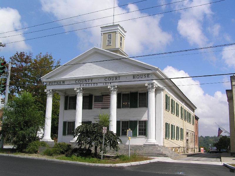
41°25′8″N 73°56′32″W / 41.41889°N 73.94222°WPhilipstown Home of Robert Parker Parrott, inventor of the Parrott gun 37 Putnam County Courthouse 
August 11, 1976 At jct. of NY 52 and NY 301
41°25′34″N 73°40′44″W / 41.42611°N 73.67889°WCarmel 1814 courthouse, still used for some court offices, is second-oldest county courthouse in state still in use 38 Reed Memorial Library 
March 28, 1980 2 Brewster Ave.
41°25′19″N 73°40′42″W / 41.42194°N 73.67833°WCarmel Stone Tudorbethan building erected in memory of local construction executive and benefactor; oldest library building in county 39 Rock Lawn and Carriage House November 23, 1982 NY 9-D
41°22′51″N 73°56′41″W / 41.38083°N 73.94472°WGarrison 40 St. Andrew's Episcopal Church 
November 23, 1998 26 Prospect St.
41°23′51″N 73°37′2″W / 41.3975°N 73.61722°WBrewster 1903 Gothic Revival church built with donation from wealthy local benefactor; only stone church in eastern Putnam County 41 St. Philip's Church in the Highlands 
October 11, 1995 NY 9D
41°22′55″N 73°56′23″W / 41.38194°N 73.93972°WGarrison 1850 Richard Upjohn-designed church; second on site where congregation dates to 1760s. Earlier church supposedly saved from destruction by Patriot mob through personal intervention of George Washington 42 Taconic State Parkway 
December 8, 2005
41°24′59.13″N 73°46′59.52″W / 41.416425°N 73.7832°WLinear north-south across center of county Putnam Valley, Carmel, Kent Scenic divided highway planned by Franklin D. Roosevelt for state park access. Built between 1920s and early 1960s, epitomizing peak period of parkway design. 43 Walter Thompson House and Carriage House November 23, 1982 Philipsebrook Rd.
41°23′1″N 73°55′56″W / 41.38361°N 73.93222°WPhilipstown 44 Tompkins Corners United Methodist Church March 31, 1983 Peekskill Hollow Rd.
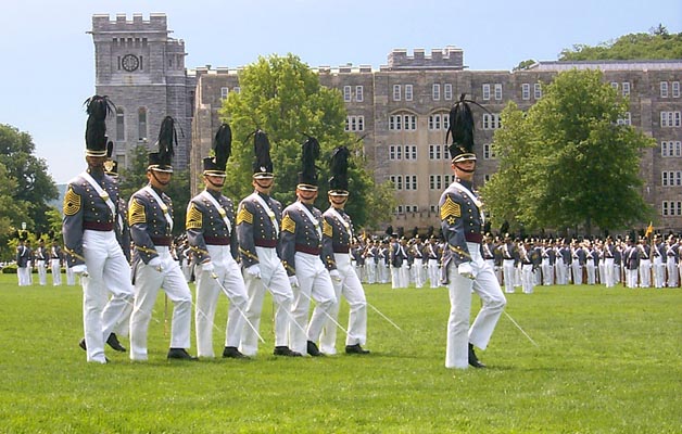
41°24′0″N 73°48′6″W / 41.4°N 73.80167°WPutnam Valley 45 U.S. Military Academy 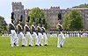
October 15, 1966 NY 218
41°23′43″N 73°58′18″W / 41.39528°N 73.97167°WWest Point Oldest continuously-operated military post in U.S., and alma mater of many notable American generals and Army officers. 46 Walker House 
November 23, 1982 Cat Rock Rd.
41°22′23″N 73°56′2″W / 41.37306°N 73.93389°WGarrison 1890 Queen Anne given by rail magnate Samuel Sloan to his daughter 47 West Point Foundry 
April 11, 1973 Foundry Cove between NY 90 and NY Central RR tracks
41°24′51″N 73°57′12″W / 41.41417°N 73.95333°WCold Spring Makers of cannon for U.S. Army through 19th century; director was Robert Parrott. Major reason for growth of Cold Spring and Nelsonville 48 West Point Foundry Archeological Site February 25, 2010 Address Restricted Cold Spring New listing; refnum 10000059 49 Wilson House 
November 23, 1982 Lower Station Rd.
41°22′35″N 73°56′50″W / 41.37639°N 73.94722°WGarrison Mid-19th century cottage has finest Carpenter Gothic detailing in the Hudson Highlands 50 Woodlawn 
November 23, 1982 NY 9-D
41°23′28″N 73°56′16″W / 41.39111°N 73.93778°WGarrison 1854 Richard Upjohn estate house on river, later used as school and now home of the Hastings Center See also
References
- ^ The latitude and longitude information provided in this table was derived originally from the National Register Information System, which has been found to be fairly accurate for about 99% of listings. For about 1% of NRIS original coordinates, experience has shown that one or both coordinates are typos or otherwise extremely far off; some corrections may have been made. A more subtle problem causes many locations to be off by up to 150 yards, depending on location in the country: most NRIS coordinates were derived from tracing out latitude and longitudes off of USGS topographical quadrant maps created under the North American Datum of 1927, which differs from the current, highly accurate WGS84 GPS system used by Google maps. Chicago is about right, but NRIS longitudes in Washington are higher by about 4.5 seconds, and are lower by about 2.0 seconds in Maine. Latitudes differ by about 1.0 second in Florida. Some locations in this table may have been corrected to current GPS standards.
- ^ "National Register of Historic Places: Weekly List Actions". National Park Service, United States Department of the Interior. Retrieved on November 18, 2011.
Categories:- National Register of Historic Places in New York by county
- Buildings and structures in Putnam County, New York
-


Wikimedia Foundation. 2010.