- National Register of Historic Places listings in Chemung County, New York
-
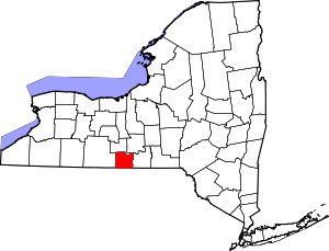 Location of Chemung County in New York
List of the National Register of Historic Places listings in Chemung County, New York
This is intended to be a complete list of properties and districts listed on the National Register of Historic Places in Chemung County, New York. The locations of National Register properties and districts (at least for all showing latitude and longitude coordinates below) may be seen in a Google map by clicking on "Map of all coordinates".[1] One site, the Newtown Battlefield, is further designated a National Historic Landmark.
-
- This National Park Service list is complete through NPS recent listings posted November 18, 2011.[2]
Contents: Counties in New York Albany (Albany) – Allegany – Bronx – Broome – Cattaraugus – Cayuga – Chautauqua – Chemung – Chenango – Clinton – Columbia – Cortland – Delaware – Dutchess – Erie (Buffalo) – Essex – Franklin – Fulton – Genesee – Greene – Hamilton – Herkimer – Jefferson – Kings (Brooklyn) – Lewis – Livingston – Madison – Monroe (Rochester) – Montgomery – Nassau – New York (Manhattan – Below 14th Street, 14th to 59th Streets, 59th to 110th Streets, Above 110th Street, Islands) – Niagara – Oneida – Onondaga (Syracuse) – Ontario – Orange – Orleans – Oswego – Otsego – Putnam – Queens – Rensselaer – Richmond (Staten Island) – Rockland – Saratoga – Schenectady – Schoharie – Schuyler – Seneca – St. Lawrence – Steuben – Suffolk – Sullivan – Tioga – Tompkins – Ulster – Warren – Washington – Wayne – Westchester (New Rochelle, Peekskill, Yonkers) – Wyoming – Yates Listings county-wide
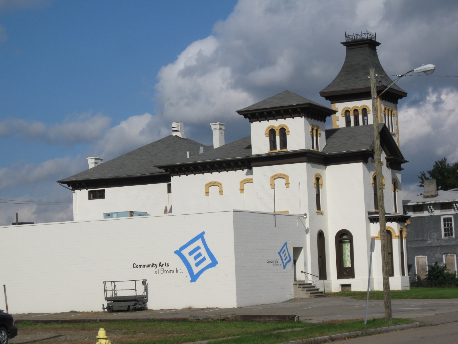
[3] Landmark name Image Date listed Location City or town Summary 1 John Brand Jr. House 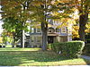
February 22, 2010 351 Maple Ave.
42°05′06″N 76°47′49″W / 42.084983°N 76.797053°WElmira New listing; refnum 10000024 2 John Brand Sr. House John Brand Sr. HouseNovember 10, 2010 405 Maple Ave.
42°05′04″N 76°47′45″W / 42.084444°N 76.795833°WElmira New listing; refnum 10000913 3 Buildings at 104-116 West Water St. December 17, 2008 104-116 W. Water St.
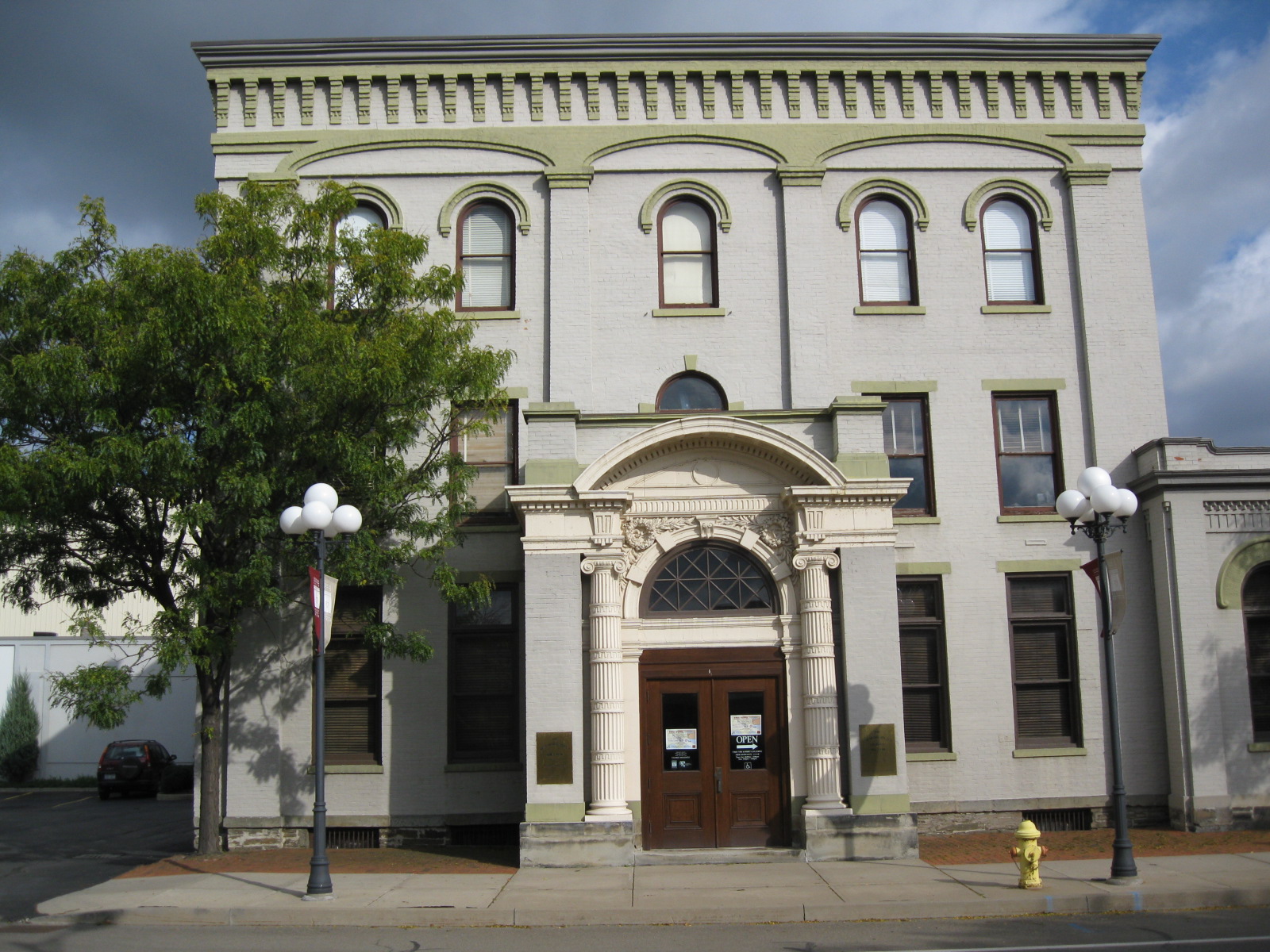
42°05′17″N 76°48′19″W / 42.088047°N 76.805328°WElmira 4 Chemung Canal Bank Building 
June 23, 1978 415 E. Water St.
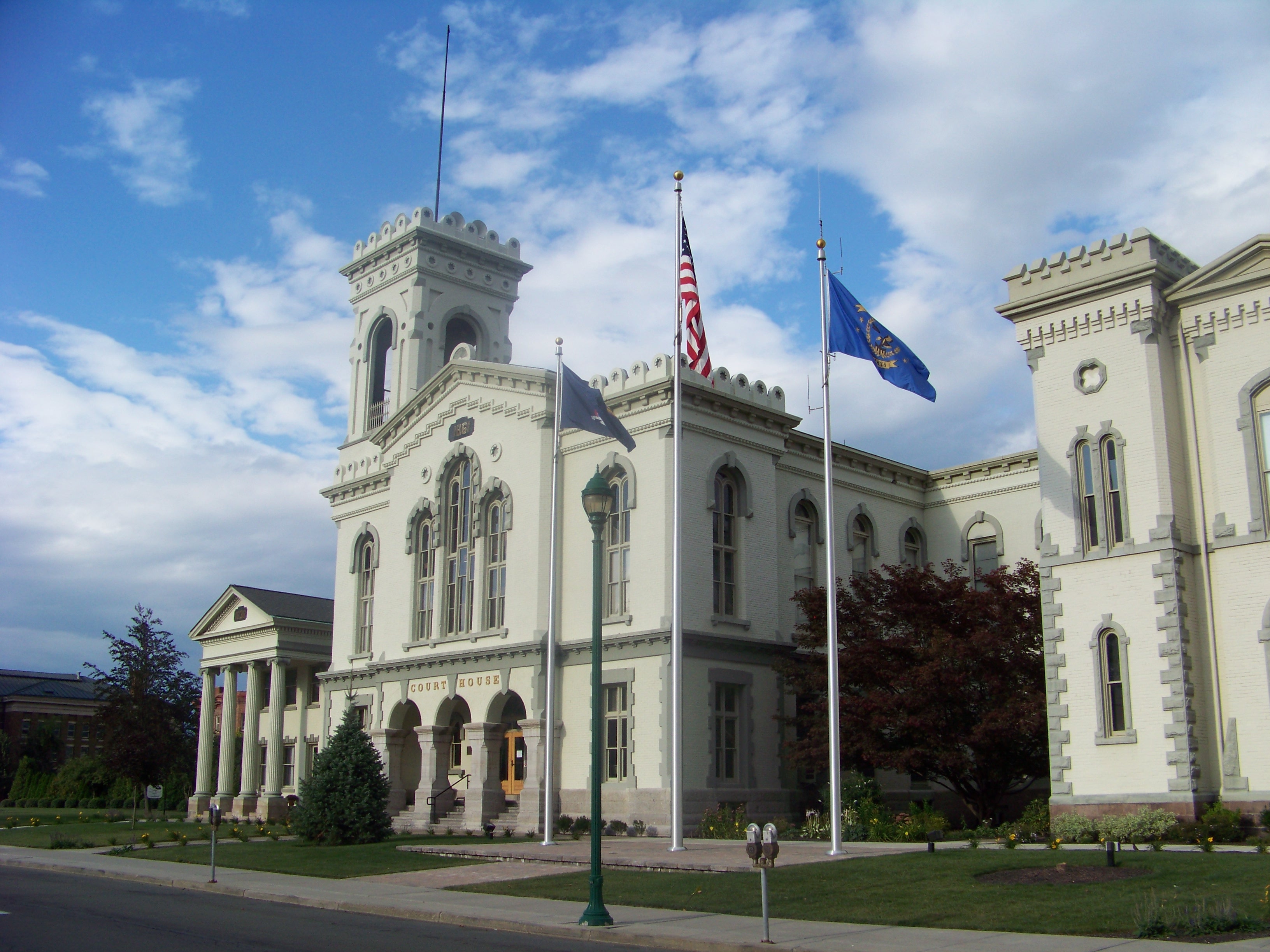
42°05′18″N 76°48′01″W / 42.088333°N 76.800278°WElmira Built 1833; oldest commercial building in Elmira 5 Chemung County Courthouse Complex 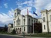
August 12, 1971 210-228 Lake St., between Market and E. Church Sts.
42°05′26″N 76°48′07″W / 42.090556°N 76.801944°WElmira Courthouse, District Attorney's and Treasurer's Building, County Clerk's Office and Courthouse Annex; built from 1836 through 1899 6 Chemung District School No. 10 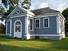
May 21, 2008 Old NY 17 at Lowman Rd.
42°01′44″N 76°42′56″W / 42.028889°N 76.715556°WLowman (new listing; refnum 08000449) 7 Chemung Railway Depot-Horseheads 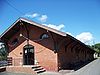
December 12, 1996 312 W. Broad St.
42°09′59″N 76°49′27″W / 42.166389°N 76.824167°WHorseheads Built 1866; in use through 1956 8 Christ Episcopal Church 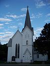
August 2, 2000 117 Main St.
42°00′54″N 76°43′39″W / 42.015°N 76.7275°WWellsburg Designed by Issac O. Perry; built in 1869 9 Elmira Civic Historic District 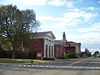
July 30, 1980 E. Church, Lake, E. Market, Baldwin, Carroll, and State Sts.
42°05′26″N 76°48′09″W / 42.090556°N 76.8025°WElmira Governmental center of early Elmira; includes Chemung County Courthouse Complex, U.S. Post Office, Armory Building and City Hall 10 Elmira Coca-Cola Bottling Company Works 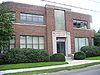
May 23, 1997 415 W. 2nd St.
42°05′21″N 76°48′58″W / 42.089167°N 76.816111°WElmira Art Moderne style building; built in 1939; significant for architecture and contribution to history of industry in Elmira 11 Elmira College Old Campus 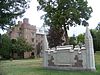
August 23, 1984 Roughly bounded by College and W. Washington Aves., N. Main St. and Park Pl.
42°05′52″N 76°48′53″W / 42.097778°N 76.814722°WElmira First college in the U.S. to have a degree program for women comparable to those at men's schools 12 Elmira Heights Village Hall 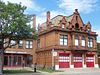
May 6, 1982 268 E. 14th St.
42°07′46″N 76°49′18″W / 42.129444°N 76.821667°WElmira Heights Built in 1896; designed by local architects Pierce and Bickford 13 Emmanuel Episcopal Church 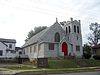
November 19, 1998 380 Pennsylvania Ave.
42°04′48″N 76°48′11″W / 42.08°N 76.803056°WElmira 14 Erste Deutsche Evangelische Kirche 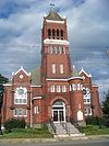
October 31, 2007 160 Madison Ave.
42°05′27″N 76°47′56″W / 42.090833°N 76.798889°WElmira Built 1898-1899; for German American congregation 15 Dr. Hovey Everett House 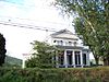
January 25, 2007 1594 Cty Rte 60
42°03′39″N 76°45′29″W / 42.060931°N 76.758153°WLowman 16 Fire Station No. 4 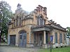
March 24, 1988 301 Maxwell Pl.
42°06′17″N 76°48′26″W / 42.104722°N 76.807222°WElmira Built in 1897; designed by local architects Pierce and Bickford 17 William S. Gerity House William S. Gerity HouseFebruary 22, 2010 415 William St.
42°05′38″N 76°48′10″W / 42.093925°N 76.802692°WElmira New listing; refnum 10000025 18 Hanover Square Historic District 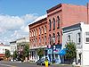
October 29, 1982 Jct. of E. and W. Franklin and N. and S. Main Sts.
42°10′03″N 76°49′16″W / 42.1675°N 76.821111°WHorseheads Downtown business district; built mainly 1862-1882 after fire levelled town 19 Horseheads 1855 Extension Historic District 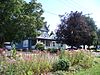
July 30, 1980 Grand Central Ave., Fletcher, Sayre, W. Mill and Center Sts.
42°09′46″N 76°49′14″W / 42.162778°N 76.820556°WHorseheads 20 F. M. Howell and Company 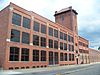
August 27, 1984 79-105 Pennsylvania Ave., 50 Pennsylvania Ave.
42°05′11″N 76°48′04″W / 42.086389°N 76.801111°WElmira 21 John W. Jones House 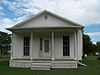
October 10, 2003 1250 Davis St.
42°06′27″N 76°49′26″W / 42.1075°N 76.823889°WElmira Home of former escaped slave, active abolitionist; worked with the Underground Railroad; sexton of Woodlawn Cemetery; buried Confederate dead 22 Near Westside Historic District 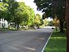
December 22, 1983 Roughly bounded by Chemung River, College Ave., 2nd and Hoffman Sts.
42°05′23″N 76°49′00″W / 42.089722°N 76.816667°WElmira 23 Newtown Battlefield 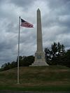
November 28, 1972 6 mi. SE of Elmira on NY 17
42°02′18″N 76°43′33″W / 42.038333°N 76.725833°WElmira Site of only major battle of the Sullivan Expedition; ordered by the Continental Congress to end the threat of the Iroquois ; the Iroquois were defeated decisively 24 Park Church 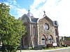
May 25, 1977 208 W. Gray St.
42°05′21″N 76°48′33″W / 42.089167°N 76.809167°WElmira 25 Pentecostal Holy Temple Church of Jesus Christ 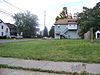
November 19, 1998 351 Division St.
42°06′26″N 76°48′31″W / 42.107222°N 76.808611°WElmira Address is currently an empty lot 26 Pratt House 
November 21, 2008 413 Lake St.
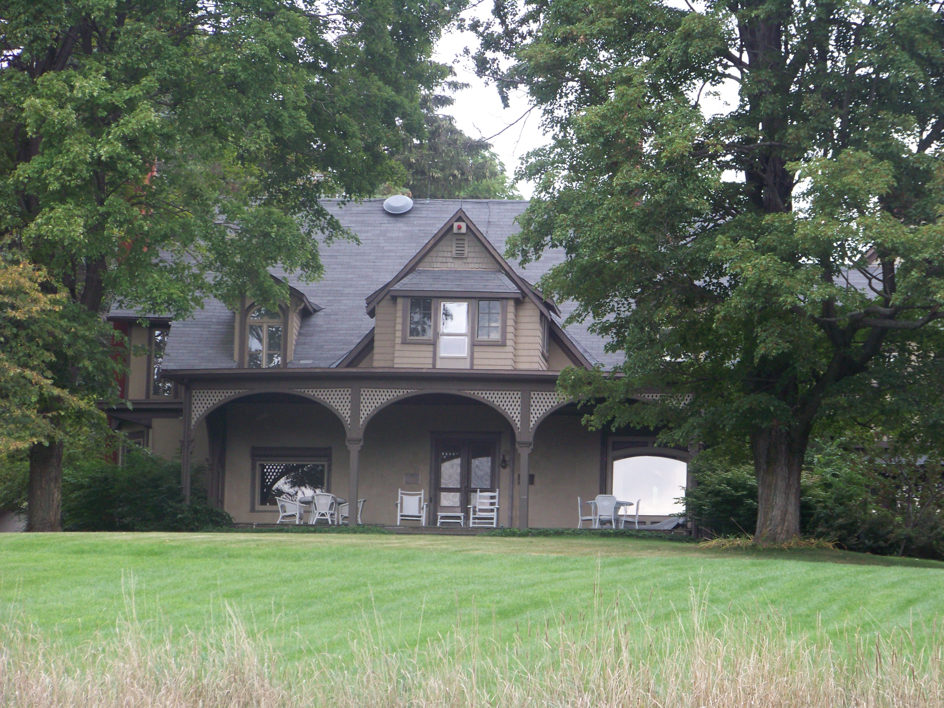
42°05′37″N 76°48′15″W / 42.093611°N 76.804167°WElmira New listing; refnum 08001075 27 Quarry Farm 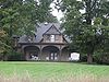
March 13, 1975 Crane Rd.
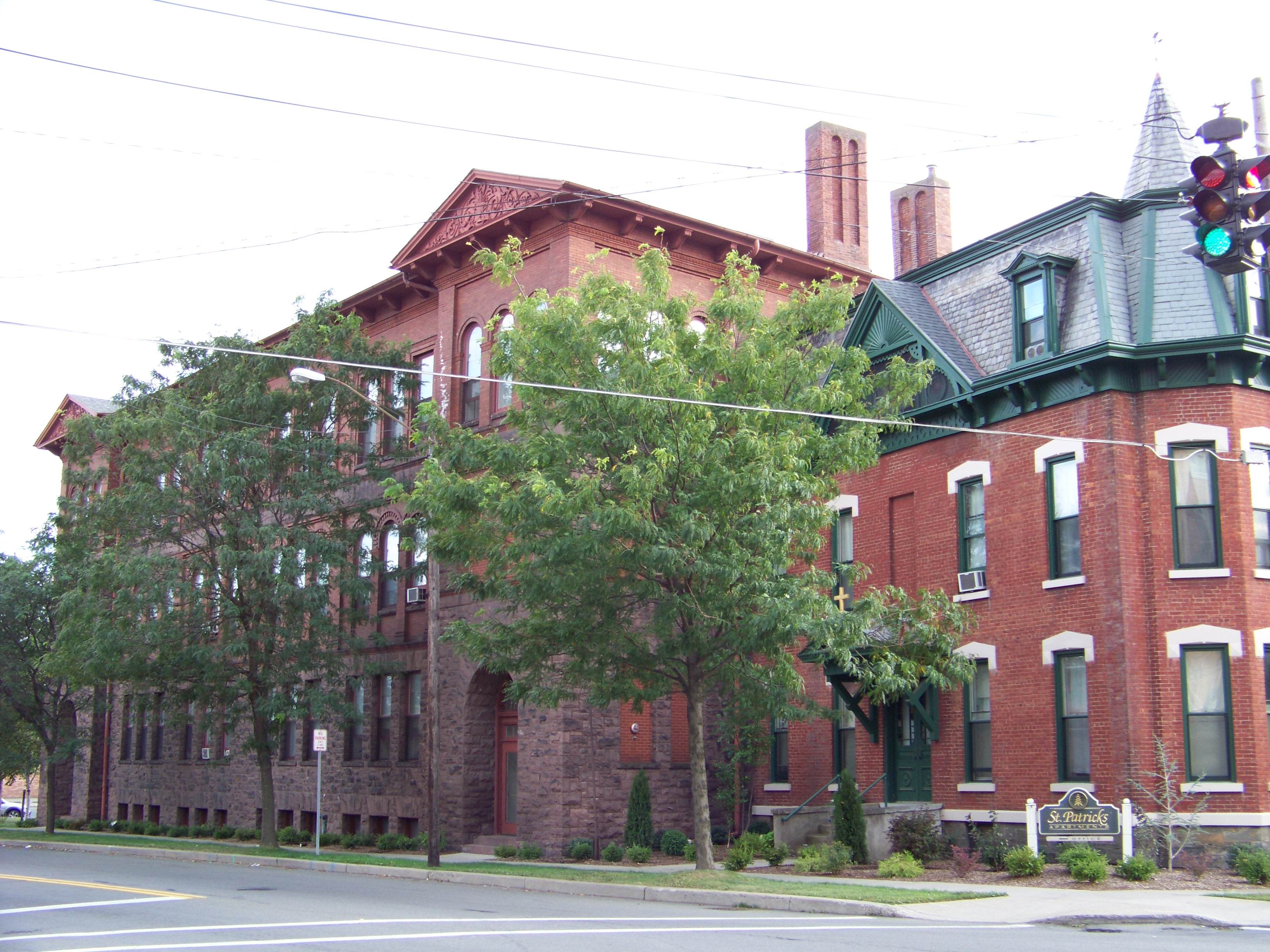
42°06′37″N 76°46′58″W / 42.110278°N 76.782778°WElmira 28 St. Patrick's Parochial Residence-Convent and School 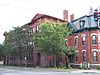
November 5, 1992 515-517 Park Pl.
42°05′36″N 76°48′40″W / 42.093333°N 76.811111°WElmira 29 Scotchtown Cemetery December 23, 2008 NY 223
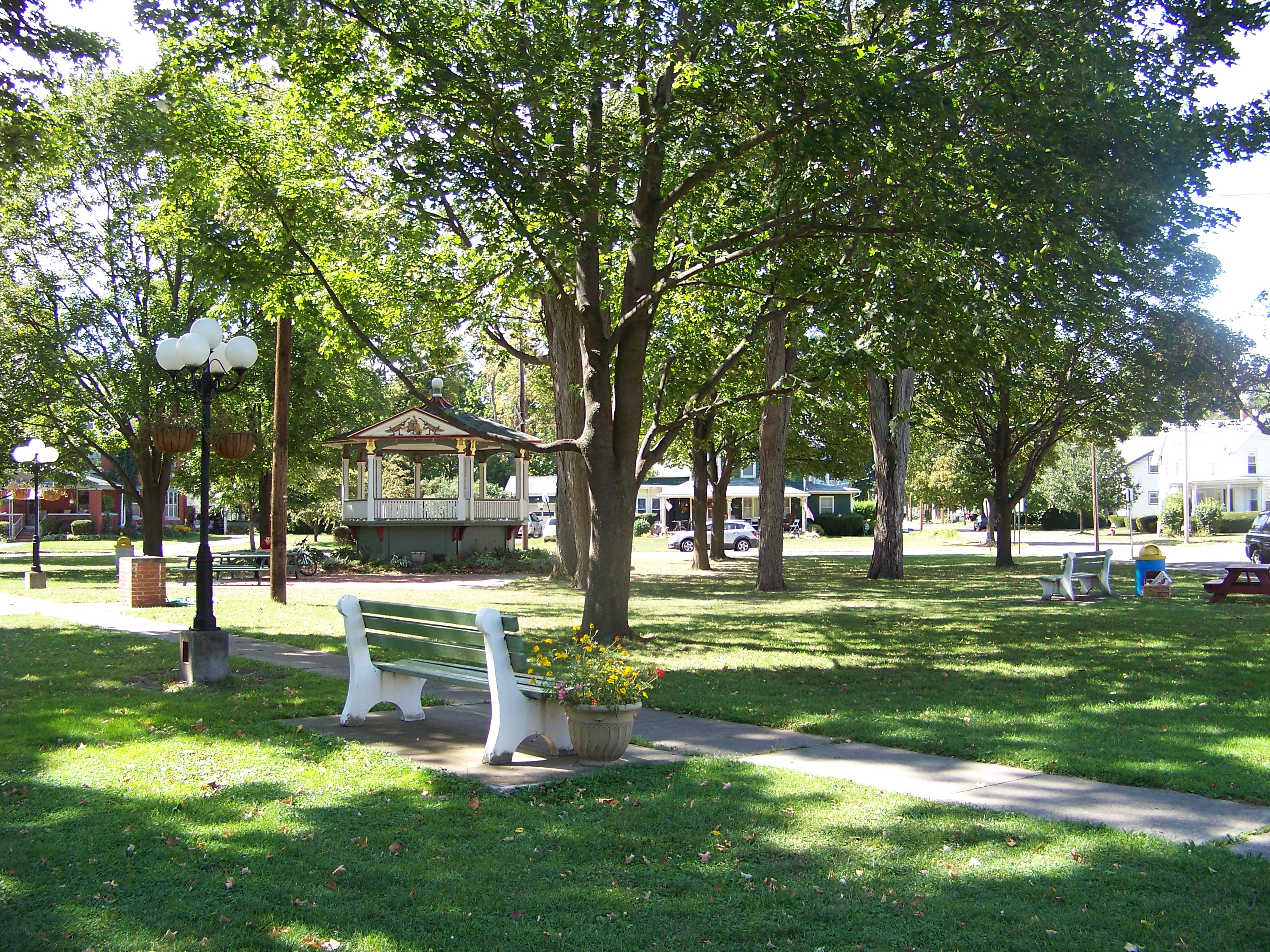
42°10′36″N 76°41′55″W / 42.176767°N 76.698656°WErin New listing; refnum# 08001229 30 Teal Park 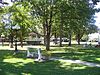
October 7, 1983 Steuben, Pine, and W. Main Sts.
42°09′51″N 76°49′11″W / 42.164167°N 76.819722°WHorseheads Public greenspace; location of the Zim bandstand; designed by political cartoonist Eugene Zimmerman 31 Trinity Church 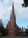
October 31, 2007 304 N. Main St.
42°05′24″N 76°48′30″W / 42.09°N 76.808333°WElmira Designed by Henry Dudley; built 1855-1858 32 Woodlawn Cemetery and Woodlawn National Cemetery 
October 6, 2004 Walnut and Davis Sts., West Hill and Bancroft Rds.
42°6′33″N 76°49′42″W / 42.10917°N 76.82833°WElmira Burial place of Mark Twain, Ernie Davis, Hal Roach, John W. Jones; National portion begun with interment of Cofederate prisoners of war during the American Civil War 33 Zimmerman House 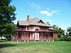
October 7, 1983 601 Pine St.
42°09′44″N 76°49′12″W / 42.162222°N 76.82°WHorseheads Home of political cartoonist Eugene Zimmerman See also
References
- ^ The latitude and longitude information provided in this table was derived originally from the National Register Information System, which has been found to be fairly accurate for about 99% of listings. For about 1% of NRIS original coordinates, experience has shown that one or both coordinates are typos or otherwise extremely far off; some corrections may have been made. A more subtle problem causes many locations to be off by up to 150 yards, depending on location in the country: most NRIS coordinates were derived from tracing out latitude and longitudes off of USGS topographical quadrant maps created under North American Datum of 1927, which differs from the current, highly accurate GPS system used by Google maps. Chicago is about right, but NRIS longitudes in Washington are higher by about 4.5 seconds, and are lower by about 2.0 seconds in Maine. Latitudes differ by about 1.0 second in Florida. Some locations in this table may have been corrected to current GPS standards.
- ^ "National Register of Historic Places: Weekly List Actions". National Park Service, United States Department of the Interior. Retrieved on November 18, 2011.
- ^ Numbers represent an ordering by significant words. Various colorings, defined here, differentiate National Historic Landmark sites and National Register of Historic Places Districts from other NRHP buildings, structures, sites or objects.
External links
- Chemung County, New York, listing, at National Register of Historic Places.Com
- Chemung Valley History Museum
Categories:- National Register of Historic Places in New York by county
- Chemung County, New York
-


Wikimedia Foundation. 2010.